Narrow Results By
Subject
- Agriculture 3
- Agriculture - Farms 3
- Buildings - Commercial - Restaurants 1
- Buildings - Public - Post Offices 1
- Buildings - Residential 1
- Buildings - Residential - Houses 2
- Cemeteries 1
- Education 3
- Elections 1
- Events - Festivals 1
- First Nations reserves - British Columbia 1
- Gardens - Market Gardens 1
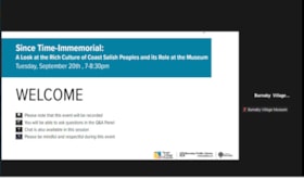
Since Time-Immemorial: A Look at the Rich Culture of Coast Salish Peoples and its Role at the Museum
https://search.heritageburnaby.ca/link/museumdescription18876
- Repository
- Burnaby Village Museum
- Date
- 20 Sep. 2022
- Collection/Fonds
- Burnaby Village Museum fonds
- Description Level
- Item
- Physical Description
- 1 video recording (mp4) (97 min., 15 sec.) : digital, col., sd., stereo ; 29 fps
- Scope and Content
- Item consists of a video recording of a live Zoom webinar hosted by Burnaby Village Museum Indigenous Education Programmer, Nicole Preissl. The webinar is titled "Since Time-Immemorial: A Look at the Rich Culture of Coast Salish Peoples and its Role at the Museum". The webinar is the third in a ser…
- Repository
- Burnaby Village Museum
- Collection/Fonds
- Burnaby Village Museum fonds
- Description Level
- Item
- Physical Description
- 1 video recording (mp4) (97 min., 15 sec.) : digital, col., sd., stereo ; 29 fps
- Material Details
- Host: Nicole Preissl
- Presenters: Carleen Thomas
- Date of Presentation: Tuesday, September 20, 2022. 7:00 pm - 8:00 pm
- Total Number of tracks: 1
- Total Length of all tracks: 97 min., 15 sec.
- Recording Device: Zoom video communication platform
- Original recording of 97 min., 15 sec. was edited to 88 min., 50 sec. for viewing on Heritage Burnaby
- Scope and Content
- Item consists of a video recording of a live Zoom webinar hosted by Burnaby Village Museum Indigenous Education Programmer, Nicole Preissl. The webinar is titled "Since Time-Immemorial: A Look at the Rich Culture of Coast Salish Peoples and its Role at the Museum". The webinar is the third in a series of six webinars presented in partnership by Burnaby Village Museum and Burnaby Public Library. The live webinar was also made available on the Burnaby Village Museum's facebook page. Community members were invited to participate by bringing questions during the interactive online sessions. In this webinar both Nicole Preissl and guest Carleeen Thomas make presentations. The webinar opens with an introduction by Nicole Preissl. Nicole shares her own Indigenous lineage and background; her educational background and experiences while a student at Emily Carr University; her interest in Indigenous materials practices and her role and experiences as Indigenous Education Programmer at the Burnaby Village Museum along with her ideas and goals for the future. Nicole supports her presentation with a slide show presentation regarding the evolution of the Indigenous Learning House on the site of the Burnaby Village Museum and the many transformations that it has gone through. Nicole shares her vision that is helping to transform the space further into a more inviting, learning and creative space for visitors and Indigenous peoples. Nicole also highlights the work that she’s been involved with to further develop educational programming and partnerships on site and her work to further develop the Indigenous Matriarch’s garden and the cedar grove area to include more Indigenous plants. Carleen provides information on the history of the Tsleil-Waututh Nation “People of the Inlet” and highlights information on land mapping that was created by the Nation during the Land Treaty process in 1980s; the many negative impacts to the Tsleil-Waututh Nation from contact and colonization; findings from archaeological investigations done in the Tsleil-Waututh territory that record village sites, seasonal camps and pictographs; stories associated with the Tsleil-Waututh Nation’s oral histories including the double-headed serpent; the impacts of contact and development including industrial logging; the many other challenges that the Tsleil-Waututh Nation have faced and the vision and goals for the future. Carleen describes many photographs of people and places in the presentation and provides important stories and oral histories that have been passed down through her family and nation for generations. Following the presentations Nicole and Carleen answer questions from the attendees and comment further on the information that they've shared.
- History
- Nicole Preissl is Stó:lo from Leq'á:mel First Nation as well as having ancestry from the Sḵwx̱wú7mesh First Nation and sq̓əc̓iy̓aɁɬ təməxʷ (Katzie) First Nation. On her mother's side she is third generation Canadian Settler with European Heritage. Nicole has a Bachelor of Arts Degree from Emily Carr University with a Major in Design and has been the Burnaby Village Museum Indigenous Education Programmer since 2022. Carleen Thomas is a Tsleil-Waututh Nation (TWN) member, elder, and current Special Projects Manager for the Treaty, Lands, and Resources department. She is the first Indigenous chancellor at Emily Carr University of Art and Design; educator; former TWN council member of 16 years; has chaired and been a representative on countless committees; and most significantly, grandmother of five amazing grandchildren. Carleen Thomas plays a vital role in her community and is a highly motivated and hardworking individual. Thomas obtained a Bachelors of Education from UBC and has deeply rooted knowledge of her culture and people. Carleen sites her grandparents: Hereditary Chief John L. George & Lillian “Dolly” George and her maternal Grandmother Caroline Thomas (nee: Joseph) as some of her key influences in life. Their teachings, unconditional love, and most of all, patience in guiding and preparing Carleen will last a lifetime. She has created a lasting mark for her family, community and for future generations of Indigenous, Coast Salish and Tsleil-Waututh families.
- Creator
- Burnaby Village Museum
- Subjects
- Indigenous peoples - British Columbia
- Indigenous peoples - British Columbia - Food
- Indigenous peoples - British Columbia - First contact with Europeans
- Indigenous peoples - British Columbia - Social life and customs
- Indigenous peoples - British Columbia - Art
- Indigenous peoples - British Columbia - Languages
- Indigenous peoples - Canada - , Treatment of
- Indigenous peoples - Indian Territory
- Plants
- Indigenous peoples - British Columbia - Rites and ceremonies
- Indigenous peoples - Canada - Government relations
- Indigenous peoples
- Names
- Burnaby Village Museum
- Preissl, Nicole
- Thomas, Carleen
- Sḵwx̱wú7mesh Nation
- Tsleil-Waututh Nation
- Accession Code
- BV022.27.3
- Date
- 20 Sep. 2022
- Media Type
- Moving Images
- Notes
- Title based on contents of item
Images

Video
Since Time-Immemorial: A Look at the Rich Culture of Coast Salish Peoples and its Role at the Museum, 20 Sep. 2022
Since Time-Immemorial: A Look at the Rich Culture of Coast Salish Peoples and its Role at the Museum, 20 Sep. 2022
https://search.heritageburnaby.ca/media/hpo/_Data/_BVM_Moving_Images/2022_0027_0003_002.mp4![Survey and Subdivision plans in New Westminster District Group 1 and Group 2 – Vancouver, ʷməθkʷəy̓əm (Musqueam) Indian Reserve, Burnaby, Surrey
, [1910-1911] thumbnail](/media/hpo/_Data/_BVM_Cartographic_Material/1977/1977_0093_0017_001.jpg?width=280)
Survey and Subdivision plans in New Westminster District Group 1 and Group 2 – Vancouver, ʷməθkʷəy̓əm (Musqueam) Indian Reserve, Burnaby, Surrey
https://search.heritageburnaby.ca/link/museumdescription6986
- Repository
- Burnaby Village Museum
- Date
- [1910-1911]
- Collection/Fonds
- Burnaby Village Museum Map collection
- Description Level
- File
- Physical Description
- 9 plans : 4 plans : blueprint ink on paper + 4 plans : black ink on paper + 1 plan : graphite on paper mounted on 2 sides of cardboard 76 x 102 cm
- Scope and Content
- File consists of a large board of three survey plans in New Westminster District Group 1 mounted on one side and six survey and subdivision plans of District Lot 85, New Westminster District Group 1 mounted on the other side. Side A: 1. Plan : blueprint on paper ; 30.5 x 80 cm. Title reads: "Fras…
- Repository
- Burnaby Village Museum
- Collection/Fonds
- Burnaby Village Museum Map collection
- Description Level
- File
- Physical Description
- 9 plans : 4 plans : blueprint ink on paper + 4 plans : black ink on paper + 1 plan : graphite on paper mounted on 2 sides of cardboard 76 x 102 cm
- Material Details
- Scales vary (One chain equals 792 inches)
- Indexed number on tape on edge of board reads "17"
- Scope and Content
- File consists of a large board of three survey plans in New Westminster District Group 1 mounted on one side and six survey and subdivision plans of District Lot 85, New Westminster District Group 1 mounted on the other side. Side A: 1. Plan : blueprint on paper ; 30.5 x 80 cm. Title reads: "Fraser River Bridge / Plan of South Approach". Plan covers area of land north of the Fraser River and Great Northern Railway with approach for a bridge running through the "ʷməθkʷəy̓əm (Musqueam) Indian Reserve" (ʷməθkʷəy̓əm (Musqueam) First Nation) and lots marked as Dominion Government and the east half of Lot 2 identified as "C. F. Brown" "Plan 851". Plan is identified as "Plan 851 / traced / Mar. 17, 1911". (Geographic location in Vancouver) Scale: 100 feet = 1 inch, Signed by Albert J. Hill / P.L.S." 2. Plan : blueprint on paper ; 36.5 x 35 cm (no title). Includes three plans of lots on the east and west sides of North Road. Note on bottom of blueprint reads: "I.E.B. McKay Surveyor General - hereby certify / that this is a correct tracing from the field / notes of the Royal Engineers on file in the / Lands Department / E.B. McKay (signature) / Surveyor General / Victoria B.C. April 11th 1911" . Plan in top left titled "Page 11 / Vol. 1. / R.E. Notes" covers District Lots east of North Road including Lot 5, Lot 7, Lot 41, Lot 9 and Lot 107 in Coquitlam. Plan in top right corner titled "Page 17 / Vol. 1. / R.E. Notes" covers District Lots east of North Road including Lot 104, Lot 54, Lot 105, Lot 55, Lot 106, Lot 9 and Lot 107 in Coquitlam and Port Moody. Plan in lower left corner titled "Page 15 / Vol. 1 / R.E. Notes" covers District Lots west of North Road including Lot 147, Lot 148, Lot 100, Lot 15 in Burnaby. 3. Plan : blue print on paper ; 29.5 x 41.5 cm. (no formal title). Plan of the North 1/2 of Section 18. Plan covers area in the "North 1/2 of Sec.18 B.5 N RGE 1 W" and "Sec. 18 B.5 N. RGE 1 W" bordered by Section 7, Section 13, Section 17 and Section 19. Bon Accord Road runs through Sec. 18. The plan is signed by surveryor "I.H. Neville Smith... C.E.B.C.L.S. / Mar. 26th 1910" and signed by "Ludwig Pillath". (Geographic location: Surrey) Side B: 1. Plan : blueprint on paper ; 43.5 x 49.5 cm. Title reads: "Plan / of Subdivision / of a Portion / of / Lot 85 / Group One / New Westminster District. Plan covers portion of land east of Deer Lake and Pole Line Road (Sperling Avenue) and south of Hastings Road in District Lot 85 in Burnaby with section 4 and a portion of section 2 coloured in red. Plan is signed by "Albert J. Hill, B.C.L.S." Plan is initialed by: "RB" [sic] (in blue pencil crayon) Scale: 4 chains = 1 inch 2. Plaln : black black ink on linen ; 39 x 37 cm. Title reads: "L.C. Hill's Property, / Burnaby". Plan covers a triangular portion of land east of Pole Line Road (Sperling Avenue) and south of Hastings Road in District Lot 85 in Burnaby. Plan is intitaled by "RB" [sic] (in blue pencil crayon). Scale: 3 chains = 1 mile 3. Plan : graphite on paper ; 23 x 17 cm. Title reads: "Portion of Lot 85 / Gr.1". Plan covers portion of land north east of Deer Lake and west of Pole Line Road (now Sperling Avenue) in District Lot 85 in Burnaby. Plan is stamped in red ink: "Albert J. Hill, Civil Engineer". Plan is initialed by: "RB" [sic] (in blue pencil crayon). Scale: 1 chain = 1 inch 4. Plan : black ink on linen ; 16 x 19 cm. Title reads: "Lot 85". Plan covers the intersection of Pole Line Road (Sperling Avenue) and Hastings Road at the north west section of District Lot 79 and District Lot 85 in Burnaby. Plan is stamped: "A.J. Hill, Civil Engineer" with identitifed in blue pencil crayon. 5. Plan : black ink on paper ; 28.5 x 37 cm. (no formal title) Plan covers an area of land, west of Pole Line Road (Sperling Avenue) and south of Deer Lake in District Lot 85 in Burnaby. Plan is initialed by: "RB" [sic] (in blue pencil crayon) 6. Plan : black ink on paper ; 21 x 34 cm (no formal title). Plan covers an area of land, west of Pole Line Road (Sperling Avenue) and south of Deer Lake in District Lot 85 in Burnaby. Plan is initialed by: "RB" [sic] (in blue pencil crayon)
- Accession Code
- HV977.93.17
- Access Restriction
- No restrictions
- Reproduction Restriction
- No known restrictions
- Date
- [1910-1911]
- Media Type
- Cartographic Material
- Historic Neighbourhood
- Burnaby Lake (Historic Neighbourhood)
- Burquitlam (Historic Neighbourhood)
- Planning Study Area
- Morley-Buckingham Area
- Douglas-Gilpin Area
- Scan Resolution
- 600
- Scan Date
- 2023-06-26
- Notes
- Title based on contents of file
- Scale is measured in chains and feet. (One chain equals 792 inches).
- The term "Lot" also refers to a "District Lot”
- Some plans are stamped: "Albert J. Hill, Civil Engineer / and / Provincial Land Surveyor, / New Westminster, / B.C." and intialed: "RB" [sic]
Zoomable Images
![Survey and Subdivision plans in New Westminster District Group 1 and Group 2 – Vancouver, ʷməθkʷəy̓əm (Musqueam) Indian Reserve, Burnaby, Surrey
, [1910-1911] thumbnail](/media/hpo/_Data/_BVM_Cartographic_Material/1977/1977_0093_0017_003_seadragon/1977_0093_0017_003.jpg?w=280)
Survey and Subdivision plans in New Westminster District Group 1 and Group 2 – Vancouver, ʷməθkʷəy̓əm (Musqueam) Indian Reserve, Burnaby, Surrey , [1910-1911]
Zoom into Image