Narrow Results By
Subject
- Advertising Medium - Signs and Signboards 1
- Agriculture - Farms 1
- Buildings - Commercial 3
- Buildings - Heritage 1
- Buildings - Religious - Churches 1
- Buildings - Residential - Houses 8
- Documentary Artifacts - Postcards 3
- Events - Openings 3
- Geographic Features - Lakes and Ponds 1
- Geographic Features - Roads 50
- Geographic Features - Sidewalks 2
- Geographic Features - Streams 1
![Deer Lake Drive, [1918] thumbnail](/media/hpo/_Data/_BVM_Images/1972/1972_0051_0012_001.jpg?width=280)
Deer Lake Drive
https://search.heritageburnaby.ca/link/museumdescription1085
- Repository
- Burnaby Village Museum
- Date
- [1918]
- Collection/Fonds
- Burnaby Village Museum Photograph collection
- Description Level
- Item
- Physical Description
- 1 photograph : b&w ; 12.9 x 32.9 cm
- Scope and Content
- Photograph is a panorama of Deer Lake Drive, including the Ceperley mansion and the surrounding grounds of the home to the left of the picture. The photograph, taken from the water tower, with Burnaby Lake in the background. In the midground, following the horizon line, power poles can be seen. Far…
- Repository
- Burnaby Village Museum
- Collection/Fonds
- Burnaby Village Museum Photograph collection
- Description Level
- Item
- Physical Description
- 1 photograph : b&w ; 12.9 x 32.9 cm
- Scope and Content
- Photograph is a panorama of Deer Lake Drive, including the Ceperley mansion and the surrounding grounds of the home to the left of the picture. The photograph, taken from the water tower, with Burnaby Lake in the background. In the midground, following the horizon line, power poles can be seen. Farm lands are visible leading down to the homes of the Andersons. An annotation on the back of the photo in pencil reads, "Deer Lake Dr." and an annotation in blue pen reads, "1918."
- Geographic Access
- Deer Lake Drive
- Deer Lake Avenue
- Street Address
- 6344 Deer Lake Avenue
- Accession Code
- HV972.51.12
- Access Restriction
- No restrictions
- Reproduction Restriction
- No known restrictions
- Date
- [1918]
- Media Type
- Photograph
- Historic Neighbourhood
- Burnaby Lake (Historic Neighbourhood)
- Planning Study Area
- Douglas-Gilpin Area
- Scan Resolution
- 600
- Scan Date
- 2023-04-04
Images
![Deer Lake Drive, [1918] thumbnail](/media/hpo/_Data/_BVM_Images/1972/1972_0051_0012_001.jpg)

Automobile on Kinnee Street
https://search.heritageburnaby.ca/link/archivedescription35060
- Repository
- City of Burnaby Archives
- Date
- 1915
- Collection/Fonds
- Burnaby Historical Society fonds
- Description Level
- Item
- Physical Description
- 1 photograph : b&w ; 11.0 x 6.2 cm
- Scope and Content
- Photograph of an automobile on Kinnee Street with the Patterson Avenue pump house and tank in the background. An annotation on the back of the photograph reads, "Water tank at Patterson Ave near the track in the Central Park (Ball park), 1915. / The roadway was Kinnee Ave which is Beresford today."
- Repository
- City of Burnaby Archives
- Date
- 1915
- Collection/Fonds
- Burnaby Historical Society fonds
- Subseries
- Pitman family subseries
- Physical Description
- 1 photograph : b&w ; 11.0 x 6.2 cm
- Description Level
- Item
- Record No.
- 186-004
- Access Restriction
- No restrictions
- Reproduction Restriction
- No known restrictions
- Accession Number
- BHS1986-35
- Scope and Content
- Photograph of an automobile on Kinnee Street with the Patterson Avenue pump house and tank in the background. An annotation on the back of the photograph reads, "Water tank at Patterson Ave near the track in the Central Park (Ball park), 1915. / The roadway was Kinnee Ave which is Beresford today."
- Media Type
- Photograph
- Notes
- Title based on contents of photograph
- Geographic Access
- Beresford Street
- Historic Neighbourhood
- Central Park (Historic Neighbourhood)
- Planning Study Area
- Maywood Area
Images


Cassie Avenue
https://search.heritageburnaby.ca/link/archivedescription35064
- Repository
- City of Burnaby Archives
- Date
- November 7, 1915
- Collection/Fonds
- Burnaby Historical Society fonds
- Description Level
- Item
- Physical Description
- 1 photograph : b&w ; 6.0 x 10.0 cm
- Scope and Content
- Photograph of Cassie Avenue, south of the railroad tracks, in the snow. Buildings and piles of lumber can be seen. An annotation on the back of the photograph reads, "Cassie Ave - South of tracks / Nov 7th 1915."
- Repository
- City of Burnaby Archives
- Date
- November 7, 1915
- Collection/Fonds
- Burnaby Historical Society fonds
- Subseries
- Pitman family subseries
- Physical Description
- 1 photograph : b&w ; 6.0 x 10.0 cm
- Description Level
- Item
- Record No.
- 186-008
- Access Restriction
- No restrictions
- Reproduction Restriction
- No known restrictions
- Accession Number
- BHS1986-35
- Scope and Content
- Photograph of Cassie Avenue, south of the railroad tracks, in the snow. Buildings and piles of lumber can be seen. An annotation on the back of the photograph reads, "Cassie Ave - South of tracks / Nov 7th 1915."
- Subjects
- Geographic Features - Roads
- Media Type
- Photograph
- Geographic Access
- Cassie Avenue
- Historic Neighbourhood
- Central Park (Historic Neighbourhood)
- Planning Study Area
- Maywood Area
Images


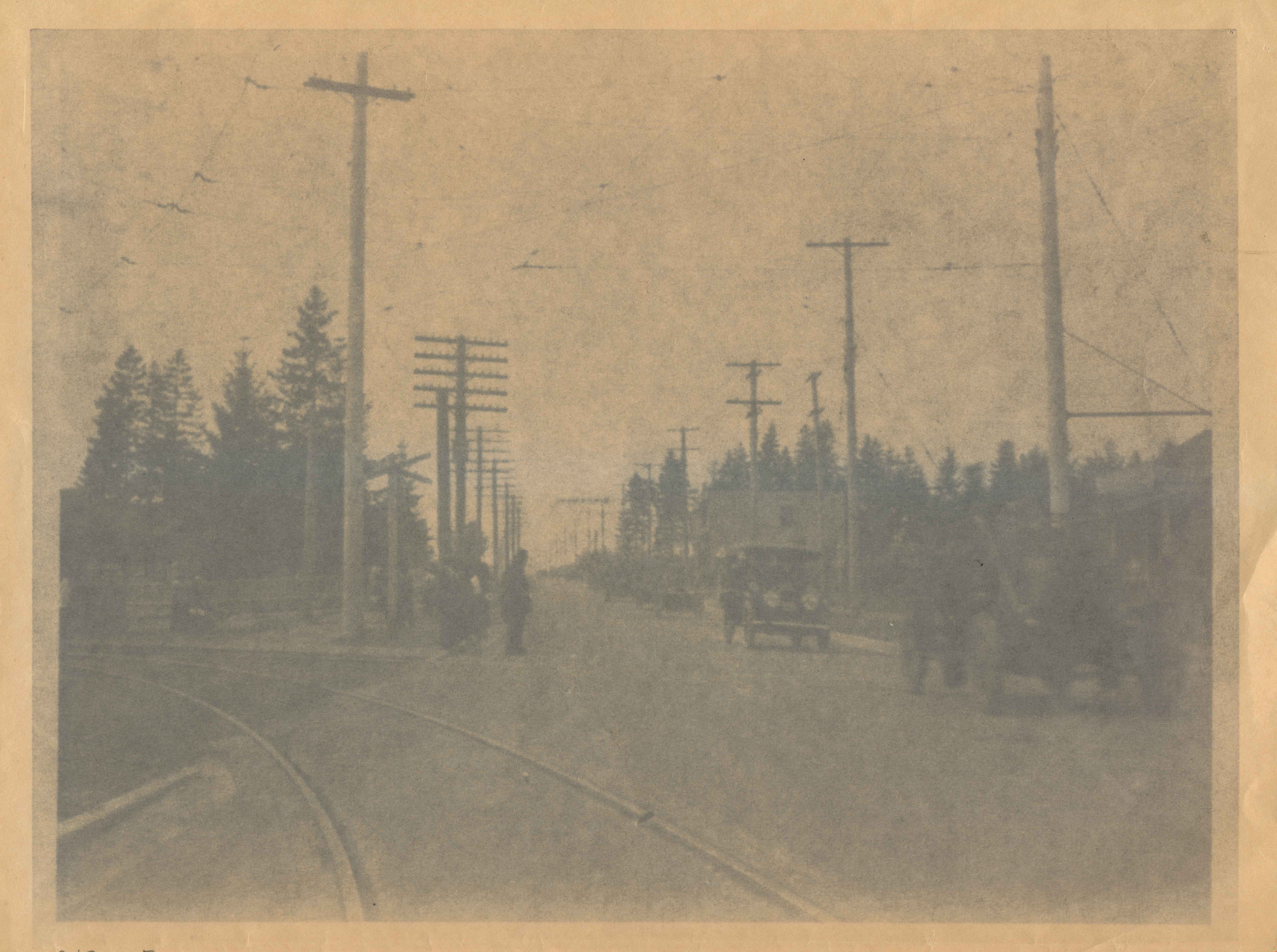
Sperling Avenue and Barnet Road
https://search.heritageburnaby.ca/link/archivedescription35442
- Repository
- City of Burnaby Archives
- Date
- 1915 (date of original), copied 1986
- Collection/Fonds
- Burnaby Historical Society fonds
- Description Level
- Item
- Physical Description
- 1 photograph : b&w ; 12.7 x 17.8 cm print
- Scope and Content
- Photograph of a Cadillac full of passengers driving along the plank roadway at Sperling Avenue and Barnet Road.
- Repository
- City of Burnaby Archives
- Date
- 1915 (date of original), copied 1986
- Collection/Fonds
- Burnaby Historical Society fonds
- Subseries
- Pioneer Tales subseries
- Physical Description
- 1 photograph : b&w ; 12.7 x 17.8 cm print
- Description Level
- Item
- Record No.
- 204-300
- Access Restriction
- No restrictions
- Reproduction Restriction
- No restrictions
- Accession Number
- BHS1988-03
- Scope and Content
- Photograph of a Cadillac full of passengers driving along the plank roadway at Sperling Avenue and Barnet Road.
- Media Type
- Photograph
- Photographer
- Eaton, Dr. Carl
- Notes
- Title based on contents of photograph
- Photograph is believed to be taken by Dr. Carl Eaton
- Geographic Access
- Sperling Avenue
- Barnet Road
- Historic Neighbourhood
- Lochdale (Historic Neighbourhood)
- Planning Study Area
- Westridge Area
Images


Boundary Road and Hastings Street vicinity
https://search.heritageburnaby.ca/link/archivedescription35447
- Repository
- City of Burnaby Archives
- Date
- 1915 (date of original), copied 1986
- Collection/Fonds
- Burnaby Historical Society fonds
- Description Level
- Item
- Physical Description
- 1 photograph : b&w ; 12.7 x 17.8 cm print
- Scope and Content
- Photograph taken in Vancouver on Hastings Street looking east toward Burnaby and Boundary Road. The Hastings Street British Columbia Electric Railway (BCER) cars can be seen labouring up the hill.
- Repository
- City of Burnaby Archives
- Date
- 1915 (date of original), copied 1986
- Collection/Fonds
- Burnaby Historical Society fonds
- Subseries
- Pioneer Tales subseries
- Physical Description
- 1 photograph : b&w ; 12.7 x 17.8 cm print
- Description Level
- Item
- Record No.
- 204-305
- Access Restriction
- No restrictions
- Reproduction Restriction
- No restrictions
- Accession Number
- BHS1988-03
- Scope and Content
- Photograph taken in Vancouver on Hastings Street looking east toward Burnaby and Boundary Road. The Hastings Street British Columbia Electric Railway (BCER) cars can be seen labouring up the hill.
- Media Type
- Photograph
- Photographer
- Eaton, Dr. Carl
- Notes
- Title based on contents of photograph
- Geographic Access
- Boundary Road
- Hastings Street
- Historic Neighbourhood
- Vancouver Heights (Historic Neighbourhood)
- Planning Study Area
- Willingdon Heights Area
Images

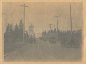
![The Pole Line Road, [1915] thumbnail](/media/hpo/_Data/_Archives_Images/_Unrestricted/477/477-742.jpg?width=280)
The Pole Line Road
https://search.heritageburnaby.ca/link/archivedescription39423
- Repository
- City of Burnaby Archives
- Date
- [1915]
- Collection/Fonds
- Peers Family and Hill Family fonds
- Description Level
- Item
- Physical Description
- 1 photograph : b&w ; 8.8 x 8.8 cm
- Scope and Content
- Photograph taken looking north along the Pole Line road (now Sperling Avenue) towards the Burnaby Lake interurban station. Notice the planks along the road.
- Repository
- City of Burnaby Archives
- Date
- [1915]
- Collection/Fonds
- Peers Family and Hill Family fonds
- Physical Description
- 1 photograph : b&w ; 8.8 x 8.8 cm
- Description Level
- Item
- Record No.
- 477-742
- Access Restriction
- No restrictions
- Reproduction Restriction
- No known restrictions
- Accession Number
- 2007-12
- Scope and Content
- Photograph taken looking north along the Pole Line road (now Sperling Avenue) towards the Burnaby Lake interurban station. Notice the planks along the road.
- Subjects
- Geographic Features - Roads
- Media Type
- Photograph
- Notes
- Title based on caption accompanying photograph
- Geographic Access
- Sperling Avenue
- Historic Neighbourhood
- Burnaby Lake (Historic Neighbourhood)
- Planning Study Area
- Burnaby Lake Area
Images
![The Pole Line Road, [1915] thumbnail](/media/hpo/_Data/_Archives_Images/_Unrestricted/477/477-742.jpg)
![Barnet Road, [1914 or 1915] thumbnail](/media/hpo/_Data/_Archives_Images/_Unrestricted/001/044-001.jpg?width=280)
Barnet Road
https://search.heritageburnaby.ca/link/archivedescription34541
- Repository
- City of Burnaby Archives
- Date
- [1914 or 1915]
- Collection/Fonds
- Burnaby Historical Society fonds
- Description Level
- Item
- Physical Description
- 1 photograph : b&w ; 16.4 x 21.3 cm
- Scope and Content
- Photograph of Barnet Road at North Road. Street signs on the left side of the photograph read, "North Ave" and "Barnet Road." A person on a motorbike or bicycle can be seen on the road in the distance. Utility poles are along the road.
- Repository
- City of Burnaby Archives
- Date
- [1914 or 1915]
- Collection/Fonds
- Burnaby Historical Society fonds
- Subseries
- Photographs subseries
- Physical Description
- 1 photograph : b&w ; 16.4 x 21.3 cm
- Description Level
- Item
- Record No.
- 044-001
- Access Restriction
- No restrictions
- Reproduction Restriction
- No known restrictions
- Accession Number
- BHS2007-04
- Scope and Content
- Photograph of Barnet Road at North Road. Street signs on the left side of the photograph read, "North Ave" and "Barnet Road." A person on a motorbike or bicycle can be seen on the road in the distance. Utility poles are along the road.
- Subjects
- Geographic Features - Roads
- Media Type
- Photograph
- Notes
- Title based on contents of photograph
- Geographic Access
- Barnet Road
- North Road
- Planning Study Area
- Burnaby Mountain Area
Images
![Barnet Road, [1914 or 1915] thumbnail](/media/hpo/_Data/_Archives_Images/_Unrestricted/001/044-001.jpg)
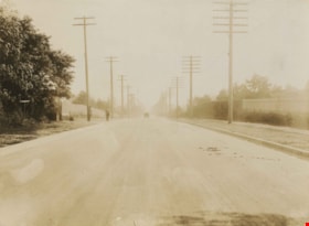
Kingsway
https://search.heritageburnaby.ca/link/archivedescription34544
- Repository
- City of Burnaby Archives
- Date
- 1914
- Collection/Fonds
- Burnaby Historical Society fonds
- Description Level
- Item
- Physical Description
- 1 photograph : sepia ; 15.3 x 20.7 cm mounted on cardboard
- Scope and Content
- Photograph of Kingsway looking southeast towards Edmonds Street. Sidewalk and utility poles run alongside the road.
- Repository
- City of Burnaby Archives
- Date
- 1914
- Collection/Fonds
- Burnaby Historical Society fonds
- Subseries
- Photographs subseries
- Physical Description
- 1 photograph : sepia ; 15.3 x 20.7 cm mounted on cardboard
- Description Level
- Item
- Record No.
- 044-004
- Access Restriction
- No restrictions
- Reproduction Restriction
- No known restrictions
- Accession Number
- BHS2007-04
- Scope and Content
- Photograph of Kingsway looking southeast towards Edmonds Street. Sidewalk and utility poles run alongside the road.
- Subjects
- Geographic Features - Roads
- Media Type
- Photograph
- Notes
- Title based on contents of photograph
- Geographic Access
- Kingsway
- Historic Neighbourhood
- Edmonds (Historic Neighbourhood)
- Planning Study Area
- Richmond Park Area
- Marlborough Area
Images

Coldicutt House
https://search.heritageburnaby.ca/link/archivedescription34549
- Repository
- City of Burnaby Archives
- Date
- 1914
- Collection/Fonds
- Burnaby Historical Society fonds
- Description Level
- Item
- Physical Description
- 1 photograph : b&w ; 16.0 x 21.1 cm mounted on 25.1 x 30.1 cm cardboard
- Scope and Content
- Photograph of the exterior of the Coldicutt House at 7510 6th Street.
- Repository
- City of Burnaby Archives
- Date
- 1914
- Collection/Fonds
- Burnaby Historical Society fonds
- Subseries
- Photographs subseries
- Physical Description
- 1 photograph : b&w ; 16.0 x 21.1 cm mounted on 25.1 x 30.1 cm cardboard
- Description Level
- Item
- Record No.
- 044-009
- Access Restriction
- No restrictions
- Reproduction Restriction
- No known restrictions
- Accession Number
- BHS2007-04
- Scope and Content
- Photograph of the exterior of the Coldicutt House at 7510 6th Street.
- Media Type
- Photograph
- Notes
- Title based on contents of photograph
- Geographic Access
- 6th Street
- Street Address
- 7510 6th Street
- Historic Neighbourhood
- East Burnaby (Historic Neighbourhood)
- Planning Study Area
- Second Street Area
Images

![North Road, 650 Feet North of Brunette Street, Looking South, [1914] thumbnail](/media/hpo/_Data/_BVM_Images/1971/197200110001.jpg?width=280)
North Road, 650 Feet North of Brunette Street, Looking South
https://search.heritageburnaby.ca/link/museumdescription3088
- Repository
- Burnaby Village Museum
- Date
- [1914]
- Collection/Fonds
- Burnaby Village Museum Photograph collection
- Description Level
- Item
- Physical Description
- 1 photograph : b&w glass negative ; 20.9 x 16.0 cm
- Scope and Content
- Photograph of North Road, between Burnaby and Coquitlam looking south towards New Westminster. The road is lined with electric poles on both sides, and a board planked sidewalk follows the road on the right side of the photograph. Fences and residential housing can be seen along the road and the ho…
- Repository
- Burnaby Village Museum
- Collection/Fonds
- Burnaby Village Museum Photograph collection
- Description Level
- Item
- Physical Description
- 1 photograph : b&w glass negative ; 20.9 x 16.0 cm
- Scope and Content
- Photograph of North Road, between Burnaby and Coquitlam looking south towards New Westminster. The road is lined with electric poles on both sides, and a board planked sidewalk follows the road on the right side of the photograph. Fences and residential housing can be seen along the road and the horizon. An earlier catalogue record from 1988 dates the negative ca. 1914. Inscribed in the negative, lower left of the print, "North Road / 650 Feet North of Brunette / Street. Looking South." and, lower right of the print, "No 1."
- Subjects
- Geographic Features - Roads
- Geographic Access
- North Road
- Accession Code
- HV972.11.1
- Access Restriction
- No restrictions
- Reproduction Restriction
- No known restrictions
- Date
- [1914]
- Media Type
- Photograph
- Scan Resolution
- 300
- Scan Date
- 14/8/2006
- Scale
- 100
- Notes
- Title based on contents of photograph
- 1 b&w contact print accompanying negative
Images
![North Road, 650 Feet North of Brunette Street, Looking South, [1914] thumbnail](/media/hpo/_Data/_BVM_Images/1971/197200110001.jpg)
![Railway embankment, [1914] thumbnail](/media/hpo/_Data/_BVM_Images/1971/197200110002.jpg?width=280)
Railway embankment
https://search.heritageburnaby.ca/link/museumdescription3089
- Repository
- Burnaby Village Museum
- Date
- [1914]
- Collection/Fonds
- Burnaby Village Museum Photograph collection
- Description Level
- Item
- Physical Description
- 1 photograph : b&w glass negative ; 14.8 x 20.1 cm
- Scope and Content
- Photograph of a railway embankment. In the foreground is the railway, and in the midground a steep bluff, on top of which an unidentified man in a suit and a bowler hat is standing. There appears to be a road lined with electric posts close to where the man stands. An earlier catalogue record from…
- Repository
- Burnaby Village Museum
- Collection/Fonds
- Burnaby Village Museum Photograph collection
- Description Level
- Item
- Physical Description
- 1 photograph : b&w glass negative ; 14.8 x 20.1 cm
- Scope and Content
- Photograph of a railway embankment. In the foreground is the railway, and in the midground a steep bluff, on top of which an unidentified man in a suit and a bowler hat is standing. There appears to be a road lined with electric posts close to where the man stands. An earlier catalogue record from 1988 notes that this is the view of the Great Northern Railway just north of Brunette Creek on North Road. Also, it notes that the road running by the man is North Road.
- Names
- Great Northern Railway
- Geographic Access
- North Road
- Accession Code
- HV972.11.2
- Access Restriction
- No restrictions
- Reproduction Restriction
- No known restrictions
- Date
- [1914]
- Media Type
- Photograph
- Planning Study Area
- Cariboo-Armstrong Area
- Related Material
- for another view of the same railway embankment, see HV972.11.4
- Scan Resolution
- 300
- Scan Date
- 14/8/2006
- Scale
- 100
- Notes
- Title based on contents of photograph
- 1 b&w contact print accompanying negative
Images
![Railway embankment, [1914] thumbnail](/media/hpo/_Data/_BVM_Images/1971/197200110002.jpg)
![Kingsway at Salisbury Avenue, [1914] thumbnail](/media/hpo/_Data/_BVM_Images/1971/197200110005.jpg?width=280)
Kingsway at Salisbury Avenue
https://search.heritageburnaby.ca/link/museumdescription3091
- Repository
- Burnaby Village Museum
- Date
- [1914]
- Collection/Fonds
- Burnaby Village Museum Photograph collection
- Description Level
- Item
- Physical Description
- 1 photograph : b&w glass negative ; 16.0 x 20.9 cm
- Scope and Content
- Photograph of Kingsway looking west from Salisbury Avenue in Burnaby. At one corner of the four-way intersection is a road sign labelling the roads "Kingsway" and "Salisbury Ave," beside which hangs a "For Sale" sign from "Wolf Merton & Son" for a house at "119 Pender St. W. Vancouver." Across fro…
- Repository
- Burnaby Village Museum
- Collection/Fonds
- Burnaby Village Museum Photograph collection
- Description Level
- Item
- Physical Description
- 1 photograph : b&w glass negative ; 16.0 x 20.9 cm
- Scope and Content
- Photograph of Kingsway looking west from Salisbury Avenue in Burnaby. At one corner of the four-way intersection is a road sign labelling the roads "Kingsway" and "Salisbury Ave," beside which hangs a "For Sale" sign from "Wolf Merton & Son" for a house at "119 Pender St. W. Vancouver." Across from these signs stands a man in a suit beside one of the electric poles that lines Kingsway. Further behind him is a water tower that an earlier catalogue record from 1988 identifies as a Municipal Water Tower. Also, the record dates the negative ca. 1914.
- Subjects
- Geographic Features - Roads
- Structures - Water Tanks and Towers
- Public Services - Utilities
- Geographic Access
- Kingsway
- Salisbury Avenue
- Accession Code
- HV972.11.5
- Access Restriction
- No restrictions
- Reproduction Restriction
- No known restrictions
- Date
- [1914]
- Media Type
- Photograph
- Historic Neighbourhood
- Edmonds (Historic Neighbourhood)
- Planning Study Area
- Stride Avenue Area
- Richmond Park Area
- Scan Resolution
- 300
- Scan Date
- 14/8/2006
- Scale
- 100
- Notes
- Title based on contents of photograph
- 1 b&w contact print accompanying negative
Images
![Kingsway at Salisbury Avenue, [1914] thumbnail](/media/hpo/_Data/_BVM_Images/1971/197200110005.jpg)
![Kingsway, [1914] thumbnail](/media/hpo/_Data/_BVM_Images/1971/197200110008.jpg?width=280)
Kingsway
https://search.heritageburnaby.ca/link/museumdescription3094
- Repository
- Burnaby Village Museum
- Date
- [1914]
- Collection/Fonds
- Burnaby Village Museum Photograph collection
- Description Level
- Item
- Physical Description
- 1 photograph : b&w glass negative ; 15.8 x 21.1 cm
- Scope and Content
- Photograph of a paved road lined with electric posts, a sidewalk and fences. There are two unidentified men in suits and bowler hats standing on one side of the road, each by a different electric post. A car is driving towards the horizon. An earlier catalogue record from 1988 notes that the view …
- Repository
- Burnaby Village Museum
- Collection/Fonds
- Burnaby Village Museum Photograph collection
- Description Level
- Item
- Physical Description
- 1 photograph : b&w glass negative ; 15.8 x 21.1 cm
- Scope and Content
- Photograph of a paved road lined with electric posts, a sidewalk and fences. There are two unidentified men in suits and bowler hats standing on one side of the road, each by a different electric post. A car is driving towards the horizon. An earlier catalogue record from 1988 notes that the view is of Kingsway looking east from Willingdon Avenue towards the community of McKay and Kingsway. It also notes that the McKay Block is visible on the far right side of the photograph at McKay Avenue and Kingsway. The record dates the negative ca. 1914.
- Subjects
- Geographic Features - Roads
- Geographic Access
- Kingsway
- Willingdon Avenue
- Accession Code
- HV972.11.8
- Access Restriction
- No restrictions
- Reproduction Restriction
- No known restrictions
- Date
- [1914]
- Media Type
- Photograph
- Historic Neighbourhood
- Central Park (Historic Neighbourhood)
- Planning Study Area
- Maywood Area
- Scan Resolution
- 300
- Scan Date
- 14/8/2006
- Scale
- 100
- Notes
- Title based on contents of photograph
- 1 b&w contact print accompanying negative
Images
![Kingsway, [1914] thumbnail](/media/hpo/_Data/_BVM_Images/1971/197200110008.jpg)
![Great Northern Railway crossing, [1914] thumbnail](/media/hpo/_Data/_BVM_Images/1971/197200110009.jpg?width=280)
Great Northern Railway crossing
https://search.heritageburnaby.ca/link/museumdescription3095
- Repository
- Burnaby Village Museum
- Date
- [1914]
- Collection/Fonds
- Burnaby Village Museum Photograph collection
- Description Level
- Item
- Physical Description
- 1 photograph : b&w glass negative ; 20.2 x 15.8 cm
- Scope and Content
- Photograph of the Great Northern Railway crossing meeting a road that appears to have run parellel to the railway on a bluff. On the left side of the photograph is a small hut beside a sign that reads, "Railway Crossing." Two unidentified men are standing outside of the hut. An earlier catalogue re…
- Repository
- Burnaby Village Museum
- Collection/Fonds
- Burnaby Village Museum Photograph collection
- Description Level
- Item
- Physical Description
- 1 photograph : b&w glass negative ; 20.2 x 15.8 cm
- Material Details
- Inscribed on negative, and printed backwards on contact print, l.r. "G.N.RAILWAY......../SHEWI [rest of the word illegible] INTERSECTION). CROSSING.../ [illegible word] ROAD. LOOKING NORTH"
- Scope and Content
- Photograph of the Great Northern Railway crossing meeting a road that appears to have run parellel to the railway on a bluff. On the left side of the photograph is a small hut beside a sign that reads, "Railway Crossing." Two unidentified men are standing outside of the hut. An earlier catalogue record from 1988 notes that the crossing street is North Road, and the photograph was taken looking northwest into Burnaby. Inscribed on negative, lower right: "G.N. Railway /Shewi [rest of the word illegible] Intersection) Crossing / [illegible word] Road. Looking North."
- Names
- Great Northern Railway
- Geographic Access
- North Road
- Accession Code
- HV972.11.9
- Access Restriction
- No restrictions
- Reproduction Restriction
- No known restrictions
- Date
- [1914]
- Media Type
- Photograph
- Planning Study Area
- Cariboo-Armstrong Area
- Scan Resolution
- 300
- Scan Date
- 14/8/2006
- Scale
- 100
- Notes
- Title based on contents of photograph
- 1 b&w contact print accompanying negative
Images
![Great Northern Railway crossing, [1914] thumbnail](/media/hpo/_Data/_BVM_Images/1971/197200110009.jpg)
![North Road near Lougheed Highway, [1914] thumbnail](/media/hpo/_Data/_BVM_Images/1971/197200110014.jpg?width=280)
North Road near Lougheed Highway
https://search.heritageburnaby.ca/link/museumdescription3100
- Repository
- Burnaby Village Museum
- Date
- [1914]
- Collection/Fonds
- Burnaby Village Museum Photograph collection
- Description Level
- Item
- Physical Description
- 1 photograph : b&w glass negative ; 15.7 x 19.8 cm
- Scope and Content
- Photograph of a paved road lined with electric poles on both sides and a wood plank sidewalk on one side of the road. There are two men in suits on the left, in the distance. Also visible are houses to the right. An earlier catalogue record from 1988 conjectures that the photograph is a view of No…
- Repository
- Burnaby Village Museum
- Collection/Fonds
- Burnaby Village Museum Photograph collection
- Description Level
- Item
- Physical Description
- 1 photograph : b&w glass negative ; 15.7 x 19.8 cm
- Scope and Content
- Photograph of a paved road lined with electric poles on both sides and a wood plank sidewalk on one side of the road. There are two men in suits on the left, in the distance. Also visible are houses to the right. An earlier catalogue record from 1988 conjectures that the photograph is a view of North Road near the modern day intersection of Lougheed Highway, looking south to New Westminster. The record also dates the negative, ca. 1914.
- Subjects
- Geographic Features - Roads
- Geographic Access
- North Road
- Lougheed Highway
- Accession Code
- HV972.11.14
- Access Restriction
- No restrictions
- Reproduction Restriction
- No known restrictions
- Date
- [1914]
- Media Type
- Photograph
- Historic Neighbourhood
- Burquitlam (Historic Neighbourhood)
- Planning Study Area
- Cameron Area
- Related Material
- 600 dpi .TIF scan of master copy contact sheet image available at Q:\51305 BVM Collections\BVM Photographs\1970
- Scan Resolution
- 300
- Scan Date
- 14/8/2006
- Scale
- 100
- Notes
- Title based on contents of photograph
- 1 b&w contact print accompanying negative
Images
![North Road near Lougheed Highway, [1914] thumbnail](/media/hpo/_Data/_BVM_Images/1971/197200110014.jpg)
![Men riding bicycles, [1914] thumbnail](/media/hpo/_Data/_BVM_Images/1971/197200110015.jpg?width=280)
Men riding bicycles
https://search.heritageburnaby.ca/link/museumdescription3101
- Repository
- Burnaby Village Museum
- Date
- [1914]
- Collection/Fonds
- Burnaby Village Museum Photograph collection
- Description Level
- Item
- Physical Description
- 1 photograph : b&w glass negative ; 16.4 x 21.3 cm
- Scope and Content
- Photograph of a paved road lined with electric poles on both sides and a wood plank sidewalk on one side of the road. There are two men in suits and bowler hats riding bicycles and another man in suit and bowler hat standing on the sidewalk. The sun is casting long shadows from the left side of the…
- Repository
- Burnaby Village Museum
- Collection/Fonds
- Burnaby Village Museum Photograph collection
- Description Level
- Item
- Physical Description
- 1 photograph : b&w glass negative ; 16.4 x 21.3 cm
- Scope and Content
- Photograph of a paved road lined with electric poles on both sides and a wood plank sidewalk on one side of the road. There are two men in suits and bowler hats riding bicycles and another man in suit and bowler hat standing on the sidewalk. The sun is casting long shadows from the left side of the photograph. An earlier catalogue record from 1988 conjectures that the photograph may be of Kingsway in Burnaby, possibly near Gilley looking east towards Griffiths Avenue. The record also dates the negative, ca. 1914.
- Geographic Access
- Kingsway
- Griffiths Avenue
- Accession Code
- HV972.11.15
- Access Restriction
- No restrictions
- Reproduction Restriction
- No known restrictions
- Date
- [1914]
- Media Type
- Photograph
- Historic Neighbourhood
- Edmonds (Historic Neighbourhood)
- Planning Study Area
- Kingsway-Beresford Area
- Scan Resolution
- 300
- Scan Date
- 14/8/2006
- Scale
- 100
- Notes
- Title based on contents of photograph
- 1 b&w contact print accompanying negative
Images
![Men riding bicycles, [1914] thumbnail](/media/hpo/_Data/_BVM_Images/1971/197200110015.jpg)
![Barnet Road and North Avenue, [1914] thumbnail](/media/hpo/_Data/_BVM_Images/1971/197200110019.jpg?width=280)
Barnet Road and North Avenue
https://search.heritageburnaby.ca/link/museumdescription3105
- Repository
- Burnaby Village Museum
- Date
- [1914]
- Collection/Fonds
- Burnaby Village Museum Photograph collection
- Description Level
- Item
- Physical Description
- 1 photograph : b&w glass negative ; 16.0 x 20.9 cm
- Scope and Content
- Photograph of Barnet Road, a dirt road at the time of the photograph, from North Road. There is a sign post in the foreground to the left that indicates the crossing is "NORTH AVE" and "BARNET RD". On the sign post a provincial notice is tacked on. There are electric posts along one side of Barnet …
- Repository
- Burnaby Village Museum
- Collection/Fonds
- Burnaby Village Museum Photograph collection
- Description Level
- Item
- Physical Description
- 1 photograph : b&w glass negative ; 16.0 x 20.9 cm
- Scope and Content
- Photograph of Barnet Road, a dirt road at the time of the photograph, from North Road. There is a sign post in the foreground to the left that indicates the crossing is "NORTH AVE" and "BARNET RD". On the sign post a provincial notice is tacked on. There are electric posts along one side of Barnet Road, and further down the road is an unidentified man riding a motorcycle or a bicycle. According to an earlier catalogue record from 1988, the view is looking East, and the mountain rising in the background is Burnaby Mountain. The record also dates the negative ca. 1914
- Subjects
- Geographic Features - Roads
- Geographic Access
- Barnet Road
- North Road
- Accession Code
- HV972.11.19
- Access Restriction
- No restrictions
- Reproduction Restriction
- No known restrictions
- Date
- [1914]
- Media Type
- Photograph
- Planning Study Area
- Burnaby Mountain Area
- Scan Resolution
- 300
- Scan Date
- 14/8/2006
- Scale
- 100
- Notes
- Title based on contents of photograph
- 1 b&w contact print accompanying negative
Images
![Barnet Road and North Avenue, [1914] thumbnail](/media/hpo/_Data/_BVM_Images/1971/197200110019.jpg)
![Brunette Bridge, looking south, [1914] thumbnail](/media/hpo/_Data/_BVM_Images/1971/197200110021.jpg?width=280)
Brunette Bridge, looking south
https://search.heritageburnaby.ca/link/museumdescription3107
- Repository
- Burnaby Village Museum
- Date
- [1914]
- Collection/Fonds
- Burnaby Village Museum Photograph collection
- Description Level
- Item
- Physical Description
- 1 photograph : b&w glass negative ; 16.4 x 21.3 cm
- Scope and Content
- Photograph of North Road and the Brunette Bridge, looking south into New Westminster from Burnaby. By the northern end of the bridge, there is a pit being dug with shovels. A few houses can be seen on the southwest side of the bridge. The house furthest away is identified as the William Holmes hou…
- Repository
- Burnaby Village Museum
- Collection/Fonds
- Burnaby Village Museum Photograph collection
- Description Level
- Item
- Physical Description
- 1 photograph : b&w glass negative ; 16.4 x 21.3 cm
- Scope and Content
- Photograph of North Road and the Brunette Bridge, looking south into New Westminster from Burnaby. By the northern end of the bridge, there is a pit being dug with shovels. A few houses can be seen on the southwest side of the bridge. The house furthest away is identified as the William Holmes house (Burnaby's first settler to pre-empt property in Burnaby). All of the land on the right side of the road was purchased by William H. Holmes in 1860 (District Lot 1, Group 1, New Westminster District). A car is parked on the side of the road south of the bridge. The shorter ash tree south of the bridge is identified as the famous "Holmes Ash Tree" (also known as the "Moody tree").
- Accession Code
- HV972.11.21
- Access Restriction
- No restrictions
- Reproduction Restriction
- No known restrictions
- Date
- [1914]
- Media Type
- Photograph
- Planning Study Area
- Cariboo-Armstrong Area
- Related Material
- See also: William Holmes fonds
- Scan Resolution
- 300
- Scan Date
- 14/8/2006
- Scale
- 100
- Notes
- Title based on contents of photograph
- 1 b&w contact print accompanying negative
- Inscribed on the negative, lower left of the print: "Brunette Bridge / Looking South."
Images
![Brunette Bridge, looking south, [1914] thumbnail](/media/hpo/_Data/_BVM_Images/1971/197200110021.jpg)
![Kingsway, [1914] thumbnail](/media/hpo/_Data/_BVM_Images/1971/197200110022.jpg?width=280)
Kingsway
https://search.heritageburnaby.ca/link/museumdescription3108
- Repository
- Burnaby Village Museum
- Date
- [1914]
- Collection/Fonds
- Burnaby Village Museum Photograph collection
- Description Level
- Item
- Physical Description
- 1 photograph : b&w glass negative ; 15.8 x 21.1 cm
- Scope and Content
- Photograph of a paved street lined on both sides with curbs and electric poles. There appears to be a car in the distance, as well as an idustrial building on the right-hand side of the road. An earlier catalogue record from 1988 conjectures that the street is Kingsway, probably in Burnaby, between…
- Repository
- Burnaby Village Museum
- Collection/Fonds
- Burnaby Village Museum Photograph collection
- Description Level
- Item
- Physical Description
- 1 photograph : b&w glass negative ; 15.8 x 21.1 cm
- Scope and Content
- Photograph of a paved street lined on both sides with curbs and electric poles. There appears to be a car in the distance, as well as an idustrial building on the right-hand side of the road. An earlier catalogue record from 1988 conjectures that the street is Kingsway, probably in Burnaby, between Sperling Avenue and Royal Oak, looking South, and that the building is possibly the Macadam making plant for the company which paved Kingsway.
- Subjects
- Geographic Features - Roads
- Geographic Access
- Kingsway
- Sperling Avenue
- Royal Oak Avenue
- Accession Code
- HV972.11.22
- Access Restriction
- No restrictions
- Reproduction Restriction
- No known restrictions
- Date
- [1914]
- Media Type
- Photograph
- Planning Study Area
- Windsor Area
- Scan Resolution
- 300
- Scan Date
- 14/8/2006
- Scale
- 100
- Notes
- Title based on contents of photograph
- 1 b&w contact print accompanying negative
Images
![Kingsway, [1914] thumbnail](/media/hpo/_Data/_BVM_Images/1971/197200110022.jpg)
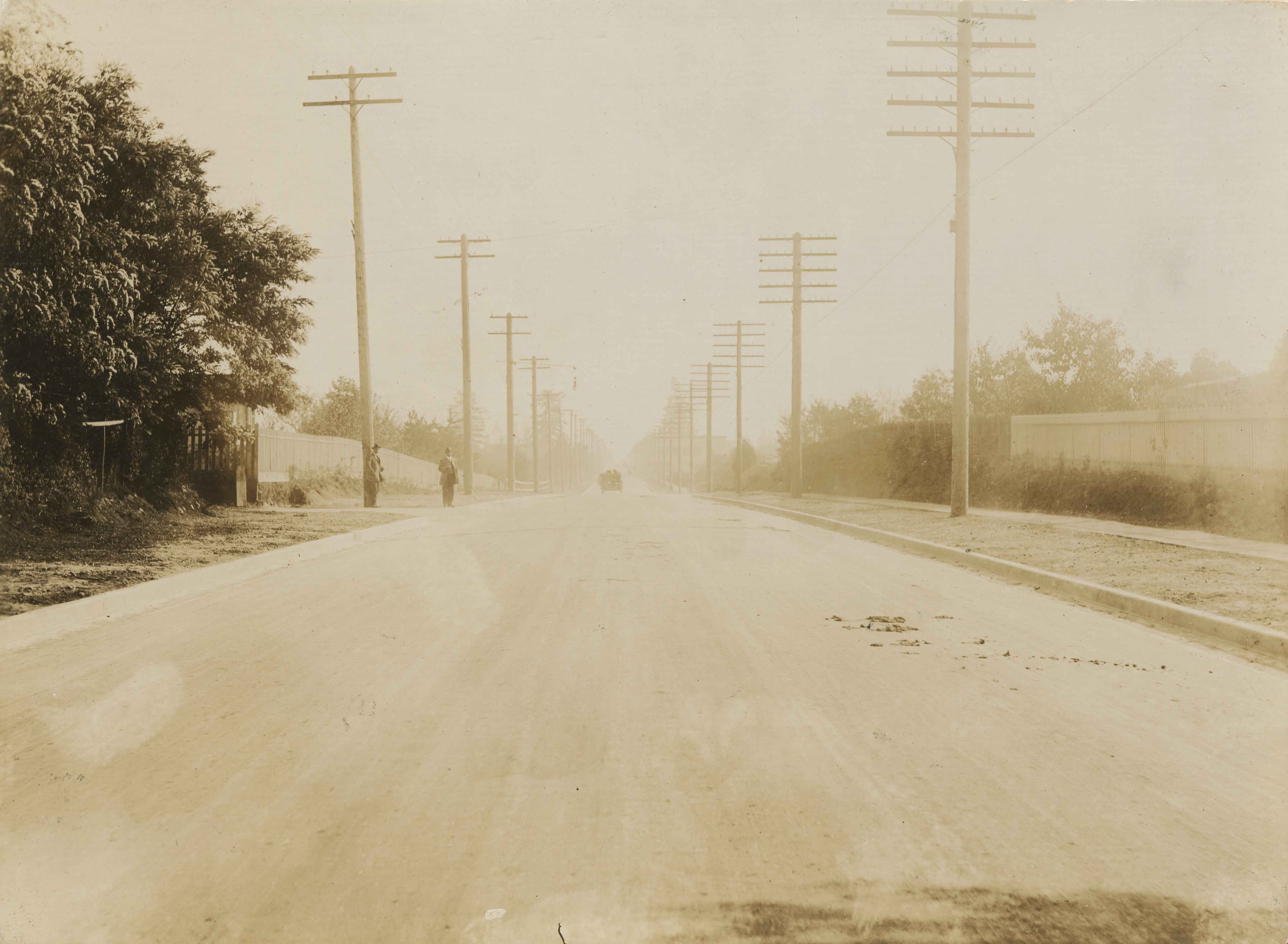
Opening of Kingsway
https://search.heritageburnaby.ca/link/archivedescription34031
- Repository
- City of Burnaby Archives
- Date
- September 30, 1913
- Collection/Fonds
- Burnaby Historical Society fonds
- Description Level
- Item
- Physical Description
- 1 photograph : b&w negative ; 8 x 11 cm
- Scope and Content
- Photograph of the official opening of Kingsway taken at Edmonds Street looking east. Automobiles and Interturban tracks are visible.
- Repository
- City of Burnaby Archives
- Date
- September 30, 1913
- Collection/Fonds
- Burnaby Historical Society fonds
- Subseries
- Stride family subseries
- Physical Description
- 1 photograph : b&w negative ; 8 x 11 cm
- Description Level
- Item
- Record No.
- 001-007
- Access Restriction
- No restrictions
- Reproduction Restriction
- No known restrictions
- Accession Number
- BHS2007-04
- Scope and Content
- Photograph of the official opening of Kingsway taken at Edmonds Street looking east. Automobiles and Interturban tracks are visible.
- Media Type
- Photograph
- Notes
- Title based on contents of photograph
- Geographic Access
- Kingsway
- Edmonds Street
- Historic Neighbourhood
- Edmonds (Historic Neighbourhood)
- Planning Study Area
- Edmonds Area
- Stride Avenue Area
Images