Narrow Results By
Subject
- Aerial Photographs 1
- Building Components 1
- Buildings - Heritage 1
- Buildings - Industrial 1
- Buildings - Industrial - Mills 1
- Buildings - Residences 1
- Buildings - Residences - Houses 2
- Buildings - Residential 4
- Buildings - Residential - Cabins 1
- Buildings - Residential - Houses 5
- Buildings - Schools 2
- Buildings - Schools - Universities and Colleges 3

Dr. William & Ruth Baldwin House
https://search.heritageburnaby.ca/link/landmark534
- Repository
- Burnaby Heritage Planning
- Description
- The Dr. William & Ruth Baldwin House is a two-storey modern post-and-beam structure, located on the southern shore of Deer Lake in Burnaby's Deer Lake Park. The site is steeply sloped, and the main entrance of the house is at the top of the slope facing onto Deer Lake Drive.
- Associated Dates
- 1965
- Formal Recognition
- Community Heritage Register
- Repository
- Burnaby Heritage Planning
- Geographic Access
- Deer Lake Drive
- Associated Dates
- 1965
- Formal Recognition
- Community Heritage Register
- Enactment Type
- Council Resolution
- Enactment Date
- 26/05/2003
- Description
- The Dr. William & Ruth Baldwin House is a two-storey modern post-and-beam structure, located on the southern shore of Deer Lake in Burnaby's Deer Lake Park. The site is steeply sloped, and the main entrance of the house is at the top of the slope facing onto Deer Lake Drive.
- Heritage Value
- The Baldwin House is valued as a prime example of Burnaby’s post-Second World War modern heritage and progressive architectural style, as well as for its personal connections to internationally-acclaimed architect, Arthur Erickson. Inspired by the modern domestic idiom established earlier in the twentieth century by Frank Lloyd Wright and Richard Neutra, Erickson conceived his architecture as responding directly to the site. A cohesive expression of simple orthogonal lines and ultimate transparency, this structure reduces the idea of post-and-beam West Coast modernism to its most refined elements. A fine example of the evolving talent of Erickson’s earlier work, this house is a landmark modern house in Burnaby and is unique in terms of siting and context. Having just won the 1963 competition for the new Simon Fraser University in Burnaby with his partner, Geoff Massey, and having built fewer than half a dozen homes previously, Erickson’s reputation was growing and his skill as a designer of modern buildings was in great demand. The same year that Erickson/Massey Architects designed SFU, Dr. William Baldwin and his wife, Ruth, personal friends of Erickson, commissioned him to design this house. Erickson was already familiar with the site; as a child he had spent time at this spot when his family visited friends who lived on Deer Lake. Both the Baldwin House and the university were completed in 1965. SFU became internationally famous; the Baldwin House was also considered an architectural success and was recognized in publications of the time. Only a single storey of this two-storey house is visible from the road, as it is built into the hillside in response to its steep site and proximity to Deer Lake. Like many other Erickson designs, this structure was conceived as a pavilion. Constructed of glass and wood, its transparency facilitates visual access to the lake’s edge, acting as an invitation, rather than a barrier, to the landscape. The house blends into the natural surroundings and the site includes other man-made landscape features such as a reflecting pool. As a reaction to the often grey quality of light in the region, Erickson exploits flat planes of water as a source of borrowed light. The refined and purposeful design, transparency, openness of plan and adjacency to the lake combine to give the house a floating appearance at the water's edge. The concept of a floating house set within an accompanying garden was inspired, in part, by the palaces and house boats of Dal Lake in Kashmir and the famed nearby Mughal Gardens. Although Erickson never visited Dal Lake, he travelled extensively throughout India, and specifically mentions the Kashmir reference in relation to this house. There is a rich complexity of other allusions worked into the fabric of the house, unified by a feeling for the conjunction of light, water and land at this special location. Widely renowned as Canada’s most brilliant modern architect, Erickson’s reputation is important to the development and growth of modern architecture in Canada and North America.
- Defining Elements
- The elements of the Baldwin House that define its character are those materials and details which respond to the location of the building and determine the relation between landscape and building, combining to create a single cohesive site. These include its: - close proximity to water - orthogonal plan and massing, with flat tar-and-gravel roof - stepped down massing orienting the house towards the water - post-and-beam construction, with the width of the beams matched to the width of the posts - wood and glass used as primary building materials - transparency and light achieved by the abundant use of glass - large undivided sheets of single glazing - butt glazed glass corners - abundant and generous balconies, which blur the transition from interior to exterior - horizontal flush cedar siding - use of salvaged brick for chimneys - use of chains as downspouts - built-in rooftop barbeque - built in furniture and fittings dating to the time of construction, such as original hardware, benches, bathroom vanities and kitchen cabinets - landscaped site including reflecting pool, plantings and a dock protruding into the lake
- Locality
- Deer Lake Park
- Historic Neighbourhood
- Burnaby Lake (Historic Neighbourhood)
- Planning Study Area
- Morley-Buckingham Area
- Function
- Primary Current--Single Dwelling
- Primary Historic--Single Dwelling
- Community
- Burnaby
- Cadastral Identifier
- P.I.D. No. 011-946-032 and P.I.D. No. 011-946-067
- Boundaries
- The Baldwin House is comprised of two municipally-owned lots located at 6543 and 6545 Deer Lake Drive, Burnaby.
- Area
- 6,070.20
- Contributing Resource
- Building
- Landscape Feature
- Ownership
- Public (local)
- Other Collection
- Canadian Architectural Archives, University of Calgary, Collection: Original Plans No. ERI 4A/76.13
- Documentation
- Heritage Site Files: PC77000 20. City of Burnaby Planning and Building Department, 4949 Canada Way, Burnaby, B.C., V5G 1M2
- Street Address
- 6543 Deer Lake Drive
Images


Bill Copeland Sports Centre & Burnaby Lake Arena
https://search.heritageburnaby.ca/link/landmark819
- Repository
- Burnaby Heritage Planning
- Geographic Access
- Kensington Avenue
- Associated Dates
- 1965
- Heritage Value
- In February 1965, the Planning Department presented to Burnaby Council a preliminary Development Plan entitled "Pacific Sports Centre," for the area immediately west of Burnaby Lake. This report proposed a conceptual plan for a comprehensive range of indoor and outdoor sporting facilities adjacent to Burnaby Lake. The idea was accepted by Council and led to the construction of the Burnaby Lake Rink beside the C.G. Brown Pool. In 1973, Burnaby and New Westminster jointly hosted the Canada Summer Games for which a rowing course and pavilion were built at Burnaby Lake and the success of the games and the sports facilities added within Burnaby Lake Park provided further stimulus for the creation of the sports and recreation facilities at this site.
- Historic Neighbourhood
- Burnaby Lake (Historic Neighbourhood)
- Planning Study Area
- Ardingley-Sprott Area
- Street Address
- 3676 Kensington Avenue
- Street View URL
- Google Maps Street View
Images


Douglas-Gilpin Neighbourhood
https://search.heritageburnaby.ca/link/landmark799
- Repository
- Burnaby Heritage Planning
- Associated Dates
- 1955-2008
- Heritage Value
- The Douglas-Gilpin Neighbourhood developed into a diverse area incorporating residential, business, educational and park districts in the period after 1955. The BCIT site was built in the early 1960s, shortly after the Burnaby Municipal Hall was located on Canada Way near Deer Lake in 1956. The construction of the Municipal Hall at this location fostered the creation of an administrative and business centre adjacent to the park, while the northern and central areas of the neighbourhood retained their primarily residential character.
- Historic Neighbourhood
- Burnaby Lake (Historic Neighbourhood)
- Planning Study Area
- Douglas-Gilpin Area
Images


Sperling-Broadway Neighbourhood
https://search.heritageburnaby.ca/link/landmark789
- Repository
- Burnaby Heritage Planning
- Associated Dates
- 1955-2008
- Heritage Value
- By the 1970s, the Sperling-Broadway Neighbourhood was characterised as one of the Municipality's fastest growing residential areas. In 1980, it was estimated that slightly less than half of the homes were single-family residences, while the remaining development was taking the form of townhouse and high-rise apartments. The emphasis shifted back to single family housing during the construction of planned subdivisions such as the Camrose subdivision in the 1980s and the area remains primarily residential in nature. The neighbourhood is well-served by park facilities and is also home to the Burnaby Mountain Golf Course.
- Historic Neighbourhood
- Lochdale (Historic Neighbourhood)
- Planning Study Area
- Sperling-Broadway Area
Images


Burnaby North High School
https://search.heritageburnaby.ca/link/landmark745
- Repository
- Burnaby Heritage Planning
- Associated Dates
- 1923-1982
- Street View URL
- Google Maps Street View
- Repository
- Burnaby Heritage Planning
- Geographic Access
- Willingdon Avenue
- Associated Dates
- 1923-1982
- Heritage Value
- Burnaby North and Burnaby South were the first high schools built in the City. Before the high school opened, Burnaby students had to travel to Vancouver if they wished to pursue education beyond an elementary level. In 1921, arrangements were made to use the basement of the Presbyterian Church for instruction of local students. By 1922 the Burnaby North High School opened at its first permanent location (4375 Pandora Street - which is now Rosser Elementary). In 1945, the Willingdon Avenue site was built and was used until a new building was constructed in 1961 on Hammarskjold Drive. From 1962, the school was used as Burnaby Heights Junior High school, but it closed in 1982 and the junior high students went to the new Burnaby North on Hammarskjold.
- Historic Neighbourhood
- Capitol Hill (Historic Neighbourhood)
- Planning Study Area
- Capitol Hill Area
- Street Address
- 250 Willingdon Avenue
- Street View URL
- Google Maps Street View
Images


Simon Fraser University
https://search.heritageburnaby.ca/link/landmark639
- Repository
- Burnaby Heritage Planning
- Description
- The planning, design concept, design coordination, site development and landscaping for the original part of the campus were all under the control of Erickson/Massey. The complex was conceived as one building, with future growth occurring at the periphery. Tall buildings would have been out of scal…
- Associated Dates
- 1965
- Street View URL
- Google Maps Street View
- Repository
- Burnaby Heritage Planning
- Geographic Access
- University Drive
- Associated Dates
- 1965
- Description
- The planning, design concept, design coordination, site development and landscaping for the original part of the campus were all under the control of Erickson/Massey. The complex was conceived as one building, with future growth occurring at the periphery. Tall buildings would have been out of scale with the massive mountaintop ridge, so a series of horizontal terraced structures were designed that hugged the ridge and dissolve into the landscape. Following the linear peak of the mountain, the scheme organized various parts of the campus along an east/west line. The concept of a central academic quadrangle was conceived within the tradition of Oxford and Cambridge, and to enhance the sense of contemplative quiet, it was designed as a perfect square raised on massive pilotis, allowing stunning views through a landscaped courtyard. The connecting link was a gigantic space frame-developed in conjunction with Jeffrey Lindsay, a one-time associate of Buckminster Fuller-that provided shelter and a gathering-place for the students. Other architects who had placed among the top five in the competition were retained to design the individual components of the original plan: the Academic Quadrangle by Zoltan S. Kiss; the Theatre, Gymnasium & Swimming Pool by Duncan McNab & Associates; the Science Complex by Rhone & Iredale; and the Library by Robert F. Harrison.
- Heritage Value
- Following the end of the Second World War, there was unprecedented growth throughout the Lower Mainland. Many returning veterans had settled on the coast, and the loosening of wartime restrictions led to the creation of many new suburban developments throughout the region. The growing population strained existing facilities, and there was a recognition that new educational facilities had to be constructed to meet these growing demands. For many years, the only university in the province was the University of British Columbia. In the 1960s, new universities were planned for both Victoria and Burnaby to serve the wave of baby boomers just then going through high school. The dramatic site chosen for the Burnaby university was the top of Burnaby Mountain, with expansive views over mountain ranges and water. An architectural competition was held for a campus of 7,000 students that could eventually be expanded to 18,000. Of the many submissions, the judges reached unanimity on the winner, an outstanding scheme submitted by the firm of Erickson/Massey. The judges went even further, and recommended that every effort be made to ensure that the winning design be built as submitted. The new Chancellor, Gordon Shrum, agreed. The realization of this scheme won extensive recognition for the work of Arthur Erickson and Geoffrey Massey, and launched Erickson’s international career. In Erickson’s words: "Unlike any previous university, Simon Fraser is a direct translation into architecture of the expanding fields of knowledge that defy traditional boundaries, of the vital role of the university as both challenger and conservor of human culture, and of the university community as one in constant intellectual, spiritual and social interchange." The new school opened for classes in September 1965, nicknamed the “instant university,” and quickly gained a radical reputation. The startling futuristic architecture and open layout suited the explosive nature of the mid-1960s, when political and social traditions of all types were being questioned and student protests were common. Many of SFU’s programs were considered experimental, even controversial, and unrest and conflict on the campus continued for a number of years. Since this auspicious beginning 40 years ago, SFU has grown to house 25,000 students on three campuses. The core of the original campus, recognized world-wide as a profound work of architecture, remains essentially intact today.
- Locality
- Burnaby Mountain
- Historic Neighbourhood
- Barnet (Historic Neighbourhood)
- Planning Study Area
- Burnaby Mountain Area
- Architect
- Erickson/Massey
- Area
- 1360000.00
- Contributing Resource
- Building
- Ownership
- Private
- Street Address
- 8888 University Drive
- Street View URL
- Google Maps Street View
Images


Academic Quadrangle construction
https://search.heritageburnaby.ca/link/archivedescription38215
- Repository
- City of Burnaby Archives
- Date
- August 5, 1966 (date of original), copied 1991
- Collection/Fonds
- Burnaby Historical Society fonds
- Description Level
- Item
- Physical Description
- 1 photograph : b&w ; 3.3 x 4.1 cm print on contact sheet 20.5 x 26.8 cm
- Scope and Content
- Photograph of the construction of the Simon Fraser University (SFU) Academic Quadrangle building, phase two. Information at lower right corner of photograph reads, "Academic Quadrangle Building / Phase Two / Simon Fraser University, Burnaby, BC / Z.S. Kiss - Architect / Laing Construction & Equipme…
- Repository
- City of Burnaby Archives
- Date
- August 5, 1966 (date of original), copied 1991
- Collection/Fonds
- Burnaby Historical Society fonds
- Subseries
- Burnaby Image Bank subseries
- Physical Description
- 1 photograph : b&w ; 3.3 x 4.1 cm print on contact sheet 20.5 x 26.8 cm
- Description Level
- Item
- Record No.
- 370-802
- Access Restriction
- No restrictions
- Reproduction Restriction
- No restrictions
- Accession Number
- BHS1999-03
- Scope and Content
- Photograph of the construction of the Simon Fraser University (SFU) Academic Quadrangle building, phase two. Information at lower right corner of photograph reads, "Academic Quadrangle Building / Phase Two / Simon Fraser University, Burnaby, BC / Z.S. Kiss - Architect / Laing Construction & Equipment Ltd, General Contractors / No14 Date Aug 5, 1966, Facing E."
- Media Type
- Photograph
- Photographer
- Frank, Leonard
- Notes
- Title based on contents of photograph
- 1 b&w copy negative accompanying
- Geographic Access
- University Drive
- Street Address
- 8888 University Drive
- Planning Study Area
- Burnaby Mountain Area
Images

Douglas Road School gymnasium construction
https://search.heritageburnaby.ca/link/archivedescription38646
- Repository
- City of Burnaby Archives
- Date
- 1960
- Collection/Fonds
- Burnaby Historical Society fonds
- Description Level
- Item
- Physical Description
- 1 photograph : b&w ; 10 x 15 cm
- Scope and Content
- Photograph of a crew of workmen working on the construction of the new Douglas Road School gymnasium. None of the men are identified.
- Repository
- City of Burnaby Archives
- Date
- 1960
- Collection/Fonds
- Burnaby Historical Society fonds
- Subseries
- Douglas Road School subseries
- Physical Description
- 1 photograph : b&w ; 10 x 15 cm
- Description Level
- Item
- Record No.
- 471-007
- Access Restriction
- No restrictions
- Reproduction Restriction
- Reproduce for fair dealing purposes only
- Accession Number
- BHS2005-3
- Scope and Content
- Photograph of a crew of workmen working on the construction of the new Douglas Road School gymnasium. None of the men are identified.
- Names
- Douglas Road School
- Media Type
- Photograph
- Photographer
- Gordon, Ethel
- Notes
- Title based on contents of photograph.
- Geographic Access
- Canada Way
- Street Address
- 4861 Canada Way
- Historic Neighbourhood
- Burnaby Lake (Historic Neighbourhood)
- Planning Study Area
- Douglas-Gilpin Area
Images
![New building under construction, [1964 or 1965] thumbnail](/media/hpo/_Data/_Archives_Images/_Unrestricted/480/480-414.jpg?width=280)
New building under construction
https://search.heritageburnaby.ca/link/archivedescription45519
- Repository
- City of Burnaby Archives
- Date
- [1964 or 1965]
- Collection/Fonds
- Columbian Newspaper collection
- Description Level
- Item
- Physical Description
- 1 photograph : b&w ; 23.5 x 36.5 cm
- Scope and Content
- Photograph of a new building at Simon Fraser University under construction.
- Repository
- City of Burnaby Archives
- Date
- [1964 or 1965]
- Collection/Fonds
- Columbian Newspaper collection
- Physical Description
- 1 photograph : b&w ; 23.5 x 36.5 cm
- Description Level
- Item
- Record No.
- 480-414
- Access Restriction
- No restrictions
- Reproduction Restriction
- Reproduce for fair dealing purposes only
- Accession Number
- 2003-02
- Scope and Content
- Photograph of a new building at Simon Fraser University under construction.
- Names
- Simon Fraser University
- Media Type
- Photograph
- Photographer
- Donnelly, David
- Notes
- Title based on contents of photograph
Images
![New building under construction, [1964 or 1965] thumbnail](/media/hpo/_Data/_Archives_Images/_Unrestricted/480/480-414.jpg)
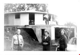
Paneloc building under construction
https://search.heritageburnaby.ca/link/museumdescription15091
- Repository
- Burnaby Village Museum
- Date
- May 1967
- Collection/Fonds
- Elmer Wilson Martin fonds
- Description Level
- Item
- Physical Description
- 1 photograph : b&w ; 9 x 12.5 cm
- Scope and Content
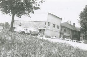
- Photograph of Elmer Wilson Martin (far left), Reta Martin and an unidentified woman standing on a construction site whereby a paneloc building is being built. The partially finished paneloc building is behind them. Three unidentified men are visible standing on the roof of the garage situated under…
- Repository
- Burnaby Village Museum
- Collection/Fonds
- Elmer Wilson Martin fonds
- Description Level
- Item
- Physical Description
- 1 photograph : b&w ; 9 x 12.5 cm
- Scope and Content
- Photograph of Elmer Wilson Martin (far left), Reta Martin and an unidentified woman standing on a construction site whereby a paneloc building is being built. The partially finished paneloc building is behind them. Three unidentified men are visible standing on the roof of the garage situated under the paneloc building.
- Geographic Access
- Hastings Street
- Street Address
- 6635 Hastings Street
- Accession Code
- BV019.40.31
- Access Restriction
- No restrictions
- Reproduction Restriction
- May be restricted by third party rights
- Date
- May 1967
- Media Type
- Photograph
- Scan Resolution
- 600
- Scan Date
- February 8, 2021
- Scale
- 100
- Photographer
- Supové, Larry
- Notes
- Title based on contents of photograph
- Stamp on verso of photograph reads: "SHOT BY / Larry Supové"
- According to an advertisement dated June 14, 1957 for Paneloc Manufacturing in the Vancouver Province newspaper, a paneloc display model was available for viewing at 6635 East Hastings Street in Burnaby. The model in this photograph may be at this location.
Images

Sewer construction
https://search.heritageburnaby.ca/link/archivedescription38006
- Repository
- City of Burnaby Archives
- Date
- January 1962 (date of original), copied 1991
- Collection/Fonds
- Burnaby Historical Society fonds
- Description Level
- Item
- Physical Description
- 1 photograph : b&w ; 3.2 x 4.7 cm print on contact sheet 20.5 x 26.4 cm
- Scope and Content
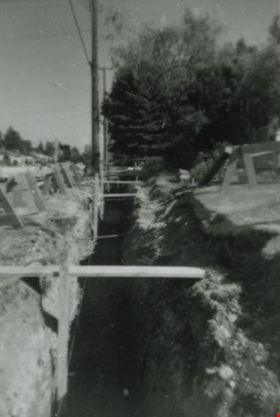
- Photograph of sewers being constructed on the 5600 block of Rumble Street.
- Repository
- City of Burnaby Archives
- Date
- January 1962 (date of original), copied 1991
- Collection/Fonds
- Burnaby Historical Society fonds
- Subseries
- Burnaby Image Bank subseries
- Physical Description
- 1 photograph : b&w ; 3.2 x 4.7 cm print on contact sheet 20.5 x 26.4 cm
- Description Level
- Item
- Record No.
- 370-593
- Access Restriction
- No restrictions
- Reproduction Restriction
- No restrictions
- Accession Number
- BHS1999-03
- Scope and Content
- Photograph of sewers being constructed on the 5600 block of Rumble Street.
- Subjects
- Public Services - Sewerages
- Media Type
- Photograph
- Notes
- Title based on contents of photograph
- 1 b&w copy negative accompanying
- Copied from col. photograph
- Annotation at bottom of photograph reads, "Rumble St. 1962"
- Geographic Access
- Rumble Street
- Historic Neighbourhood
- Alta-Vista (Historic Neighbourhood)
- Planning Study Area
- Clinton-Glenwood Area
Images

Sewer construction
https://search.heritageburnaby.ca/link/archivedescription38007
- Repository
- City of Burnaby Archives
- Date
- January 1962 (date of original), copied 1991
- Collection/Fonds
- Burnaby Historical Society fonds
- Description Level
- Item
- Physical Description
- 1 photograph : b&w ; 4.5 x 3.0 cm print on contact sheet 20.5 x 26.4 cm
- Scope and Content
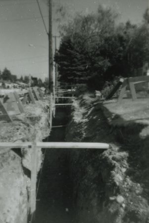
- Photograph of sewers being constructed on the 5600 block of Rumble Street.
- Repository
- City of Burnaby Archives
- Date
- January 1962 (date of original), copied 1991
- Collection/Fonds
- Burnaby Historical Society fonds
- Subseries
- Burnaby Image Bank subseries
- Physical Description
- 1 photograph : b&w ; 4.5 x 3.0 cm print on contact sheet 20.5 x 26.4 cm
- Description Level
- Item
- Record No.
- 370-594
- Access Restriction
- No restrictions
- Reproduction Restriction
- No restrictions
- Accession Number
- BHS1999-03
- Scope and Content
- Photograph of sewers being constructed on the 5600 block of Rumble Street.
- Subjects
- Public Services - Sewerages
- Media Type
- Photograph
- Notes
- Title based on contents of photograph
- 1 b&w copy negative accompanying
- Copied from col. photograph
- Geographic Access
- Rumble Street
- Historic Neighbourhood
- Alta-Vista (Historic Neighbourhood)
- Planning Study Area
- Clinton-Glenwood Area
Images
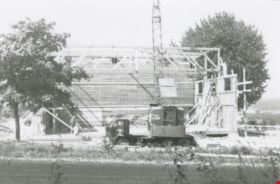
![Simon Fraser University construction, [196-] (date of original), copied 1991 thumbnail](/media/hpo/_Data/_Archives_Images/_Unrestricted/370/370-799.jpg?width=280)
Simon Fraser University construction
https://search.heritageburnaby.ca/link/archivedescription38212
- Repository
- City of Burnaby Archives
- Date
- [196-] (date of original), copied 1991
- Collection/Fonds
- Burnaby Historical Society fonds
- Description Level
- Item
- Physical Description
- 1 photograph : b&w ; 3.2 x 4.5 cm print on contact sheet 20.5 x 26.8 cm
- Scope and Content
- Photograph of a the construction of a Simon Fraser University (SFU) campus building. A crane can be seen in the background.
- Repository
- City of Burnaby Archives
- Date
- [196-] (date of original), copied 1991
- Collection/Fonds
- Burnaby Historical Society fonds
- Subseries
- Burnaby Image Bank subseries
- Physical Description
- 1 photograph : b&w ; 3.2 x 4.5 cm print on contact sheet 20.5 x 26.8 cm
- Description Level
- Item
- Record No.
- 370-799
- Access Restriction
- No restrictions
- Reproduction Restriction
- Reproduce for fair dealing purposes only
- Accession Number
- BHS1999-03
- Scope and Content
- Photograph of a the construction of a Simon Fraser University (SFU) campus building. A crane can be seen in the background.
- Subjects
- Construction Tools and Equipment
- Names
- Simon Fraser University
- Media Type
- Photograph
- Notes
- Title based on contents of photograph
- 1 b&w copy negative accompanying
- Geographic Access
- University Drive
- Street Address
- 8888 University Drive
- Planning Study Area
- Burnaby Mountain Area
Images
![Simon Fraser University construction, [196-] (date of original), copied 1991 thumbnail](/media/hpo/_Data/_Archives_Images/_Unrestricted/370/370-799.jpg)
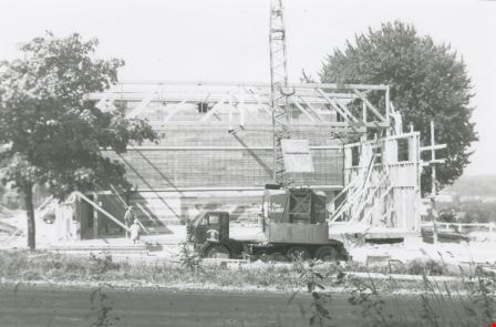
![Simon Fraser University construction, [196-] (date of original), copied 1991 thumbnail](/media/hpo/_Data/_Archives_Images/_Unrestricted/370/370-800.jpg?width=280)
Simon Fraser University construction
https://search.heritageburnaby.ca/link/archivedescription38213
- Repository
- City of Burnaby Archives
- Date
- [196-] (date of original), copied 1991
- Collection/Fonds
- Burnaby Historical Society fonds
- Description Level
- Item
- Physical Description
- 1 photograph : b&w ; 3.1 x 4.5 cm print on contact sheet 20.5 x 26.8 cm
- Scope and Content
- Photograph of a the construction of a Simon Fraser University (SFU) campus building. A crane can be seen in the background.
- Repository
- City of Burnaby Archives
- Date
- [196-] (date of original), copied 1991
- Collection/Fonds
- Burnaby Historical Society fonds
- Subseries
- Burnaby Image Bank subseries
- Physical Description
- 1 photograph : b&w ; 3.1 x 4.5 cm print on contact sheet 20.5 x 26.8 cm
- Description Level
- Item
- Record No.
- 370-800
- Access Restriction
- No restrictions
- Reproduction Restriction
- Reproduce for fair dealing purposes only
- Accession Number
- BHS1999-03
- Scope and Content
- Photograph of a the construction of a Simon Fraser University (SFU) campus building. A crane can be seen in the background.
- Names
- Simon Fraser University
- Media Type
- Photograph
- Notes
- Title based on contents of photograph
- 1 b&w copy negative accompanying
- Geographic Access
- University Drive
- Street Address
- 8888 University Drive
- Planning Study Area
- Burnaby Mountain Area
Images
![Simon Fraser University construction, [196-] (date of original), copied 1991 thumbnail](/media/hpo/_Data/_Archives_Images/_Unrestricted/370/370-800.jpg)
![Historic photo of Cariboo Road, [190-] date of original, copied [198_] thumbnail](/media/hpo/_Data/_BVM_Images/2020/2020_0005_0860_001.jpg?width=280)
Historic photo of Cariboo Road
https://search.heritageburnaby.ca/link/museumdescription13516
- Repository
- Burnaby Village Museum
- Date
- [190-] date of original, copied [198_]
- Collection/Fonds
- Century Park Museum Association fonds
- Description Level
- Item
- Physical Description
- 1 photograph : b&w print ; 8.7 x 12.5 cm
- Scope and Content
- Photograph of a historic photograph of an unidentified man standing on a boardwalk on the corner of Cariboo Road in Burnaby. Historic photograph includes a label in the top corner that reads: "Cariboo Rd / Burnaby". The road is made of dirt and a two story house is visible across the road from the …
- Repository
- Burnaby Village Museum
- Collection/Fonds
- Century Park Museum Association fonds
- Description Level
- Item
- Physical Description
- 1 photograph : b&w print ; 8.7 x 12.5 cm
- Scope and Content
- Photograph of a historic photograph of an unidentified man standing on a boardwalk on the corner of Cariboo Road in Burnaby. Historic photograph includes a label in the top corner that reads: "Cariboo Rd / Burnaby". The road is made of dirt and a two story house is visible across the road from the man.
- Subjects
- Construction - Road Construction
- Names
- Burnaby Village Museum
- Geographic Access
- Cariboo Road
- Accession Code
- BV020.5.860
- Access Restriction
- No restrictions
- Reproduction Restriction
- May be restricted by third party rights
- Date
- [190-] date of original, copied [198_]
- Media Type
- Photograph
- Scan Resolution
- 600
- Scan Date
- 25-Aug-2020
- Scale
- 100
- Photographer
- Brown, Cice Chandler
- Notes
- Title based on contents of photograph
Images
![Historic photo of Cariboo Road, [190-] date of original, copied [198_] thumbnail](/media/hpo/_Data/_BVM_Images/2020/2020_0005_0860_001.jpg)
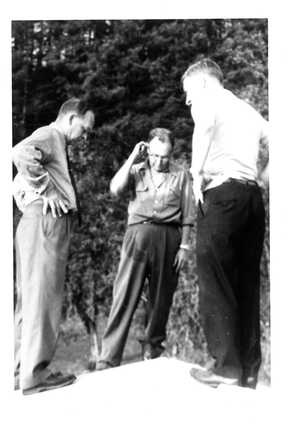
![Bob Prittie with George McNeil, [between 1969 and 1973] thumbnail](/media/hpo/_Data/_Archives_Images/_Unrestricted/480/480-913.jpg?width=280)
Bob Prittie with George McNeil
https://search.heritageburnaby.ca/link/archivedescription46025
- Repository
- City of Burnaby Archives
- Date
- [between 1969 and 1973]
- Collection/Fonds
- Columbian Newspaper collection
- Description Level
- Item
- Physical Description
- 1 photograph : b&w ; 15 x 9 cm
- Scope and Content
- Photograph of Bob Prittie sitting in a excavator with YMCA (Young Men's Christian Association) President George McNeil standing next to him, holding an architectural drawing. They are at the site of the "new" Burnaby YMCA.
- Repository
- City of Burnaby Archives
- Date
- [between 1969 and 1973]
- Collection/Fonds
- Columbian Newspaper collection
- Physical Description
- 1 photograph : b&w ; 15 x 9 cm
- Description Level
- Item
- Record No.
- 480-913
- Access Restriction
- No restrictions
- Reproduction Restriction
- Reproduce for fair dealing purposes only
- Accession Number
- 2003-02
- Scope and Content
- Photograph of Bob Prittie sitting in a excavator with YMCA (Young Men's Christian Association) President George McNeil standing next to him, holding an architectural drawing. They are at the site of the "new" Burnaby YMCA.
- Media Type
- Photograph
- Notes
- Title based on contents of photograph
Images
![Bob Prittie with George McNeil, [between 1969 and 1973] thumbnail](/media/hpo/_Data/_Archives_Images/_Unrestricted/480/480-913.jpg)
Douglas Road School gymnasium
https://search.heritageburnaby.ca/link/archivedescription38648
- Repository
- City of Burnaby Archives
- Date
- 1960
- Collection/Fonds
- Burnaby Historical Society fonds
- Description Level
- Item
- Physical Description
- 1 photograph : b&w ; 10 x 15 cm
- Scope and Content
- Photograph of two workmen (unidentified) standing next to a truckload of lumber outside the new Douglas Road School gymnasium.
- Repository
- City of Burnaby Archives
- Date
- 1960
- Collection/Fonds
- Burnaby Historical Society fonds
- Subseries
- Douglas Road School subseries
- Physical Description
- 1 photograph : b&w ; 10 x 15 cm
- Description Level
- Item
- Record No.
- 471-009
- Access Restriction
- No restrictions
- Reproduction Restriction
- Reproduce for fair dealing purposes only
- Accession Number
- BHS2005-3
- Scope and Content
- Photograph of two workmen (unidentified) standing next to a truckload of lumber outside the new Douglas Road School gymnasium.
- Names
- Douglas Road School
- Media Type
- Photograph
- Photographer
- Gordon, Ethel
- Notes
- Title based on contents of photograph.
- Geographic Access
- Douglas Road
- Canada Way
- Street Address
- 4861 Canada Way
- Historic Neighbourhood
- Burnaby Lake (Historic Neighbourhood)
- Planning Study Area
- Douglas-Gilpin Area
Images

Elmer and men on roof of paneloc house
https://search.heritageburnaby.ca/link/museumdescription15089
- Repository
- Burnaby Village Museum
- Date
- May 1967
- Collection/Fonds
- Elmer Wilson Martin fonds
- Description Level
- Item
- Physical Description
- 1 photograph : b&w ; 9 x 12.5 cm
- Scope and Content
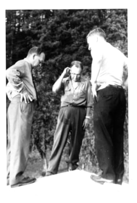
- Photograph of Elmer Wilson Martin with two unidentified men standing on the roof of a paneloc house. Elmer Wilson is standing on the left.
- Repository
- Burnaby Village Museum
- Collection/Fonds
- Elmer Wilson Martin fonds
- Description Level
- Item
- Physical Description
- 1 photograph : b&w ; 9 x 12.5 cm
- Scope and Content
- Photograph of Elmer Wilson Martin with two unidentified men standing on the roof of a paneloc house. Elmer Wilson is standing on the left.
- Geographic Access
- Hastings Street
- Street Address
- 6635 Hastings Street
- Accession Code
- BV019.40.29
- Access Restriction
- No restrictions
- Reproduction Restriction
- May be restricted by third party rights
- Date
- May 1967
- Media Type
- Photograph
- Scan Resolution
- 600
- Scan Date
- February 8, 2021
- Scale
- 100
- Photographer
- Supové, Larry
- Notes
- Title based on contents of photograph
- Stamp on verso of photograph reads: "SHOT BY / Larry Supové"
- According to an advertisement dated June 14, 1957 for Paneloc Manufacturing in the Vancouver Province newspaper, a paneloc display model was available for viewing at 6635 East Hastings Street in Burnaby. The model in this photograph may be at this location.
Images
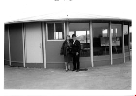
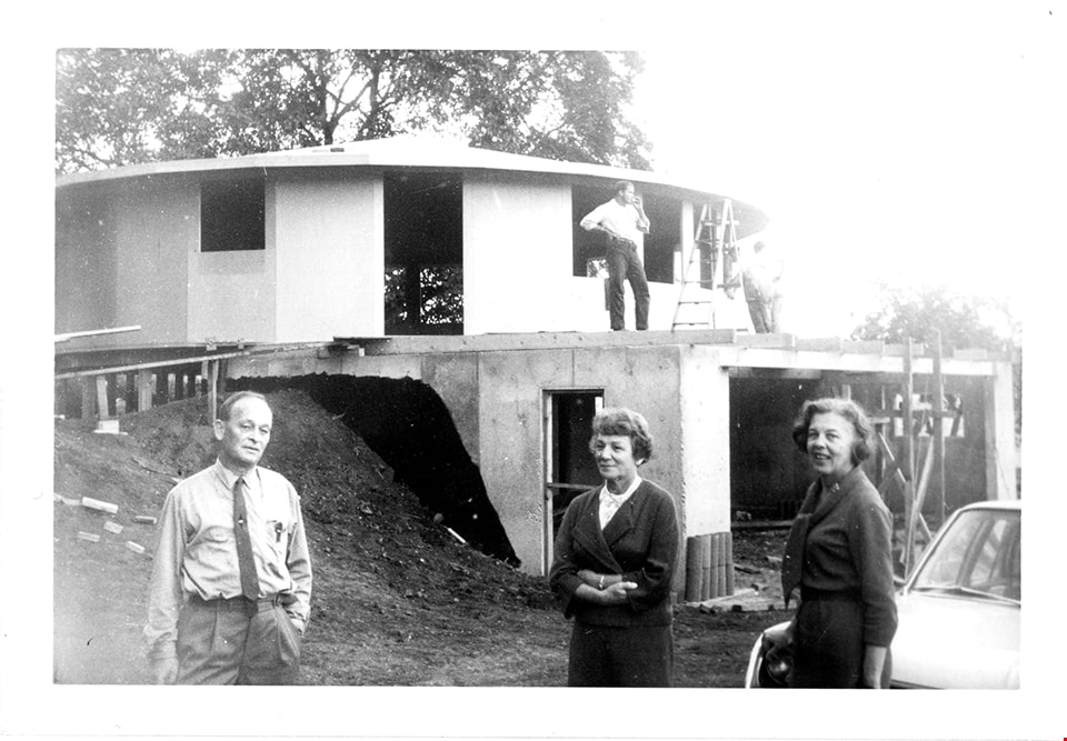
Elmer and Reta Martin in front of paneloc house
https://search.heritageburnaby.ca/link/museumdescription15088
- Repository
- Burnaby Village Museum
- Date
- May 1967
- Collection/Fonds
- Elmer Wilson Martin fonds
- Description Level
- Item
- Physical Description
- 1 photograph : b&w ; 9 x 12.5 cm
- Scope and Content
- Photograph of Elmer Wilson Martin with his wife Renatta "Reta" Boyd Martin. The couple are standing in front of a paneloc house.
- Repository
- Burnaby Village Museum
- Collection/Fonds
- Elmer Wilson Martin fonds
- Description Level
- Item
- Physical Description
- 1 photograph : b&w ; 9 x 12.5 cm
- Scope and Content
- Photograph of Elmer Wilson Martin with his wife Renatta "Reta" Boyd Martin. The couple are standing in front of a paneloc house.
- Geographic Access
- Hastings Street
- Street Address
- 6635 Hastings Street
- Accession Code
- BV019.40.28
- Access Restriction
- No restrictions
- Reproduction Restriction
- May be restricted by third party rights
- Date
- May 1967
- Media Type
- Photograph
- Scan Resolution
- 600
- Scan Date
- February 8, 2021
- Scale
- 100
- Notes
- Title based on contents of photograph
- Stamp on verso of photograph reads: "F 791"
- According to an advertisement dated June 14, 1957 for Paneloc Manufacturing in the Vancouver Province newspaper, a paneloc display model was available for viewing at 6635 East Hastings Street in Burnaby. The model in this photograph may be at this location.
Images

![Ron Smitherman, [199-]. Item no. 549-065. thumbnail](/media/hpo/_Data/_Archives_Images/_Unrestricted/540/549-065.jpg?width=280)
Interview with Ron Smitherman by Eric Damer November 15, 2012 - Track 1
https://search.heritageburnaby.ca/link/oralhistory403
- Repository
- City of Burnaby Archives
- Date Range
- 1945-1979
- Length
- 0:08:43
- Summary
- This portion of the recording pertains to Ron Smitherman's memories of his early years in construction. Ron discusses what it was like to be in construction during the postwar era. He also discusses his father's work as a carpenter and the changes that occurred with the introduction of electric car…
- Repository
- City of Burnaby Archives
- Summary
- This portion of the recording pertains to Ron Smitherman's memories of his early years in construction. Ron discusses what it was like to be in construction during the postwar era. He also discusses his father's work as a carpenter and the changes that occurred with the introduction of electric carpentry tools.
- Date Range
- 1945-1979
- Photo Info
- Ron Smitherman, [199-]. Item no. 549-065.
- Length
- 0:08:43
- Subjects
- Construction Tools and Equipment
- Interviewer
- Damer, Eric
- Interview Date
- November 15, 2012
- Scope and Content
- Recording is an interview with Ron Smitherman conducted by Burnaby Village Museum employee Eric Damer, November 15, 2012. Major theme discussed: building construction and development in Burnaby.
- Biographical Notes
- Born in 1933 and raised in Vancouver, Ron Smitherman learned the construction trade from his father, upgrading his knowledge and skills as techniques and materials changed and improved. Ron built houses and commercial buildings in Burnaby and elsewhere during the nineteen-forties, fifties and sixties. In 1969 Ron and his family settled in Burnaby where he shifted his business to real estate.
- Total Tracks
- 6
- Total Length
- 0:46:51
- Interviewee Name
- Smitherman, Ron
- Interview Location
- Burnaby Village Museum
- Interviewer Bio
- Eric Damer is a lifelong British Columbian born in Victoria, raised in Kamloops, and currently residing in Burnaby. After studying philosophy at the University of Victoria, he became interested in the educational forces that had shaped his own life. He completed master’s and doctoral degrees in educational studies at the University of British Columbia with a particular interest in the history of adult and higher education in the province. In 2012, Eric worked for the City of Burnaby as a field researcher and writer, conducting interviews for the City Archives and Museum Oral History Program.
- Collection/Fonds
- Community Heritage Commission Special Projects fonds
- Transcript Available
- None
- Media Type
- Sound Recording
Images
![Ron Smitherman, [199-]. Item no. 549-065. thumbnail](/media/hpo/_Data/_Archives_Images/_Unrestricted/540/549-065.jpg)
Audio Tracks
Track one of recording of interview with Ron Smitherman
Track one of recording of interview with Ron Smitherman
https://search.heritageburnaby.ca/media/hpo/_Data/_Archives_Oral_Histories/_Unrestricted/MSS171-025/MSS171-025_Track_1.mp3