Narrow Results By
Decade
- 2020s 40
- 2010s 25
- 2000s 145
- 1990s 157
- 1980s
- 1970s 549
- 1960s 251
- 1950s 254
- 1940s 187
- 1930s 166
- 1920s 318
- 1910s 142
- 1900s 63
- 1890s
- 1880s 10
- 1870s 5
- 1860s 6
- 1850s 3
- 1840s 1
- 1830s 1
- 1820s 1
- 1810s 2
- 1800s 2
- 1790s 2
- 1780s 2
- 1770s 2
- 1760s 2
- 1750s 2
- 1740s 2
- 1730s 2
- 1720s 2
- 1710s 2
- 1700s 2
- 1690s 2
- 1680s 2
- 1670s 1
- 1660s 1
- 1650s 1
- 1640s 1
- 1630s 1
- 1620s 1
- 1610s 1
- 1600s 1
- 1590s 1
- 1580s 1
- 1570s 1
- 1560s 1
- 1550s 1
- 1540s 1
- 1530s 1
- 1520s 2
- 1510s 1
- 1500s 1
- 1490s
- 1480s 1
Creator
- Battistoni, Peter 5
- Binks, James 2
- Braid, Tom 5
- Burnaby Village Museum 7
- Damer, Eric 1
- Fong, Denise 2
- Galbraith, Eleanor Lois 1
- Garden, Hermon & Burwell 1
- Gibson, Wilfred 1
- Government of British Columbia - Department of Lands and Works 1
- Government of Canada - Department of Mines - Geological Survey Branch 1
- Hill, Albert James 1
Person / Organization
- Adams, Rocky 2
- Ansdell, Elsie Brown-John 1
- Army, Navy and Air Force Veterans in Canada, Pompier Unit #314 1
- Bateman, Edwin W. 1
- Bateman, Marianne May 1
- Bell-Irving, Henry P "Budge" 4
- Bell-Irving, Nancy 3
- Bingham, Alfred "Alf" 4
- The Bollywood Boyz 1
- Boy Scouts of Canada 13
- Braaten, Jean 1
- Bradbury, Dr. Bettina 3

East Burnaby School (Edmonds Street School)
https://search.heritageburnaby.ca/link/landmark735
- Repository
- Burnaby Heritage Planning
- Geographic Access
- Canada Way
- Associated Dates
- 1894
- Heritage Value
- One of the first tasks of Burnaby's Municipal Government upon its incorporation was to lobby for a public school in Burnaby. By 1893, land on Douglas Road near Edmonds was donated and the new school was built in 1893. The one-room school opened on January 22, 1894 with 29 students under the charge of teacher, Ethel LePage. The School has been known as the Burnaby School (until1896), and then East Burnaby School from 1896 to 1907 and finally, Edmonds Street School.
- Historic Neighbourhood
- Edmonds (Historic Neighbourhood)
- Planning Study Area
- Edmonds Area
- Street Address
- 7376 Canada Way
- Street View URL
- Google Maps Street View
Images


South Burnaby Cenotaph
https://search.heritageburnaby.ca/link/landmark860
- Repository
- Burnaby Heritage Planning
- Description
- The South Burnaby Cenotaph is located in Bonsor Park at the corner of Nelson Avenue and Imperial Street. The cenotaph commemorates those lost in the First World War, Second World War and the Korean War.
- Associated Dates
- 1988
- Other Names
- Bonsor Park Cenotaph
- Street View URL
- Google Maps Street View
- Repository
- Burnaby Heritage Planning
- Other Names
- Bonsor Park Cenotaph
- Geographic Access
- Nelson Avenue
- Associated Dates
- 1988
- Description
- The South Burnaby Cenotaph is located in Bonsor Park at the corner of Nelson Avenue and Imperial Street. The cenotaph commemorates those lost in the First World War, Second World War and the Korean War.
- Historic Neighbourhood
- Central Park (Historic Neighbourhood)
- Planning Study Area
- Marlborough Area
- Community
- Burnaby
- Cadastral Identifier
- P.I.D. No. 027-719-375
- Boundaries
- The property (Bonsor Park) is comprised of a single municipally-owned property located at 6749 Nelson Avenue.
- Area
- 3570.00
- Contributing Resource
- Landscape Feature
- Structure
- Ownership
- Public (local)
- Street Address
- 6749 Nelson Avenue
- Street View URL
- Google Maps Street View
Images


Charles R. Shaw House
https://search.heritageburnaby.ca/link/landmark525
- Repository
- Burnaby Heritage Planning
- Description
- The Charles R. Shaw House is a one and one-half storey plus basement wood-frame late Victorian era residence, located on the grounds of the Normanna Rest Home development in East Burnaby, near its original location on this site. Originally a modest vernacular Victorian structure, it has been enlarg…
- Associated Dates
- 1891
- Formal Recognition
- Heritage Designation, Community Heritage Register
- Other Names
- Charles R. & Mary Shaw House
- Street View URL
- Google Maps Street View
- Repository
- Burnaby Heritage Planning
- Other Names
- Charles R. & Mary Shaw House
- Geographic Access
- 12th Avenue
- 4th Street
- 13th Avenue
- Associated Dates
- 1891
- Formal Recognition
- Heritage Designation, Community Heritage Register
- Enactment Type
- Bylaw No. 10739
- Enactment Date
- 06/04/1998
- Description
- The Charles R. Shaw House is a one and one-half storey plus basement wood-frame late Victorian era residence, located on the grounds of the Normanna Rest Home development in East Burnaby, near its original location on this site. Originally a modest vernacular Victorian structure, it has been enlarged and embellished through later additions.
- Heritage Value
- The Shaw House is one of the oldest surviving houses in Burnaby, and is valued as a representation of a typical vernacular pioneer house in Burnaby, and a rare survivor from the late Victorian era. The original portion of the house displays a simplicity of form and detail consistent with early local construction, while the later additions display a more sophisticated approach. Originally built in 1891, this house is valued for its association with first owner, Charles R. Shaw (1834-1916) and Mary D. Shaw (1848-1897), one of Burnaby’s earliest settlers. Born in England, Shaw immigrated to Toronto in 1869, and relocated to New Westminster in 1889, where he worked as an employee of the Mechanic's Mill Company, an early woodworking plant. After moving to Burnaby, he was unanimously elected by acclamation as first reeve (mayor) of the new municipality in 1892. In 1894, Shaw sold his house and farm and moved his family to Kamloops due to his wife Mary's failing health. After Mary died in 1897, the Shaw family returned to Toronto. The Shaw House is additionally valued for its association with a later owner, James Brookes (1884-1953), founder of James Brookes Woodworking Ltd., a mill that was a major employer in East Burnaby. Brookes bought and renovated the house in 1917. In 1927, he built a much larger house on the property (now demolished), and the original house was moved to the corner of the property to serve as a gardener's cottage for Brookes' estate. The additions made to the house at this time employed sash and milled products produced by the Brookes plant. Although altered, this Victorian era residence remains largely intact, with Brookes’s later additions.
- Defining Elements
- Key elements that define the heritage character of the Shaw House include its: - modest vernacular residential form, scale and massing, as exemplified by its one and one-half storey plus basement height, front gabled roof, shed roofed verandah and asymmetrical plan - asymmetrical front entrance - cladding: horizontal wooden drop siding on the original portion of the house; cedar shingles on additions; decorative octagonal cedar shingles in the front gable; original decorated bargeboards at front, with cut-out details - later renovations to the front verandah and side addition which resulted in a partially glazed porch entrance and addition with large window assemblies - square verandah columns - irregular fenestration: double-hung wooden-sash windows in a variety of configurations such as 6-over-1 and 4-over-1 windows in the original portion of the house, 12-over-1 windows, and one 24-over-1 window in the front addition - small window at front entry - fifteen-pane French front entry door - internal red brick chimney with corbelled cap
- Historic Neighbourhood
- East Burnaby (Historic Neighbourhood)
- Planning Study Area
- Edmonds Area
- Function
- Primary Historic--Single Dwelling
- Primary Current--Single Dwelling
- Community
- Burnaby
- Cadastral Identifier
- 003-253-848
- Boundaries
- The Shaw House is comprised of a single residential lot located at 7725 Fourth Street (legal address), Burnaby
- Area
- 9199.27
- Contributing Resource
- Building
- Ownership
- Private
- Names
- Shaw, Charles R
- Street Address
- 7725 4th Street
- Street View URL
- Google Maps Street View
Images


Douglas-Gilpin Neighbourhood
https://search.heritageburnaby.ca/link/landmark799
- Repository
- Burnaby Heritage Planning
- Associated Dates
- 1955-2008
- Heritage Value
- The Douglas-Gilpin Neighbourhood developed into a diverse area incorporating residential, business, educational and park districts in the period after 1955. The BCIT site was built in the early 1960s, shortly after the Burnaby Municipal Hall was located on Canada Way near Deer Lake in 1956. The construction of the Municipal Hall at this location fostered the creation of an administrative and business centre adjacent to the park, while the northern and central areas of the neighbourhood retained their primarily residential character.
- Historic Neighbourhood
- Burnaby Lake (Historic Neighbourhood)
- Planning Study Area
- Douglas-Gilpin Area
Images


Joseph & Jane Wintemute House
https://search.heritageburnaby.ca/link/landmark523
- Repository
- Burnaby Heritage Planning
- Description
- The Wintemute House is a large two-storey wood-frame Victorian era country farm house with Victorian Italianate detailing. Designed in a symmetrical Foursquare form, it features a low-pitched hipped roof with deep eaves. Later additions to the rear of the house, and the extensive wraparound veranda…
- Associated Dates
- 1891
- Formal Recognition
- Heritage Designation, Community Heritage Register
- Other Names
- Burnett House
- Street View URL
- Google Maps Street View
- Repository
- Burnaby Heritage Planning
- Other Names
- Burnett House
- Geographic Access
- Berkley Street
- Associated Dates
- 1891
- Formal Recognition
- Heritage Designation, Community Heritage Register
- Enactment Type
- Bylaw No. 6889
- Enactment Date
- 07/03/1977
- Description
- The Wintemute House is a large two-storey wood-frame Victorian era country farm house with Victorian Italianate detailing. Designed in a symmetrical Foursquare form, it features a low-pitched hipped roof with deep eaves. Later additions to the rear of the house, and the extensive wraparound verandah and porte-cochere, were Edwardian era additions. It is located on its original site, in the modern subdivision of Buckingham Heights in southeast Burnaby. The Burnett House is one of the oldest surviving houses in Burnaby.
- Heritage Value
- Built circa 1891, the Joseph and Jane Wintemute House is valued as a representation of the early history of Burnaby and its agricultural origins. Built prior to the civic incorporation of Burnaby in 1892, the house was situated to face Douglas Road (now Canada Way), one of the first roads built to connect the rural farmlands of Burnaby to New Westminster. The original large property has been extensively subdivided and the house is now isolated in a modern subdivision. Designated in 1977, the Wintemute House is also significant as Burnaby's first protected municipal heritage site. The house is valued for its association with Joseph S. Wintemute (1832-1911) and Jane Wintemute (1832-1910), who came to British Columbia from Port Stanley, Ontario in 1865, traveling via the Isthmus of Panama. Joseph Wintemute, a skilled carpenter and contractor by trade, operated the Wintemute Furniture Factory in New Westminster, the first furniture plant established on the mainland of British Columbia. In 1891, he acquired this property, where he set up a cord wood sawmill to supply his factory. Wintemute was likely responsible for the design and construction of this commodious structure, as it was built in an Eastern Canadian style he would have been familiar with. After the lands were cleared of timber, the Wintemutes developed the property into a typical small-scale 'market garden,’ involved in the production of vegetables and fruits, such as strawberries, for sale at the New Westminster City Market. The Wintemute House is additionally significant for its association with the speculative land boom that occurred prior to the First World War, and ongoing suburban subdivision. Charles Gordon, a real estate agent, acquired the Wintemute farm and subdivided the acreage, which he marketed through the People’s Trust Company as 'Montrelynview' and offered this house as a draw prize to lot purchasers. With the collapse of the land boom, the house remained in Gordon’s possession until 1929 when it was purchased by his brother-in-law, Geoffrey Burnett, a local surveyor responsible for many of the original land surveys of Burnaby. David Burnett, Geoffrey's son, requested designation of the house when the family decided to subdivide the remaining 1.4 hectares of property in 1977. Furthermore, the Wintemute House is valued as an excellent example of a Victorian era country farm house, based loosely on the traditional farmhouses seen commonly in nineteenth century Ontario. Designed in a vernacular version of the Victorian Italianate style, the house displays restrained detailing, including several original multi-paned windows notable for their vertical proportions. The house retains many original exterior features, and the original interior layout, although modernized during the Edwardian era, is substantially intact, including finely crafted maple and cedar interior millwork that was produced by the Wintemute Furniture Factory. From 1904 to 1910, Charles Gordon, the second owner, made a number of alterations to the house including the addition of the wrap-around verandah, a porte-cochere and a 7.6 metre by 9 metre billiard room in the Arts and Crafts style, beamed and panelled in Douglas Fir. These later additions and alterations have value in demonstrating the evolution of the house and property and changing tastes at the turn of the nineteenth century.
- Defining Elements
- Key elements that define the heritage character of the Wintemute House include its: - picturesque original setting with views to the North Shore - residential form, scale and massing as expressed by its symmetrical cubic form and two-storey height, with later additions to the rear - Victorian Italianate architectural features such as the vertically-proportioned original windows with vestigial window hoods, low-pitched hipped roof and Classical Revival details such as the corner boards articulated as pilasters - hipped roof with deep boxed eaves - horizontal lapped narrow wooden siding - second storey balcony over front entry - wide wraparound columned verandah with porte-cochere, with square trimmed columns - irregular fenestration: original Victorian era double-hung 6-over-6 wood-sash windows with vertical proportions and segmental arched tops; Edwardian era double-hung 1-over-1 wooden-sash windows; and Edwardian era wooden-sash casement window assemblies with leaded transoms - central front entry with sidelights and transom - multi-paned French doors opening out to verandah - interior features such as its 3.7 metre ceiling height on the main and second floors; the coal grate fireplace with elaborate woodwork and glazed tile surround in the front parlour; five other fireplaces throughout the house; maple and cedar interior millwork; and the Douglas Fir panelled and beamed billiard room with hidden doors, seven-panelled doors, original light fixtures and mouldings - internal red brick chimneys with corbelled caps
- Historic Neighbourhood
- Burnaby Lake (Historic Neighbourhood)
- Planning Study Area
- Morley-Buckingham Area
- Function
- Primary Historic--Single Dwelling
- Primary Current--Single Dwelling
- Community
- Burnaby
- Cadastral Identifier
- 003-297-152
- Boundaries
- The Wintemute House is comprised of a single residential lot located at 7640 Berkley Street, Burnaby.
- Area
- 1566.73
- Contributing Resource
- Building
- Ownership
- Private
- Names
- Wintemute, Joseph
- Street Address
- 7640 Berkley Street
- Street View URL
- Google Maps Street View
Images


Lake City Neighbourhood
https://search.heritageburnaby.ca/link/landmark793
- Repository
- Burnaby Heritage Planning
- Associated Dates
- 1955-2008
- Heritage Value
- When Simon Fraser University opened in 1965, approximately sixteen industrial properties had been developed in the Lake City Industrial Park. In addition, significant tracts of land in the western portion had been pre-cleared and graded in anticipation of additional development, while most of the eastern half remained forested. Some of the early companies to locate in the area were Nabob Foods, Volkswagen Canada, British Columbia Television Broadcasting, Simpson Sears, and H.Y. Louie Company Limited. Both Imperial Oil and Shell Oil established petroleum storage and distribution facilities in the area. Initially a heavy industrial area, by 1979, single family neighbourhoods south of Lougheed Highway and west of Eagle Creek had been largely developed. By the mid1980's, the Burnaby 200 multi-family development along Forest Grove Drive had also been completed.
- Planning Study Area
- Lake City Area
Images


Morley-Buckingham Neighbourhood
https://search.heritageburnaby.ca/link/landmark829
- Repository
- Burnaby Heritage Planning
- Associated Dates
- 1955-2008
- Heritage Value
- In the 1980 "Residential Neighbourhood Environment Study," the Morley-Buckingham Neighbourhood is described as "perhaps Burnaby's most prestigious residential area. The lots are larger than most other areas of the Municipality and this, along with the new expensive housing developed over the past 10 years, has created a very desirable residential neighbourhood...The older area of Buckingham lies at the lower edge of the slope and here the homes and streets are more uniform and aged between 20 and 25 years old...to the east of Canada Way lies...a cluster townhouse development."
- Historic Neighbourhood
- Burnaby Lake (Historic Neighbourhood)
- Planning Study Area
- Morley-Buckingham Area
Images


Willingdon Heights Neighbourhood
https://search.heritageburnaby.ca/link/landmark777
- Repository
- Burnaby Heritage Planning
- Associated Dates
- 1955-2008
- Heritage Value
- The convenient location of Willingdon Heights to the Trans Canada Highway, Lougheed Highway and Hastings Street has fostered its development as a primarily residential commuter neighbourhood. Characterised in the post-World War Two period by predominantly single-family developments, the neighbourhood has retained this identity despite some higher density apartment buildings now found there.
- Planning Study Area
- Willingdon Heights Area
Images


Canada geese in the park
https://search.heritageburnaby.ca/link/archivedescription59046
- Repository
- City of Burnaby Archives
- Date
- ca.1983
- Collection/Fonds
- Columbian Newspaper collection
- Description Level
- Item
- Physical Description
- 1 photograph : b&w ; 17.5 x 20 cm
- Scope and Content
- Photograph of a flock of Canada geese on a grassy field in a park.
- Repository
- City of Burnaby Archives
- Date
- ca.1983
- Collection/Fonds
- Columbian Newspaper collection
- Physical Description
- 1 photograph : b&w ; 17.5 x 20 cm
- Description Level
- Item
- Record No.
- 480-1452
- Access Restriction
- No restrictions
- Reproduction Restriction
- Reproduce for fair dealing purposes only
- Accession Number
- 2009-01
- Scope and Content
- Photograph of a flock of Canada geese on a grassy field in a park.
- Subjects
- Geographic Features - Fields
- Geographic Features - Lakes and Ponds
- Geographic Features - Parks
- Animals - Birds
- Media Type
- Photograph
- Photographer
- Battistoni, Peter
- Notes
- Title based on contents of photograph
- Photographer's stamp on verso
- Note on verso reads: "page 4 / Burnaby / Today / PMT 100%"
Images

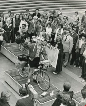
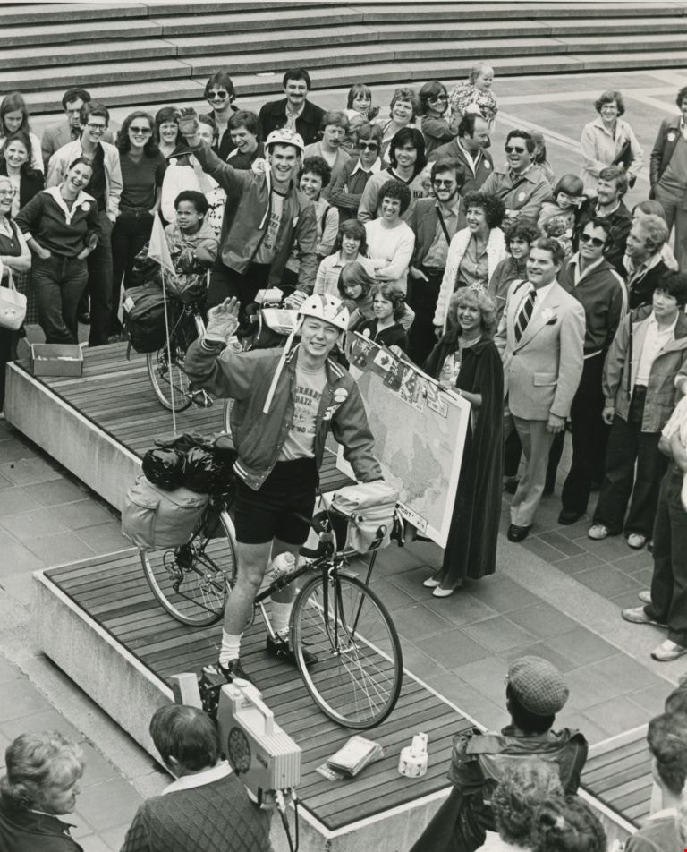
Cross Canada Bicycle Trip
https://search.heritageburnaby.ca/link/archivedescription45498
- Repository
- City of Burnaby Archives
- Date
- May 25, 1980
- Collection/Fonds
- Columbian Newspaper collection
- Description Level
- Item
- Physical Description
- 1 photograph : b&w ; 23.5 x 19.5 cm
- Scope and Content
- Photograph of Burnaby Villa bellboys Tony Urquart (front) and Rocky Adams as they prepare to set off from Simon Fraser University on a cross-Canada bicycle trip. A crowd, including the Queen of Burnaby, has gathered to see them off.
- Repository
- City of Burnaby Archives
- Date
- May 25, 1980
- Collection/Fonds
- Columbian Newspaper collection
- Physical Description
- 1 photograph : b&w ; 23.5 x 19.5 cm
- Description Level
- Item
- Record No.
- 480-393
- Access Restriction
- No restrictions
- Reproduction Restriction
- No restrictions
- Accession Number
- 2003-02
- Scope and Content
- Photograph of Burnaby Villa bellboys Tony Urquart (front) and Rocky Adams as they prepare to set off from Simon Fraser University on a cross-Canada bicycle trip. A crowd, including the Queen of Burnaby, has gathered to see them off.
- Names
- Urquhart, Tony
- Adams, Rocky
- Media Type
- Photograph
- Photographer
- King, Basil
- Notes
- Title based on contents of photograph
- Newspaper clipping attached to verso of photograph reads: "READY, SET ... Burnaby Villa bellboys Tony Urquart (front) and Rocky Adams prepare to set off from Simon Fraser University on a cross-Canada bicycle trip as part of SFU's Ethnic Day, Sunday, held as part of Burnay days '80. But not before a warming kiss from the Queen of Burnaby."
- Geographic Access
- University Drive
- Street Address
- 8888 University Drive
- Planning Study Area
- Burnaby Mountain Area
Images
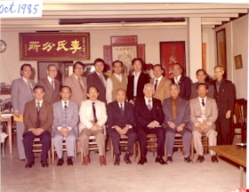
Lee's Benevolent Association of Canada
https://search.heritageburnaby.ca/link/museumdescription16720
- Repository
- Burnaby Village Museum
- Date
- Oct. 1985, copied 2021
- Collection/Fonds
- Quon Lip Lee fonds
- Description Level
- Item
- Physical Description
- 1 photograph (tiff)
- Scope and Content
- Photograph of members of Lee's Benevolent Association of Canada on the occasion of the association's fifty third anniversary and opening of the new association building. The group is assembled in two rows inside the associaton building located at 313 East Pender Street, Vancouver. Members identifie…
- Repository
- Burnaby Village Museum
- Collection/Fonds
- Quon Lip Lee fonds
- Description Level
- Item
- Physical Description
- 1 photograph (tiff)
- Scope and Content
- Photograph of members of Lee's Benevolent Association of Canada on the occasion of the association's fifty third anniversary and opening of the new association building. The group is assembled in two rows inside the associaton building located at 313 East Pender Street, Vancouver. Members identified include; Quon Lip Lee, seated in the front row (second from the right) and Ron Bick Lee, seated in the centre. Association members are composed of Chinese businessmen with the name "Lee".
- Geographic Access
- Vancouver
- Accession Code
- BV021.18.4
- Access Restriction
- No restrictions
- Reproduction Restriction
- May be restricted by third party rights
- Date
- Oct. 1985, copied 2021
- Media Type
- Photograph
- Scan Resolution
- 600
- Scan Date
- April 8, 2021
- Scale
- 100
- Notes
- Title based on contents of photograph
- Note in upper left corner of photograph reads "Oct. 1985"
Images

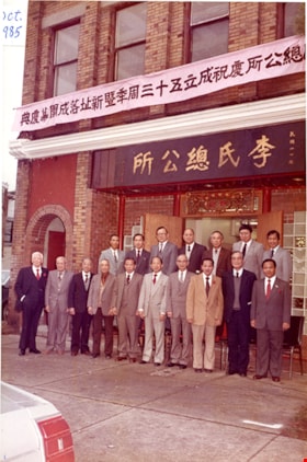
Lee's Benevolent Association of Canada
https://search.heritageburnaby.ca/link/museumdescription16721
- Repository
- Burnaby Village Museum
- Date
- Oct. 1985, copied 2021
- Collection/Fonds
- Quon Lip Lee fonds
- Description Level
- Item
- Physical Description
- 1 photograph (tiff)
- Scope and Content
- Photograph of members of Lee's Benevolent Association of Canada on the occasion of the association's fifty third anniversary and opening of the new association building. The group is assembled in two rows, standing outside of the associaton building located at 313 East Pender Street, Vancouver. Mem…
- Repository
- Burnaby Village Museum
- Collection/Fonds
- Quon Lip Lee fonds
- Description Level
- Item
- Physical Description
- 1 photograph (tiff)
- Scope and Content
- Photograph of members of Lee's Benevolent Association of Canada on the occasion of the association's fifty third anniversary and opening of the new association building. The group is assembled in two rows, standing outside of the associaton building located at 313 East Pender Street, Vancouver. Member, Quon Lip Lee is identified standing in the front row (fourth from the left). Association members are composed of Chinese businessmen with the name "Lee". Banners with Chinese lettering are hanging on the building above the group.
- Geographic Access
- Vancouver
- Accession Code
- BV021.18.5
- Access Restriction
- No restrictions
- Reproduction Restriction
- May be restricted by third party rights
- Date
- Oct. 1985, copied 2021
- Media Type
- Photograph
- Scan Resolution
- 600
- Scan Date
- April 8, 2021
- Scale
- 100
- Notes
- Title based on contents of photograph
Images


Subdivision plans in New Westminster District Group 1 – Burnaby, Vancouver and map - Canada Department of Mines
https://search.heritageburnaby.ca/link/museumdescription6994
- Repository
- Burnaby Village Museum
- Date
- 1890-1909
- Collection/Fonds
- Burnaby Village Museum Map collection
- Description Level
- File
- Physical Description
- 1 plan : graphite on paper + 2 plans : black ink on paper + 1 map : col. on paper mounted on 2 sides of cardboard 76 x 102 cm
- Scope and Content
- Item consists of a large board with one New Westminster District subdivision plan mounted on one side and two New Westminster District subdivision plans and one colour map mounted on the other side. Side A: 1. "Plan / of Subdivision of / Blocks 2, 3, 4, 5, 6 / Lot 77 / Group 1 / New Westminster D…
- Repository
- Burnaby Village Museum
- Collection/Fonds
- Burnaby Village Museum Map collection
- Description Level
- File
- Physical Description
- 1 plan : graphite on paper + 2 plans : black ink on paper + 1 map : col. on paper mounted on 2 sides of cardboard 76 x 102 cm
- Material Details
- Scales 1:720 and 1:1200 and 1:.00001578
- Scope and Content
- Item consists of a large board with one New Westminster District subdivision plan mounted on one side and two New Westminster District subdivision plans and one colour map mounted on the other side. Side A: 1. "Plan / of Subdivision of / Blocks 2, 3, 4, 5, 6 / Lot 77 / Group 1 / New Westminster District / BC. / Scale 100 feet = 1 inch", "Deposited 8th day / of April 1890 / Mowileg [sic] / Dist. Regt". Plan is drawn in graphite with annotations: "AB_Parts_lettered_are_lots_in / the_different_subdivisions" / "Owners: / James E. Hall / P.S.Cabilan [sic] by his attorney Joseph Hall / Joseph Hall / Eliza J. Shannon / John Harrison"; "This plan is correct and is prepared under the / provisions of the Land Registry Act" ; signed by: "Gordon Herman & Burwell / Dominion & Provincial Land Surveryors / Vancouver March 19th/90" . Plan is initialed by: "RB" [sic] (in blue pencil crayon) and measures: 99.5 x 65 cm (Geographic location: Burnaby) Side B: 1. Map titled "Canada / Department of Mines / Geological Survey Branch" / "Hon.W Templeton, Minister / A.P. Low, Deputy Minister / R.W. Brock, Acting Director", Vol. XXXI, Plate I / Compiled under the direction of / James White, F.R.G.S. Geographer /Dep. of Interior". Note above map reads: "To illustrate Mr. James Barrowman's report as Delegate at the Excursion - meeting of the Canadian Mining Institute", "The instiitution of Mining Engineers / Transactions 1908 - 1909", "The Mining Institute of Scotland / Transactions 1908-1909". Map identifies minerals and includes a Legend and Scale: 100 miles = 1 inch 2. "Plan / of Subdivision of / Lot 4 / of Subdivision of / Lot 87. Gr. 1 / New Westminster District / Scale 60' = 1in." Plan is initialed by: "RB" [sic] along with a note "also Board / 48" (in blue pencil crayon) (Geographic location: Burnaby) 3. Plan of "Lot 335 / G. 1" west of Boundary Road and north of River Road - Vancouver. (Geographic location: Vancouver)
- Publisher
- The Mining Institute of Scotland
- Geographic Access
- Vancouver
- Accession Code
- HV977.93.25
- Access Restriction
- No restrictions
- Reproduction Restriction
- No known restrictions
- Date
- 1890-1909
- Media Type
- Cartographic Material
- Scan Resolution
- 300
- Scale
- 72
- Notes
- Title based on contents of file
- Scale is measured in feet and miles.
- The term "Lot" often refers to "District Lot"
Images


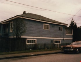
Burnaby School House
https://search.heritageburnaby.ca/link/archivedescription34856
- Repository
- City of Burnaby Archives
- Date
- 1985
- Collection/Fonds
- Burnaby Historical Society fonds
- Description Level
- Item
- Physical Description
- 1 photograph : col. ; 8.8 x 11.4 cm
- Scope and Content
- Photograph of the exterior of the former Burnaby School building at 19th Avenue and Canada Way.
- Repository
- City of Burnaby Archives
- Date
- 1985
- Collection/Fonds
- Burnaby Historical Society fonds
- Subseries
- Evelyn Salisbury subseries
- Physical Description
- 1 photograph : col. ; 8.8 x 11.4 cm
- Description Level
- Item
- Record No.
- 145-004
- Access Restriction
- No restrictions
- Reproduction Restriction
- Reproduce for fair dealing purposes only
- Accession Number
- BHS1985-15
- Scope and Content
- Photograph of the exterior of the former Burnaby School building at 19th Avenue and Canada Way.
- Subjects
- Buildings - Schools
- Media Type
- Photograph
- Notes
- Title based on contents of photograph
- Geographic Access
- Canada Way
- Street Address
- 7376 Canada Way
- Historic Neighbourhood
- Edmonds (Historic Neighbourhood)
- Planning Study Area
- Edmonds Area
Images

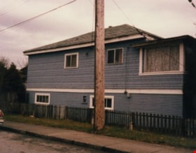
Burnaby School House
https://search.heritageburnaby.ca/link/archivedescription34857
- Repository
- City of Burnaby Archives
- Date
- 1985
- Collection/Fonds
- Burnaby Historical Society fonds
- Description Level
- Item
- Physical Description
- 1 photograph : col. ; 8.8 x 11.3 cm
- Scope and Content
- Photograph of the exterior of the former Burnaby School building at 19th Avenue and Canada Way.
- Repository
- City of Burnaby Archives
- Date
- 1985
- Collection/Fonds
- Burnaby Historical Society fonds
- Subseries
- Evelyn Salisbury subseries
- Physical Description
- 1 photograph : col. ; 8.8 x 11.3 cm
- Description Level
- Item
- Record No.
- 145-005
- Access Restriction
- No restrictions
- Reproduction Restriction
- Reproduce for fair dealing purposes only
- Accession Number
- BHS1985-15
- Scope and Content
- Photograph of the exterior of the former Burnaby School building at 19th Avenue and Canada Way.
- Subjects
- Buildings - Schools
- Media Type
- Photograph
- Notes
- Title based on contents of photograph
- Geographic Access
- Canada Way
- Street Address
- 7376 Canada Way
- Historic Neighbourhood
- Edmonds (Historic Neighbourhood)
- Planning Study Area
- Edmonds Area
Images

Burnaby's first Public School
https://search.heritageburnaby.ca/link/archivedescription35881
- Repository
- City of Burnaby Archives
- Date
- February 1894 (date of original), copied 1986
- Collection/Fonds
- Burnaby Historical Society fonds
- Description Level
- Item
- Physical Description
- 1 photograph : b&w ; 12.7 x 17.8 cm print
- Scope and Content
- Photograph of school officials standing on the steps of the first public school in Burnaby, Douglas Road and Edmonds Street. Left to right: William McDermott (school trustee), Ethel Lepage (first teacher), Lancelot Grimmer (school trustee), and Bernard Hill (school board chairman and secretary). Th…
- Repository
- City of Burnaby Archives
- Date
- February 1894 (date of original), copied 1986
- Collection/Fonds
- Burnaby Historical Society fonds
- Subseries
- Pioneer Tales subseries
- Physical Description
- 1 photograph : b&w ; 12.7 x 17.8 cm print
- Description Level
- Item
- Record No.
- 204-740
- Access Restriction
- No restrictions
- Reproduction Restriction
- No known restrictions
- Accession Number
- BHS1988-03
- Scope and Content
- Photograph of school officials standing on the steps of the first public school in Burnaby, Douglas Road and Edmonds Street. Left to right: William McDermott (school trustee), Ethel Lepage (first teacher), Lancelot Grimmer (school trustee), and Bernard Hill (school board chairman and secretary). The school was called Burnaby School from 1894 to 1896, and then East Burnaby School from 1896 to 1907. The present day address of the site is 7376 Canada Way.
- Subjects
- Officials
- Occupations - Teachers
- Media Type
- Photograph
- Notes
- Title based on contents of photograph
- Geographic Access
- Canada Way
- Street Address
- 7376 Canada Way
- Historic Neighbourhood
- Edmonds (Historic Neighbourhood)
- Planning Study Area
- Edmonds Area
Images
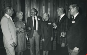
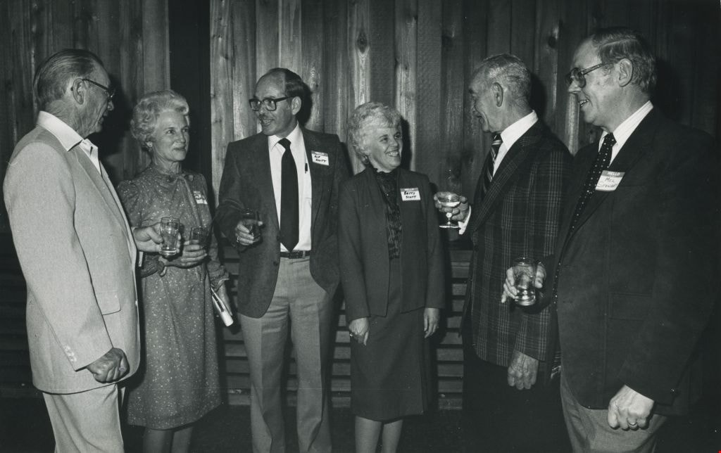
Burnaby Winter Club's 25th Anniversary
https://search.heritageburnaby.ca/link/archivedescription58950
- Repository
- City of Burnaby Archives
- Date
- ca.1983
- Collection/Fonds
- Columbian Newspaper collection
- Description Level
- Item
- Physical Description
- 1 photograph : b&w ; 16.5 x 25 cm
- Scope and Content
- Photograph of attendees at the Burnaby Winter Club's 25th anniversary reunion.
- Repository
- City of Burnaby Archives
- Date
- ca.1983
- Collection/Fonds
- Columbian Newspaper collection
- Physical Description
- 1 photograph : b&w ; 16.5 x 25 cm
- Description Level
- Item
- Record No.
- 480-1395
- Access Restriction
- No restrictions
- Reproduction Restriction
- Reproduce for fair dealing purposes only
- Accession Number
- 2009-01
- Scope and Content
- Photograph of attendees at the Burnaby Winter Club's 25th anniversary reunion.
- Subjects
- Celebrations
- Names
- Burnaby Winter Club
- Media Type
- Photograph
- Photographer
- Braid, Tom
- Notes
- Title based on contents of photograph
- Photographer's stamp on verso
- Note on verso reads: "PMT / 117% / page A-9 / Burnaby Today / reunion"
- Newspaper clipping attached to verso reads: "Reunion At Winter Club / Among hundreds of former and current members gathering Sunday for Burnaby Winter Club's 25th anniversary reunion were, from left, Cas and Mary Treleaven now of Maple Lake, B.C.; club president Alf Scott and his wife Bett, of Burnaby; Bill Hall of Burnaby and Mel Spowart, a past-president of the club."
- Street Address
- 4990 Canada Way
- Historic Neighbourhood
- Burnaby Lake (Historic Neighbourhood)
- Planning Study Area
- Douglas-Gilpin Area
Images
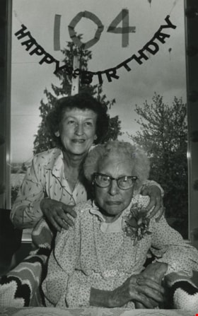
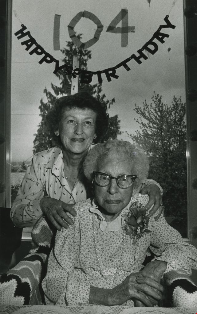
Elizabeth McIntyre's 104th birthday
https://search.heritageburnaby.ca/link/archivedescription45981
- Repository
- City of Burnaby Archives
- Date
- May 1983
- Collection/Fonds
- Columbian Newspaper collection
- Description Level
- Item
- Physical Description
- 1 photograph : b&w ; 22 x 14 cm
- Scope and Content
- Photograph of Elizabeth McIntyre, being hugged by her niece Jean Braaten, on her 104th birthday. The party was held at Carlton Hospital, where she was residing.
- Repository
- City of Burnaby Archives
- Date
- May 1983
- Collection/Fonds
- Columbian Newspaper collection
- Physical Description
- 1 photograph : b&w ; 22 x 14 cm
- Description Level
- Item
- Record No.
- 480-876
- Access Restriction
- No restrictions
- Reproduction Restriction
- Reproduce for fair dealing purposes only
- Accession Number
- 2003-02
- Scope and Content
- Photograph of Elizabeth McIntyre, being hugged by her niece Jean Braaten, on her 104th birthday. The party was held at Carlton Hospital, where she was residing.
- Subjects
- Celebrations
- Media Type
- Photograph
- Photographer
- Battistoni, Peter
- Notes
- Title based on contents of photograph
- Geographic Access
- Canada Way
- Street Address
- 4125 Canada Way
- Historic Neighbourhood
- Broadview (Historic Neighbourhood)
- Planning Study Area
- Cascade-Schou Area
Images
![Hill family, [189-] (date of original), copied 1986 thumbnail](/media/hpo/_Data/_Archives_Images/_Unrestricted/204/204-794.jpg?width=280)
Hill family
https://search.heritageburnaby.ca/link/archivedescription35934
- Repository
- City of Burnaby Archives
- Date
- [189-] (date of original), copied 1986
- Collection/Fonds
- Burnaby Historical Society fonds
- Description Level
- Item
- Physical Description
- 1 photograph : b&w ; 12.7 x 17.8 cm print
- Scope and Content
- Photograph of Bernard Hill (centre) and Gerry Hill (right) on the Bernard Hill family veranda. The three women are unidentified.
- Repository
- City of Burnaby Archives
- Date
- [189-] (date of original), copied 1986
- Collection/Fonds
- Burnaby Historical Society fonds
- Subseries
- Pioneer Tales subseries
- Physical Description
- 1 photograph : b&w ; 12.7 x 17.8 cm print
- Description Level
- Item
- Record No.
- 204-794
- Access Restriction
- No restrictions
- Reproduction Restriction
- No restrictions
- Accession Number
- BHS1988-03
- Scope and Content
- Photograph of Bernard Hill (centre) and Gerry Hill (right) on the Bernard Hill family veranda. The three women are unidentified.
- Media Type
- Photograph
- Notes
- Title based on contents of photograph
- Geographic Access
- Canada Way
- Street Address
- 4990 Canada Way
- Historic Neighbourhood
- Burnaby Lake (Historic Neighbourhood)
- Planning Study Area
- Douglas-Gilpin Area
Images
![Hill family, [189-] (date of original), copied 1986 thumbnail](/media/hpo/_Data/_Archives_Images/_Unrestricted/204/204-794.jpg)
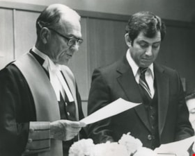
Justice G. L. Murray swearing in Mayor Dave Mercier
https://search.heritageburnaby.ca/link/archivedescription46289
- Repository
- City of Burnaby Archives
- Date
- March 11, 1980
- Collection/Fonds
- Columbian Newspaper collection
- Description Level
- Item
- Physical Description
- 1 photograph : b&w ; 19 x 24 cm
- Scope and Content
- Photograph of Justice G. L. Murray administrating the oath of office to Mayor Dave Mercier. Dave Mercier was a council member from 1968 to 1971, and from 1977 to 1981, serving as Mayor from 1979 to 1981.
- Repository
- City of Burnaby Archives
- Date
- March 11, 1980
- Collection/Fonds
- Columbian Newspaper collection
- Physical Description
- 1 photograph : b&w ; 19 x 24 cm
- Description Level
- Item
- Record No.
- 480-1177
- Access Restriction
- No restrictions
- Reproduction Restriction
- No restrictions
- Accession Number
- 2003-02
- Scope and Content
- Photograph of Justice G. L. Murray administrating the oath of office to Mayor Dave Mercier. Dave Mercier was a council member from 1968 to 1971, and from 1977 to 1981, serving as Mayor from 1979 to 1981.
- Media Type
- Photograph
- Photographer
- King, Basil
- Notes
- Title based on contents of photograph
- Geographic Access
- Canada Way
- Street Address
- 4949 Canada Way
- Historic Neighbourhood
- Burnaby Lake (Historic Neighbourhood)
- Planning Study Area
- Douglas-Gilpin Area
Images
