Ardingley-Sprott Neighbourhood
https://search.heritageburnaby.ca/link/landmark797
- Repository
- Burnaby Heritage Planning
- Associated Dates
- 1955-2008
- Heritage Value
- The Ardingley-Sprott Neighbourhood is primarily non-residential and developed in the 1970s west of the Burnaby Lake park area. It grew to include a large recreational component in the form of the Burnaby Lake Sports Complex and playing fields.
- Historic Neighbourhood
- Burnaby Lake (Historic Neighbourhood)
- Planning Study Area
- Ardingley-Sprott Area
Images
Burnaby Lake Neighbourhood
https://search.heritageburnaby.ca/link/landmark821
- Repository
- Burnaby Heritage Planning
- Associated Dates
- 1955-2008
- Heritage Value
- In 1966 Burnaby Lake was identified as a key potential regional park in the GVRD ’s Regional Park Plan for the Lower Mainland. The lake was to be developed for nature study, strolling, trail riding, canoeing, sightseeing and picnicking. It was formally recognized as a regional nature park in 1979, at which time the GVRD assumed management of the park through a lease agreement with the City of Burnaby. In 1993 Burnaby Lake was selected by the City of Burnaby to be included in Greater Vancouver ’s Green Zone, and was identified as a key component of the GVRD ’s Park and Outdoor Recreation System (PORS) for the Burrard/Peninsula/Richmond sector, which includes Burnaby, Vancouver, New Westminster, and Richmond.
- Historic Neighbourhood
- Burnaby Lake (Historic Neighbourhood)
- Planning Study Area
- Burnaby Lake Area
Images
Burnaby Village Museum
https://search.heritageburnaby.ca/link/landmark808
- Repository
- Burnaby Heritage Planning
- Geographic Access
- Deer Lake Avenue
- Associated Dates
- 1971
- Heritage Value
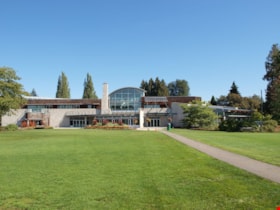
- The Burnaby Village Museum is a ten-acre heritage site located adjacent to Deer Lake. The site was originally created as a B.C. Centennial Project in 1971. The official sod turning for was April 11, 1971 by the then Governor General of Canada Roland Mitchener. The Village was initially managed by the Century Park Museum Association, a volunteer society of Burnaby citizens. Over the years many heritage building which could not be maintained in their original locations have been moved to the museum. Today half of the buildings in the village are heritage structures and the remainder are reproductions. In 1990 the City of Burnaby assumed direct management of the Village, and the museum became part of the Parks, Recreation and Culture Department. Visitors can enjoy the shops on Hill Street, ride the Parker 119 Carousel, and climb aboard the Interurban 1223 tram.
- Historic Neighbourhood
- Burnaby Lake (Historic Neighbourhood)
- Planning Study Area
- Douglas-Gilpin Area
- Morley-Buckingham Area
- Street Address
- 6501 Deer Lake Avenue
- Street View URL
- Google Maps Street View
Images
Douglas-Gilpin Neighbourhood
https://search.heritageburnaby.ca/link/landmark799
- Repository
- Burnaby Heritage Planning
- Associated Dates
- 1955-2008
- Heritage Value
- The Douglas-Gilpin Neighbourhood developed into a diverse area incorporating residential, business, educational and park districts in the period after 1955. The BCIT site was built in the early 1960s, shortly after the Burnaby Municipal Hall was located on Canada Way near Deer Lake in 1956. The construction of the Municipal Hall at this location fostered the creation of an administrative and business centre adjacent to the park, while the northern and central areas of the neighbourhood retained their primarily residential character.
- Historic Neighbourhood
- Burnaby Lake (Historic Neighbourhood)
- Planning Study Area
- Douglas-Gilpin Area
Images
Morley-Buckingham Neighbourhood
https://search.heritageburnaby.ca/link/landmark829
- Repository
- Burnaby Heritage Planning
- Associated Dates
- 1955-2008
- Heritage Value
- In the 1980 "Residential Neighbourhood Environment Study," the Morley-Buckingham Neighbourhood is described as "perhaps Burnaby's most prestigious residential area. The lots are larger than most other areas of the Municipality and this, along with the new expensive housing developed over the past 10 years, has created a very desirable residential neighbourhood...The older area of Buckingham lies at the lower edge of the slope and here the homes and streets are more uniform and aged between 20 and 25 years old...to the east of Canada Way lies...a cluster townhouse development."
- Historic Neighbourhood
- Burnaby Lake (Historic Neighbourhood)
- Planning Study Area
- Morley-Buckingham Area
Images
Shadbolt Centre for the Arts
https://search.heritageburnaby.ca/link/landmark820
- Repository
- Burnaby Heritage Planning
- Geographic Access
- Deer Lake Avenue
- Associated Dates
- 1995
- Heritage Value
- The Shadbolt Centre for the Arts opened in 1995. The Shadbolt Centre was named after two Burnaby residents who dedicated a lifetime of support and cultivation of the arts locally, nationally and internationally. Doris and Jack Shadbolt resided in Burnaby for over 50 years until Jack's death in November 1998. Doris Shadbolt spent her life's work bringing the artist and the audience closer together through her writing and curatorial work. Jack Shadbolt was an internationally recognized Canadian painter. He was also an author and both received many awards including the Order of Canada. In keeping with the Shadbolts' generosity the arts, Jack Shadbolt donated two of his paintings to the Centre for permanent display.
- Historic Neighbourhood
- Burnaby Lake (Historic Neighbourhood)
- Planning Study Area
- Douglas-Gilpin Area
- Street Address
- 6450 Deer Lake Avenue
- Street View URL
- Google Maps Street View
Images
1930 Ford
https://search.heritageburnaby.ca/link/archivedescription79492
- Repository
- City of Burnaby Archives
- Date
- September 24, 1976
- Collection/Fonds
- Burnaby Public Library Contemporary Visual Archive Project
- Description Level
- Item
- Physical Description
- 1 photograph : b&w ; 11 x 16 cm mounted on cardboard
- Scope and Content
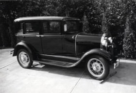
- Photograph shows a 1930 Ford car parked in the driveway of 6675 Eagles Drive.
- Repository
- City of Burnaby Archives
- Date
- September 24, 1976
- Collection/Fonds
- Burnaby Public Library Contemporary Visual Archive Project
- Physical Description
- 1 photograph : b&w ; 11 x 16 cm mounted on cardboard
- Description Level
- Item
- Record No.
- 556-323
- Access Restriction
- No restrictions
- Reproduction Restriction
- Reproduce for fair dealing purposes only
- Accession Number
- 2013-13
- Scope and Content
- Photograph shows a 1930 Ford car parked in the driveway of 6675 Eagles Drive.
- Subjects
- Transportation - Automobiles
- Media Type
- Photograph
- Photographer
- Norton, Paul
- Notes
- Scope note taken directly from BPL photograph description.
- 1 b&w copy negative : 10 x 12.5 cm accompanying
- Geographic Access
- Eagles Drive
- Street Address
- 6675 Eagles Drive
- Historic Neighbourhood
- Burnaby Lake (Historic Neighbourhood)
- Planning Study Area
- Morley-Buckingham Area
Images
3060 Norland Ave
https://search.heritageburnaby.ca/link/archivedescription94332
- Repository
- City of Burnaby Archives
- Date
- April 1995
- Collection/Fonds
- Grover, Elliott & Co. Ltd. fonds
- Description Level
- File
- Physical Description
- 18 photographs : col. negatives ; 35 mm
- Scope and Content
- Photographs of the exterior of Northgate Business Centre, a commercial complex located at 3060 Norland Avenue. Tenants of the building include: Leading Star Enterprises Ltd., i.t. Productions, Music Station, and CSI
- Repository
- City of Burnaby Archives
- Date
- April 1995
- Collection/Fonds
- Grover, Elliott & Co. Ltd. fonds
- Physical Description
- 18 photographs : col. negatives ; 35 mm
- Description Level
- File
- Record No.
- 622-117
- Access Restriction
- No restrictions
- Reproduction Restriction
- No restrictions
- Accession Number
- 2017-39
- Scope and Content
- Photographs of the exterior of Northgate Business Centre, a commercial complex located at 3060 Norland Avenue. Tenants of the building include: Leading Star Enterprises Ltd., i.t. Productions, Music Station, and CSI
- Subjects
- Buildings - Commercial
- Media Type
- Photograph
- Notes
- Transcribed title
- Title transcribed from envelope photographs were originally housed in
- File no. 95-146-B
- Geographic Access
- Norland Avenue
- Street Address
- 3060 Norland Avenue
- Historic Neighbourhood
- Burnaby Lake (Historic Neighbourhood)
- Planning Study Area
- Ardingley-Sprott Area
3183 Norland Rd
https://search.heritageburnaby.ca/link/archivedescription94298
- Repository
- City of Burnaby Archives
- Date
- November 1993
- Collection/Fonds
- Grover, Elliott & Co. Ltd. fonds
- Description Level
- File
- Physical Description
- 44 photographs : col. negatives ; 35 mm
- Scope and Content
- Photographs of the exterior of the two-storey industrial property located at 3183 Norland Avenue. Industrial Movers Ltd. and Pacific are the tenants of the property.
- Repository
- City of Burnaby Archives
- Date
- November 1993
- Collection/Fonds
- Grover, Elliott & Co. Ltd. fonds
- Physical Description
- 44 photographs : col. negatives ; 35 mm
- Description Level
- File
- Record No.
- 622-083
- Access Restriction
- No restrictions
- Reproduction Restriction
- No restrictions
- Accession Number
- 2017-39
- Scope and Content
- Photographs of the exterior of the two-storey industrial property located at 3183 Norland Avenue. Industrial Movers Ltd. and Pacific are the tenants of the property.
- Subjects
- Buildings - Industrial
- Media Type
- Photograph
- Notes
- Transcribed title
- Title transcribed from envelope photographs were originally housed in
- File no. 93-474-B
- Photographer identified as "D.E."
- Geographic Access
- Norland Avenue
- Street Address
- 3183 Norland Avenue
- Historic Neighbourhood
- Burnaby Lake (Historic Neighbourhood)
- Planning Study Area
- Ardingley-Sprott Area
5486 Dominion Street
https://search.heritageburnaby.ca/link/archivedescription91871
- Repository
- City of Burnaby Archives
- Date
- 1971
- Collection/Fonds
- Small family fonds
- Description Level
- Item
- Physical Description
- 1 photograph : b&w ; 9 cm x 9 cm
- Scope and Content
- Photograph of the Small family's house at 5486 Dominion Street with a "For Sale" sign on the lawn. The house was put up for sale by Lauretta Small after she inherited the Roberts' house at 5538 Dominion Street in 1969. Lauretta, by then a widow, relocated back into the Roberts' house which was th…
- Repository
- City of Burnaby Archives
- Date
- 1971
- Collection/Fonds
- Small family fonds
- Physical Description
- 1 photograph : b&w ; 9 cm x 9 cm
- Description Level
- Item
- Record No.
- 620-052
- Access Restriction
- No restrictions
- Reproduction Restriction
- No reproduction permitted
- Accession Number
- 2017-01
- Scope and Content
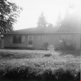
- Photograph of the Small family's house at 5486 Dominion Street with a "For Sale" sign on the lawn. The house was put up for sale by Lauretta Small after she inherited the Roberts' house at 5538 Dominion Street in 1969. Lauretta, by then a widow, relocated back into the Roberts' house which was the house she grew up in as a child.
- Media Type
- Photograph
- Notes
- Transcribed title
- Title transcribed from donor's notes
- Note in blue ink on verso of photograph reads: "P.14"
- Note in blue ink on verso of photograph reads: "5486 Dominion St / Burnaby, B.C. / Fall '71"
- 5486 Dominion Street later subdivided into two lots: 5480 and 5488 Dominion Street
- Street Address
- 5486 Dominion Street
- Historic Neighbourhood
- Burnaby Lake (Historic Neighbourhood)
- Planning Study Area
- Ardingley-Sprott Area
Images
5486 Dominion Street
https://search.heritageburnaby.ca/link/archivedescription91872
- Repository
- City of Burnaby Archives
- Date
- May 1994
- Collection/Fonds
- Small family fonds
- Description Level
- Item
- Physical Description
- 1 photograph : b&w ; 10 cm x 15 cm
- Scope and Content
- Photograph of a two-storey house at 5486 Dominion Street. The Dehn family purchased the house on this property in 1971 or 1972 and raised it several years later to build a complete furnished basement underneath it. This photograph was taken just prior to the demolition of the house following its …
- Repository
- City of Burnaby Archives
- Date
- May 1994
- Collection/Fonds
- Small family fonds
- Physical Description
- 1 photograph : b&w ; 10 cm x 15 cm
- Description Level
- Item
- Record No.
- 620-053
- Access Restriction
- No restrictions
- Reproduction Restriction
- No reproduction permitted
- Accession Number
- 2017-01
- Scope and Content
- Photograph of a two-storey house at 5486 Dominion Street. The Dehn family purchased the house on this property in 1971 or 1972 and raised it several years later to build a complete furnished basement underneath it. This photograph was taken just prior to the demolition of the house following its sale and the subdivision of the property into two 33 foot lots.
- Subjects
- Buildings - Residential - Houses
- Media Type
- Photograph
- Notes
- Transcribed title
- Title transcribed from donor's notes
- Note in blue ink on verso of photograph reads: "P.15"
- Note in blue ink on verso of photograph reads: "5486 Dominion St / Just before demolition - May 1994"
- 5486 Dominion Street subdivided into two lots: 5480 and 5488 Dominion Street
- Street Address
- 5486 Dominion Street
- Historic Neighbourhood
- Burnaby Lake (Historic Neighbourhood)
- Planning Study Area
- Ardingley-Sprott Area
Images
5505 Roy St.
https://search.heritageburnaby.ca/link/archivedescription94307
- Repository
- City of Burnaby Archives
- Date
- April 1994
- Collection/Fonds
- Grover, Elliott & Co. Ltd. fonds
- Description Level
- File
- Physical Description
- 62 photographs : col. negatives ; 35 mm
- Scope and Content
- Photographs of a building complex being constructed at 5505 Roy Street. File also includes photographs of commercial buildings located near Lougheed Highway and Holdom Avenue North. Tenants of the buildings include: Thunderbird Home Centres, Kingston College, Makita Factory Service Center, and Arl…
- Repository
- City of Burnaby Archives
- Date
- April 1994
- Collection/Fonds
- Grover, Elliott & Co. Ltd. fonds
- Physical Description
- 62 photographs : col. negatives ; 35 mm
- Description Level
- File
- Record No.
- 622-092
- Access Restriction
- No restrictions
- Reproduction Restriction
- No restrictions
- Accession Number
- 2017-39
- Scope and Content
- Photographs of a building complex being constructed at 5505 Roy Street. File also includes photographs of commercial buildings located near Lougheed Highway and Holdom Avenue North. Tenants of the buildings include: Thunderbird Home Centres, Kingston College, Makita Factory Service Center, and Arlene's Designer Fabrics.
- Subjects
- Buildings - Commercial
- Media Type
- Photograph
- Notes
- Transcribed title
- Title transcribed from envelope photographs were originally housed in
- File no. 94-113-B
- Photographer identified as "K.D."
- Geographic Access
- Roy Street
- Holdom Avenue North
- Street Address
- 5505 Roy Street
- Historic Neighbourhood
- Burnaby Lake (Historic Neighbourhood)
- Planning Study Area
- Ardingley-Sprott Area
5573-5623 Buckingham Ave
https://search.heritageburnaby.ca/link/archivedescription94323
- Repository
- City of Burnaby Archives
- Date
- November 1994
- Collection/Fonds
- Grover, Elliott & Co. Ltd. fonds
- Description Level
- File
- Physical Description
- 37 photographs : col. negatives ; 35 mm
- Scope and Content
- Photographs of a single-family home located at 5573 Buckingham Avenue and the surrounding property. File also contains photographs of the 5500 and 5600 blocks of Bucking Avenue and the corner of Buckingham Avenue and Haszard Street.
- Repository
- City of Burnaby Archives
- Date
- November 1994
- Collection/Fonds
- Grover, Elliott & Co. Ltd. fonds
- Physical Description
- 37 photographs : col. negatives ; 35 mm
- Description Level
- File
- Record No.
- 622-108
- Access Restriction
- No restrictions
- Reproduction Restriction
- No restrictions
- Accession Number
- 2017-39
- Scope and Content
- Photographs of a single-family home located at 5573 Buckingham Avenue and the surrounding property. File also contains photographs of the 5500 and 5600 blocks of Bucking Avenue and the corner of Buckingham Avenue and Haszard Street.
- Media Type
- Photograph
- Notes
- Transcribed title
- Title transcribed from envelope photographs were originally housed in
- File no. 94-391-B
- Geographic Access
- Buckingham Avenue
- Street Address
- 5573 Buckingham Avenue
- Historic Neighbourhood
- Burnaby Lake (Historic Neighbourhood)
- Planning Study Area
- Morley-Buckingham Area
6501 Sprott St
https://search.heritageburnaby.ca/link/archivedescription93771
- Repository
- City of Burnaby Archives
- Date
- September 1992
- Collection/Fonds
- Grover, Elliott & Co. Ltd. fonds
- Description Level
- File
- Physical Description
- 48 photographs : col. negatives ; 35 mm
- Scope and Content
- Photographs of the industrial property located at 6501 Sprott Street, which includestwo buildings and a parking lot.
- Repository
- City of Burnaby Archives
- Date
- September 1992
- Collection/Fonds
- Grover, Elliott & Co. Ltd. fonds
- Physical Description
- 48 photographs : col. negatives ; 35 mm
- Description Level
- File
- Record No.
- 622-055
- Access Restriction
- No restrictions
- Reproduction Restriction
- No restrictions
- Accession Number
- 2017-39
- Scope and Content
- Photographs of the industrial property located at 6501 Sprott Street, which includestwo buildings and a parking lot.
- Subjects
- Buildings - Industrial
- Media Type
- Photograph
- Notes
- Transcribed title
- Title transcribed from envelope photographs were originally housed in
- File no. 92-327-B
- Photographer identified as "D.C."
- Geographic Access
- Sprott Street
- Street Address
- 6501 Sprott Street
- Historic Neighbourhood
- Burnaby Lake (Historic Neighbourhood)
- Planning Study Area
- Ardingley-Sprott Area
6664 Deer Lake Avenue billiard room
https://search.heritageburnaby.ca/link/archivedescription95589
- Repository
- City of Burnaby Archives
- Date
- [1979]
- Collection/Fonds
- City of Burnaby Archives photograph collection
- Description Level
- File
- Physical Description
- 2 photographs (tiff)
- Scope and Content
- File contains photographs of the furnished billiard room in 6664 Deer Lake Avenue (formerly the F.J. Hart Estate "Avalon"; now Hart House). These photographs were taken prior to the City of Burnaby’s purchase of the home in 1979. The photographs depict the second floor room's fireplace, billiard ta…
- Repository
- City of Burnaby Archives
- Date
- [1979]
- Collection/Fonds
- City of Burnaby Archives photograph collection
- Physical Description
- 2 photographs (tiff)
- Description Level
- File
- Record No.
- 625-011
- Access Restriction
- No restrictions
- Reproduction Restriction
- Reproduce for fair dealing purposes only
- Accession Number
- 2021-10
- Scope and Content
- File contains photographs of the furnished billiard room in 6664 Deer Lake Avenue (formerly the F.J. Hart Estate "Avalon"; now Hart House). These photographs were taken prior to the City of Burnaby’s purchase of the home in 1979. The photographs depict the second floor room's fireplace, billiard table, and view to the southwest.
- Subjects
- Buildings - Heritage
- Media Type
- Photograph
- Notes
- Title based on caption
- Captions were added during digitization.
- Street Address
- 6664 Deer Lake Avenue
- Historic Neighbourhood
- Burnaby Lake (Historic Neighbourhood)
- Planning Study Area
- Morley-Buckingham Area
Images
6664 Deer Lake Avenue cabana
https://search.heritageburnaby.ca/link/archivedescription95592
- Repository
- City of Burnaby Archives
- Date
- [1979]
- Collection/Fonds
- City of Burnaby Archives photograph collection
- Description Level
- File
- Physical Description
- 2 photographs (tiff)
- Scope and Content
- File contains photographs of the cabana in 6664 Deer Lake Avenue (formerly the F.J. Hart Estate "Avalon"; now Hart House). These photographs were taken prior to the City of Burnaby’s purchase of the home in 1979. The photographs depict the cabana's interior bar with an entrance to a changing room, …
- Repository
- City of Burnaby Archives
- Date
- [1979]
- Collection/Fonds
- City of Burnaby Archives photograph collection
- Physical Description
- 2 photographs (tiff)
- Description Level
- File
- Record No.
- 625-017
- Access Restriction
- No restrictions
- Reproduction Restriction
- Reproduce for fair dealing purposes only
- Accession Number
- 2021-10
- Scope and Content
- File contains photographs of the cabana in 6664 Deer Lake Avenue (formerly the F.J. Hart Estate "Avalon"; now Hart House). These photographs were taken prior to the City of Burnaby’s purchase of the home in 1979. The photographs depict the cabana's interior bar with an entrance to a changing room, and its view of the fish pond, swimming pool, and patio.
- Subjects
- Buildings - Heritage
- Media Type
- Photograph
- Notes
- Title based on caption
- Captions were added during digitization.
- Street Address
- 6664 Deer Lake Avenue
- Historic Neighbourhood
- Burnaby Lake (Historic Neighbourhood)
- Planning Study Area
- Morley-Buckingham Area
Images
6664 Deer Lake Avenue caretaker's cottage
https://search.heritageburnaby.ca/link/archivedescription95605
- Repository
- City of Burnaby Archives
- Date
- [1979]
- Collection/Fonds
- City of Burnaby Archives photograph collection
- Description Level
- Item
- Physical Description
- 1 photograph (tiff)
- Scope and Content
- Photograph of the exterior of the Caretaker's Cottage at 6664 Deer Lake Avenue (formerly the F.J. Hart Estate "Avalon"; now Hart House). This photograph was taken prior to the City of Burnaby’s purchase of the home in 1979. The photograph shows the front exterior of the cottage, surrounded by trees…
- Repository
- City of Burnaby Archives
- Date
- [1979]
- Collection/Fonds
- City of Burnaby Archives photograph collection
- Physical Description
- 1 photograph (tiff)
- Description Level
- Item
- Record No.
- 625-033
- Access Restriction
- No restrictions
- Reproduction Restriction
- Reproduce for fair dealing purposes only
- Accession Number
- 2021-10
- Scope and Content
- Photograph of the exterior of the Caretaker's Cottage at 6664 Deer Lake Avenue (formerly the F.J. Hart Estate "Avalon"; now Hart House). This photograph was taken prior to the City of Burnaby’s purchase of the home in 1979. The photograph shows the front exterior of the cottage, surrounded by trees and a lawn.
- Subjects
- Buildings - Heritage
- Media Type
- Photograph
- Notes
- Title based on caption
- Caption was added during digitization.
- Street Address
- 6664 Deer Lake Avenue
- Historic Neighbourhood
- Burnaby Lake (Historic Neighbourhood)
- Planning Study Area
- Morley-Buckingham Area
Images
6664 Deer Lake Avenue conservatory
https://search.heritageburnaby.ca/link/archivedescription95595
- Repository
- City of Burnaby Archives
- Date
- [1979]
- Collection/Fonds
- City of Burnaby Archives photograph collection
- Description Level
- Item
- Physical Description
- 1 photograph (tiff)
- Scope and Content
- Photograph of the conservatory in 6664 Deer Lake Avenue (formerly the F.J. Hart Estate "Avalon"; now Hart House). This photograph was taken prior to the City of Burnaby’s purchase of the home in 1979. The photograph is taken from the living room and shows a plant-filled room through the open glass …
- Repository
- City of Burnaby Archives
- Date
- [1979]
- Collection/Fonds
- City of Burnaby Archives photograph collection
- Physical Description
- 1 photograph (tiff)
- Description Level
- Item
- Record No.
- 625-023
- Access Restriction
- No restrictions
- Reproduction Restriction
- Reproduce for fair dealing purposes only
- Accession Number
- 2021-10
- Scope and Content
- Photograph of the conservatory in 6664 Deer Lake Avenue (formerly the F.J. Hart Estate "Avalon"; now Hart House). This photograph was taken prior to the City of Burnaby’s purchase of the home in 1979. The photograph is taken from the living room and shows a plant-filled room through the open glass door.
- Subjects
- Buildings - Heritage
- Media Type
- Photograph
- Notes
- Title based on caption
- Caption was added during digitization.
- Street Address
- 6664 Deer Lake Avenue
- Historic Neighbourhood
- Burnaby Lake (Historic Neighbourhood)
- Planning Study Area
- Morley-Buckingham Area
Images
6664 Deer Lake Avenue dining room
https://search.heritageburnaby.ca/link/archivedescription95585
- Repository
- City of Burnaby Archives
- Date
- [1979]
- Collection/Fonds
- City of Burnaby Archives photograph collection
- Description Level
- File
- Physical Description
- 2 photographs (tiff)
- Scope and Content
- File contains two photographs of the furnished dining room in 6664 Deer Lake Avenue (formerly the F.J. Hart Estate "Avalon"; now Hart House). These photographs were taken prior to the City of Burnaby’s purchase of the home in 1979. The photographs show the large dining room table and chandelier, wi…
- Repository
- City of Burnaby Archives
- Date
- [1979]
- Collection/Fonds
- City of Burnaby Archives photograph collection
- Physical Description
- 2 photographs (tiff)
- Description Level
- File
- Record No.
- 625-005
- Access Restriction
- No restrictions
- Reproduction Restriction
- Reproduce for fair dealing purposes only
- Accession Number
- 2021-10
- Scope and Content
- File contains two photographs of the furnished dining room in 6664 Deer Lake Avenue (formerly the F.J. Hart Estate "Avalon"; now Hart House). These photographs were taken prior to the City of Burnaby’s purchase of the home in 1979. The photographs show the large dining room table and chandelier, with views of the adjoining verandah and the living room.
- Subjects
- Buildings - Heritage
- Media Type
- Photograph
- Notes
- Title based on caption
- Captions were added during digitization.
- Street Address
- 6664 Deer Lake Avenue
- Historic Neighbourhood
- Burnaby Lake (Historic Neighbourhood)
- Planning Study Area
- Morley-Buckingham Area
Images
6664 Deer Lake Avenue driveway
https://search.heritageburnaby.ca/link/archivedescription95608
- Repository
- City of Burnaby Archives
- Date
- [1979]
- Collection/Fonds
- City of Burnaby Archives photograph collection
- Description Level
- Item
- Physical Description
- 1 photograph (tiff)
- Scope and Content
- Photograph of the driveway at 6664 Deer Lake Avenue (formerly the F.J. Hart Estate "Avalon"; now Hart House). This photograph was taken prior to the City of Burnaby’s purchase of the home in 1979. The photograph depicts a tree-lined driveway that is the Sperling Avenue entrance to the property.
- Repository
- City of Burnaby Archives
- Date
- [1979]
- Collection/Fonds
- City of Burnaby Archives photograph collection
- Physical Description
- 1 photograph (tiff)
- Description Level
- Item
- Record No.
- 625-036
- Access Restriction
- No restrictions
- Reproduction Restriction
- Reproduce for fair dealing purposes only
- Accession Number
- 2021-10
- Scope and Content
- Photograph of the driveway at 6664 Deer Lake Avenue (formerly the F.J. Hart Estate "Avalon"; now Hart House). This photograph was taken prior to the City of Burnaby’s purchase of the home in 1979. The photograph depicts a tree-lined driveway that is the Sperling Avenue entrance to the property.
- Subjects
- Buildings - Heritage
- Media Type
- Photograph
- Notes
- Title based on content of item
- Caption was added during digitization.
- Street Address
- 6664 Deer Lake Avenue
- Historic Neighbourhood
- Burnaby Lake (Historic Neighbourhood)
- Planning Study Area
- Morley-Buckingham Area




![6664 Deer Lake Avenue billiard room, [1979] thumbnail](/media/hpo/_Data/_Archives_Images/_Unrestricted/600/625-012.jpg?width=280)
![6664 Deer Lake Avenue cabana, [1979] thumbnail](/media/hpo/_Data/_Archives_Images/_Unrestricted/600/625-018.jpg?width=280)
![6664 Deer Lake Avenue caretaker's cottage, [1979] thumbnail](/media/hpo/_Data/_Archives_Images/_Unrestricted/600/625-033.jpg?width=280)
![6664 Deer Lake Avenue conservatory, [1979] thumbnail](/media/hpo/_Data/_Archives_Images/_Unrestricted/600/625-023.jpg?width=280)
![6664 Deer Lake Avenue dining room, [1979] thumbnail](/media/hpo/_Data/_Archives_Images/_Unrestricted/600/625-006.jpg?width=280)
![6664 Deer Lake Avenue driveway, [1979] thumbnail](/media/hpo/_Data/_Archives_Images/_Unrestricted/600/625-036.jpg?width=280)