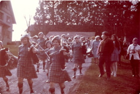
Bagpipe band in parade for Heritage Village sod-turning
https://search.heritageburnaby.ca/link/museumdescription13378
- Repository
- Burnaby Village Museum
- Date
- 11 April 1971
- Collection/Fonds
- Donald Copan collection
- Description Level
- Item
- Physical Description
- 1 photograph : col. ; 8.9 x 12.7 cm
- Scope and Content
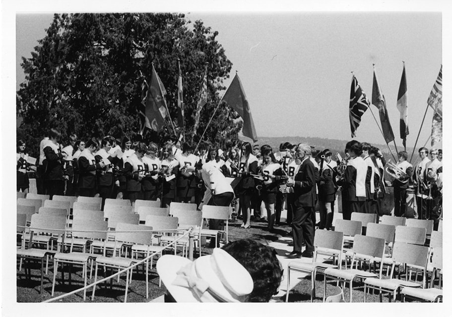
- Photograph of a marching bagpipe band in parade leading to the Heritage Village sod-turning event on April 11, 1971. Heritage Village (now Burnaby Village Museum) was Burnaby's Centennial '71 Commemorative project.
- Repository
- Burnaby Village Museum
- Collection/Fonds
- Donald Copan collection
- Series
- Copan album series
- Description Level
- Item
- Physical Description
- 1 photograph : col. ; 8.9 x 12.7 cm
- Scope and Content
- Photograph of a marching bagpipe band in parade leading to the Heritage Village sod-turning event on April 11, 1971. Heritage Village (now Burnaby Village Museum) was Burnaby's Centennial '71 Commemorative project.
- Subjects
- Celebrations - Centennials
- Buildings - Civic - Museums
- Events
- Events - Parades
- Organizations - Bands
- Names
- Burnaby Village Museum
- Accession Code
- BV005.54.400
- Access Restriction
- No restrictions
- Reproduction Restriction
- May be restricted by third party rights
- Date
- 11 April 1971
- Media Type
- Photograph
- Historic Neighbourhood
- Burnaby Lake (Historic Neighbourhood)
- Planning Study Area
- Morley-Buckingham Area
- Scan Resolution
- 600
- Scan Date
- August 11, 2020
- Scale
- 100
- Notes
- Title based on contents of photograph
Images

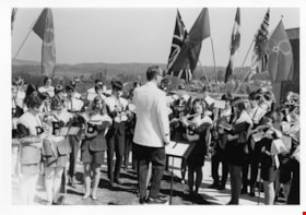
Band at Royal visit to Burnaby Municipal Hall
https://search.heritageburnaby.ca/link/museumdescription3569
- Repository
- Burnaby Village Museum
- Date
- 7 May 1971
- Collection/Fonds
- Donald Copan collection
- Description Level
- Item
- Physical Description
- 1 photograph : b&w ; 8.9 x 12.7 cm
- Scope and Content
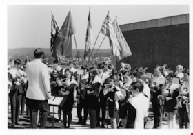
- Photograph of a highschool band performing at Burnaby Municipal Hall for the royal visit on May 7, 1971. Queen Elizabeth II and Prince Philip made an official visit to Burnaby as part of their Centennial tour.
- Repository
- Burnaby Village Museum
- Collection/Fonds
- Donald Copan collection
- Series
- Copan album series
- Description Level
- Item
- Physical Description
- 1 photograph : b&w ; 8.9 x 12.7 cm
- Scope and Content
- Photograph of a highschool band performing at Burnaby Municipal Hall for the royal visit on May 7, 1971. Queen Elizabeth II and Prince Philip made an official visit to Burnaby as part of their Centennial tour.
- Geographic Access
- Canada Way
- Street Address
- 4949 Canada Way
- Accession Code
- BV005.54.20
- Access Restriction
- No restrictions
- Reproduction Restriction
- May be restricted by third party rights
- Date
- 7 May 1971
- Media Type
- Photograph
- Historic Neighbourhood
- Burnaby Lake (Historic Neighbourhood)
- Planning Study Area
- Douglas-Gilpin Area
- Scan Resolution
- 600
- Scan Date
- July 16, 2020
- Scale
- 100
- Notes
- Title based on contents of photograph
Images
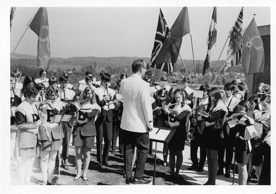
Band at Royal visit to Burnaby Municipal Hall
https://search.heritageburnaby.ca/link/museumdescription3570
- Repository
- Burnaby Village Museum
- Date
- 7 May 1971
- Collection/Fonds
- Donald Copan collection
- Description Level
- Item
- Physical Description
- 1 photograph : b&w ; 8.9 x 12.7 cm
- Scope and Content
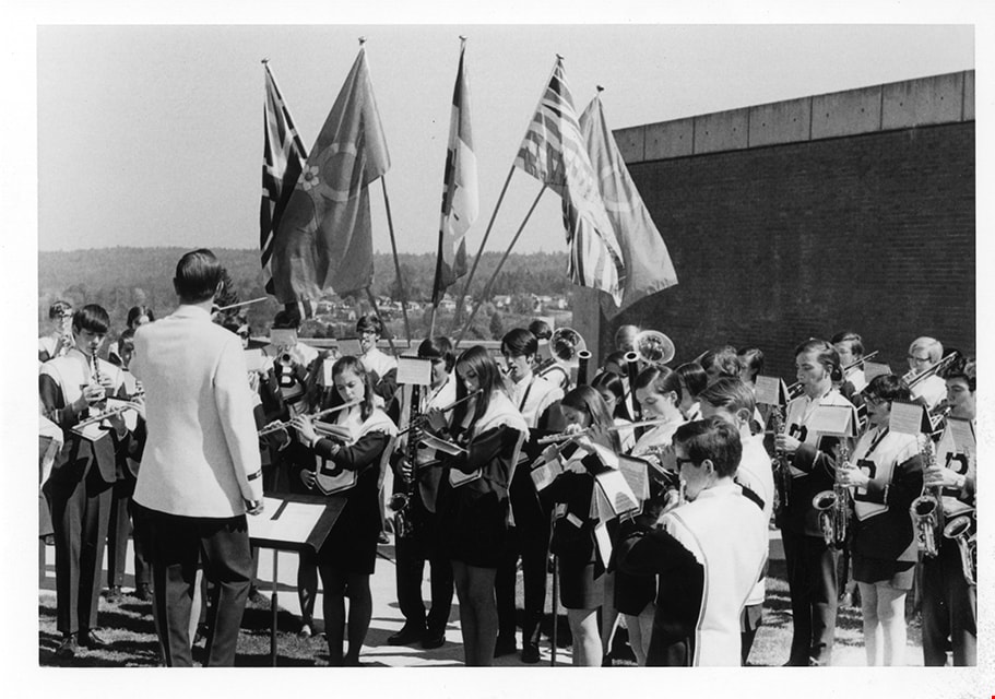
- Photograph of a highschool band performing at Burnaby Municipal Hall for the royal visit on May 7, 1971. Queen Elizabeth II and Prince Philip made an official visit to Burnaby as part of their Centennial tour.
- Repository
- Burnaby Village Museum
- Collection/Fonds
- Donald Copan collection
- Series
- Copan album series
- Description Level
- Item
- Physical Description
- 1 photograph : b&w ; 8.9 x 12.7 cm
- Scope and Content
- Photograph of a highschool band performing at Burnaby Municipal Hall for the royal visit on May 7, 1971. Queen Elizabeth II and Prince Philip made an official visit to Burnaby as part of their Centennial tour.
- Names
- Burnaby City Hall
- Geographic Access
- Canada Way
- Street Address
- 4949 Canada Way
- Accession Code
- BV005.54.21
- Access Restriction
- No restrictions
- Reproduction Restriction
- May be restricted by third party rights
- Date
- 7 May 1971
- Media Type
- Photograph
- Historic Neighbourhood
- Burnaby Lake (Historic Neighbourhood)
- Planning Study Area
- Douglas-Gilpin Area
- Scan Resolution
- 600
- Scan Date
- July 16, 2020
- Scale
- 100
- Notes
- Title based on contents of photograph
Images
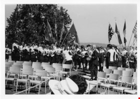
Band at Royal visit to Burnaby Municipal Hall
https://search.heritageburnaby.ca/link/museumdescription3572
- Repository
- Burnaby Village Museum
- Date
- 7 May 1971
- Collection/Fonds
- Donald Copan collection
- Description Level
- Item
- Physical Description
- 1 photograph : b&w ; 8.9 x 12.7 cm
- Scope and Content
- Photograph of a highschool band performing at Burnaby Municipal Hall for the royal visit on May 7, 1971. Queen Elizabeth II and Prince Philip made an official visit to Burnaby as part of their Centennial tour.
- Repository
- Burnaby Village Museum
- Collection/Fonds
- Donald Copan collection
- Series
- Copan album series
- Description Level
- Item
- Physical Description
- 1 photograph : b&w ; 8.9 x 12.7 cm
- Scope and Content
- Photograph of a highschool band performing at Burnaby Municipal Hall for the royal visit on May 7, 1971. Queen Elizabeth II and Prince Philip made an official visit to Burnaby as part of their Centennial tour.
- Names
- Burnaby City Hall
- Geographic Access
- Canada Way
- Street Address
- 4949 Canada Way
- Accession Code
- BV005.54.23
- Access Restriction
- No restrictions
- Reproduction Restriction
- May be restricted by third party rights
- Date
- 7 May 1971
- Media Type
- Photograph
- Historic Neighbourhood
- Burnaby Lake (Historic Neighbourhood)
- Planning Study Area
- Douglas-Gilpin Area
- Scan Resolution
- 600
- Scan Date
- July 16, 2020
- Scale
- 100
- Notes
- Title based on contents of photograph
Images

Barn at Lubbock's farm
https://search.heritageburnaby.ca/link/archivedescription36520
- Repository
- City of Burnaby Archives
- Date
- 1977
- Collection/Fonds
- Burnaby Historical Society fonds
- Description Level
- Item
- Physical Description
- 1 photograph : col. ; 9 x 8.5 cm
- Scope and Content
- Photograph of the horse barn at Lubbock's farm. Both the Burnaby Lake Riding Academy and the Burnaby Lake Saddle Club operated out of the Lubbock farm.
- Repository
- City of Burnaby Archives
- Date
- 1977
- Collection/Fonds
- Burnaby Historical Society fonds
- Subseries
- Lubbock family subseries
- Physical Description
- 1 photograph : col. ; 9 x 8.5 cm
- Description Level
- Item
- Record No.
- 289-009
- Access Restriction
- No restrictions
- Reproduction Restriction
- Reproduce for fair dealing purposes only
- Accession Number
- BHS1992-24
- Scope and Content
- Photograph of the horse barn at Lubbock's farm. Both the Burnaby Lake Riding Academy and the Burnaby Lake Saddle Club operated out of the Lubbock farm.
- Subjects
- Buildings - Agricultural - Barns
- Media Type
- Photograph
- Notes
- Title based on contents of photograph
- Geographic Access
- Grandview Highway
- Canada Way
- Burris Street
- Street Address
- 7803 Burris Street
- Historic Neighbourhood
- Burnaby Lake (Historic Neighbourhood)
- Planning Study Area
- Morley-Buckingham Area
Images


Barn, paddock and out buildings
https://search.heritageburnaby.ca/link/museumdescription12818
- Repository
- Burnaby Village Museum
- Date
- 1977
- Collection/Fonds
- Century Park Museum Association fonds
- Description Level
- Item
- Physical Description
- 1 photograph : col. slide ; 35 mm
- Scope and Content
- Photograph of the barn, fenced paddocks and out buildings on the Lubbock family farm located at 7803 Burris Street.
- Repository
- Burnaby Village Museum
- Collection/Fonds
- Century Park Museum Association fonds
- Description Level
- Item
- Physical Description
- 1 photograph : col. slide ; 35 mm
- Scope and Content
- Photograph of the barn, fenced paddocks and out buildings on the Lubbock family farm located at 7803 Burris Street.
- History
- In 1977, Century Park Museum was granted access to the Sprott-Lubbock farm to appraise the heritage buildings for preservation. Buildings that were saved included the old farrier shed (BV985.1240.2) which was also used as a blacksmith shop and the Vorce tram station building (BV985.1240.3) from the old Burnaby Lake Interurban line which was used as a grain storage shed on the property. Segments of the original farmhouse and other out buildings were retained. Other buildings on the site were demolished to make way for a new housing development.
- Subjects
- Agriculture - Farms
- Names
- Lubbock farm
- Geographic Access
- Grandview Highway
- Burris Street
- Street Address
- 7803 Burris Street
- Accession Code
- BV020.5.485
- Access Restriction
- No restrictions
- Reproduction Restriction
- No known restrictions
- Date
- 1977
- Media Type
- Photograph
- Historic Neighbourhood
- Burnaby Lake (Historic Neighbourhood)
- Planning Study Area
- Morley-Buckingham Area
- Scan Resolution
- 2400
- Scan Date
- 13-Mar-20
- Scale
- 100
- Notes
- Title based on contents of photograph
Images

![Barns at Oakalla, [195-] (date of original), copied 1991 thumbnail](/media/hpo/_Data/_Archives_Images/_Unrestricted/370/370-706.jpg?width=280)
Barns at Oakalla
https://search.heritageburnaby.ca/link/archivedescription38119
- Repository
- City of Burnaby Archives
- Date
- [195-] (date of original), copied 1991
- Collection/Fonds
- Burnaby Historical Society fonds
- Description Level
- Item
- Physical Description
- 1 photograph : b&w ; 2.8 x 4.1 cm print on contact sheet 20.1 x 26.5 cm
- Scope and Content
- Photograph of the exterior of horse and cattle barns at Oakalla Prison Farm.
- Repository
- City of Burnaby Archives
- Date
- [195-] (date of original), copied 1991
- Collection/Fonds
- Burnaby Historical Society fonds
- Subseries
- Burnaby Image Bank subseries
- Physical Description
- 1 photograph : b&w ; 2.8 x 4.1 cm print on contact sheet 20.1 x 26.5 cm
- Description Level
- Item
- Record No.
- 370-706
- Access Restriction
- No restrictions
- Reproduction Restriction
- Reproduce for fair dealing purposes only
- Accession Number
- BHS1999-03
- Scope and Content
- Photograph of the exterior of horse and cattle barns at Oakalla Prison Farm.
- Subjects
- Buildings - Agricultural - Barns
- Agriculture - Farms
- Buildings - Public - Detention Facilities
- Names
- Oakalla Prison Farm
- Media Type
- Photograph
- Notes
- Title based on contents of photograph
- 1 b&w copy negative accompanying
- Negative has a pink cast
- Geographic Access
- Oakmount Crescent
- Street Address
- 5220 Oakmount Crescent
- Historic Neighbourhood
- Burnaby Lake (Historic Neighbourhood)
- Planning Study Area
- Oakalla Area
Images
![Barns at Oakalla, [195-] (date of original), copied 1991 thumbnail](/media/hpo/_Data/_Archives_Images/_Unrestricted/370/370-706.jpg)
Basement at Tom Irvine's house
https://search.heritageburnaby.ca/link/museumdescription1860
- Repository
- Burnaby Village Museum
- Date
- December 1974
- Collection/Fonds
- Century Park Museum Association fonds
- Description Level
- Item
- Physical Description
- 1 photograph : col. ; 13 x 17.5 cm reprint
- Scope and Content
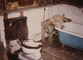
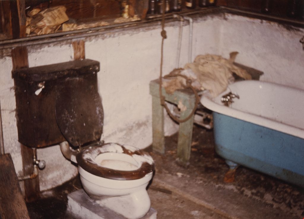
- Photograph of the bathtub and toilet in the basement of Tom Irvine's house in its original location on Laurel Street in Central Burnaby.
- Repository
- Burnaby Village Museum
- Collection/Fonds
- Century Park Museum Association fonds
- Description Level
- Item
- Physical Description
- 1 photograph : col. ; 13 x 17.5 cm reprint
- Scope and Content
- Photograph of the bathtub and toilet in the basement of Tom Irvine's house in its original location on Laurel Street in Central Burnaby.
- Names
- Irvine, Tom
- Geographic Access
- Laurel Street
- Accession Code
- BV005.14.13
- Access Restriction
- Restricted access
- Reproduction Restriction
- May be restricted by third party rights
- Date
- December 1974
- Media Type
- Photograph
- Historic Neighbourhood
- Burnaby Lake (Historic Neighbourhood)
- Planning Study Area
- Ardingley-Sprott Area
- Scan Resolution
- 600
- Scan Date
- 10-Jun-09
- Scale
- 100
- Notes
- Title based on contents of photograph
- Note in blue ink on verso of photograph reads: "Irvine House Basement December 1974 (reprint from slide)"
- Reprint is a Kodak "Type R" print made from an original col. transparency
- Reference file at BVM includes a col. copy slide of this image
Images

Basement at Tom Irvine's house
https://search.heritageburnaby.ca/link/museumdescription1861
- Repository
- Burnaby Village Museum
- Date
- December 1974
- Collection/Fonds
- Century Park Museum Association fonds
- Description Level
- Item
- Physical Description
- 1 photograph : col. ; 17.5 x 13 cm reprint
- Scope and Content
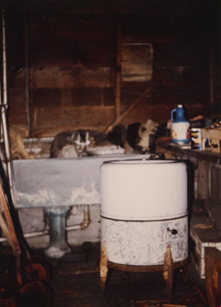
- Photograph of the sink and the washing machine in the basement at Tom Irvine's house in its original location on Laurel Street in Central Burnaby.
- Repository
- Burnaby Village Museum
- Collection/Fonds
- Century Park Museum Association fonds
- Description Level
- Item
- Physical Description
- 1 photograph : col. ; 17.5 x 13 cm reprint
- Scope and Content
- Photograph of the sink and the washing machine in the basement at Tom Irvine's house in its original location on Laurel Street in Central Burnaby.
- Names
- Irvine, Tom
- Geographic Access
- Laurel Street
- Accession Code
- BV005.14.14
- Access Restriction
- Restricted access
- Reproduction Restriction
- May be restricted by third party rights
- Date
- December 1974
- Media Type
- Photograph
- Historic Neighbourhood
- Burnaby Lake (Historic Neighbourhood)
- Planning Study Area
- Ardingley-Sprott Area
- Scan Resolution
- 600
- Scan Date
- 10-Jun-09
- Scale
- 100
- Notes
- Title based on contents of photograph
- Note in blue ink on verso of photograph reads: "Irvine House Basement December 1974 (reprint from slide)"
- Reprint is a Kodak "Type R" print made from an original col. transparency
- Reference file at BVM includes a col. copy slide of this image
Images
Basement at Tom Irvine's house
https://search.heritageburnaby.ca/link/museumdescription1862
- Repository
- Burnaby Village Museum
- Date
- December 1974
- Collection/Fonds
- Century Park Museum Association fonds
- Description Level
- Item
- Physical Description
- 1 photograph : col. ; 13 x 17.5 cm reprint
- Scope and Content
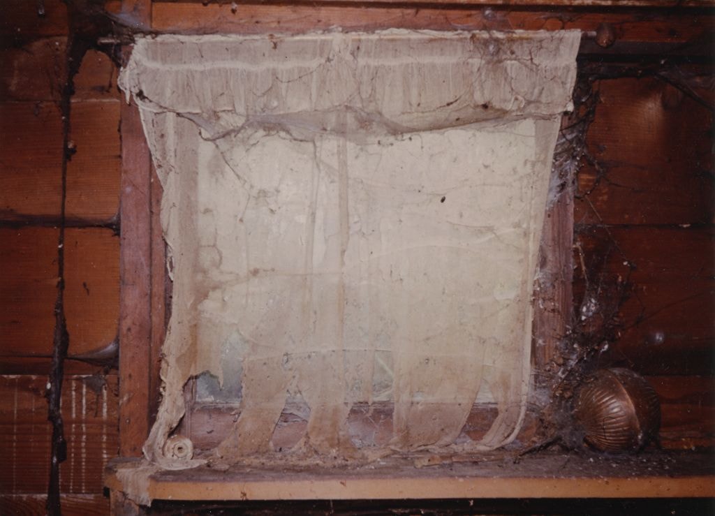
- Photograph of the tattered curtain (over a small window) in the basement at Tom Irvine's house in its original location on Laurel Street in Central Burnaby.
- Repository
- Burnaby Village Museum
- Collection/Fonds
- Century Park Museum Association fonds
- Description Level
- Item
- Physical Description
- 1 photograph : col. ; 13 x 17.5 cm reprint
- Scope and Content
- Photograph of the tattered curtain (over a small window) in the basement at Tom Irvine's house in its original location on Laurel Street in Central Burnaby.
- Names
- Irvine, Tom
- Geographic Access
- Laurel Street
- Accession Code
- BV005.14.15
- Access Restriction
- Restricted access
- Reproduction Restriction
- May be restricted by third party rights
- Date
- December 1974
- Media Type
- Photograph
- Historic Neighbourhood
- Burnaby Lake (Historic Neighbourhood)
- Planning Study Area
- Ardingley-Sprott Area
- Scan Resolution
- 600
- Scan Date
- 10-Jun-09
- Scale
- 100
- Notes
- Title based on contents of photograph
- Note in blue ink on verso of photograph reads: "Irvine House basement December 1974 (reprint from slide)"
- Reprint is a Kodak "Type R" print made from an original col. transparency
- Reference file at BVM includes a col. copy slide of this image
Images
Basement at Tom Irvine's house
https://search.heritageburnaby.ca/link/museumdescription1863
- Repository
- Burnaby Village Museum
- Date
- December 1974
- Collection/Fonds
- Century Park Museum Association fonds
- Description Level
- Item
- Physical Description
- 1 photograph : col. ; 17.5 x 13 cm reprint
- Scope and Content
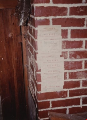
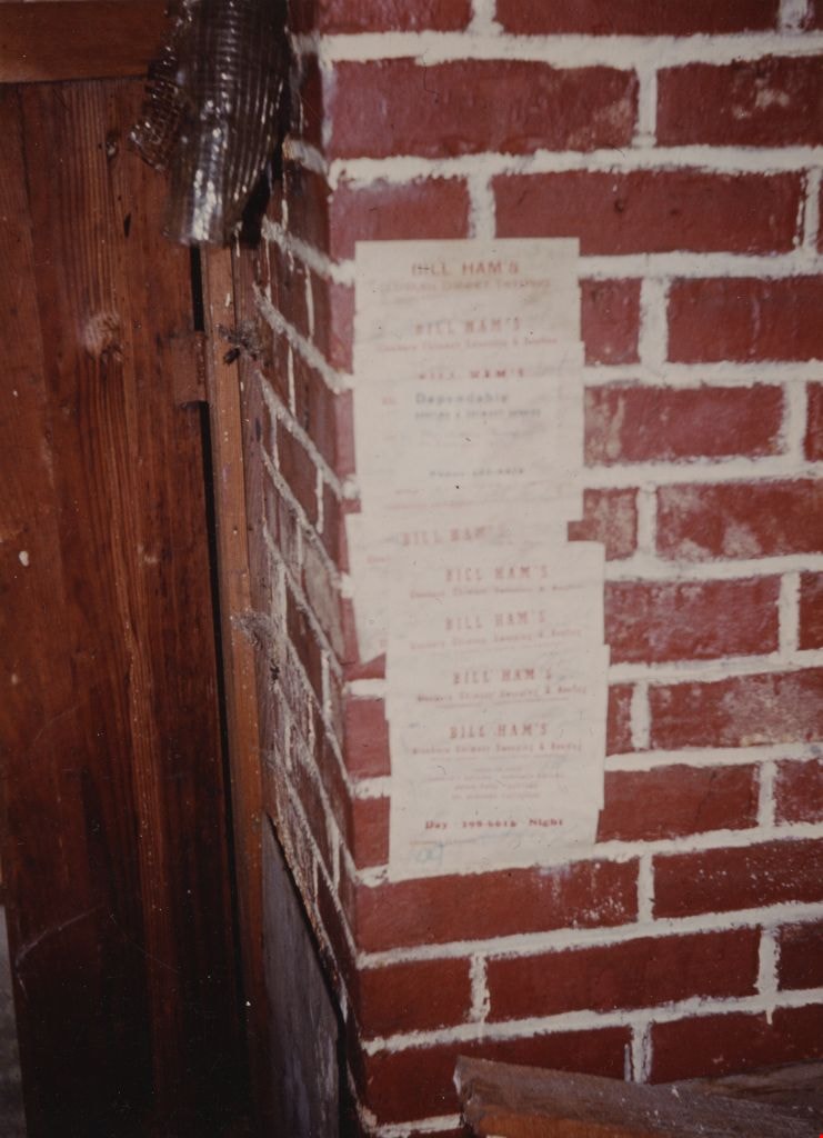
- Photograph of the chimney bricks (with inspection stickers by Bill Ham) in the basement at Tom Irvine's house in its original location on Laurel Street in Central Burnaby.
- Repository
- Burnaby Village Museum
- Collection/Fonds
- Century Park Museum Association fonds
- Description Level
- Item
- Physical Description
- 1 photograph : col. ; 17.5 x 13 cm reprint
- Scope and Content
- Photograph of the chimney bricks (with inspection stickers by Bill Ham) in the basement at Tom Irvine's house in its original location on Laurel Street in Central Burnaby.
- Subjects
- Building Components - Fireplaces
- Names
- Irvine, Tom
- Geographic Access
- Laurel Street
- Accession Code
- BV005.14.16
- Access Restriction
- Restricted access
- Reproduction Restriction
- May be restricted by third party rights
- Date
- December 1974
- Media Type
- Photograph
- Historic Neighbourhood
- Burnaby Lake (Historic Neighbourhood)
- Planning Study Area
- Ardingley-Sprott Area
- Scan Resolution
- 600
- Scan Date
- 10-Jun-09
- Scale
- 100
- Notes
- Title based on contents of photograph
- Note in blue ink on verso of photograph reads: "Irvine House Basement December 1974 (reprint from slide)"
- Reprint is a Kodak "Type R" print made from an original col. transparency
- Reference file at BVM includes a col. copy slide of this image
Images
Basement at Tom Irvine's house
https://search.heritageburnaby.ca/link/museumdescription1864
- Repository
- Burnaby Village Museum
- Date
- December 1974
- Collection/Fonds
- Century Park Museum Association fonds
- Description Level
- Item
- Physical Description
- 1 photograph : col. ; 13 x 17.5 cm reprint
- Scope and Content
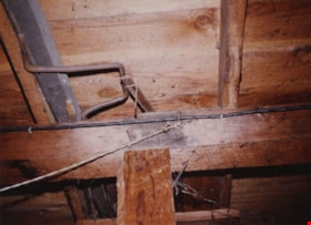
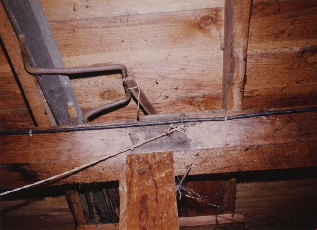
- Photograph detail of the basement joists and wood ceiling at Tom Irvine's house in its original location on Laurel Street in Central Burnaby.
- Repository
- Burnaby Village Museum
- Collection/Fonds
- Century Park Museum Association fonds
- Description Level
- Item
- Physical Description
- 1 photograph : col. ; 13 x 17.5 cm reprint
- Scope and Content
- Photograph detail of the basement joists and wood ceiling at Tom Irvine's house in its original location on Laurel Street in Central Burnaby.
- Subjects
- Building Components
- Names
- Irvine, Tom
- Geographic Access
- Laurel Street
- Accession Code
- BV005.14.17
- Access Restriction
- Restricted access
- Reproduction Restriction
- May be restricted by third party rights
- Date
- December 1974
- Media Type
- Photograph
- Historic Neighbourhood
- Burnaby Lake (Historic Neighbourhood)
- Planning Study Area
- Ardingley-Sprott Area
- Scan Resolution
- 600
- Scan Date
- 11-Jun-09
- Scale
- 100
- Notes
- Title based on contents of photograph
- Note in blue ink on verso of photograph reads: "Irvine House Basement December 1974 (reprint from slide)"
- Reprint is a Kodak "Type R" print made from an original col. transparency
- Reference file at BVM includes a col. copy slide of this image
Images

BCGEU Protestors
https://search.heritageburnaby.ca/link/archivedescription79500
- Repository
- City of Burnaby Archives
- Date
- October 14, 1976
- Collection/Fonds
- Burnaby Public Library Contemporary Visual Archive Project
- Description Level
- Item
- Physical Description
- 1 photograph : b&w ; 11 x 16 cm mounted on cardboard
- Scope and Content
- Photograph shows two members of the BC Government Employees Union, holding a large sign protesting wage and price controls outside the gates of the Lower Mainland Regional Correctional Centre at 5700 Royal Oak Avenue (later 5220 Oakmount Crescent).
- Repository
- City of Burnaby Archives
- Date
- October 14, 1976
- Collection/Fonds
- Burnaby Public Library Contemporary Visual Archive Project
- Physical Description
- 1 photograph : b&w ; 11 x 16 cm mounted on cardboard
- Description Level
- Item
- Record No.
- 556-329
- Access Restriction
- No restrictions
- Reproduction Restriction
- Reproduce for fair dealing purposes only
- Accession Number
- 2013-13
- Scope and Content
- Photograph shows two members of the BC Government Employees Union, holding a large sign protesting wage and price controls outside the gates of the Lower Mainland Regional Correctional Centre at 5700 Royal Oak Avenue (later 5220 Oakmount Crescent).
- Media Type
- Photograph
- Photographer
- Norton, Paul
- Notes
- Scope note taken directly from BPL photograph description.
- 1 b&w copy negative : 10 x 12.5 cm accompanying
- Geographic Access
- Oakmount Crescent
- Street Address
- 5220 Oakmount Crescent
- 5700 Royal Oak Avenue
- Historic Neighbourhood
- Burnaby Lake (Historic Neighbourhood)
- Planning Study Area
- Oakalla Area
Images

BCGEU Protestors
https://search.heritageburnaby.ca/link/archivedescription79502
- Repository
- City of Burnaby Archives
- Date
- October 14, 1976
- Collection/Fonds
- Burnaby Public Library Contemporary Visual Archive Project
- Description Level
- Item
- Physical Description
- 1 photograph : b&w ; 11 x 16 cm mounted on cardboard
- Scope and Content
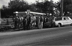
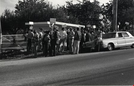
- Photograph shows a group of BC Government Employees demonstrating against wage and price controls outside the fence of the Lower Mainland Regional Correctional Centre at 5700 Royal Oak Avenue (later 5220 Oakmount Crescent).
- Repository
- City of Burnaby Archives
- Date
- October 14, 1976
- Collection/Fonds
- Burnaby Public Library Contemporary Visual Archive Project
- Physical Description
- 1 photograph : b&w ; 11 x 16 cm mounted on cardboard
- Description Level
- Item
- Record No.
- 556-330
- Access Restriction
- No restrictions
- Reproduction Restriction
- Reproduce for fair dealing purposes only
- Accession Number
- 2013-13
- Scope and Content
- Photograph shows a group of BC Government Employees demonstrating against wage and price controls outside the fence of the Lower Mainland Regional Correctional Centre at 5700 Royal Oak Avenue (later 5220 Oakmount Crescent).
- Subjects
- Protests and Demonstrations
- Media Type
- Photograph
- Photographer
- Norton, Paul
- Notes
- Scope note taken directly from BPL photograph description.
- 1 b&w copy negative : 10 x 12.5 cm accompanying
- Geographic Access
- Oakmount Crescent
- Street Address
- 5220 Oakmount Crescent
- 5700 Royal Oak Avenue
- Historic Neighbourhood
- Burnaby Lake (Historic Neighbourhood)
- Planning Study Area
- Oakalla Area
Images

BC Institute of Technology
https://search.heritageburnaby.ca/link/archivedescription93613
- Repository
- City of Burnaby Archives
- Date
- October 16, 1977
- Collection/Fonds
- Burnaby Public Library Contemporary Visual Archive Project
- Description Level
- Item
- Physical Description
- 1 photograph : b&w ; 12.5 x 17.5 cm
- Scope and Content
- Photograph of the exterior of the British Columbia Institute of Technology (BCIT). The photograph is taken facing east on the 3600 block of Willingdon Avenue.
- Repository
- City of Burnaby Archives
- Date
- October 16, 1977
- Collection/Fonds
- Burnaby Public Library Contemporary Visual Archive Project
- Physical Description
- 1 photograph : b&w ; 12.5 x 17.5 cm
- Description Level
- Item
- Record No.
- 556-570
- Access Restriction
- No restrictions
- Reproduction Restriction
- Reproduce for fair dealing purposes only
- Accession Number
- 2017-57
- Scope and Content
- Photograph of the exterior of the British Columbia Institute of Technology (BCIT). The photograph is taken facing east on the 3600 block of Willingdon Avenue.
- Media Type
- Photograph
- Photographer
- Chapman, Fred
- Notes
- Title taken from project information form
- Accompanied by a project information form and 1 photograph (b&w negative ; 9.5 x 12.5 cm)
- BPL no. 16
- Geographic Access
- Willingdon Avenue
- Street Address
- 3700 Willingdon Avenue
- Historic Neighbourhood
- Burnaby Lake (Historic Neighbourhood)
- Planning Study Area
- Douglas-Gilpin Area
Images


BC Institute of Technology
https://search.heritageburnaby.ca/link/archivedescription93614
- Repository
- City of Burnaby Archives
- Date
- October 16, 1977
- Collection/Fonds
- Burnaby Public Library Contemporary Visual Archive Project
- Description Level
- Item
- Physical Description
- 1 photograph : b&w ; 12.5 x 17.5 cm
- Scope and Content
- Photograph of the exterior of the British Columbia Institute of Technology (BCIT). The photograph is taken facing east on the 3600 block of Willingdon Avenue.
- Repository
- City of Burnaby Archives
- Date
- October 16, 1977
- Collection/Fonds
- Burnaby Public Library Contemporary Visual Archive Project
- Physical Description
- 1 photograph : b&w ; 12.5 x 17.5 cm
- Description Level
- Item
- Record No.
- 556-571
- Access Restriction
- No restrictions
- Reproduction Restriction
- Reproduce for fair dealing purposes only
- Accession Number
- 2017-57
- Scope and Content
- Photograph of the exterior of the British Columbia Institute of Technology (BCIT). The photograph is taken facing east on the 3600 block of Willingdon Avenue.
- Media Type
- Photograph
- Photographer
- McGillivray, Don
- Notes
- Title taken from project information form
- Accompanied by a project information form and 1 photograph (b&w negative ; 9.5 x 12.5 cm)
- BPL no. 17
- Geographic Access
- Willingdon Avenue
- Street Address
- 3700 Willingdon Avenue
- Historic Neighbourhood
- Burnaby Lake (Historic Neighbourhood)
- Planning Study Area
- Douglas-Gilpin Area
Images


BC Institute of Technology
https://search.heritageburnaby.ca/link/archivedescription93615
- Repository
- City of Burnaby Archives
- Date
- October 16, 1977
- Collection/Fonds
- Burnaby Public Library Contemporary Visual Archive Project
- Description Level
- Item
- Physical Description
- 1 photograph : b&w ; 12.5 x 17.5 cm
- Scope and Content
- Photograph of the British Columbia Institute of Technology (BCIT) campus, including main buildings and portables. The photograph is taken from a hgh point, facing northeast, on the 3600 block of Willingdon Avenue. The residential neighbourhood and mountains are visible in the background.
- Repository
- City of Burnaby Archives
- Date
- October 16, 1977
- Collection/Fonds
- Burnaby Public Library Contemporary Visual Archive Project
- Physical Description
- 1 photograph : b&w ; 12.5 x 17.5 cm
- Description Level
- Item
- Record No.
- 556-572
- Access Restriction
- No restrictions
- Reproduction Restriction
- Reproduce for fair dealing purposes only
- Accession Number
- 2017-57
- Scope and Content
- Photograph of the British Columbia Institute of Technology (BCIT) campus, including main buildings and portables. The photograph is taken from a hgh point, facing northeast, on the 3600 block of Willingdon Avenue. The residential neighbourhood and mountains are visible in the background.
- Media Type
- Photograph
- Photographer
- McGillivray, Don
- Notes
- Title taken from project information form
- Accompanied by a project information form and 1 photograph (b&w negative ; 9.5 x 12.5 cm)
- BPL no. 18
- Geographic Access
- Willingdon Avenue
- Street Address
- 3700 Willingdon Avenue
- Historic Neighbourhood
- Burnaby Lake (Historic Neighbourhood)
- Planning Study Area
- Douglas-Gilpin Area
Images


BCIT BCVS Parking Area
https://search.heritageburnaby.ca/link/archivedescription93636
- Repository
- City of Burnaby Archives
- Date
- October 26, 1977
- Collection/Fonds
- Burnaby Public Library Contemporary Visual Archive Project
- Description Level
- Item
- Physical Description
- 1 photograph : b&w ; 12.5 x 17.5 cm
- Scope and Content
- Photograph of the parking lot at the British Columbia Institute of Technology (BCIT) and the British Columbia Vocational School (BCVS) on Wayburne Drive. The parking lot is full of cars and campus buildings are visible in the background. The photograph is taken facing north.
- Repository
- City of Burnaby Archives
- Date
- October 26, 1977
- Collection/Fonds
- Burnaby Public Library Contemporary Visual Archive Project
- Physical Description
- 1 photograph : b&w ; 12.5 x 17.5 cm
- Description Level
- Item
- Record No.
- 556-593
- Access Restriction
- No restrictions
- Reproduction Restriction
- Reproduce for fair dealing purposes only
- Accession Number
- 2017-57
- Scope and Content
- Photograph of the parking lot at the British Columbia Institute of Technology (BCIT) and the British Columbia Vocational School (BCVS) on Wayburne Drive. The parking lot is full of cars and campus buildings are visible in the background. The photograph is taken facing north.
- Subjects
- Geographic Features - Automobile Parking Lots
- Buildings - Schools - Universities and Colleges
- Media Type
- Photograph
- Photographer
- Surridge, Jack
- Notes
- Title taken from project information form
- Accompanied by a project information form and 1 photograph (b&w negative ; 9.5 x 12.5 cm)
- BPL no. 42
- Geographic Access
- Wayburne Drive
- Street Address
- 3700 Willingdon Avenue
- Historic Neighbourhood
- Burnaby Lake (Historic Neighbourhood)
- Planning Study Area
- Douglas-Gilpin Area
Images

B.C. Teachers Credit Union
https://search.heritageburnaby.ca/link/archivedescription79079
- Repository
- City of Burnaby Archives
- Date
- September, 1976
- Collection/Fonds
- Burnaby Public Library Contemporary Visual Archive Project
- Description Level
- Item
- Physical Description
- 1 photograph : b&w ; 11 x 16 cm mounted on cardboard
- Scope and Content
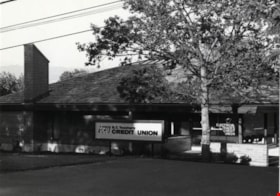
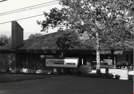
- Photograph shows the B.C. Teachers Credit Union at 4162 Norland Avenue. The building was constructed in June 1976. It also houses the Electrical Trades Credit Union.
- Repository
- City of Burnaby Archives
- Date
- September, 1976
- Collection/Fonds
- Burnaby Public Library Contemporary Visual Archive Project
- Physical Description
- 1 photograph : b&w ; 11 x 16 cm mounted on cardboard
- Description Level
- Item
- Record No.
- 556-139
- Access Restriction
- No restrictions
- Reproduction Restriction
- Reproduce for fair dealing purposes only
- Accession Number
- 2013-13
- Scope and Content
- Photograph shows the B.C. Teachers Credit Union at 4162 Norland Avenue. The building was constructed in June 1976. It also houses the Electrical Trades Credit Union.
- Subjects
- Buildings - Commercial - Banks
- Media Type
- Photograph
- Photographer
- Salmon, Stu
- Notes
- Scope note taken directly from BPL photograph description.
- 1 b&w copy negative : 10 x 12.5 cm accompanying
- Geographic Access
- Norland Avenue
- Street Address
- 4162 Norland Avenue
- Historic Neighbourhood
- Burnaby Lake (Historic Neighbourhood)
- Planning Study Area
- Douglas-Gilpin Area
Images

B.C. Vocational School
https://search.heritageburnaby.ca/link/archivedescription93611
- Repository
- City of Burnaby Archives
- Date
- October 17, 1977
- Collection/Fonds
- Burnaby Public Library Contemporary Visual Archive Project
- Description Level
- Item
- Physical Description
- 1 photograph : b&w ; 12.5 x 17.5 cm
- Scope and Content
- Photograph of the parking lot and the exterior of the British Columbia Vocational School building, located at 3650 Willingdon Avenue. The photograph is taken facing northeast. BCVS merged with BCIT in 1986.
- Repository
- City of Burnaby Archives
- Date
- October 17, 1977
- Collection/Fonds
- Burnaby Public Library Contemporary Visual Archive Project
- Physical Description
- 1 photograph : b&w ; 12.5 x 17.5 cm
- Description Level
- Item
- Record No.
- 556-568
- Access Restriction
- No restrictions
- Reproduction Restriction
- Reproduce for fair dealing purposes only
- Accession Number
- 2017-57
- Scope and Content
- Photograph of the parking lot and the exterior of the British Columbia Vocational School building, located at 3650 Willingdon Avenue. The photograph is taken facing northeast. BCVS merged with BCIT in 1986.
- Media Type
- Photograph
- Photographer
- McGillivray, Don
- Notes
- Title taken from project information form
- Accompanied by a project information form and 1 photograph (b&w negative ; 9.5 x 12.5 cm)
- BPL no. 14
- Geographic Access
- Willingdon Avenue
- Street Address
- 3650 Willingdon Avenue
- 3700 Willingdon Avenue
- Historic Neighbourhood
- Burnaby Lake (Historic Neighbourhood)
- Planning Study Area
- Douglas-Gilpin Area
Images
