Narrow Results By
Decade
- 2020s 461
- 2010s 979
- 2000s 2813
- 1990s 4532
- 1980s 3030
- 1970s 5023
- 1960s 2375
- 1950s 2540
- 1940s 2393
- 1930s 2313
- 1920s 2747
- 1910s 2146
- 1900s 981
- 1890s 297
- 1880s 146
- 1870s 40
- 1860s 45
- 1850s 25
- 1840s 13
- 1830s 9
- 1820s 9
- 1810s 6
- 1800s 6
- 1790s 5
- 1780s 5
- 1770s 5
- 1760s 5
- 1750s 5
- 1740s 5
- 1730s 5
- 1720s 5
- 1710s 5
- 1700s 5
- 1690s 5
- 1680s 5
- 1670s 4
- 1660s 4
- 1650s 4
- 1640s 4
- 1630s 4
- 1620s 4
- 1610s 4
- 1600s 4
- 1590s 1
- 1580s 1
- 1570s 1
- 1560s 1
- 1550s 1
- 1540s 1
- 1530s 1
- 1520s 2
- 1510s 1
- 1500s 1
- 1490s 1
- 1480s 1
Subject
- Academic Disciplines 3
- Accidents 13
- Accidents - Automobile Accidents 29
- Accidents - Train Accidents 9
- Adminstrative Groups - Committees 4
- Adornment 21
- Adornment - Jewelry 5
- Adornment - Lapel Pins 24
- Advertising Medium 36
- Advertising Medium - Business Cards 5
- Advertising Medium - Flyer 20
- Advertising Medium - Poster 16
Kapoor Mill
https://search.heritageburnaby.ca/link/landmark683
- Repository
- Burnaby Heritage Planning
- Associated Dates
- 1939
- Heritage Value
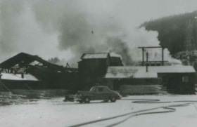
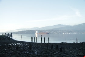
- In 1939, Mr. Kapoor Singh Siddoo purchased the eastern section of the former Barnet Mill site from the City of Burnaby and founded Kapoor Sawmills Ltd. The mill was struck by disaster in 1947 when a fire caused $500,000.00 in damage to the property. A smaller mill was rebuilt and was in operation until 1959. Mr. Siddoo, who had been considered to be one of the most influential men in Vancouver's East Indian Community, died in 1964. The mill site became inactive except for a sand and gravel storage area that was used by the Kask Brothers Company, and in 1972 the family sold the property to the Municipality of Burnaby who later turned it into the Barnet Marine Park.
- Historic Neighbourhood
- Barnet (Historic Neighbourhood)
- Planning Study Area
- Burnaby Mountain Area
Images
Lakeview Elementary School
https://search.heritageburnaby.ca/link/landmark834
- Repository
- Burnaby Heritage Planning
- Geographic Access
- Mayfield Street
- Associated Dates
- 1958
- Heritage Value
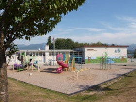
- The Burnaby School Inspector's report of 1955 estimated that by 1960, the total enrolment in Burnaby would go up by over 8000 pupils. As a result, new schools needed to be built to manage this increase, Lakeview being only one of many. Lakeview opened in 1958 with 193 students. Additions to the school were made in 1965 and 1969.
- Historic Neighbourhood
- Burnaby Lake (Historic Neighbourhood)
- Planning Study Area
- Lakeview-Mayfield Area
- Street Address
- 7777 Mayfield Street
- Street View URL
- Google Maps Street View
Images
Lewis & Millicent Physick Residence
https://search.heritageburnaby.ca/link/landmark616
- Repository
- Burnaby Heritage Planning
- Description
- Residential building.
- Associated Dates
- 1939
- Street View URL
- Google Maps Street View
- Repository
- Burnaby Heritage Planning
- Geographic Access
- Boundary Road North
- Associated Dates
- 1939
- Description
- Residential building.
- Heritage Value
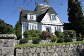
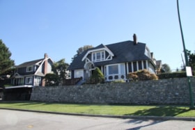
- This modest residence was built for Lewis Baker Physick (1905-1971), a freight dispatcher for B.C. Motor Transport Company who later worked for B.C. Hydro, and Millicent Physick (née Edwards, 1894-1971), a hairdresser, who lived here until their respective deaths. Situated on a terraced lot with stone-clad retaining walls, this home was influenced by the British Arts and Crafts style, which remained popular throughout the 1930s. Such stylistic influence can be seen in the second floor overhang, which is supported by false beams, leaded casement windows and steeply pitched roof and front gable. The roofline is enhanced by a jerkin-headed roof on the front gable. Apart from the addition of a later south elevation extension, the house remains in excellent original condition. Located on an elevated site, this residence has an unobstructed view of downtown Vancouver and Burrard Inlet.
- Locality
- Vancouver Heights
- Historic Neighbourhood
- Vancouver Heights (Historic Neighbourhood)
- Planning Study Area
- Burnaby Heights Area
- Area
- 566.71
- Contributing Resource
- Building
- Ownership
- Private
- Street Address
- 420 Boundary Road North
- Street View URL
- Google Maps Street View
Images
Louis Claude Hill home "Brookfield"
https://search.heritageburnaby.ca/link/landmark725
- Repository
- Burnaby Heritage Planning
- Geographic Access
- Deer Lake Avenue
- Associated Dates
- 1894
- Heritage Value
- In 1894, Burnaby pioneer L. Claude Hill built this home near the shore of Deer Lake. Mr. Hill was married that year to Annie Sara Kenrick, and they took up residence in the house until 1906 when they sold the property and built a new home in the vicinity of Buckingham and Sperling. Brookfield was still on the property when the Burnaby Village Museum was planned in 1971 as Heritage Village, but it was removed to make room for other buildings on the site. In 1894, Claude discovered a midden on his farm and recovered many artifacts. In 2002, his descendants donated this valuable collection to the Museum.
- Historic Neighbourhood
- Burnaby Lake (Historic Neighbourhood)
- Planning Study Area
- Morley-Buckingham Area
- Street Address
- 6501 Deer Lake Avenue
Images
Lucy Turner Residence
https://search.heritageburnaby.ca/link/landmark618
- Repository
- Burnaby Heritage Planning
- Description
- Residential building.
- Associated Dates
- 1930
- Street View URL
- Google Maps Street View
- Repository
- Burnaby Heritage Planning
- Geographic Access
- Boundary Road North
- Associated Dates
- 1930
- Description
- Residential building.
- Heritage Value
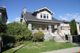
- This house was built for Lucy Lillian Turner (1881-1959), the daughter of Captain Andrew Jackson Cates of North Vancouver. Lucy Turner was the widow of Robert Ketchson Turner (1871-1918), who was a purser for her father’s Terminal Steam Navigation Company. They were married in 1913; Robert died during the 1918 Spanish Influenza epidemic and was buried at Mountain View Cemetery in Vancouver. Located on an elevated site, this residence boasts an unobstructed view of downtown Vancouver and Burrard Inlet and is situated amidst a context of homes of a similar age and scale. Demonstrating the late influence of the Craftsman style, this one and one-half storey house has triangular eave brackets and exposed rafter tails and purlins. A central wall dormer projects over the central front entry. Though the integrity of the house has been compromised with a later coat of stucco over the original siding, it maintains its double-hung wooden windows and original form, scale and massing.
- Locality
- Vancouver Heights
- Historic Neighbourhood
- Vancouver Heights (Historic Neighbourhood)
- Planning Study Area
- Burnaby Heights Area
- Area
- 566.71
- Contributing Resource
- Building
- Ownership
- Private
- Street Address
- 324 Boundary Road North
- Street View URL
- Google Maps Street View
Images
Mary McNeil Residence
https://search.heritageburnaby.ca/link/landmark620
- Repository
- Burnaby Heritage Planning
- Description
- Residential building.
- Associated Dates
- 1930
- Street View URL
- Google Maps Street View
- Repository
- Burnaby Heritage Planning
- Geographic Access
- MacDonald Avenue North
- Associated Dates
- 1930
- Description
- Residential building.
- Heritage Value
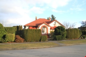
- Built for Mary McNeil, this house is a well-preserved example of an interwar Period Revival cottage, combining eclectic elements such as curved entrance porch buttresses, rolled roof edges, round-arched windows, smooth stucco cladding and imitation voussoirs. The house retains its original window sash with leaded glass panes.
- Locality
- Vancouver Heights
- Historic Neighbourhood
- Vancouver Heights (Historic Neighbourhood)
- Planning Study Area
- Burnaby Heights Area
- Area
- 566.71
- Contributing Resource
- Building
- Ownership
- Private
- Street Address
- 310 Macdonald Avenue North
- Street View URL
- Google Maps Street View
Images
Mary Sutcliffe Residence
https://search.heritageburnaby.ca/link/landmark621
- Repository
- Burnaby Heritage Planning
- Description
- Residential building.
- Associated Dates
- c.1930
- Street View URL
- Google Maps Street View
- Repository
- Burnaby Heritage Planning
- Geographic Access
- Boundary Road North
- Associated Dates
- c.1930
- Description
- Residential building.
- Heritage Value
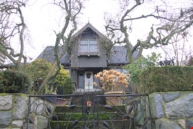
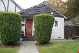
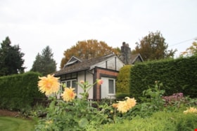
- Built at a time when historical styles were favoured for domestic construction, this charming cottage residence was built for Mary Seymour Sutcliffe (1870-1959), the wife of retired painter Arthur Sutcliffe (1863-1932). It was inspired by the British Arts and Crafts movement, as displayed in the half-timbering, rounded door hood and the picturesque, jerkin-headed roof with exposed purlins. While this house has a Boundary Road address, the house faces north instead of west, facing an elevated and extraordinary view of Burrard Inlet.
- Locality
- Vancouver Heights
- Historic Neighbourhood
- Vancouver Heights (Historic Neighbourhood)
- Planning Study Area
- Burnaby Heights Area
- Area
- 566.71
- Contributing Resource
- Building
- Ownership
- Private
- Street Address
- 650 Boundary Road North
- Street View URL
- Google Maps Street View
Images
McColl-Frontenac Oil Company
https://search.heritageburnaby.ca/link/landmark682
- Repository
- Burnaby Heritage Planning
- Associated Dates
- 1945
- Heritage Value
- In 1945, the McColl-Frontenac Oil Company purchased the western section of what used to be the Barnet Mill site from the City of Burnaby. McColl-Frontenac handled the distribution of Texaco gas and built a new plant at the site for this purpose. The company built an improved road access to the plant which later became known as Texaco Drive. Competition from other refineries eventually forced the closure of this plant and in 1985 the area was acquired by the Municipality for the expansion of Barnet Marine Park.
- Historic Neighbourhood
- Barnet (Historic Neighbourhood)
- Planning Study Area
- Burnaby Mountain Area
Images
Montague & Marcia Moore Residence
https://search.heritageburnaby.ca/link/landmark499
- Repository
- Burnaby Heritage Planning
- Description
- The Montague and Marcia Moore Residence, situated on Sperling Avenue, is a one and one-half storey wood-frame house with Tudor Revival elements such as half-timbering and diamond-leaded windows. The landscaping includes a large hedge at the front of the property. It is located on a lakefront site w…
- Associated Dates
- 1943
- Street View URL
- Google Maps Street View
- Repository
- Burnaby Heritage Planning
- Geographic Access
- Sperling Avenue
- Associated Dates
- 1943
- Description
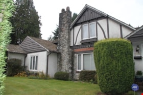
- The Montague and Marcia Moore Residence, situated on Sperling Avenue, is a one and one-half storey wood-frame house with Tudor Revival elements such as half-timbering and diamond-leaded windows. The landscaping includes a large hedge at the front of the property. It is located on a lakefront site within the scenic Deer Lake Park Heritage Precinct.
- Heritage Value
- Located within the historic Deer Lake Park neighbourhood, the Montague and Marcia Moore Residence is valued as an example of the late persistence of the historicist influence on domestic architecture, at a time when it was still considered the height of good taste for a house to be designed in a recognizable period revival style. This is reflected in the rustic Tudor Revival elements such as half-timbering, waney-edged boards in the gables, brick nogging, diamond-leaded windows, and bird houses in the main gable. The cobblestone chimney, the major focal point of the house, was constructed from river stones that were transported from Lynn Canyon. Meticulously retained in its original condition, this was the last home to be constructed by the Moore family before the Second World War construction supply rationing took effect. It was built by Danish contractor, Hans Jorgensen Hau (1878-1944), who had a flair for the construction of homes with a rustic character, and shares a number of design features with Hau’s own house at 5070 Canada Way.
- Defining Elements
- Key elements that define the heritage character of the Montague and Marcia Moore Residence include its: - location on a lakefront site, within the Deer Lake Park Heritage Precinct - residential form, scale and massing as expressed by its one and one-half storey height, rectangular plan and front gabled roof - wood-frame construction - Tudor Revival elements such as stucco and wood half-timbering, diamond-leaded casement windows, scroll-cut brackets, brick nogging on the front façade, bird houses in the main front gable, waney-edged boards at gable peaks, plank front door with strap hinges and a prominent external cobblestone chimney - associated landscape features such as a granite wall, and mature coniferous and deciduous trees
- Historic Neighbourhood
- Burnaby Lake (Historic Neighbourhood)
- Planning Study Area
- Morley-Buckingham Area
- Organization
- Canadian Institute of Mining and Metallurgy
- Builder
- Hans Jorgensen Hau
- Function
- Primary Historic--Single Dwelling
- Primary Current--Single Dwelling
- Community
- Deer Lake
- Cadastral Identifier
- P.I.D.006-082-696
- Boundaries
- The Montague and Marcia Moore Residence is comprised of a single residential lot located at 5165 Sperling Avenue, Burnaby.
- Area
- 4104
- Contributing Resource
- Building
- Ownership
- Public (local)
- Documentation
- City of Burnaby Planning and Building Department, Heritage Site Files
- Street Address
- 5165 Sperling Avenue
- Street View URL
- Google Maps Street View
Images
Moore House
https://search.heritageburnaby.ca/link/landmark497
- Repository
- Burnaby Heritage Planning
- Description
- The Moore House is a one-storey, side-gabled house with stepped roof planes and a split-level attached garage. The house faces east, and features distinct river rock porch columns and a large central tapered chimney. It is located within the Deer Lake Park Heritage Precinct, and is adjacent to a re…
- Associated Dates
- 1941
- Formal Recognition
- Community Heritage Register
- Other Names
- Ethel Moore Residence
- Street View URL
- Google Maps Street View
- Repository
- Burnaby Heritage Planning
- Other Names
- Ethel Moore Residence
- Geographic Access
- Sperling Avenue
- Associated Dates
- 1941
- Formal Recognition
- Community Heritage Register
- Enactment Type
- Council Resolution
- Enactment Date
- 26/05/2003
- Description
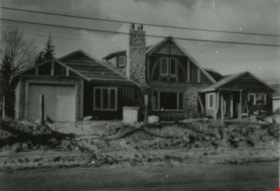
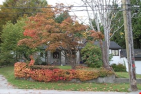
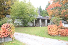
- The Moore House is a one-storey, side-gabled house with stepped roof planes and a split-level attached garage. The house faces east, and features distinct river rock porch columns and a large central tapered chimney. It is located within the Deer Lake Park Heritage Precinct, and is adjacent to a related house, the Rosalie (Moore) Barrett Residence, built the following year.
- Heritage Value
- The Moore House is significant for its relationship to first owner, Ethel Hutchings Moore (1884-1948), who purchased the property from Maud and Harriet Woodward, two of Deer Lake's first residents. Moore purchased the property with the hopes of introducing her children into the house construction business. This house, built in 1941, borrows its design from a 'California Desert House' built in Carmel a few years earlier. Rendered in traditional materials, this modern style merges comfortably with the rustic British Arts and Crafts tradition of most Deer Lake houses. Unusual for being built during wartime date, it was built at a time when domestic construction was severely curtailed due to shortages of labour and material. It is now owned by the City of Burnaby and is part of the Deer Lake Park Heritage Precinct. The Moore House is significant as a testament to Deer Lake's continued popularity as a residential neighbourhood in the 1940s. Although Burnaby was serviced by a number of transportation links at the time, the increasing availability of automobiles provided improved access to outlying suburbs. Rising real estate prices in Vancouver and New Westminster attracted residents to this neighbourhood because of its relative affordability, central location and beautiful scenery.
- Defining Elements
- Key elements that define the heritage character of the Moore House include its: - location within the Deer Lake Park Heritage Precinct - residential form, scale and massing as expressed by its one-storey height, linear plan, side gabled roof with multiple roof planes and split-level attached garage - wood-frame construction with stucco cladding - river rock porch columns and external tapered chimney - decorative embellishments including scroll-cut stickwork on the rear elevation and waney-edged boards in the gable peaks - wooden-sash casement windows with three-part, horizontal leading - associated landscaping features, including stone wall at the front of the property and coniferous and deciduous trees surrounding the property
- Historic Neighbourhood
- Burnaby Lake (Historic Neighbourhood)
- Planning Study Area
- Morley-Buckingham Area
- Function
- Primary Historic--Single Dwelling
- Primary Current--Single Dwelling
- Community
- Deer Lake
- Cadastral Identifier
- P.I.D. 011-454-521
- Boundaries
- The Moore House is comprised of a single residential lot located at 5145 Sperling Avenue, Burnaby.
- Area
- 993.39
- Contributing Resource
- Building
- Ownership
- Public (local)
- Documentation
- City of Burnaby Planning and Building Department, Heritage Site Files
- Street Address
- 5145 Sperling Avenue
- Street View URL
- Google Maps Street View
Images
Morley-Buckingham Neighbourhood
https://search.heritageburnaby.ca/link/landmark829
- Repository
- Burnaby Heritage Planning
- Associated Dates
- 1955-2008
- Heritage Value
- In the 1980 "Residential Neighbourhood Environment Study," the Morley-Buckingham Neighbourhood is described as "perhaps Burnaby's most prestigious residential area. The lots are larger than most other areas of the Municipality and this, along with the new expensive housing developed over the past 10 years, has created a very desirable residential neighbourhood...The older area of Buckingham lies at the lower edge of the slope and here the homes and streets are more uniform and aged between 20 and 25 years old...to the east of Canada Way lies...a cluster townhouse development."
- Historic Neighbourhood
- Burnaby Lake (Historic Neighbourhood)
- Planning Study Area
- Morley-Buckingham Area
Images
Morley Elementary School
https://search.heritageburnaby.ca/link/landmark835
- Repository
- Burnaby Heritage Planning
- Geographic Access
- Morley Street
- Associated Dates
- 1955
- Heritage Value
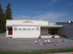
- In 1955 Morley Elementary School opened with 292 pupils, an indication of how quickly the residential areas around the Morley area were growing in the post-war period. Similar to other elementary schools built in Burnaby at the time, Morley was constructed on one level with classrooms in a line that could be added to as the need arose. Additions were made to the school in 1956, 1960 and 1969.
- Historic Neighbourhood
- Burnaby Lake (Historic Neighbourhood)
- Planning Study Area
- Morley-Buckingham Area
- Street Address
- 7355 Morley Street
- Street View URL
- Google Maps Street View
Images
Nichols Chemical Company
https://search.heritageburnaby.ca/link/landmark749
- Repository
- Burnaby Heritage Planning
- Geographic Access
- Barnet Road
- Associated Dates
- 1905
- Heritage Value
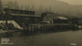
- In 1905 the Nichols Chemical Company, acid manufacturers based in Montreal, established their plant on a large point of land just east of the North Pacific Lumber Company. This company was later amalgamated and acquired by General Chemical and remains in operation on the original waterfront site.
- Historic Neighbourhood
- Barnet (Historic Neighbourhood)
- Planning Study Area
- Burnaby Mountain Area
- Street Address
- 8655 Barnet Road
Images
North Pacific Lumber Company Ruins
https://search.heritageburnaby.ca/link/landmark627
- Repository
- Burnaby Heritage Planning
- Geographic Access
- Barnet Road
- Associated Dates
- 1909
- Description
- Industrial building.
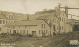
- Heritage Value
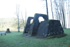
- Located on the shore of Burrard Inlet, these poured concrete piers of the smokestack burner and the former boiler and plant of the North Pacific Lumber Company are among the only remains of the once-thriving industrial site located on the waterfront on the south shore of Burrard Inlet. The sawmill and the Village of Barnet were initiated by David MacLaren, a wealthy lumberman from Buckingham, Quebec, who had previously established the Fraser Mills in Coquitlam in 1889. McLaren gambled that a sawmill on the main line of the C.P.R near Vancouver would serve the Canadian domestic market and be a profitable venture. The North Pacific Lumber Company established itself on this peninsula on Burrard Inlet and was fully operational in 1900. In 1909, the mill was completely burned out by a fire starting in the boiler room. Immediately the plant was rebuilt, modern in every respect and absolutely fireproof, as the entire power plant and boiler room was built of reinforced concrete and steel, of which these ruins are the last remains. The plant closed during the First World War and reopened as the Barnet Lumber Company in 1925 only to close forever in 1931 after a strike during the Great Depression.
- Locality
- Barnet
- Historic Neighbourhood
- Barnet (Historic Neighbourhood)
- Planning Study Area
- Burnaby Mountain Area
Images
North Road
https://search.heritageburnaby.ca/link/landmark722
- Repository
- Burnaby Heritage Planning
- Associated Dates
- 1859
- Heritage Value
- When New Westminster was chosen as the first site for the capital city of British Columbia in 1859, Colonel R.C. Moody developed a plan to defend the city from American attack by building a road to connect New Westminster to the Burrard Inlet. Although an attack never came, North Road became a well-used route for citizens in the capital city who travelled the road to enjoy a picnic at the beach or to board a ferry for the city of Port Moody. The road's route over the mountain remained in use until the 1960s, when this section was closed to traffic. North Road is the oldest road in the Lower Mainland.
- Planning Study Area
- Burnaby Mountain Area
Images
Oakalla Prison
https://search.heritageburnaby.ca/link/landmark752
- Repository
- Burnaby Heritage Planning
- Geographic Access
- Royal Oak Avenue
- Associated Dates
- 1912
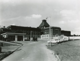
- Heritage Value
- The Oakalla Prison Farm opened in 1912 and was hailed as the most modern facility of its kind. Initially designed to hold 150 men and 50 women, by the 1950s, the population was well over 1000. A working farm, the prison had its own dairy, vegetable gardens and livestock. From the beginning, the location of Oakalla on 185 acres of scenic land next to Burnaby's Deer Lake was the source of contention with residents petitioning the government to relocate the prison and by 1979 it was decided to close the farm and 64 acres of land were transferred to Burnaby for inclusion on the Deer Lake Park. In 1991, Oakalla closed forever and the buildings were demolished to make way for a new residential housing development and an expansion of the park.
- Historic Neighbourhood
- Burnaby Lake (Historic Neighbourhood)
- Planning Study Area
- Oakalla Area
Images
Overlynn Mansion
https://search.heritageburnaby.ca/link/landmark520
- Repository
- Burnaby Heritage Planning
- Description
- Overlynn Mansion is a two and one-half storey British Arts and Crafts mansion, with an exterior composed of a massive native granite rubble-stone base surmounted by distinctive half-timbering, a hip hipped roof, a rare surviving intact interior, and elaborate landscape features including stone wall…
- Associated Dates
- 1909
- Formal Recognition
- Heritage Designation, Community Heritage Register
- Other Names
- Charles J. Peter Mansion
- Street View URL
- Google Maps Street View
- Repository
- Burnaby Heritage Planning
- Other Names
- Charles J. Peter Mansion
- Geographic Access
- McGill Street
- Associated Dates
- 1909
- Formal Recognition
- Heritage Designation, Community Heritage Register
- Enactment Type
- Bylaw No. 10211
- Enactment Date
- 18/09/1995
- Description
- Overlynn Mansion is a two and one-half storey British Arts and Crafts mansion, with an exterior composed of a massive native granite rubble-stone base surmounted by distinctive half-timbering, a hip hipped roof, a rare surviving intact interior, and elaborate landscape features including stone walls and planted terraces. It is situated in the residential neighbourhood of Vancouver Heights, on a high point of land overlooking Burrard Inlet to the west and the mouth of Lynn Creek to the east. This prominent residence is now part of a large senior citizens development known as Seton Villa.
- Heritage Value
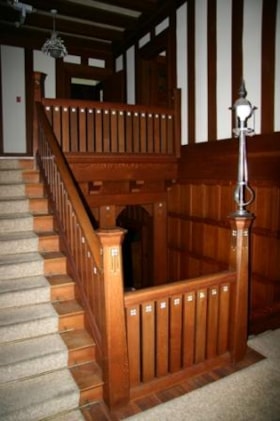
- Overlynn Mansion is valued as a superb example of the work of the noted architectural firm of Maclure and Fox. The architecture of Samuel Maclure (1860-1929) was synonymous with high quality residential design for prominent citizens in both Vancouver and Victoria. Maclure was known for his British Arts and Crafts style with meticulous attention paid to functional and beautiful interiors that utilized native wood combined with luxurious imported fittings. He was a leading exponent of the Art and Crafts design movement in B.C., and established a sophisticated local variation of residential architecture. Maclure’s Vancouver office, in association with his partner Cecil Croker Fox (1879-1916), received some sixty residential commissions between 1909-1915 as a result of the booming local economy and subsequent development of new residential districts. Maclure’s practice in Victoria was equally prolific at the time. Overlynn Mansion is valued as one of Burnaby’s oldest upper-class estates and for its association with the development of Vancouver Heights. In 1909, C.J. Peter and his employer, G.F. and J. Galt Limited, pioneered the development of Vancouver Heights in North Burnaby, believing it to be one of the most picturesque districts in area and an alternative to the CPR’s prestigious Shaughnessy Heights development in Vancouver. Buyers were obligated to build houses worth $3,500 at a time when the average house price was $1,000. Overlynn Mansion, built in 1909 for $75,000, was one of the first houses constructed in Vancouver Heights and by far the most grandiose and impressive. Additionally, this landmark residence is significant and an intact and comprehensive representation of a grand Edwardian era estate home. The interior is notably intact, and retains many highly-refined original features, including substantive millwork of exotic woods, silver-plated and nickel-plated light fixtures, fine plasterwork, tiled fireplaces and exceptional hardware. Landscape features of Overlynn Mansion include the original layout for circulation paths, a porte-cochere, granite posts and stone walls, a sandstone and iron sundial, and mature trees and shrubbery. The house was designated by Burnaby Council in 1995 and was the first heritage building in B.C. to receive legal protection for its interior features.
- Defining Elements
- Key elements that define the heritage character of Overlynn Mansion include its: - prominent corner location on a steep sloping site in the Vancouver Heights neighbourhood - views to Burrard Inlet and the North Shore mountains - residential form, scale and massing as exemplified by its grand two-storey plus basement height and irregular plan - British Arts and Crafts elements such as the rubble-stone granite masonry on the ground floor and foundation level, and decorative half-timbering and rough-cast stucco on the upper storey - compound hipped bell-cast roof, clad with cedar shingles, with shed dormers at the rear - subtle battering of ground floor and foundation level stonework - porte-cochere with hipped roof and battered granite piers - wood-clad projecting bay extensions - irregular fenestration: double-hung 6-over-1 wooden-sash windows; multi-pane casement wooden windows with multi-pane transoms; diamond leaded casement windows; and banks of stained glass windows - five tall rubble-stone granite block stone chimneys - interior features such as the oak, cedar and Yaka (Australian mahogany) panelled walls, oak panelling and staircase walls inlaid with ebony, ivory and brass, stenciled canvas friezes, wooden dadoes and plaster walls, encaustic floor tiles, Australian gumwood floors, oak panelled doors with art glass, oak beamed ceiling with stucco panels, cast plaster vaulted hall and living room ceilings, sterling silver light fixtures including a chandelier and scones, nickel-plated newel light, brass Art Nouveau styled ceiling light, brass stair carpet poles and locks, built-in bookcases and buffet, fireplace with encaustic tiles and fire dogs, imported Medmenham fireplace tiles (the earliest known use outside of the United Kingdom), fireplace mantel with green tile and cast iron firebox, and inglenook fireplace with encaustic tiles and carved mantel and brass fireplace insert - landscape features such as the granite gate posts and iron entrance gate, granite posts and iron fence, granite garden wall, sandstone garden steps, sandstone and iron sundial, granite and concrete terraces adjacent to the house, configuration of pathways and sandstone steps including the front access road, mature deciduous and coniferous tree stock including a Monkey Puzzle Tree and pruned shrubbery throughout the site
- Historic Neighbourhood
- Vancouver Heights (Historic Neighbourhood)
- Planning Study Area
- Burnaby Heights Area
- Organization
- G.F. and J. Galt Limited
- Architect
- Samuel Maclure
- Cecil Croker Fox
- Function
- Primary Historic--Estate
- Primary Current--Multiple Dwelling
- Community
- Burnaby
- Cadastral Identifier
- 004-943-295
- Boundaries
- Overlynn Mansion is a part of a single institutional lot located at 3755 McGill Street, Burnaby.
- Area
- 7912.77
- Contributing Resource
- Building
- Ownership
- Private
- Street Address
- 3755 McGill Street
- Street View URL
- Google Maps Street View
Images
Peter & Alma Newstrom Residence
https://search.heritageburnaby.ca/link/landmark631
- Repository
- Burnaby Heritage Planning
- Description
- Residential building.
- Associated Dates
- c.1915
- Street View URL
- Google Maps Street View
- Repository
- Burnaby Heritage Planning
- Geographic Access
- Oxford Street
- Associated Dates
- c.1915
- Description
- Residential building.
- Heritage Value
- This bungalow was built and owned by Peter John Newstrom (1861-1947), who later worked as a bricklayer, and his wife Alma Mary (1865-1935). The Newstroms arrived in Canada from Sweden about 1912 and were long-term residents of this home; Peter lived in the house after the death of his wife, until his own death in 1947. Typical of the Craftsman style, the house has a side gabled roof with large front gabled dormer, scroll-cut bargeboards, open front verandah and granite rubble-stone foundation and tapered piers. It retains its original glazed front door assembly.
- Locality
- Vancouver Heights
- Historic Neighbourhood
- Vancouver Heights (Historic Neighbourhood)
- Planning Study Area
- Burnaby Heights Area
- Area
- 566.71
- Contributing Resource
- Building
- Ownership
- Private
- Street Address
- 3865 Oxford Street
- Street View URL
- Google Maps Street View
Images
R.M. Edgar House
https://search.heritageburnaby.ca/link/landmark543
- Repository
- Burnaby Heritage Planning
- Description
- The R.M. Edgar House is a particularly large wood-frame Craftsman-inspired bungalow on the south shore of Deer Lake, built as a family estate home. It has a symmetrical front elevation, a deep wrap-around verandah, and a pyramidal roof with massive dormers on each face. Set on a large lot and isola…
- Associated Dates
- 1912
- Formal Recognition
- Heritage Designation, Community Heritage Register
- Other Names
- Robert McBeth & Maude Edgar Residence
- Repository
- Burnaby Heritage Planning
- Other Names
- Robert McBeth & Maude Edgar Residence
- Geographic Access
- Deer Lake Drive
- Associated Dates
- 1912
- Formal Recognition
- Heritage Designation, Community Heritage Register
- Enactment Type
- Bylaw No. 9807
- Enactment Date
- 23/11/1992
- Description
- The R.M. Edgar House is a particularly large wood-frame Craftsman-inspired bungalow on the south shore of Deer Lake, built as a family estate home. It has a symmetrical front elevation, a deep wrap-around verandah, and a pyramidal roof with massive dormers on each face. Set on a large lot and isolated from its neighbours, the house is surrounded by a manicured naturalistic landscape.
- Heritage Value
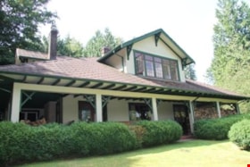
- The R.M. Edgar House represents an alternative reading of the aesthetic and lifestyle values of those who settled on these lakeside estates in the early twentieth century. By comparison with the grand mansions, set in formally landscaped gardens, on the north shore of Deer Lake, the R.M. Edgar House demonstrates a reverence for the natural, wooded environs, and a deliberate orientation near a stream running through the property. The house is important for its connection with Robert McBeth Edgar, not only a successful and wealthy businessman (partner in the real estate firm Hampton and Edgar) but also an active supporter of the Liberal party, Dominion Returning Officer for Vancouver, and Burnaby Councillor for six years; his contribution to Burnaby and British Columbia was far-reaching and significant. The house illustrates the desire for a simpler lifestyle and retreat into nature of those who settled on the south shore of Deer Lake and also this community's attraction for those of an artistic temperament. Maude Edgar was a poet and broadcaster; and the Edgar's daughter - Ann, known as 'Bebe' - was an accomplished sculptress. This was the first house built on the south shore of Deer Lake.
- Defining Elements
- Key elements that define the heritage character of the R.M. Edgar House include its: - overall bungalow massing and its location facing Deer Lake and backing onto a wilderness of Douglas Fir and moss-covered rocks, with a stream running through the site - remnants of the original landscaping such as the box hedge, rockeries and granite retaining walls - the surrounding naturalistic landscape augmented by ornamental cedars, maples, and rhododendrons - square floor plan with a deep enclosed verandah under a prominent broad hipped roof - symmetrical gable dormers - internal brick chimneys, including one at the centre peak of the roof - Craftsman-influenced exterior with such characteristics as: woodwork brackets on the square verandah pillars; deep overhanging roof eaves; and exposed rafter tails - multiple-assembly 12-paned casement wooden-sash windows in the dormers with 6-paned transoms - rustic Arts and Crafts interior with such items as Douglas fir paneling and large granite fireplace in the Drawing Room
- Locality
- Deer Lake Park
- Historic Neighbourhood
- Burnaby Lake (Historic Neighbourhood)
- Planning Study Area
- Morley-Buckingham Area
- Function
- Primary Current--Single Dwelling
- Primary Historic--Estate
- Community
- Burnaby
- Cadastral Identifier
- P.I.D. No. 001-178-024 and P.I.D. No. 001-178-016 Legal Description: Parcel 'D' (Explanatory Plan 4272) District Lot 85, Group 1, New Westminster District and Parcel 'W' (Explanatory Plan 255) District Lot 85, Group 1, New Westminster District
- Boundaries
- The R.M. Edgar House is comprised of a single municipally-owned property located at 6450 Deer Lake Drive, Burnaby.
- Area
- 11,661.30
- Contributing Resource
- Building
- Landscape Feature
- Ownership
- Public (local)
- Documentation
- Heritage Site Files: PC77000 20. City of Burnaby Planning and Building Department, 4949 Canada Way, Burnaby, B.C., V5G 1M2
- Street Address
- 6450 Deer Lake Drive
Images
Robert & Mary B. McLennan House
https://search.heritageburnaby.ca/link/landmark634
- Repository
- Burnaby Heritage Planning
- Description
- Residential building.
- Associated Dates
- 1911
- Street View URL
- Google Maps Street View
- Repository
- Burnaby Heritage Planning
- Geographic Access
- Yale Street
- Associated Dates
- 1911
- Description
- Residential building.
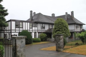
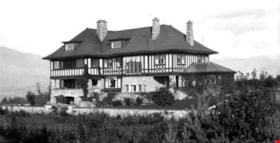
- Heritage Value
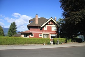
- Robert McLennan was the vice-president of the prominent Vancouver hardware firm of McLennan, McFeely & Company, popularly known as Mc.& Mc. Born in Pictou, Nova Scotia in 1861, Robert McLennan entered the hardware business at age fifteen. The West was an irresistible lure, and after he moved to Victoria in 1884, he took on a friend, Edward J. McFeely, as a business partner. Their business was a success and they soon opened a branch in the rapidly-developing new city of Vancouver. In 1898, Robert went to Dawson, where he opened a branch operation and served as mayor for one year in 1903. He returned to Vancouver in 1904, and as the business expanded, E.G. Prior was taken on as partner. In addition to his business pursuits, the public-spirited McLennan served on many boards and committees. In 1887, Robert returned to Nova Scotia where he married Bessie Archibald McKenzie. They had nine children, one of whom was born in Dawson. Robert died in 1927, and Bessie died in 1941. This grand residence was one of the first to be built in the Vancouver Heights subdivision, and its spectacular location retains panoramic views of Burrard Inlet and the North Shore. This house was undoubtedly designed by a local architect as it is an excellent example of the British Arts and Crafts style, with a shingled exterior, half-timbered gables and prominent brick chimneys. Although the west verandah has been enclosed and the windows altered, the house has been well maintained. Although owned by the McLennans, it may have been an investment property, as they lived for many years at a Vancouver address. In 1926, the house was sold to Vancouver Medical Health Officer, F.T. Underhill.
- Locality
- Vancouver Heights
- Historic Neighbourhood
- Vancouver Heights (Historic Neighbourhood)
- Planning Study Area
- Burnaby Heights Area
- Area
- 576.00
- Contributing Resource
- Building
- Ownership
- Private
- Street Address
- 3789 Yale Street
- Street View URL
- Google Maps Street View
