Narrow Results By
Subject
- Accidents - Automobile Accidents 2
- Advertising Medium - Signs and Signboards 12
- Aerial Photographs 13
- Agricultural Tools and Equipment 8
- Agricultural Tools and Equipment - Gardening Equipment 1
- Agricultural Tools and Equipment - Plows 6
- Agriculture 1
- Agriculture - Crops 10
- Agriculture - Farms
- Agriculture - Fruit and Berries 8
- Agriculture - Poultry 1
- Animals 3
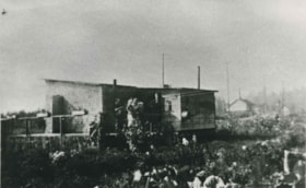
Barns at Oakalla
https://search.heritageburnaby.ca/link/archivedescription38119
- Repository
- City of Burnaby Archives
- Date
- [195-] (date of original), copied 1991
- Collection/Fonds
- Burnaby Historical Society fonds
- Description Level
- Item
- Physical Description
- 1 photograph : b&w ; 2.8 x 4.1 cm print on contact sheet 20.1 x 26.5 cm
- Scope and Content
- Photograph of the exterior of horse and cattle barns at Oakalla Prison Farm.
- Repository
- City of Burnaby Archives
- Date
- [195-] (date of original), copied 1991
- Collection/Fonds
- Burnaby Historical Society fonds
- Subseries
- Burnaby Image Bank subseries
- Physical Description
- 1 photograph : b&w ; 2.8 x 4.1 cm print on contact sheet 20.1 x 26.5 cm
- Description Level
- Item
- Record No.
- 370-706
- Access Restriction
- No restrictions
- Reproduction Restriction
- Reproduce for fair dealing purposes only
- Accession Number
- BHS1999-03
- Scope and Content
- Photograph of the exterior of horse and cattle barns at Oakalla Prison Farm.
- Subjects
- Buildings - Agricultural - Barns
- Agriculture - Farms
- Buildings - Public - Detention Facilities
- Names
- Oakalla Prison Farm
- Media Type
- Photograph
- Notes
- Title based on contents of photograph
- 1 b&w copy negative accompanying
- Negative has a pink cast
- Geographic Access
- Oakmount Crescent
- Street Address
- 5220 Oakmount Crescent
- Historic Neighbourhood
- Burnaby Lake (Historic Neighbourhood)
- Planning Study Area
- Oakalla Area
Images
Boberg family home and farm
https://search.heritageburnaby.ca/link/archivedescription35772
- Repository
- City of Burnaby Archives
- Date
- 1924
- Collection/Fonds
- Burnaby Historical Society fonds
- Description Level
- Item
- Physical Description
- 1 photograph : b&w ; 12.7 x 17.8 cm print
- Scope and Content
- Photograph of the Boberg family home and farm on Douglas Road. Shown on the back porch, John Boberg (father) and Elin Boberg (mother) holding their only son, John, then 3 years old (born 1921).
- Repository
- City of Burnaby Archives
- Date
- 1924
- Collection/Fonds
- Burnaby Historical Society fonds
- Subseries
- Pioneer Tales subseries
- Physical Description
- 1 photograph : b&w ; 12.7 x 17.8 cm print
- Description Level
- Item
- Record No.
- 204-630
- Access Restriction
- No restrictions
- Reproduction Restriction
- No known restrictions
- Accession Number
- BHS1988-03
- Scope and Content
- Photograph of the Boberg family home and farm on Douglas Road. Shown on the back porch, John Boberg (father) and Elin Boberg (mother) holding their only son, John, then 3 years old (born 1921).
- Media Type
- Photograph
- Notes
- Title based on contents of photograph
- Historic Neighbourhood
- Burnaby Lake (Historic Neighbourhood)
- Planning Study Area
- Ardingley-Sprott Area
Images
Calf Barn at Oakalla
https://search.heritageburnaby.ca/link/archivedescription38131
- Repository
- City of Burnaby Archives
- Date
- [195-] (date of original), copied 1991
- Collection/Fonds
- Burnaby Historical Society fonds
- Description Level
- Item
- Physical Description
- 1 photograph : b&w ; 3.0 x 4.3 cm print on contact sheet 19.8 x 26.2 cm
- Scope and Content
- Photograph of the exterior of the calf barn at Oakalla Prison Farm.
- Repository
- City of Burnaby Archives
- Date
- [195-] (date of original), copied 1991
- Collection/Fonds
- Burnaby Historical Society fonds
- Subseries
- Burnaby Image Bank subseries
- Physical Description
- 1 photograph : b&w ; 3.0 x 4.3 cm print on contact sheet 19.8 x 26.2 cm
- Description Level
- Item
- Record No.
- 370-718
- Access Restriction
- No restrictions
- Reproduction Restriction
- Reproduce for fair dealing purposes only
- Accession Number
- BHS1999-03
- Scope and Content
- Photograph of the exterior of the calf barn at Oakalla Prison Farm.
- Subjects
- Buildings - Agricultural - Barns
- Agriculture - Farms
- Buildings - Public - Detention Facilities
- Names
- Oakalla Prison Farm
- Media Type
- Photograph
- Notes
- Title based on contents of photograph
- 1 b&w copy negative accompanying
- Negative has a pink cast
- Geographic Access
- Oakmount Crescent
- Street Address
- 5220 Oakmount Crescent
- Historic Neighbourhood
- Burnaby Lake (Historic Neighbourhood)
- Planning Study Area
- Oakalla Area
Images
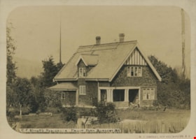
C.F. Sprott's house
https://search.heritageburnaby.ca/link/archivedescription34498
- Repository
- City of Burnaby Archives
- Date
- 1908
- Collection/Fonds
- Burnaby Historical Society fonds
- Description Level
- Item
- Physical Description
- 1 photograph : sepia ; 12.8 x 17.7 cm mounted on cardboard 14.8 x 19.7 cm
- Scope and Content
- Photograph of C.F. Sprott's House at Douglas Road and Norland Avenue. A unidentified man is standing on the porch steps.
- Repository
- City of Burnaby Archives
- Date
- 1908
- Collection/Fonds
- Burnaby Historical Society fonds
- Subseries
- Photographs subseries
- Physical Description
- 1 photograph : sepia ; 12.8 x 17.7 cm mounted on cardboard 14.8 x 19.7 cm
- Description Level
- Item
- Record No.
- 022-001
- Access Restriction
- No restrictions
- Reproduction Restriction
- No known restrictions
- Accession Number
- BHS2007-04
- Scope and Content
- Photograph of C.F. Sprott's House at Douglas Road and Norland Avenue. A unidentified man is standing on the porch steps.
- Media Type
- Photograph
- Photographer
- Cooksley, William Thomas
- Notes
- Title based on contents of photograph
- Annotation at bottom of photograph reads, "C.F. Sprott's Residence, Fruit Farm, Burnaby B.C."
- Annotation underneath photograph reads, "W.T. Cooksley, New Westminster, B.C."
- Geographic Access
- Douglas Road
- Norland Avenue
- Historic Neighbourhood
- Burnaby Lake (Historic Neighbourhood)
- Planning Study Area
- Ardingley-Sprott Area
Images
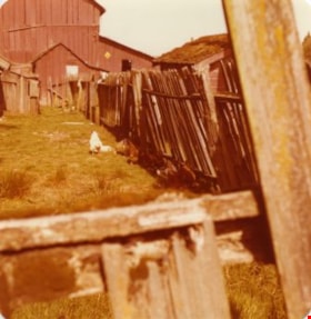
Chicken at Lubbock's farm
https://search.heritageburnaby.ca/link/archivedescription36522
- Repository
- City of Burnaby Archives
- Date
- 1977
- Collection/Fonds
- Burnaby Historical Society fonds
- Description Level
- Item
- Physical Description
- 1 photograph : col. ; 9 x 8.5 cm
- Scope and Content
- Photograph of chickens inside a tall fence at the Lubbock farm. The barn is visible in the background.
- Repository
- City of Burnaby Archives
- Date
- 1977
- Collection/Fonds
- Burnaby Historical Society fonds
- Subseries
- Lubbock family subseries
- Physical Description
- 1 photograph : col. ; 9 x 8.5 cm
- Description Level
- Item
- Record No.
- 289-011
- Access Restriction
- No restrictions
- Reproduction Restriction
- Reproduce for fair dealing purposes only
- Accession Number
- BHS1992-24
- Scope and Content
- Photograph of chickens inside a tall fence at the Lubbock farm. The barn is visible in the background.
- Subjects
- Animals - Poultry
- Agriculture - Farms
- Media Type
- Photograph
- Notes
- Title based on contents of photograph
- Geographic Access
- Grandview Highway
- Canada Way
- Burris Street
- Street Address
- 7803 Burris Street
- Historic Neighbourhood
- Burnaby Lake (Historic Neighbourhood)
- Planning Study Area
- Morley-Buckingham Area
Images
Chicken houses at Oakalla
https://search.heritageburnaby.ca/link/archivedescription38130
- Repository
- City of Burnaby Archives
- Date
- [195-] (date of original), copied 1991
- Collection/Fonds
- Burnaby Historical Society fonds
- Description Level
- Item
- Physical Description
- 1 photograph : b&w ; 3.0 x 4.3 cm print on contact sheet 19.8 x 26.2 cm
- Scope and Content
- Photograph of the exterior of chicken houses at Oakalla Prison Farm.
- Repository
- City of Burnaby Archives
- Date
- [195-] (date of original), copied 1991
- Collection/Fonds
- Burnaby Historical Society fonds
- Subseries
- Burnaby Image Bank subseries
- Physical Description
- 1 photograph : b&w ; 3.0 x 4.3 cm print on contact sheet 19.8 x 26.2 cm
- Description Level
- Item
- Record No.
- 370-717
- Access Restriction
- No restrictions
- Reproduction Restriction
- Reproduce for fair dealing purposes only
- Accession Number
- BHS1999-03
- Scope and Content
- Photograph of the exterior of chicken houses at Oakalla Prison Farm.
- Subjects
- Animals - Poultry
- Agriculture - Farms
- Names
- Oakalla Prison Farm
- Media Type
- Photograph
- Notes
- Title based on contents of photograph
- 1 b&w copy negative accompanying
- Negative has a pink cast
- Geographic Access
- Oakmount Crescent
- Street Address
- 5220 Oakmount Crescent
- Historic Neighbourhood
- Burnaby Lake (Historic Neighbourhood)
- Planning Study Area
- Oakalla Area
Images
Claude Hill
https://search.heritageburnaby.ca/link/archivedescription39336
- Repository
- City of Burnaby Archives
- Date
- [1915]
- Collection/Fonds
- Peers Family and Hill Family fonds
- Description Level
- Item
- Physical Description
- 1 photograph : b&w ; 5.9 x 10.4 cm on page 24.5 x 32.5 cm (pasted in album)
- Scope and Content
- Photograph of Claude Hill in his fields, standing next to a row of bushes and fence posts.
- Repository
- City of Burnaby Archives
- Date
- [1915]
- Collection/Fonds
- Peers Family and Hill Family fonds
- Physical Description
- 1 photograph : b&w ; 5.9 x 10.4 cm on page 24.5 x 32.5 cm (pasted in album)
- Description Level
- Item
- Record No.
- 477-655
- Access Restriction
- No restrictions
- Reproduction Restriction
- No known restrictions
- Accession Number
- 2007-12
- Scope and Content
- Photograph of Claude Hill in his fields, standing next to a row of bushes and fence posts.
- Subjects
- Agriculture - Farms
- Media Type
- Photograph
- Notes
- Title based on contents of photograph
- Historic Neighbourhood
- Burnaby Lake (Historic Neighbourhood)
- Planning Study Area
- Morley-Buckingham Area
Images
Dairy and Silos at Oakalla
https://search.heritageburnaby.ca/link/archivedescription38129
- Repository
- City of Burnaby Archives
- Date
- [195-] (date of original), copied 1991
- Collection/Fonds
- Burnaby Historical Society fonds
- Description Level
- Item
- Physical Description
- 1 photograph : b&w ; 3.0 x 4.3 cm print on contact sheet 19.8 x 26.2 cm
- Scope and Content
- Photograph of the exterior of the dairy and silos at Oakalla Prison Farm.
- Repository
- City of Burnaby Archives
- Date
- [195-] (date of original), copied 1991
- Collection/Fonds
- Burnaby Historical Society fonds
- Subseries
- Burnaby Image Bank subseries
- Physical Description
- 1 photograph : b&w ; 3.0 x 4.3 cm print on contact sheet 19.8 x 26.2 cm
- Description Level
- Item
- Record No.
- 370-716
- Access Restriction
- No restrictions
- Reproduction Restriction
- Reproduce for fair dealing purposes only
- Accession Number
- BHS1999-03
- Scope and Content
- Photograph of the exterior of the dairy and silos at Oakalla Prison Farm.
- Names
- Oakalla Prison Farm
- Media Type
- Photograph
- Notes
- Title based on contents of photograph
- 1 b&w copy negative accompanying
- Negative has a pink cast
- Geographic Access
- Oakmount Crescent
- Street Address
- 5220 Oakmount Crescent
- Historic Neighbourhood
- Burnaby Lake (Historic Neighbourhood)
- Planning Study Area
- Oakalla Area
Images
Farm workers
https://search.heritageburnaby.ca/link/archivedescription38856
- Repository
- City of Burnaby Archives
- Date
- [1905]
- Collection/Fonds
- Peers Family and Hill Family fonds
- Description Level
- Item
- Physical Description
- 1 photograph : b&w ; 6 x 10.5 cm on page 14 x 17.5 cm (pasted in album)
- Scope and Content
- Photograph of workers in the field picking crops on the farm belonging to F.J. Hart. The property was on the corner of Douglas Road (later Canada Way) and Sperling Avenue although the Hart House was located at 6664 Deer Lake Avenue.
- Repository
- City of Burnaby Archives
- Date
- [1905]
- Collection/Fonds
- Peers Family and Hill Family fonds
- Physical Description
- 1 photograph : b&w ; 6 x 10.5 cm on page 14 x 17.5 cm (pasted in album)
- Description Level
- Item
- Record No.
- 477-175
- Access Restriction
- No restrictions
- Reproduction Restriction
- No known restrictions
- Accession Number
- 2007-12
- Scope and Content
- Photograph of workers in the field picking crops on the farm belonging to F.J. Hart. The property was on the corner of Douglas Road (later Canada Way) and Sperling Avenue although the Hart House was located at 6664 Deer Lake Avenue.
- Subjects
- Agriculture - Crops
- Occupations - Agricultural Labourers
- Agriculture - Farms
- Agriculture - Fruit and Berries
- Media Type
- Photograph
- Notes
- Title based on contents of photograph
- Geographic Access
- Douglas Road
- Sperling Avenue
- Canada Way
- Deer Lake Avenue
- Historic Neighbourhood
- Burnaby Lake (Historic Neighbourhood)
- Planning Study Area
- Morley-Buckingham Area
Images
Hill farm
https://search.heritageburnaby.ca/link/archivedescription39334
- Repository
- City of Burnaby Archives
- Date
- [1915]
- Collection/Fonds
- Peers Family and Hill Family fonds
- Description Level
- Item
- Physical Description
- 2 photographs : b&w ; 5 x 10.5 cm on page 24.5 x 32.5 cm (pasted in album and joined to form one panorama)
- Scope and Content
- Photograph of the Hill family farm near Deer Lake. The panorama shows the buildings and fields and off to the right can be seen the Pole Line Road (Sperling Avenue).
- Repository
- City of Burnaby Archives
- Date
- [1915]
- Collection/Fonds
- Peers Family and Hill Family fonds
- Physical Description
- 2 photographs : b&w ; 5 x 10.5 cm on page 24.5 x 32.5 cm (pasted in album and joined to form one panorama)
- Description Level
- Item
- Record No.
- 477-653
- Access Restriction
- No restrictions
- Reproduction Restriction
- No known restrictions
- Accession Number
- 2007-12
- Scope and Content
- Photograph of the Hill family farm near Deer Lake. The panorama shows the buildings and fields and off to the right can be seen the Pole Line Road (Sperling Avenue).
- Media Type
- Photograph
- Notes
- Title based on contents of photograph
- Geographic Access
- Sperling Avenue
- Historic Neighbourhood
- Burnaby Lake (Historic Neighbourhood)
- Planning Study Area
- Morley-Buckingham Area
Images
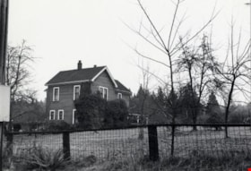
House at 7700 Haszard Street
https://search.heritageburnaby.ca/link/archivedescription78891
- Repository
- City of Burnaby Archives
- Date
- February 7, 1977
- Collection/Fonds
- Burnaby Public Library Contemporary Visual Archive Project
- Description Level
- Item
- Physical Description
- 1 photograph : b&w ; 11 x 16 cm mounted on cardboard
- Scope and Content
- Photograph shows the house and farm yard at 7700 Haszard Street, near Caanda Way.
- Repository
- City of Burnaby Archives
- Date
- February 7, 1977
- Collection/Fonds
- Burnaby Public Library Contemporary Visual Archive Project
- Physical Description
- 1 photograph : b&w ; 11 x 16 cm mounted on cardboard
- Description Level
- Item
- Record No.
- 556-017
- Access Restriction
- No restrictions
- Reproduction Restriction
- Reproduce for fair dealing purposes only
- Accession Number
- 2013-13
- Scope and Content
- Photograph shows the house and farm yard at 7700 Haszard Street, near Caanda Way.
- Subjects
- Agriculture - Farms
- Media Type
- Photograph
- Notes
- Scope note taken directly from BPL photograph description.
- 1 b&w copy negative : 10 x 12.5 cm accompanying
- Photographers identified by surnames only: Carr and Vardeman
- Geographic Access
- Haszard Street
- Street Address
- 7700 Haszard Street
- Historic Neighbourhood
- Burnaby Lake (Historic Neighbourhood)
- Planning Study Area
- Morley-Buckingham Area
Images
Kitty, M. Sprott and Mr. Nicholson
https://search.heritageburnaby.ca/link/archivedescription39433
- Repository
- City of Burnaby Archives
- Date
- 1905
- Collection/Fonds
- Peers Family and Hill Family fonds
- Description Level
- Item
- Physical Description
- 1 photograph : b&w ; 5.5 x 8.1 cm
- Scope and Content
- Photograph of (l t r): Muriel Sprott, Kitty Hill and Malcolm Nicholson. This photograph was likely taken at the home of Mr. Nicholson, on Douglas Road (now Canada Way).
- Repository
- City of Burnaby Archives
- Date
- 1905
- Collection/Fonds
- Peers Family and Hill Family fonds
- Physical Description
- 1 photograph : b&w ; 5.5 x 8.1 cm
- Description Level
- Item
- Record No.
- 477-752
- Access Restriction
- No restrictions
- Reproduction Restriction
- No known restrictions
- Accession Number
- 2007-12
- Scope and Content
- Photograph of (l t r): Muriel Sprott, Kitty Hill and Malcolm Nicholson. This photograph was likely taken at the home of Mr. Nicholson, on Douglas Road (now Canada Way).
- Subjects
- Agriculture - Farms
- Media Type
- Photograph
- Notes
- Title based on caption accompanying photograph
- Geographic Access
- Canada Way
- Historic Neighbourhood
- Burnaby Lake (Historic Neighbourhood)
- Planning Study Area
- Morley-Buckingham Area
Images
L. Claude Hill's Farm, Burnaby BC
https://search.heritageburnaby.ca/link/archivedescription39550
- Repository
- City of Burnaby Archives
- Date
- 1906
- Collection/Fonds
- Peers Family and Hill Family fonds
- Description Level
- Item
- Physical Description
- 1 photograph : b&w ; 12.5 x 17.5 cm on page 21.5 x 28 cm (pasted in album)
- Scope and Content
- Photograph looking towards the Pole Line Road (later Sperling Avenue) from the farm belonging to Claude Hill and known as Broadview on Buckingham Avenue. This property formerly belonged to Malcolm Nicholson. A fence can be seen dividing the garden from the field and two men are standing alongside…
- Repository
- City of Burnaby Archives
- Date
- 1906
- Collection/Fonds
- Peers Family and Hill Family fonds
- Physical Description
- 1 photograph : b&w ; 12.5 x 17.5 cm on page 21.5 x 28 cm (pasted in album)
- Description Level
- Item
- Record No.
- 477-869
- Access Restriction
- No restrictions
- Reproduction Restriction
- No known restrictions
- Accession Number
- 2007-12
- Scope and Content
- Photograph looking towards the Pole Line Road (later Sperling Avenue) from the farm belonging to Claude Hill and known as Broadview on Buckingham Avenue. This property formerly belonged to Malcolm Nicholson. A fence can be seen dividing the garden from the field and two men are standing alongside with a horse and carriage nearby. Four children are walking in the field - from left to right, Kitty Hill, Ed Clayton, Gerry Hill and Florence Hart . A house can be seen in the background, this is most likely the cottage belonging to Harriet Woodward which served as the first school and post office at Burnaby Lake. To the right of the Woodward house can be seen the roof of the Claude Hill house known as Brookfield which was at 6501 Deer Lake Avenue and above that is a house on a hill which was the George Clayton home (on what later became the Henry and Grace Ceperley Fairacres estate at 6344 Deer Lake Avenue).
- Names
- Clayton, Edward
- Godwin, Florence Hart
- Hill, Minard Gerald "Gerry"
- Peers, Katherine Maude Hill "Kitty"
- Media Type
- Photograph
- Photographer
- Cooksley, William Thomas
- Notes
- Title based on caption accompanying photograph
- Geographic Access
- Deer Lake Avenue
- Buckingham Avenue
- Sperling Avenue
- Street Address
- 6501 Deer Lake Avenue
- 5141 Sperling Avenue
- 5730 Buckingham Avenue
- Historic Neighbourhood
- Burnaby Lake (Historic Neighbourhood)
- Planning Study Area
- Morley-Buckingham Area
Images
Looking south from Bernard Hill's house
https://search.heritageburnaby.ca/link/archivedescription39527
- Repository
- City of Burnaby Archives
- Date
- 1906
- Collection/Fonds
- Peers Family and Hill Family fonds
- Description Level
- Item
- Physical Description
- 1 photograph : b&w ; 11.8 x 17 cm on page 21.5 x 28 cm (pasted in album)
- Scope and Content
- Photograph of the fields and farmland looking southeast from the home of Bernard Hill down Douglas Road towards Deer Lake Brook. In the foreground view can be seen what is the present-day Kensington Avenue freeway entrance and No. 1 Firehall site on Sperling Avenue. The cabin that can be seen to …
- Repository
- City of Burnaby Archives
- Date
- 1906
- Collection/Fonds
- Peers Family and Hill Family fonds
- Physical Description
- 1 photograph : b&w ; 11.8 x 17 cm on page 21.5 x 28 cm (pasted in album)
- Description Level
- Item
- Record No.
- 477-846
- Access Restriction
- No restrictions
- Reproduction Restriction
- No known restrictions
- Accession Number
- 2007-12
- Scope and Content
- Photograph of the fields and farmland looking southeast from the home of Bernard Hill down Douglas Road towards Deer Lake Brook. In the foreground view can be seen what is the present-day Kensington Avenue freeway entrance and No. 1 Firehall site on Sperling Avenue. The cabin that can be seen to the left in the background is an unknown residence further along Douglas Road near Rayside Drive and the cabin that is just visible in the centre background of the photograph (between treeline split) belonged to Mr. Nicholson. It was later torn down when Bernard Hill's brother Claude Hill built his home, Broadview at that location. To the extreme right of the picture on the opposite side of Douglas Road is the property of Claude Hill's first Burnaby home also known as Brookfield (the current location of the Burnaby Village Museum).
- Subjects
- Agriculture - Farms
- Media Type
- Photograph
- Notes
- Title based on caption accompanying photograph
- Geographic Access
- Douglas Road
- Canada Way
- Deer Lake Brook
- Street Address
- 4990 Canada Way
- Historic Neighbourhood
- Burnaby Lake (Historic Neighbourhood)
- Planning Study Area
- Douglas-Gilpin Area
Images
Lubbock family home and farm
https://search.heritageburnaby.ca/link/archivedescription35861
- Repository
- City of Burnaby Archives
- Date
- [197-] (date of original), copied 1986
- Collection/Fonds
- Burnaby Historical Society fonds
- Description Level
- Item
- Physical Description
- 1 photograph : b&w ; 12.7 x 17.8 cm print
- Scope and Content
- Photograph of the Lubbock family home and farm, built in 1898 by Edgar Sprott, brother of former Reeve, Charles F. Sprott. The Lubbock family moved into the house in 1915.
- Repository
- City of Burnaby Archives
- Date
- [197-] (date of original), copied 1986
- Collection/Fonds
- Burnaby Historical Society fonds
- Subseries
- Pioneer Tales subseries
- Physical Description
- 1 photograph : b&w ; 12.7 x 17.8 cm print
- Description Level
- Item
- Record No.
- 204-720
- Access Restriction
- No restrictions
- Reproduction Restriction
- Reproduce for fair dealing purposes only
- Accession Number
- BHS1988-03
- Scope and Content
- Photograph of the Lubbock family home and farm, built in 1898 by Edgar Sprott, brother of former Reeve, Charles F. Sprott. The Lubbock family moved into the house in 1915.
- Media Type
- Photograph
- Notes
- Title based on contents of photograph.
- A note with the photograph indicated that the old street address of this farm was 1 Arbor Lane.
- Geographic Access
- Grandview Highway
- Canada Way
- Burris Street
- Street Address
- 7803 Burris Street
- Historic Neighbourhood
- Burnaby Lake (Historic Neighbourhood)
- Planning Study Area
- Morley-Buckingham Area
Images
Lubbock family home and farm
https://search.heritageburnaby.ca/link/archivedescription35862
- Repository
- City of Burnaby Archives
- Date
- [197-] (date of original), copied 1986
- Collection/Fonds
- Burnaby Historical Society fonds
- Description Level
- Item
- Physical Description
- 1 photograph : b&w ; 12.7 x 17.8 cm print
- Scope and Content
- Photograph of cows grazing on the Lubbock farm with the family home seen in the background. The house was built in 1898 by Edgar Sprott, brother of former Reeve, Charles F. Sprott. The Lubbock family moved into the house in 1915.
- Repository
- City of Burnaby Archives
- Date
- [197-] (date of original), copied 1986
- Collection/Fonds
- Burnaby Historical Society fonds
- Subseries
- Pioneer Tales subseries
- Physical Description
- 1 photograph : b&w ; 12.7 x 17.8 cm print
- Description Level
- Item
- Record No.
- 204-721
- Access Restriction
- No restrictions
- Reproduction Restriction
- Reproduce for fair dealing purposes only
- Accession Number
- BHS1988-03
- Scope and Content
- Photograph of cows grazing on the Lubbock farm with the family home seen in the background. The house was built in 1898 by Edgar Sprott, brother of former Reeve, Charles F. Sprott. The Lubbock family moved into the house in 1915.
- Media Type
- Photograph
- Notes
- Title based on contents of photograph.
- A note with this photograph indicated that the old street address of this property was 1 Arbor Lane.
- Geographic Access
- Grandview Highway
- Canada Way
- Burris Street
- Street Address
- 7803 Burris Street
- Historic Neighbourhood
- Burnaby Lake (Historic Neighbourhood)
- Planning Study Area
- Morley-Buckingham Area
Images
Lubbock farm
https://search.heritageburnaby.ca/link/archivedescription37248
- Repository
- City of Burnaby Archives
- Date
- April 1976
- Collection/Fonds
- Burnaby Historical Society fonds
- Description Level
- Item
- Physical Description
- 1 photograph : b&w ; 11.5 x 16.5 cm
- Scope and Content
- Photograph of the Lubbock farm and riding stable.
- Repository
- City of Burnaby Archives
- Date
- April 1976
- Collection/Fonds
- Burnaby Historical Society fonds
- Subseries
- Lubbock family subseries
- Physical Description
- 1 photograph : b&w ; 11.5 x 16.5 cm
- Description Level
- Item
- Record No.
- 342-022
- Access Restriction
- No restrictions
- Reproduction Restriction
- Reproduce for fair dealing purposes only
- Accession Number
- BHS1994-02
- Scope and Content
- Photograph of the Lubbock farm and riding stable.
- Subjects
- Agriculture - Farms
- Media Type
- Photograph
- Notes
- Title based on contents of photograph
- Note on verso of photograph reads: "COLUMBIAN 1976 APRIL"
- Geographic Access
- Grandview Highway
- Canada Way
- Burris Street
- Street Address
- 7803 Burris Street
- Historic Neighbourhood
- Burnaby Lake (Historic Neighbourhood)
- Planning Study Area
- Morley-Buckingham Area
Images
Lubbock farmhouse
https://search.heritageburnaby.ca/link/archivedescription37227
- Repository
- City of Burnaby Archives
- Date
- [1935]
- Collection/Fonds
- Burnaby Historical Society fonds
- Description Level
- Item
- Physical Description
- 1 photograph : sepia ; 5.5 x 8 cm
- Scope and Content
- Photograph of the exterior of the Lubbock farmhouse at Canada Way and Burris.
- Repository
- City of Burnaby Archives
- Date
- [1935]
- Collection/Fonds
- Burnaby Historical Society fonds
- Subseries
- Lubbock family subseries
- Physical Description
- 1 photograph : sepia ; 5.5 x 8 cm
- Description Level
- Item
- Record No.
- 342-001
- Access Restriction
- No restrictions
- Reproduction Restriction
- No known restrictions
- Accession Number
- BHS1994-02
- Scope and Content
- Photograph of the exterior of the Lubbock farmhouse at Canada Way and Burris.
- Media Type
- Photograph
- Notes
- Title based on contents of photograph
- Geographic Access
- Grandview Highway
- Canada Way
- Burris Street
- Street Address
- 7803 Burris Street
- Historic Neighbourhood
- Burnaby Lake (Historic Neighbourhood)
- Planning Study Area
- Morley-Buckingham Area
Images
Lubbock farmhouse
https://search.heritageburnaby.ca/link/archivedescription37228
- Repository
- City of Burnaby Archives
- Date
- [1935]
- Collection/Fonds
- Burnaby Historical Society fonds
- Description Level
- Item
- Physical Description
- 1 photograph : sepia ; 5.5 x 8 cm
- Scope and Content
- Photograph of the Lubbock family farmhouse at Burris Street and Canada Way.
- Repository
- City of Burnaby Archives
- Date
- [1935]
- Collection/Fonds
- Burnaby Historical Society fonds
- Subseries
- Lubbock family subseries
- Physical Description
- 1 photograph : sepia ; 5.5 x 8 cm
- Description Level
- Item
- Record No.
- 342-002
- Access Restriction
- No restrictions
- Reproduction Restriction
- No known restrictions
- Accession Number
- BHS1994-02
- Scope and Content
- Photograph of the Lubbock family farmhouse at Burris Street and Canada Way.
- Media Type
- Photograph
- Notes
- Title based on contents of photograph
- Geographic Access
- Grandview Highway
- Canada Way
- Burris Street
- Street Address
- 7803 Burris Street
- Historic Neighbourhood
- Burnaby Lake (Historic Neighbourhood)
- Planning Study Area
- Morley-Buckingham Area
Images
Lubbock farmhouse
https://search.heritageburnaby.ca/link/archivedescription37229
- Repository
- City of Burnaby Archives
- Date
- [1935]
- Collection/Fonds
- Burnaby Historical Society fonds
- Description Level
- Item
- Physical Description
- 1 photograph : sepia ; 5.5 x 8 cm
- Scope and Content
- Photograph of the Lubbock family farmhouse and garden at Burris Street and Canada Way.
- Repository
- City of Burnaby Archives
- Date
- [1935]
- Collection/Fonds
- Burnaby Historical Society fonds
- Subseries
- Lubbock family subseries
- Physical Description
- 1 photograph : sepia ; 5.5 x 8 cm
- Description Level
- Item
- Record No.
- 342-003
- Access Restriction
- No restrictions
- Reproduction Restriction
- No known restrictions
- Accession Number
- BHS1994-02
- Scope and Content
- Photograph of the Lubbock family farmhouse and garden at Burris Street and Canada Way.
- Media Type
- Photograph
- Notes
- Title based on contents of photograph
- Geographic Access
- Grandview Highway
- Canada Way
- Burris Street
- Street Address
- 7803 Burris Street
- Historic Neighbourhood
- Burnaby Lake (Historic Neighbourhood)
- Planning Study Area
- Morley-Buckingham Area
![Barns at Oakalla, [195-] (date of original), copied 1991 thumbnail](/media/hpo/_Data/_Archives_Images/_Unrestricted/370/370-706.jpg?width=280)
![Calf Barn at Oakalla, [195-] (date of original), copied 1991 thumbnail](/media/hpo/_Data/_Archives_Images/_Unrestricted/370/370-718.jpg?width=280)
![Chicken houses at Oakalla, [195-] (date of original), copied 1991 thumbnail](/media/hpo/_Data/_Archives_Images/_Unrestricted/370/370-717.jpg?width=280)
![Claude Hill, [1915] thumbnail](/media/hpo/_Data/_Archives_Images/_Unrestricted/477/477-655.jpg?width=280)
![Dairy and Silos at Oakalla, [195-] (date of original), copied 1991 thumbnail](/media/hpo/_Data/_Archives_Images/_Unrestricted/370/370-716.jpg?width=280)
![Farm workers, [1905] thumbnail](/media/hpo/_Data/_Archives_Images/_Unrestricted/477/477-175.jpg?width=280)
![Hill farm, [1915] thumbnail](/media/hpo/_Data/_Archives_Images/_Unrestricted/477/477-653.jpg?width=280)

![Lubbock family home and farm, [197-] (date of original), copied 1986 thumbnail](/media/hpo/_Data/_Archives_Images/_Unrestricted/204/204-720.jpg?width=280)
![Lubbock family home and farm, [197-] (date of original), copied 1986 thumbnail](/media/hpo/_Data/_Archives_Images/_Unrestricted/204/204-721.jpg?width=280)
![Lubbock farmhouse, [1935] thumbnail](/media/hpo/_Data/_Archives_Images/_Unrestricted/316/342-001.jpg?width=280)
![Lubbock farmhouse, [1935] thumbnail](/media/hpo/_Data/_Archives_Images/_Unrestricted/316/342-002.jpg?width=280)
![Lubbock farmhouse, [1935] thumbnail](/media/hpo/_Data/_Archives_Images/_Unrestricted/316/342-003.jpg?width=280)