Narrow Results By
Decade
- 2020s 40
- 2010s 44
- 2000s 105
- 1990s 191
- 1980s 144
- 1970s 277
- 1960s 120
- 1950s 216
- 1940s 231
- 1930s 197
- 1920s 119
- 1910s 113
- 1900s 47
- 1890s 18
- 1880s 3
- 1870s 6
- 1860s 7
- 1850s 6
- 1840s 3
- 1830s 2
- 1820s 2
- 1810s 2
- 1800s 2
- 1790s 1
- 1780s 1
- 1770s 1
- 1760s 1
- 1750s 1
- 1740s 1
- 1730s 1
- 1720s 1
- 1710s 1
- 1700s 1
- 1690s 1
- 1680s 1
Subject
- Accidents - Automobile Accidents 3
- Accidents - Train Accidents 2
- Adornment 3
- Adornment - Lapel Pins 4
- Advertising Medium 33
- Advertising Medium - Business Cards 5
- Advertising Medium - Flyer 14
- Advertising Medium - Poster 1
- Advertising Medium - Signs and Signboards 31
- Aerial Photographs 2
- Agriculture 6
- Agriculture - Crops 1

Municipality of Burnaby - Volume XV and Volume XVIII
https://search.heritageburnaby.ca/link/museumdescription8680
- Repository
- Burnaby Village Museum
- Date
- May 1927
- Collection/Fonds
- Burnaby Village Museum Map collection
- Description Level
- File
- Physical Description
- 4 plans on 4 sheets : col. lithographic prints ; 63.5 x 53.5 cm folded to 53 x 31.5 cm
- Scope and Content
- File consists of four pages of plans removed from a bound book containing a series of fire insurance plans of the Municipality of Burnaby. The first two pages are numbered "A" and "B" and are key plans from "GREATER VANCOUVER B.C. / VOLUME XV / Surveyed _ May 1927 / MUNICIPALITY OF / BURNABY", "PLA…
- Repository
- Burnaby Village Museum
- Collection/Fonds
- Burnaby Village Museum Map collection
- Description Level
- File
- Physical Description
- 4 plans on 4 sheets : col. lithographic prints ; 63.5 x 53.5 cm folded to 53 x 31.5 cm
- Material Details
- Scales [1:1200] and [1:6000]
- Scope and Content
- File consists of four pages of plans removed from a bound book containing a series of fire insurance plans of the Municipality of Burnaby. The first two pages are numbered "A" and "B" and are key plans from "GREATER VANCOUVER B.C. / VOLUME XV / Surveyed _ May 1927 / MUNICIPALITY OF / BURNABY", "PLAN DEPT. FIRE BRANCH _ B.C. INSURANCE UNDERWRITERS ASSN.". Key Plan "B" covers plans: 1505; 1506; 1512 to 1516; 1540 to 1544; 1550 to 1557 and District Lots: 129 to 132; 135 to 138; 205 to 208 and 215 to 218. Key Plan "A" covers plans: 1501 to 1504; 1507 to 1511; 1517 to 1525; 1531 to 1539; 1545 to 1550 and District Lots: 116 to 127 and 186 to 189. Plan "1806" is part of "GREATER VANCOUVER B.C. / VOLUME XVIII / Municipality of Burnaby / May, 1927" and covers District Lot 153. Plan "1807" is from "GREATER VANCOUVER B.C. / VOLUME XVIII / Municipality of Burnaby / May, 1927" and covers District Lots: 99,149 and 152.
- Responsibility
- British Columbia Underwriters' Association
- Accession Code
- HV972.111.2
- Access Restriction
- No restrictions
- Reproduction Restriction
- May be restricted by third party rights
- Date
- May 1927
- Media Type
- Cartographic Material
- Historic Neighbourhood
- Vancouver Heights (Historic Neighbourhood)
- Lochdale (Historic Neighbourhood)
- Capitol Hill (Historic Neighbourhood)
- Central Park (Historic Neighbourhood)
- Alta Vista (Historic Neighbourhood)
- Planning Study Area
- Burnaby Heights Area
- Sperling-Broadway Area
- Lochdale Area
- Parkcrest-Aubrey Area
- Westridge Area
- Willingdon Heights Area
- Capitol Hill Area
- Maywood Area
- Marlborough Area
- Scan Resolution
- 400
- Scan Date
- 2021-11-18
- Notes
- Title based on content of plans
- Scales are measured 1 inch = 100 feet and 1 inch = 500 feet
- See also BV987.1.70d for revised versions of plans
Zoomable Images


Municipality of Burnaby - Volume XV and Volume XVIII
https://search.heritageburnaby.ca/link/museumdescription8681
- Repository
- Burnaby Village Museum
- Date
- May 1927
- Collection/Fonds
- Burnaby Village Museum Map collection
- Description Level
- File
- Physical Description
- 4 plans on 4 sheets : col. lithographic prints, ms. annotations in blue ink ; 63.5 x 53.5 cm folded to 53 x 31.5 cm
- Scope and Content
- File consists of four pages of plans removed from a bound book containing a series of fire insurance plans of the Municipality of Burnaby. Plan "1507" and plan "1517" are from "GREATER VANCOUVER B.C. / VOLUME XV / Municipality of Burnaby / May, 1927". Plan "1507" covers District Lot 186 and plan "1…
- Repository
- Burnaby Village Museum
- Collection/Fonds
- Burnaby Village Museum Map collection
- Description Level
- File
- Physical Description
- 4 plans on 4 sheets : col. lithographic prints, ms. annotations in blue ink ; 63.5 x 53.5 cm folded to 53 x 31.5 cm
- Material Details
- Scale [1:600] and [1:1200]
- Scope and Content
- File consists of four pages of plans removed from a bound book containing a series of fire insurance plans of the Municipality of Burnaby. Plan "1507" and plan "1517" are from "GREATER VANCOUVER B.C. / VOLUME XV / Municipality of Burnaby / May, 1927". Plan "1507" covers District Lot 186 and plan "1517" covers District Lot 116. Plan "1804" and plan "1805" are from "GREATER VANCOUVER B.C. / VOLUME XVIII / Municipality of Burnaby / May, 1927". Plans "1804" and "1805" cover District Lot 153.
- Responsibility
- British Columbia Underwriters' Association
- Accession Code
- HV972.111.3
- Access Restriction
- No restrictions
- Reproduction Restriction
- May be restricted by third party rights
- Date
- May 1927
- Media Type
- Cartographic Material
- Historic Neighbourhood
- Central Park (Historic Neighbourhood)
- Vancouver Heights (Historic Neighbourhood)
- Planning Study Area
- Maywood Area
- Willingdon Heights Area
- Scan Resolution
- 400
- Scan Date
- 2021-11-18
- Notes
- Title based on content of plans
- See also BV987.1.70d for revised versions of plans
- Scale is measured 1 inch = 100 feet
Images


![Municipality of Burnaby - Volume XV and Volume XVIII, 1927-[1940] thumbnail](/media/hpo/_Data/_BVM_Artifacts/1972/1972_0111_0004_003.jpg?width=280)
Municipality of Burnaby - Volume XV and Volume XVIII
https://search.heritageburnaby.ca/link/museumdescription8682
- Repository
- Burnaby Village Museum
- Date
- 1927-[1940]
- Collection/Fonds
- Burnaby Village Museum Map collection
- Description Level
- File
- Physical Description
- 4 plans on 4 sheets: col. lithographic prints ; 63.5 x 53.5 cm folded to 53 x 31.5 cm
- Scope and Content
- File consists of four pages of plans removed from a bound book containing a series of fire insurance plans of the Municipality of Burnaby. Plan "1518" and "1519" are from "GREATER VANCOUVER B.C. / VOLUME XV / Municipality of Burnaby / May, 1927". Plan "1518" covers District Lot 116 and Plan "1519"…
- Repository
- Burnaby Village Museum
- Collection/Fonds
- Burnaby Village Museum Map collection
- Description Level
- File
- Physical Description
- 4 plans on 4 sheets: col. lithographic prints ; 63.5 x 53.5 cm folded to 53 x 31.5 cm
- Material Details
- Scale [1:600]
- Scope and Content
- File consists of four pages of plans removed from a bound book containing a series of fire insurance plans of the Municipality of Burnaby. Plan "1518" and "1519" are from "GREATER VANCOUVER B.C. / VOLUME XV / Municipality of Burnaby / May, 1927". Plan "1518" covers District Lot 116 and Plan "1519" covers District Lot 121. Plan "1802" and plan "1803" are from "GREATER VANCOUVER B.C. / VOLUME XVIII / Municipality of Burnaby / May, 1927". Both plans "1802" and "1803" cover District Lot 153.
- Responsibility
- British Columbia Underwriters' Association
- Accession Code
- HV972.111.4
- Access Restriction
- No restrictions
- Reproduction Restriction
- May be restricted by third party rights
- Date
- 1927-[1940]
- Media Type
- Cartographic Material
- Historic Neighbourhood
- Vancouver Heights (Historic Neighbourhood)
- Central Park (Historic Neighbourhood)
- Planning Study Area
- Willingdon Heights Area
- Marlborough Area
- Scan Resolution
- 400
- Scan Date
- 2021-11-18
- Notes
- Title based on content of plans
- See also BV987.1.70d for revised versions of plans
- Scale is measured 1 inch = 50 feet
- Contact Burnaby Village Museum to access plans 1518 and 1519 (these plans have revisions on top - date of revisions is uncertain)
Images
![Municipality of Burnaby - Volume XV and Volume XVIII, 1927-[1940] thumbnail](/media/hpo/_Data/_BVM_Artifacts/1972/1972_0111_0004_003.jpg)


Municipality of Burnaby- Volume XV and Volume XVIII
https://search.heritageburnaby.ca/link/museumdescription8686
- Repository
- Burnaby Village Museum
- Date
- May 1927
- Collection/Fonds
- Burnaby Village Museum Map collection
- Description Level
- File
- Physical Description
- 4 plans on 4 sheets : col. lithographic prints ; 63.5 x 53.5 cm folded to 53 x 31.5 cm
- Scope and Content
- File consists of four pages of plans removed from a bound book containing a series of fire insurance plans of the Municipality of Burnaby. Plan "1520" is part of "GREATER VANCOUVER B.C. / VOLUME XV / Municipality of Burnaby / May 1927" and covers District Lots: 121 and 187. Plann "1521" is part of …
- Repository
- Burnaby Village Museum
- Collection/Fonds
- Burnaby Village Museum Map collection
- Description Level
- File
- Physical Description
- 4 plans on 4 sheets : col. lithographic prints ; 63.5 x 53.5 cm folded to 53 x 31.5 cm
- Material Details
- Scale [1:600] and [1:1200]
- Scope and Content
- File consists of four pages of plans removed from a bound book containing a series of fire insurance plans of the Municipality of Burnaby. Plan "1520" is part of "GREATER VANCOUVER B.C. / VOLUME XV / Municipality of Burnaby / May 1927" and covers District Lots: 121 and 187. Plann "1521" is part of "GREATER VANCOUVER B.C. / VOLUME XV / Municipality of Burnaby / May 1927" and covers District Lots: 121 and 187. Key plan "H" reads: "GREATER VANCOUVER B.C. / VOLUME XVIII / Surveyed _ May 1927 / MUNICIPALITY OF / BURNABY" and covers plans: 1813 to 1822; 1824 to 1832; 1839; 1840; 1853 to 1865 and District Lots: 28; 30; 53; 90 to 93; 95 to 97; 155a; 155b; 155c; 159; 160; 171 to 173. Plan "1801" is part of "GREATER VANCOUVER B.C. / VOLUME XVIII / Municipality of Burnaby / May 1927" and covers District Lot 153.
- Responsibility
- British Columbia Underwriters' Association
- Accession Code
- HV972.111.8
- Access Restriction
- No restrictions
- Reproduction Restriction
- May be restricted by third party rights
- Date
- May 1927
- Media Type
- Cartographic Material
- Historic Neighbourhood
- Fraser Arm (Historic Neighbourhood)
- Vancouver Heights (Historic Neighbourhood)
- East Burnaby (Historic Neighbourhood)
- Edmonds (Historic Neighbourhood)
- Planning Study Area
- Marlborough Area
- Kingsway-Beresford Area
- Windsor Area
- Big Bend Area
- Clinton-Glenwood Area
- Burnaby Heights Area
- Edmonds Area
- Stride Avenue Area
- Scan Resolution
- 400
- Scan Date
- 2021-11-18
- Notes
- Title based on content of plans
- See also BV987.1.70d for revised versions of plans
- Scale is measured 1 inch = 500 feet
Zoomable Images


Municipality of Burnaby - Volume XVI and Volume XVII
https://search.heritageburnaby.ca/link/museumdescription8684
- Repository
- Burnaby Village Museum
- Date
- May 1927
- Collection/Fonds
- Burnaby Village Museum Map collection
- Description Level
- File
- Physical Description
- 4 plans on 4 sheets : col. lithographic prints ; 63.5 x 53.5 cm folded to 53 x 31.5 cm
- Scope and Content
- File consists of four pages of plans removed from a bound book containing a series of fire insurance plans of the Municipality of Burnaby. Page "D" is titled: "GREATER VANCOUVER B.C. / VOLUME XVI / Surveyed _ May 1927 / MUNICIPALITY OF / BURNABY / PLAN DEPT. FIRE BRANCH _ B.C. INSURANCE UNDERWRITE…
- Repository
- Burnaby Village Museum
- Collection/Fonds
- Burnaby Village Museum Map collection
- Description Level
- File
- Physical Description
- 4 plans on 4 sheets : col. lithographic prints ; 63.5 x 53.5 cm folded to 53 x 31.5 cm
- Material Details
- Scale [1:1200] and [1:6000]
- Scope and Content
- File consists of four pages of plans removed from a bound book containing a series of fire insurance plans of the Municipality of Burnaby. Page "D" is titled: "GREATER VANCOUVER B.C. / VOLUME XVI / Surveyed _ May 1927 / MUNICIPALITY OF / BURNABY / PLAN DEPT. FIRE BRANCH _ B.C. INSURANCE UNDERWRITERS ASSN." / KEY PLAN". Plans covered in this "Key Plan" are numbered 1601 to 1626, 1632 and 1651 covering District Lots: 15; 31; 100 to 102; 114; 141 to 144; 147 and 148; 209 to 214. Plan "E" is part of "GREATER VANCOUVER B.C. / VOLUME XVII / Municipality of Burnaby / May 1927" and covers plans: 1701 to 1705; 1711 to 1715; 1723 to 1727; 1729 to 1733; 1737 to 1742 and District Lots: 68 to 74; 80 to 84; 32 to 35 and 38 to 39. Plan marked "F" is a key plan titled: "GREATER VANCOUVER B.C. / VOLUME XVII / Surveyed _ May 1927 / MUNICIPALITY OF / BURNABY and covers plans: 1706 to 1710; 1716 to 1722; 1734 and 1735; 1743 to 1752 and District Lots: 42 to 44; 59; 75 to 80; 83 to 87; 89 to 93 and 130. Plan "1729" is part of "GREATER VANCOUVER B.C. / VOLUME XVII / Municipality of Burnaby / May 1927" and covers District Lots 34 and 35.
- Responsibility
- British Columbia Underwriters' Association
- Accession Code
- HV972.111.6
- Access Restriction
- No restrictions
- Reproduction Restriction
- May be restricted by third party rights
- Date
- May 1927
- Media Type
- Cartographic Material
- Historic Neighbourhood
- Barnet (Historic Neighbourhood)
- Burquitlam (Historic Neighbourhood)
- Central Park (Historic Neighbourhood)
- Burnaby Lake (Historic Neighbourhood)
- Broadview (Historic Neighbourhood)
- Planning Study Area
- Burnaby Mountain Area
- Lyndhurst Area
- Lake City Area
- Cascade-Schou Area
- Garden Village Area
- Douglas-Gilpin Area
- Oakalla Area
- Scan Resolution
- 400
- Scan Date
- 2021-11-18
- Notes
- Title based on content of plans
- See also BV987.1.70d for revised versions of plans
- Scale is measured 1 inch = 500 feet
Zoomable Images


Municipality of Burnaby - Volume XVIII
https://search.heritageburnaby.ca/link/museumdescription8687
- Repository
- Burnaby Village Museum
- Date
- May 1927
- Collection/Fonds
- Burnaby Village Museum Map collection
- Description Level
- File
- Physical Description
- 2 plans on 2 sheets : col. lithographic prints; 63.5 x 53.5 cm folded to 53 x 31.5 cm
- Scope and Content
- File consists of two pages of plans removed from a bound book containing a series of fire insurance plans of the Municipality of Burnaby. Plan "1819" and Plan "1820 are part of "GREATER VANCOUVER B.C. / VOLUME XVIII / Municipality of Burnaby / May 1927. Plan "1819" covers District Lot 95 and plan …
- Repository
- Burnaby Village Museum
- Collection/Fonds
- Burnaby Village Museum Map collection
- Description Level
- File
- Physical Description
- 2 plans on 2 sheets : col. lithographic prints; 63.5 x 53.5 cm folded to 53 x 31.5 cm
- Material Details
- Scales [1:600]
- Scope and Content
- File consists of two pages of plans removed from a bound book containing a series of fire insurance plans of the Municipality of Burnaby. Plan "1819" and Plan "1820 are part of "GREATER VANCOUVER B.C. / VOLUME XVIII / Municipality of Burnaby / May 1927. Plan "1819" covers District Lot 95 and plan "1820" covers District Lots 30 and 95.
- Responsibility
- British Columbia Underwriters' Association
- Accession Code
- HV972.111.38
- Access Restriction
- No restrictions
- Reproduction Restriction
- May be restricted by third party rights
- Date
- May 1927
- Media Type
- Cartographic Material
- Historic Neighbourhood
- Edmonds (Historic Neighbourhood)
- Highland Park (Historic Neighbourhood)
- Planning Study Area
- Stride Hill Area
- Kingsway-Beresford Area
- Scan Resolution
- 400
- Scan Date
- 2021-11-18
- Notes
- Title based on content of plans
- Scales are measured 1 inch = 50 feet
- See also BV987.1.70d for revised versions of plans
Images


Municipality of Burnaby - Volume XVIII and Volume XIX
https://search.heritageburnaby.ca/link/museumdescription8683
- Repository
- Burnaby Village Museum
- Date
- May 1927
- Collection/Fonds
- Burnaby Village Museum Map collection
- Description Level
- File
- Physical Description
- 2 plans on 2 sheets : col. lithographic prints ; 63.5 x 53.5 cm folded to 53 x 31.5 cm
- Scope and Content
- File consists of two pages of plans removed from a bound book containing a series of fire insurance plans of the Municipality of Burnaby. Plan "1832" is from "GREATER VANCOUVER B.C. / VOLUME XVIII / Municipality of Burnaby / May, 1927" and covers District Lots: 98 and 28. Plan "K" is part of a key …
- Repository
- Burnaby Village Museum
- Collection/Fonds
- Burnaby Village Museum Map collection
- Description Level
- File
- Physical Description
- 2 plans on 2 sheets : col. lithographic prints ; 63.5 x 53.5 cm folded to 53 x 31.5 cm
- Material Details
- Scale [1:1200] to [1:6000]
- Scope and Content
- File consists of two pages of plans removed from a bound book containing a series of fire insurance plans of the Municipality of Burnaby. Plan "1832" is from "GREATER VANCOUVER B.C. / VOLUME XVIII / Municipality of Burnaby / May, 1927" and covers District Lots: 98 and 28. Plan "K" is part of a key plan "GREATER VANCOUVER B.C. / Surveyed VOLUME XIX May 1927 / MUNICIPALITY OF / BURNABY / PLAN DEPT. British Columbia Ins. Underwriters Association / FIRE BRANCH / KEY PLAN", "Scale 500 FT = 1 INCH / FOR REPORT SEE VOL. XV" covering plans: 1901 to 1914 and District Lots: 161; 164 to 167; 155c; 155; 172 and 173.
- Responsibility
- British Columbia Underwriters' Association
- Accession Code
- HV972.111.5
- Access Restriction
- No restrictions
- Reproduction Restriction
- May be restricted by third party rights
- Date
- May 1927
- Media Type
- Cartographic Material
- Historic Neighbourhood
- East Burnaby (Historic Neighbourhood)
- Central Park (Historic Neighbourhood)
- Fraser Arm (Historic Neighbourhood)
- Alta Vista (Historic Neighbourhood)
- Planning Study Area
- Windsor Area
- Marlborough Area
- Second Street Area
- Big Bend Area
- Sussex-Nelson Area
- Scan Resolution
- 400
- Scan Date
- 2021-11-18
- Notes
- Title based on content of plans
- See also BV987.1.70d for revised versions of plans
- Scale is measured 1 inch = 500 feet
Zoomable Images


Municipality of Burnaby - Volume XV, Volume XVI, Volume XVII, Volume XVIII
https://search.heritageburnaby.ca/link/museumdescription8685
- Repository
- Burnaby Village Museum
- Date
- May 1927
- Collection/Fonds
- Burnaby Village Museum Map collection
- Description Level
- File
- Physical Description
- 4 plans on 4 sheets : col. lithographic prints ; 63.5 x 53.5 cm folded to 53 x 31.5 cm
- Scope and Content
- File consists of four pages of plans removed from a bound book containing a series of fire insurance plans of the Municipality of Burnaby. Plan "1531" is part of "GREATER VANCOUVER B.C. / VOLUME XV / Municipality of Burnaby / May 1927" and covers District Lots: 116 and 117. Key Plan "C" is part of …
- Repository
- Burnaby Village Museum
- Collection/Fonds
- Burnaby Village Museum Map collection
- Description Level
- File
- Physical Description
- 4 plans on 4 sheets : col. lithographic prints ; 63.5 x 53.5 cm folded to 53 x 31.5 cm
- Material Details
- Scale [1:600] and [1:1200]
- Scope and Content
- File consists of four pages of plans removed from a bound book containing a series of fire insurance plans of the Municipality of Burnaby. Plan "1531" is part of "GREATER VANCOUVER B.C. / VOLUME XV / Municipality of Burnaby / May 1927" and covers District Lots: 116 and 117. Key Plan "C" is part of "GREATER VANCOUVER B.C. / VOLUME XVI / Municipality of Burnaby / May 1927" and covers plans 1623 to 1651 and District Lots: 1 and 2; 4; 6; 8; 10 to 14; 25; 27; 40; 56 to 58; 88 and 89. Plan "1738" is part of "GREATER VANCOUVER B.C. / VOLUME XVII / Municipality of Burnaby / May 1927" and covers District Lots: 34 and 35. Key plan "G" is part of "GREATER VANCOUVER B.C. / VOLUME XVIII / Municipality of Burnaby / May 1927" and covers plans: 1801 to 1813; 1823; 1824; 1833 to 1838; 1841 to 1853 and District Lots: 32; 93; 94; 97 to 99; 149; 150; 152; 155 to 159; 161 to 164.
- Responsibility
- British Columbia Underwriters' Association
- Accession Code
- HV972.111.7
- Access Restriction
- No restrictions
- Reproduction Restriction
- May be restricted by third party rights
- Date
- May 1927
- Media Type
- Cartographic Material
- Historic Neighbourhood
- Central Park (Historic Neighbourhood)
- Fraser Arm (Historic Neighbourhood)
- Alta Vista (Historic Neighbourhood)
- Broadview (Historic Neighbourhood)
- Vancouver Heights (Historic Neighbourhood)
- Burquitlam (Historic Neighbourhood)
- East Burnaby (Historic Neighbourhood)
- Edmonds (Historic Neighbourhood)
- Lozells (Historic Neighbourhood)
- Planning Study Area
- Clinton-Glenwood Area
- Marlborough Area
- Maywood Area
- Windsor Area
- Big Bend Area
- Garden Village Area
- Willingdon Heights Area
- West Central Valley Area
- Cariboo-Armstrong Area
- Lyndhurst Area
- Cameron Area
- Lake City Area
- Edmonds Area
- Second Street Area
- Sperling-Broadway Area
- Lakeview-Mayfield Area
- Scan Resolution
- 400
- Scan Date
- 2021-11-18
- Notes
- Title based on content of plans
- See also BV987.1.70d for revised versions of plans
- Scale is measured 1 inch = 500 feet
Zoomable Images

Municipality of Burnaby - Volume XV, Volume XVI, Volume XVII, Volume XVIII, May 1927
Zoom into Image

Thomas Irvine House
https://search.heritageburnaby.ca/link/landmark536
- Repository
- Burnaby Heritage Planning
- Description
- The Thomas Irvine House is a very small, two room wood frame cottage, originally located on Laurel Street in Central Burnaby (now the site of the Burnaby Lake Sports Complex - West), and now relocated to the Burnaby Village Museum.
- Associated Dates
- 1911
- Formal Recognition
- Heritage Designation, Community Heritage Register
- Other Names
- Tommy Irvine House
- Repository
- Burnaby Heritage Planning
- Other Names
- Tommy Irvine House
- Geographic Access
- Deer Lake Avenue
- Associated Dates
- 1911
- Formal Recognition
- Heritage Designation, Community Heritage Register
- Enactment Type
- Bylaw No. 9807
- Enactment Date
- 23/11/1992
- Description
- The Thomas Irvine House is a very small, two room wood frame cottage, originally located on Laurel Street in Central Burnaby (now the site of the Burnaby Lake Sports Complex - West), and now relocated to the Burnaby Village Museum.
- Heritage Value
- The Thomas Irvine House is representative of an extremely modest, vernacular working-class cottage of the early twentieth century, once common but mostly now demolished. Irish-born Thomas Irvine (1864-1964) and his friend, Robert Moore, constructed the house in 1911 to suit the simple needs of a bachelor. Irvine worked on the construction of the British Columbia Electric Railway Burnaby Lake Interurban Line and was a pile driver by trade. The house consists of two rooms, a living room/kitchen and a bedroom. There were some improvements made throughout the fifty years Irvine lived there, such as running water in 1929, and electricity in the 1950s, but the essential character and form of the house remained intact. Irvine was a well-known local character and pioneer of Burnaby. The heritage value for this house also lies in its interpretive value within the Burnaby Village Museum. The site is an important cultural feature for the interpretation of Burnaby’s heritage to the public. The Thomas Irvine House was moved to the Burnaby Village Museum in 1975 and was restored to its 1920s appearance.
- Defining Elements
- The character defining elements of the Thomas Irvine House include its: - rectangular form and simple massing - bellcast hipped form with cedar shingle cladding - cedar shingle cladding stained dark brown - double-hung 1-over-1 wooden-sash window on front facade; simple double wooden-sash casement on west facade - interior layout of the house with 2 rooms, a living room/kitchen and bedroom - V-joint tongue-and-groove wood interior paneling
- Locality
- Deer Lake Park
- Historic Neighbourhood
- Burnaby Lake (Historic Neighbourhood)
- Planning Study Area
- Morley-Buckingham Area
- Organization
- British Columbia Electric Railway
- Burnaby Village Museum
- Builder
- Thomas Irvine (Owner)
- Robert Moore
- Function
- Primary Current--Museum
- Primary Historic--Single Dwelling
- Community
- Burnaby
- Cadastral Identifier
- P.I.D. No. 011-030-356 Legal Description: Parcel 1, District Lot 79 and District Lot 85, Group 1, New Westminster District, Reference Plan 77594
- Boundaries
- Burnaby Village Museum is comprised of a single municipally-owned property located at 6501 Deer Lake Avenue, Burnaby.
- Area
- 38,488.63
- Contributing Resource
- Building
- Landscape Feature
- Structure
- Ownership
- Public (local)
- Documentation
- Heritage Site Files: PC77000 20. City of Burnaby Planning and Building Department, 4949 Canada Way, Burnaby, B.C., V5G 1M2
- Names
- Irvine, Tom
- Street Address
- 6501 Deer Lake Avenue
Images


Vorce Station
https://search.heritageburnaby.ca/link/landmark664
- Repository
- Burnaby Heritage Planning
- Description
- The Vorce Station is a modest utilitarian passenger tram shelter, originally constructed at the foot of Nursery Street as part of the British Columbia Electric Railway Company’s Burnaby Lake Interurban Line. In 1953, it was moved to a local farm by the Lubbock family, and in 1977 it was relocated t…
- Associated Dates
- 1911
- Formal Recognition
- Heritage Designation, Community Heritage Register
- Repository
- Burnaby Heritage Planning
- Geographic Access
- Deer Lake Avenue
- Associated Dates
- 1911
- Formal Recognition
- Heritage Designation, Community Heritage Register
- Enactment Type
- Bylaw No. 9807
- Enactment Date
- 23/11/1992
- Description
- The Vorce Station is a modest utilitarian passenger tram shelter, originally constructed at the foot of Nursery Street as part of the British Columbia Electric Railway Company’s Burnaby Lake Interurban Line. In 1953, it was moved to a local farm by the Lubbock family, and in 1977 it was relocated to Burnaby Village Museum. The wood-frame structure has a rectangular plan and hipped roof. It is enclosed on three sides, with an open side for access to the train platform and a single long built-in bench across the back of the station.
- Heritage Value
- The heritage value of the Vorce Station is as the last remaining interurban station in Burnaby and one of the few extant structures left in the Greater Vancouver region that were once part of the extensive British Columbia Electric Railway (BCER) interurban system. The Vorce Station was designed and built by the BCER, and is typical of the small local passenger stations on the Burnaby Lake and Chilliwack interurban lines. It was named after C.B. Vorce, the Chief Engineer for the company. The impact of the interurban line on local development was extremely significant, as it connected the cities of New Westminster and Vancouver, and enabled the residents of Burnaby to form a cohesive municipality from the mainly rural lands remaining between the two larger centres. Much of the early development in Burnaby was due to the growth of the interurban rail lines. The heritage significance for this station also lies in its interpretive value within the Burnaby Village Museum. The Vorce Station is an important cultural feature for the interpretation of Burnaby’s transportation history to the public, and is an important surviving feature of the BCER interurban system.
- Defining Elements
- The character defining features of the Vorce Station include its: - rectangular form and pyramidal roof with overhanging eaves - simple vernacular design and utilitarian nature - cedar shingle wall cladding - cedar shingle-clad roof with galvanized pressed tin roof ridges - interior vertical tongue-and-groove panelling - heritage graffiti: initials and messages carved and scrawled on the walls - identifying sign with large letters visible at a distance
- Locality
- Deer Lake Park
- Historic Neighbourhood
- Burnaby Lake (Historic Neighbourhood)
- Planning Study Area
- Morley-Buckingham Area
- Organization
- British Columbia Electric Railway
- Burnaby Village Museum
- Function
- Primary Current--Museum
- Primary Historic--Rail Station
- Community
- Burnaby
- Cadastral Identifier
- P.I.D. No. 011-030-356 Legal Description: Parcel 1, District Lot 79 and District Lot 85, Group 1, New Westminster District, Reference Plan 77594
- Boundaries
- Burnaby Village Museum is comprised of a single municipally-owned property located at 6501 Deer Lake Avenue, Burnaby.
- Area
- 38,488.63
- Contributing Resource
- Building
- Structure
- Landscape Feature
- Documentation
- Heritage Site Files: PC77000 20. City of Burnaby Planning and Building Department, 4949 Canada Way, Burnaby, B.C., V5G 1M2
- Street Address
- 6501 Deer Lake Avenue
Images


George S. & Jessie Haddon House
https://search.heritageburnaby.ca/link/landmark508
- Repository
- Burnaby Heritage Planning
- Description
- The George and Jessie Haddon House is a symmetrical two-storey Dutch Colonial-style house with a side-gambrel roof and shed dormers. It is situated in the Burnaby Lake neighborhood in East Burnaby.
- Associated Dates
- 1922
- Formal Recognition
- Heritage Designation, Community Heritage Register
- Street View URL
- Google Maps Street View
- Repository
- Burnaby Heritage Planning
- Geographic Access
- Buckingham Avenue
- Associated Dates
- 1922
- Formal Recognition
- Heritage Designation, Community Heritage Register
- Enactment Type
- Bylaw No. 12064
- Enactment Date
- 19/06/2006
- Description
- The George and Jessie Haddon House is a symmetrical two-storey Dutch Colonial-style house with a side-gambrel roof and shed dormers. It is situated in the Burnaby Lake neighborhood in East Burnaby.
- Heritage Value
- Built in 1923, the George and Jessie Haddon House is a significant example of the romantic period revival styles that were popular during the period between the two World Wars. These traditionally styled homes reflected ongoing pride in past traditions but also recognized the modern ideals of economy and good design. At the time, houses displayed traditional and readily-identifiable historical styles as a hallmark of good taste. The use of the various Colonial Revival styles had gained new popularity during the 1920s, and this design could have originated in a residential pattern book, which were in wide circulation and used to expedite residential projects. This house displays the typical features of the Dutch Colonial style, imported from the eastern United States and relatively rare on the West Coast. The house originally featured an unusual porte-cochere with tapered supports, that indicated the growing importance of automobiles at the time. The house was built for George Samuel Haddon (1886-1971) and his wife Jessie (née Reade) Haddon, whom he married in 1915. George Haddon, who was born in British Columbia, was a prominent Vancouver figure and served as Secretary of the Vancouver General Hospital. Following Jessie's death, George Haddon was remarried to Alice Margaret Currie (1890-1951). The George and Jessie Haddon House is further valued for its connection with the continued development of the Burnaby Lake neighbourhood in the 1920s. The area was highly desirable to wealthy Vancouver and New Westminster residents because of its scenery, and easy access was provided by the British Columbia Electric Railway 'Burnaby Lake' interurban line, which opened in June 1911. The Haddon House illustrates the evolving nature of regional transportation and the growing communities made possible by increasing options for transportation. The house originally stood on a larger lot, and was relocated in 2006 to allow for subdivision and legal protection. The current owners restored the porte-cochere in 2014.
- Defining Elements
- Key elements that define the heritage character of the George and Jessie Haddon House include its: - location within the Burnaby Lake neighbourhood - residential form, scale and massing as expressed by its two-storey height and gambrel roof with shed dormers - rough-cast stucco cladding - Colonial Revival details such as the symmetrical façade and massing, and side-gambrel roof with shed dormers - additional exterior features such as an interior chimney, exposed purlins and window boxes supported on large projecting brackets - wooden front door with glazed insets - interior features including original staircase, and wooden door and window trim
- Historic Neighbourhood
- Burnaby Lake (Historic Neighbourhood)
- Planning Study Area
- Morley-Buckingham Area
- Builder
- William Dodson
- Function
- Primary Historic--Single Dwelling
- Cadastral Identifier
- P.I.D.026-745-127
- Boundaries
- The George and Jessie Haddon House is comprised of a single residential lot located at 5558 Buckingham Avenue, Burnaby.
- Area
- 1080
- Contributing Resource
- Building
- Ownership
- Private
- Documentation
- City of Burnaby Planning and Building Department, Heritage Site Files
- Street Address
- 5558 Buckingham Avenue
- Street View URL
- Google Maps Street View
Images


H.T. Ceperley Estate 'Fairacres' Mansion
https://search.heritageburnaby.ca/link/landmark526
- Repository
- Burnaby Heritage Planning
- Description
- 'Fairacres' is a large, two-and-one-half storey estate house in the British Arts and Crafts style, located in Deer Lake Park, with four associated original outbuildings.
- Associated Dates
- 1911
- Formal Recognition
- Heritage Designation, Community Heritage Register
- Other Names
- Henry Tracy & Grace Ceperley Estate
- Burnaby Art Gallery
- Street View URL
- Google Maps Street View
- Repository
- Burnaby Heritage Planning
- Other Names
- Henry Tracy & Grace Ceperley Estate
- Burnaby Art Gallery
- Geographic Access
- Deer Lake Avenue
- Associated Dates
- 1911
- Formal Recognition
- Heritage Designation, Community Heritage Register
- Enactment Type
- Bylaw No. 9807
- Enactment Date
- 23/11/1992
- Description
- 'Fairacres' is a large, two-and-one-half storey estate house in the British Arts and Crafts style, located in Deer Lake Park, with four associated original outbuildings.
- Heritage Value
- 'Fairacres' is important as a record of the early years of Burnaby, specifically the Deer Lake area, as a place of tranquility and beautiful scenery in which the wealthy and successful in the burgeoning cities of New Westminster and Vancouver chose to retire or to make their family homes. The main house, which anchors in style and setting the outbuildings on the estate, demonstrates the social, cultural, and aesthetic values of local wealthy businessmen and women of the early twentieth century - values such as appreciation of architectural elegance and grand interior spaces, leisure and recreation, formal landscaped gardens and scenic views. Also important is the association with the English-born and trained architect Robert Mackay Fripp (1858-1917), as this was one of his grandest residential commissions. Steeped in the current architectural trends in Great Britain, Fripp designed this sprawling mansion in the Arts and Crafts style, reflected in the architectural detailing and proportions. The style was common at the time and was often used for estate mansions as a symbol of affluence and good, modern taste as well as an affinity for all things British. Quality is displayed inside and out in the finishes and materials, orchestrated by prominent local contractor, James Charles Allen, including imported English materials of specific value such as imported Medmenham tiles in the fireplace surrounds, one of the earliest documented use of these tiles outside the United Kingdom. Detailed features of the interior woodwork were carved by Scottish-born master wood carver George Selkirk Gibson (1867-1942), who was best known for his many commissions for prominent British Columbia architect Samuel Maclure. The outbuildings at 'Fairacres' are an important record of the functioning of a large estate of the time. The Garage and Stables and the Chauffeur’s Cottage accommodated the use of automobiles, horses and carriages, and in concert with the estate's location near the new British Columbia Electric Railway 'Burnaby Lake' interurban line, illustrate the evolving nature of regional transportation and the growing bedroom communities and estates made possible by increasing options for transportation. Other outbuildings accommodated the agricultural activities that helped support the Ceperley estate. The estate was conceived and funded by American-born Grace E. Dixon Ceperley (1863-1917), who had achieved significant wealth through a bequest from her brother-in-law, Vancouver pioneer Arthur Ferguson. Her husband, Henry Tracy Ceperley (1850-1929), also American-born, was a successful and well-respected businessman who made a significant contribution to the development of the City of Vancouver. The construction of 'Fairacres' spawned the transformation of the Deer Lake area from a farming community into a preferred location for elite suburban homes. 'Fairacres' is significant to the City of Burnaby as its first civic heritage conservation project. Acquired in 1966 for conversion to Burnaby’s first art gallery, it was dedicated in 1967 to mark Canada’s Centennial of Confederation.
- Defining Elements
- Key elements that define the heritage character of the ‘Fairacres’ mansion include its: - setting in relation to the gardens, its former market garden, and the vistas to Deer Lake and other grand homes in the area - side gable roof with prominent dormers and cedar shingle cladding - verandah across the eastern (garden) facade, with its view over the landscaped gardens and the distant mountains - porte cochere with its side steps for those arriving by automobile, and central raised step for those alighting from horse-drawn carriages - rich variety of exterior elements that demonstrate the typical Arts and Crafts use of local materials such as cobble stone chimneys and foundations, wide wooden siding and half-timbering - mixture of double-hung and casement wooden-sash windows, many with multi-paned sash - lavish interior spaces, designed for entertaining on a grand scale, including a billiard room with a beamed ceiling and an inglenook fireplace, and generous living and dining rooms arranged off a central hall - quality of the interior materials such as imported Medmenham tiles in fireplace surrounds, window hardware by Hope and Sons, and leaded stained glass - interior wood work including the staircase, and carvings by George Selkirk Gibson - remaining formal Edwardian garden landscape elements, including the cross-axial plan that reflects the relationship of the mansion to its 'outdoor rooms'
- Locality
- Deer Lake Park
- Historic Neighbourhood
- Burnaby Lake (Historic Neighbourhood)
- Planning Study Area
- Douglas-Gilpin Area
- Architect
- Robert Mackay Fripp
- Function
- Primary Current--Museum
- Primary Historic--Estate
- Community
- Burnaby
- Cadastral Identifier
- P.I.D. No. 004-493-311 Legal Description: Block 3 Except: Part subdivided by Plan 26865, District Lot 79, Group 1, New Westminster District, Plan 536
- Boundaries
- ‘Fairacres’ is comprised of a single municipally-owned property located at 6344 Deer Lake Avenue, Burnaby.
- Area
- 17,065.00
- Contributing Resource
- Building
- Landscape Feature
- Ownership
- Public (local)
- Other Collection
- City of Burnaby, Visual Art Collection: Original rendering by R.P.S. Twizell Burnaby Historical Society, Community Archives: Ceperley Photograph Album Burnaby Village Museum, Collection: Carved dining room panels by G.S. Gibson and other hardware items
- Documentation
- Heritage Site Files: PC77000 20. City of Burnaby Planning and Building Department, 4949 Canada Way, Burnaby, B.C., V5G 1M2
- Names
- Ceperley, Grace
- Ceperley, H.T.
- Fripp, Robert Mackay
- Allen, James Charles
- Gibson, George Selkirk
- Street Address
- 6344 Deer Lake Avenue
- Street View URL
- Google Maps Street View
Images


Joseph & Jane Wintemute House
https://search.heritageburnaby.ca/link/landmark523
- Repository
- Burnaby Heritage Planning
- Description
- The Wintemute House is a large two-storey wood-frame Victorian era country farm house with Victorian Italianate detailing. Designed in a symmetrical Foursquare form, it features a low-pitched hipped roof with deep eaves. Later additions to the rear of the house, and the extensive wraparound veranda…
- Associated Dates
- 1891
- Formal Recognition
- Heritage Designation, Community Heritage Register
- Other Names
- Burnett House
- Street View URL
- Google Maps Street View
- Repository
- Burnaby Heritage Planning
- Other Names
- Burnett House
- Geographic Access
- Berkley Street
- Associated Dates
- 1891
- Formal Recognition
- Heritage Designation, Community Heritage Register
- Enactment Type
- Bylaw No. 6889
- Enactment Date
- 07/03/1977
- Description
- The Wintemute House is a large two-storey wood-frame Victorian era country farm house with Victorian Italianate detailing. Designed in a symmetrical Foursquare form, it features a low-pitched hipped roof with deep eaves. Later additions to the rear of the house, and the extensive wraparound verandah and porte-cochere, were Edwardian era additions. It is located on its original site, in the modern subdivision of Buckingham Heights in southeast Burnaby. The Burnett House is one of the oldest surviving houses in Burnaby.
- Heritage Value
- Built circa 1891, the Joseph and Jane Wintemute House is valued as a representation of the early history of Burnaby and its agricultural origins. Built prior to the civic incorporation of Burnaby in 1892, the house was situated to face Douglas Road (now Canada Way), one of the first roads built to connect the rural farmlands of Burnaby to New Westminster. The original large property has been extensively subdivided and the house is now isolated in a modern subdivision. Designated in 1977, the Wintemute House is also significant as Burnaby's first protected municipal heritage site. The house is valued for its association with Joseph S. Wintemute (1832-1911) and Jane Wintemute (1832-1910), who came to British Columbia from Port Stanley, Ontario in 1865, traveling via the Isthmus of Panama. Joseph Wintemute, a skilled carpenter and contractor by trade, operated the Wintemute Furniture Factory in New Westminster, the first furniture plant established on the mainland of British Columbia. In 1891, he acquired this property, where he set up a cord wood sawmill to supply his factory. Wintemute was likely responsible for the design and construction of this commodious structure, as it was built in an Eastern Canadian style he would have been familiar with. After the lands were cleared of timber, the Wintemutes developed the property into a typical small-scale 'market garden,’ involved in the production of vegetables and fruits, such as strawberries, for sale at the New Westminster City Market. The Wintemute House is additionally significant for its association with the speculative land boom that occurred prior to the First World War, and ongoing suburban subdivision. Charles Gordon, a real estate agent, acquired the Wintemute farm and subdivided the acreage, which he marketed through the People’s Trust Company as 'Montrelynview' and offered this house as a draw prize to lot purchasers. With the collapse of the land boom, the house remained in Gordon’s possession until 1929 when it was purchased by his brother-in-law, Geoffrey Burnett, a local surveyor responsible for many of the original land surveys of Burnaby. David Burnett, Geoffrey's son, requested designation of the house when the family decided to subdivide the remaining 1.4 hectares of property in 1977. Furthermore, the Wintemute House is valued as an excellent example of a Victorian era country farm house, based loosely on the traditional farmhouses seen commonly in nineteenth century Ontario. Designed in a vernacular version of the Victorian Italianate style, the house displays restrained detailing, including several original multi-paned windows notable for their vertical proportions. The house retains many original exterior features, and the original interior layout, although modernized during the Edwardian era, is substantially intact, including finely crafted maple and cedar interior millwork that was produced by the Wintemute Furniture Factory. From 1904 to 1910, Charles Gordon, the second owner, made a number of alterations to the house including the addition of the wrap-around verandah, a porte-cochere and a 7.6 metre by 9 metre billiard room in the Arts and Crafts style, beamed and panelled in Douglas Fir. These later additions and alterations have value in demonstrating the evolution of the house and property and changing tastes at the turn of the nineteenth century.
- Defining Elements
- Key elements that define the heritage character of the Wintemute House include its: - picturesque original setting with views to the North Shore - residential form, scale and massing as expressed by its symmetrical cubic form and two-storey height, with later additions to the rear - Victorian Italianate architectural features such as the vertically-proportioned original windows with vestigial window hoods, low-pitched hipped roof and Classical Revival details such as the corner boards articulated as pilasters - hipped roof with deep boxed eaves - horizontal lapped narrow wooden siding - second storey balcony over front entry - wide wraparound columned verandah with porte-cochere, with square trimmed columns - irregular fenestration: original Victorian era double-hung 6-over-6 wood-sash windows with vertical proportions and segmental arched tops; Edwardian era double-hung 1-over-1 wooden-sash windows; and Edwardian era wooden-sash casement window assemblies with leaded transoms - central front entry with sidelights and transom - multi-paned French doors opening out to verandah - interior features such as its 3.7 metre ceiling height on the main and second floors; the coal grate fireplace with elaborate woodwork and glazed tile surround in the front parlour; five other fireplaces throughout the house; maple and cedar interior millwork; and the Douglas Fir panelled and beamed billiard room with hidden doors, seven-panelled doors, original light fixtures and mouldings - internal red brick chimneys with corbelled caps
- Historic Neighbourhood
- Burnaby Lake (Historic Neighbourhood)
- Planning Study Area
- Morley-Buckingham Area
- Function
- Primary Historic--Single Dwelling
- Primary Current--Single Dwelling
- Community
- Burnaby
- Cadastral Identifier
- 003-297-152
- Boundaries
- The Wintemute House is comprised of a single residential lot located at 7640 Berkley Street, Burnaby.
- Area
- 1566.73
- Contributing Resource
- Building
- Ownership
- Private
- Names
- Wintemute, Joseph
- Street Address
- 7640 Berkley Street
- Street View URL
- Google Maps Street View
Images


T.O. Townley Estate 'Deerholme'
https://search.heritageburnaby.ca/link/landmark545
- Repository
- Burnaby Heritage Planning
- Description
- The T.O. Townley Estate, 'Deerholme,' is located on a lake front property on the north shore of Deer Lake Park. The main house is a two-and-one-half storey symmetrical-massed wood-frame Colonial Revival structure, with flanking one-storey wings, a side gable roof and a central front entry.
- Associated Dates
- 1913
- Formal Recognition
- Heritage Designation, Community Heritage Register
- Other Names
- Thomas & Frances Townley Estate, Loftus House
- Street View URL
- Google Maps Street View
- Repository
- Burnaby Heritage Planning
- Other Names
- Thomas & Frances Townley Estate, Loftus House
- Geographic Access
- Price Street
- Associated Dates
- 1913
- Formal Recognition
- Heritage Designation, Community Heritage Register
- Enactment Type
- Bylaw No. 9807
- Enactment Date
- 23/11/1992
- Description
- The T.O. Townley Estate, 'Deerholme,' is located on a lake front property on the north shore of Deer Lake Park. The main house is a two-and-one-half storey symmetrical-massed wood-frame Colonial Revival structure, with flanking one-storey wings, a side gable roof and a central front entry.
- Heritage Value
- 'Deerholme' was built as the retirement estate of Lieutenant-Colonel Thomas Owen Townley (1862-1935) and his wife, Frances M. Townley. Townley was a pioneer resident of the Lower Mainland of British Columbia: he served as a lawyer, Registrar of Land Titles for New Westminster District and Mayor of Vancouver for one term in 1901. Built in 1913, this is one of the most significant of the Deer Lake estate houses and was the last of grand Edwardian era mansions built on the lots surrounding the lake. The area had been opened up for development two years earlier by the construction of the British Columbia Electric Railway Interurban Line. The estate speaks of a gracious way of life achieved by society's elite during the Edwardian era, supported by the use of domestic servants. Grand in scale, architecturally sophisticated and set in a bucolic landscape, this residence demonstrates the social status of the owner in the privileged classes of the rapidly developing social structure of Burnaby. The house is also significant as one of the earliest designs by the son of Thomas and Frances Townley, architect Fred Laughton Townley (1887-1966), who had graduated in architecture in 1911 from the University of Pennsylvania. In this house for his parents, he demonstrated his deft understanding of the American Period Revival styles learned during his schooling in the United States. The prevailing local taste for British-derived architecture dictated that this was a style he was rarely able to use until the Colonial Revival styles became more popular in the 1920s. F.L. Townley was a founding partner in Townley and Matheson, which achieved significant success as one of the most accomplished local architectural firms, culminating in their best-known commission, Vancouver City Hall, 1935-36.
- Defining Elements
- Key elements the define the heritage character of ‘Deerholme’ include its: - integration with its south-sloping lakefront site, which contains many original landscape features (extant rockeries, formal drive, tennis lawn, open fields, and specimen shrubs and trees) - two-and-one-half storey form with flanking one-storey wings - side gable roof with symmetrical shed dormers, three at the front and three at the rear - complex fenestration, including multi-paned wooden-sash double-hung windows, 6-over-1 on the ground floor and 6-over-9 on the second floor, and multi-paned wooden-sash casements in the dormers - pair of prominent exterior brick chimneys on each side elevation, clad with rough-cast stucco up to the roof level, and each with four chimney-pots - rough-cast stucco cladding - design elements typical of the Colonial Revival style, such as composed classical formality, side gable roof and balanced symmetrical massing - exterior architectural elements, such as classical columns, window shutters, fanlight feature window, multi-paned quarter-round windows flanking the chimneys, and projecting square brackets in the gables - superior level of design and craftsmanship throughout, including refined interior woodwork such as fireplaces, interior columned screen between hallway and living room and a staircase with Colonial Revival details - significant mature trees (such as Red Oaks, Silver Maples, and Copper Beech). - original guest house and stables, which survive on an adjacent property at 6176 Price Street
- Historic Neighbourhood
- Burnaby Lake (Historic Neighbourhood)
- Planning Study Area
- Douglas-Gilpin Area
- Architect
- Fred Laughton Townley
- Function
- Primary Current--Estate
- Primary Historic--Estate
- Community
- Burnaby
- Cadastral Identifier
- P.I.D. No. 002-652-111 Legal Description: Parcel 'C' (Explanatory Plan 12891) , Blocks 4 and 5, District Lot 79 Group 1, New Westminster District, Plan 536
- Boundaries
- ‘Deerholme’ is comprised of a single municipally-owned property located at 6110 Price Street, Burnaby.
- Area
- 14,099.52
- Contributing Resource
- Building
- Landscape Feature
- Ownership
- Public (local)
- Other Collection
- City of Vancouver Archives: T.O. Townley Residence, Original Plans, Add. MSS. 1399, Temporary No. 61, Location 920-D
- Documentation
- Heritage Site Files: PC77000 20. City of Burnaby Planning and Building Department, 4949 Canada Way, Burnaby, B.C., V5G 1M2
- Street Address
- 6110 Price Street
- Street View URL
- Google Maps Street View
Images


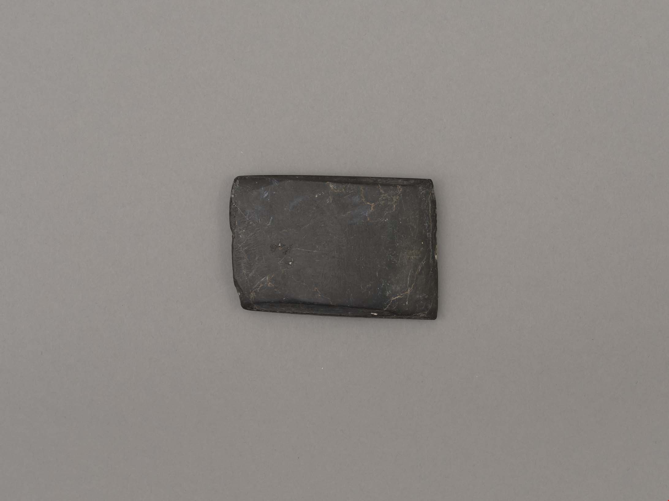
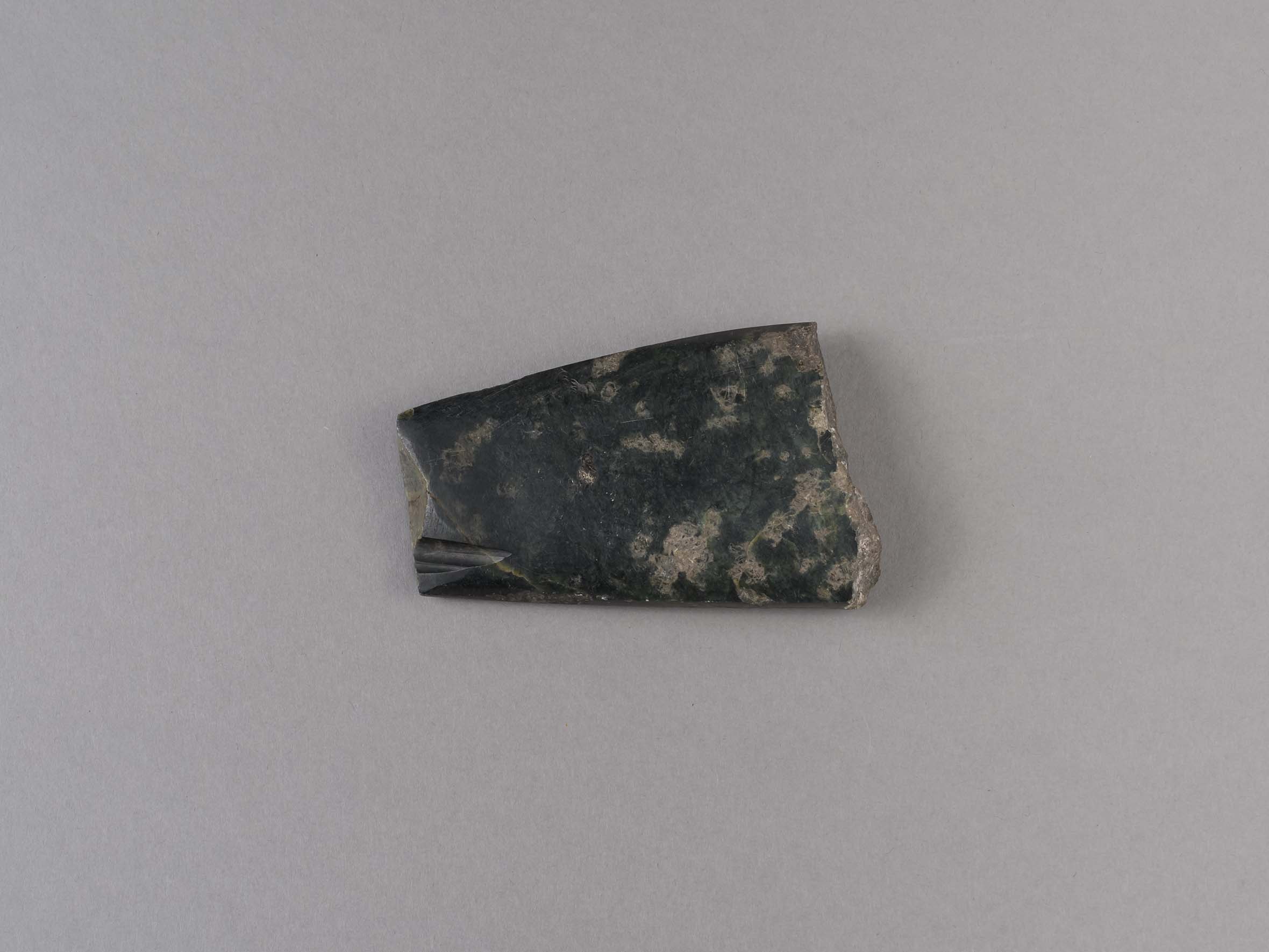
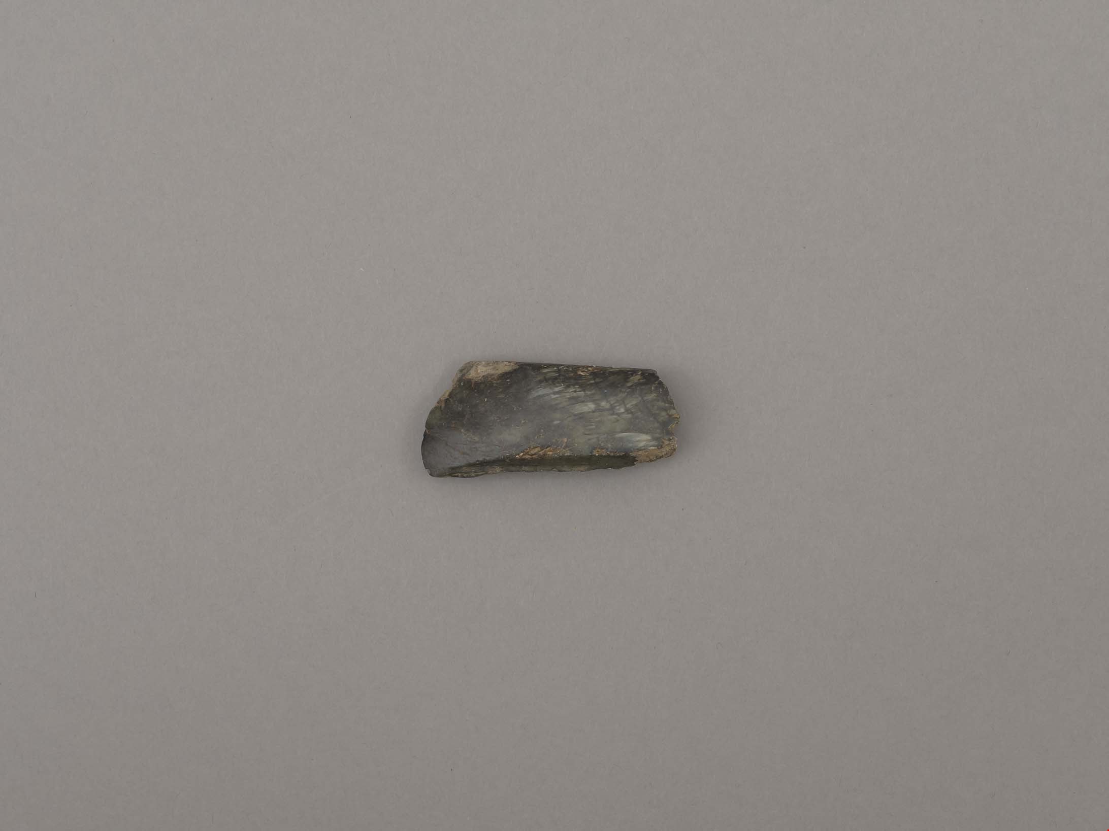
adze blade
https://search.heritageburnaby.ca/link/museumartifact44868
- Repository
- Burnaby Village Museum
- Accession Code
- BV002.57.19
- Description
- Nephrite adze blade; chipped on one end; rectangular shaped.
- Object History
- The donor inherited this artifact from his mother, Katherine Maude (Kitty) Peers, who inherited them from her father, Louis Claude Hill. The artifacts were found on his farm, Brookfield Farm, at Douglas Road and Sperling Avenue (now site of Burnaby Village Museum).
- Nephrite is found in the Fraser Canyon
- Culture Phase: Possibly Locarno Beach phase (3520-2200 Before Present) or Marpole (400BC - 400AD)
- Historic Neighbourhood
- Burnaby Lake (Historic Neighbourhood)
Images
Documents
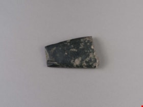
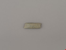
adze blade
https://search.heritageburnaby.ca/link/museumartifact44870
- Repository
- Burnaby Village Museum
- Accession Code
- BV002.57.21
- Description
- Chisel, adze or axe blade made of serpentine; black; ends broken off; tapered rectangle shape.
- Object History
- The donor inherited this artifact from his mother, Katherine Maude (Kitty) Peers, who inherited them from her father, Louis Claude Hill. The artifacts were found on his farm, Brookfield Farm, at Douglas Road and Sperling Avenue (now site of Burnaby Village Museum).
- Culture Phase: Locarno Beach (3520-2200 Before Present) or Marpole (400BC - 400AD)
- Historic Neighbourhood
- Burnaby Lake (Historic Neighbourhood)
Images
Documents
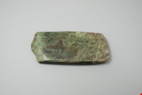
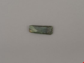
adze blade
https://search.heritageburnaby.ca/link/museumartifact44872
- Repository
- Burnaby Village Museum
- Accession Code
- BV002.57.23
- Description
- Chisel, adze or axe blade made of serpentine; small
- Object History
- The donor inherited this artifact from his mother, Katherine Maude (Kitty) Peers, who inherited them from her father, Louis Claude Hill. The artifacts were found on his farm, Brookfield Farm, at Douglas Road and Sperling Avenue (now site of Burnaby Village Museum).
- Culture Phase: Locarno Beach (3520-2200 Before Present) or Marpole (400BC - 400AD)
- Historic Neighbourhood
- Burnaby Lake (Historic Neighbourhood)
Images

Documents
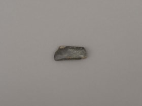
adze blade
https://search.heritageburnaby.ca/link/museumartifact44873
- Repository
- Burnaby Village Museum
- Accession Code
- BV002.57.24
- Description
- Nephrite adze blade; small
- Object History
- The donor inherited this artifact from his mother, Katherine Maude (Kitty) Peers, who inherited them from her father, Louis Claude Hill. The artifacts were found on his farm, Brookfield Farm, at Douglas Road and Sperling Avenue (now site of Burnaby Village Museum).
- Nephrite is found in the Fraser Canyon
- Culture Phase: Locarno Beach (3520-2200 Before Present) or Marpole (400BC - 400AD)
- Historic Neighbourhood
- Burnaby Lake (Historic Neighbourhood)
Images

Documents
adze blade
https://search.heritageburnaby.ca/link/museumartifact44874
- Repository
- Burnaby Village Museum
- Accession Code
- BV002.57.25
- Description
- Adze blade; small; possibly nephrite.
- Object History
- The donor inherited this artifact from his mother, Katherine Maude (Kitty) Peers, who inherited them from her father, Louis Claude Hill. The artifacts were found on his farm, Brookfield Farm, at Douglas Road and Sperling Avenue (now site of Burnaby Village Museum).
- Nephrite is found in the Fraser Canyon
- Culture Phase: Locarno Beach (3520-2200 Before Present) or Marpole (400BC - 400AD)
- Historic Neighbourhood
- Burnaby Lake (Historic Neighbourhood)
Images
Documents

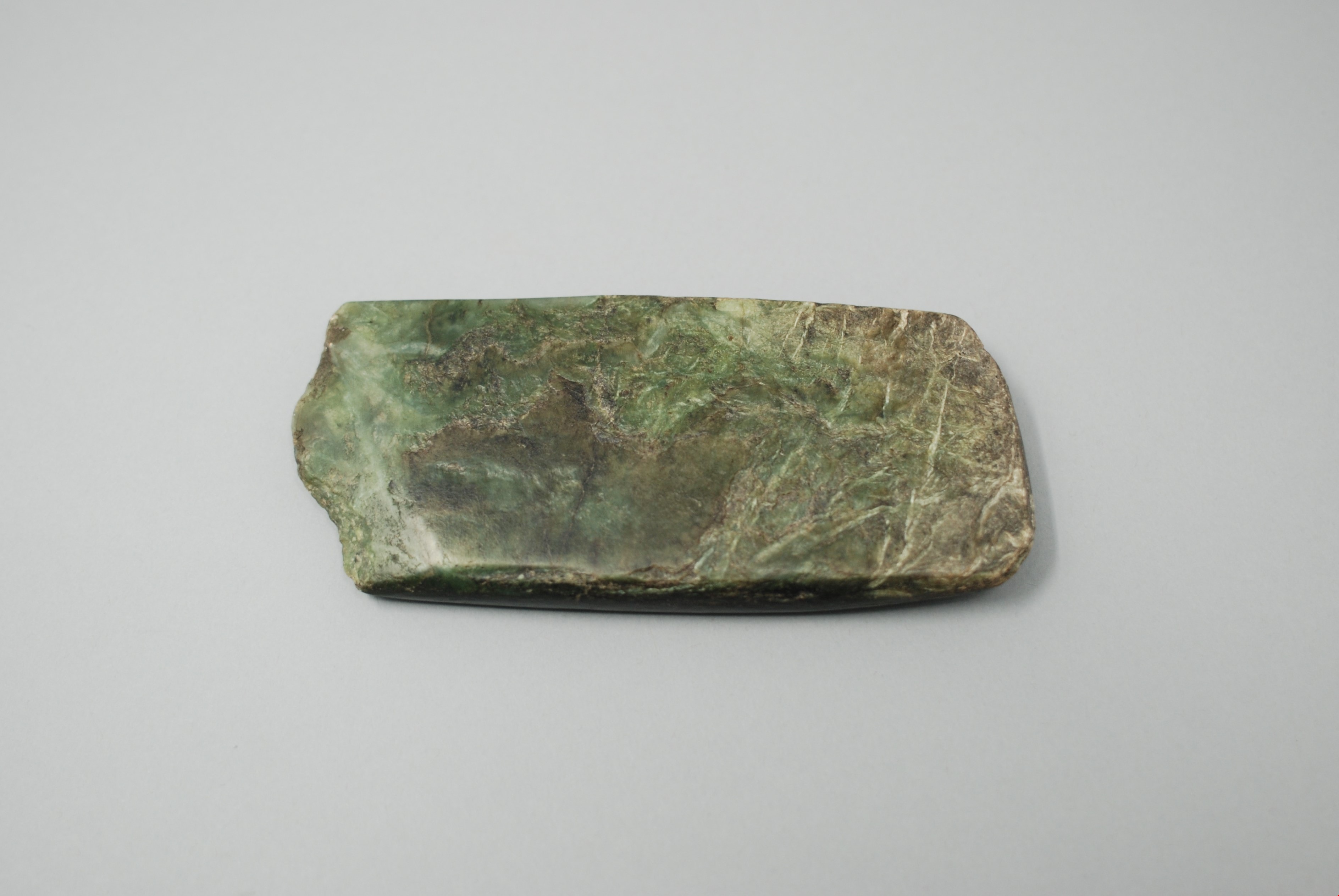
adze blade
https://search.heritageburnaby.ca/link/museumartifact44876
- Repository
- Burnaby Village Museum
- Accession Code
- BV002.57.27
- Description
- Nephrite adze blade; rectangular; chipped on one side; slightly grooved on longer edges.
- Object History
- The donor inherited this artifact from his mother, Katherine Maude (Kitty) Peers, who inherited them from her father, Louis Claude Hill. The artifacts were found on his farm, Brookfield Farm, at Douglas Road and Sperling Avenue (now site of Burnaby Village Museum).
- Nephrite is found in the Fraser Canyon
- Marpole Culture (400BC - 400AD) or Gulf of Georgia Culture (400 AD – 1800); essentially these archaeological materials date to the last 2400 years.
- Historic Neighbourhood
- Burnaby Lake (Historic Neighbourhood)
Images