Narrow Results By
Decade
- 2020s 55
- 2010s 85
- 2000s 157
- 1990s 257
- 1980s 459
- 1970s 426
- 1960s 157
- 1950s 80
- 1940s 55
- 1930s 71
- 1920s 95
- 1910s
- 1900s 44
- 1890s 16
- 1880s
- 1870s 1
- 1860s 1
- 1850s 1
- 1840s 1
- 1830s 1
- 1820s 1
- 1810s 1
- 1800s 1
- 1790s 1
- 1780s 1
- 1770s 1
- 1760s 1
- 1750s 1
- 1740s 1
- 1730s 1
- 1720s 1
- 1710s 1
- 1700s 1
- 1690s 1
- 1680s 1
- 1670s 1
- 1660s 1
- 1650s 1
- 1640s 1
- 1630s 1
- 1620s 1
- 1610s 1
- 1600s 1
Subject
- Agriculture - Fruit and Berries 2
- Arts - Paintings 1
- Arts - Sculptures 1
- Buildings - Agricultural - Stables 1
- Buildings - Commercial 1
- Buildings - Commercial - Grocery Stores 1
- Buildings - Heritage 5
- Buildings - Industrial - Factories 1
- Buildings - Industrial - Saw Mills 1
- Buildings - Religious 1
- Buildings - Religious - Churches 1
- Buildings - Residences - Houses 1
Creator
- Arnold, Matthew, 1822-1888 1
- Atkinson, Frank H., 1871- 1
- Augé, Claude, 1854-1924 1
- Augé, Paul, 1881-1951 1
- Babcock, John Pease, 1855-1936 1
- Bernard R. Hill 1
- Burnaby Art Gallery 1
- Burnaby Village Museum 1
- Buxton, George Searby 1
- Buxton, Leopold George 1
- Corneille, Pierre, 1606-1684 1
- Cunliffe, John William, 1865-1946 1
Introduction to inorganic chemistry
https://search.heritageburnaby.ca/link/museumlibrary3159
- Repository
- Burnaby Village Museum
- Author
- Smith, Alexander, 1865-1922
- Edition
- 3rd ed.
- Publication Date
- 1919
- c1905
- Call Number
- 546 SMI
- Repository
- Burnaby Village Museum
- Collection
- Special Collection
- Material Type
- Book
- Accession Code
- HV972.165.127
- Call Number
- 546 SMI
- Edition
- 3rd ed.
- Author
- Smith, Alexander, 1865-1922
- Place of Publication
- New York
- Publisher
- The Century Co.
- Publication Date
- 1919
- c1905
- Physical Description
- v-xiv; 925 p. : ill. ; 20 cm.
- Inscription
- inside, "T J M Roy Agassiz, B.C." "Arts '23" "U.B.C." "Sept. 1919" "1426 - 8th Ave. W. Vancouver, BC" crossed-out "W111"
- Library Subject (LOC)
- Chemistry, Inorganic
- Chemistry--Textbooks
- Notes
- Includes index.
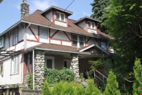
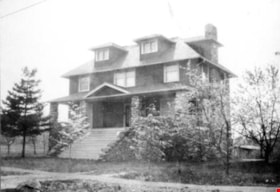
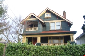
Jacob & Margaret Wysong House
https://search.heritageburnaby.ca/link/landmark507
- Repository
- Burnaby Heritage Planning
- Description
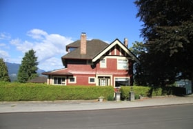
- The Jacob and Margaret Wysong House is a two and one-half storey, wood-frame Arts and Crafts house with a hipped roof and hipped dormers. Symmetrical in massing, it is distinguished by its masonry verandah columns, foundations and chimneys. It is located on a corner lot on Sperling Avenue at Stanle…
- Associated Dates
- 1912
- Formal Recognition
- Heritage Designation, Community Heritage Register
- Street View URL
- Google Maps Street View
- Repository
- Burnaby Heritage Planning
- Geographic Access
- Sperling Avenue
- Associated Dates
- 1912
- Formal Recognition
- Heritage Designation, Community Heritage Register
- Enactment Type
- By-law No. 11978
- Enactment Date
- 17/10/2005
- Description
- The Jacob and Margaret Wysong House is a two and one-half storey, wood-frame Arts and Crafts house with a hipped roof and hipped dormers. Symmetrical in massing, it is distinguished by its masonry verandah columns, foundations and chimneys. It is located on a corner lot on Sperling Avenue at Stanley Street in the Edmonds neighbourhood of South Burnaby.
- Heritage Value
- The Jacob and Margaret Wysong House is significant for illustrating the early development of the Edmonds neighbourhood, a speculative subdivision that was created and marketed during the pre-First World War real estate boom. The area’s proximity to New Westminster, coupled with extensive views and two newly developed streetcar lines, ensured that Edmonds attracted a wave of suburban development. The scale of this house is atypical of the usual suburban lots, and reflects the prominence of this location and its spectacular views. Set on a large lot, the Jacob and Margaret Wysong House is a grand estate home that is one of the earliest, and most prominent, in South Burnaby. This is also an exceptional example of Arts and Crafts architecture, displaying the use of native materials that was a hallmark of the style. The first owners were Jacob Wysong and his wife Margaret. Jacob Wysong, a local contractor, constructed the house in 1912. The stonework is exceptional, and the use of rough-cut granite and fieldstone, with overall shingle cladding, recalls the rustic vernacular common in Western park lodges, and evokes a country lifestyle in harmony with nature. The hipped roof was designed with a flat top that acted as a lookout tower that provided views of the surrounding landscape.
- Defining Elements
- Key elements that define the heritage character of the Jacob and Margaret Wysong House include its: - prominent corner location in the Edmonds neighbourhood of South Burnaby - residential form, scale and massing as expressed by its two and one-half storey plus raised basement height, symmetrical plan, hipped roof with flat top, hipped dormers, and hipped roof over the full open front verandah with a central front gable - masonry elements such as rough-cut granite and fieldstone foundations, verandah columns, stair cheeks, and external and internal chimneys - wooden-frame construction including original cedar shingling on dormers and facing verandah, shingling on remainder of house under later stucco cladding, and surviving original dimensional trim facing verandah and on dormers - Arts and Crafts features such as the use of natural materials, open soffits and angled roof overhang - windows including: double-hung 18-over-1 wooden sash windows; multi-paned casement windows; French doors to verandah; and front door with glazed sidelights - associated landscape features including surrounding mature trees, hedges and perimeter plantings
- Historic Neighbourhood
- Edmonds (Historic Neighbourhood)
- Planning Study Area
- Kingsway-Beresford Area
- Function
- Primary Historic--Single Dwelling
- Primary Current--Single Dwelling
- Community
- Edmonds
- Cadastral Identifier
- P.I.D. 000-497-801
- Boundaries
- The Jacob and Margaret Wysong House is comprised of a single residential lot located at 6325 Sperling Avenue, Burnaby.
- Area
- 1087.62
- Contributing Resource
- Building
- Ownership
- Private
- Documentation
- City of Burnaby Planning and Building Department, Heritage Site Files
- Street Address
- 6325 Sperling Avenue
- Street View URL
- Google Maps Street View
Images
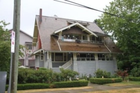
James & Harriet Atkey Residence
https://search.heritageburnaby.ca/link/landmark603
- Repository
- Burnaby Heritage Planning
- Description
- Residential building.
- Associated Dates
- 1913
- Street View URL
- Google Maps Street View
- Repository
- Burnaby Heritage Planning
- Geographic Access
- MacDonald Avenue North
- Associated Dates
- 1913
- Description
- Residential building.
- Heritage Value
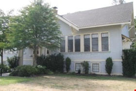
- This Arts and Crafts residence has retained many of its original features, such as its full open front verandah with twinned square columns, shingle siding, and triangular eave brackets. Typical of the era, the front door has glazed insets and the living room window assembly has opening casements and transoms above. The second floor sleeping porch has retained its original arched openings. It has been restored and is in very good condition. It was built by C.A. Curseaden of Kerrisdale and sold to James William Atkey (1868-1956), a general store merchant, and his wife Harriet Ellen (née Bugg, 1868-1944) in 1915.
- Locality
- Vancouver Heights
- Historic Neighbourhood
- Vancouver Heights (Historic Neighbourhood)
- Planning Study Area
- Burnaby Heights Area
- Area
- 371.61
- Contributing Resource
- Building
- Ownership
- Private
- Street Address
- 20 Macdonald Avenue North
- Street View URL
- Google Maps Street View
Images
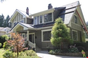
J.A. Thurston House 'Altese'
https://search.heritageburnaby.ca/link/landmark511
- Repository
- Burnaby Heritage Planning
- Description
- The J.A. Thurston House is a very large, two and one-half storey plus basement wood-frame Arts and Crafts style house. It is located on the south side of Thurston Street, near Kingsway and the SkyTrain (formerly the interurban tramline route), within the Metrotown area of Burnaby and is now part of…
- Associated Dates
- 1912
- Formal Recognition
- Heritage Designation, Community Heritage Register
- Other Names
- John A. & Sarah Thurston House
- Street View URL
- Google Maps Street View
- Repository
- Burnaby Heritage Planning
- Other Names
- John A. & Sarah Thurston House
- Geographic Access
- Thurston Street
- Associated Dates
- 1912
- Formal Recognition
- Heritage Designation, Community Heritage Register
- Enactment Type
- Bylaw No. 9934
- Enactment Date
- 09/08/1993
- Description
- The J.A. Thurston House is a very large, two and one-half storey plus basement wood-frame Arts and Crafts style house. It is located on the south side of Thurston Street, near Kingsway and the SkyTrain (formerly the interurban tramline route), within the Metrotown area of Burnaby and is now part of a large apartment complex.
- Heritage Value
- The J.A. Thurston House demonstrates Burnaby's real estate and construction boom along the interurban tramline in 1911. The house was built for John Albert Thurston (1874-1944) and his wife Sarah Sedona Thurston (1879-1961). Typical of the entrepreneurial spirit of the age, John Thurston, a manager for the Leckie Shoe Company Limited in Vancouver, was also involved in real estate development, and purchased a twenty-one lot subdivision consisting of 3.2 hectares bound by the interurban tramline right-of-way to the south, Boundary Road to the west and Smith Street (now Thurston Street) to the north. Additionally, the J.A. Thurston House is an excellent, high quality example of an Arts and Crafts style dwelling, with numerous notable design elements such as the battered piers, the elaborate second storey dormer and stained glass windows with landscape and seascape motifs. The enormous scale of the house reflects a time when large families were common and domestic servants were needed to run the household. Indicative of the labour-saving devices and luxury features being introduced at the high end of the housing market, it was equipped with a built-in vacuum system, refrigeration, servant summoning devices and a round safe built into a fireplace mantle. The J.A. Thurston House also represents the proliferation during the Edwardian era of homes built from pattern books and standardized designs as a means to expedite the construction process and offer competitive costs.
- Defining Elements
- Key elements that define the heritage character of the J.A. Thurston House include its: - location on Thurston Street, in the old Central Park district - residential form, scale and massing as exemplified by its two and one-half storey plus above-ground basement height and regular, rectangular plan - Arts and Crafts style details such as the picturesque roofline, deep open eaves with exposed purlins, narrow lapped wooden siding on the first storey and cedar shingle siding on the upper storeys - broad and unusually steep side gabled roof, clad with cedar shingles - deeply-recessed full open front verandah with complementary recessed balcony in second storey dormer, incorporating both a gabled roof and shed roof - twinned and triple square bracketed columns on the verandahs and balcony - decorative battered verandah piers, supported on exposed beams - irregular fenestration, including: double-hung wooden-sash windows; picture windows; casement windows; and several stained glass windows with landscape and seascape motifs - tall brick external chimney on east facade - original interior features such as fireplaces, and wooden trim and floors
- Historic Neighbourhood
- Central Park (Historic Neighbourhood)
- Planning Study Area
- Garden Village Area
- Function
- Primary Historic--Single Dwelling
- Primary Current--Single Dwelling
- Community
- Burnaby
- Cadastral Identifier
- 018-224-113
- Boundaries
- The J.A. Thurston House is comprised of a single residential lot located at 3762 Thurston Street, Burnaby.
- Area
- 3880
- Contributing Resource
- Building
- Ownership
- Private
- Street Address
- 3762 Thurston Street
- Street View URL
- Google Maps Street View
Images
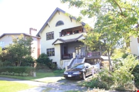
J.D. Shearer House
https://search.heritageburnaby.ca/link/landmark513
- Repository
- Burnaby Heritage Planning
- Description
- The J.D. Shearer House is a one and one-half storey British Arts and Crafts-style house distinguished by its picturesque roofline, half-timbered rough-cast stucco cladding on the upper floor and battered window casings. It is located on the south side of Buckingham Avenue at Haszard Street in Burna…
- Associated Dates
- 1912
- Formal Recognition
- Heritage Designation, Community Heritage Register
- Other Names
- John D. & Katherine Shearer House
- Street View URL
- Google Maps Street View
- Repository
- Burnaby Heritage Planning
- Other Names
- John D. & Katherine Shearer House
- Geographic Access
- Buckingham Avenue
- Associated Dates
- 1912
- Formal Recognition
- Heritage Designation, Community Heritage Register
- Enactment Type
- Bylaw No. 10423
- Enactment Date
- 26/08/1996
- Description
- The J.D. Shearer House is a one and one-half storey British Arts and Crafts-style house distinguished by its picturesque roofline, half-timbered rough-cast stucco cladding on the upper floor and battered window casings. It is located on the south side of Buckingham Avenue at Haszard Street in Burnaby's Deer Lake neighbourhood.
- Heritage Value
- Built in 1912, the J.D. Shearer House is an excellent example of the high quality residences constructed in the British Arts and Crafts style by affluent citizens in Burnaby's Deer Lake neighbourhood, promoted at the time as the equivalent of the prestigious Shaughnessy Heights development in Vancouver. The site of this house was part of Louis Claude Hill's Buckingham Estate subdivision. Development of these Edwardian era neighbourhoods in Burnaby was facilitated by the B.C. Electric Railway interurban line. In addition, the increasing availability of automobiles to the well-to-do families of the era sped up the process of urbanization in the outlying areas of Vancouver. Built for retired English military officer John D. Shearer and his wife, Katherine, the British Arts and Crafts design of the house represents associations with the Mother Country and the displays of patriotic loyalty considered desirable characteristics at the time. The picturesque charm and character of rural England is evoked in harmony with its woodland setting.
- Defining Elements
- Key elements that define the heritage character of the J.D. Shearer House include its: - location in the Buckingham Estate subdivision in the Deer Lake neighbourhood - residential form, scale and massing as exemplified by its one and one-half storey plus basement height, asymmetrical plan, front bay window and picturesque roofline - British Arts and Crafts details such as the half-timbering and rough-cast stucco on the upper storey, battered window casings, external clinker brick chimney on the east facade, deep overhanging closed eaves and bargeboards with distinctive lower returns - side gabled roof with gabled and shed dormers, clad in cedar - raised central entrance porch - irregular fenestration, including multi-paned transoms over casement windows - two internal red brick chimneys
- Historic Neighbourhood
- Burnaby Lake (Historic Neighbourhood)
- Planning Study Area
- Morley-Buckingham Area
- Function
- Primary Historic--Single Dwelling
- Primary Current--Single Dwelling
- Community
- Burnaby
- Cadastral Identifier
- 023-316-977
- Boundaries
- The J.D. Shearer House is comprised of a single residential lot located at 5573 Buckingham Avenue, Burnaby.
- Area
- 1044
- Contributing Resource
- Building
- Ownership
- Private
- Street Address
- 5573 Buckingham Avenue
- Street View URL
- Google Maps Street View
Images
Jesse Love farmhouse series
https://search.heritageburnaby.ca/link/museumdescription9782
- Repository
- Burnaby Village Museum
- Date
- [1893-1970] (date of originals), copied 1988-1998, predominant 1988-2000
- Collection/Fonds
- Burnaby Village Museum fonds
- Description Level
- Series
- Physical Description
- approx. 84 cm of textual records + approx. 1,910 photographs + approx. 100 architectural drawings + 3 audio cassettes + 1 videocassette
- Scope and Content
- Series consists of records involved in the purchase, moving, restoration, research, conservation and exhibiting of the Love family farmhouse by Burnaby Village Museum. Records have been arranged into the following subseries: 1) Love farmhouse conservation work files subseries 2) Love farmhouse re…
- Repository
- Burnaby Village Museum
- Collection/Fonds
- Burnaby Village Museum fonds
- Series
- Jesse Love farmhouse series
- Description Level
- Series
- Physical Description
- approx. 84 cm of textual records + approx. 1,910 photographs + approx. 100 architectural drawings + 3 audio cassettes + 1 videocassette
- Scope and Content
- Series consists of records involved in the purchase, moving, restoration, research, conservation and exhibiting of the Love family farmhouse by Burnaby Village Museum. Records have been arranged into the following subseries: 1) Love farmhouse conservation work files subseries 2) Love farmhouse restoration photographs subseries 3) Love farmhouse curatorial files subseries 4) Love farmouse research files subseries 5) Love family photographs 6) Love farmhouse Oral History subseries 7) Love farmhouse architectural drawings subseries
- History
- Jesse Love was born in Swindon, England in 1847 and left England to work on a dairy farm in the Toronto area. While working on the farm in Toronto, he met Martha Leonard who he married in 1879. Martha was born on February 3, 1858 in Bedfordshire, England and had come to Canada with her parents George and Ann Leonard. While living in Toronto, Jesse and Martha had two children, George born March 22, 1880 and Annie Elizabeth on August 24, 1881. About one year after Annie was born, the Love family moved to North Dakota to grow wheat. While living there, they had two more children, Henry who was born August 24, 1883 and Edith Minnie born October 9, 1885. The family decided to move further west after hearing about the fairer weather conditions from Martha’s father, George Leonard, who had settled in Vancouver in 1885. On May 23, 1887, Jesse, Martha and their four children arrived in Vancouver after travelling across Canada from Winnipeg on the first transcontinental train. The Loves made their home in Vancouver while Jesse helped clear land on Granville Street. Their fifth child, Thomas Robert was born on September 17, 1887 and soon after, the family moved to Lulu Island in Richmond where they lived growing vegetables and selling them to Vancouver hotels. While living and farming on Lulu island, the couple had two more girls, Martha (Dot or Dorothy) born on December 17, 1889 and Sarah Marie, born February 8, 1892. On October 6, 1893 an agreement was signed by Jesse Love to purchase 14.52 acres of land from Joseph C. Armstrong. The acreage covered the north east section of District Lot 25 within the newly incorporated District of the Municipality of Burnaby. It was here where the original Love house was built (between October 1893 and April 15, 1894) by Jesse Love with the help of local builder George Salt and father in law, George Leonard. The house consisted of an entrance hall, dining room, lean to kitchen, master bedroom and three bedrooms upstairs. A road was constructed and named Cumberland in 1905 and ran from District Lot 25 through to District Lot 11. The address for the Love home was 1390 Cumberland Road and in the early 1960’s the address was renumbered 7651 Cumberland Street. On the land surrounding the house, Jesse Love planted an orchard along with strawberries and raspberries which he sold at the Fraser Valley Market, T.S. Anandale’s Grocery Store in New Westminster and to hotels around Vancouver. Jesse Love served on the Burnaby School Board and also as a District Councillor in 1901 and from 1904-1907. While living in the house, Jesse and Martha had four more children, Phoebe Leonard, born April 15, 1894, Esther, born August 28, 1896, John Leonard, born June 7, 1899 and Hannah Victoria (also known as Girlie) who was born May 12, 1902. As the family grew to eleven children, additions along with some substantial remodelling in the craftsman style took place. In about 1898, a north wing addition was added to include a parlour with two windows, the construction of two more bedrooms and the relocation of the stair case to the North West wall. In 1903 the front door moved to the north elevation, a front porch was extended along the east wall and a summer lean to kitchen was added to the west elevation. Between 1905 and 1910, a tin embossed ceiling was installed along with an addition of the main kitchen which included a pantry, bathtub and a back porch. In about 1912, five craftsman style windows replaced the original pioneer tent style, the front verandah was enlarged to wrap around the south and east elevations, a back door was installed in the kitchen to access the verandah and wood shingle siding and brackets were added to the exterior. In 1918, at the age of 31 years, Robert Love fell ill due to an influenza epidemic and died on November 23, 1918. Following their son’s death, Martha Love became weak and on August 24, 1920, she passed away. By this time, Jesse had sold off a large percentage of his land and his youngest daughter, Girlie decided to stay on to live and care for him. Since the house was too large for just the two of them, Jesse invited any other children to return and share the residence. For a while his son, George and his wife joined them until 1925, followed by his daughter Sarah Parker (nee Love), her husband William and their three children, Albert, Bill and Elsie. The house remained pretty unchanged until 1928 after Jesse Love died of pneumonia (March 10, 1928) and the house was purchased by Sarah and her husband William Parker who continued to live there with their children. The master bedroom wall on the main floor opened up to the dining room, the kitchen pantry and bathtub converted to an alcove with a marble counter and enlarged window and sink while the bathroom was moved to the upstairs and the furnace and coolers were installed in the crawl space under the kitchen. A hot water tank was installed in the house in 1966. Sarah continued to live in the house until a little while after her husband William died in 1961. She sold the house to her daughter Elsie and husband John Hughes in 1966, who lived in the house along with their son Brent, until August 23, 1971. Mahbir Molchan Papan and his wife Geraldine Papan bought the house August 23, 1971 and by 1982, the house was sold to Nirmal Singh Singha and Narinder Singha. The Papans continued to rent the house from Nirmal Singh Singha and Narinder Singha until the late 1980s. In 1988, the house was scheduled for demolition with the remaining property to be subdivided. Fortunately, a neighbour, Mr. Harvey Elder recognized the farmhouse's historical significance and contacted the Burnaby Historical Society. Following this event, the owners agreed to donate the building to the Burnaby Village Museum (under the Century Park Museum Association) who financed the move of the house from Cumberland Street to the museum site. Heritage planner and architect, Robert Lemon provided guidance for the project. Prior to the move, the two porches were removed and demolished while the kitchen and roof were both separated from the main house. The kitchen and roof of the house were transported to Burnaby Village Museum on May 20, 1988 by Nickel Bros. House Moving company, while the main frame of the house completed its transportation to the museum near the end of May 1988 (due to low overhead wires). The house was moved down Cumberland Street to 10th Avenue, up Canada Way to Sperling and set on temporary footings near Hart House. Robert Lemon oversaw structural improvements such as, upgrading floor joists and creating new foundations to replace the original timber foundation of the farmhouse. The restoration went through several phases of work between 1988 until it opened in November 1998. Restoration began on both the interior and exterior features to be interpreted from the period of 1925. On November 23, 1992, the building was designated a heritage building under Heritage Designation Bylaw 1992, Bylaw Number 9807. In 1993, the architecture firm of Brian G. Hart Associates was appointed for the design and construction supervision of the restoration project. Plans were created for a foundation on the museum site in 1989 and the farmhouse was eventually settled on a permanent foundation behind the Burnaby Village Museum administration building in 1993 along with the reattachment of the roof. The kitchen section was reattached to the main house in 1994 along with skirting around the foundation and the reshingling of the exterior. In 1996, the tin ceiling was removed to make way for the installation of the internal electrical system along with sprinklers, ceiling heating and fire break gyprock. The dining room ceiling joists were consolidated, a pantry and bathroom were added to the kitchen, the downstairs bedroom wall was opened and filled, the dining and kitchen doorways were widened. In 1997, a wheelchair ramp was installed along with a concrete sidewalk, stair rails, cement pads at the base of the stairs and a gravel sink for any excess water. Interior work included painting of the kitchen, restoration and furnishing of the kitchen pantry, insulation of the house floor to protect from rodents along with the reconstruction of the kitchen and house chimneys. The registrar worked together with the curator and conservator and was tasked with a large research project on the house including the family contacts and family history, property information, plans, photographs, artifacts, furnishings, stories etc. all organized in files for easy retrieval. A great deal of research and conservation was undertaken in order to make the interior of the house authentic to the time period as possible. One of the biggest projects was selecting and obtaining wall coverings since much of the original wallpaper was incomplete and poor condition. The conservator and registrar were lucky enough to locate a few samples of the original paper and engage the Bradbury and Bradbury Art Wallpaper Company of Benica, California to reproduce replica designs for free. The City of Burnaby now has its own series “Burnaby Village Papers” produced by this company which are titled “Burnaby Wall”; “Burnaby Border” and “Burnaby Ceiling”. All three of these wallpaper designs have been used in the Love farm house and are also commercially available through the Bradbury and Bradbury Art Wallpaper Company. In 1997, restoration of the kitchen was completed and opened to the public. After the completion of the dining room, main floor bedroom and parlour, the Love farmhouse exhibit opened on November 29, 1998 with an open invitation to the public and extended members of the Love family. Officials including the Mayor, Doug Drummond and Love family members were all present to cut the ribbon for the special event.
- Accession Code
- BV018.41; BV020.5
- Access Restriction
- Restricted access
- Date
- [1893-1970] (date of originals), copied 1988-1998, predominant 1988-2000
- Arrangement
- The majority of the records within series and subseries were arranged by a staff members of Burnaby Village Museum who worked on the historical research and restoration of the house. Other photographs documenting the move and further restoration work were added later and included in the arrangment by format and subject.
- Notes
- Title based on content of series
- Jesse Love farmhouse is described as an Artifact under BV988.33.1
- Some records within this collection have restricted access and are subject to FIPPA
- Accessions BV018.41 and BV020.5 form this fonds
J.R. & Frances Dawson Residence
https://search.heritageburnaby.ca/link/landmark599
- Repository
- Burnaby Heritage Planning
- Description
- Residential building.
- Associated Dates
- c.1912
- Street View URL
- Google Maps Street View
- Repository
- Burnaby Heritage Planning
- Geographic Access
- Cambridge Street
- Associated Dates
- c.1912
- Description
- Residential building.
- Heritage Value
- This beautifully-detailed house displays a highly sophisticated mix of fashionable Arts and Crafts elements. The asymmetrical design has stacked inset verandahs on one side, with the ground floor verandah wrapping around the side of the house. The second floor verandah has an arched opening, supported by short versions of the ground floor columns and accessed by French doors with geometric patterned, multi-paned glazing. A semi-circular lunette window lights the attic, and banked windows with leaded transoms are used on the front façade. Decorative details include triangular eave brackets and square verandah columns with distinctive bracketted capitals. The house has survived in original condition except for a later asbestos siding that was applied over the original shingle siding, and the enclosure of the side verandah. The home was owned by J.R. Dawson and Frances Abigail Dawson (née Thompson, 1853-1938) from 1915 until Frances’ death in 1938.
- Locality
- Vancouver Heights
- Historic Neighbourhood
- Vancouver Heights (Historic Neighbourhood)
- Planning Study Area
- Burnaby Heights Area
- Area
- 566.71
- Contributing Resource
- Building
- Ownership
- Private
- Street Address
- 3746 Cambridge Street
- Street View URL
- Google Maps Street View
Images
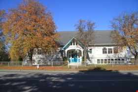
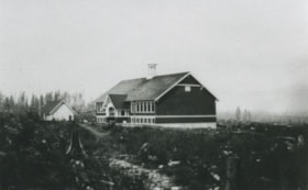
Kingsway East School
https://search.heritageburnaby.ca/link/landmark546
- Repository
- Burnaby Heritage Planning
- Description
- The Kingsway East School is a two-storey wood-frame Arts and Crafts styled building. The school, and the adjacent cenotaph and memorial tennis courts, comprise Burnaby South Memorial Park.
- Associated Dates
- 1913
- Formal Recognition
- Heritage Designation, Community Heritage Register
- Other Names
- Alan Emmott Centre
- Street View URL
- Google Maps Street View
- Repository
- Burnaby Heritage Planning
- Other Names
- Alan Emmott Centre
- Geographic Access
- Southoaks Crescent
- Associated Dates
- 1913
- Formal Recognition
- Heritage Designation, Community Heritage Register
- Enactment Type
- Bylaw No. 9807
- Enactment Date
- 23/11/1992
- Description
- The Kingsway East School is a two-storey wood-frame Arts and Crafts styled building. The school, and the adjacent cenotaph and memorial tennis courts, comprise Burnaby South Memorial Park.
- Heritage Value
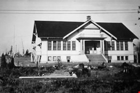
- This school structure completed in 1913, the oldest surviving public education building in the city, was intended to be the auditorium and gymnasium for Burnaby’s first high school. However, because of the 1913 recession and the outbreak of the First World War, it was utilized as the Kingsway East Elementary School for the Edmonds District until 1921. Burnaby South High School opened here in 1922, and after it relocated this building was used for a variety of school purposes until it became redundant. The school was rehabilitated for community purposes in 2002-03 and renamed the Alan Emmott Centre to honor a former Mayor of Burnaby. The impressive scale of the Kingsway East School is indicative of the relative size of the community and its growing demand for schooling at the time of construction, illustrating the value that early community residents placed on education. Built to plans of the Burnaby School Board architect, Joseph Henry Bowman (1864-1943), it also indicates the individual values and design control exercised by the school board during this era. It is also significant for its Arts and Crafts style, allied to the typical Craftsman residential vocabulary, which was employed locally for school buildings of the Edwardian era. By using a common architectural vocabulary, this allowed the institution to reflect the values and aspirations of the local community. The Arts and Crafts style also demonstrated an allegiance to British educational antecedents and a demonstration of loyalty to the Mother Country.
- Historic Neighbourhood
- Edmonds (Historic Neighbourhood)
- Planning Study Area
- Kingsway-Beresford Area
- Function
- Primary Historic--Primary School
- Community
- Burnaby
- Cadastral Identifier
- P.I.D. No. 016-367-154 Legal Description: Lot 1, District Lot 96, Group 1 New Westminster District, Plan 86581
- Boundaries
- The Kingsway East School is comprised of a single municipally-owned property located at 6650 Southoaks Crescent, Burnaby.
- Area
- 6,070.00
- Contributing Resource
- Building
- Landscape Feature
- Structure
- Ownership
- Public (local)
- Documentation
- Heritage Site Files: PC77000 20. City of Burnaby Planning and Building Department, 4949 Canada Way, Burnaby, B.C., V5G 1M2
- Street Address
- 6650 Southoaks Crescent
- Street View URL
- Google Maps Street View
Images
Le Cid : tragedie par Corneille
https://search.heritageburnaby.ca/link/museumlibrary3161
- Repository
- Burnaby Village Museum
- Author
- Corneille, Pierre, 1606-1684
- Publication Date
- 1918
- Call Number
- 842.41 COR
- Repository
- Burnaby Village Museum
- Collection
- Special Collection
- Material Type
- Book
- Accession Code
- HV972.165.129
- Call Number
- 842.41 COR
- Author
- Corneille, Pierre, 1606-1684
- Contributor
- Marks, J. (Joseph), -1964
- Place of Publication
- Manchester
- Publisher
- Manchester University Press
- Publication Date
- 1918
- Series
- French series for schools
- Printer
- R. & R. Clark, Ltd.
- Physical Description
- lxxxiv, 152, [4] p. : 19 cm.
- Inscription
- inner front cover: "W 113" [written in pencil, crossed out] inner front page: "1.10" [written in pencil] inner front page: "F.J. McRae Arts '23" [handwritten in ink] "1426 - 8th Ave W. Vancouver B.C." handwritten notes inside the text
- Library Subject (LOC)
- El Cid, Ca. 1043-1099--Drama
- Notes
- Text in French, introduction and notes in English.
- Includes index and bibliographic references.
- Marks, Joseph editor.
Leila Orman subseries
https://search.heritageburnaby.ca/link/archivedescription62945
- Repository
- City of Burnaby Archives
- Date
- 1918-1976
- Collection/Fonds
- Burnaby Historical Society fonds
- Description Level
- Subseries
- Physical Description
- Textual records and other materials
- Scope and Content
- Subseries consists of manuscripts written by Leila Orman as well as paintings, scrapbooks, postcards, photographs, hymn books and correspondence.
- Repository
- City of Burnaby Archives
- Date
- 1918-1976
- Collection/Fonds
- Burnaby Historical Society fonds
- Subseries
- Leila Orman subseries
- Physical Description
- Textual records and other materials
- Description Level
- Subseries
- Accession Number
- BHS2007-04
- Scope and Content
- Subseries consists of manuscripts written by Leila Orman as well as paintings, scrapbooks, postcards, photographs, hymn books and correspondence.
- History
- A. Leila Orman was born June 2, 1901 in Eastleigh, Hampshire, England. She is the youngest daughter of Daisy Marie Orman, her sister Daisy Hilda Orman (later Targett) being three and a half years her senior. At five years old Leila began a long fight with a crippling type of rheumatoid arthritis. By the time she was thirteen, she experienced completely ankylosed joints. Her family travelled all over hoping to find a cure, but to no avail. In 1913 her father joined his two brothers in Calgary, and by 1915 the family had joined him. Leila developed an interest in painting and knitting, and composed her own poems. She began writing news articles for the Calgary Daily Herald in the 1930s, and her first sonnet was published in that paper on August 28, 1934. She had a strong interest in the arts, often writing about music and the visual arts. While living in Calgary, she became a member of the Business and Professional Women’s Club as well as a member of the Canadian Author’s Association. When her father retired in 1938, the family moved to Rosewood Avenue in Burnaby. Leila wrote on a typewriter with two sticks to type out the letters. She was an avid reader and was able to turn the pages with a special stick with elastic bands wound around the ends. Canadian novelist Maida Parlow French became her lifelong friend and encouraged her to write her own autobiography, but she was not able to finish it. Leila wrote “The Giving Heart” in October of 1948. By 1952, she was writing the "Across the Board" column for the British Columbia Saturday Magazine with the intention of inspiring other “incapacitated folk” to live up to their full potential: “If [she] could reach a few people, and encourage them to reach up and out, [she] should feel the effort well worthwhile.” A member of the St. Alban’s Prayer Healing Fellowship group, Leila wrote the “Christian Manifesto for World Peace” in 1963. The Prayer Group met twice monthly at one of the members’ homes and undertook to pray daily for the sick and for world peace. After Leila’s mother died in 1955, Leila’s friend Jeanie Brown kept house for her and was her constant companion. Jeanie Brown and Leila lived together for over thirteen years until an accident sent Leila to hospital and later to nursing home where she died on February 16, 1976.
- Media Type
- Textual Record
- Photograph
- Creator
- Orman, A. Leila
- Notes
- MSS104 and PC506
- Title based on content of subseries
Nuttall's standard dictionary of the English language : based on the labours of the most eminent lexicographers
https://search.heritageburnaby.ca/link/museumlibrary388
- Repository
- Burnaby Village Museum
- Collection
- Special Collection
- Material Type
- Book
- Accession Code
- BV989.35.16
- Call Number
- 423 NUT
- Edition
- New ed.
- Place of Publication
- London
- Publisher
- Frederick Warne and Co.
- Publication Date
- 1911
- Printer
- Ballantyne, Hanson & Co.
- Physical Description
- vii-x, 816 p. : ill. ; 20 cm.
- Inscription
- inside front page: "Teo Y Pratt [handwritten in pencil] Bradner BC"
- Library Subject (LOC)
- English language--Dictionaries
- English language
- Notes
- "Based on the labours of the most eminent lexicographers". :
- "New and greatly enlarged edition comprising many thousands of new words which modern literature, science, and art have called into existence and common usage with pronunciations, etymologies, definitions, appendices of proper names, illustrations, etc., etc."
- "Revised, extended and improved throughout by the Rev. James Wood".
Personal material
https://search.heritageburnaby.ca/link/archivedescription82732
- Repository
- City of Burnaby Archives
- Date
- [1910-1978]
- Collection/Fonds
- Hazel Simnett collection
- Description Level
- File
- Physical Description
- 9 paintings : colour print, 2 photographs : b&w, and 1 folder of textual records
- Scope and Content
- File consists of application for a driver's license, Kingsway Driving School report card, driver's examination receipt and a letter addressed to Hazel Simnett from the Victorian Order of Nurses for Canada. Also included is an immigration inspection card of Fred Simnett aboard the S.S. Lake Champlai…
- Repository
- City of Burnaby Archives
- Date
- [1910-1978]
- Collection/Fonds
- Hazel Simnett collection
- Physical Description
- 9 paintings : colour print, 2 photographs : b&w, and 1 folder of textual records
- Description Level
- File
- Record No.
- MSS167-008
- Accession Number
- 2013-22
- Scope and Content
- File consists of application for a driver's license, Kingsway Driving School report card, driver's examination receipt and a letter addressed to Hazel Simnett from the Victorian Order of Nurses for Canada. Also included is an immigration inspection card of Fred Simnett aboard the S.S. Lake Champlain from Liverpool and a letter from the Office of the Mayor addressed to Mary Ann Simnett for her ninetieth birthday. Also included is a photograph (see item 559-001). Also included are newsclippings regarding Robert Burnaby and the "Bygones of Burnaby" book, a programme of the Robert Burnaby Commemorative Dinner, a photocopy of "The Argus" (Burnaby South High School's newspaper) from 1938, a programme from Madys Pridmore Brown's Variety Programme, "The Buzzer" Volume 40 Issue 16 advertising Vancouver street cars, New Vista Society certificate addressed to Hazel Simnett, an envelope of Fenwick Lansdowne bird prints from 1957 and a print of the Royal Family found in a cardboard envelope postmarked 1972.
- Subjects
- Arts - Paintings
- Documentary Artifacts - Newspapers
- Documentary Artifacts - Photographs
- Performances - Concerts
- Organizations - Societies and Clubs
- Personal Symbols - Certificates
- Transportation
- Persons - Royalty
- Media Type
- Textual Record
- Photograph
- Graphic Material
- Notes
- Title based on note accompanying file on folder ; The Argue was stapled together
- Simnett personal papers series
- Historic Neighbourhood
- Alta-Vista (Historic Neighbourhood)
- Planning Study Area
- Clinton-Glenwood Area
Principles of economics
https://search.heritageburnaby.ca/link/museumlibrary3157
- Repository
- Burnaby Village Museum
- Collection
- Special Collection
- Material Type
- Book
- Accession Code
- HV972.165.125
- Call Number
- 330 TAU
- Edition
- 2nd Ed. Rev.
- Place of Publication
- New York, N.Y.
- Publisher
- Macmillan
- Publication Date
- 1919
- Printer
- J. S. Cushing Co.
- Berwick & Smith Co.
- Physical Description
- xxxvii, 547 p. : diagrs. ; 22 cm.
- Inscription
- "W109" -- handwritten and crossed-out in pen on endpaper (front).
- "F.J. McRae / Arts '23 / U.B.C. Vancouver, B.C. Sept. 1920" -- handwritten in ink on flyleaf.
- "Agassiz B.C" -- handwritten in pencil on flyleaf.
- Library Subject (LOC)
- Economics
- Notes
- "PATRI DILECTO FILIVS GRATVS" -- inside.
- Includes index.
R.F. Anderson House
https://search.heritageburnaby.ca/link/landmark531
- Repository
- Burnaby Heritage Planning
- Description
- The R.F. Anderson House is a large, two-and-one-half storey Arts and Crafts style wood frame house, now located in Deer Lake Park, built as a family home and now used as institutional offices.
- Associated Dates
- 1912
- Formal Recognition
- Heritage Designation, Community Heritage Register
- Other Names
- Robert Fenwick & Bessie Anderson House, Anderson Residence
- Street View URL
- Google Maps Street View
- Repository
- Burnaby Heritage Planning
- Other Names
- Robert Fenwick & Bessie Anderson House, Anderson Residence
- Geographic Access
- Deer Lake Avenue
- Associated Dates
- 1912
- Formal Recognition
- Heritage Designation, Community Heritage Register
- Enactment Type
- Bylaw No. 9807
- Enactment Date
- 23/11/1992
- Description
- The R.F. Anderson House is a large, two-and-one-half storey Arts and Crafts style wood frame house, now located in Deer Lake Park, built as a family home and now used as institutional offices.
- Heritage Value
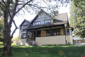
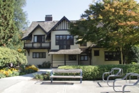
- The R.F. Anderson House contributes to the overall stylistic ambiance of the area and demonstrates that a range of architectural features can be read as a cohesive whole. Although designed primarily in the British Arts and Crafts genre, as were other residences around Deer Lake, it also displays some influences of the popular Craftsman style. It was constructed in the Deer Lake Crescent subdivision, which was originally promoted as an upper class neighbourhood. It represents one of the first residential developments in the City of Burnaby that required buildings to be of a specific value, thus demonstrating the desire for exclusivity among the successful businessmen who chose to settle in the area. The house and grounds illustrate the social, cultural, lifestyle and leisure sensibilities of a successful local businessman and his family in the early twentieth century; Anderson was a New Westminster hardware merchant and Justice of the Peace. The development of the house and grounds within a controlled suburban context also illustrate the values of the owners in the Deer Lake Crescent subdivision, such as social aspiration, racial exclusivity, demonstration of architectural taste, importance of a landscaped garden, and the provision of facilities for fashionable leisure pursuits such as lawn tennis. The estate makes an important contribution to the residential grouping now preserved within Deer Lake Park, and demonstrates the broad social mix of those who chose to live in the area at a time when it was in transition from a market gardening area to a more exclusive residential community. The R.F. Anderson House is important for its association with local architect Frank William Macey (1863-1935), the first resident architect in Burnaby. Macey was born and trained in England where he was well-respected for having published two standard texts for the architectural profession. He settled in Burnaby in the first decade of the twentieth century and obtained a number of commissions from prominent businessmen who were building grand homes in the new community of Deer Lake. He designed these houses mostly in the British Arts and Crafts style.
- Defining Elements
- Key elements that define the heritage character of the R.F. Anderson House include its: - location within a park setting in relation to the W.J. Mathers House - irregular massing of the exterior and its cladding of drop-siding, with half-timbering and rough-cast stucco in the gables - picturesque irregular roofline, including an alteration in pitch over the front verandah, with cedar shingle cladding - interior plan with its generous entrance hall, staircase, and massive staircase window with leaded-lights - multiple-assembly wooden-sash casement windows - quality of interior features such as the Douglas Fir woodwork (some with original varnish finish); original hardware supplied by Anderson's hardware company; and original fireplaces with ornate tile surrounds - setting with the imprint of the lawn tennis court, now a garden terrace, and some of the original plantings
- Locality
- Deer Lake Park
- Historic Neighbourhood
- Burnaby Lake (Historic Neighbourhood)
- Planning Study Area
- Douglas-Gilpin Area
- Architect
- Frank William Macey
- Function
- Primary Current--Government Office
- Primary Historic--Single Dwelling
- Community
- Burnaby
- Cadastral Identifier
- P.I.D. No. 007-525-931 Legal Description: North 225 feet Lot 'C', District Lot 79, Group 1, New Westminster District, Plan 6884
- Boundaries
- The R.F. Anderson House is comprised of a single municipally-owned property located at 6450 Deer Lake Avenue, Burnaby.
- Area
- 63,100.00
- Contributing Resource
- Building
- Landscape Feature
- Ownership
- Public (local)
- Documentation
- Heritage Site Files: PC77000 20. City of Burnaby Planning and Building Department, 4949 Canada Way, Burnaby, B.C., V5G 1M2
- Names
- Macey, Frank W.
- Street Address
- 6450 Deer Lake Avenue
- Street View URL
- Google Maps Street View
Images
R.M. Edgar House
https://search.heritageburnaby.ca/link/landmark543
- Repository
- Burnaby Heritage Planning
- Description
- The R.M. Edgar House is a particularly large wood-frame Craftsman-inspired bungalow on the south shore of Deer Lake, built as a family estate home. It has a symmetrical front elevation, a deep wrap-around verandah, and a pyramidal roof with massive dormers on each face. Set on a large lot and isola…
- Associated Dates
- 1912
- Formal Recognition
- Heritage Designation, Community Heritage Register
- Other Names
- Robert McBeth & Maude Edgar Residence
- Repository
- Burnaby Heritage Planning
- Other Names
- Robert McBeth & Maude Edgar Residence
- Geographic Access
- Deer Lake Drive
- Associated Dates
- 1912
- Formal Recognition
- Heritage Designation, Community Heritage Register
- Enactment Type
- Bylaw No. 9807
- Enactment Date
- 23/11/1992
- Description
- The R.M. Edgar House is a particularly large wood-frame Craftsman-inspired bungalow on the south shore of Deer Lake, built as a family estate home. It has a symmetrical front elevation, a deep wrap-around verandah, and a pyramidal roof with massive dormers on each face. Set on a large lot and isolated from its neighbours, the house is surrounded by a manicured naturalistic landscape.
- Heritage Value
- The R.M. Edgar House represents an alternative reading of the aesthetic and lifestyle values of those who settled on these lakeside estates in the early twentieth century. By comparison with the grand mansions, set in formally landscaped gardens, on the north shore of Deer Lake, the R.M. Edgar House demonstrates a reverence for the natural, wooded environs, and a deliberate orientation near a stream running through the property. The house is important for its connection with Robert McBeth Edgar, not only a successful and wealthy businessman (partner in the real estate firm Hampton and Edgar) but also an active supporter of the Liberal party, Dominion Returning Officer for Vancouver, and Burnaby Councillor for six years; his contribution to Burnaby and British Columbia was far-reaching and significant. The house illustrates the desire for a simpler lifestyle and retreat into nature of those who settled on the south shore of Deer Lake and also this community's attraction for those of an artistic temperament. Maude Edgar was a poet and broadcaster; and the Edgar's daughter - Ann, known as 'Bebe' - was an accomplished sculptress. This was the first house built on the south shore of Deer Lake.
- Defining Elements
- Key elements that define the heritage character of the R.M. Edgar House include its: - overall bungalow massing and its location facing Deer Lake and backing onto a wilderness of Douglas Fir and moss-covered rocks, with a stream running through the site - remnants of the original landscaping such as the box hedge, rockeries and granite retaining walls - the surrounding naturalistic landscape augmented by ornamental cedars, maples, and rhododendrons - square floor plan with a deep enclosed verandah under a prominent broad hipped roof - symmetrical gable dormers - internal brick chimneys, including one at the centre peak of the roof - Craftsman-influenced exterior with such characteristics as: woodwork brackets on the square verandah pillars; deep overhanging roof eaves; and exposed rafter tails - multiple-assembly 12-paned casement wooden-sash windows in the dormers with 6-paned transoms - rustic Arts and Crafts interior with such items as Douglas fir paneling and large granite fireplace in the Drawing Room
- Locality
- Deer Lake Park
- Historic Neighbourhood
- Burnaby Lake (Historic Neighbourhood)
- Planning Study Area
- Morley-Buckingham Area
- Function
- Primary Current--Single Dwelling
- Primary Historic--Estate
- Community
- Burnaby
- Cadastral Identifier
- P.I.D. No. 001-178-024 and P.I.D. No. 001-178-016 Legal Description: Parcel 'D' (Explanatory Plan 4272) District Lot 85, Group 1, New Westminster District and Parcel 'W' (Explanatory Plan 255) District Lot 85, Group 1, New Westminster District
- Boundaries
- The R.M. Edgar House is comprised of a single municipally-owned property located at 6450 Deer Lake Drive, Burnaby.
- Area
- 11,661.30
- Contributing Resource
- Building
- Landscape Feature
- Ownership
- Public (local)
- Documentation
- Heritage Site Files: PC77000 20. City of Burnaby Planning and Building Department, 4949 Canada Way, Burnaby, B.C., V5G 1M2
- Street Address
- 6450 Deer Lake Drive
Images
Robert A.C. Dick at home
https://search.heritageburnaby.ca/link/archivedescription37135
- Repository
- City of Burnaby Archives
- Date
- [between 1911 and 1919]
- Collection/Fonds
- Burnaby Historical Society fonds
- Description Level
- Item
- Physical Description
- 1 photograph : b&w ; 7 x 12.5 cm print
- Scope and Content
- Photograph of Robert A.C. Dick sitting at the table reading a book in his home in the Edmonds district. A number of art pieces are hanging on the wall.
- Repository
- City of Burnaby Archives
- Date
- [between 1911 and 1919]
- Collection/Fonds
- Burnaby Historical Society fonds
- Subseries
- Disney family subseries
- Physical Description
- 1 photograph : b&w ; 7 x 12.5 cm print
- Description Level
- Item
- Record No.
- 325-007
- Access Restriction
- No restrictions
- Reproduction Restriction
- No known restrictions
- Accession Number
- BHS1996-04
- Scope and Content
- Photograph of Robert A.C. Dick sitting at the table reading a book in his home in the Edmonds district. A number of art pieces are hanging on the wall.
- Subjects
- Furniture
- Names
- Dick, Robert A.C.
- Media Type
- Photograph
- Photographer
- Disney, John Harold "Jack"
- Notes
- Title based on contents of photograph
- Historic Neighbourhood
- Edmonds (Historic Neighbourhood)
Images
Robert & Mary B. McLennan House
https://search.heritageburnaby.ca/link/landmark634
- Repository
- Burnaby Heritage Planning
- Description
- Residential building.
- Associated Dates
- 1911
- Street View URL
- Google Maps Street View
- Repository
- Burnaby Heritage Planning
- Geographic Access
- Yale Street
- Associated Dates
- 1911
- Description
- Residential building.
- Heritage Value
- Robert McLennan was the vice-president of the prominent Vancouver hardware firm of McLennan, McFeely & Company, popularly known as Mc.& Mc. Born in Pictou, Nova Scotia in 1861, Robert McLennan entered the hardware business at age fifteen. The West was an irresistible lure, and after he moved to Victoria in 1884, he took on a friend, Edward J. McFeely, as a business partner. Their business was a success and they soon opened a branch in the rapidly-developing new city of Vancouver. In 1898, Robert went to Dawson, where he opened a branch operation and served as mayor for one year in 1903. He returned to Vancouver in 1904, and as the business expanded, E.G. Prior was taken on as partner. In addition to his business pursuits, the public-spirited McLennan served on many boards and committees. In 1887, Robert returned to Nova Scotia where he married Bessie Archibald McKenzie. They had nine children, one of whom was born in Dawson. Robert died in 1927, and Bessie died in 1941. This grand residence was one of the first to be built in the Vancouver Heights subdivision, and its spectacular location retains panoramic views of Burrard Inlet and the North Shore. This house was undoubtedly designed by a local architect as it is an excellent example of the British Arts and Crafts style, with a shingled exterior, half-timbered gables and prominent brick chimneys. Although the west verandah has been enclosed and the windows altered, the house has been well maintained. Although owned by the McLennans, it may have been an investment property, as they lived for many years at a Vancouver address. In 1926, the house was sold to Vancouver Medical Health Officer, F.T. Underhill.
- Locality
- Vancouver Heights
- Historic Neighbourhood
- Vancouver Heights (Historic Neighbourhood)
- Planning Study Area
- Burnaby Heights Area
- Area
- 576.00
- Contributing Resource
- Building
- Ownership
- Private
- Street Address
- 3789 Yale Street
- Street View URL
- Google Maps Street View
Images
Roy & Catherine Cummins House
https://search.heritageburnaby.ca/link/landmark506
- Repository
- Burnaby Heritage Planning
- Description
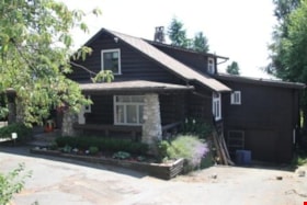
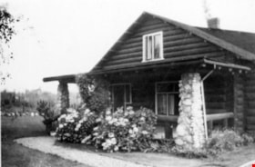
- Located on Rumble Street in the Alta Vista neighbourhood, the Roy and Catherine Cummins House is a one and one-half storey, front-gabled rustic Arts and Crafts house, distinguished by the use of log construction and fieldstone verandah columns.
- Associated Dates
- 1912
- Formal Recognition
- Heritage Designation, Community Heritage Register
- Street View URL
- Google Maps Street View
- Repository
- Burnaby Heritage Planning
- Geographic Access
- Rumble Street
- Associated Dates
- 1912
- Formal Recognition
- Heritage Designation, Community Heritage Register
- Enactment Type
- By-law No. 11959
- Enactment Date
- 17/10/2005
- Description
- Located on Rumble Street in the Alta Vista neighbourhood, the Roy and Catherine Cummins House is a one and one-half storey, front-gabled rustic Arts and Crafts house, distinguished by the use of log construction and fieldstone verandah columns.
- Heritage Value
- The Roy and Catherine Cummins House is valued for its association with the early settlement of Burnaby. Its construction is linked to the opening of the Burnaby Lake Interurban line, which ran through the central part of Burnaby, providing access between Vancouver and New Westminster. The accessibility of the area, combined with spectacular views of the Fraser River, made Alta Vista a desirable Edwardian era middle-class neighbourhood. The house was built in 1912 for Roy Franklin Cummins and his wife, Catherine Emma Cummins (née Cook), shortly after their marriage. Roy Cummins was a lineman with the B.C. Electric Railway Company, an economic driving force in Burnaby. The Roy and Catherine Cummins House is a unique and sophisticated local example of a rustic Arts and Crafts structure. Roy Cummins constructed the house from logs cleared for the construction of Rumble Street; the house is also unique for its use of local fieldstone for its verandah columns and chimney. Reminiscent of park lodge architecture, it exemplifies the semi-wild nature of the area as it was being opened for subdivision. It is also an indication of how far Burnaby was removed from the more urban lifestyles and attitudes of Vancouver and New Westminster.
- Defining Elements
- Key elements that define the heritage character of the Roy and Catherine Cummins House include its: - location on a steeply sloping site in the Alta Vista neighbourhood of Burnaby - residential form, scale and massing as expressed by its one and one-half storey height plus full basement, front-gabled roof and shed dormer, full open front verandah and partial rear verandah - peeled log construction including notched corner posts, log verandah roof framing and log balustrades - masonry elements including fieldstone verandah columns and internal chimney, and board-formed concrete foundations with fieldstone aggregate - rustic Arts and Crafts features such as the use of natural materials, tapered columns, front door with sidelights and exposed eave purlins - original windows, including wooden sash casement windows in multiple assembly with continuous transoms - interior features including fir-panelled walls, wooden mouldings and fieldstone fireplace - associated landscape features including terraced stone walls
- Historic Neighbourhood
- Alta Vista (Historic Neighbourhood)
- Planning Study Area
- Sussex-Nelson Area
- Function
- Primary Historic--Single Dwelling
- Primary Current--Single Dwelling
- Community
- Alta Vista
- Cadastral Identifier
- P.I.D.026-635-534
- Boundaries
- The Roy and Catherine Cummins House is comprised of a single residential lot located at 4156 Rumble Street, Burnaby.
- Area
- 718
- Contributing Resource
- Building
- Ownership
- Private
- Documentation
- City of Burnaby Planning and Building Department, Heritage Site Files
- Street Address
- 4156 Rumble Street
- Street View URL
- Google Maps Street View
Images
Schou Street School
https://search.heritageburnaby.ca/link/landmark637
- Repository
- Burnaby Heritage Planning
- Description
- School building.
- Associated Dates
- 1914
- Street View URL
- Google Maps Street View
- Repository
- Burnaby Heritage Planning
- Geographic Access
- Norfolk Street
- Associated Dates
- 1914
- Description
- School building.
- Heritage Value
- This school was built to replace tents and temporary buildings that had previously been used for the local children of the Broadview neighbourhood. The site was donated to the School Board in 1911 by the real estate firm of Leibly & Blumer in anticipation of increased settlement in the district. The school was named after the street, which had been named after Nicolai Schou, Burnaby’s second Reeve. Originally designed in the Arts and Crafts style, the character of the school was altered in 1964 when its original siding was covered in stucco and the windows were replaced, but has retained its original form and massing, including its front gabled entrance with recessed doorway and twinned square columns. Of special note is the name of the school above the front entry.This school was designed by Joseph H. Bowman (1864-1943), a specialist in school buildings, who was retained as the school board architect for South Vancouver and Burnaby. One of his first designs for Burnaby was a utilitarian two-storey school that could be built with two classrooms and later expanded to eight rooms as the district’s school population grew; five schools from this design were built in 1908, and then four others in modified versions between 1910-16, including this school.
- Locality
- Broadview
- Historic Neighbourhood
- Broadview (Historic Neighbourhood)
- Planning Study Area
- Cascade-Schou Area
- Architect
- Joseph H. Bowman
- Area
- 7660.46
- Contributing Resource
- Building
- Street Address
- 4054 Norfolk Street
- Street View URL
- Google Maps Street View
Images
SFU/Burnaby Centennial Committee fonds
https://search.heritageburnaby.ca/link/archivedescription97236
- Repository
- City of Burnaby Archives
- Date
- [191-?] (date of original) -2015
- Collection/Fonds
- SFU/Burnaby Centennial Committee fonds
- Description Level
- Fonds
- Physical Description
- 10 cm. of textual records and other material.
- Scope and Content
- Records consist of material created and collected by the SFU/Burnaby Centennial Committee in celebration of Burnaby's Centennial in 1992. Celebration projects undertaken by the Committee include: Image Bank project; Centennial Oral History project; Burnaby at 100 video series; and two publications:…
- Repository
- City of Burnaby Archives
- Date
- [191-?] (date of original) -2015
- Collection/Fonds
- SFU/Burnaby Centennial Committee fonds
- Physical Description
- 10 cm. of textual records and other material.
- Description Level
- Fonds
- Accession Number
- 2015-03
- 2014-28
- Scope and Content
- Records consist of material created and collected by the SFU/Burnaby Centennial Committee in celebration of Burnaby's Centennial in 1992. Celebration projects undertaken by the Committee include: Image Bank project; Centennial Oral History project; Burnaby at 100 video series; and two publications: "Burnaby: A Cultural Inventory and Resource Guide" and "Suburb of Happy Homes: Burnaby Centennial Themes".
- History
- The SFU (Simon Fraser University)/Burnaby Centennial Committee was established in 1990 and obtained initial funding from the President of Simon Fraser University, which was matched by a grant authorized by the Mayor and Council of the Municipality of Burnaby. Further funding came from the Burnaby (civic) Centennial Committee after the projects had been accepted as part of the recognition for Burnaby's Centennial celebrations in 1992. The suggestion for this committee originated with Professor Robert Anderson from the School of Communications and he was joined by Professors Veronica Strong-Boag from the Department of History and Leonard J. Evenden from the Department of Geography. Primary responsibilities ended up falling jointly to Professor Evenden and Susan Jamieson-McLarnon. The Committee was made up of the following members who helped to carry out the projects to completion: Rodney Fowler (SFU Department of Geography), Terry Fowler (Adler School of Professional Psychology, Chicago), Edward Gibson (SFU Department of Geography and Director of the Simon Fraser Gallery), James Ross (SFU Archivist), Allen Seager (Department of History), Grant Strate (SFU Fine and Performing Arts), and Arthur Wirick (representing Burnaby Municipal Centennial Committee). Other members of the university community contributed their expertise in a variety of ways, including: Jack Corse (SFU Librarian), Stephen Duguid (Institute of Humanities), Christine Hearn (Continuing Studies), Ken Mennel (Media and Public Relations), Jane Parkinson (Historian and Researcher), Stanley Shapiro (Business Administration) and Jerry Zaslove (Institute for the Humanities). Rodney Fowler also filled the position of committee coordinator. The committee's first undertaking was to explore the extent and availability of historical resources in the community of Burnaby. Two graduate students were hired to help carry out this work in the summer of 1991, which took two forms: a document-based study and an oral history project. The document-based history resulted in an inventory of 'archival' resources titled "Burnaby: A Cultural Inventory and Resource Guide," and the Oral History Project consisted of interviews with 11 Burnaby citizens. With the culmination of these two projects, a day-long workshop was held with both the SFU and the Burnaby municipal committees and other members of the Burnaby community who were pursuing various centennial projects of their own. Following the workshop and several meetings, the committee proposed other projects in addition to the Cultural Inventory and Oral History Project. The other completed projects consisted of: "The Burnaby Image Bank" which included an exhibition titled, "Images of Burnaby"; a finding aid video titled, "Burnaby's Photographic Family Album / Burnaby Image Bank Collection / Volume 1 / 1992"; a video titled "Burnaby at 100: Images and Voices"; a book of essays titled, "Suburb of Happy Homes: Burnaby Centennial Themes"; and a dance festival sponsored by The Centre for the Arts. "Suburb of Happy Homes: Burnaby Centennial Themes", dedicated to the citizens and students of Burnaby, and to the students of Simon Fraser University, was published in 1995. For this project, Leonard Evenden received the City of Burnaby Heritage Award in 1997. A companion project to the book of essays consisted of a map project which illustrated the development of settlement within the city, but it never came to fruition due to funding constraints.
- Media Type
- Textual Record
- Photograph
- Sound Recording
- Moving Images
- Notes
- Title based on contents of fonds
- PC 576, MI 579, MSS 187
![Robert A.C. Dick at home, [between 1911 and 1919] thumbnail](/media/hpo/_Data/_Archives_Images/_Unrestricted/316/325-007.jpg?width=280)
