Narrow Results By
Subject
- Arts - Paintings 1
- Buildings - Commercial - Grocery Stores 2
- Buildings - Heritage 1
- Buildings - Schools 2
- Documentary Artifacts - Newspapers 1
- Documentary Artifacts - Photographs 1
- Education 1
- Geographic Features - Lakes and Ponds 1
- Geographic Features - Mountains 2
- Industries - Mining 1
- Occupations - Designers 2
- Occupations - Gold Miners 1
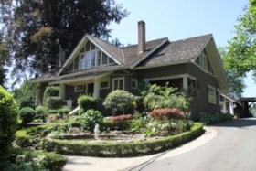
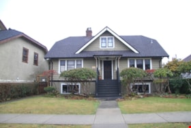
Frederick & Edna Cunningham House
https://search.heritageburnaby.ca/link/landmark522
- Repository
- Burnaby Heritage Planning
- Description
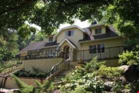
- Set back from Douglas Road, the Frederick and Edna Cunningham House is a picturesque wood-frame one and one-half storey British Arts and Crafts-style residence, clad with rough-cast stucco and featuring half-timbering in the gable ends. Set far back on a large east-sloping site in a mature landscap…
- Associated Dates
- 1923
- Formal Recognition
- Heritage Designation, Community Heritage Register
- Street View URL
- Google Maps Street View
- Repository
- Burnaby Heritage Planning
- Geographic Access
- Douglas Road
- Associated Dates
- 1923
- Formal Recognition
- Heritage Designation, Community Heritage Register
- Enactment Type
- Bylaw No. 10470
- Enactment Date
- 04/11/1996
- Description
- Set back from Douglas Road, the Frederick and Edna Cunningham House is a picturesque wood-frame one and one-half storey British Arts and Crafts-style residence, clad with rough-cast stucco and featuring half-timbering in the gable ends. Set far back on a large east-sloping site in a mature landscape setting, it is located in the Douglas Road neighbourhood located in the central valley of Burnaby.
- Heritage Value
- Considered a landmark in the Douglas Road neighbourhood, the Cunningham House is valued as a good example of a British Arts and Crafts-style residence. The house blends into its surroundings, which are extensively landscaped with rockeries, lawns, shrubs, trees and perennial beds. The two majestic copper beech trees, over 60 years old, are among the best specimens of their type to be found in Greater Vancouver and are protected under covenant. The Cunningham property is significant as one of the last estate homes remaining on the old Douglas Road, at one time noted for its beautiful estates set within the rural character of Burnaby’s Central Valley. Insurance agent Frederick Woodman Cunningham (1882-1963) and his wife, Edna Elizabeth Cunningham (1884-1982), built this country residence in 1923. Fred was the only son of James Cunningham, a pioneer of New Westminster who arrived in 1862 and served as the City’s Mayor from 1872 to 1874. The landmark flagpole that once stood in the garden was moved to this site when Fred Cunningham's prestigious family home in New Westminster at Third Avenue and Seventh Street was demolished in 1938. Kept within the family until 1982 and largely maintained in its original condition, the Cunningham House is an excellent example of one of Burnaby's best estate homes from the 1920s and was designated by the City of Burnaby in 1996.
- Defining Elements
- Key elements that define the heritage character of the Cunningham House include its: - location on Douglas Road, in Burnaby’s Central Valley - views from the property to the east and towards the North Shore - residential form, scale and massing as exemplified by its one and one-half storey height and rectangular plan - side gabled roof with front gabled dormer and cedar shingle cladding - British Arts and Crafts elements such as its rough-cast stucco, tapered porch columns, large eave brackets, exposed purlins and half-timbering - irregular fenestration including double-hung 1-over-1 wooden-sash windows, multi-pane wooden-sash casement windows and multiple-assembly windows in the gable ends - front entrance porch with shed roof - two internal red brick chimneys - early cedar-shingled garage at side of house - associated landscape features, including two landmark Copper beech trees and landscaped rockeries at the front of the property
- Historic Neighbourhood
- Burnaby Lake (Historic Neighbourhood)
- Planning Study Area
- Douglas-Gilpin Area
- Function
- Primary Historic--Single Dwelling
- Primary Current--Single Dwelling
- Community
- Burnaby
- Cadastral Identifier
- 003-118-746
- Boundaries
- The Cunningham House is comprised of a single residential lot located at 3555 Douglas Road, Burnaby.
- Area
- 4446.5
- Contributing Resource
- Building
- Ownership
- Private
- Street Address
- 3555 Douglas Road
- Street View URL
- Google Maps Street View
Images
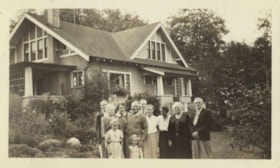
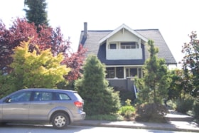
Louis & Annie Hill Residence
https://search.heritageburnaby.ca/link/landmark504
- Repository
- Burnaby Heritage Planning
- Description
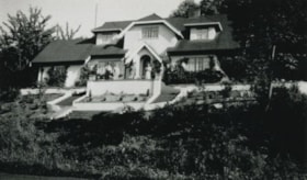
- The Louis and Annie Hill Residence is a modest one-storey, wood-frame, side-gabled Arts and Crafts bungalow with two projecting front gables, that was originally part of the Deer Lake Crescent Subdivision. The lot is heavily treed, and sits near the east end of Deer Lake.
- Associated Dates
- 1925
- Street View URL
- Google Maps Street View
- Repository
- Burnaby Heritage Planning
- Geographic Access
- Deer Lake Avenue
- Associated Dates
- 1925
- Description
- The Louis and Annie Hill Residence is a modest one-storey, wood-frame, side-gabled Arts and Crafts bungalow with two projecting front gables, that was originally part of the Deer Lake Crescent Subdivision. The lot is heavily treed, and sits near the east end of Deer Lake.
- Heritage Value
- The heritage value of the Louis and Annie Hill Residence lies in its association with prominent Burnaby pioneers, Louis Hill (1860-1931) and his wife, Annie Sara Hill (née Kenrick, 1864-1957). Originally from London, England, Louis Hill immigrated to Burnaby circa 1887, and established a small fruit farm on this site in 1891. Hill was elected to the first municipal council in 1892, when Burnaby was incorporated, and was later responsible for the subdivision of Buckingham Estate in the Deer Lake neighbourhood. The Louis and Annie Hill Residence, built as a retirement home in 1925, is further valued as a representation of the continued suburban development of the Deer Lake Crescent Subdivision, that was originally promoted in 1911 as an upper class suburban neighbourhood. Its modest nature illustrates the reduced scale of residential construction during the austere times that followed the end of the First World War. The style of the house demonstrates the late persistence of the Arts and Crafts movement, which remained a strong influence on domestic architecture. In 2006, the Louis and Annie Hill Residence was purchased by the City of Burnaby, and today it is part of the Deer Lake Park Heritage Precinct, Burnaby's most significant collection of historic sites.
- Defining Elements
- Key elements that define the heritage character of the Louis and Annie Hill Residence include its: - location within the Deer Lake Park Heritage Precinct - residential form, scale and massing as expressed by its one-storey height plus crawlspace, side-gabled-roof, front projecting gables, square projecting front bay and open front porch - wood-frame construction with original wood siding intact under a later coat of stucco - modest Arts and Crafts details such as diamond-point triangular eave brackets - windows, including double-hung, 1-over-1 wooden sash windows with horns - associated landscape features, including mature cedars lining the driveway
- Historic Neighbourhood
- Burnaby Lake (Historic Neighbourhood)
- Planning Study Area
- Morley-Buckingham Area
- Function
- Primary Historic--Single Dwelling
- Primary Current--Single Dwelling
- Community
- Deer Lake
- Cadastral Identifier
- P.I.D.012-446-963
- Boundaries
- The Louis and Annie Hill Residence is comprised of a single residential lot located at 6570 Deer Lake Avenue, Burnaby.
- Area
- 1521.75
- Contributing Resource
- Building
- Ownership
- Public (local)
- Documentation
- City of Burnaby Planning and Building Department, Heritage Site Files
- Street Address
- 6570 Deer Lake Avenue
- Street View URL
- Google Maps Street View
Images
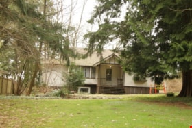
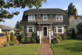
Mortimer-Lamb House
https://search.heritageburnaby.ca/link/landmark494
- Repository
- Burnaby Heritage Planning
- Description
- The Mortimer-Lamb House is a one and one half-storey, Arts and Crafts-style residence with a steeply pitched, side-gabled roof. The original cottage form has been enlarged with a later addition on the west side of the house. Located next to the Burnaby Lake Regional Park Wildlife Rescue Care Centre…
- Associated Dates
- c.1922
- Formal Recognition
- Community Heritage Register
- Other Names
- Harold & Katherine Mortimer-Lamb Residence
- Street View URL
- Google Maps Street View
- Repository
- Burnaby Heritage Planning
- Other Names
- Harold & Katherine Mortimer-Lamb Residence
- Geographic Access
- Glencarin Drive
- Associated Dates
- c.1922
- Formal Recognition
- Community Heritage Register
- Enactment Type
- Council Resolution
- Enactment Date
- 26/05/2003
- Description
- The Mortimer-Lamb House is a one and one half-storey, Arts and Crafts-style residence with a steeply pitched, side-gabled roof. The original cottage form has been enlarged with a later addition on the west side of the house. Located next to the Burnaby Lake Regional Park Wildlife Rescue Care Centre, the house has picturesque views of Burnaby Lake.
- Heritage Value
- Built circa 1922, the Mortimer-Lamb House is valued for its association with first owners, Harold Mortimer-Lamb (1872-1970), and his wife, Katherine Mary Mortimer-Lamb (1873-1939). Born in Leatherhead, Surrey, England, Harold Mortimer-Lamb immigrated to Canada in 1889. Seven years later in Vancouver, he married Katherine Mary Lindsay, a native of Winnipeg. Mortimer-Lamb was a key figure in the B.C. mining industry, serving as Secretary of the Mining Association of B.C. between 1900 and 1945, and also as the Secretary of the Canadian Institute of Mining and Metallurgy. In addition to his professional life, Mortimer-Lamb was a pioneer art photographer and was among Canada's leading art critics, and this house served as a central gathering place for renowned Canadian artists of the day. Mortimer-Lamb’s daughter, Molly Lamb Bobak (born 1922), became a renowned watercolourist, and was the only woman ever hired as an official Canadian war artist. The Mortimer-Lamb House is a significant example of the work of noted architect, Samuel Maclure (1860-1929) and his partner, Ross Lort (1889-1969). Maclure, who was a close friend of the Mortimer-Lamb family, was British Columbia's leading residential architect, and was renowned for his high quality designs for prominent citizens in both Vancouver and Victoria. Maclure was a leading exponent of the Art and Crafts design movement in B.C., and established a sophisticated local variation of residential architecture. The Mortimer-Lamb House was designed at the time when Maclure was in partnership with Ross Lort. In 1907, Lort began working for Maclure's firm as a draftsman, and by 1920 was in charge of Maclure's Vancouver office. Lort's architectural career spanned some sixty-years, and he designed some of the province's most familiar houses, apartments, institutions and places of worship. The Mortimer-Lamb House is also a significant local example of the Arts and Crafts style, and incorporates elements such as board-and-batten siding on the ground floor, shingled gables and leaded casement windows. It is a testament to the domestic architecture built outside of established suburbs during the post-First World War era, typically modest in scale and representative of middle-class residential ideals.
- Defining Elements
- Key elements that define the heritage character of the Mortimer-Lamb House include its: - treed setting with views of Burnaby Lake - residential form, scale and massing as expressed by its one and one-half storey height, rectangular plan and steeply pitched side-gabled roof - wood-frame construction - Arts and Crafts elements such as board-and-batten siding on the ground floor, cedar shingles in the gables and open soffits - original straight-leaded casement windows in single and multiple-assembly - internal red-brick chimney with corbelled cap
- Historic Neighbourhood
- Burnaby Lake (Historic Neighbourhood)
- Planning Study Area
- Burnaby Lake Area
- Organization
- Mining Association of B.C.
- G.F. and J. Galt Limited
- Architect
- Samuel Maclure
- Ross Lort
- Function
- Primary Historic--Single Dwelling
- Primary Current--Single Dwelling
- Community
- Burnaby Lake
- Cadastral Identifier
- P.I.D.002-977-788
- Boundaries
- The Mortimer-Lamb House is comprised of a single residential lot located at 5180 Glencairn Drive, Burnaby.
- Area
- 5652.78
- Contributing Resource
- Building
- Ownership
- Private
- Documentation
- City of Burnaby Planning and Building Department, Heritage Site Files
- Street Address
- 5180 Glencarin Drive
- Street View URL
- Google Maps Street View
Images
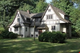
Stanley & Isabel Picken House 'Aintree'
https://search.heritageburnaby.ca/link/landmark519
- Repository
- Burnaby Heritage Planning
- Description
- Nestled within a stand of deciduous trees, the Stanley and Isabel Picken House 'Aintree' is a two and one-half storey plus basement shingled and half-timbered Arts and Crafts influenced residence, set on its original 0.6 hectare site adjacent to Brunette Creek in the Burnaby Lake Regional Nature Pa…
- Associated Dates
- 1929
- Formal Recognition
- Heritage Designation, Community Heritage Register
- Street View URL
- Google Maps Street View
- Repository
- Burnaby Heritage Planning
- Geographic Access
- Cariboo Road
- Associated Dates
- 1929
- Formal Recognition
- Heritage Designation, Community Heritage Register
- Enactment Type
- Bylaw No. 11756
- Enactment Date
- 09/08//2004
- Description
- Nestled within a stand of deciduous trees, the Stanley and Isabel Picken House 'Aintree' is a two and one-half storey plus basement shingled and half-timbered Arts and Crafts influenced residence, set on its original 0.6 hectare site adjacent to Brunette Creek in the Burnaby Lake Regional Nature Park.
- Heritage Value
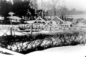
- 'Aintree' is an example of the type of private country estate residences built in Burnaby outside of the established suburbs during the 1920s, and is representative of middle-class residential life during this time. Stanley Boyd Picken (1890-1950) and Isabel Grace Frederique Picken (1893-1971) purchased this property in 1927 to establish the Aintree Dog Kennels, which was the first in the province to breed Irish Setters. This country residence was completed in 1929. Stanley Picken worked at a variety of other jobs including his position as keeper of the Brunette River Caribou Dam. Considered a fine example of romantic architecture, 'Aintree' stands in harmony with its woodland setting. The north wing was added in a compatible style in 1932 using former bridge support beams from the old Caribou Road Bridge for foundation support. 'Aintree' retains most of its original exterior elements including its picturesque shingled siding and half-timbering, demonstrating the late influence of an Arts and Crafts sensibility considered compatible with a country lifestyle.
- Defining Elements
- Key elements that define the heritage character of 'Aintree' include its: - woodland setting adjacent to Brunette Creek in the Burnaby Lake Regional Nature Park, with a deep setback from Cariboo Road - residential form, scale and massing as exemplified by its asymmetrical two and one-half storey plus basement height and irregular U-shaped plan - romantic Arts and Crafts influence as expressed in elements such as half-timbering on the upper storeys and hand-split cedar shake wall cladding - steeply pitched cross-gabled roofs with dormers connected by a lower central gabled roof, and 'cat slide' extension over side entry - regular fenestration, including wooden-sash casement windows with diamond leaded glass - red brick internal chimney with corbelled cap - associated landscape features, such as a curving driveway leading to the house, an early garage, grassed yard and a backdrop of mature deciduous trees
- Historic Neighbourhood
- Burquitlam (Historic Neighbourhood)
- Planning Study Area
- Burnaby Lake Area
- Function
- Primary Historic--Single Dwelling
- Community
- Burnaby
- Cadastral Identifier
- 010-867-147
- Boundaries
- 'Aintree' is comprised of a single residential lot located at 6825 Cariboo Road, Burnaby.
- Area
- 5436.75
- Contributing Resource
- Building
- Ownership
- Private
- Names
- Picken, Stanley
- Street Address
- 6825 Cariboo Road
- Street View URL
- Google Maps Street View
Images
Drs. Blythe and Violet Eagles Estate
https://search.heritageburnaby.ca/link/landmark535
- Repository
- Burnaby Heritage Planning
- Description
- The Drs. Blythe and Violet Eagles Estate is a one hectare property located within Deer Lake Park in Burnaby. The property encompasses a carefully conceived garden of local, non-conventional, and exotic plantings. Conceived as a series of rockeries and terraces, the garden cascades from the house do…
- Associated Dates
- 1929
- Formal Recognition
- Heritage Designation, Community Heritage Register
- Other Names
- Eagles Estate Heritage Garden
- Street View URL
- Google Maps Street View
- Repository
- Burnaby Heritage Planning
- Other Names
- Eagles Estate Heritage Garden
- Geographic Access
- Sperling Avenue
- Associated Dates
- 1929
- Formal Recognition
- Heritage Designation, Community Heritage Register
- Enactment Type
- Bylaw No. 11592
- Enactment Date
- 15/09/2003
- Description
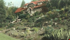
- The Drs. Blythe and Violet Eagles Estate is a one hectare property located within Deer Lake Park in Burnaby. The property encompasses a carefully conceived garden of local, non-conventional, and exotic plantings. Conceived as a series of rockeries and terraces, the garden cascades from the house down towards the waterfront, divided by paths and strips of plantings.
- Heritage Value
- The Eagles Estate is significant because of its unique character within Burnaby’s Deer Lake Park heritage precinct, and the people who were its creators and residents. The garden is a unique expression of the talents and tastes of both the Eagles and Frank Ebenezer Buck (1875-1970). Buck served as the Assistant Dominion Horticulturist in charge of landscape horticulture and floriculture in Ottawa from 1912. In 1920, he was head of the Horticultural Department and the Campus Landscape Architect at the University of British Columbia. He established the plan for the Eagles garden while Dr. Blythe Alfred Eagles (1902-1990), the long-time Dean of the Faculty of Agriculture at UBC, selected many of the plantings. The Eagles themselves designed the house as a romantic cottage inspired by the British Arts and Crafts style. Trained in enzyme chemistry, Dr. Violet Evelyn (Dunbar) Eagles (1899-1994) was an enthusiastic amateur gardener, and was perhaps the driving force behind the maintenance and continued development of the garden. The Eagles were also well known in Burnaby for their active volunteerism in the local community as well as at UBC. When Simon Fraser University opened in Burnaby as the Greater Vancouver’s second university, the Eagles, in particular Violet, became well-known for entertaining dignitaries and special guests of the university in their lavish garden. Drs. Blythe and Violet Eagles were recognized for their good citizenship and the ongoing use of their garden for charitable Burnaby-based functions and celebrations.
- Defining Elements
- Due to the extensive and varied nature of the garden, the character-defining elements of the Eagles Estate are many and complex. The elements that encompass the character of the site include its: - British Arts and Crafts-inspired house with original exterior features such as a picturesque roofline, stucco cladding and six- and eight-paned steel-frame casement windows, and original interior features such as the central fireplace, wood floors and kitchen cabinetry - formal staircase leading to the north (formal entry) side of the house - carefully planned yet informal garden design, with 'garden rooms' used to create intimacy - terraced landscape cascading from the house down to the garden - incorporation of local, exotic, flowering and non-flowering plants. - contrast of manicured versus freely growing landscape elements - use of wood lattice fencing gates, arbors and trellis
- Historic Neighbourhood
- Burnaby Lake (Historic Neighbourhood)
- Planning Study Area
- Morley-Buckingham Area
- Community
- Burnaby
- Cadastral Identifier
- P.I.D. No. 007-302-801 Legal Description: Lot 143, District Lot 85, Group 1, New Westminster District, Plan 36335
- Boundaries
- The Eagles Estate is comprised of a single municipally-owned property located at 5655 Sperling Avenue, Burnaby.
- Area
- 6,403.91
- Contributing Resource
- Building
- Landscape Feature
- Documentation
- Heritage Site Files: PC77000 20. City of Burnaby Planning and Building Department, 4949 Canada Way, Burnaby, B.C., V5G 1M2
- Street Address
- 5655 Sperling Avenue
- Street View URL
- Google Maps Street View
Images
'The Gables'
https://search.heritageburnaby.ca/link/landmark516
- Repository
- Burnaby Heritage Planning
- Description
- 'The Gables' is a one and one-half storey plus basement residence with a distinctive cross-gambrel roof. The foundations and first storey facade are constructed of granite rubble-stone with raised pointing, and the remainder of the house is clad in cedar shingles. It is now part of the Tudor Grove …
- Associated Dates
- 1920
- Formal Recognition
- Heritage Designation, Community Heritage Register
- Other Names
- John & Christina Mackie House
- Street View URL
- Google Maps Street View
- Repository
- Burnaby Heritage Planning
- Other Names
- John & Christina Mackie House
- Geographic Access
- Arbroath Street
- Southoaks Crescent
- Associated Dates
- 1920
- Formal Recognition
- Heritage Designation, Community Heritage Register
- Enactment Type
- Bylaw No. 10314
- Enactment Date
- 15/01/1996
- Description
- 'The Gables' is a one and one-half storey plus basement residence with a distinctive cross-gambrel roof. The foundations and first storey facade are constructed of granite rubble-stone with raised pointing, and the remainder of the house is clad in cedar shingles. It is now part of the Tudor Grove residential complex.
- Heritage Value
- The residence is valued as the house of John Mackie (1879-1937) and Christina Mackie (1881-1959) and is significant as the last house remaining from the original Highland Park subdivision. The area was first laid out in 1902, and then remarketed by C.L. Merritt and Company in 1911 as 'Gilley Park - the Suburb Beautiful.' Located on the B.C. Electric Railway interurban line, this was one of many middle-class commuter suburbs in Burnaby promoted during the Edwardian era. These suburbs were reflective of the City Beautiful Movement, a process of urbanization that sought to create morally, socially and aesthetically uplifting civic environments. The site is significant as a rare example of a modest residence incorporating high quality Arts and Crafts stylistic elements. Unusual for a house of this moderate scale, the foundation, first storey walls and chimney are constructed of rough-dressed granite. John Mackie was a stone mason, and it is assumed that he undertook the work himself. The cross gambrel roof is an unusual feature, relatively uncommon in B.C., from which the house derives its name, ‘The Gables.’
- Defining Elements
- Key elements that define the heritage character of 'The Gables' include its: - location in the original Highland Park subdivision - vernacular residential form, scale and massing as exemplified by the one and one-half storey plus basement height, inset porch and symmetrical, rectangular plan - cross-gambrel roof with closed eaves and returned lower edges, clad with cedar shingles - Arts and Crafts influence as exemplified in its use of natural materials such as rough-dressed granite rubble-stone foundation, first storey walls and chimney, and cedar shingle siding on the upper storey - other elements of masonry construction, such as the granite window-box brackets, granite stair cheeks and granite interior chimney with rustic cap - wooden-sash windows - house name, ‘The Gables,’ carved into a granite block on the left-hand pier of the front porch
- Historic Neighbourhood
- Edmonds (Historic Neighbourhood)
- Planning Study Area
- Kingsway-Beresford Area
- Function
- Primary Historic--Single Dwelling
- Primary Current--Single Dwelling
- Community
- Burnaby
- Cadastral Identifier
- 002-837-765
- Boundaries
- 'The Gables' is comprised of a single residential lot located at 6445 Arbroath Street, Burnaby.
- Area
- 5453.12
- Contributing Resource
- Building
- Ownership
- Private
- Street Address
- 6445 Arbroath Street
- Street View URL
- Google Maps Street View
Images
A.E. Brown Residence
https://search.heritageburnaby.ca/link/landmark553
- Repository
- Burnaby Heritage Planning
- Description
- Residential building.
- Associated Dates
- 1924
- Street View URL
- Google Maps Street View
- Repository
- Burnaby Heritage Planning
- Geographic Access
- Sperling Avenue
- Associated Dates
- 1924
- Description
- Residential building.
- Heritage Value
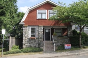
- Built after the end of the First World War, this house features an eclectic blend of Arts and Crafts elements. Constructed for A.E. Brown and a full two storeys in height, it has a front jerkin-headed roof with a jerkin-headed side projection, and a corner wraparound verandah with tapered columns. The house has been maintained in near original condition, with original lapped wooden siding, multi-paned windows and square balusters.
- Locality
- Edmonds
- Historic Neighbourhood
- Edmonds (Historic Neighbourhood)
- Planning Study Area
- Kingsway-Beresford Area
- Ownership
- Private
- Street Address
- 6830 Sperling Avenue
- Street View URL
- Google Maps Street View
Images
Burnaby South High School
https://search.heritageburnaby.ca/link/landmark770
- Repository
- Burnaby Heritage Planning
- Associated Dates
- 1922-1988
- Street View URL
- Google Maps Street View
- Repository
- Burnaby Heritage Planning
- Geographic Access
- Southoaks Crescent
- Associated Dates
- 1922-1988
- Heritage Value
- Burnaby South and Burnaby North were Burnaby's first high schools. The first rooms of the school were built in 1922 on the same grounds as the Kingsway East Elementary School. In 1940, a two-storey building was erected and additions were made in 1963, 1967 and 1972. Kingsway East closed in 1925 and its buildings were used by the high school for Industrial Arts and Home Economics. In the early 1990s, a new "urban education centre" (Burnaby South/B.C. School for the Deaf) was opened, replacing the old Burnaby South High School.
- Historic Neighbourhood
- Edmonds (Historic Neighbourhood)
- Planning Study Area
- Kingsway-Beresford Area
- Street Address
- 6650 Southoaks Crescent
- Street View URL
- Google Maps Street View
Images
Capitol Hill School
https://search.heritageburnaby.ca/link/landmark564
- Repository
- Burnaby Heritage Planning
- Description
- School building.
- Associated Dates
- 1923
- Other Names
- Ecole Capitol Hill Elementary School
- Street View URL
- Google Maps Street View
- Repository
- Burnaby Heritage Planning
- Other Names
- Ecole Capitol Hill Elementary School
- Geographic Access
- Holdom Avenue
- Associated Dates
- 1923
- Description
- School building.
- Heritage Value
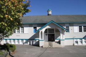
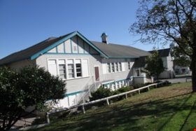
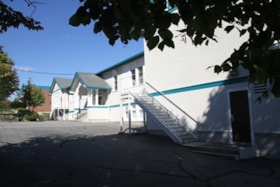
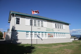
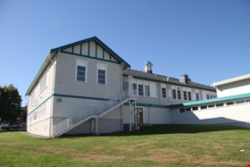
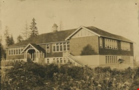
- This school was originally designed by Bowman & Cullerne as a two-storey, four-room school building in 1923, with a two-room addition completed in 1926 and another in 1927. Originally designed in the Arts and Crafts style, it has been altered, with the addition of stucco over the original siding and replacement windows, but has retained its original form and massing, as well as its roof-top ventilator and front gabled entrance with grouped columns. Bowman & Cullerne specialized in school design. After Harold Cullerne (1890-1976) returned from service during the First World War, he joined J.H. Bowman (1864-1943) in a partnership that lasted from 1919 to 1934. The firm’s other school designs included Seaforth School (1922, now relocated to Burnaby Village Museum), Burnaby North High School (1923), and Nelson Avenue School (1927).
- Locality
- Capitol Hill
- Historic Neighbourhood
- Capitol Hill (Historic Neighbourhood)
- Planning Study Area
- Capitol Hill Area
- Architect
- Bowman & Cullerne
- Ownership
- Public (local)
- Subjects
- Buildings - Heritage
- Buildings - Schools
- Street Address
- 350 Holdom Avenue
- Street View URL
- Google Maps Street View
Images
John & Jessie MacLean Residence
https://search.heritageburnaby.ca/link/landmark608
- Repository
- Burnaby Heritage Planning
- Description
- Residential building.
- Associated Dates
- c.1926
- Street View URL
- Google Maps Street View
- Repository
- Burnaby Heritage Planning
- Geographic Access
- Pandora Street
- Associated Dates
- c.1926
- Description
- Residential building.
- Heritage Value
- This cottage illustrates the traditionalism of the interwar years, when domestic ideals were expressed through modest homes displaying period revival influences. Reflecting the influence of the British Arts and Crafts movement, it features a symmetrical plan, a side jerkin-headed roof, a gabled front dormer and twin-coursed shingle siding, and retains its original wooden-sash windows with unusual multi-paned upper sash. It was built for John R. and Jessie MacLean. The house was recently restored by the owners.
- Locality
- Vancouver Heights
- Historic Neighbourhood
- Vancouver Heights (Historic Neighbourhood)
- Planning Study Area
- Burnaby Heights Area
- Area
- 566.71
- Contributing Resource
- Building
- Ownership
- Private
- Street Address
- 3827 Pandora Street
- Street View URL
- Google Maps Street View
Images
Rev. James Black Residence
https://search.heritageburnaby.ca/link/landmark632
- Repository
- Burnaby Heritage Planning
- Description
- Residential building.
- Associated Dates
- 1925
- Street View URL
- Google Maps Street View
- Repository
- Burnaby Heritage Planning
- Geographic Access
- Sussex Avenue
- Associated Dates
- 1925
- Description
- Residential building.
- Heritage Value
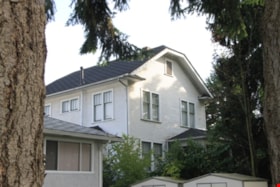
- This home was built as a retirement home for Baptist Missionary Reverend James Black and his family in 1925; the Black family resided in the home until the early 1970s. The Black Residence is a good example of the Period Revival movement that occurred between the two World Wars. At the time, it was considered good taste for a house to have an identifiable historical style. The Black Residence was likely designed by a local architect or built by a contractor using a pattern book plan, and the British Arts and Crafts influence was typical of many middle class homes of the period built in Burnaby. The house was originally located facing Sardis Street with a beautiful garden landscape that was lost when the house was relocated in 2005.
- Locality
- Central Park
- Historic Neighbourhood
- Central Park (Historic Neighbourhood)
- Planning Study Area
- Marlborough Area
- Area
- 639.00
- Contributing Resource
- Building
- Ownership
- Private
- Street Address
- 5688 Sussex Avenue
- Street View URL
- Google Maps Street View
Images
George & Rose Nuttall Residence
https://search.heritageburnaby.ca/link/landmark585
- Repository
- Burnaby Heritage Planning
- Description
- Residential building.
- Associated Dates
- 1921
- Other Names
- HILLCREST
- Street View URL
- Google Maps Street View
- Repository
- Burnaby Heritage Planning
- Other Names
- HILLCREST
- Geographic Access
- McGill Street
- Associated Dates
- 1921
- Description
- Residential building.
- Heritage Value
- This house was built for local plumber contractor George Nuttall (1883-1970) and his wife Rose Ann Nuttall (née Clagg, 1881-1955). George continued to live in the house after Rose’s death, until his own death in 1970. Although typical of the Craftsman style and form with its side-gabled roof, triangular eave brackets and front gabled dormer, this house has a number of special details, such as its beautiful art glass transom windows. The front verandah supports are massive stucco columns that contain stained glass lanterns with the house name, Hillcrest, and address.
- Locality
- Vancouver Heights
- Historic Neighbourhood
- Vancouver Heights (Historic Neighbourhood)
- Planning Study Area
- Burnaby Heights Area
- Area
- 566.71
- Contributing Resource
- Building
- Ownership
- Private
- Street Address
- 3756 McGill Street
- Street View URL
- Google Maps Street View
Images
Personal material
https://search.heritageburnaby.ca/link/archivedescription82732
- Repository
- City of Burnaby Archives
- Date
- [1910-1978]
- Collection/Fonds
- Hazel Simnett collection
- Description Level
- File
- Physical Description
- 9 paintings : colour print, 2 photographs : b&w, and 1 folder of textual records
- Scope and Content
- File consists of application for a driver's license, Kingsway Driving School report card, driver's examination receipt and a letter addressed to Hazel Simnett from the Victorian Order of Nurses for Canada. Also included is an immigration inspection card of Fred Simnett aboard the S.S. Lake Champlai…
- Repository
- City of Burnaby Archives
- Date
- [1910-1978]
- Collection/Fonds
- Hazel Simnett collection
- Physical Description
- 9 paintings : colour print, 2 photographs : b&w, and 1 folder of textual records
- Description Level
- File
- Record No.
- MSS167-008
- Accession Number
- 2013-22
- Scope and Content
- File consists of application for a driver's license, Kingsway Driving School report card, driver's examination receipt and a letter addressed to Hazel Simnett from the Victorian Order of Nurses for Canada. Also included is an immigration inspection card of Fred Simnett aboard the S.S. Lake Champlain from Liverpool and a letter from the Office of the Mayor addressed to Mary Ann Simnett for her ninetieth birthday. Also included is a photograph (see item 559-001). Also included are newsclippings regarding Robert Burnaby and the "Bygones of Burnaby" book, a programme of the Robert Burnaby Commemorative Dinner, a photocopy of "The Argus" (Burnaby South High School's newspaper) from 1938, a programme from Madys Pridmore Brown's Variety Programme, "The Buzzer" Volume 40 Issue 16 advertising Vancouver street cars, New Vista Society certificate addressed to Hazel Simnett, an envelope of Fenwick Lansdowne bird prints from 1957 and a print of the Royal Family found in a cardboard envelope postmarked 1972.
- Subjects
- Arts - Paintings
- Documentary Artifacts - Newspapers
- Documentary Artifacts - Photographs
- Performances - Concerts
- Organizations - Societies and Clubs
- Personal Symbols - Certificates
- Transportation
- Persons - Royalty
- Media Type
- Textual Record
- Photograph
- Graphic Material
- Notes
- Title based on note accompanying file on folder ; The Argue was stapled together
- Simnett personal papers series
- Historic Neighbourhood
- Alta-Vista (Historic Neighbourhood)
- Planning Study Area
- Clinton-Glenwood Area
Interview with Annie Boulanger by Rod Fowler April 9, 1990 - Track 6
https://search.heritageburnaby.ca/link/oralhistory488
- Repository
- City of Burnaby Archives
- Date Range
- 1925-1970
- Length
- 00:07:42
- Summary
- This portion of the interview is about Annie Boulanger’s family history, her parents’ origin, work and move to Burnaby, what the Napier Street area looked like in the 1950s and the Government Street neighbourhood in the 1960s, her education and teaching career, and her marriage. She explains why Go…
- Repository
- City of Burnaby Archives
- Summary
- This portion of the interview is about Annie Boulanger’s family history, her parents’ origin, work and move to Burnaby, what the Napier Street area looked like in the 1950s and the Government Street neighbourhood in the 1960s, her education and teaching career, and her marriage. She explains why Government Street has a jog in it at Brighton.
- Date Range
- 1925-1970
- Length
- 00:07:42
- Subjects
- Occupations - Teachers
- Historic Neighbourhood
- Vancouver Heights (Historic Neighbourhood)
- Lozells (Historic Neighbourhood)
- Planning Study Area
- Burnaby Heights Area
- Government Road Area
- Interviewer
- Fowler, Rod
- Interview Date
- April 9, 1990
- Scope and Content
- Recording is of an interview with Annie Boulanger, conducted by Rod Fowler. Annie Boulanger was one of eleven participants interviewed as part of the SFU/Burnaby Centennial Committee's oral history series titled, "Voices of Burnaby". The interview is mainly about Annie Boulanger’s volunteer community work in Burnaby, including initiating the teaching of french and gymnastics at Seaforth School where her children attended, doing historical research and oral histories for Burnaby Heritage Village and the SFU Archives, becoming a long term member of the Burnaby Writers’ Club, being a member and President of Burnaby Arts Council, and member of the Parks Board's Centre for the Performing Arts Committee (1987). The interview focuses attention on the Arts Council’s financial difficulties between 1985 and 1990, and the need for a comprehensive approach to supporting the arts through a municipal arts policy. Annie Boulanger also talks about her parents’ history, their home on Napier Street and her later home on Government Road, her education and teaching career, and her arts journalism. To view “Narrow By” terms for each track expand this description and see “Notes”.
- Biographical Notes
- Annie Urbanovits Boulanger’s parents emigrated from Hungary to Toronto, Louis in 1925 and Irene in 1930, where they married. Louis and Irene Boulanger moved to Vancouver where Louis worked in the Vancouver Shipyards during WWII and then for Nichols Chemical Company in Barnet for 15 years. While the Urbanovits family lived in Cloverdale, Louis commuted to Kask’s Camp in Barnet, until they moved to Burnaby in 1951 to an old farm purchased on Napier Street. Between 1951 and 1956 Annie completed her BA degree, majoring in chemistry and english with a minor in physical education, and obtained her teaching diploma at UBC. She taught for 4 years in various locations in BC before marrying and moving to Manitoba and Ottawa. She and her husband and five children (two more children to come later) returned to Burnaby in 1964 to a home on Government Street to be close to family. Annie Boulanger became involved in the community first through her children’s school, initiating and teaching french classes in Seaforth School in 1969, and supporting the development of gymnastics in school and as a municipal program. Her interest in Archives lead to doing oral histories for John Adams, curator of Heritage Village [Burnaby Heritage Village], and for SFU Archives. She became a long time member of the Burnaby Writers’ Club in the 1970s, taking a course in writing non-fiction from Chris Potter. In 1983 Annie Boulanger joined the Burnaby Arts Council, becoming President in 1985. She was involved in lobbying the municipality for better monetary support and facilities for the arts and for the creation of a Municipal Arts Policy. She has continued to promote the arts in Burnaby through her appointment to Burnaby’s Visual Arts Advisory Board in 1997, her arts journalism, writing regular book and theatre reviews for the local newspaper, and other activities. She was a member of the Burnaby Centennial Committee and was one of the editors of the book “Burnaby Centennial Anthology”.
- Total Tracks
- 8
- Total Length
- 0:41:53
- Interviewee Name
- Boulanger, Annie
- Interviewer Bio
- Rod Fowler returned to university as a mature student in the 1980s after working about twenty years in the field of economics and computerization in business in England, Europe and Western Canada. He graduated with a BA from SFU in both History and Sociology in 1987, his MA degree in Geography in 1989, and his PhD in Cultural Geography at SFU. He taught courses in Geography, Sociology, History and Canadian Studies at several Lower Mainland colleges, before becoming a full time member of the Geography Department at Kwantlen University College.
- Collection/Fonds
- SFU/Burnaby Centennial Committee fonds
- Transcript Available
- Transcript available
- Media Type
- Sound Recording
- Web Notes
- Interviews were digitized in 2015 allowing them to be accessible on Heritage Burnaby. The digitization project was initiated by the Community Heritage Commission with support from City of Burnaby Council.
Audio Tracks
Track six of interview with Annie Boulanger
Track six of interview with Annie Boulanger
https://search.heritageburnaby.ca/media/hpo/_Data/_Archives_Oral_Histories/_Unrestricted/MSS187-022/MSS187-022_Track_6.mp3Donald N. Brown subseries
https://search.heritageburnaby.ca/link/archivedescription35
- Repository
- City of Burnaby Archives
- Date
- 1925 (date of original)-1995
- Collection/Fonds
- Burnaby Historical Society fonds
- Description Level
- Subseries
- Physical Description
- Textual records and other material
- Scope and Content
- Subseries consists of photographs taken by Freeman Donald N. Brown while involved in Burnaby Historical Society activities and textual records pertaining to his career with the Royal Canadian Mounted Police. Also included in the subseries are documents and photographs from his involvement with vari…
- Repository
- City of Burnaby Archives
- Date
- 1925 (date of original)-1995
- Collection/Fonds
- Burnaby Historical Society fonds
- Subseries
- Donald N. Brown subseries
- Physical Description
- Textual records and other material
- Description Level
- Subseries
- Accession Number
- BHS1987-03
- BHS2003-04
- BHS1992-20
- BHS1995-09
- BHS2000-10
- BHS1991-41
- BHS2001-12
- BHS2004-01
- BHS2004-12
- Scope and Content
- Subseries consists of photographs taken by Freeman Donald N. Brown while involved in Burnaby Historical Society activities and textual records pertaining to his career with the Royal Canadian Mounted Police. Also included in the subseries are documents and photographs from his involvement with various community groups including the Oakalla Lands Citizens' Committee, renovations of Burnaby Village Museum, and the restoration of Interurban tram no. 1223.
- History
- Donald Neil "Don" Brown was born in Birmingham, England. In 1922, while still an infant, he and his family moved to Winnipeg, Canada. On September 8, 1939, Don left his Senior Matriculation classes to join the Royal Canadian Engineers. Two weeks later, he eloped with his high school sweetheart, Helen J., just months before he was to be shipped overseas with the 3rd Contingent of Canadian Troops. He served in the army with the Royal Canadian Engineer’s 12th Field Company and saw action in both Sicily and Italy. In 1945, Don returned to obtain his Senior Matriculation and a year of university studies before re-enlisting in the army as a Second Lieutenant. He spent the next two years stationed in Chilliwack with Helen and their first child. In 1947, he left the army to join the ranks of the British Columbia Provincial Police force, embarking on a three-decade long career. His first assignment brought him to Burnaby where he served from 1947-1954, first as a member of the BC Police Department and then as a Royal Canadian Mounted Policeman. In 1954, Don was transferred to Regina, Saskatchewan and then to Ottawa, Ontario to serve in the Crime Detection Laboratories. He became a qualified Examiner of Questioned Documents and provided expert testimony in handwriting, counterfeiting, graphic arts, and alterations. He attained the rank of first Corporal, and then Sergeant in the RCMP. He was transferred to Vancouver to be the Second in Charge of a new laboratory and head of the Document Section in July, 1963. On December 9, 1967, Helen Brown ran as an independent for the position of Alderman on the Burnaby Council. She was not elected. In May 1970, Don was promoted to Sub-Inspector and transferred to Edmonton to take command of the new Crime Detection Laboratory. By 1972, he was promoted to full Inspector. Transferred back to Vancouver in 1975, Don became the Officer-in-Charge of a new Crime Laboratory and took over the National Police Services pilot project for British Columbia. He was rewarded for this work with a promotion to Superintendent in September 1975. In 1976, after a distinguished 35 years combined service to the armed forces and the police, Don retired and founded his own laboratory to carry on his work in the field of questioned documents. He became a Fellow (Emeritus) of the American Academy of Forensic Sciences, a Life Member (Emeritus) and Past Director of the Canadian Society of Forensic Sciences, a Member of the American Society of Questioned Document Examiners, and a Diplomate of the American Board of Forensic Document Examiners. After his retirement, Don became involved in local politics and, with the blessing of his wife and six children, joined the Burnaby Voters’ Association as their Secretary. In 1978 he was elected to a two-year term as a Burnaby School Trustee. During the next municipal election in November 1979, he successfully ran for Alderman. Don Brown served Burnaby as Alderman from 1979 to 1985. During this time, Don also became a member of the Community College for the Retired, the Horsemen’s Society and the Burnaby Historical Society. He also gave his support to Arts Council programs and numerous other community functions over the years and author "Why?: The Last Years of the British Columbia Policy 1858-1950" about the BC Provincial Police. In 1991, Don was appointed as Chair of the Burnaby Centennial Committee, dedicating himself to making Burnaby’s Centennial celebration a memorable success. His contributions were always supported by his wife Helen, and their work during the Centennial Year was just one example of the strength of their 66-year partnership. They were both formally recognized for their efforts when they were chosen to receive the Kushiro Cup and named the Citizens of the Year in 1992. Also that year, Don was a recipient of the Canadian 125 Medal and one year later, in March 1993, Donald Brown was awarded Burnaby’s highest honour and was made a Freeman of the City of Burnaby. Don passed away in 2009.
- Media Type
- Textual Record
- Photograph
- Moving Images
- Creator
- Brown, Donald N. "Don"
- Notes
- Title based on contents of fonds
- PC194, PC241, MSS098, MSS148
Gladys Killip subseries
https://search.heritageburnaby.ca/link/archivedescription58418
- Repository
- City of Burnaby Archives
- Date
- 1904-1998
- Collection/Fonds
- Burnaby Historical Society fonds
- Description Level
- Subseries
- Physical Description
- Textual records and graphic material
- Scope and Content
- Subseries consists of papers pertaining to the Killip family, primarily Gladys Killip's personal activism in the municipality of Burnaby and the causes she supported. Subseries also includes photographs of the Burnaby Council of Women taken during Gladys Killip's time as Publicity Co-Chairwoman du…
- Repository
- City of Burnaby Archives
- Date
- 1904-1998
- Collection/Fonds
- Burnaby Historical Society fonds
- Subseries
- Gladys Killip subseries
- Physical Description
- Textual records and graphic material
- Description Level
- Subseries
- Accession Number
- BHS1996-12
- BHS1998-11
- BHS2000-02
- BHS2007-04
- Scope and Content
- Subseries consists of papers pertaining to the Killip family, primarily Gladys Killip's personal activism in the municipality of Burnaby and the causes she supported. Subseries also includes photographs of the Burnaby Council of Women taken during Gladys Killip's time as Publicity Co-Chairwoman during the 1967 Centennial Celebration festivity "100 Years of Progress in Women's Activities, Arts and Crafts" .
- History
- Gladys M. Yeomans married Alfred Charles “Charlie” Killip in St. Andrew’s Wesley United Church in Vancouver on August 16, 1947. They spent their honeymoon together at the Sunset Inn at Qualicum Beach. The Killips lived in the same house in South Burnaby for the greater part of their married lives. Their address began as 729 Marshall, changed to 729 Hazelmere Street in 1951 (due to bylaw 3133) and again to 7763 Hazelmere Street (due to 1958/1959 street re-numbering). The Killips were activists within Burnaby, writing letters to their member of Council when they felt that the citizens of Burnaby were not being treated fairly. An example of this is when they led the protest against Pacific Stage Lines for reducing its service on the Grandview Highway by making fewer stops and by changing its route. Gladys led their delegation to Council in June of 1964. Gladys was also involved in the activities of the Valley View Players and in Burnaby Little Theatre activities. She was part of the cast of “Crime at Blossoms” in 1951 and held a membership card from 1952 to 1959 for the Valley View Players Club. Among other roles, she was one of the principle actors in “You Can’t Take it With You” and “In the Shadow of the Glen” both performed in 1957. Gladys was the Burnaby Council of Women Publicity Co-Chairwoman. In this capacity she helped to organize such events as the "100 Years of Progress in Women's Activities, Arts and Crafts" for the Centennial Celebration in 1967 (the Burnaby Diamond Jubilee). She was also a founding member of the Century Park Museum Association, which created under the auspices of the Burnaby Centennial '71 Committee, to administer Burnaby's Centennial '71 Commemorative Project, Heritage Village. Both Gladys and Charles Killip were active members of the Monarchist League of Canada. Gladys’ hobby started with a small silver spoon commemorating King George VI taking the throne in 1936. Her collection includes items commemorating every Royal from Prince Edward, Queen Victoria's father, to a cup commemorating one of Prince Williams recent birthdays. Gladys opened the Silver Spoon collectors shop in Burnaby in 1974 and operated it until 1980 when she and her husband Charlie retired to Qualicum Beach and opened Chilham Village Antiques and Collectables in 1984. The Killips earned a Silver Badge of Service from the Monarchist League of Canada in 1992 for their significant contribution to the League’s work. As of November 2010, Ms. Gladys Yeomans’ collection of British Royal family memorabilia has grown so large, that she has countless of mugs, spoons, plates, t-shirts and pieces of poetry, filling a room in her basement and upstairs in her home in Vancouver Island, British Columbia.
- Media Type
- Textual Record
- Photograph
- Notes
- Title based on contents of subseries
- PC497, MSS125, MSS081, MSS085
Interview with Toki Miyashita by Rod Fowler February 27, 1990 - Track 1
https://search.heritageburnaby.ca/link/oralhistory516
- Repository
- City of Burnaby Archives
- Date Range
- 1900-1946
- Length
- 00:07:05
- Summary
- This portion of the interview is about Toki Miyashita’s family’s internment during WWII, and her Oikawa grandparent’s immigration to BC and settlement on Lion and Don Islands at the mouth of the Fraser River. She describes how the family was moved to the internment camp “The Orchard” in New Denver,…
- Repository
- City of Burnaby Archives
- Summary
- This portion of the interview is about Toki Miyashita’s family’s internment during WWII, and her Oikawa grandparent’s immigration to BC and settlement on Lion and Don Islands at the mouth of the Fraser River. She describes how the family was moved to the internment camp “The Orchard” in New Denver, but managed to find a place to live outside the camp where her grandmother grew a large garden from seeds brought in the seams of her clothing. She notes that the Lion Islands were named Oikawa-shima by the Japanese settlers.
- Date Range
- 1900-1946
- Length
- 00:07:05
- Interviewer
- Fowler, Rod
- Interview Date
- February 27, 1990
- Scope and Content
- Recording is of an interview with Toki Miyashita, conducted by Rod Fowler. Toki Miyashita was one of eleven participants interviewed as part of the SFU/Burnaby Centennial Committee's oral history series titled, "Voices of Burnaby". The interview is about Toki Miyashita’s family’s internment during WWII, her awakening interest in Japanese culture after the war, her subsequent interest in teaching others about Japanese crafts and arts, and becoming a helpful intermediary between Burnaby and visitors from Japan. The interview explores her interest in the Ainu of Japan and their possible link to the aboriginals of BC, her impressions of the Ainu carver Nuburi Toko, and her involvement in the events surrounding the creation of the sculpture “Playground of the Gods” for Burnaby Mountain. The interview also contains interesting details about the art of Japanese flower-arranging. To view “Narrow By” terms for each track expand this description and see “Notes”.
- Biographical Notes
- Toki Miyashita was born in Richmond B.C., ca. 1935, at the Nelson Brothers “fishery”, a second generation Canadian descended from the Oikawa family who settled on Don and Lion Islands (Oikawa-shima). In 1942 the Japanese Canadians in BC were forcibly moved from the coast and their belongings confiscated. Toki Miyashita, her parents, two brothers, and grandparents were first taken to Hastings Park where her father was separated from the family to work in road camps, and the rest of the family were interned in New Denver. Her resourceful grandmother moved the family to land outside the internment camp, growing a large garden from seeds brought with her. In 1946 the family moved to Kamloops and in 1958, after finishing high school, Toki Miyashita moved to Montreal to be with relatives and a small Japanese community. At this time she became interested in Japanese culture and took a Japanese language course at age 22. She learned about Japanese flower-arranging (Ikebana), paper folding (Origami), silk doll making (from a Russian Jew), and how to wear a kimono. She began demonstrating these arts in schools and to other groups, which she continued doing when she, her husband and two young children moved to Burnaby in 1969. Toki Miyashita has been called an unpaid “ambassador” of Japanese culture to the Lower Mainland. She has acted as liaison between Burnaby and her sister city Kushiro in Japan, which involved her in the creation of the Ainu sculpture “Playground of the Gods” on Burnaby Mountain for Burnaby’s Centennial. Toki Miyashita is a recognized Master in Ikebana Sogetsu, a school of flower-arranging, and has served on the board of the Vancouver Ikebana Association. She also served on Burnaby’s Family Court in the 1980s.
- Total Tracks
- 11
- Total Length
- 01:34:10
- Interviewee Name
- Miyashita, Toki
- Interviewer Bio
- Rod Fowler returned to university as a mature student in the 1980s after working about twenty years in the field of economics and computerization in business in England, Europe and Western Canada. He graduated with a BA from SFU in both History and Sociology in 1987, his MA degree in Geography in 1989, and his PhD in Cultural Geography at SFU. He taught courses in Geography, Sociology, History and Canadian Studies at several Lower Mainland colleges, before becoming a full time member of the Geography Department at Kwantlen University College.
- Collection/Fonds
- SFU/Burnaby Centennial Committee fonds
- Transcript Available
- Transcript available
- Media Type
- Sound Recording
- Web Notes
- Interviews were digitized in 2015 allowing them to be accessible on Heritage Burnaby. The digitization project was initiated by the Community Heritage Commission with support from City of Burnaby Council.
Audio Tracks
Track one of interview with Toki Miyashita
Track one of interview with Toki Miyashita
https://search.heritageburnaby.ca/media/hpo/_Data/_Archives_Oral_Histories/_Unrestricted/MSS187-017/MSS187-017_Track_1.mp3Leila Orman subseries
https://search.heritageburnaby.ca/link/archivedescription62945
- Repository
- City of Burnaby Archives
- Date
- 1918-1976
- Collection/Fonds
- Burnaby Historical Society fonds
- Description Level
- Subseries
- Physical Description
- Textual records and other materials
- Scope and Content
- Subseries consists of manuscripts written by Leila Orman as well as paintings, scrapbooks, postcards, photographs, hymn books and correspondence.
- Repository
- City of Burnaby Archives
- Date
- 1918-1976
- Collection/Fonds
- Burnaby Historical Society fonds
- Subseries
- Leila Orman subseries
- Physical Description
- Textual records and other materials
- Description Level
- Subseries
- Accession Number
- BHS2007-04
- Scope and Content
- Subseries consists of manuscripts written by Leila Orman as well as paintings, scrapbooks, postcards, photographs, hymn books and correspondence.
- History
- A. Leila Orman was born June 2, 1901 in Eastleigh, Hampshire, England. She is the youngest daughter of Daisy Marie Orman, her sister Daisy Hilda Orman (later Targett) being three and a half years her senior. At five years old Leila began a long fight with a crippling type of rheumatoid arthritis. By the time she was thirteen, she experienced completely ankylosed joints. Her family travelled all over hoping to find a cure, but to no avail. In 1913 her father joined his two brothers in Calgary, and by 1915 the family had joined him. Leila developed an interest in painting and knitting, and composed her own poems. She began writing news articles for the Calgary Daily Herald in the 1930s, and her first sonnet was published in that paper on August 28, 1934. She had a strong interest in the arts, often writing about music and the visual arts. While living in Calgary, she became a member of the Business and Professional Women’s Club as well as a member of the Canadian Author’s Association. When her father retired in 1938, the family moved to Rosewood Avenue in Burnaby. Leila wrote on a typewriter with two sticks to type out the letters. She was an avid reader and was able to turn the pages with a special stick with elastic bands wound around the ends. Canadian novelist Maida Parlow French became her lifelong friend and encouraged her to write her own autobiography, but she was not able to finish it. Leila wrote “The Giving Heart” in October of 1948. By 1952, she was writing the "Across the Board" column for the British Columbia Saturday Magazine with the intention of inspiring other “incapacitated folk” to live up to their full potential: “If [she] could reach a few people, and encourage them to reach up and out, [she] should feel the effort well worthwhile.” A member of the St. Alban’s Prayer Healing Fellowship group, Leila wrote the “Christian Manifesto for World Peace” in 1963. The Prayer Group met twice monthly at one of the members’ homes and undertook to pray daily for the sick and for world peace. After Leila’s mother died in 1955, Leila’s friend Jeanie Brown kept house for her and was her constant companion. Jeanie Brown and Leila lived together for over thirteen years until an accident sent Leila to hospital and later to nursing home where she died on February 16, 1976.
- Media Type
- Textual Record
- Photograph
- Creator
- Orman, A. Leila
- Notes
- MSS104 and PC506
- Title based on content of subseries
SFU/Burnaby Centennial Committee fonds
https://search.heritageburnaby.ca/link/archivedescription97236
- Repository
- City of Burnaby Archives
- Date
- [191-?] (date of original) -2015
- Collection/Fonds
- SFU/Burnaby Centennial Committee fonds
- Description Level
- Fonds
- Physical Description
- 10 cm. of textual records and other material.
- Scope and Content
- Records consist of material created and collected by the SFU/Burnaby Centennial Committee in celebration of Burnaby's Centennial in 1992. Celebration projects undertaken by the Committee include: Image Bank project; Centennial Oral History project; Burnaby at 100 video series; and two publications:…
- Repository
- City of Burnaby Archives
- Date
- [191-?] (date of original) -2015
- Collection/Fonds
- SFU/Burnaby Centennial Committee fonds
- Physical Description
- 10 cm. of textual records and other material.
- Description Level
- Fonds
- Accession Number
- 2015-03
- 2014-28
- Scope and Content
- Records consist of material created and collected by the SFU/Burnaby Centennial Committee in celebration of Burnaby's Centennial in 1992. Celebration projects undertaken by the Committee include: Image Bank project; Centennial Oral History project; Burnaby at 100 video series; and two publications: "Burnaby: A Cultural Inventory and Resource Guide" and "Suburb of Happy Homes: Burnaby Centennial Themes".
- History
- The SFU (Simon Fraser University)/Burnaby Centennial Committee was established in 1990 and obtained initial funding from the President of Simon Fraser University, which was matched by a grant authorized by the Mayor and Council of the Municipality of Burnaby. Further funding came from the Burnaby (civic) Centennial Committee after the projects had been accepted as part of the recognition for Burnaby's Centennial celebrations in 1992. The suggestion for this committee originated with Professor Robert Anderson from the School of Communications and he was joined by Professors Veronica Strong-Boag from the Department of History and Leonard J. Evenden from the Department of Geography. Primary responsibilities ended up falling jointly to Professor Evenden and Susan Jamieson-McLarnon. The Committee was made up of the following members who helped to carry out the projects to completion: Rodney Fowler (SFU Department of Geography), Terry Fowler (Adler School of Professional Psychology, Chicago), Edward Gibson (SFU Department of Geography and Director of the Simon Fraser Gallery), James Ross (SFU Archivist), Allen Seager (Department of History), Grant Strate (SFU Fine and Performing Arts), and Arthur Wirick (representing Burnaby Municipal Centennial Committee). Other members of the university community contributed their expertise in a variety of ways, including: Jack Corse (SFU Librarian), Stephen Duguid (Institute of Humanities), Christine Hearn (Continuing Studies), Ken Mennel (Media and Public Relations), Jane Parkinson (Historian and Researcher), Stanley Shapiro (Business Administration) and Jerry Zaslove (Institute for the Humanities). Rodney Fowler also filled the position of committee coordinator. The committee's first undertaking was to explore the extent and availability of historical resources in the community of Burnaby. Two graduate students were hired to help carry out this work in the summer of 1991, which took two forms: a document-based study and an oral history project. The document-based history resulted in an inventory of 'archival' resources titled "Burnaby: A Cultural Inventory and Resource Guide," and the Oral History Project consisted of interviews with 11 Burnaby citizens. With the culmination of these two projects, a day-long workshop was held with both the SFU and the Burnaby municipal committees and other members of the Burnaby community who were pursuing various centennial projects of their own. Following the workshop and several meetings, the committee proposed other projects in addition to the Cultural Inventory and Oral History Project. The other completed projects consisted of: "The Burnaby Image Bank" which included an exhibition titled, "Images of Burnaby"; a finding aid video titled, "Burnaby's Photographic Family Album / Burnaby Image Bank Collection / Volume 1 / 1992"; a video titled "Burnaby at 100: Images and Voices"; a book of essays titled, "Suburb of Happy Homes: Burnaby Centennial Themes"; and a dance festival sponsored by The Centre for the Arts. "Suburb of Happy Homes: Burnaby Centennial Themes", dedicated to the citizens and students of Burnaby, and to the students of Simon Fraser University, was published in 1995. For this project, Leonard Evenden received the City of Burnaby Heritage Award in 1997. A companion project to the book of essays consisted of a map project which illustrated the development of settlement within the city, but it never came to fruition due to funding constraints.
- Media Type
- Textual Record
- Photograph
- Sound Recording
- Moving Images
- Notes
- Title based on contents of fonds
- PC 576, MI 579, MSS 187
Burnaby Art Gallery subseries
https://search.heritageburnaby.ca/link/archivedescription14
- Repository
- City of Burnaby Archives
- Date
- 1890 (date of original)-1983
- Collection/Fonds
- Burnaby Historical Society fonds
- Description Level
- Subseries
- Physical Description
- Photographs and textual records
- Scope and Content
- Subseries consists of photographs of and publications related to the Burnaby Art Gallery and Fairacres property.
- Repository
- City of Burnaby Archives
- Date
- 1890 (date of original)-1983
- Collection/Fonds
- Burnaby Historical Society fonds
- Subseries
- Burnaby Art Gallery subseries
- Physical Description
- Photographs and textual records
- Description Level
- Subseries
- Accession Number
- BHS1996-12
- BHS1990-05
- Scope and Content
- Subseries consists of photographs of and publications related to the Burnaby Art Gallery and Fairacres property.
- History
- The Burnaby Art Gallery association was founded in 1967. The purpose of the association was to present a historical and contemporary art program by local, regional, national, and international artists; facilitate the development of emerging artists; provide diverse art educational programming; acquire culturally significant works on paper. The City of Burnaby assumed management of the gallery, its collection, staff and governance in 1998, with the art gallery then taking on the added responsibility of caring for and managing the City of Burnaby’s permanent art collection. The Gallery, along with the Shadbolt Centre for the Arts and the Burnaby Village Museum in Deer Lake Park, are part of the Parks, Recreation and Cultural Services Department of the City of Burnaby. The Burnaby Art Gallery is located inside the historic Ceperley House, built by Henry and Grace Ceperley. The couple purchased a strawbery farm on the north shore of Deer Lake from George Clayton in 1909 and built their home, also known as "Fairacres", on the property in 1911. The house was designed by the English architect, R.P.S. Twizell and with its river rock veranda, beautiful hand-crafted woodwork, stained-glass and tile, remains one of the finest examples of Edwardian architecture in the Lower Mainland. Grace and Hentry Ceperley had one daughter named Ethelwyn who married James Edward Hall. Ethelwyn and James Edward Hall had three children: Edith Ceperley, James Edward "Junior," and Florence Renn. In 1917, Grace Ceperley died and left Fairacres to her husband with the stipulation that when the home was sold the proceeds would be used to build a playground for the children of Vancouver in Stanley Park. In 1939, the local Catholic Diocese funded a group of five Benedictine monks from Mount Angel, Oregon to establish a priory in the province. The monks purchased the Ceperley House for their monastery. They also built a large gymnasium on the property. After serving as a monastery, the house was used as a fraternity for some of the first students attending Simon Fraser University, and then became home to the art gallery in the 1960s. The City of Burnaby acquired the property in 1966 and the house was designated a heritage building in 1992. In 1998 the City began restoring exterior of the house and upgraded the building for improved public use. The renovations were completed in 2000, and transformed the house back to its appearance of 1911. The gymnasium built by the Benedictine monks was converted into into the James Cowan Theatre. There are two main galleries, a lounge gallery with a fireplace and easy chairs and The Shopping Bag, a gallery shop run by volunteers. The goals of the gallery are to: provide access to contemporary Canadian art, present works from the permanent collection; collect contemporary works on paper; and offer challenging and educational exhibition related programming.
- Media Type
- Textual Record
- Photograph
- Creator
- Burnaby Art Gallery
- Notes
- Title based on contents of subseries
- PC241, PC242, MSS066
