Narrow Results By
Subject
- Accidents 4
- Accidents - Automobile Accidents 2
- Accidents - Train Accidents 2
- Advertising Medium 3
- Advertising Medium - Signs and Signboards 39
- Aerial Photographs 36
- Agricultural Tools and Equipment 7
- Agricultural Tools and Equipment - Cultivators 1
- Agricultural Tools and Equipment - Gardening Equipment 6
- Agricultural Tools and Equipment - Plows 8
- Agriculture - Crops 16
- Agriculture - Farms 85

Coburn House
https://search.heritageburnaby.ca/link/landmark510
- Repository
- Burnaby Heritage Planning
- Description
- The Coburn House is a two and one-half storey plus basement Foursquare farm house. Prominently situated on a rise of land along the east side of Boundary Road overlooking Kingsway, it stands among single-family houses later constructed on its subdivided farm land.
- Associated Dates
- 1910
- Formal Recognition
- Heritage Designation, Community Heritage Register
- Other Names
- Minerva Jane Coburn House
- Street View URL
- Google Maps Street View
- Repository
- Burnaby Heritage Planning
- Other Names
- Minerva Jane Coburn House
- Geographic Access
- Boundary Road
- Associated Dates
- 1910
- Formal Recognition
- Heritage Designation, Community Heritage Register
- Enactment Type
- Bylaw No. 9184
- Enactment Date
- 08/05/1989
- Description
- The Coburn House is a two and one-half storey plus basement Foursquare farm house. Prominently situated on a rise of land along the east side of Boundary Road overlooking Kingsway, it stands among single-family houses later constructed on its subdivided farm land.
- Heritage Value
- The Coburn House is important as a surviving representation of Burnaby’s early settlement period, when the municipality was largely an agricultural and residential suburb. It was built in 1910 by carpenter William Kirkham for Minerva Jane Coburn (1868-1940), and three years later the builder and client were married. Together, they operated the Surprise Poultry Farm, and were frequent participants at the local Central Park Farmers' Institute Exhibitions. This house is valued as an excellent and well-preserved example of a substantial Edwardian era Foursquare farm house. Significant due to its generous size, dominant symmetry, the prominent verandah that wraps around the front and both sides, and the three roof dormers, this house retains a high degree of original material and integrity. The elevated siting of the house, its tall proportions and symmetrical appearance combined with its fine condition make this an excellent example of its type.
- Defining Elements
- Key elements that define the heritage character of the Coburn House include its: - prominent location on Boundary Road, on an elevated site overlooking Vancouver - residential form, scale and massing as expressed by its cubic massing and tall, dominant roof form - Foursquare style as exemplified by its symmetry, square floor plan, pyramidal bellcast roof and three hipped dormers - Edwardian era construction details such as narrow bevelled wooden siding, broad horizontal eave band with scroll-cut eave brackets, and simple window surrounds - wraparound verandah encircling three main facades, with hipped roof, square columns and closed balustrades, connected to one storey extension at rear - projecting bay window on the main floor south facade - original double-hung 1-over-1 wooden-sash windows, some in double assembly on the ground floor - internal red brick chimney
- Historic Neighbourhood
- Central Park (Historic Neighbourhood)
- Planning Study Area
- Garden Village Area
- Function
- Primary Historic--Single Dwelling
- Primary Current--Single Dwelling
- Community
- Burnaby
- Cadastral Identifier
- 002-653-427
- Boundaries
- The Coburn House is comprised of a single residential lot located at 5170 Boundary Road, Burnaby
- Area
- 541.91
- Contributing Resource
- Building
- Ownership
- Private
- Street Address
- 5170 Boundary Road
- Street View URL
- Google Maps Street View
Images


F.J. Hart Estate 'Avalon'
https://search.heritageburnaby.ca/link/landmark542
- Repository
- Burnaby Heritage Planning
- Description
- The F.J. Hart Estate, 'Avalon,' is comprised of 5.26 hectares of lakefront property now located within Deer Lake Park, an Arts and Crafts/Tudor Revival styled mansion and an associated later outbuilding. The mansion is now operated as the Hart House Restaurant.
- Associated Dates
- 1912
- Formal Recognition
- Heritage Designation, Community Heritage Register
- Other Names
- Hart House, Rosedale Gardens, Frederick John & Alice Hart Estate
- Street View URL
- Google Maps Street View
- Repository
- Burnaby Heritage Planning
- Other Names
- Hart House, Rosedale Gardens, Frederick John & Alice Hart Estate
- Geographic Access
- Deer Lake Avenue
- Associated Dates
- 1912
- Formal Recognition
- Heritage Designation, Community Heritage Register
- Enactment Type
- Bylaw No. 9807
- Enactment Date
- 23/11/1992
- Description
- The F.J. Hart Estate, 'Avalon,' is comprised of 5.26 hectares of lakefront property now located within Deer Lake Park, an Arts and Crafts/Tudor Revival styled mansion and an associated later outbuilding. The mansion is now operated as the Hart House Restaurant.
- Heritage Value
- 'Avalon' and its estate grounds are important as an illustration of the cultural, aesthetic, and lifestyle values of the wealthy families that settled in the Deer Lake area early in the twentieth century. These values were predominantly those of elegant country living and leisure pursuits. The estate is important for its connection with wealthy land developer Frederick John Hart (1868-1945), who was not only instrumental in the creation of subdivisions which promoted Deer Lake as an exclusive residential development for successful families in the New Westminster and Vancouver area, but was also an influential member of this new suburban community and of the emerging municipality of Burnaby. Hart had a wide range of business, civic, and political interests: his real-estate company managed many of the land sales in the area and numerous other large developments throughout the region; he was an entrepreneurial businessman associated with a number of companies important to the economic development of the area and British Columbia; and he was a 'public spirited citizen' and an alderman for the City of New Westminster. The architectural style of ‘Avalon’ set the tone for many of the grand mansions in the adjacent residential development - British Arts and Crafts in derivation, with eclectic details, particularly Tudor precedents. Designed for Hart and his wife Alice Chapman Hart (1867-1935) by Burnaby architect Frank William Macey (1863-1935), the use of references to Tudor England illustrates the relevance and importance to the residents of the area of a strong and visible connection with Britain. The first resident architect in Burnaby, Macey was born and trained in England where he was well-respected for having published two standard texts for the architectural profession. He settled in Burnaby in the first decade of the twentieth century and obtained a number of commissions from prominent businessmen who were building grand homes in the new community of Deer Lake. He designed mostly in the British Arts and Crafts style and introduced the use of rough-cast stucco for building exteriors, a characteristic for which he was renowned, and of which ‘Avalon’ is an excellent example.
- Defining Elements
- Key elements that define the heritage character of 'Avalon' include its: - estate in its entirety: house, grounds, landscape features and garage outbuilding - complex asymmetrical massing - side gable roof punctuated with massive cross gables at the front and rear and open gable ends - exterior features of the house such as the rough-cast stucco with mock-Tudor timbering; cobble-stone facings; square tower with mock battlements - multiple-assemblies of wooden-sash casement windows - tall, prominent corbelled brick chimneys - grand interior spaces and fittings: particularly the entrance hall with its carved stone fireplace; the main staircase; panelled wainscotting; Tudor-arched windows; and fireplaces with original tile surrounds
- Locality
- Deer Lake Park
- Historic Neighbourhood
- Burnaby Lake (Historic Neighbourhood)
- Planning Study Area
- Morley-Buckingham Area
- Architect
- Frank William Macey
- Function
- Primary Current--Eating or Drinking Establishment
- Primary Historic--Estate
- Community
- Burnaby
- Cadastral Identifier
- P.I.D. No. 002-764-431 Legal Description: Lot 6 Except: Firstly: Part on Reference Plan 14874 and Secondly: Part subdivided by Plan 77594, District Lot 85, Group 1, New Westminster District, Plan 11109
- Boundaries
- 'Avalon' is comprised of a single municipally-owned property located at 6664 Deer Lake Avenue, Burnaby.
- Area
- 18,792.29
- Contributing Resource
- Building
- Landscape Feature
- Ownership
- Public (local)
- Other Collection
- Burnaby Village Museum, Collection: Hart Photograph Albums
- Documentation
- Heritage Site Files: PC77000 20. City of Burnaby Planning and Building Department, 4949 Canada Way, Burnaby, B.C., V5G 1M2
- Street Address
- 6664 Deer Lake Avenue
- Street View URL
- Google Maps Street View
Images


Mortimer-Lamb House
https://search.heritageburnaby.ca/link/landmark494
- Repository
- Burnaby Heritage Planning
- Description
- The Mortimer-Lamb House is a one and one half-storey, Arts and Crafts-style residence with a steeply pitched, side-gabled roof. The original cottage form has been enlarged with a later addition on the west side of the house. Located next to the Burnaby Lake Regional Park Wildlife Rescue Care Centre…
- Associated Dates
- c.1922
- Formal Recognition
- Community Heritage Register
- Other Names
- Harold & Katherine Mortimer-Lamb Residence
- Street View URL
- Google Maps Street View
- Repository
- Burnaby Heritage Planning
- Other Names
- Harold & Katherine Mortimer-Lamb Residence
- Geographic Access
- Glencarin Drive
- Associated Dates
- c.1922
- Formal Recognition
- Community Heritage Register
- Enactment Type
- Council Resolution
- Enactment Date
- 26/05/2003
- Description
- The Mortimer-Lamb House is a one and one half-storey, Arts and Crafts-style residence with a steeply pitched, side-gabled roof. The original cottage form has been enlarged with a later addition on the west side of the house. Located next to the Burnaby Lake Regional Park Wildlife Rescue Care Centre, the house has picturesque views of Burnaby Lake.
- Heritage Value
- Built circa 1922, the Mortimer-Lamb House is valued for its association with first owners, Harold Mortimer-Lamb (1872-1970), and his wife, Katherine Mary Mortimer-Lamb (1873-1939). Born in Leatherhead, Surrey, England, Harold Mortimer-Lamb immigrated to Canada in 1889. Seven years later in Vancouver, he married Katherine Mary Lindsay, a native of Winnipeg. Mortimer-Lamb was a key figure in the B.C. mining industry, serving as Secretary of the Mining Association of B.C. between 1900 and 1945, and also as the Secretary of the Canadian Institute of Mining and Metallurgy. In addition to his professional life, Mortimer-Lamb was a pioneer art photographer and was among Canada's leading art critics, and this house served as a central gathering place for renowned Canadian artists of the day. Mortimer-Lamb’s daughter, Molly Lamb Bobak (born 1922), became a renowned watercolourist, and was the only woman ever hired as an official Canadian war artist. The Mortimer-Lamb House is a significant example of the work of noted architect, Samuel Maclure (1860-1929) and his partner, Ross Lort (1889-1969). Maclure, who was a close friend of the Mortimer-Lamb family, was British Columbia's leading residential architect, and was renowned for his high quality designs for prominent citizens in both Vancouver and Victoria. Maclure was a leading exponent of the Art and Crafts design movement in B.C., and established a sophisticated local variation of residential architecture. The Mortimer-Lamb House was designed at the time when Maclure was in partnership with Ross Lort. In 1907, Lort began working for Maclure's firm as a draftsman, and by 1920 was in charge of Maclure's Vancouver office. Lort's architectural career spanned some sixty-years, and he designed some of the province's most familiar houses, apartments, institutions and places of worship. The Mortimer-Lamb House is also a significant local example of the Arts and Crafts style, and incorporates elements such as board-and-batten siding on the ground floor, shingled gables and leaded casement windows. It is a testament to the domestic architecture built outside of established suburbs during the post-First World War era, typically modest in scale and representative of middle-class residential ideals.
- Defining Elements
- Key elements that define the heritage character of the Mortimer-Lamb House include its: - treed setting with views of Burnaby Lake - residential form, scale and massing as expressed by its one and one-half storey height, rectangular plan and steeply pitched side-gabled roof - wood-frame construction - Arts and Crafts elements such as board-and-batten siding on the ground floor, cedar shingles in the gables and open soffits - original straight-leaded casement windows in single and multiple-assembly - internal red-brick chimney with corbelled cap
- Historic Neighbourhood
- Burnaby Lake (Historic Neighbourhood)
- Planning Study Area
- Burnaby Lake Area
- Organization
- Mining Association of B.C.
- G.F. and J. Galt Limited
- Architect
- Samuel Maclure
- Ross Lort
- Function
- Primary Historic--Single Dwelling
- Primary Current--Single Dwelling
- Community
- Burnaby Lake
- Cadastral Identifier
- P.I.D.002-977-788
- Boundaries
- The Mortimer-Lamb House is comprised of a single residential lot located at 5180 Glencairn Drive, Burnaby.
- Area
- 5652.78
- Contributing Resource
- Building
- Ownership
- Private
- Documentation
- City of Burnaby Planning and Building Department, Heritage Site Files
- Street Address
- 5180 Glencarin Drive
- Street View URL
- Google Maps Street View
Images


'The Gables'
https://search.heritageburnaby.ca/link/landmark516
- Repository
- Burnaby Heritage Planning
- Description
- 'The Gables' is a one and one-half storey plus basement residence with a distinctive cross-gambrel roof. The foundations and first storey facade are constructed of granite rubble-stone with raised pointing, and the remainder of the house is clad in cedar shingles. It is now part of the Tudor Grove …
- Associated Dates
- 1920
- Formal Recognition
- Heritage Designation, Community Heritage Register
- Other Names
- John & Christina Mackie House
- Street View URL
- Google Maps Street View
- Repository
- Burnaby Heritage Planning
- Other Names
- John & Christina Mackie House
- Geographic Access
- Arbroath Street
- Southoaks Crescent
- Associated Dates
- 1920
- Formal Recognition
- Heritage Designation, Community Heritage Register
- Enactment Type
- Bylaw No. 10314
- Enactment Date
- 15/01/1996
- Description
- 'The Gables' is a one and one-half storey plus basement residence with a distinctive cross-gambrel roof. The foundations and first storey facade are constructed of granite rubble-stone with raised pointing, and the remainder of the house is clad in cedar shingles. It is now part of the Tudor Grove residential complex.
- Heritage Value
- The residence is valued as the house of John Mackie (1879-1937) and Christina Mackie (1881-1959) and is significant as the last house remaining from the original Highland Park subdivision. The area was first laid out in 1902, and then remarketed by C.L. Merritt and Company in 1911 as 'Gilley Park - the Suburb Beautiful.' Located on the B.C. Electric Railway interurban line, this was one of many middle-class commuter suburbs in Burnaby promoted during the Edwardian era. These suburbs were reflective of the City Beautiful Movement, a process of urbanization that sought to create morally, socially and aesthetically uplifting civic environments. The site is significant as a rare example of a modest residence incorporating high quality Arts and Crafts stylistic elements. Unusual for a house of this moderate scale, the foundation, first storey walls and chimney are constructed of rough-dressed granite. John Mackie was a stone mason, and it is assumed that he undertook the work himself. The cross gambrel roof is an unusual feature, relatively uncommon in B.C., from which the house derives its name, ‘The Gables.’
- Defining Elements
- Key elements that define the heritage character of 'The Gables' include its: - location in the original Highland Park subdivision - vernacular residential form, scale and massing as exemplified by the one and one-half storey plus basement height, inset porch and symmetrical, rectangular plan - cross-gambrel roof with closed eaves and returned lower edges, clad with cedar shingles - Arts and Crafts influence as exemplified in its use of natural materials such as rough-dressed granite rubble-stone foundation, first storey walls and chimney, and cedar shingle siding on the upper storey - other elements of masonry construction, such as the granite window-box brackets, granite stair cheeks and granite interior chimney with rustic cap - wooden-sash windows - house name, ‘The Gables,’ carved into a granite block on the left-hand pier of the front porch
- Historic Neighbourhood
- Edmonds (Historic Neighbourhood)
- Planning Study Area
- Kingsway-Beresford Area
- Function
- Primary Historic--Single Dwelling
- Primary Current--Single Dwelling
- Community
- Burnaby
- Cadastral Identifier
- 002-837-765
- Boundaries
- 'The Gables' is comprised of a single residential lot located at 6445 Arbroath Street, Burnaby.
- Area
- 5453.12
- Contributing Resource
- Building
- Ownership
- Private
- Street Address
- 6445 Arbroath Street
- Street View URL
- Google Maps Street View
Images


T.O. Townley Estate 'Deerholme'
https://search.heritageburnaby.ca/link/landmark545
- Repository
- Burnaby Heritage Planning
- Description
- The T.O. Townley Estate, 'Deerholme,' is located on a lake front property on the north shore of Deer Lake Park. The main house is a two-and-one-half storey symmetrical-massed wood-frame Colonial Revival structure, with flanking one-storey wings, a side gable roof and a central front entry.
- Associated Dates
- 1913
- Formal Recognition
- Heritage Designation, Community Heritage Register
- Other Names
- Thomas & Frances Townley Estate, Loftus House
- Street View URL
- Google Maps Street View
- Repository
- Burnaby Heritage Planning
- Other Names
- Thomas & Frances Townley Estate, Loftus House
- Geographic Access
- Price Street
- Associated Dates
- 1913
- Formal Recognition
- Heritage Designation, Community Heritage Register
- Enactment Type
- Bylaw No. 9807
- Enactment Date
- 23/11/1992
- Description
- The T.O. Townley Estate, 'Deerholme,' is located on a lake front property on the north shore of Deer Lake Park. The main house is a two-and-one-half storey symmetrical-massed wood-frame Colonial Revival structure, with flanking one-storey wings, a side gable roof and a central front entry.
- Heritage Value
- 'Deerholme' was built as the retirement estate of Lieutenant-Colonel Thomas Owen Townley (1862-1935) and his wife, Frances M. Townley. Townley was a pioneer resident of the Lower Mainland of British Columbia: he served as a lawyer, Registrar of Land Titles for New Westminster District and Mayor of Vancouver for one term in 1901. Built in 1913, this is one of the most significant of the Deer Lake estate houses and was the last of grand Edwardian era mansions built on the lots surrounding the lake. The area had been opened up for development two years earlier by the construction of the British Columbia Electric Railway Interurban Line. The estate speaks of a gracious way of life achieved by society's elite during the Edwardian era, supported by the use of domestic servants. Grand in scale, architecturally sophisticated and set in a bucolic landscape, this residence demonstrates the social status of the owner in the privileged classes of the rapidly developing social structure of Burnaby. The house is also significant as one of the earliest designs by the son of Thomas and Frances Townley, architect Fred Laughton Townley (1887-1966), who had graduated in architecture in 1911 from the University of Pennsylvania. In this house for his parents, he demonstrated his deft understanding of the American Period Revival styles learned during his schooling in the United States. The prevailing local taste for British-derived architecture dictated that this was a style he was rarely able to use until the Colonial Revival styles became more popular in the 1920s. F.L. Townley was a founding partner in Townley and Matheson, which achieved significant success as one of the most accomplished local architectural firms, culminating in their best-known commission, Vancouver City Hall, 1935-36.
- Defining Elements
- Key elements the define the heritage character of ‘Deerholme’ include its: - integration with its south-sloping lakefront site, which contains many original landscape features (extant rockeries, formal drive, tennis lawn, open fields, and specimen shrubs and trees) - two-and-one-half storey form with flanking one-storey wings - side gable roof with symmetrical shed dormers, three at the front and three at the rear - complex fenestration, including multi-paned wooden-sash double-hung windows, 6-over-1 on the ground floor and 6-over-9 on the second floor, and multi-paned wooden-sash casements in the dormers - pair of prominent exterior brick chimneys on each side elevation, clad with rough-cast stucco up to the roof level, and each with four chimney-pots - rough-cast stucco cladding - design elements typical of the Colonial Revival style, such as composed classical formality, side gable roof and balanced symmetrical massing - exterior architectural elements, such as classical columns, window shutters, fanlight feature window, multi-paned quarter-round windows flanking the chimneys, and projecting square brackets in the gables - superior level of design and craftsmanship throughout, including refined interior woodwork such as fireplaces, interior columned screen between hallway and living room and a staircase with Colonial Revival details - significant mature trees (such as Red Oaks, Silver Maples, and Copper Beech). - original guest house and stables, which survive on an adjacent property at 6176 Price Street
- Historic Neighbourhood
- Burnaby Lake (Historic Neighbourhood)
- Planning Study Area
- Douglas-Gilpin Area
- Architect
- Fred Laughton Townley
- Function
- Primary Current--Estate
- Primary Historic--Estate
- Community
- Burnaby
- Cadastral Identifier
- P.I.D. No. 002-652-111 Legal Description: Parcel 'C' (Explanatory Plan 12891) , Blocks 4 and 5, District Lot 79 Group 1, New Westminster District, Plan 536
- Boundaries
- ‘Deerholme’ is comprised of a single municipally-owned property located at 6110 Price Street, Burnaby.
- Area
- 14,099.52
- Contributing Resource
- Building
- Landscape Feature
- Ownership
- Public (local)
- Other Collection
- City of Vancouver Archives: T.O. Townley Residence, Original Plans, Add. MSS. 1399, Temporary No. 61, Location 920-D
- Documentation
- Heritage Site Files: PC77000 20. City of Burnaby Planning and Building Department, 4949 Canada Way, Burnaby, B.C., V5G 1M2
- Street Address
- 6110 Price Street
- Street View URL
- Google Maps Street View
Images


Woodward House
https://search.heritageburnaby.ca/link/landmark500
- Repository
- Burnaby Heritage Planning
- Description
- The Woodward House is a two-storey plus basement, wood-framed house with British Arts and Crafts influences. It is set in a wooded landscape on a lakefront property, on Sperling Avenue within the Deer Lake Park Heritage Precinct of Burnaby, with expansive views of the lake.
- Associated Dates
- 1912
- Formal Recognition
- Community Heritage Register
- Other Names
- Maud & Harriet Woodward Residence
- Street View URL
- Google Maps Street View
- Repository
- Burnaby Heritage Planning
- Other Names
- Maud & Harriet Woodward Residence
- Geographic Access
- Sperling Avenue
- Associated Dates
- 1912
- Formal Recognition
- Community Heritage Register
- Enactment Type
- Council Resolution
- Enactment Date
- 26/05/2003
- Description
- The Woodward House is a two-storey plus basement, wood-framed house with British Arts and Crafts influences. It is set in a wooded landscape on a lakefront property, on Sperling Avenue within the Deer Lake Park Heritage Precinct of Burnaby, with expansive views of the lake.
- Heritage Value
- Maud Sarah Woodward (1865-1958), a pioneer nurse originally from England, and her sister Harriet Julia Woodward (1879-1969), one of Burnaby’s first teachers, had this large house built in 1912 to replace the smaller cottage they owned nearby at 5141 Sperling Avenue. Farmer, builder and longtime Deer Lake resident, Bernard R. Hill (1858-1939), was hired as the contractor. The Woodward House played an important role in the Deer Lake community. The Woodward sisters were tireless community organizers and volunteers. This house served a number of functions, and in addition to being the sisters’ home was the local post office until 1949 and also a private kindergarten/school until 1935. Originally designed in the British Arts and Crafts style with a simple rustic exterior of cedar shingles, it is an excellent example of the type of residence constructed by middle-class citizens in the Deer Lake neighbourhood. The B.C. Electric Railway's Burnaby Lake Interurban line, which opened June 12, 1911, fostered the development of Deer Lake as well as other Edwardian era neighbourhoods in Burnaby.
- Defining Elements
- Key elements that define the heritage character of the Woodward House include its: - lakefront location, within the Deer Lake Park Heritage Precinct - residential form, scale and massing as exhibited by its two-storey height, full basement, square floor plan and side-gabled roof - internal red-brick chimneys - British Arts and Crafts features such as cedar shingle siding, extant under later plywood - associated landscape features such as mature coniferous trees
- Historic Neighbourhood
- Burnaby Lake (Historic Neighbourhood)
- Planning Study Area
- Morley-Buckingham Area
- Builder
- Bernard R. Hill
- Function
- Primary Historic--Single Dwelling
- Primary Current--Single Dwelling
- Community
- Deer Lake
- Cadastral Identifier
- P.I.D.002-507-064
- Boundaries
- The Woodward House is comprised of a single residential lot located at 5195 Sperling Avenue, Burnaby.
- Area
- 1788.5
- Contributing Resource
- Building
- Ownership
- Public (local)
- Documentation
- City of Burnaby Planning and Building Department, Heritage Site Files
- Street Address
- 5195 Sperling Avenue
- Street View URL
- Google Maps Street View
Images


Burnaby Lake slide show
https://search.heritageburnaby.ca/link/archivedescription91684
- Repository
- City of Burnaby Archives
- Date
- 1976-1999
- Collection/Fonds
- Doreen Lawson fonds
- Description Level
- File
- Physical Description
- 85 photographs : col. slides ; 35 mm
- Scope and Content
- File consists of photographs compiled by Doreen Lawson for slideshow presentations about Burnaby Lake. Slideshow primarily depicts the wildlife and foliage of Burnaby Lake, including: the painted turtle, heron, American coot, coyote, barn owl, rainbow fry, Canadian goose, and beaver, as well as a v…
- Repository
- City of Burnaby Archives
- Date
- 1976-1999
- Collection/Fonds
- Doreen Lawson fonds
- Physical Description
- 85 photographs : col. slides ; 35 mm
- Description Level
- File
- Record No.
- 618-002
- Access Restriction
- No restrictions
- Reproduction Restriction
- May be restricted by third party rights
- Accession Number
- 2015-15
- Scope and Content
- File consists of photographs compiled by Doreen Lawson for slideshow presentations about Burnaby Lake. Slideshow primarily depicts the wildlife and foliage of Burnaby Lake, including: the painted turtle, heron, American coot, coyote, barn owl, rainbow fry, Canadian goose, and beaver, as well as a variety of scenic photographs of the Burnaby Lake shoreline with mountains and the Metrotown skyline in distance. Also included in file are photographs of people canoeing, kayaking, feeding geese, and participating in conservation activities including fencing trees and testing water levels. Photographs also depict the pipeline leading into Burnaby Lake, lake dredging equipment, and an oil slick.
- Subjects
- Geographic Features - Lakes and Ponds
- Animals - Birds
- Animals
- Geographic Features - Forests
- Media Type
- Photograph
- Photographer
- Lawson, Doreen A.
- Notes
- Title based on contents of photographs
- Note in black ink on recto of slide sheet photographs 618-002-1 : 618-002-9 originally housed in read: "Burnby Lake Slideshow"
- Note in black ink on recto of slide sheet photographs 618-002-10 : 608-002-19 originally housed in read: "Burnaby Lake / Rejects (My Fav!)"
- Photographs contents are identified on many of the slide cases within the file.
- Historic Neighbourhood
- Burnaby Lake (Historic Neighbourhood)
- Planning Study Area
- Burnaby Lake Area
Images

Riverway East and Riverway West Schools
https://search.heritageburnaby.ca/link/archivedescription87921
- Repository
- City of Burnaby Archives
- Date
- 1926-1967 (date of originals), copied [1990]
- Collection/Fonds
- Mary Forsyth fonds
- Description Level
- File
- Physical Description
- 24 photographs : b&w copy prints + 25 photographs : b&w negatives ; 35 mm
- Scope and Content
- Photographs of Dundonald, Riverway East, Glenwood and Riverway West schools and negatives.
- Repository
- City of Burnaby Archives
- Date
- 1926-1967 (date of originals), copied [1990]
- Collection/Fonds
- Mary Forsyth fonds
- Physical Description
- 24 photographs : b&w copy prints + 25 photographs : b&w negatives ; 35 mm
- Description Level
- File
- Record No.
- 572-002
- Access Restriction
- In Archives only
- Reproduction Restriction
- No reproduction permitted
- Accession Number
- 2014-27
- Scope and Content
- Photographs of Dundonald, Riverway East, Glenwood and Riverway West schools and negatives.
- Subjects
- Buildings - Schools
- Names
- Riverway East School
- Media Type
- Photograph
- Notes
- Title based on contents of photograph
- Most of the photographs are copy prints taken from the Riverway West PTA scrapbook MSS068-001 (Bay 64 - Shelf 6)
- Many of the photographs contain annotations on verso
- Note in pencil on verso of photograph 572-002-1 reads: "Riverway East"
- Note in pencil on verso of photograph 572-002-2 reads: "school site for/ 1) Dundonald with shed/ 2) Riverway East 1905/ 3) Glenwood"
- Note in blue pen on verso of photograph 572-002-38 reads:"back row/ Miss Kidd, Donald Kin, William Waldner, Sammy Gilbert, Lucy Checkowsky, Geraldine McIntyre, Beatrice MacGowen, Jean Banon, Dorren McClure, Sady Mann, Sonny McClure, 2 Normal Students/2nd row/Eva Eng, Florence MacGowen, Evelyn Rorison, Kay Rorison, Nelie Wilson, Jessie Gilbert, Margaret Corothers, Audrey Banon, Betty Mann, Jean MacMullin/3rd row/ Hughie Rorison, Engine Banoff, David Downs, Donald McIntyre, Fred Chambers, George Eng, Anthony Checkowsky, Jimmy Wintson, Art McClure, Leonard Geall, Jack Rorison, Peter Smith, Gum Eng."
- Historic Neighbourhood
- Fraser Arm (Historic Neighbourhood)
- Planning Study Area
- Big Bend Area
![Early Troop Photos, [between 1950 and 1959] thumbnail](/media/Hpo/_Data/_Archives_Images/_Unrestricted/629/631-002-2.jpg?width=280)
Early Troop Photos
https://search.heritageburnaby.ca/link/archivedescription55146
- Repository
- City of Burnaby Archives
- Date
- [between 1950 and 1959]
- Collection/Fonds
- Burnaby Historical Society fonds
- Description Level
- File
- Physical Description
- 3 photograph: b&w
- Scope and Content
- Photograph portraits of early Burnaby Boy Scout troops, including a photograph of the first Central Park B.P. Boy Scouts. One photograph is taken in a photography studio; the other two in Central Park.
- Repository
- City of Burnaby Archives
- Date
- [between 1950 and 1959]
- Collection/Fonds
- Burnaby Historical Society fonds
- Subseries
- Burnaby Scouts subseries
- Physical Description
- 3 photograph: b&w
- Description Level
- File
- Record No.
- 631-002
- Access Restriction
- No restrictions
- Reproduction Restriction
- May be restricted by third party rights
- Accession Number
- BHS1994-05
- Scope and Content
- Photograph portraits of early Burnaby Boy Scout troops, including a photograph of the first Central Park B.P. Boy Scouts. One photograph is taken in a photography studio; the other two in Central Park.
- Names
- Boy Scouts of Canada
- Media Type
- Photograph
- Notes
- Photographs 631-002-1 and 631-002-2 are mounted on board
- Geographic Access
- Central Park
Images
![Early Troop Photos, [between 1950 and 1959] thumbnail](/media/Hpo/_Data/_Archives_Images/_Unrestricted/629/631-002-2.jpg)
Society correspondence and ephemera
https://search.heritageburnaby.ca/link/archivedescription98395
- Repository
- City of Burnaby Archives
- Date
- 1957-1989
- Collection/Fonds
- Burnaby Historical Society fonds
- Description Level
- File
- Physical Description
- 1 cm of textual records, 2 technical drawings, and 3 photographs : b&w ; 14.5 cm x 9 cm
- Scope and Content
- File contains Burnaby Historical Society correspondence and ephemera, including flyers, invitations, logo designs, and copies of BC Historical Association newsletters. File also includes correspondence and two technical drawings related to the Society's Burnaby Lake interurban tram project and pho…
- Repository
- City of Burnaby Archives
- Date
- 1957-1989
- Collection/Fonds
- Burnaby Historical Society fonds
- Series
- Administration series
- Physical Description
- 1 cm of textual records, 2 technical drawings, and 3 photographs : b&w ; 14.5 cm x 9 cm
- Description Level
- File
- Record No.
- MSS205-068
- Access Restriction
- No restrictions
- Accession Number
- 2020-06
- Scope and Content
- File contains Burnaby Historical Society correspondence and ephemera, including flyers, invitations, logo designs, and copies of BC Historical Association newsletters. File also includes correspondence and two technical drawings related to the Society's Burnaby Lake interurban tram project and photographs of Mrs. George Westover, Mrs. Barry Mather, and Miss Bessie Choate picnicking in Fort Langley.
- Names
- Choate, Bessie Perley
- Media Type
- Textual Record
- Technical Drawing
- Photograph
- Notes
- Title based on contents of file
- Original file folder titled: "General Meeting Sept 10/08"
- Photographs assigned item no. 633-002-1:633-002-3. Photographs in original location within folder.
6622 Willingdon Ave
https://search.heritageburnaby.ca/link/archivedescription93750
- Repository
- City of Burnaby Archives
- Date
- July 18, 1990
- Collection/Fonds
- Grover, Elliott & Co. Ltd. fonds
- Description Level
- File
- Physical Description
- 20 photographs : col. negatives ; 35 mm
- Scope and Content
- Photographs of the exterior of a three-storey apartment complex located at 6622 Willingdon Avenue and the surrounding area.
- Repository
- City of Burnaby Archives
- Date
- July 18, 1990
- Collection/Fonds
- Grover, Elliott & Co. Ltd. fonds
- Physical Description
- 20 photographs : col. negatives ; 35 mm
- Description Level
- File
- Record No.
- 622-035
- Access Restriction
- No restrictions
- Reproduction Restriction
- No restrictions
- Accession Number
- 2017-39
- Scope and Content
- Photographs of the exterior of a three-storey apartment complex located at 6622 Willingdon Avenue and the surrounding area.
- Media Type
- Photograph
- Notes
- Transcribed title
- Title transcribed from envelope photographs were originally housed in
- File no. 90V-002-B
- Geographic Access
- Willingdon Avenue
- Street Address
- 6622 Willingdon Avenue
- Historic Neighbourhood
- Central Park (Historic Neighbourhood)
- Planning Study Area
- Maywood Area
BHS Photo Discs by Sid Cumbers 2004
https://search.heritageburnaby.ca/link/archivedescription98460
- Repository
- City of Burnaby Archives
- Date
- 2000-2004
- Collection/Fonds
- Burnaby Historical Society fonds
- Description Level
- File
- Physical Description
- 205 photographs (jpgs and pdd) on 2 optical discs
- Scope and Content
- Photographs of various events in which the Burnaby Historical Society participated including bus trips, Christmas parties, 1223 interurban tram events, and Canada Day and other holiday celebrations.
- Repository
- City of Burnaby Archives
- Date
- 2000-2004
- Collection/Fonds
- Burnaby Historical Society fonds
- Series
- Administration series
- Physical Description
- 205 photographs (jpgs and pdd) on 2 optical discs
- Description Level
- File
- Record No.
- 633-015
- Access Restriction
- No restrictions
- Reproduction Restriction
- No restrictions
- Accession Number
- 2020-06
- Scope and Content
- Photographs of various events in which the Burnaby Historical Society participated including bus trips, Christmas parties, 1223 interurban tram events, and Canada Day and other holiday celebrations.
- Media Type
- Photograph
- Photographer
- Cumbers, Sidney
- Notes
- Transcribed title
- Title transcribed from original disc envelope
- Disc 2020-06-001 label reads: "Burnaby Historical Society 2004 / Content Description 1. BHS Bus Trip, 2000 2. BHS Xmas, 2001 3. BHS XMas, 2003 4. Canada Day, 2004 5. Victoria Day, 2004 6. Tram1223, 2001-2004 7. Tram1223BBQ, 2004 8. Tram1223 Volunteers, 2004:
- Disc 2020-06-002 label reads: "Burnaby Village Museum Labour Day Fair / Monday September 6, 2004"
- Contact sheet for photographs on 2020-06-001 available in accession file.
Images
Edmonds St + 18th Ave (SW of 16th Street)
https://search.heritageburnaby.ca/link/archivedescription93727
- Repository
- City of Burnaby Archives
- Date
- March 1989
- Collection/Fonds
- Grover, Elliott & Co. Ltd. fonds
- Description Level
- File
- Physical Description
- 14 photographs : col. negatives ; 35 mm
- Scope and Content
- Photographs of the intersections at Edmonds Street and 18th Avenue and Edmonds Street and 16th Avenue and an unidentified residential lane.
- Repository
- City of Burnaby Archives
- Date
- March 1989
- Collection/Fonds
- Grover, Elliott & Co. Ltd. fonds
- Physical Description
- 14 photographs : col. negatives ; 35 mm
- Description Level
- File
- Record No.
- 622-015
- Access Restriction
- No restrictions
- Reproduction Restriction
- No restrictions
- Accession Number
- 2017-39
- Scope and Content
- Photographs of the intersections at Edmonds Street and 18th Avenue and Edmonds Street and 16th Avenue and an unidentified residential lane.
- Media Type
- Photograph
- Notes
- Transcribed title
- Title transcribed from original print envelope
- Photographs 622-015-001 : 622-015-002 depict Edmonds Street and 16th Avenue, facing south
- Photographs 622-015-003 : 622-015-004 depict the view southwest along Edmonds Street
- Photographs 622-015-006 : 622-015-008 depict the view southeast along 16th Street
- Photographs 622-015-009 : 622-015-011 depict the view southwest along 18th Avenue
- Locations were identified using notes on verso of accompanying prints
- Geographic Access
- 18th Avenue
- Edmonds Street
- 16th Avenue
- Historic Neighbourhood
- Edmonds (Historic Neighbourhood)
- Planning Study Area
- Stride Avenue Area

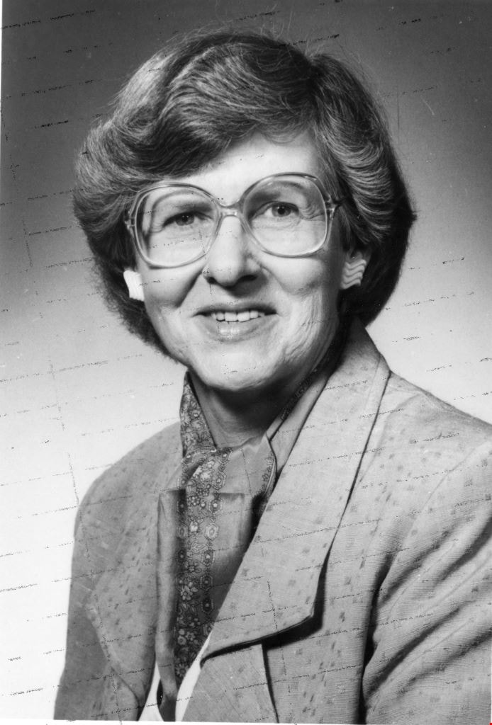
Election 1990 photographs
https://search.heritageburnaby.ca/link/archivedescription91556
- Repository
- City of Burnaby Archives
- Date
- 1990
- Collection/Fonds
- Doreen Lawson fonds
- Description Level
- File
- Physical Description
- 2 photographs : col. and b&w ; 11.5 x 16.5 cm and 10 x 15 cm
- Scope and Content
- File consists of photographs related to Doreen Lawson's 1990 election campaign. One photograph is a black and white portrait of Ms. Lawson and the second photograph depicts two municipal election signs posted in a resident's front yard.
- Repository
- City of Burnaby Archives
- Date
- 1990
- Collection/Fonds
- Doreen Lawson fonds
- Physical Description
- 2 photographs : col. and b&w ; 11.5 x 16.5 cm and 10 x 15 cm
- Description Level
- File
- Record No.
- 605-002
- Access Restriction
- No restrictions
- Reproduction Restriction
- No restrictions
- Accession Number
- 2003-30
- Scope and Content
- File consists of photographs related to Doreen Lawson's 1990 election campaign. One photograph is a black and white portrait of Ms. Lawson and the second photograph depicts two municipal election signs posted in a resident's front yard.
- Names
- Lawson, Doreen A.
- Media Type
- Photograph
- Notes
- Title based on contents of photographs
- Photographs separated from file MSS071-002
Images
![Harry, [1928] thumbnail](/media/hpo/_Data/_Archives_Images/_Unrestricted/487/491-008.jpg?width=280)
Harry
https://search.heritageburnaby.ca/link/archivedescription58070
- Repository
- City of Burnaby Archives
- Date
- [1928]
- Collection/Fonds
- Burnaby Historical Society fonds
- Description Level
- Item
- Physical Description
- 1 photograph : b&w ; 8.7 x 6.2 cm
- Scope and Content
- Photograph of a man identified only as "Harry" standing on crutches on an unidentified road . The letter that was originally with this photograph (in file MSS055-002) is a letter written by Amelia Jane (nee Johnston) Eagles to her son Dr Blythe Eagles. In the letter she states that "Harry" came ov…
- Repository
- City of Burnaby Archives
- Date
- [1928]
- Collection/Fonds
- Burnaby Historical Society fonds
- Subseries
- Eagles family subseries
- Physical Description
- 1 photograph : b&w ; 8.7 x 6.2 cm
- Description Level
- Item
- Record No.
- 491-008
- Access Restriction
- No restrictions
- Reproduction Restriction
- No known restrictions
- Accession Number
- BHS1991-18
- Scope and Content
- Photograph of a man identified only as "Harry" standing on crutches on an unidentified road . The letter that was originally with this photograph (in file MSS055-002) is a letter written by Amelia Jane (nee Johnston) Eagles to her son Dr Blythe Eagles. In the letter she states that "Harry" came over to listen to records with her and her husband and stayed for a "light lunch" before being driven home.
- Media Type
- Photograph
- Notes
- Title based on contents of photograph
- Note in pencil on verso of photograph reads: "Hello_Blythe: / Best_Regards_from / Harry"
Images
![Harry, [1928] thumbnail](/media/hpo/_Data/_Archives_Images/_Unrestricted/487/491-008.jpg)
![John Burton family home, [1923] thumbnail](/media/Hpo/_Data/_Archives_Images/_Unrestricted/205/216-001.jpg?width=280)
John Burton family home
https://search.heritageburnaby.ca/link/archivedescription36067
- Repository
- City of Burnaby Archives
- Date
- [1923]
- Collection/Fonds
- Burnaby Historical Society fonds
- Description Level
- Item
- Physical Description
- 1 photograph : col. ; 7.5 x 12.5 cm print
- Scope and Content
- Photograph of the John Burton family home at 420 12th Avenue. It was renamed 661 12th Avenue [1925] and later, 7835 12th Avenue.
- Repository
- City of Burnaby Archives
- Date
- [1923]
- Collection/Fonds
- Burnaby Historical Society fonds
- Subseries
- John Burton subseries
- Physical Description
- 1 photograph : col. ; 7.5 x 12.5 cm print
- Description Level
- Item
- Record No.
- 216-001
- Access Restriction
- No restrictions
- Reproduction Restriction
- No known restrictions
- Accession Number
- BHS1989-05
- Scope and Content
- Photograph of the John Burton family home at 420 12th Avenue. It was renamed 661 12th Avenue [1925] and later, 7835 12th Avenue.
- Subjects
- Buildings - Residential - Houses
- Media Type
- Photograph
- Notes
- Title based on contents of photograph
- 1 col. copy negative accompanying
- Accompanying materials state that item no. 216-002 and no. 397-001 are of the same address as this item
- Geographic Access
- 12th Avenue
- Street Address
- 7835 12th Avenue
- Historic Neighbourhood
- Edmonds (Historic Neighbourhood)
- Planning Study Area
- Edmonds Area
Images
![John Burton family home, [1923] thumbnail](/media/Hpo/_Data/_Archives_Images/_Unrestricted/205/216-001.jpg)
![Alfred Hickman, [195-] (date of original), copied 1986 thumbnail](/media/hpo/_Data/_Archives_Images/_Unrestricted/126/183-002.jpg?width=280)
Alfred Hickman
https://search.heritageburnaby.ca/link/archivedescription35054
- Repository
- City of Burnaby Archives
- Date
- [195-] (date of original), copied 1986
- Collection/Fonds
- Burnaby Historical Society fonds
- Description Level
- Item
- Physical Description
- 1 photograph : b&w ; 7.5 x 11 cm print
- Scope and Content
- Photograph of two men standing outside Hickman's Grocery on Patterson Avenue near the railroad tracks. One of the men is Alfred Hickman, the store's owner. Signs on the store read, "Hickmans / Groceries / Produce" and "Groceries / Hickmans / Meats." Signs in the window advertise wieners and "Mea…
- Repository
- City of Burnaby Archives
- Date
- [195-] (date of original), copied 1986
- Collection/Fonds
- Burnaby Historical Society fonds
- Subseries
- Alfred Hickman subseries
- Physical Description
- 1 photograph : b&w ; 7.5 x 11 cm print
- Description Level
- Item
- Record No.
- 183-002
- Access Restriction
- No restrictions
- Reproduction Restriction
- Reproduce for fair dealing purposes only
- Accession Number
- BHS1986-31
- Scope and Content
- Photograph of two men standing outside Hickman's Grocery on Patterson Avenue near the railroad tracks. One of the men is Alfred Hickman, the store's owner. Signs on the store read, "Hickmans / Groceries / Produce" and "Groceries / Hickmans / Meats." Signs in the window advertise wieners and "Meat Makes the Meal."
- Subjects
- Buildings - Commercial - Grocery Stores
- Occupations - Grocers
- Advertising Medium - Signs and Signboards
- Media Type
- Photograph
- Notes
- Title based on contents of photograph
- Street address for the grocery store later numbered 5932 Patterson Avenue
- Geographic Access
- Patterson Avenue
- Street Address
- 5932 Patterson Avenue
- Historic Neighbourhood
- Central Park (Historic Neighbourhood)
- Planning Study Area
- Maywood Area
Images
![Alfred Hickman, [195-] (date of original), copied 1986 thumbnail](/media/hpo/_Data/_Archives_Images/_Unrestricted/126/183-002.jpg)

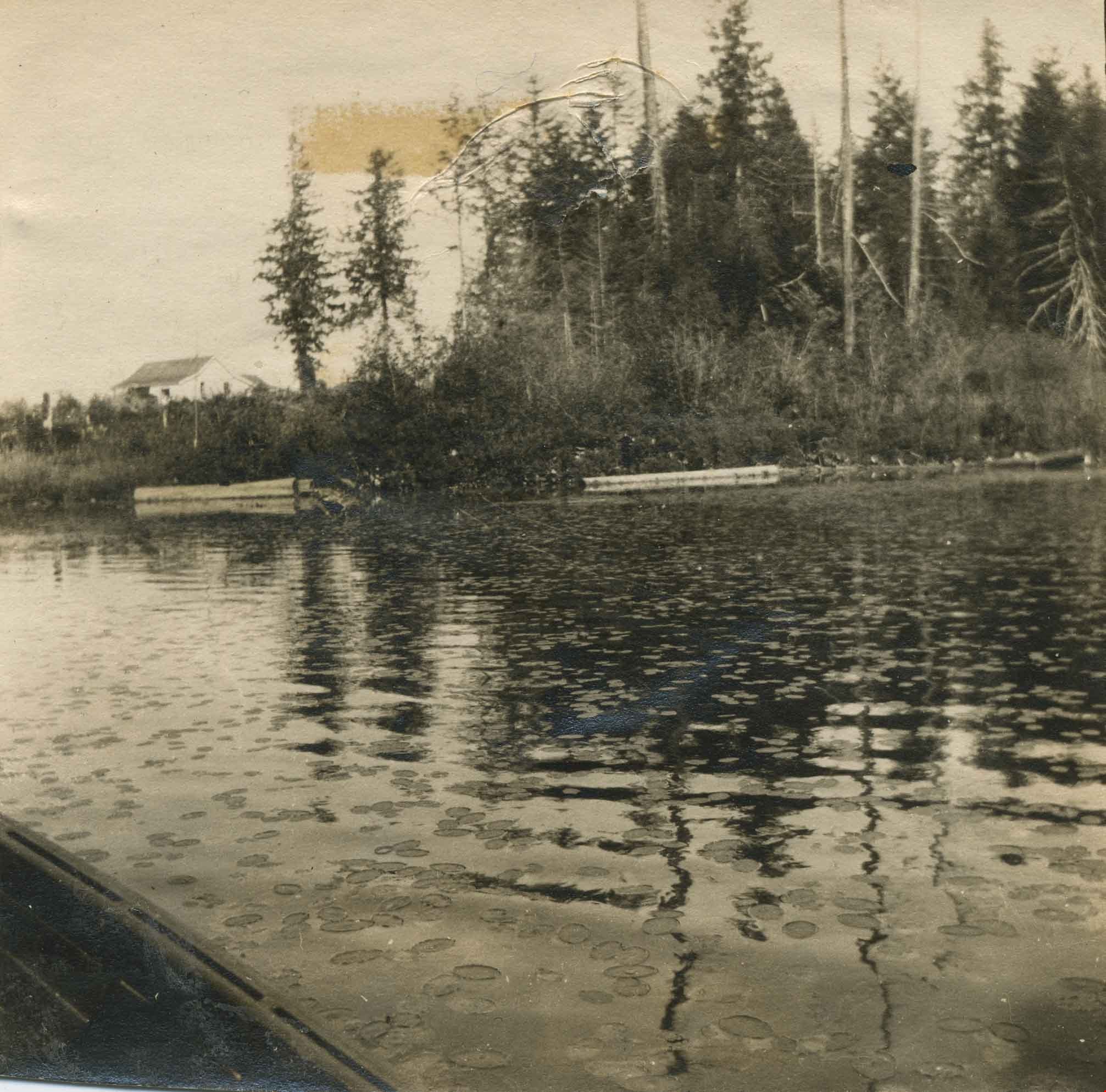
Deer Lake
https://search.heritageburnaby.ca/link/archivedescription34054
- Repository
- City of Burnaby Archives
- Date
- 1907
- Collection/Fonds
- Burnaby Historical Society fonds
- Description Level
- Item
- Physical Description
- 1 photograph : b&w ; 8.6 x 8.7 cm
- Scope and Content
- Photograph of the northeast shore of Deer Lake.
- Repository
- City of Burnaby Archives
- Date
- 1907
- Collection/Fonds
- Burnaby Historical Society fonds
- Subseries
- Photographs subseries
- Physical Description
- 1 photograph : b&w ; 8.6 x 8.7 cm
- Description Level
- Item
- Record No.
- 002-002
- Access Restriction
- No restrictions
- Reproduction Restriction
- No known restrictions
- Accession Number
- BHS2007-04
- Scope and Content
- Photograph of the northeast shore of Deer Lake.
- Media Type
- Photograph
- Notes
- Title based on contents of photograph
- Geographic Access
- Deer Lake
- Deer Lake Avenue
- Historic Neighbourhood
- Burnaby Lake (Historic Neighbourhood)
- Planning Study Area
- Morley-Buckingham Area
Images
100 Years of Women's Progress display
https://search.heritageburnaby.ca/link/archivedescription58420
- Repository
- City of Burnaby Archives
- Date
- 1967
- Collection/Fonds
- Burnaby Historical Society fonds
- Description Level
- Item
- Physical Description
- 1 photograph : col.; 9 x 9 cm
- Scope and Content
- Photograph of (left to right) C. Norton, Dr. Violet Eagles, K. McAulay, C. Turner, and Gladys Killip at the Burnaby Council of Women event "100 Years of Progress in Women's Activities, Arts and Crafts" that was held in recognition of the Centennial Celebration and featured "Burnaby Treasures" at J…
- Repository
- City of Burnaby Archives
- Date
- 1967
- Collection/Fonds
- Burnaby Historical Society fonds
- Subseries
- Gladys Killip subseries
- Physical Description
- 1 photograph : col.; 9 x 9 cm
- Description Level
- Item
- Record No.
- 497-002
- Access Restriction
- In Archives only
- Reproduction Restriction
- No restrictions
- Accession Number
- BHS1996-12
- Scope and Content
- Photograph of (left to right) C. Norton, Dr. Violet Eagles, K. McAulay, C. Turner, and Gladys Killip at the Burnaby Council of Women event "100 Years of Progress in Women's Activities, Arts and Crafts" that was held in recognition of the Centennial Celebration and featured "Burnaby Treasures" at James Cowan Hall during the second week of April 1967. This was a non competitive exhibition of "Burnaby Treasures" old and new, combined with demonstrations of skills of yesterday and today. Burnaby Council of Women members and exhibitors dressed in period costumes for the event.
- Media Type
- Photograph
- Notes
- Title based on contents of item

2007 Advisory Planning Commission portrait
https://search.heritageburnaby.ca/link/archivedescription90391
- Repository
- City of Burnaby Archives
- Date
- 2007
- Collection/Fonds
- City Council and Office of the City Clerk fonds
- Description Level
- Item
- Physical Description
- 1 photograph : col. ; 12.5 x 19 cm
- Scope and Content
- Photograph of the 2007 Advisory Planning Commission. Commission members left to right are: Rana Dhatt, Joanne Tseng, Tony Coccia, David Pereira, Gurmukh Bhogal, and Kwangyoung Conn. Photograph is a studio portrait.
- Repository
- City of Burnaby Archives
- Date
- 2007
- Collection/Fonds
- City Council and Office of the City Clerk fonds
- Series
- Council Committee series
- Subseries
- Advisory Planning Commission subseries
- Physical Description
- 1 photograph : col. ; 12.5 x 19 cm
- Description Level
- Item
- Record No.
- 527-002
- Reproduction Restriction
- No restrictions
- Accession Number
- 2011-07
- Scope and Content
- Photograph of the 2007 Advisory Planning Commission. Commission members left to right are: Rana Dhatt, Joanne Tseng, Tony Coccia, David Pereira, Gurmukh Bhogal, and Kwangyoung Conn. Photograph is a studio portrait.
- Subjects
- Documentary Artifacts - Portraits
- Officials - Alderman and Councillors
- Officials - Commissioners
- Media Type
- Photograph
- Notes
- Title based on contents of photograph
Images
