Narrow Results By
Subject
- Advertising Medium - Signs and Signboards 4
- Agricultural Tools and Equipment
- Agricultural Tools and Equipment - Cultivators 1
- Agricultural Tools and Equipment - Gardening Equipment 10
- Agricultural Tools and Equipment - Plows 9
- Agriculture 9
- Agriculture - Crops 27
- Agriculture - Farms 116
- Agriculture - Fruit and Berries 29
- Agriculture - Orchards 3
- Agriculture - Poultry 6
- Animals 5

H.T. Ceperley Estate 'Fairacres' Root House
https://search.heritageburnaby.ca/link/landmark527
- Repository
- Burnaby Heritage Planning
- Description
- The ‘Fairacres’ Root House is a long, low one-storey masonry building, measuring 4.6 metres by 9.1 metres, with massively buttressed concrete walls and foundations. Built into sloping ground adjacent to the location of the former greenhouses, the surviving orchard and the kitchen entrance of the ma…
- Associated Dates
- 1908
- Formal Recognition
- Heritage Designation, Community Heritage Register
- Repository
- Burnaby Heritage Planning
- Geographic Access
- Deer Lake Avenue
- Associated Dates
- 1908
- Formal Recognition
- Heritage Designation, Community Heritage Register
- Enactment Type
- Bylaw No. 9807
- Enactment Date
- 23/11/1992
- Description
- The ‘Fairacres’ Root House is a long, low one-storey masonry building, measuring 4.6 metres by 9.1 metres, with massively buttressed concrete walls and foundations. Built into sloping ground adjacent to the location of the former greenhouses, the surviving orchard and the kitchen entrance of the main house, 'Fairacres,' this functional structure was used as a frost-free store for fruit and vegetables for the family's use.
- Heritage Value
- The outbuildings at 'Fairacres' are a rare surviving architecturally-designed ensemble of agricultural structures that exist in complementary harmony with the main estate house. Architect Robert Mackay Fripp (1858-1917), an outspoken advocate of Arts and Crafts design, was retained by the Ceperleys to design several original outbuildings on their estate. The Root House is important as a rare surviving, and exceptionally large, example of this building type in the Vancouver region. Unusual in the fact that an architect designed a building of such modest aspirations, it is also remarkable in its method of construction. The use of concrete as a structural material is one of the earliest in the region and extraordinary for its use on such a modest vernacular outbuilding; root cellars were typically built of loose stone. Built in 1908, the Root House was significantly altered in the 1960s and restored to its original design in 2000. The building is significant as an indicator of the market gardening activity in the area around Deer Lake and of the country-house self-sufficiency practiced by the Ceperley family. The Root House illustrates the cultural, aesthetic, and lifestyle values of the Ceperleys in constructing such a large building for storing their own produce.
- Defining Elements
- The outbuildings at 'Fairacres' are a rare surviving architecturally-designed ensemble of agricultural structures that exist in complementary harmony with the main estate house. Architect Robert Mackay Fripp (1858-1917), an outspoken advocate of Arts and Crafts design, was retained by the Ceperleys to design several original outbuildings on their estate. The Root House is important as a rare surviving, and exceptionally large, example of this building type in the Vancouver region. Unusual in the fact that an architect designed a building of such modest aspirations, it is also remarkable in its method of construction. The use of concrete as a structural material is one of the earliest in the region and extraordinary for its use on such a modest vernacular outbuilding; root cellars were typically built of loose stone. Built in 1908, the Root House was significantly altered in the 1960s and restored to its original design in 2000. The building is significant as an indicator of the market gardening activity in the area around Deer Lake and of the country-house self-sufficiency practiced by the Ceperley family. The Root House illustrates the cultural, aesthetic, and lifestyle values of the Ceperleys in constructing such a large building for storing their own produce.
- Locality
- Deer Lake Park
- Historic Neighbourhood
- Burnaby Lake (Historic Neighbourhood)
- Planning Study Area
- Douglas-Gilpin Area
- Architect
- Robert Mackay Fripp
- Function
- Primary Historic--Outbuilding
- Secondary Historic--Food Storage
- Community
- Burnaby
- Cadastral Identifier
- P.I.D. No. 004-493-311 Legal Description: Block 3 Except: Part subdivided by Plan 26865, District Lot 79, Group 1, New Westminster District, Plan 536
- Boundaries
- ‘Fairacres’ is comprised of a single municipally-owned property located at 6344 Deer Lake Avenue, Burnaby.
- Area
- 17,065.00
- Contributing Resource
- Building
- Landscape Feature
- Ownership
- Public (local)
- Other Collection
- Burnaby Historical Society, Community Archives: Ceperley Photograph Album
- Documentation
- Heritage Site Files: PC77000 20. City of Burnaby Planning and Building Department, 4949 Canada Way, Burnaby, B.C., V5G 1M2
- Street Address
- 6344 Deer Lake Avenue
Images


H.T. Ceperley Estate 'Fairacres' Steam Plant Building
https://search.heritageburnaby.ca/link/landmark528
- Repository
- Burnaby Heritage Planning
- Description
- Designed in the British Arts and Crafts style, the ‘Fairacres’ Steam Plant Buiding is a single-storey wood frame building with a gabled roof that originally housed the apparatus for climate control in the greenhouses, formerly located to its north. The original rubble stone walls that formed the fo…
- Associated Dates
- 1908
- Formal Recognition
- Heritage Designation, Community Heritage Register
- Repository
- Burnaby Heritage Planning
- Geographic Access
- Deer Lake Avenue
- Associated Dates
- 1908
- Formal Recognition
- Heritage Designation, Community Heritage Register
- Enactment Type
- Bylaw No. 9807
- Enactment Date
- 23/11/1992
- Description
- Designed in the British Arts and Crafts style, the ‘Fairacres’ Steam Plant Buiding is a single-storey wood frame building with a gabled roof that originally housed the apparatus for climate control in the greenhouses, formerly located to its north. The original rubble stone walls that formed the foundation for the greenhouses stand adjacent. The Steam Plant Building stands as a pendant to the Root House, which is to the north of the former greenhouses.
- Heritage Value
- The outbuildings at 'Fairacres' are a rare surviving architecturally-designed ensemble of agricultural structures that exist in complementary harmony with the main estate house. Architect Robert Mackay Fripp (1858-1917), an outspoken advocate of Arts and Crafts design, was retained by the Ceperleys to design several original outbuildings on their estate. The Ceperleys operated 'Fairacres' with staff, a farm manager and workers, including Chinese, to grow produce for themselves and for sale at local markets. The Steam Plant Building illustrates the market gardening activity of the area around Deer Lake and its importance to the Ceperley family, which valued a year-round supply of fresh fruit and vegetables for the kitchen and flowers for the house. It also illustrates the cultural and aesthetic values of the Ceperleys in retaining an architect to design a functional outbuilding using an accepted and contemporary architectural style. Built in 1908, the Steam Plant Building was significantly altered in the 1960s and restored to its original design in 2000.
- Defining Elements
- Key elements that define the heritage character of the ‘Fairacres’ Steam Plant Building include its: - overall spatial arrangement of the Steam Plant Building in relation to the former greenhouses and the Root House - side gable roof with cedar shingle cladding. - tall brick chimney indicitive of the building's original function. - distinctive Arts and Crafts architectural features such as the shingle wall cladding with decorative shingling under window sills, deep eaves, and pebble-dashed concrete foundation walls - six-paned wooden-sash casement windows - simple functional interior features - rubble stone walls that formed the foundation for the greenhouses
- Locality
- Deer Lake Park
- Historic Neighbourhood
- Burnaby Lake (Historic Neighbourhood)
- Planning Study Area
- Douglas-Gilpin Area
- Architect
- Robert Mackay Fripp
- Function
- Primary Historic--Outbuilding
- Community
- Burnaby
- Cadastral Identifier
- P.I.D. No. 004-493-311 Legal Description: Block 3 Except: Part subdivided by Plan 26865, District Lot 79, Group 1, New Westminster District, Plan 536
- Boundaries
- ‘Fairacres’ is comprised of a single municipally-owned property located at 6344 Deer Lake Avenue, Burnaby.
- Area
- 17,065.00
- Contributing Resource
- Building
- Landscape Feature
- Ownership
- Public (local)
- Other Collection
- Burnaby Historical Society, Community Archives: Ceperley Photograph Album
- Documentation
- Heritage Site Files: PC77000 20. City of Burnaby Planning and Building Department, 4949 Canada Way, Burnaby, B.C., V5G 1M2
- Street Address
- 6344 Deer Lake Avenue
Images


H.T. Ceperley Estate 'Fairacres' Garage & Stables
https://search.heritageburnaby.ca/link/landmark530
- Repository
- Burnaby Heritage Planning
- Description
- Designed in the British Arts and Crafts style, the ‘Fairacres’ Garage and Stables is a two-storey wood frame building located on the 'Fairacres' estate, situated to the north of the Chauffeur's Cottage; at the south end of the structure is a single vehicle garage and to the north are several stable…
- Associated Dates
- 1911
- Formal Recognition
- Heritage Designation, Community Heritage Register
- Street View URL
- Google Maps Street View
- Repository
- Burnaby Heritage Planning
- Geographic Access
- Deer Lake Avenue
- Associated Dates
- 1911
- Formal Recognition
- Heritage Designation, Community Heritage Register
- Enactment Type
- Bylaw No. 9807
- Enactment Date
- 23/11/1992
- Description
- Designed in the British Arts and Crafts style, the ‘Fairacres’ Garage and Stables is a two-storey wood frame building located on the 'Fairacres' estate, situated to the north of the Chauffeur's Cottage; at the south end of the structure is a single vehicle garage and to the north are several stables for carriage, riding, and draught horses, a coach house, and tack room; the upper floor was originally a hay loft.
- Heritage Value
- The outbuildings at 'Fairacres' are a rare surviving architecturally designed ensemble of agricultural structures that exist in complementary harmony with the main estate house. Architect Robert Mackay Fripp (1858-1917) was retained by the Ceperleys to design several original outbuildings on their estate at the same time as the main house was constructed. The Garage and Stables building is important as a record of its era when transportation modes were in transition and the horse-drawn carriage, while still in use, was giving way to the automobile. The relative spatial arrangements within the building are a valuable indication of the economy of space associated with the automobile, as compared to the horse. The extent of the stabling arrangements signifies not only the use of carriage horses but also the continued reliance on draught horses in farming activities in this era. As well, it is an indication of the fashionable nature of equestrianism for wealthy families during this time. The building is important as a demonstration of the aesthetics of the Ceperley family in having an architect-designed outbuilding and obtaining craftsmanship and materials of the highest quality for each structure on their estate.
- Defining Elements
- Key elements that define the heritage character of the 'Fairacres' Garage and Stables include its: - location within easy reach of the main house and in close proximity to the Chauffeur's Cottage - floor plan with the garage at one end, close to the Chauffeur's Cottage, and stables and equine facilities at the other - variety and complexity of the roofline, including gable wall dormers, gable-on-hip roof ends, and half-hip extensions - Arts and Crafts architectural features of the exterior such as the shingle wall cladding articulated with a chevron-patterned course of shingles at the first floor level; casement windows; and deep eaves with additional purlins to support the overhang - original stable doors with hand-made forged-iron door hardware - multi-paned wooden-sash windows, some retaining original wire glass
- Locality
- Deer Lake Park
- Historic Neighbourhood
- Burnaby Lake (Historic Neighbourhood)
- Planning Study Area
- Douglas-Gilpin Area
- Architect
- Robert Mackay Fripp
- Function
- Primary Historic--Outbuilding
- Community
- Burnaby
- Cadastral Identifier
- P.I.D. No. 004-493-311 Legal Description: Block 3 Except: Part subdivided by Plan 26865, District Lot 79, Group 1, New Westminster District, Plan 536
- Boundaries
- ‘Fairacres’ is comprised of a single municipally-owned property located at 6344 Deer Lake Avenue, Burnaby.
- Area
- 17,065.00
- Contributing Resource
- Building
- Landscape Feature
- Ownership
- Public (local)
- Other Collection
- Burnaby Historical Society, Community Archives: Ceperley Photograph Album
- Documentation
- Heritage Site Files: PC77000 20. City of Burnaby Planning and Building Department, 4949 Canada Way, Burnaby, B.C., V5G 1M2
- Street Address
- 6344 Deer Lake Avenue
- Street View URL
- Google Maps Street View
Images


Duncan & Margaret McGregor Estate 'Glen-Lyon' Mansion
https://search.heritageburnaby.ca/link/landmark518
- Repository
- Burnaby Heritage Planning
- Description
- Overlooking the rich farmland of the Fraser River floodplain, 'Glen-Lyon' is an Edwardian era rural estate, with a tall, two and one-half storey plus basement wood-frame mansion, set in a pastoral and formal landscape with an associated barn and early log pond, located near a ravine and forested ar…
- Associated Dates
- 1902
- Formal Recognition
- Heritage Designation, Community Heritage Register
- Street View URL
- Google Maps Street View
- Repository
- Burnaby Heritage Planning
- Geographic Access
- Marine Drive
- Associated Dates
- 1902
- Formal Recognition
- Heritage Designation, Community Heritage Register
- Enactment Type
- Bylaw No. 12183
- Enactment Date
- 11/12/2006
- Description
- Overlooking the rich farmland of the Fraser River floodplain, 'Glen-Lyon' is an Edwardian era rural estate, with a tall, two and one-half storey plus basement wood-frame mansion, set in a pastoral and formal landscape with an associated barn and early log pond, located near a ravine and forested area adjacent to Marine Drive in South Burnaby.
- Heritage Value
- ‘Glen-Lyon’ is valued as an excellent example of a privately-owned Edwardian era country estate built at the turn of the nineteenth century. The property retains significant heritage features including the Edwardian era mansion with rustic Arts and Crafts features, and elements of a working agricultural landscape. The property was originally the Royal City Mills logging camp, and in 1900 was purchased by Duncan Campbell McGregor (1853-1929) and Margaret Jane McGregor (1875-1960), who named their estate ‘Glen-Lyon’ after Duncan McGregor’s birthplace in Perthshire, Scotland. The McGregors were active in municipal affairs and social activities, and played a significant role in the early development of Burnaby. Duncan McGregor served as a city councillor from 1909 to 1912 and was elected reeve of Burnaby in 1913. Margaret McGregor was instrumental in the formation and fundraising activities of the Victoria Order of Nurses in Burnaby. Additionally, the site is historically significant for its association with early social welfare and correctional reform. The estate was sold in 1926 to an inter-denominational religious organization called the Home of the Friendless, which used it as their B.C. headquarters. The organization was charged with several cases of abuse and neglect in 1937, after which a Royal Commission was formed that led to new legislation to regulate and license all private welfare institutions. 'Glen-Lyon' was sold to the provincial government, and was dedicated in 1939 by the Lt.-Gov. E.W. Hamber for use as the New Haven Borstal Home for Boys and Youthful Offenders (later renamed the New Haven Correction Centre). The Borstal movement originated in England in the late nineteenth century, as an alternative to sending young offenders and runaways to prisons by providing reformatories that focused on discipline and vocational skill. This site’s role as the first North American institution devoted to the Borstal School philosophy was historic, and influenced corrections programs across Canada. The site retains significant features from its development in 1939 as the Borstal School, including a large gambrel-roofed barn designed by Chief Provincial Architect Henry Whittaker of the Department of Public Works that is the only remaining structure of its kind in Burnaby. Between 1941 and 1945 the mansion housed the Provincial School for the Deaf and Blind when the Borstal School was closed temporarily as a war measure during the Second World War.
- Defining Elements
- Key elements that define the heritage character of 'Glen-Lyon' Mansion include its: - location on a sloping site with expansive southern exposure, adjacent to Marine Drive - residential form, scale and massing of the house as exemplified by its two and one-half storey height, above-ground basement and rectangular plan - Arts and Crafts elements of the house such as its stone foundation, multi-gabled roof line with steep central hipped roof, symmetrical cross-gables, side shed dormers, bellcast upper walls sheathed in cedar shingles and lower walls sheathed in narrow clapboard - original exterior features of the house such as the full width front verandah with square columns, central staircase on the southern elevation, original doors and stained glass windows; and the irregular fenestration such as double-hung 1-over-1 wooden-sash windows, bay windows, and projecting windows in the gable ends - original interior features of the house such as the U-shaped main stair designed around two symmetrically placed Ionic columns, and interior trim on the main floor including boxed beams and fireplaces - gambrel-roofed barn with roof vent with finial, sliding hay loft and access doors, small multi-pane windows, and lapped wooden siding - associated landscape features such as the original garden plantings with some exotic and many native specimen trees; the original log pond and its concrete Marine Drive causeway and culvert; rockeries and a rose garden
- Historic Neighbourhood
- Fraser Arm (Historic Neighbourhood)
- Planning Study Area
- Big Bend Area
- Architect
- Henry Whittaker
- Function
- Primary Historic--Estate
- Community
- Burnaby
- Cadastral Identifier
- 003-004-661
- Boundaries
- 'Glen-Lyon' is comprised of a single residential lot located at 4250 Marine Drive, Burnaby.
- Area
- 230873.18
- Contributing Resource
- Building
- Ownership
- Private
- Names
- McGregor, Duncan C. (1853-1929)
- Whittaker, Henry
- Home of the Friendless
- Borstal School
- New Haven Correction Centre
- Subjects
- Buildings - Heritage
- Buildings - Residential - Houses
- Buildings - Public - Detention Facilities
- Buildings - Residential
- Street Address
- 4250 Marine Drive
- Street View URL
- Google Maps Street View
Images


Duncan & Margaret McGregor Estate 'Glen-Lyon' New Haven Barn
https://search.heritageburnaby.ca/link/landmark852
- Repository
- Burnaby Heritage Planning
- Description
- Designed in a vernacular architectural style, the New Haven Barn is a large gambrel-roofed barn located on the Edwardian era McGregor Estate 'Glen-Lyon,' overlooking the rich farmland of the Fraser River floodplain and near a ravine and forested area adjacent to Marine Drive in South Burnaby.
- Associated Dates
- 1939
- Formal Recognition
- Heritage Designation, Community Heritage Register
- Other Names
- Home of the Friendless, New Haven Borstal Home for Boys and Youthful Offenders, New Haven Correction Centre
- Street View URL
- Google Maps Street View
- Repository
- Burnaby Heritage Planning
- Other Names
- Home of the Friendless, New Haven Borstal Home for Boys and Youthful Offenders, New Haven Correction Centre
- Geographic Access
- Marine Drive
- Associated Dates
- 1939
- Formal Recognition
- Heritage Designation, Community Heritage Register
- Enactment Type
- Bylaw No. 12183
- Enactment Date
- 11/12/2006
- Description
- Designed in a vernacular architectural style, the New Haven Barn is a large gambrel-roofed barn located on the Edwardian era McGregor Estate 'Glen-Lyon,' overlooking the rich farmland of the Fraser River floodplain and near a ravine and forested area adjacent to Marine Drive in South Burnaby.
- Heritage Value
- The site is historically significant for its association with early social welfare and correctional reform. The estate was sold in 1926 to an inter-denominational religious organization called the Home of the Friendless, which used it as their B.C. headquarters. The organization was charged with several cases of abuse and neglect in 1937, after which a Royal Commission was formed that led to new legislation to regulate and license all private welfare institutions. 'Glen-Lyon' was sold to the provincial government, and was dedicated in 1939 by the Lt.-Gov. E.W. Hamber for use as the New Haven Borstal Home for Boys and Youthful Offenders (later renamed the New Haven Correction Centre). The Borstal movement originated in England in the late nineteenth century, as an alternative to sending young offenders and runaways to prisons by providing reformatories that focused on discipline and vocational skill. This site’s role as the first North American institution devoted to the Borstal School philosophy was historic, and influenced corrections programs across Canada. The New Haven Barn is a significant feature from its development in 1939 as the Borstal School, designed by Chief Provincial Architect Henry Whittaker of the Department of Public Works, and is the only remaining structure of its kind in Burnaby.
- Defining Elements
- Key elements that define the heritage character of the New Haven Barn include its: - gambrel-roofed barn with roof vent with finial, sliding hay loft and access doors, small multi-pane windows, and lapped wooden siding
- Historic Neighbourhood
- Fraser Arm (Historic Neighbourhood)
- Planning Study Area
- Big Bend Area
- Architect
- Henry Whittaker
- Function
- Primary Historic--Estate
- Community
- Burnaby
- Cadastral Identifier
- 003-004-661
- Boundaries
- 'Glen-Lyon' is comprised of a single residential lot located at 4250 Marine Drive, Burnaby.
- Area
- 230873.18
- Contributing Resource
- Building
- Ownership
- Private
- Names
- Whittaker, George
- New Haven Borstal Home for Boys and Youthful Offenders
- New Haven Correction Centre
- Borstal School
- Street Address
- 4250 Marine Drive
- Street View URL
- Google Maps Street View
Images


H.T. Ceperley Estate 'Fairacres' Chauffeur's Cottage
https://search.heritageburnaby.ca/link/landmark529
- Repository
- Burnaby Heritage Planning
- Description
- Designed in the British Arts and Crafts style, the Chauffeur's Cottage is situated across from the main entrance to the Ceperley Mansion, and adjacent to the Garage and Stables. A long, narrow single-storey building, it was constructed by joining together two modest estate cottages.
- Associated Dates
- 1911
- Formal Recognition
- Heritage Designation, Community Heritage Register
- Repository
- Burnaby Heritage Planning
- Geographic Access
- Deer Lake Avenue
- Associated Dates
- 1911
- Formal Recognition
- Heritage Designation, Community Heritage Register
- Enactment Type
- Bylaw No. 9807
- Enactment Date
- 23/11/1992
- Description
- Designed in the British Arts and Crafts style, the Chauffeur's Cottage is situated across from the main entrance to the Ceperley Mansion, and adjacent to the Garage and Stables. A long, narrow single-storey building, it was constructed by joining together two modest estate cottages.
- Heritage Value
- The outbuildings at 'Fairacres' are a rare surviving architecturally designed ensemble of agricultural structures that exist in complementary harmony with the main estate house. Architect Robert Mackay Fripp (1858-1917) was retained by the Ceperleys to design several original outbuildings on their estate at the same time as the main house was constructed. The Chauffeur's Cottage illustrates the increasing importance of the automobile in the lives of the wealthy of the early twentieth century. It also demonstrates Grace and Henry Tracy Ceperley's social aspirations and grand-country-estate pretension in having a chauffeur. The cottage's location - close to the garage and convenient, but not adjacent, to the main house - enhances the grand country house landscape design and contributes to the overall composition of the estate's plan. The Arts and Crafts styled Chauffeur's Cottage is important as an indicator of the aesthetic and social sensibilities of the Ceperley family in retaining an architect to design a modest building for staff accommodation.
- Defining Elements
- Key elements that define the heritage character of the 'Fairacres' Chauffeur's Cottage include its: - location, in relation to the main house and in close proximity to the Garage and Stables buildings - side gable roof with cedar shingle cladding - Arts and Crafts architectural features such as the jerkin-headed door hood, a reference to the thatched-roofed cottages of southern England; eight-paned wooden-sash casement windows; and cedar-shingled exterior - two internal brick chimneys - modest, functional interior, with simple trim and lack of pretension
- Locality
- Deer Lake Park
- Historic Neighbourhood
- Burnaby Lake (Historic Neighbourhood)
- Planning Study Area
- Douglas-Gilpin Area
- Architect
- Robert Mackay Fripp
- Function
- Primary Historic--Outbuilding
- Community
- Burnaby
- Cadastral Identifier
- P.I.D. No. 004-493-311 Legal Description: Block 3 Except: Part subdivided by Plan 26865, District Lot 79, Group 1, New Westminster District, Plan 536
- Boundaries
- ‘Fairacres’ is comprised of a single municipally-owned property located at 6344 Deer Lake Avenue, Burnaby.
- Area
- 17,065.00
- Contributing Resource
- Building
- Landscape Feature
- Ownership
- Public (local)
- Other Collection
- Burnaby Historical Society, Community Archives: Ceperley Photograph Album Burnaby Village Museum, Collection: Chinese ‘Tiger Whiskey’ and opium bottles found during restoration
- Documentation
- Heritage Site Files: PC77000 20. City of Burnaby Planning and Building Department, 4949 Canada Way, Burnaby, B.C., V5G 1M2
- Street Address
- 6344 Deer Lake Avenue
Images


H.T. Ceperley Estate 'Fairacres' Mansion
https://search.heritageburnaby.ca/link/landmark526
- Repository
- Burnaby Heritage Planning
- Description
- 'Fairacres' is a large, two-and-one-half storey estate house in the British Arts and Crafts style, located in Deer Lake Park, with four associated original outbuildings.
- Associated Dates
- 1911
- Formal Recognition
- Heritage Designation, Community Heritage Register
- Other Names
- Henry Tracy & Grace Ceperley Estate
- Burnaby Art Gallery
- Street View URL
- Google Maps Street View
- Repository
- Burnaby Heritage Planning
- Other Names
- Henry Tracy & Grace Ceperley Estate
- Burnaby Art Gallery
- Geographic Access
- Deer Lake Avenue
- Associated Dates
- 1911
- Formal Recognition
- Heritage Designation, Community Heritage Register
- Enactment Type
- Bylaw No. 9807
- Enactment Date
- 23/11/1992
- Description
- 'Fairacres' is a large, two-and-one-half storey estate house in the British Arts and Crafts style, located in Deer Lake Park, with four associated original outbuildings.
- Heritage Value
- 'Fairacres' is important as a record of the early years of Burnaby, specifically the Deer Lake area, as a place of tranquility and beautiful scenery in which the wealthy and successful in the burgeoning cities of New Westminster and Vancouver chose to retire or to make their family homes. The main house, which anchors in style and setting the outbuildings on the estate, demonstrates the social, cultural, and aesthetic values of local wealthy businessmen and women of the early twentieth century - values such as appreciation of architectural elegance and grand interior spaces, leisure and recreation, formal landscaped gardens and scenic views. Also important is the association with the English-born and trained architect Robert Mackay Fripp (1858-1917), as this was one of his grandest residential commissions. Steeped in the current architectural trends in Great Britain, Fripp designed this sprawling mansion in the Arts and Crafts style, reflected in the architectural detailing and proportions. The style was common at the time and was often used for estate mansions as a symbol of affluence and good, modern taste as well as an affinity for all things British. Quality is displayed inside and out in the finishes and materials, orchestrated by prominent local contractor, James Charles Allen, including imported English materials of specific value such as imported Medmenham tiles in the fireplace surrounds, one of the earliest documented use of these tiles outside the United Kingdom. Detailed features of the interior woodwork were carved by Scottish-born master wood carver George Selkirk Gibson (1867-1942), who was best known for his many commissions for prominent British Columbia architect Samuel Maclure. The outbuildings at 'Fairacres' are an important record of the functioning of a large estate of the time. The Garage and Stables and the Chauffeur’s Cottage accommodated the use of automobiles, horses and carriages, and in concert with the estate's location near the new British Columbia Electric Railway 'Burnaby Lake' interurban line, illustrate the evolving nature of regional transportation and the growing bedroom communities and estates made possible by increasing options for transportation. Other outbuildings accommodated the agricultural activities that helped support the Ceperley estate. The estate was conceived and funded by American-born Grace E. Dixon Ceperley (1863-1917), who had achieved significant wealth through a bequest from her brother-in-law, Vancouver pioneer Arthur Ferguson. Her husband, Henry Tracy Ceperley (1850-1929), also American-born, was a successful and well-respected businessman who made a significant contribution to the development of the City of Vancouver. The construction of 'Fairacres' spawned the transformation of the Deer Lake area from a farming community into a preferred location for elite suburban homes. 'Fairacres' is significant to the City of Burnaby as its first civic heritage conservation project. Acquired in 1966 for conversion to Burnaby’s first art gallery, it was dedicated in 1967 to mark Canada’s Centennial of Confederation.
- Defining Elements
- Key elements that define the heritage character of the ‘Fairacres’ mansion include its: - setting in relation to the gardens, its former market garden, and the vistas to Deer Lake and other grand homes in the area - side gable roof with prominent dormers and cedar shingle cladding - verandah across the eastern (garden) facade, with its view over the landscaped gardens and the distant mountains - porte cochere with its side steps for those arriving by automobile, and central raised step for those alighting from horse-drawn carriages - rich variety of exterior elements that demonstrate the typical Arts and Crafts use of local materials such as cobble stone chimneys and foundations, wide wooden siding and half-timbering - mixture of double-hung and casement wooden-sash windows, many with multi-paned sash - lavish interior spaces, designed for entertaining on a grand scale, including a billiard room with a beamed ceiling and an inglenook fireplace, and generous living and dining rooms arranged off a central hall - quality of the interior materials such as imported Medmenham tiles in fireplace surrounds, window hardware by Hope and Sons, and leaded stained glass - interior wood work including the staircase, and carvings by George Selkirk Gibson - remaining formal Edwardian garden landscape elements, including the cross-axial plan that reflects the relationship of the mansion to its 'outdoor rooms'
- Locality
- Deer Lake Park
- Historic Neighbourhood
- Burnaby Lake (Historic Neighbourhood)
- Planning Study Area
- Douglas-Gilpin Area
- Architect
- Robert Mackay Fripp
- Function
- Primary Current--Museum
- Primary Historic--Estate
- Community
- Burnaby
- Cadastral Identifier
- P.I.D. No. 004-493-311 Legal Description: Block 3 Except: Part subdivided by Plan 26865, District Lot 79, Group 1, New Westminster District, Plan 536
- Boundaries
- ‘Fairacres’ is comprised of a single municipally-owned property located at 6344 Deer Lake Avenue, Burnaby.
- Area
- 17,065.00
- Contributing Resource
- Building
- Landscape Feature
- Ownership
- Public (local)
- Other Collection
- City of Burnaby, Visual Art Collection: Original rendering by R.P.S. Twizell Burnaby Historical Society, Community Archives: Ceperley Photograph Album Burnaby Village Museum, Collection: Carved dining room panels by G.S. Gibson and other hardware items
- Documentation
- Heritage Site Files: PC77000 20. City of Burnaby Planning and Building Department, 4949 Canada Way, Burnaby, B.C., V5G 1M2
- Names
- Ceperley, Grace
- Ceperley, H.T.
- Fripp, Robert Mackay
- Allen, James Charles
- Gibson, George Selkirk
- Street Address
- 6344 Deer Lake Avenue
- Street View URL
- Google Maps Street View
Images


![Bernard Hill farm, [190-] (date of original), copied 1986 thumbnail](/media/hpo/_Data/_Archives_Images/_Unrestricted/204/204-789.jpg?width=280)
Bernard Hill farm
https://search.heritageburnaby.ca/link/archivedescription35929
- Repository
- City of Burnaby Archives
- Date
- [190-] (date of original), copied 1986
- Collection/Fonds
- Burnaby Historical Society fonds
- Description Level
- Item
- Physical Description
- 1 photograph : b&w ; 12.7 x 17.8 cm print
- Scope and Content
- Photograph of the Hill brothers Frank, Claude and Gerry and their pet dog riding on hay wagon on their father's farm.
- Repository
- City of Burnaby Archives
- Date
- [190-] (date of original), copied 1986
- Collection/Fonds
- Burnaby Historical Society fonds
- Subseries
- Pioneer Tales subseries
- Physical Description
- 1 photograph : b&w ; 12.7 x 17.8 cm print
- Description Level
- Item
- Record No.
- 204-789
- Access Restriction
- No restrictions
- Reproduction Restriction
- No restrictions
- Accession Number
- BHS1988-03
- Scope and Content
- Photograph of the Hill brothers Frank, Claude and Gerry and their pet dog riding on hay wagon on their father's farm.
- Subjects
- Animals - Dogs
- Transportation - Horses
- Agriculture - Crops
- Agricultural Tools and Equipment
- Media Type
- Photograph
- Notes
- Title based on contents of photograph
- Geographic Access
- Douglas Road
- Canada Way
- Street Address
- 4990 Canada Way
- Historic Neighbourhood
- Burnaby Lake (Historic Neighbourhood)
- Planning Study Area
- Douglas-Gilpin Area
Images
![Bernard Hill farm, [190-] (date of original), copied 1986 thumbnail](/media/hpo/_Data/_Archives_Images/_Unrestricted/204/204-789.jpg)
![Burnaby Village Museum strawberry patch, [2001] thumbnail](/media/hpo/_Data/_Archives_Images/_Unrestricted/535/535-2735.jpg?width=280)
Burnaby Village Museum strawberry patch
https://search.heritageburnaby.ca/link/archivedescription97345
- Repository
- City of Burnaby Archives
- Date
- [2001]
- Collection/Fonds
- Burnaby NewsLeader photograph collection
- Description Level
- Item
- Physical Description
- 1 photograph (tiff) : col.
- Scope and Content
- Photograph of Andrew Hildred, a historical interpreter at the Burnaby Village Museum. Hildred, dressed in a period costume, is harvesting strawberries from the garden at the Museum's Jesse & Martha Love Farmhouse, which is visible in the background.
- Repository
- City of Burnaby Archives
- Date
- [2001]
- Collection/Fonds
- Burnaby NewsLeader photograph collection
- Physical Description
- 1 photograph (tiff) : col.
- Description Level
- Item
- Record No.
- 535-2735
- Access Restriction
- No restrictions
- Reproduction Restriction
- No restrictions
- Accession Number
- 2018-12
- Scope and Content
- Photograph of Andrew Hildred, a historical interpreter at the Burnaby Village Museum. Hildred, dressed in a period costume, is harvesting strawberries from the garden at the Museum's Jesse & Martha Love Farmhouse, which is visible in the background.
- Names
- Burnaby Village Museum
- Media Type
- Photograph
- Photographer
- Bartel, Mario
- Notes
- Title based on caption
- Collected by editorial for use in a September 2001 issue of the Burnaby NewsLeader
- Caption from metadata: "Andrew Hildred, a historical interpreter at Burnaby Village Museum, picks strawberries from one of the Museum's heritage gardens, at the Jessie Love Farmhouse. The Museum will be hosting its annual Fall Fair, Sept. 8 and 9."
- Street Address
- 4900 Deer Lake Avenue
- 6501 Deer Lake Avenue
- Historic Neighbourhood
- Burnaby Lake (Historic Neighbourhood)
- Planning Study Area
- Morley-Buckingham Area
Images
![Burnaby Village Museum strawberry patch, [2001] thumbnail](/media/hpo/_Data/_Archives_Images/_Unrestricted/535/535-2735.jpg)
![Dad at Deer Lake, [1905] thumbnail](/media/hpo/_Data/_Archives_Images/_Unrestricted/477/477-183.jpg?width=280)
Dad at Deer Lake
https://search.heritageburnaby.ca/link/archivedescription38864
- Repository
- City of Burnaby Archives
- Date
- [1905]
- Collection/Fonds
- Peers Family and Hill Family fonds
- Description Level
- Item
- Physical Description
- 1 photograph : sepia ; 8 x 5.5 cm on page 14 x 17.5 cm (pasted in album)
- Scope and Content
- Photograph of Claude Hill on a hay rake being pulled by the workhorse, "Tom." His daughter, Kitty, wrote the caption "Dad at Deer Lake" next to this photograph.
- Repository
- City of Burnaby Archives
- Date
- [1905]
- Collection/Fonds
- Peers Family and Hill Family fonds
- Physical Description
- 1 photograph : sepia ; 8 x 5.5 cm on page 14 x 17.5 cm (pasted in album)
- Description Level
- Item
- Record No.
- 477-183
- Access Restriction
- No restrictions
- Reproduction Restriction
- No known restrictions
- Accession Number
- 2007-12
- Scope and Content
- Photograph of Claude Hill on a hay rake being pulled by the workhorse, "Tom." His daughter, Kitty, wrote the caption "Dad at Deer Lake" next to this photograph.
- Subjects
- Agriculture - Crops
- Animals - Horses
- Occupations - Farmers
- Agricultural Tools and Equipment
- Media Type
- Photograph
- Notes
- Title based on caption accompanying photograph
- Geographic Access
- Douglas Road
- Deer Lake Avenue
- Street Address
- 6501 Deer Lake Avenue
- Historic Neighbourhood
- Burnaby Lake (Historic Neighbourhood)
- Planning Study Area
- Morley-Buckingham Area
Images
![Dad at Deer Lake, [1905] thumbnail](/media/hpo/_Data/_Archives_Images/_Unrestricted/477/477-183.jpg)
![Garage and mushroom house, [before 1969] (date of original), digitally copied 2013 thumbnail](/media/hpo/_Data/_Archives_Images/_Unrestricted/550/552-006.jpg?width=280)
Garage and mushroom house
https://search.heritageburnaby.ca/link/archivedescription77192
- Repository
- City of Burnaby Archives
- Date
- [before 1969] (date of original), digitally copied 2013
- Collection/Fonds
- Stiglish family fonds
- Description Level
- Item
- Physical Description
- 1 photograph : b&w copy-print ; 9 x 9 cm
- Scope and Content
- Photograph of the garage where Jack Stiglish repaired machinery and housed his tools, and the mushroom house beside it. A sign propped up between the two buildings reads "manure" with an arrow pointing to the right.
- Repository
- City of Burnaby Archives
- Date
- [before 1969] (date of original), digitally copied 2013
- Collection/Fonds
- Stiglish family fonds
- Physical Description
- 1 photograph : b&w copy-print ; 9 x 9 cm
- Description Level
- Item
- Record No.
- 552-006
- Access Restriction
- No restrictions
- Reproduction Restriction
- Reproduce for fair dealing purposes only
- Accession Number
- 2013-07
- Scope and Content
- Photograph of the garage where Jack Stiglish repaired machinery and housed his tools, and the mushroom house beside it. A sign propped up between the two buildings reads "manure" with an arrow pointing to the right.
- Names
- Stiglish, F.J. "Jack"
- Media Type
- Photograph
- Notes
- Title based on contents of photograph
- Note in blue ink on verso of photograph reads: "view of father's garage where his tools were + he repaired the machinery / sign saying bags of manure this way / mushroom house next to garage"
- Original spelling of surname was "Stiglich"
- Geographic Access
- Keswick Avenue
- Street Address
- 3782 Keswick Avenue
- Historic Neighbourhood
- Burquitlam (Historic Neighbourhood)
- Planning Study Area
- Cameron Area
Images
![Garage and mushroom house, [before 1969] (date of original), digitally copied 2013 thumbnail](/media/hpo/_Data/_Archives_Images/_Unrestricted/550/552-006.jpg)
![Haying on the Hill farm, [1906] thumbnail](/media/hpo/_Data/_Archives_Images/_Unrestricted/477/477-074.jpg?width=280)
Haying on the Hill farm
https://search.heritageburnaby.ca/link/archivedescription38755
- Repository
- City of Burnaby Archives
- Date
- [1906]
- Collection/Fonds
- Peers Family and Hill Family fonds
- Description Level
- Item
- Physical Description
- 1 photograph : b&w ; 5 x 8 cm on page 11.5 x 14 cm (pasted in album)
- Scope and Content
- Photograph of a man (probably Claude Hill) with a horse and hay rake, tending to a field of hay. Kitty Hill is in the foreground holding some loose hay. This photograph was likely taken on the Hill farm, known as Brookfield.
- Repository
- City of Burnaby Archives
- Date
- [1906]
- Collection/Fonds
- Peers Family and Hill Family fonds
- Physical Description
- 1 photograph : b&w ; 5 x 8 cm on page 11.5 x 14 cm (pasted in album)
- Description Level
- Item
- Record No.
- 477-074
- Access Restriction
- No restrictions
- Reproduction Restriction
- No known restrictions
- Accession Number
- 2007-12
- Scope and Content
- Photograph of a man (probably Claude Hill) with a horse and hay rake, tending to a field of hay. Kitty Hill is in the foreground holding some loose hay. This photograph was likely taken on the Hill farm, known as Brookfield.
- Media Type
- Photograph
- Notes
- Title based on contents of photograph
- Geographic Access
- Deer Lake Avenue
- Street Address
- 6501 Deer Lake Avenue
- Historic Neighbourhood
- Burnaby Lake (Historic Neighbourhood)
- Planning Study Area
- Morley-Buckingham Area
Images
![Haying on the Hill farm, [1906] thumbnail](/media/hpo/_Data/_Archives_Images/_Unrestricted/477/477-074.jpg)
![John Shaw, [1941] thumbnail](/media/hpo/_Data/_Archives_Images/_Unrestricted/485/485-016.jpg?width=280)
John Shaw
https://search.heritageburnaby.ca/link/archivedescription55541
- Repository
- City of Burnaby Archives
- Date
- [1941]
- Collection/Fonds
- John Shaw fonds
- Description Level
- Item
- Physical Description
- 1 photograph : b&w ; 6.5 x 4.5 cm
- Scope and Content
- Photograph of John Shaw in his air force uniform in front of a pig farm. An empty hay wagon and pig pen full of pigs are both visible in the background.
- Repository
- City of Burnaby Archives
- Date
- [1941]
- Collection/Fonds
- John Shaw fonds
- Series
- Military series
- Physical Description
- 1 photograph : b&w ; 6.5 x 4.5 cm
- Description Level
- Item
- Record No.
- 485-016
- Access Restriction
- No restrictions
- Reproduction Restriction
- No known restrictions
- Accession Number
- 2005-15
- 2006-01
- 2007-18
- Scope and Content
- Photograph of John Shaw in his air force uniform in front of a pig farm. An empty hay wagon and pig pen full of pigs are both visible in the background.
- Subjects
- Occupations - Military Personnel
- Clothing - Military Uniforms
- Agricultural Tools and Equipment
- Agriculture - Farms
- Animals - Pigs
- Wars - World War, 1939-1945
- Names
- Shaw, John Horace "Jack"
- Media Type
- Photograph
- Notes
- Title based on contents of photograph
- Note on verso reads: "On a farm near Gl[?]"
Images
![John Shaw, [1941] thumbnail](/media/hpo/_Data/_Archives_Images/_Unrestricted/485/485-016.jpg)
![Mowing at Gaines' Farm, Burnaby, [1906] thumbnail](/media/hpo/_Data/_Archives_Images/_Unrestricted/477/477-867.jpg?width=280)
Mowing at Gaines' Farm, Burnaby
https://search.heritageburnaby.ca/link/archivedescription39548
- Repository
- City of Burnaby Archives
- Date
- [1906]
- Collection/Fonds
- Peers Family and Hill Family fonds
- Description Level
- Item
- Physical Description
- 1 photograph : b&w ; 12 x 17 cm on page 21.5 x 28 cm (pasted in album)
- Scope and Content
- Photograph of a farmer driving a team of two horses mowing hay in a field. The photograph bears the caption "Mowing at Gaines' farm" and is accompanied by a notation in the album indicating that the field was across Douglas Road from Brookfield, the home of Claude Hill. This property belonged to …
- Repository
- City of Burnaby Archives
- Date
- [1906]
- Collection/Fonds
- Peers Family and Hill Family fonds
- Physical Description
- 1 photograph : b&w ; 12 x 17 cm on page 21.5 x 28 cm (pasted in album)
- Description Level
- Item
- Record No.
- 477-867
- Access Restriction
- No restrictions
- Reproduction Restriction
- No known restrictions
- Accession Number
- 2007-12
- Scope and Content
- Photograph of a farmer driving a team of two horses mowing hay in a field. The photograph bears the caption "Mowing at Gaines' farm" and is accompanied by a notation in the album indicating that the field was across Douglas Road from Brookfield, the home of Claude Hill. This property belonged to Claude's brother Bernard Hill and was later known as 4990 Canada Way. The man is unidentified. In the background to the west can be seen Burnaby Lake and to the left the Pole Line Road (later Sperling Avenue) and to the right, Douglas Road and an unidentified house. This is the current location of the Kensington Avenue freeway interchange.
- Subjects
- Agriculture - Crops
- Agricultural Tools and Equipment
- Animals - Horses
- Occupations - Farmers
- Media Type
- Photograph
- Photographer
- Cooksley, William Thomas
- Notes
- Title based on caption accompanying photograph
- Geographic Access
- Deer Lake Avenue
- Canada Way
- Douglas Road
- Street Address
- 4990 Canada Way
- Historic Neighbourhood
- Burnaby Lake (Historic Neighbourhood)
- Planning Study Area
- Douglas-Gilpin Area
Images
![Mowing at Gaines' Farm, Burnaby, [1906] thumbnail](/media/hpo/_Data/_Archives_Images/_Unrestricted/477/477-867.jpg)
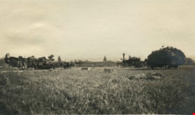
Threshing at Frost's
https://search.heritageburnaby.ca/link/archivedescription34306
- Repository
- City of Burnaby Archives
- Date
- 1923
- Collection/Fonds
- Burnaby Historical Society fonds
- Description Level
- Item
- Physical Description
- 1 photograph : b&w ; 7.5 x 12.4 cm on page 17.5 x 24 cm
- Scope and Content
- Photograph of a threshing machine working in a field. An unidentified man can be seen sitting on top of a pile of hay on a wagon. Written under the photograph is: "Threshing at Frost's Sept. '23." The picture was taken in the Tynehead area of Surrey.
- Repository
- City of Burnaby Archives
- Date
- 1923
- Collection/Fonds
- Burnaby Historical Society fonds
- Subseries
- Peers family subseries
- Physical Description
- 1 photograph : b&w ; 7.5 x 12.4 cm on page 17.5 x 24 cm
- Description Level
- Item
- Record No.
- 020-013
- Access Restriction
- No restrictions
- Reproduction Restriction
- No known restrictions
- Accession Number
- BHS2007-04
- Scope and Content
- Photograph of a threshing machine working in a field. An unidentified man can be seen sitting on top of a pile of hay on a wagon. Written under the photograph is: "Threshing at Frost's Sept. '23." The picture was taken in the Tynehead area of Surrey.
- Media Type
- Photograph
- Notes
- Title based on caption accompanying photograph
Images

![Tom and Kitty, [1904] thumbnail](/media/hpo/_Data/_Archives_Images/_Unrestricted/477/477-861.jpg?width=280)
Tom and Kitty
https://search.heritageburnaby.ca/link/archivedescription39542
- Repository
- City of Burnaby Archives
- Date
- [1904]
- Collection/Fonds
- Peers Family and Hill Family fonds
- Description Level
- Item
- Physical Description
- 1 photograph : b&w ; 5 x 7.5 cm on page 21.5 x 28 cm (pasted in album)
- Scope and Content
- Photograph of Kitty Hill riding on her horse Tom, who is pulling a hay rake. The photograph was taken at the Hill family farm on Deer Lake Avenue, known as Brookfield. This is the current site of the Burnaby Village Museum.
- Repository
- City of Burnaby Archives
- Date
- [1904]
- Collection/Fonds
- Peers Family and Hill Family fonds
- Physical Description
- 1 photograph : b&w ; 5 x 7.5 cm on page 21.5 x 28 cm (pasted in album)
- Description Level
- Item
- Record No.
- 477-861
- Access Restriction
- No restrictions
- Reproduction Restriction
- No known restrictions
- Accession Number
- 2007-12
- Scope and Content
- Photograph of Kitty Hill riding on her horse Tom, who is pulling a hay rake. The photograph was taken at the Hill family farm on Deer Lake Avenue, known as Brookfield. This is the current site of the Burnaby Village Museum.
- Media Type
- Photograph
- Notes
- Title based on caption accompanying photograph
- Geographic Access
- Deer Lake Avenue
- Street Address
- 6501 Deer Lake Avenue
- Historic Neighbourhood
- Burnaby Lake (Historic Neighbourhood)
- Planning Study Area
- Morley-Buckingham Area
Images
![Tom and Kitty, [1904] thumbnail](/media/hpo/_Data/_Archives_Images/_Unrestricted/477/477-861.jpg)
![Tom pulling a hay rake, [1905] thumbnail](/media/hpo/_Data/_Archives_Images/_Unrestricted/477/477-179.jpg?width=280)
Tom pulling a hay rake
https://search.heritageburnaby.ca/link/archivedescription38860
- Repository
- City of Burnaby Archives
- Date
- [1905]
- Collection/Fonds
- Peers Family and Hill Family fonds
- Description Level
- Item
- Physical Description
- 1 photograph : sepia ; 5.5 x 10.2 cm on page 14 x 17.5 cm (pasted in album)
- Scope and Content
- Photograph of horse, "Tom," pulling a hay rake through a field. The photograph appears to have been taken at the home of Claude Hill in the Burnaby Lake area.
- Repository
- City of Burnaby Archives
- Date
- [1905]
- Collection/Fonds
- Peers Family and Hill Family fonds
- Physical Description
- 1 photograph : sepia ; 5.5 x 10.2 cm on page 14 x 17.5 cm (pasted in album)
- Description Level
- Item
- Record No.
- 477-179
- Access Restriction
- No restrictions
- Reproduction Restriction
- No known restrictions
- Accession Number
- 2007-12
- Scope and Content
- Photograph of horse, "Tom," pulling a hay rake through a field. The photograph appears to have been taken at the home of Claude Hill in the Burnaby Lake area.
- Media Type
- Photograph
- Notes
- Title based on contents of photograph
- Geographic Access
- Deer Lake Avenue
- Street Address
- 6501 Deer Lake Avenue
- Historic Neighbourhood
- Burnaby Lake (Historic Neighbourhood)
- Planning Study Area
- Morley-Buckingham Area
Images
![Tom pulling a hay rake, [1905] thumbnail](/media/hpo/_Data/_Archives_Images/_Unrestricted/477/477-179.jpg)
![View at back of mushroom houses, [before 1969] (date of original), digitally copied 2013 thumbnail](/media/hpo/_Data/_Archives_Images/_Unrestricted/550/552-005.jpg?width=280)
View at back of mushroom houses
https://search.heritageburnaby.ca/link/archivedescription77191
- Repository
- City of Burnaby Archives
- Date
- [before 1969] (date of original), digitally copied 2013
- Collection/Fonds
- Stiglish family fonds
- Description Level
- Item
- Physical Description
- 1 photograph : b&w copy-print ; 9 x 9 cm
- Scope and Content
- Photograph of the equipment at the back of the mushroom houses used to get compost ready to be used in the mushroom houses.
- Repository
- City of Burnaby Archives
- Date
- [before 1969] (date of original), digitally copied 2013
- Collection/Fonds
- Stiglish family fonds
- Physical Description
- 1 photograph : b&w copy-print ; 9 x 9 cm
- Description Level
- Item
- Record No.
- 552-005
- Access Restriction
- No restrictions
- Reproduction Restriction
- Reproduce for fair dealing purposes only
- Accession Number
- 2013-07
- Scope and Content
- Photograph of the equipment at the back of the mushroom houses used to get compost ready to be used in the mushroom houses.
- Media Type
- Photograph
- Notes
- Title based on contents of photograph
- Note in blue ink on verso of photograph reads: "curing [illegible] - with compost on for mushroom houses / at back of mushroom houses no 5 and no 6"
- Original spelling of surname was "Stiglich"
- Geographic Access
- Keswick Avenue
- Street Address
- 3782 Keswick Avenue
- Historic Neighbourhood
- Burquitlam (Historic Neighbourhood)
- Planning Study Area
- Cameron Area
Images
![View at back of mushroom houses, [before 1969] (date of original), digitally copied 2013 thumbnail](/media/hpo/_Data/_Archives_Images/_Unrestricted/550/552-005.jpg)
![Bill and Jackie Martin, [between 1933 and 1940] (date of original), copied 2011 thumbnail](/media/hpo/_Data/_Archives_Images/_Unrestricted/513/525-018.jpg?width=280)
Bill and Jackie Martin
https://search.heritageburnaby.ca/link/archivedescription66712
- Repository
- City of Burnaby Archives
- Date
- [between 1933 and 1940] (date of original), copied 2011
- Collection/Fonds
- William Martin family fonds
- Description Level
- Item
- Physical Description
- 1 photograph (jpeg)
- Scope and Content
- Photograph of Bill and his younger brother Jackie Martin, each pushing their own wheelbarrow.
- Repository
- City of Burnaby Archives
- Date
- [between 1933 and 1940] (date of original), copied 2011
- Collection/Fonds
- William Martin family fonds
- Physical Description
- 1 photograph (jpeg)
- Description Level
- Item
- Record No.
- 525-018
- Access Restriction
- No restrictions
- Reproduction Restriction
- No restrictions
- Accession Number
- 2011-11
- Scope and Content
- Photograph of Bill and his younger brother Jackie Martin, each pushing their own wheelbarrow.
- Subjects
- Agricultural Tools and Equipment
- Media Type
- Photograph
- Photographer
- Martin, William
- Notes
- Title based on contents of photograph
- Geographic Access
- Spruce Street
- Historic Neighbourhood
- Burnaby Lake (Historic Neighbourhood)
- Planning Study Area
- Douglas-Gilpin Area
Images
![Bill and Jackie Martin, [between 1933 and 1940] (date of original), copied 2011 thumbnail](/media/hpo/_Data/_Archives_Images/_Unrestricted/513/525-018.jpg)
![Bill Dunbar, [1938] (date of original), copied 1991 thumbnail](/media/hpo/_Data/_Archives_Images/_Unrestricted/370/370-546.jpg?width=280)
Bill Dunbar
https://search.heritageburnaby.ca/link/archivedescription37959
- Repository
- City of Burnaby Archives
- Date
- [1938] (date of original), copied 1991
- Collection/Fonds
- Burnaby Historical Society fonds
- Description Level
- Item
- Physical Description
- 1 photograph : b&w ; 3.4 x 2.4 cm print on contact sheet 20.6 x 26.1 cm
- Scope and Content
- Photograph of Bill Dunbar working in a field at Sperling Avenue and Douglas Road.
- Repository
- City of Burnaby Archives
- Date
- [1938] (date of original), copied 1991
- Collection/Fonds
- Burnaby Historical Society fonds
- Subseries
- Burnaby Image Bank subseries
- Physical Description
- 1 photograph : b&w ; 3.4 x 2.4 cm print on contact sheet 20.6 x 26.1 cm
- Description Level
- Item
- Record No.
- 370-546
- Access Restriction
- No restrictions
- Reproduction Restriction
- No known restrictions
- Accession Number
- BHS1999-03
- Scope and Content
- Photograph of Bill Dunbar working in a field at Sperling Avenue and Douglas Road.
- Names
- Dunbar, Bill
- Media Type
- Photograph
- Notes
- Title based on contents of photograph
- 1 b&w copy negative accompanying
- Geographic Access
- Canada Way
- Sperling Avenue
- Historic Neighbourhood
- Burnaby Lake (Historic Neighbourhood)
- Planning Study Area
- Morley-Buckingham Area
Images
![Bill Dunbar, [1938] (date of original), copied 1991 thumbnail](/media/hpo/_Data/_Archives_Images/_Unrestricted/370/370-546.jpg)