Narrow Results By
Subject
- Advertising Medium - Signs and Signboards 1
- Building Components 1
- Building Components - Fireplaces
- Buildings - Other 1
- Buildings - Religious - Churches 2
- Buildings - Residential - Houses 10
- Construction
- Construction Tools and Equipment 2
- Geographic Features - Automobile Parking Lots 1
- Land Clearing 1
- Maintenance Tools and Equipment - Washing Machine 1
- Occupations - Clergy 1
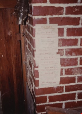
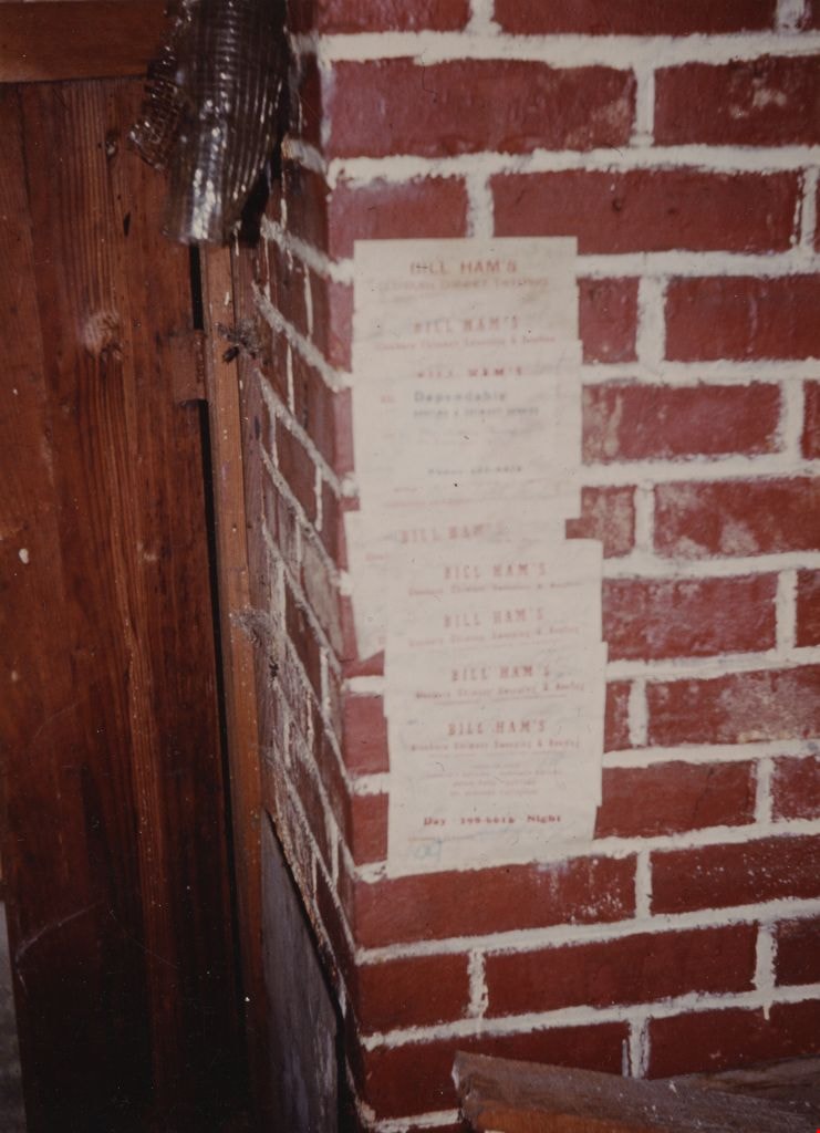
Basement at Tom Irvine's house
https://search.heritageburnaby.ca/link/museumdescription1863
- Repository
- Burnaby Village Museum
- Date
- December 1974
- Collection/Fonds
- Century Park Museum Association fonds
- Description Level
- Item
- Physical Description
- 1 photograph : col. ; 17.5 x 13 cm reprint
- Scope and Content
- Photograph of the chimney bricks (with inspection stickers by Bill Ham) in the basement at Tom Irvine's house in its original location on Laurel Street in Central Burnaby.
- Repository
- Burnaby Village Museum
- Collection/Fonds
- Century Park Museum Association fonds
- Description Level
- Item
- Physical Description
- 1 photograph : col. ; 17.5 x 13 cm reprint
- Scope and Content
- Photograph of the chimney bricks (with inspection stickers by Bill Ham) in the basement at Tom Irvine's house in its original location on Laurel Street in Central Burnaby.
- Subjects
- Building Components - Fireplaces
- Names
- Irvine, Tom
- Geographic Access
- Laurel Street
- Accession Code
- BV005.14.16
- Access Restriction
- Restricted access
- Reproduction Restriction
- May be restricted by third party rights
- Date
- December 1974
- Media Type
- Photograph
- Historic Neighbourhood
- Burnaby Lake (Historic Neighbourhood)
- Planning Study Area
- Ardingley-Sprott Area
- Scan Resolution
- 600
- Scan Date
- 10-Jun-09
- Scale
- 100
- Notes
- Title based on contents of photograph
- Note in blue ink on verso of photograph reads: "Irvine House Basement December 1974 (reprint from slide)"
- Reprint is a Kodak "Type R" print made from an original col. transparency
- Reference file at BVM includes a col. copy slide of this image
Images

Construction of Saint Theresa's Roman Catholic Church
https://search.heritageburnaby.ca/link/museumdescription903
- Repository
- Burnaby Village Museum
- Date
- March 19, 1929
- Collection/Fonds
- Burnaby Village Museum Photograph collection
- Description Level
- Item
- Physical Description
- 1 photograph : sepia ; 6.9 x 11.5 cm
- Scope and Content
- Photograph of Douglas Road (later renamed in part Canada Way) with Laurel Street in the background on the left and the site of Saint Theresa's Roman Catholic Church as a lot with blackened stumps. The church was located at the southeast corner of Canada Way and Laurel Street. The photograph is ta…
- Repository
- Burnaby Village Museum
- Collection/Fonds
- Burnaby Village Museum Photograph collection
- Description Level
- Item
- Physical Description
- 1 photograph : sepia ; 6.9 x 11.5 cm
- Scope and Content
- Photograph of Douglas Road (later renamed in part Canada Way) with Laurel Street in the background on the left and the site of Saint Theresa's Roman Catholic Church as a lot with blackened stumps. The church was located at the southeast corner of Canada Way and Laurel Street. The photograph is taken from the same angle as HV975.105.1. There is a freight wagon loaded with lumber, pulled by two horses on Douglas Road. An annotation on the back of the photo reads, "March 19th 1929 / The first load of lumber taken for the construction of St St [sic] Therese [sic] Church on the Grandview Highway / Burnaby BC."
- Geographic Access
- Douglas Road
- Canada Way
- Laurel Street
- Accession Code
- HV975.105.2
- Access Restriction
- No restrictions
- Reproduction Restriction
- No known restrictions
- Date
- March 19, 1929
- Media Type
- Photograph
- Historic Neighbourhood
- Burnaby Lake (Historic Neighbourhood)
- Planning Study Area
- Douglas-Gilpin Area
- Scan Resolution
- 600
- Scan Date
- 2023-06-13
- Notes
- Title based on contents of photograph
- Information on the scope and content of the photograph is taken from an acquisition record from the time of the accession
Images
