Narrow Results By
Subject
- Advertising Medium - Signs and Signboards 3
- Aerial Photographs 3
- Animals - Cats 3
- Animals - Dogs 1
- Animals - Poultry 1
- Buildings - Commercial 5
- Buildings - Commercial - Offices 4
- Buildings - Heritage 1
- Buildings - Residential 1
- Buildings - Residential - Houses 4
- Clothing 1
- Construction - Road Construction 1
Person / Organization
- Allard, Nancy Davis 1
- Bower, Janet Shankie 17
- British Columbia Electric Railway Company 1
- British Columbia Telephone Company 2
- Carpenter, Ernie 1
- Charles, Prince of Wales, 1948- 1
- Diana, Princess of Wales, 1961-1997 1
- Ellis, Bobby 1
- Lewarne, William A. "Bill" 1
- McKeeman, Ann 1
- McKeeman, Shannon 1
- Paterson, Bob 1
Coburn House
https://search.heritageburnaby.ca/link/landmark510
- Repository
- Burnaby Heritage Planning
- Description
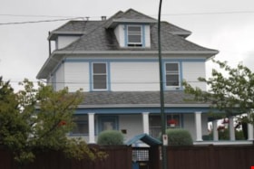
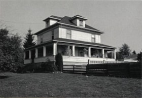
- The Coburn House is a two and one-half storey plus basement Foursquare farm house. Prominently situated on a rise of land along the east side of Boundary Road overlooking Kingsway, it stands among single-family houses later constructed on its subdivided farm land.
- Associated Dates
- 1910
- Formal Recognition
- Heritage Designation, Community Heritage Register
- Other Names
- Minerva Jane Coburn House
- Street View URL
- Google Maps Street View
- Repository
- Burnaby Heritage Planning
- Other Names
- Minerva Jane Coburn House
- Geographic Access
- Boundary Road
- Associated Dates
- 1910
- Formal Recognition
- Heritage Designation, Community Heritage Register
- Enactment Type
- Bylaw No. 9184
- Enactment Date
- 08/05/1989
- Description
- The Coburn House is a two and one-half storey plus basement Foursquare farm house. Prominently situated on a rise of land along the east side of Boundary Road overlooking Kingsway, it stands among single-family houses later constructed on its subdivided farm land.
- Heritage Value
- The Coburn House is important as a surviving representation of Burnaby’s early settlement period, when the municipality was largely an agricultural and residential suburb. It was built in 1910 by carpenter William Kirkham for Minerva Jane Coburn (1868-1940), and three years later the builder and client were married. Together, they operated the Surprise Poultry Farm, and were frequent participants at the local Central Park Farmers' Institute Exhibitions. This house is valued as an excellent and well-preserved example of a substantial Edwardian era Foursquare farm house. Significant due to its generous size, dominant symmetry, the prominent verandah that wraps around the front and both sides, and the three roof dormers, this house retains a high degree of original material and integrity. The elevated siting of the house, its tall proportions and symmetrical appearance combined with its fine condition make this an excellent example of its type.
- Defining Elements
- Key elements that define the heritage character of the Coburn House include its: - prominent location on Boundary Road, on an elevated site overlooking Vancouver - residential form, scale and massing as expressed by its cubic massing and tall, dominant roof form - Foursquare style as exemplified by its symmetry, square floor plan, pyramidal bellcast roof and three hipped dormers - Edwardian era construction details such as narrow bevelled wooden siding, broad horizontal eave band with scroll-cut eave brackets, and simple window surrounds - wraparound verandah encircling three main facades, with hipped roof, square columns and closed balustrades, connected to one storey extension at rear - projecting bay window on the main floor south facade - original double-hung 1-over-1 wooden-sash windows, some in double assembly on the ground floor - internal red brick chimney
- Historic Neighbourhood
- Central Park (Historic Neighbourhood)
- Planning Study Area
- Garden Village Area
- Function
- Primary Historic--Single Dwelling
- Primary Current--Single Dwelling
- Community
- Burnaby
- Cadastral Identifier
- 002-653-427
- Boundaries
- The Coburn House is comprised of a single residential lot located at 5170 Boundary Road, Burnaby
- Area
- 541.91
- Contributing Resource
- Building
- Ownership
- Private
- Street Address
- 5170 Boundary Road
- Street View URL
- Google Maps Street View
Images
Daniel & Amelia Mowat House
https://search.heritageburnaby.ca/link/landmark570
- Repository
- Burnaby Heritage Planning
- Description
- Residential building.
- Associated Dates
- 1913
- Formal Recognition
- Heritage Designation, Community Heritage Register
- Street View URL
- Google Maps Street View
- Repository
- Burnaby Heritage Planning
- Geographic Access
- Beresford Street
- McKay Avenue
- Associated Dates
- 1913
- Formal Recognition
- Heritage Designation, Community Heritage Register
- Enactment Type
- Bylaw No. 13058
- Enactment Date
- 12/03/2012
- Description
- Residential building.
- Heritage Value
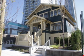
- This home was built by Daniel Mowat (1848-1923) and Amelia Mary Mowat (née Hoy, 1848-1923). Daniel originally worked as a merchant, and was operating a chicken farm at this location as early as 1908, and later a goat ranch. It is one of Burnaby’s few two-storey Arts and Crafts residences. The generous proportions of the house, its broad, medium-pitched, front-gabled roof and symmetrical design serve as further features. Additionally, the house boasts a high degree of integrity, retaining its original shingle wall cladding, half-timbered gables and original windows – a combination of casement windows with stained glass transoms and double-hung windows with square, multi-paned upper sashes.This house is located adjacent to what was once the Central Park interurban rail line, operated by the B.C. Electric Company, which conveniently connected this area of Burnaby to Vancouver. The arrival of this commuter line in 1892 led to the suburban development of this area of Burnaby.
- Locality
- Central Park
- Historic Neighbourhood
- Central Park (Historic Neighbourhood)
- Planning Study Area
- Maywood Area
- Contributing Resource
- Building
- Ownership
- Private
- Street Address
- 6368 McKay Avenue
- Street View URL
- Google Maps Street View
Images
5516-84 Barker St.
https://search.heritageburnaby.ca/link/archivedescription93740
- Repository
- City of Burnaby Archives
- Date
- 1989
- Collection/Fonds
- Grover, Elliott & Co. Ltd. fonds
- Description Level
- File
- Physical Description
- 14 photographs : col. negatives ; 35 mm
- Scope and Content
- Photographs of Barker Avenue and the properties located at 5516-5584 Barker Avenue - addresses that no longer exist. File also contains a photograph of the Sheffield Court at Central Park condominium development being constructed. Sheffield Court is located at 5635 Patterson Avenue
- Repository
- City of Burnaby Archives
- Date
- 1989
- Collection/Fonds
- Grover, Elliott & Co. Ltd. fonds
- Physical Description
- 14 photographs : col. negatives ; 35 mm
- Description Level
- File
- Record No.
- 622-025
- Access Restriction
- No restrictions
- Reproduction Restriction
- No restrictions
- Accession Number
- 2017-39
- Scope and Content
- Photographs of Barker Avenue and the properties located at 5516-5584 Barker Avenue - addresses that no longer exist. File also contains a photograph of the Sheffield Court at Central Park condominium development being constructed. Sheffield Court is located at 5635 Patterson Avenue
- Media Type
- Photograph
- Notes
- Transcribed title
- Title transcribed from print envelope photographs were originally housed in
- File no. 89-217-B
- Geographic Access
- Barker Avenue
- Patterson Avenue
- Street Address
- 5635 Patterson Avenue
- Historic Neighbourhood
- Central Park (Historic Neighbourhood)
- Planning Study Area
- Garden Village Area
Aerial view of Kingsway and Barker
https://search.heritageburnaby.ca/link/archivedescription78859
- Repository
- City of Burnaby Archives
- Date
- September 27, 1976
- Collection/Fonds
- Burnaby Public Library Contemporary Visual Archive Project
- Description Level
- Item
- Physical Description
- 1 photograph : b&w ; 11 x 16 cm mounted on cardboard
- Scope and Content
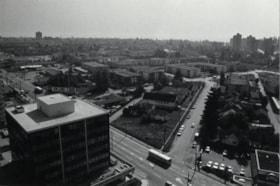
- Photograph is an aerial view of Kingsway and Barker Avenue, looking southeast from Central Park Place.
- Repository
- City of Burnaby Archives
- Date
- September 27, 1976
- Collection/Fonds
- Burnaby Public Library Contemporary Visual Archive Project
- Physical Description
- 1 photograph : b&w ; 11 x 16 cm mounted on cardboard
- Description Level
- Item
- Record No.
- 556-005
- Access Restriction
- No restrictions
- Reproduction Restriction
- Reproduce for fair dealing purposes only
- Accession Number
- 2013-13
- Scope and Content
- Photograph is an aerial view of Kingsway and Barker Avenue, looking southeast from Central Park Place.
- Subjects
- Aerial Photographs
- Media Type
- Photograph
- Photographer
- Norton, Paul
- Notes
- Scope note taken directly from BPL photograph description.
- 1 b&w copy negative : 10 x 12.5 cm accompanying
- Geographic Access
- Kingsway
- Barker Avenue
- Historic Neighbourhood
- Central Park (Historic Neighbourhood)
- Planning Study Area
- Maywood Area
- Garden Village Area
Images
Automobile on Kinnee Street
https://search.heritageburnaby.ca/link/archivedescription35060
- Repository
- City of Burnaby Archives
- Date
- 1915
- Collection/Fonds
- Burnaby Historical Society fonds
- Description Level
- Item
- Physical Description
- 1 photograph : b&w ; 11.0 x 6.2 cm
- Scope and Content
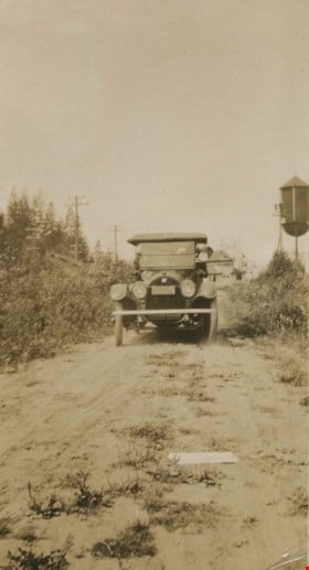
- Photograph of an automobile on Kinnee Street with the Patterson Avenue pump house and tank in the background. An annotation on the back of the photograph reads, "Water tank at Patterson Ave near the track in the Central Park (Ball park), 1915. / The roadway was Kinnee Ave which is Beresford today."
- Repository
- City of Burnaby Archives
- Date
- 1915
- Collection/Fonds
- Burnaby Historical Society fonds
- Subseries
- Pitman family subseries
- Physical Description
- 1 photograph : b&w ; 11.0 x 6.2 cm
- Description Level
- Item
- Record No.
- 186-004
- Access Restriction
- No restrictions
- Reproduction Restriction
- No known restrictions
- Accession Number
- BHS1986-35
- Scope and Content
- Photograph of an automobile on Kinnee Street with the Patterson Avenue pump house and tank in the background. An annotation on the back of the photograph reads, "Water tank at Patterson Ave near the track in the Central Park (Ball park), 1915. / The roadway was Kinnee Ave which is Beresford today."
- Media Type
- Photograph
- Notes
- Title based on contents of photograph
- Geographic Access
- Beresford Street
- Historic Neighbourhood
- Central Park (Historic Neighbourhood)
- Planning Study Area
- Maywood Area
Images
BC Tel Building
https://search.heritageburnaby.ca/link/archivedescription93609
- Repository
- City of Burnaby Archives
- Date
- October 16, 1977
- Collection/Fonds
- Burnaby Public Library Contemporary Visual Archive Project
- Description Level
- Item
- Physical Description
- 1 photograph : b&w ; 12.5 x 17.5 cm
- Scope and Content
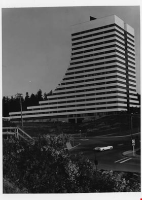
- Photograph of the BC Tel Building (now the Brian Canfield Centre), located at Kingsway and Boundary Road. The photograph is taken facing north and shows the pedestrian overpass over Kingsway and the mountains in the background.
- Repository
- City of Burnaby Archives
- Date
- October 16, 1977
- Collection/Fonds
- Burnaby Public Library Contemporary Visual Archive Project
- Physical Description
- 1 photograph : b&w ; 12.5 x 17.5 cm
- Description Level
- Item
- Record No.
- 556-566
- Access Restriction
- No restrictions
- Reproduction Restriction
- Reproduce for fair dealing purposes only
- Accession Number
- 2017-57
- Scope and Content
- Photograph of the BC Tel Building (now the Brian Canfield Centre), located at Kingsway and Boundary Road. The photograph is taken facing north and shows the pedestrian overpass over Kingsway and the mountains in the background.
- Media Type
- Photograph
- Photographer
- McGillivray, Don
- Notes
- Title taken from project information form
- Accompanied by a project information form and 1 photograph (b&w negative ; 9.5 x 12.5 cm)
- BPL no. 10
- Geographic Access
- Boundary Road
- Kingsway
- Street Address
- 3777 Kingsway
- Historic Neighbourhood
- Central Park (Historic Neighbourhood)
- Planning Study Area
- Garden Village Area
Images
BC Tel Building
https://search.heritageburnaby.ca/link/archivedescription93678
- Repository
- City of Burnaby Archives
- Date
- June 4, 1978
- Collection/Fonds
- Burnaby Public Library Contemporary Visual Archive Project
- Description Level
- Item
- Physical Description
- 1 photograph : b&w ; 17.5 x 12.5 cm
- Scope and Content
- Photograph of the exterior of the BC Tel Building, located at Kingsway and Boundary Road, and the lawn and roads in front of the building. The photograph is taken from a high point across the intersection, facing southeast.
- Repository
- City of Burnaby Archives
- Date
- June 4, 1978
- Collection/Fonds
- Burnaby Public Library Contemporary Visual Archive Project
- Physical Description
- 1 photograph : b&w ; 17.5 x 12.5 cm
- Description Level
- Item
- Record No.
- 556-635
- Access Restriction
- No restrictions
- Reproduction Restriction
- Reproduce for fair dealing purposes only
- Accession Number
- 2017-57
- Scope and Content
- Photograph of the exterior of the BC Tel Building, located at Kingsway and Boundary Road, and the lawn and roads in front of the building. The photograph is taken from a high point across the intersection, facing southeast.
- Subjects
- Buildings - Commercial - Offices
- Media Type
- Photograph
- Photographer
- Chapman, Fred
- Notes
- Title taken from project information form
- Accompanied by a project information form and 1 photograph (b&w negative ; 12.5 x 9.5 cm)
- BPL no. 84
- Geographic Access
- Boundary Road
- Kingsway
- Street Address
- 3777 Kingsway
- Historic Neighbourhood
- Central Park (Historic Neighbourhood)
- Planning Study Area
- Garden Village Area
Images
BC Tel Building
https://search.heritageburnaby.ca/link/archivedescription93679
- Repository
- City of Burnaby Archives
- Date
- June 4, 1978
- Collection/Fonds
- Burnaby Public Library Contemporary Visual Archive Project
- Description Level
- Item
- Physical Description
- 1 photograph : b&w ; 12.5 x 17.5 cm
- Scope and Content
- Photograph of the exterior of the BC Tel Building, located at Kingsway and Boundary Road. The photograph is taken from across a lawn and railway tracks, facing southeast. The railway tracks are visible in the bottom left corner of the photograph.
- Repository
- City of Burnaby Archives
- Date
- June 4, 1978
- Collection/Fonds
- Burnaby Public Library Contemporary Visual Archive Project
- Physical Description
- 1 photograph : b&w ; 12.5 x 17.5 cm
- Description Level
- Item
- Record No.
- 556-636
- Access Restriction
- No restrictions
- Reproduction Restriction
- Reproduce for fair dealing purposes only
- Accession Number
- 2017-57
- Scope and Content
- Photograph of the exterior of the BC Tel Building, located at Kingsway and Boundary Road. The photograph is taken from across a lawn and railway tracks, facing southeast. The railway tracks are visible in the bottom left corner of the photograph.
- Media Type
- Photograph
- Photographer
- Chapman, Fred
- Notes
- Title taken from project information form
- Accompanied by a project information form and 1 photograph (b&w negative ; 9.5 x 12.5 cm)
- BPL no. 85
- Geographic Access
- Boundary Road
- Kingsway
- Street Address
- 3777 Kingsway
- Historic Neighbourhood
- Central Park (Historic Neighbourhood)
- Planning Study Area
- Garden Village Area
Images
BC Tel Building
https://search.heritageburnaby.ca/link/archivedescription93680
- Repository
- City of Burnaby Archives
- Date
- June 4, 1978
- Collection/Fonds
- Burnaby Public Library Contemporary Visual Archive Project
- Description Level
- Item
- Physical Description
- 1 photograph : b&w ; 12.5 x 17.5 cm
- Scope and Content
- Photograph of the exterior of the BC Tel Building, located at Kingsway and Boundary Road, and the lawn and neighbourhood surrounding the building. The photograph is taken from across the lawn, facing north. Boundary Road is on the left side of the photograph and the mountains are visible in the bac…
- Repository
- City of Burnaby Archives
- Date
- June 4, 1978
- Collection/Fonds
- Burnaby Public Library Contemporary Visual Archive Project
- Physical Description
- 1 photograph : b&w ; 12.5 x 17.5 cm
- Description Level
- Item
- Record No.
- 556-637
- Access Restriction
- No restrictions
- Reproduction Restriction
- Reproduce for fair dealing purposes only
- Accession Number
- 2017-57
- Scope and Content
- Photograph of the exterior of the BC Tel Building, located at Kingsway and Boundary Road, and the lawn and neighbourhood surrounding the building. The photograph is taken from across the lawn, facing north. Boundary Road is on the left side of the photograph and the mountains are visible in the background.
- Media Type
- Photograph
- Photographer
- Chapman, Fred
- Notes
- Title taken from project information form
- Accompanied by a project information form and 1 photograph (b&w negative ; 9.5 x 12.5 cm)
- BPL no. 86
- Geographic Access
- Kingsway
- Boundary Road
- Street Address
- 3777 Kingsway
- Historic Neighbourhood
- Central Park (Historic Neighbourhood)
- Planning Study Area
- Garden Village Area
Images
Bertha and Ramsay Shankie on porch
https://search.heritageburnaby.ca/link/museumdescription4109
- Repository
- Burnaby Village Museum
- Date
- [June 1923] (date of original), copied [2016]
- Collection/Fonds
- Esther Love Stanley fonds
- Description Level
- Item
- Physical Description
- 1 photograph (tiff)
- Scope and Content
- Photograph of a one story house and garden. House has been identified as the Shankie family home located at 3718 Barker Avenue (address after 1960: 5515 Barker Avenue). Bertha Shankie is standing on the front porch of the house and Ramsay Shankie is standing in the garden. Ramsay is wearing shorts …
- Repository
- Burnaby Village Museum
- Collection/Fonds
- Esther Love Stanley fonds
- Description Level
- Item
- Physical Description
- 1 photograph (tiff)
- Material Details
- Handwritten date at bottom of photograph reads: "June 1923".
- Scope and Content
- Photograph of a one story house and garden. House has been identified as the Shankie family home located at 3718 Barker Avenue (address after 1960: 5515 Barker Avenue). Bertha Shankie is standing on the front porch of the house and Ramsay Shankie is standing in the garden. Ramsay is wearing shorts and a white hat. A neighbouring house can be glimpsed on the right side of the photograph.
- Geographic Access
- Barker Avenue
- Street Address
- 5515 Barker Avenue
- Accession Code
- BV016.43.10
- Access Restriction
- No restrictions
- Reproduction Restriction
- May be restricted by third party rights
- Date
- [June 1923] (date of original), copied [2016]
- Media Type
- Photograph
- Historic Neighbourhood
- Central Park (Historic Neighbourhood)
- Planning Study Area
- Garden Village Area
- Notes
- Title based on contents of photograph.
- Image is from a binder of family history. Binder 1, orange cover "Old Stanley Family Photo / Old Shankie Family Photos / War Photos - Echo Photos".
- Digital image created from orginal photograph by donor
Images
Bertha, Janet and Ramsay Shankie
https://search.heritageburnaby.ca/link/museumdescription5523
- Repository
- Burnaby Village Museum
- Date
- 1923 (date of original), copied [2016]
- Collection/Fonds
- Esther Love Stanley fonds
- Description Level
- Item
- Physical Description
- 1 photograph (tiff)
- Scope and Content
- Photograph of a young Ramsay Shankie walking towards the camera on a sidewalk in front of a house's front porch. Behind him is Bertha Shankie standing, holding a baby Janet Shankie. House is identified as being the Shankie house on Barker Avenue.
- Repository
- Burnaby Village Museum
- Collection/Fonds
- Esther Love Stanley fonds
- Description Level
- Item
- Physical Description
- 1 photograph (tiff)
- Material Details
- Handwritten text in black on front of photograph [illegible]
- Scope and Content
- Photograph of a young Ramsay Shankie walking towards the camera on a sidewalk in front of a house's front porch. Behind him is Bertha Shankie standing, holding a baby Janet Shankie. House is identified as being the Shankie house on Barker Avenue.
- Subjects
- Persons - Children
- Geographic Access
- Barker Avenue
- Street Address
- 5515 Barker Avenue
- Accession Code
- BV016.43.30
- Access Restriction
- No restrictions
- Reproduction Restriction
- May be restricted by third party rights
- Date
- 1923 (date of original), copied [2016]
- Media Type
- Photograph
- Historic Neighbourhood
- Central Park (Historic Neighbourhood)
- Planning Study Area
- Garden Village Area
- Notes
- Title based on contents of photograph.
- Image is from a binder of family history. Binder 1, orange cover "Old Stanley Family Photo / Old Shankie Family Photos / War Photos - Echo Photos".
- Digital image created from orginal photograph by donor
Images
Bertha, Janet and Ramsay Shankie with cat
https://search.heritageburnaby.ca/link/museumdescription4119
- Repository
- Burnaby Village Museum
- Date
- [1923] (date of original), copied [2016]
- Collection/Fonds
- Esther Love Stanley fonds
- Description Level
- Item
- Physical Description
- 1 photograph (tiff)
- Scope and Content
- Photograph of Bertha Shankie seated on a lawn, holding a cat. Seated on a large cushion in front of Bertha is Ramsay Shankie and baby Janet Shankie. Bertha and Janet are both wearing light coloured dresses. Ramsay is wearing a light coloured short sleeve shirt. The group is seated in a garden, besi…
- Repository
- Burnaby Village Museum
- Collection/Fonds
- Esther Love Stanley fonds
- Description Level
- Item
- Physical Description
- 1 photograph (tiff)
- Material Details
- Handwritten text in white on front of photograph reads: " (illegible) 1923".
- Scope and Content
- Photograph of Bertha Shankie seated on a lawn, holding a cat. Seated on a large cushion in front of Bertha is Ramsay Shankie and baby Janet Shankie. Bertha and Janet are both wearing light coloured dresses. Ramsay is wearing a light coloured short sleeve shirt. The group is seated in a garden, beside the Shankie's Barker Avenue home.
- Subjects
- Persons - Children
- Animals - Cats
- Geographic Access
- Barker Avenue
- Street Address
- 5515 Barker Avenue
- Accession Code
- BV016.43.20
- Access Restriction
- No restrictions
- Reproduction Restriction
- May be restricted by third party rights
- Date
- [1923] (date of original), copied [2016]
- Media Type
- Photograph
- Historic Neighbourhood
- Central Park (Historic Neighbourhood)
- Planning Study Area
- Garden Village Area
- Notes
- Title based on contents of photograph.
- Image is from a binder of family history. Binder 1, orange cover "Old Stanley Family Photo / Old Shankie Family Photos / War Photos - Echo Photos".
- Digital image created from orginal photograph by donor
Images
Bertha, Ramsay and Janet Shankie
https://search.heritageburnaby.ca/link/museumdescription4118
- Repository
- Burnaby Village Museum
- Date
- [1923] (date of original), copied [2016]
- Collection/Fonds
- Esther Love Stanley fonds
- Description Level
- Item
- Physical Description
- 1 photograph (tiff)
- Scope and Content
- Photograph of Bertha Shankie holding a baby Janet Shankie, with a young Ramsay Shankie standing in front of her. Bertha and Janet are both wearing light coloured dresses. Ramsay is wearing a light coloured collared shirt and bib overall shorts. The group is standing in a garden, beside the Shankie'…
- Repository
- Burnaby Village Museum
- Collection/Fonds
- Esther Love Stanley fonds
- Description Level
- Item
- Physical Description
- 1 photograph (tiff)
- Material Details
- Handwritten text in black ink on front of photograph reads: " (illegible) 7 1923".
- Scope and Content
- Photograph of Bertha Shankie holding a baby Janet Shankie, with a young Ramsay Shankie standing in front of her. Bertha and Janet are both wearing light coloured dresses. Ramsay is wearing a light coloured collared shirt and bib overall shorts. The group is standing in a garden, beside the Shankie's Barker Avenue home. There is topiary vegetation and a picket fence behind them.
- Names
- Shankie, Bertha Gray, 1891-1965
- Shankie, Thomas Ramsay Hunter, 1920-1996
- Bower, Janet Shankie
- Shankie Family
- Geographic Access
- Barker Avenue
- Street Address
- 5515 Barker Avenue
- Accession Code
- BV016.43.19
- Access Restriction
- No restrictions
- Reproduction Restriction
- May be restricted by third party rights
- Date
- [1923] (date of original), copied [2016]
- Media Type
- Photograph
- Historic Neighbourhood
- Central Park (Historic Neighbourhood)
- Planning Study Area
- Garden Village Area
- Notes
- Title based on contents of photograph.
- Image is from a binder of family history. Binder 1, orange cover "Old Stanley Family Photo / Old Shankie Family Photos / War Photos - Echo Photos".
- Digital image created from orginal photograph by donor
Images
Bertha, Ramsay and Janet Shankie with cat
https://search.heritageburnaby.ca/link/museumdescription4121
- Repository
- Burnaby Village Museum
- Date
- [8 June 1924] (date of original), copied [2016]
- Collection/Fonds
- Esther Love Stanley fonds
- Description Level
- Item
- Physical Description
- 1 photograph (tiff)
- Scope and Content
- Photograph of Bertha Shankie standing with two young children, Ramsay and Janet Shankie. A cat is sitting at her feet. Ramsay is standing in front of Bertha, while Janet is seated on a tricycle without pedals. Bertha and Janet are wearing light coloured dresses. Ramsay is wearing a long sleeved dar…
- Repository
- Burnaby Village Museum
- Collection/Fonds
- Esther Love Stanley fonds
- Description Level
- Item
- Physical Description
- 1 photograph (tiff)
- Material Details
- Handwritten text in white on front of photograph reads: "8th June 1924".
- Image taken at the same time as BV016.43.26.
- Scope and Content
- Photograph of Bertha Shankie standing with two young children, Ramsay and Janet Shankie. A cat is sitting at her feet. Ramsay is standing in front of Bertha, while Janet is seated on a tricycle without pedals. Bertha and Janet are wearing light coloured dresses. Ramsay is wearing a long sleeved dark coloured shirt and shorts. They are standing on a wooden sidewalk, in front of a picket fence and topiary vegetation. Bertha and Thomas Shankie's home on Barker Avenue is partially visible in the background.
- Subjects
- Persons - Children
- Geographic Access
- Barker Avenue
- Street Address
- 5515 Barker Avenue
- Accession Code
- BV016.43.22
- Access Restriction
- No restrictions
- Reproduction Restriction
- May be restricted by third party rights
- Date
- [8 June 1924] (date of original), copied [2016]
- Media Type
- Photograph
- Historic Neighbourhood
- Central Park (Historic Neighbourhood)
- Planning Study Area
- Garden Village Area
- Notes
- Title based on contents of photograph.
- Image is from a binder of family history. Binder 1, orange cover "Old Stanley Family Photo / Old Shankie Family Photos / War Photos - Echo Photos".
- Digital image created from orginal photograph by donor
Images
Bertha Shankie in garden with pets
https://search.heritageburnaby.ca/link/museumdescription4125
- Repository
- Burnaby Village Museum
- Date
- [between 1930 and 1940] (date of original), copied [2016]
- Collection/Fonds
- Esther Love Stanley fonds
- Description Level
- Item
- Physical Description
- 1 photograph (tiff)
- Scope and Content
- Photograph of Bertha Shankie sitting on a bench in a garden. She is holding two cats and there is a dog sitting at her feet. The family's Barker Avenue home and yard is visible behind her.
- Repository
- Burnaby Village Museum
- Collection/Fonds
- Esther Love Stanley fonds
- Description Level
- Item
- Physical Description
- 1 photograph (tiff)
- Material Details
- Handwritten text in white on back of photograph reads: "Do you know Who this [?] / Looks pretty cranky".
- Scope and Content
- Photograph of Bertha Shankie sitting on a bench in a garden. She is holding two cats and there is a dog sitting at her feet. The family's Barker Avenue home and yard is visible behind her.
- Subjects
- Animals - Cats
- Animals - Dogs
- Geographic Access
- Barker Avenue
- Street Address
- 5515 Barker Avenue
- Accession Code
- BV016.43.25
- Access Restriction
- No restrictions
- Reproduction Restriction
- May be restricted by third party rights
- Date
- [between 1930 and 1940] (date of original), copied [2016]
- Media Type
- Photograph
- Historic Neighbourhood
- Central Park (Historic Neighbourhood)
- Planning Study Area
- Garden Village Area
- Notes
- Title based on contents of photograph.
- Image is from a binder of family history. Binder 1, orange cover "Old Stanley Family Photo / Old Shankie Family Photos / War Photos - Echo Photos".
- Digital image created from orginal photograph by donor
Images
Bertha Shankie with children Ramsay and Janet Shankie and cat
https://search.heritageburnaby.ca/link/museumdescription4126
- Repository
- Burnaby Village Museum
- Date
- 8 Jun. 1924 (date of original), copied [2016]
- Collection/Fonds
- Esther Love Stanley fonds
- Description Level
- Item
- Physical Description
- 1 photograph (tiff)
- Scope and Content
- Photograph of Bertha Shankie kneeling behind two young children, Janet and Ramsay Shankie. A cat is walking in front of the group. Ramsay Shankie is standing beside Bertha, while Janet is seated on a tricycle without pedals. Bertha and Janet are wearing light coloured dresses. Ramsay is wearing a l…
- Repository
- Burnaby Village Museum
- Collection/Fonds
- Esther Love Stanley fonds
- Description Level
- Item
- Physical Description
- 1 photograph (tiff)
- Material Details
- Handwritten text in white on front of photograph reads: "8th June 1924".
- Image taken at the same time as BV016.43.22.
- Scope and Content
- Photograph of Bertha Shankie kneeling behind two young children, Janet and Ramsay Shankie. A cat is walking in front of the group. Ramsay Shankie is standing beside Bertha, while Janet is seated on a tricycle without pedals. Bertha and Janet are wearing light coloured dresses. Ramsay is wearing a long sleeved dark coloured shirt and shorts. They are standing on a wooden sidewalk, in front of a picket fence and topiary vegetation. The family's Barker Avenue home is partially visible in the background.
- Subjects
- Persons - Children
- Animals - Cats
- Geographic Access
- Barker Avenue
- Street Address
- 5515 Barker Avenue
- Accession Code
- BV016.43.26
- Access Restriction
- No restrictions
- Reproduction Restriction
- May be restricted by third party rights
- Date
- 8 Jun. 1924 (date of original), copied [2016]
- Media Type
- Photograph
- Historic Neighbourhood
- Central Park (Historic Neighbourhood)
- Planning Study Area
- Garden Village Area
- Notes
- Title based on contents of photograph.
- Image is from a binder of family history. Binder 1, orange cover "Old Stanley Family Photo / Old Shankie Family Photos / War Photos - Echo Photos".
- Digital image created from orginal photograph by donor
Images
Bertha Shankie with Ramsay and baby Janet Shankie
https://search.heritageburnaby.ca/link/museumdescription4128
- Repository
- Burnaby Village Museum
- Date
- [1923] (date of original), copied [2016]
- Collection/Fonds
- Esther Love Stanley fonds
- Description Level
- Item
- Physical Description
- 1 photograph (tiff)
- Scope and Content
- Photograph of Bertha Shankie sitting on the porch of the family's Barker Avenue house. Next to her is Ramsay Shankie and they are holding baby Janet Shankie in between them.
- Repository
- Burnaby Village Museum
- Collection/Fonds
- Esther Love Stanley fonds
- Description Level
- Item
- Physical Description
- 1 photograph (tiff)
- Material Details
- Image taken at the same time as BV016.43.30.
- Scope and Content
- Photograph of Bertha Shankie sitting on the porch of the family's Barker Avenue house. Next to her is Ramsay Shankie and they are holding baby Janet Shankie in between them.
- Subjects
- Persons - Children
- Geographic Access
- Barker Avenue
- Street Address
- 5515 Barker Avenue
- Accession Code
- BV016.43.28
- Access Restriction
- No restrictions
- Reproduction Restriction
- May be restricted by third party rights
- Date
- [1923] (date of original), copied [2016]
- Media Type
- Photograph
- Historic Neighbourhood
- Central Park (Historic Neighbourhood)
- Planning Study Area
- Garden Village Area
- Related Material
- See also BV016.43.30.
- Notes
- Title based on contents of photograph.
- Image is from a binder of family history. Binder 1, orange cover "Old Stanley Family Photo / Old Shankie Family Photos / War Photos - Echo Photos".
- Digital image created from orginal photograph by donor
Images
Berth Shankie with her two children
https://search.heritageburnaby.ca/link/museumdescription5607
- Repository
- Burnaby Village Museum
- Date
- 1923 (date of original), copied [2016]
- Collection/Fonds
- Esther Love Stanley fonds
- Description Level
- Item
- Physical Description
- 1 photograph (jpg)
- Scope and Content
- Group photograph of mother, Bertha Gray Shankie, with her two children, Thomas Ramsay Shankie aged about three years, and Janet Shankie Bower, in arms. Group is seated on front steps of their home at 3718 Barker Avenue (5515 Barker Avenue). Baby Janet is held between Ramsay on the left and Bertha o…
- Repository
- Burnaby Village Museum
- Collection/Fonds
- Esther Love Stanley fonds
- Description Level
- Item
- Physical Description
- 1 photograph (jpg)
- Scope and Content
- Group photograph of mother, Bertha Gray Shankie, with her two children, Thomas Ramsay Shankie aged about three years, and Janet Shankie Bower, in arms. Group is seated on front steps of their home at 3718 Barker Avenue (5515 Barker Avenue). Baby Janet is held between Ramsay on the left and Bertha on the right.
- Subjects
- Persons - Children
- Names
- Shankie, Thomas Ramsay Hunter, 1920-1996
- Shankie, Bertha Gray, 1891-1965
- Bower, Janet Shankie
- Shankie Family
- Geographic Access
- Barker Avenue
- Street Address
- 5515 Barker Avenue
- Accession Code
- BV015.40.40
- Access Restriction
- No restrictions
- Reproduction Restriction
- No known restrictions
- Date
- 1923 (date of original), copied [2016]
- Media Type
- Photograph
- Historic Neighbourhood
- Central Park (Historic Neighbourhood)
- Planning Study Area
- Garden Village Area
- Scan Resolution
- 300
- Scan Date
- 09-Sep-18
- Notes
- Title based on annotations on digital file name
- Digital image created from orginal photograph by donor
Images
Bobby Ellis
https://search.heritageburnaby.ca/link/archivedescription37731
- Repository
- City of Burnaby Archives
- Date
- [1941 or 1942] (date of original), copied 1991
- Collection/Fonds
- Burnaby Historical Society fonds
- Description Level
- Item
- Physical Description
- 1 photograph : b&w ; 2.7 x 4.0 cm print on contact sheet 20.4 x 26.5 cm
- Scope and Content
- Photograph of Bobby Ellis at the front of a house at Grange Street and Barker Avenue.
- Repository
- City of Burnaby Archives
- Date
- [1941 or 1942] (date of original), copied 1991
- Collection/Fonds
- Burnaby Historical Society fonds
- Subseries
- Burnaby Image Bank subseries
- Physical Description
- 1 photograph : b&w ; 2.7 x 4.0 cm print on contact sheet 20.4 x 26.5 cm
- Description Level
- Item
- Record No.
- 370-319
- Access Restriction
- No restrictions
- Reproduction Restriction
- No known restrictions
- Accession Number
- BHS1999-03
- Scope and Content
- Photograph of Bobby Ellis at the front of a house at Grange Street and Barker Avenue.
- Names
- Ellis, Bobby
- Media Type
- Photograph
- Notes
- Title based on contents of photograph
- 1 b&w copy negative accompanying
- Negative has a pink cast
- Geographic Access
- Grange Street
- Barker Avenue
- Historic Neighbourhood
- Central Park (Historic Neighbourhood)
Images
Bond family home
https://search.heritageburnaby.ca/link/archivedescription35832
- Repository
- City of Burnaby Archives
- Date
- 1913 (date of original), copied 1986
- Collection/Fonds
- Burnaby Historical Society fonds
- Description Level
- Item
- Physical Description
- 1 photograph : b&w ; 12.7 x 17.8 cm print
- Scope and Content
- Photograph of the second Bond family home, on John Street (later renamed and renumbered 4144 Beresford Street; the site was then addressed as 6128 Patterson Avenue after the house was demolished). David Bond, the father of the family and also a carpenter, built this 14-room house in the Central Pa…
- Repository
- City of Burnaby Archives
- Date
- 1913 (date of original), copied 1986
- Collection/Fonds
- Burnaby Historical Society fonds
- Subseries
- Pioneer Tales subseries
- Physical Description
- 1 photograph : b&w ; 12.7 x 17.8 cm print
- Description Level
- Item
- Record No.
- 204-691
- Access Restriction
- No restrictions
- Reproduction Restriction
- No known restrictions
- Accession Number
- BHS1988-03
- Scope and Content
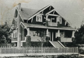
- Photograph of the second Bond family home, on John Street (later renamed and renumbered 4144 Beresford Street; the site was then addressed as 6128 Patterson Avenue after the house was demolished). David Bond, the father of the family and also a carpenter, built this 14-room house in the Central Park district.
- Subjects
- Buildings - Residential - Houses
- Media Type
- Photograph
- Notes
- Title based on contents of photograph
- Geographic Access
- Beresford Street
- Patterson Avenue
- Street Address
- 6128 Patterson Avenue
- Historic Neighbourhood
- Central Park (Historic Neighbourhood)
- Planning Study Area
- Maywood Area



![Bertha and Ramsay Shankie on porch, [June 1923] (date of original), copied [2016] thumbnail](/media/hpo/_Data/_BVM_Images/2016/201600430010_001.jpg?width=280)
![Bertha, Janet and Ramsay Shankie, 1923 (date of original), copied [2016] thumbnail](/media/hpo/_Data/_BVM_Images/2016/201600430030_001.jpg?width=280)
![Bertha, Janet and Ramsay Shankie with cat, [1923] (date of original), copied [2016] thumbnail](/media/hpo/_Data/_BVM_Images/2016/201600430020_001.jpg?width=280)
![Bertha, Ramsay and Janet Shankie, [1923] (date of original), copied [2016] thumbnail](/media/hpo/_Data/_BVM_Images/2016/201600430019_001.jpg?width=280)
![Bertha, Ramsay and Janet Shankie with cat, [8 June 1924] (date of original), copied [2016] thumbnail](/media/hpo/_Data/_BVM_Images/2016/201600430022_001.jpg?width=280)
![Bertha Shankie in garden with pets, [between 1930 and 1940] (date of original), copied [2016] thumbnail](/media/hpo/_Data/_BVM_Images/2016/201600430025_001.jpg?width=280)
![Bertha Shankie with children Ramsay and Janet Shankie and cat, 8 Jun. 1924 (date of original), copied [2016] thumbnail](/media/hpo/_Data/_BVM_Images/2016/201600430026_001.jpg?width=280)
![Bertha Shankie with Ramsay and baby Janet Shankie, [1923] (date of original), copied [2016] thumbnail](/media/hpo/_Data/_BVM_Images/2016/201600430028_001.jpg?width=280)
![Berth Shankie with her two children, 1923 (date of original), copied [2016] thumbnail](/media/hpo/_Data/_BVM_Images/2015/2015_0040_0040.jpg?width=280)
![Bobby Ellis, [1941 or 1942] (date of original), copied 1991 thumbnail](/media/hpo/_Data/_Archives_Images/_Unrestricted/370/370-319.jpg?width=280)
