Narrow Results By
Subject
- Accidents - Automobile Accidents 2
- Advertising Medium - Signs and Signboards 26
- Agriculture - Crops 4
- Agriculture - Farms 3
- Agriculture - Fruit and Berries 1
- Animals 1
- Animals - Dogs 4
- Animals - Poultry 3
- Buildings - Agricultural 1
- Buildings - Civic - Archives 1
- Buildings - Civic - Community Centres 1
- Buildings - Civic - Libraries 9
Central Park
https://search.heritageburnaby.ca/link/landmark728
- Repository
- Burnaby Heritage Planning
- Geographic Access
- Imperial Street
- Associated Dates
- 1891
- Heritage Value
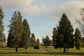
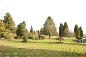
- In 1860, as the Royal Engineers constructed the road from New Westminster to Vancouver (now Kingsway), a military reserve was set aside at the trail's highest point along the ridge. This reserve provided a particularly good scenic look-out since the original forest had burned down prior to 1860, the remaining stumps offered unobstructed views. By the 1880s, the city council of both New Westminster and Vancouver eyed the reserve as potential recreation ground. As construction of the tram line was underway, the Provincial Government moved to designate the whole reserve as a park. On January 14, 1891, the Lieutenant Governor of British Columbia proclaimed it as a public recreation ground.
- Historic Neighbourhood
- Central Park (Historic Neighbourhood)
- Planning Study Area
- Maywood Area
- Street Address
- 3883 Imperial Street
- Street View URL
- Google Maps Street View
Images
Central Park Entrance Gate
https://search.heritageburnaby.ca/link/landmark544
- Repository
- Burnaby Heritage Planning
- Description
- The Central Park Entrance Gate is the ceremonial entrance to Burnaby’s historic Central Park from Kingsway, and consists of two massive stone pillars, approximately 7.5 metres high and 1.8 metres square, adjacent gate posts and a low flanking stone wall that curves into the park to the east.
- Associated Dates
- 1913
- Formal Recognition
- Heritage Designation, Community Heritage Register
- Street View URL
- Google Maps Street View
- Repository
- Burnaby Heritage Planning
- Geographic Access
- Imperial Street
- Associated Dates
- 1913
- Formal Recognition
- Heritage Designation, Community Heritage Register
- Enactment Type
- Bylaw No. 9807
- Enactment Date
- 23/11/1992
- Description
- The Central Park Entrance Gate is the ceremonial entrance to Burnaby’s historic Central Park from Kingsway, and consists of two massive stone pillars, approximately 7.5 metres high and 1.8 metres square, adjacent gate posts and a low flanking stone wall that curves into the park to the east.
- Heritage Value
- The Central Park Entrance Gate is significant as a ceremonial entry to a major park, for its connection with the early history of the British Columbia Electric Railway (BCER) and as an important design by an accomplished British Columbian architect. When the original interurban line between Vancouver and New Westminster was constructed in 1891, one of the first stations was located where the tramway crossed the Vancouver-Westminster Road (now Kingsway) within the newly-created Central Park. The interurban line ran through the park on a diagonal right-of-way (the current SkyTrain line, opened in 1986, follows this original alignment). In 1912 an agreement was reached between the successor interurban company, the BCER, and the Central Park Provincial Park Board, to deed additional land for an expanded right-of-way through the Park in exchange for improvements that included the construction of an ornamental stone wall and gate with an iron arch, with an illuminated 'Central Park' sign, adjacent to the interurban station on Kingsway. This was an early and rare example of an electric sign used for a public recreation facility. The Gate is also significant as a surviving early design by Robert Lyon (1879-1963), an Edinburgh-born and trained immigrant who was one of the most accomplished of British Columbia's early architects. After he moved to Vancouver, he was employed by the BCER from 1911 until 1918, and worked on a broad range of projects including some of the grandest and most innovative local industrial structures of the time. The arch was built by the Westminster Ironworks Company, one of the leading firms of its kind in Western Canada, operated by John Reid of New Westminster. The Gate was completed in 1914; in 1968 the decorative ironwork was removed due to corrosion and placed in storage.
- Defining Elements
- Key elements that define the heritage character of the Central Park Entrance Gate include its: - two subtly tapered massive stone pillars, which rise in stages from a larger base to a shaft with random coursed multi-coloured granite with roughly formed grey granite quoins, to a top formed of finely finished grey granite blocks with a coved and bracketed cap - adjacent gate posts with monolithic pyramidal granite caps - low flanking stone wall that curves into the park to the east, constructed of random coursed multi-coloured granite with a river rock triangular cap
- Historic Neighbourhood
- Central Park (Historic Neighbourhood)
- Planning Study Area
- Maywood Area
- Architect
- Robert Lyon
- Builder
- John Reid
- Westminster Iron Works Co.
- Function
- Primary Current--Park Fixture
- Primary Historic--Park Fixture
- Community
- Burnaby
- Cadastral Identifier
- P.I.D. No. 017-767-172 Legal Description: Block B of Lot 2 Except Firstly: Part on Plan 8669 and Secondly: Part on Plan LMP4689 District Lot 151, Group 1, New Westminster District, Plan 3443
- Boundaries
- The property (Central Park) is a municipally-owned park that lies at the western edge of Burnaby, between 49th Avenue to the south, Kingsway to the north, Boundary Road to the west and Patterson Avenue to the east.
- Area
- 853,403.82
- Contributing Resource
- Structure
- Landscape Feature
- Ownership
- Public (local)
- Names
- Lyon, Robert
- Reid, John
- Westminster Iron Works Company
- British Columbia Electric Railway Company
- Central Park Provincial Park Board
- Subjects
- Structures - Fences
- Street Address
- 3883 Imperial Street
- Street View URL
- Google Maps Street View
Images
City of Burnaby Archives
https://search.heritageburnaby.ca/link/landmark783
- Repository
- Burnaby Heritage Planning
- Geographic Access
- Albert Street
- Associated Dates
- 2001
- Heritage Value
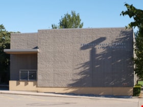
- The City of Burnaby Archives officially opened on Saturday, November 10, 2001. The Archives is Burnaby's first municipal archives, and is located in the McGill Branch Library. The City Archives functions as a branch of the Office of the City Clerk and operates as the official repository of Burnaby's municipal records, containing records dating back to Burnaby's incorporation in 1892. In 2007, the City of Burnaby Archives expanded its collection mandate to include private as well as public records. On February 14, 2007 an agreement was signed with the Burnaby Historical Society and, as a result, the Archives accepted into its custody the collection of community records that had been maintained and managed by the Historical Society since the 1950s. In the Spring of 2007, these records were transferred from the Burnaby Village Museum to their permanent home in the Archives facility.
- Historic Neighbourhood
- Capitol Hill (Historic Neighbourhood)
- Planning Study Area
- Capitol Hill Area
- Street Address
- 4595 Albert Street
- Street View URL
- Google Maps Street View
Images
H.D. Morrison House
https://search.heritageburnaby.ca/link/landmark521
- Repository
- Burnaby Heritage Planning
- Description
- The H.D. Morrison House is a tall, two and one-half storey plus basement wood-frame Edwardian era residence, with an eclectic combination of Arts and Crafts stylistic elements. It is now located adjacent to a large multi-family residential building in the Vancouver Heights neighbourhood of North Bu…
- Associated Dates
- 1912
- Formal Recognition
- Heritage Designation, Community Heritage Register
- Other Names
- Harrison D. Morrison House
- Street View URL
- Google Maps Street View
- Repository
- Burnaby Heritage Planning
- Other Names
- Harrison D. Morrison House
- Geographic Access
- Albert Street
- Associated Dates
- 1912
- Formal Recognition
- Heritage Designation, Community Heritage Register
- Enactment Type
- Bylaw No. 10626
- Enactment Date
- 22/09/1997
- Description
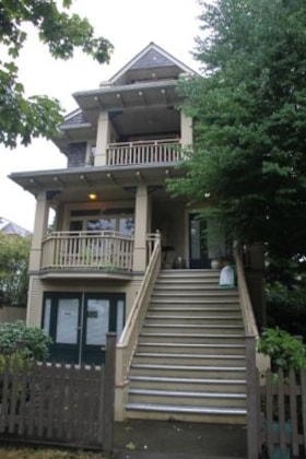
- The H.D. Morrison House is a tall, two and one-half storey plus basement wood-frame Edwardian era residence, with an eclectic combination of Arts and Crafts stylistic elements. It is now located adjacent to a large multi-family residential building in the Vancouver Heights neighbourhood of North Burnaby.
- Heritage Value
- The H.D. Morrison House is valued for its association with the initial speculative development phase of the Vancouver Heights neighbourhood, initiated during the Edwardian era as a high-class residential subdivision. Building contractor Harrison D. Morrison built this house as a rental property in 1912, at the height of the land speculation boom prior to the First World War. Buyers in the neighbourhood were obligated by the developer, G.F. and J. Galt Limited, to build houses worth a minimum of $3,500 at a time when the average house price was $1,000. Additionally, the H.D. Morrison House is a typical example of builders' houses of the time period, distinguished by the unique stacked balconies on the front facade. It was one of the surviving landmark residences built between 1909 and 1914 during the first development boom in Vancouver Heights.
- Defining Elements
- Key elements that define the heritage character of the H.D. Morrison House include its: - location on a south-facing slope in the Vancouver Heights neighbourhood of North Burnaby - residential form, scale and massing as exemplified by its symmetrical two and one-half storey plus basement height, front gabled roof and rectangular plan - vernacular Arts and Crafts style elements such as the exposed roof beams and rafter tails, decorative scalloped shingles in the front gable and decorative brackets - main floor full open front verandah on the front facade with two stacked balconies above, all detailed with square columns, scroll-cut brackets and overhanging roof eaves - bowed balustrade on main floor verandah - boxed eaves with scroll-cut brackets - recessed top floor gable treatment - cladding, including lapped wooden siding at the main floor and cedar shingles on the second floor and in the gable ends, with decorative diamond-cut shingles in the front gable end - front entry door with incised design, dentil detail and rectangular glass inset, with glassed sidelights - irregular fenestration: double-hung 1-over-1 wooden-sash windows; and three part casement window on main floor front facade, with diamond-shaped leaded lights in double transom above - corbelled red brick internal chimney
- Historic Neighbourhood
- Vancouver Heights (Historic Neighbourhood)
- Planning Study Area
- Burnaby Heights Area
- Function
- Primary Historic--Single Dwelling
- Primary Current--Multiple Dwelling
- Community
- Burnaby
- Cadastral Identifier
- 003-318-371
- Boundaries
- The H.D. Morrison House is comprised of a single residential lot located at 3765 Albert Street, Burnaby.
- Area
- 2263
- Contributing Resource
- Building
- Ownership
- Private
- Street Address
- 3765 Albert Street
- Street View URL
- Google Maps Street View
Images
Jubilee Grove Arch
https://search.heritageburnaby.ca/link/landmark533
- Repository
- Burnaby Heritage Planning
- Description
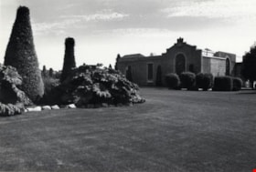
- The Jubilee Grove Arch sits at the corner of Kingsway and Patterson Avenue. Located within Central Park, the ceremonial arch and its decorative plantings provide a visual anchor to the northeast corner and entry point to the park.
- Associated Dates
- 1939
- Formal Recognition
- Heritage Designation, Community Heritage Register
- Street View URL
- Google Maps Street View
- Repository
- Burnaby Heritage Planning
- Geographic Access
- Imperial Street
- Associated Dates
- 1939
- Formal Recognition
- Heritage Designation, Community Heritage Register
- Enactment Type
- Bylaw No. 9807
- Enactment Date
- 23/11/1992
- Description
- The Jubilee Grove Arch sits at the corner of Kingsway and Patterson Avenue. Located within Central Park, the ceremonial arch and its decorative plantings provide a visual anchor to the northeast corner and entry point to the park.
- Heritage Value
- Jubilee Grove Arch was dedicated as part of the municipality’s celebration of the Jubilee of the coronation of King George V and was dedicated during Burnaby’s annual May Day celebrations in 1935. Much of the construction work was carried out by local citizens under the direction of the Burnaby Engineering Department through a Depression era work relief program that provided a way for local residents to pay their taxes. The garden was also chosen as the site for the ceremonial planting of an oak tree from the Royal Forest at Windsor, in honor of the Coronation of King George VI and Queen Elizabeth in 1937. The original bronze garden dedication plaque and oak tree remain at the site today. The decorative stone arch was erected in 1939 as a symbol of Burnaby's, and the Lower Mainland of British Columbia’s, strong ties to the English monarchy at the time, and the arch’s unveiling during May Day ceremonies shows the social role that such a commemorative feature played both to the local government and people of Burnaby. It was erected just prior to the Royal Visit of 1939, the first time that reigning British monarchs had travelled to Canada. Built of Haddington Island sandstone, the arch itself was reconstructed from a salvaged architectural element of a historic Vancouver landmark. The arch originally framed the entrance door to the Vancouver Club building in Vancouver, built in 1893-94 on West Hastings Street and designed by architect C.O. Wickenden. The building was demolished in 1930, however the arch was stored and rebuilt as the focal point of the Jubilee Grove after being bought by the Municipality of Burnaby. The work was undertaken by Italian-born stone mason Rizieri Stefanini (1879-1954), the owner of Burnaby Monumental Works. The re-use of the arch symbolizes the close tie between Vancouver and Burnaby and the joint evolution of the neighbouring cities.
- Defining Elements
- The Jubilee Grove Arch has character-defining elements that recognize it both as a remnant of a past building and as a new and individual structure. These include its: - axial diagonal placement and prominent corner location marking one of the entries to Central Park - visibility and accessibility as a public monument - hand carved stone blocks of Haddington Island sandstone - decorative twisted-rope motif carved to outline the arch - supporting rusticated sidewalls with planting urns - original bronze dedication plaque - flanking ornamental gardens - Royal Oak tree and plaque
- Historic Neighbourhood
- Central Park (Historic Neighbourhood)
- Planning Study Area
- Maywood Area
- Organization
- City of Burnaby
- Architect
- C.O. Wickenden
- Function
- Primary Current--Park Fixture
- Primary Historic--Park Fixture
- Community
- Burnaby
- Cadastral Identifier
- P.I.D. No. 017-767-172 Legal Description: Block B of Lot 2 Except Firstly: Part on Plan 8669 and Secondly: Part on Plan LMP4689 District Lot 151, Group 1, New Westminster District, Plan 3443
- Boundaries
- The property (Central Park) is a municipally-owned park that lies at the western edge of Burnaby, between 49th Avenue to the south, Kingsway to the north, Boundary Road to the west and Patterson Avenue to the east.
- Area
- 853,403.82
- Contributing Resource
- Structure
- Landscape Feature
- Ownership
- Public (local)
- Documentation
- Heritage Site Files: PC77000 20. City of Burnaby Planning and Building Department, 4949 Canada Way, Burnaby, B.C., V5G 1M2
- Names
- Burnaby Monumental Works
- Street Address
- 3883 Imperial Street
- Street View URL
- Google Maps Street View
Images
Maywood Elementary School
https://search.heritageburnaby.ca/link/landmark812
- Repository
- Burnaby Heritage Planning
- Geographic Access
- Imperial Street
- Associated Dates
- 1962
- Heritage Value
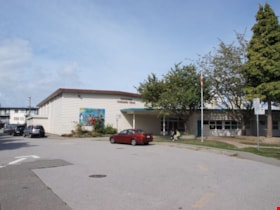
- Located between Nelson and Suncrest Schools, Maywood Elementary School was built in 1962 and helped eased the increasing enrolments at these other schools. Like other schools of this period, Maywood was built on one level with no basement and no high stairs. The classrooms were built in a line which could be easily added to as required. Additions to the original structure were completed in 1964, 1966, 1967, 1971, 1972. Fires at the school in 1979 and 1989 caused extensive damage and required partial reconstruction of the building.
- Historic Neighbourhood
- Central Park (Historic Neighbourhood)
- Planning Study Area
- Maywood Area
- Street Address
- 4567 Imperial Street
- Street View URL
- Google Maps Street View
Images
Ocean View Burial Park - Chapel
https://search.heritageburnaby.ca/link/landmark628
- Repository
- Burnaby Heritage Planning
- Geographic Access
- Imperial Street
- Associated Dates
- 1936
- Description
- Church building.
- Heritage Value
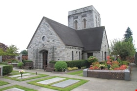
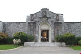
- Subsequent work at Ocean View was designed by local architects Sharp & Thompson through the 1950s, including the stone-faced Garden Chapel, built in 1936 as a replica of a Norman church. Prominent stone gates also replaced the original gates at the corner entrance. George Sharp (1880-1974) and Charles Thompson (1878-1961) formed Vancouver’s longest surviving architectural firm in 1908. They were born, educated and articled in London, before arriving in Vancouver via different routes. In 1912, the firm won the competition for the new University of British Columbia.
- Locality
- Alta Vista
- Historic Neighbourhood
- Alta Vista (Historic Neighbourhood)
- Planning Study Area
- Suncrest Area
- Architect
- Sharp & Thompson
- Area
- 359280.00
- Contributing Resource
- Building
- Ownership
- Private
- Street Address
- 4000 Imperial Street
Images
Ocean View Burial Park - Landscape
https://search.heritageburnaby.ca/link/landmark629
- Repository
- Burnaby Heritage Planning
- Description
- Cemetery site.
- Associated Dates
- 1919
- Street View URL
- Google Maps Street View
- Repository
- Burnaby Heritage Planning
- Geographic Access
- Imperial Street
- Associated Dates
- 1919
- Description
- Cemetery site.
- Heritage Value
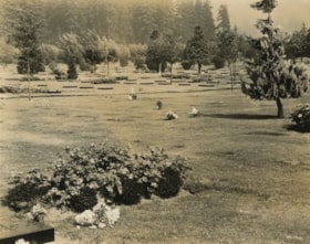
- Burnaby’s landmark Ocean View Burial Park was British Columbia’s first non-sectarian cemetery created as a for-profit business enterprise. Organized by a group of local investors headed by Lieut. Col. G.H. Dorrell, the Ocean View Cemetery Company offered a place for burials that was not owned or associated with a civic government, religious or fraternal organization. The cemetery’s design was the vision of Albert F. Arnold, an officer of the Canadian Financiers Trust Company, who was “...always depressed by the lack of beauty in so many places of internment and inevitable neglect that finally reduced them to long-grassed places of unhappy memories.” One local newspaper described the landscape of the cemetery: "The design includes ornamental trees and shrubs, beautiful flower beds and smooth winding walks and drives, with a total absence of the usual somewhat ostentatious reminders of the harvest garnered by the grim reaper."
- Locality
- Alta Vista
- Historic Neighbourhood
- Alta Vista (Historic Neighbourhood)
- Planning Study Area
- Suncrest Area
- Architect
- Albert F. Arnold
- Area
- 359280.00
- Contributing Resource
- Landscape Feature
- Ownership
- Private
- Street Address
- 4000 Imperial Street
- Street View URL
- Google Maps Street View
Images
Ocean View Burial Park - Mausoleum
https://search.heritageburnaby.ca/link/landmark630
- Repository
- Burnaby Heritage Planning
- Geographic Access
- Imperial Street
- Associated Dates
- 1928
- Description
- Cemetery site.
- Heritage Value
- In 1928, the design for the Ocean View Abbey was provided by San Francisco architect Wallace H. Hubbert, who specialized in the design of mausoleums. This was the first large-scale mausoleum and columbarium constructed in British Columbia. Although planned to be a much larger structure initially, only one wing was completed in 1931 before the Great Depression halted further additions. Hubbert was born in San Francisco in 1891 and attended the San Francisco Architectural Club. From 1914-15, he worked for famed architect Bernard Maybeck, and during the Depression years he temporarily closed his solo practice and worked for Miller & Pflueger from 1935-1939. He died in San Francisco in 1948. Hubbert was responsible for the designs of the Sunset Mausoleums in Berkeley and Eureka, Evergreen Mausoleum in Oakland and others in Merced and Santa Monica.
- Locality
- Alta Vista
- Historic Neighbourhood
- Alta Vista (Historic Neighbourhood)
- Planning Study Area
- Suncrest Area
- Architect
- Wallace H. Hubbert
- Area
- 359280.00
- Contributing Resource
- Building
- Ownership
- Private
- Street Address
- 4000 Imperial Street
Images
Swangard Stadium
https://search.heritageburnaby.ca/link/landmark818
- Repository
- Burnaby Heritage Planning
- Geographic Access
- Imperial Street
- Associated Dates
- 1969
- Heritage Value
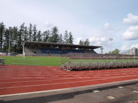
- On 26 April 1969 Swangard Stadium held its official opening. Named after Vancouver Sun former Managing Editor, Erwin Swangard, the stadium was funded entirely from private donations and civic and provincial grants.
- Historic Neighbourhood
- Central Park (Historic Neighbourhood)
- Planning Study Area
- Maywood Area
- Street Address
- 3883 Imperial Street
Images
Windsor Street School
https://search.heritageburnaby.ca/link/landmark659
- Repository
- Burnaby Heritage Planning
- Description
- School building.
- Associated Dates
- 1924
- Street View URL
- Google Maps Street View
- Repository
- Burnaby Heritage Planning
- Geographic Access
- Imperial Street
- Associated Dates
- 1924
- Description
- School building.
- Heritage Value
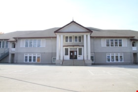
- This school was built to replace Kingsway East School, which became part of Burnaby South High School. Architects Bowman & Cullerne designed the school in 1924; additions were made in 1927. The school features a distinctive double-height gabled entrance, a broad hipped roof and an octagonal rooftop ventilator. The Windsor Street School was designed by the architectural firm of Bowman & Cullerne, who specialized in school design. The firm’s projects include Seaforth School (1922, now relocated to Burnaby Village Museum), Burnaby North High School (1923), and Nelson Avenue School (1927).
- Locality
- Edmonds
- Historic Neighbourhood
- Edmonds (Historic Neighbourhood)
- Planning Study Area
- Windsor Area
- Architect
- Bowman & Cullerne
- Area
- 3716.12
- Contributing Resource
- Building
- Street Address
- 6166 Imperial Street
- Street View URL
- Google Maps Street View
Images
24-hour relay at Swangard Stadium
https://search.heritageburnaby.ca/link/archivedescription98153
- Repository
- City of Burnaby Archives
- Date
- [1999]
- Collection/Fonds
- Burnaby NewsLeader photograph collection
- Description Level
- Item
- Physical Description
- 1 photograph (tiff) : col.
- Scope and Content
- Photograph of a runner wearing a cow-spotted costume during a 24-hour relay race at Swangard Stadium. Other runners and participants with a banner are on the track behind the runner and many people are sitting in the stands in the background.
- Repository
- City of Burnaby Archives
- Date
- [1999]
- Collection/Fonds
- Burnaby NewsLeader photograph collection
- Physical Description
- 1 photograph (tiff) : col.
- Description Level
- Item
- Record No.
- 535-3231
- Access Restriction
- No restrictions
- Reproduction Restriction
- No restrictions
- Accession Number
- 2018-12
- Scope and Content
- Photograph of a runner wearing a cow-spotted costume during a 24-hour relay race at Swangard Stadium. Other runners and participants with a banner are on the track behind the runner and many people are sitting in the stands in the background.
- Names
- Swangard Stadium
- Media Type
- Photograph
- Notes
- Title based on contents of photograph
- Collected by editorial for use in a June 1999 issue of the Burnaby NewsLeader
- Geographic Access
- Central Park
- Imperial Street
- Street Address
- 3883 Imperial Street
- Historic Neighbourhood
- Central Park (Historic Neighbourhood)
- Planning Study Area
- Maywood Area
Images
24 Hour Relay for Kids
https://search.heritageburnaby.ca/link/archivedescription96952
- Repository
- City of Burnaby Archives
- Date
- [2001]
- Collection/Fonds
- Burnaby NewsLeader photograph collection
- Description Level
- Item
- Physical Description
- 1 photograph (tiff) : col.
- Scope and Content
- Photograph of two unidentified runners handing a baton to each other at the start/finish line during the 24 Hour Relay for Kids fundraising event for Easter Seals Camps at Swangard Stadium. Other relay runners wait in the background and the stadium's stands are filled with spectators.
- Repository
- City of Burnaby Archives
- Date
- [2001]
- Collection/Fonds
- Burnaby NewsLeader photograph collection
- Physical Description
- 1 photograph (tiff) : col.
- Description Level
- Item
- Record No.
- 535-2507
- Access Restriction
- No restrictions
- Reproduction Restriction
- No restrictions
- Accession Number
- 2018-12
- Scope and Content
- Photograph of two unidentified runners handing a baton to each other at the start/finish line during the 24 Hour Relay for Kids fundraising event for Easter Seals Camps at Swangard Stadium. Other relay runners wait in the background and the stadium's stands are filled with spectators.
- Names
- Swangard Stadium
- Media Type
- Photograph
- Photographer
- Bartel, Mario
- Notes
- Title based on caption
- Collected by editorial for use in a June 2001 issue of the Burnaby NewsLeader
- Caption from metadata: "Runners hand off to each other at the hectic Start/Finish area in the early-going of The 24 Hour Relay for the Kids, held all weekend at Swangard Stadium. The annual event attracted more than 2400 runners on 120 teams, who covered almost 18,000 miles to raise money to send kids to Easter Seal Camps around BC."
- Geographic Access
- Central Park
- Imperial Street
- Street Address
- 3883 Imperial Street
- Historic Neighbourhood
- Central Park (Historic Neighbourhood)
- Planning Study Area
- Maywood Area
Images
24 Hour Relay for the Kids
https://search.heritageburnaby.ca/link/archivedescription96891
- Repository
- City of Burnaby Archives
- Date
- [2000]
- Collection/Fonds
- Burnaby NewsLeader photograph collection
- Description Level
- Item
- Physical Description
- 1 photograph (tiff) : col.
- Scope and Content
- Photograph of crowd of runners at the starting line for the 21st annual 24 Hour Relay for the Kids at Swangard Stadium. The runners are starting from beneath a banner advertising the event and the stands in the background are filled with people.
- Repository
- City of Burnaby Archives
- Date
- [2000]
- Collection/Fonds
- Burnaby NewsLeader photograph collection
- Physical Description
- 1 photograph (tiff) : col.
- Description Level
- Item
- Record No.
- 535-2449
- Access Restriction
- No restrictions
- Reproduction Restriction
- No restrictions
- Accession Number
- 2018-12
- Scope and Content
- Photograph of crowd of runners at the starting line for the 21st annual 24 Hour Relay for the Kids at Swangard Stadium. The runners are starting from beneath a banner advertising the event and the stands in the background are filled with people.
- Names
- Swangard Stadium
- Media Type
- Photograph
- Photographer
- Bartel, Mario
- Notes
- Title based on caption
- Collected by editorial for use in a June 2000 issue of the Burnaby NewsLeader
- Caption from metadata: "Runners from 145 teams start the 21st annual 24 Hour Relay for the Kids at Swangard Stadium. Money raised by the relay goes towards funding one-week camping trips for children with disabilities."
- Geographic Access
- Imperial Street
- Central Park
- Street Address
- 3883 Imperial Street
- Historic Neighbourhood
- Central Park (Historic Neighbourhood)
- Planning Study Area
- Maywood Area
Images
50-Foot High Stump
https://search.heritageburnaby.ca/link/archivedescription36668
- Repository
- City of Burnaby Archives
- Date
- 1936 (date of original), copied 1992
- Collection/Fonds
- Burnaby Historical Society fonds
- Description Level
- Item
- Physical Description
- 1 photograph : b&w ; 12.5 x 8.5 cm print
- Scope and Content
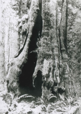
- Photograph of a stump in Central Park. Typed note at the bottom of the photograph reads, "Hollow stump in Central Park (about centre of park). Fifty feet high. At five feet from ground, fifty feet in circumference as measured by Mr. and Mrs. R.T. Wilson. Central Park, November 1936. / City Archiv…
- Repository
- City of Burnaby Archives
- Date
- 1936 (date of original), copied 1992
- Collection/Fonds
- Burnaby Historical Society fonds
- Subseries
- Burnaby Centennial Anthology subseries
- Physical Description
- 1 photograph : b&w ; 12.5 x 8.5 cm print
- Description Level
- Item
- Record No.
- 315-023
- Access Restriction
- No restrictions
- Reproduction Restriction
- No known restrictions
- Accession Number
- BHS1994-04
- Scope and Content
- Photograph of a stump in Central Park. Typed note at the bottom of the photograph reads, "Hollow stump in Central Park (about centre of park). Fifty feet high. At five feet from ground, fifty feet in circumference as measured by Mr. and Mrs. R.T. Wilson. Central Park, November 1936. / City Archives."
- Media Type
- Photograph
- Notes
- Title based on contents of photograph
- Geographic Access
- Central Park
- Imperial Street
- Street Address
- 3883 Imperial Street
- Historic Neighbourhood
- Central Park (Historic Neighbourhood)
- Planning Study Area
- Maywood Area
Images
3717-3763 Albert Street
https://search.heritageburnaby.ca/link/archivedescription93763
- Repository
- City of Burnaby Archives
- Date
- June 26, 1992
- Collection/Fonds
- Grover, Elliott & Co. Ltd. fonds
- Description Level
- File
- Physical Description
- 16 photographs : col. negatives ; 35 mm
- Scope and Content
- Photographs of the residential houses and laneways located at 3717-3763 Albert Street - addresses that no longer exist. The property's current address is 3755 Albert Street.
- Repository
- City of Burnaby Archives
- Date
- June 26, 1992
- Collection/Fonds
- Grover, Elliott & Co. Ltd. fonds
- Physical Description
- 16 photographs : col. negatives ; 35 mm
- Description Level
- File
- Record No.
- 622-048
- Access Restriction
- No restrictions
- Reproduction Restriction
- No restrictions
- Accession Number
- 2017-39
- Scope and Content
- Photographs of the residential houses and laneways located at 3717-3763 Albert Street - addresses that no longer exist. The property's current address is 3755 Albert Street.
- Subjects
- Buildings - Residential - Houses
- Media Type
- Photograph
- Photographer
- Young, Richard
- Notes
- Transcribed title
- Title transcribed from envelope photographs were originally housed in
- File no. 92-247-B
- Geographic Access
- Albert Street
- Street Address
- 3755 Albert Street
- Historic Neighbourhood
- Vancouver Heights (Historic Neighbourhood)
- Planning Study Area
- Burnaby Heights Area
3900 Albert Street
https://search.heritageburnaby.ca/link/archivedescription37389
- Repository
- City of Burnaby Archives
- Date
- [between 1965 and 1970]
- Collection/Fonds
- Burnaby Historical Society fonds
- Description Level
- Item
- Physical Description
- 1 photograph : b&w negative
- Scope and Content
- Photograph of the north side of 3900 Albert Street, looking west. The Vancouver Heights Baptist Church can be seen to the far right (at the corner of Albert Street and Ingleton Avenue).
- Repository
- City of Burnaby Archives
- Date
- [between 1965 and 1970]
- Collection/Fonds
- Burnaby Historical Society fonds
- Subseries
- Municipal record subseries
- Physical Description
- 1 photograph : b&w negative
- Description Level
- Item
- Record No.
- 366-018
- Access Restriction
- No restrictions
- Reproduction Restriction
- Reproduce for fair dealing purposes only
- Accession Number
- BHS1998-12
- Scope and Content
- Photograph of the north side of 3900 Albert Street, looking west. The Vancouver Heights Baptist Church can be seen to the far right (at the corner of Albert Street and Ingleton Avenue).
- Media Type
- Photograph
- Notes
- Title based on contents of photograph
- Geographic Access
- Ingleton Avenue
- Albert Street
- Street Address
- 3900 Albert Street
- 271 Ingleton Avenue
- 3977 Albert Street
- Historic Neighbourhood
- Vancouver Heights (Historic Neighbourhood)
- Planning Study Area
- Burnaby Heights Area
Images
3900 Albert Street at Ingleton Avenue
https://search.heritageburnaby.ca/link/archivedescription37390
- Repository
- City of Burnaby Archives
- Date
- [between 1965 and 1970]
- Collection/Fonds
- Burnaby Historical Society fonds
- Description Level
- Item
- Physical Description
- 1 photograph : b&w negative
- Scope and Content
- Photograph looking west along the north side of Albert Street from the 3900 Block. At the far right can be seen the Vancouver Heights Baptist Church, at the intersection of Albert and Ingleton Avenue.
- Repository
- City of Burnaby Archives
- Date
- [between 1965 and 1970]
- Collection/Fonds
- Burnaby Historical Society fonds
- Subseries
- Municipal record subseries
- Physical Description
- 1 photograph : b&w negative
- Description Level
- Item
- Record No.
- 366-019
- Access Restriction
- No restrictions
- Reproduction Restriction
- Reproduce for fair dealing purposes only
- Accession Number
- BHS1998-12
- Scope and Content
- Photograph looking west along the north side of Albert Street from the 3900 Block. At the far right can be seen the Vancouver Heights Baptist Church, at the intersection of Albert and Ingleton Avenue.
- Media Type
- Photograph
- Notes
- Title based on contents of photograph.
- Geographic Access
- Albert Street
- Ingleton Avenue
- Street Address
- 3900 Albert Street
- 271 Ingleton Avenue
- Historic Neighbourhood
- Vancouver Heights (Historic Neighbourhood)
- Planning Study Area
- Burnaby Heights Area
Images
3900 Albert Street - South Side
https://search.heritageburnaby.ca/link/archivedescription97610
- Repository
- City of Burnaby Archives
- Date
- [196-]
- Collection/Fonds
- Burnaby Historical Society fonds
- Description Level
- Item
- Physical Description
- 1 photograph : b&w negative
- Scope and Content
- Photograph of two houses on the south corner of Albert Street and Ingleton Avenue at 3900 Albert Street.
- Repository
- City of Burnaby Archives
- Date
- [196-]
- Collection/Fonds
- Burnaby Historical Society fonds
- Subseries
- Municipal record subseries
- Physical Description
- 1 photograph : b&w negative
- Description Level
- Item
- Record No.
- 366-027
- Access Restriction
- No restrictions
- Reproduction Restriction
- Reproduce for fair dealing purposes only
- Accession Number
- BHS1998-12
- Scope and Content
- Photograph of two houses on the south corner of Albert Street and Ingleton Avenue at 3900 Albert Street.
- Subjects
- Buildings - Residential - Houses
- Media Type
- Photograph
- Notes
- Transcribed title
- Note on verso of photograph in black ink reads: "3900 Albert - South Side - Two Houses at East End of Block"
- Geographic Access
- Albert Street
- Street Address
- 3900 Albert Street
- Historic Neighbourhood
- Vancouver Heights (Historic Neighbourhood)
- Planning Study Area
- Burnaby Heights Area
Images
3980 Albert Street
https://search.heritageburnaby.ca/link/archivedescription37395
- Repository
- City of Burnaby Archives
- Date
- [between 1965 and 1970]
- Collection/Fonds
- Burnaby Historical Society fonds
- Description Level
- Item
- Physical Description
- 1 photograph : b&w negative
- Scope and Content
- Photograph of the home located at 3980 Albert Street (old street number).
- Repository
- City of Burnaby Archives
- Date
- [between 1965 and 1970]
- Collection/Fonds
- Burnaby Historical Society fonds
- Subseries
- Municipal record subseries
- Physical Description
- 1 photograph : b&w negative
- Description Level
- Item
- Record No.
- 366-024
- Access Restriction
- No restrictions
- Reproduction Restriction
- Reproduce for fair dealing purposes only
- Accession Number
- BHS1998-12
- Scope and Content
- Photograph of the home located at 3980 Albert Street (old street number).
- Subjects
- Buildings - Residential - Houses
- Media Type
- Photograph
- Notes
- Title based on contents of photograph
- Geographic Access
- Albert Street
- Historic Neighbourhood
- Vancouver Heights (Historic Neighbourhood)
- Planning Study Area
- Burnaby Heights Area




![24-hour relay at Swangard Stadium, [1999] thumbnail](/media/hpo/_Data/_Archives_Images/_Unrestricted/535/535-3231.jpg?width=280)
![24 Hour Relay for Kids, [2001] thumbnail](/media/hpo/_Data/_Archives_Images/_Unrestricted/535/535-2507.jpg?width=280)
![24 Hour Relay for the Kids, [2000] thumbnail](/media/hpo/_Data/_Archives_Images/_Unrestricted/535/535-2449.jpg?width=280)
![3900 Albert Street, [between 1965 and 1970] thumbnail](/media/hpo/_Data/_Archives_Images/_Unrestricted/316/366-018.jpg?width=280)
![3900 Albert Street at Ingleton Avenue, [between 1965 and 1970] thumbnail](/media/hpo/_Data/_Archives_Images/_Unrestricted/316/366-019.jpg?width=280)
![3900 Albert Street - South Side, [196-] thumbnail](/media/hpo/_Data/_Archives_Images/_Unrestricted/316/366-027.jpg?width=280)
![3980 Albert Street, [between 1965 and 1970] thumbnail](/media/hpo/_Data/_Archives_Images/_Unrestricted/316/366-024.jpg?width=280)