Narrow Results By
Subject
- Accidents - Automobile Accidents 1
- Advertising Medium - Signs and Signboards 3
- Agricultural Tools and Equipment - Cultivators 1
- Agricultural Tools and Equipment - Gardening Equipment 2
- Agriculture - Farms 2
- Agriculture - Fruit and Berries 2
- Agriculture - Orchards 1
- Arts - Paintings 1
- Buildings - Commercial - Offices 1
- Buildings - Heritage 4
- Buildings - Recreational - Gazebos 3
- Buildings - Recreational - Sports 1

Masonic Cemetery
https://search.heritageburnaby.ca/link/landmark622
- Repository
- Burnaby Heritage Planning
- Description
- Cemetery site.
- Associated Dates
- 1924
- Street View URL
- Google Maps Street View
- Repository
- Burnaby Heritage Planning
- Geographic Access
- Halifax Street
- Associated Dates
- 1924
- Description
- Cemetery site.
- Heritage Value
- Tucked into a sloping site in a zone that is now transitional between light industrial and residential uses, the Masonic Cemetery is a beautifully landscaped oasis. Two outstanding features of this cemetery are the Woodward mausoleum, constructed in 1924, and the 1930s entrance gates. These substantial gates are constructed of random-coursed granite, and mark the cemetery’s main entrance off Douglas Road. An elaborate granite mausoleum, built for the prominent Woodward family, is located on axis with the main entry, at the brow of the slope. The Egyptian Revival style of the mausoleum was inspired by the opening of Tutankamun’s tomb just two years earlier, a discovery that sparked world-wide Egyptomania. The Woodward’s department store dynasty was founded by Charles Woodward (1852-1937), who visited Vancouver in 1891 and bought two lots for a store. Woodward’s drug department opened in 1895. In 1901, he took an option on a lot at the corner of Hastings and Abbott Streets and incorporated as Woodward’s Department Stores, which opened in November 1903. The family continued to run the business until 1993, when it went bankrupt and was sold to the Hudson’s Bay Company. A number of the Woodward family are interred here.
- Locality
- Vancouver Heights
- Historic Neighbourhood
- Vancouver Heights (Historic Neighbourhood)
- Planning Study Area
- Willingdon Heights Area
- Area
- 60137.87
- Contributing Resource
- Building
- Landscape Feature
- Ownership
- Private
- Street Address
- 4305 Halifax Street
- Street View URL
- Google Maps Street View
Images


Parkcrest Elementary School
https://search.heritageburnaby.ca/link/landmark784
- Repository
- Burnaby Heritage Planning
- Geographic Access
- Halifax Street
- Associated Dates
- 1960
- Heritage Value
- Parkcrest School was opened in 1960 to accommodate the growing population in the area north of the Lougheed Highway between Holdom and Sperling Avenues. The school was expanded with additional classrooms in 1964 and 1968.
- Planning Study Area
- Parkcrest-Aubrey Area
- Street Address
- 6055 Halifax Street
- Street View URL
- Google Maps Street View
Images

4430 Halifax Street
https://search.heritageburnaby.ca/link/archivedescription93810
- Repository
- City of Burnaby Archives
- Date
- September 12, 1992
- Collection/Fonds
- Grover, Elliott & Co. Ltd. fonds
- Description Level
- Item
- Physical Description
- 1 photograph : col. ; 10 cm x 15 cm
- Scope and Content
- Photograph of a two-storey office building located at 4430 Halifax Street. Photograph is of the rear of the building and a small parking lot, taken from Buchanan Street.
- Repository
- City of Burnaby Archives
- Date
- September 12, 1992
- Collection/Fonds
- Grover, Elliott & Co. Ltd. fonds
- Physical Description
- 1 photograph : col. ; 10 cm x 15 cm
- Description Level
- Item
- Record No.
- 622-058
- Access Restriction
- No restrictions
- Reproduction Restriction
- No restrictions
- Accession Number
- 2017-39
- Scope and Content
- Photograph of a two-storey office building located at 4430 Halifax Street. Photograph is of the rear of the building and a small parking lot, taken from Buchanan Street.
- Subjects
- Buildings - Commercial - Offices
- Media Type
- Photograph
- Notes
- Transcribed title
- Title transcribed from envelope photographs were originally housed in
- File no. 92-337-B
- Photographer identified as "J.C."
- Geographic Access
- Halifax Street
- Street Address
- 4430 Halifax Street
- Historic Neighbourhood
- Vancouver Heights (Historic Neighbourhood)
- Planning Study Area
- Willingdon Heights Area

6671 Halifax Street
https://search.heritageburnaby.ca/link/archivedescription97965
- Repository
- City of Burnaby Archives
- Date
- 1946
- Collection/Fonds
- Burnaby Historical Society fonds
- Description Level
- Item
- Physical Description
- 1 photograph : b&w. ; 7 cm x 12 cm
- Scope and Content
- Photograph of the newly-built Easthope family house at 6671 Halifax Street.
- Repository
- City of Burnaby Archives
- Date
- 1946
- Collection/Fonds
- Burnaby Historical Society fonds
- Subseries
- Easthope family subseries
- Physical Description
- 1 photograph : b&w. ; 7 cm x 12 cm
- Description Level
- Item
- Record No.
- 451-032
- Access Restriction
- No restrictions
- Reproduction Restriction
- No restrictions
- Accession Number
- BHS2003-06
- Scope and Content
- Photograph of the newly-built Easthope family house at 6671 Halifax Street.
- Subjects
- Buildings - Residential - Houses
- Media Type
- Photograph
- Notes
- Title based on contents of photograph
- Note in black ink on verso of photograph reads: "6671 Halifax St. 1946"
- Geographic Access
- Halifax Street
- Street Address
- 6671 Halifax Street
- Historic Neighbourhood
- Lochdale (Historic Neighbourhood)
- Planning Study Area
- Lochdale Area
Images

7119-7125 17th Ave and 7016-7124 18th Ave
https://search.heritageburnaby.ca/link/archivedescription94299
- Repository
- City of Burnaby Archives
- Date
- December 1993
- Collection/Fonds
- Grover, Elliott & Co. Ltd. fonds
- Description Level
- File
- Physical Description
- 12 photographs : col. negatives ; 35 mm
- Scope and Content
- Photographs of two single-family homes and their surrounding properties.
- Repository
- City of Burnaby Archives
- Date
- December 1993
- Collection/Fonds
- Grover, Elliott & Co. Ltd. fonds
- Physical Description
- 12 photographs : col. negatives ; 35 mm
- Description Level
- File
- Record No.
- 622-084
- Access Restriction
- No restrictions
- Reproduction Restriction
- No restrictions
- Accession Number
- 2017-39
- Scope and Content
- Photographs of two single-family homes and their surrounding properties.
- Subjects
- Buildings - Residential - Houses
- Media Type
- Photograph
- Notes
- Transcribed title
- Title transcribed from envelope photographs were originally housed in
- File no. 93-515-B
- Photographer identified as "J.C."
- Geographic Access
- 17th Avenue
- 18th Avenue
- Historic Neighbourhood
- Edmonds (Historic Neighbourhood)
- Planning Study Area
- Stride Avenue Area
7128-7143 Edmonds and 7131-7143 18th Ave
https://search.heritageburnaby.ca/link/archivedescription93760
- Repository
- City of Burnaby Archives
- Date
- May 11, 1992
- Collection/Fonds
- Grover, Elliott & Co. Ltd. fonds
- Description Level
- Item
- Physical Description
- 1 photograph : col. ; 10 cm x 15 cm
- Scope and Content
- Photographs of three single-storey houses located at 7131-7143 18th Avenue (addresses that no longer exist) with a high-rise condominium in the background. 7131-7143 18th Avenue are now 7139 18th Avenue. The condominium in the distance is located at 7108 Edmonds Avenue.
- Repository
- City of Burnaby Archives
- Date
- May 11, 1992
- Collection/Fonds
- Grover, Elliott & Co. Ltd. fonds
- Physical Description
- 1 photograph : col. ; 10 cm x 15 cm
- Description Level
- Item
- Record No.
- 622-045
- Access Restriction
- No restrictions
- Reproduction Restriction
- No restrictions
- Accession Number
- 2017-39
- Scope and Content
- Photographs of three single-storey houses located at 7131-7143 18th Avenue (addresses that no longer exist) with a high-rise condominium in the background. 7131-7143 18th Avenue are now 7139 18th Avenue. The condominium in the distance is located at 7108 Edmonds Avenue.
- Subjects
- Buildings - Residential - Houses
- Media Type
- Photograph
- Photographer
- Young, Richard
- Notes
- Transcribed title
- Title transcribed from envelope photograph was originally housed in
- File no. 92-190-B
- Geographic Access
- 18th Avenue
- Edmonds Street
- Street Address
- 7139 18th Avenue
- 7108 Edmonds Avenue
- Historic Neighbourhood
- Edmonds (Historic Neighbourhood)
- Planning Study Area
- Stride Avenue Area
7143 - 18th Ave
https://search.heritageburnaby.ca/link/archivedescription93758
- Repository
- City of Burnaby Archives
- Date
- 1992
- Collection/Fonds
- Grover, Elliott & Co. Ltd. fonds
- Description Level
- Item
- Physical Description
- 1 photograph : col. ; 10 cm x 15 cm
- Scope and Content
- Photograph of a white, single-storey house located at 7143 18th Avenue - an address that no longer exists. The current address of the property is 7139 18th Avenue.
- Repository
- City of Burnaby Archives
- Date
- 1992
- Collection/Fonds
- Grover, Elliott & Co. Ltd. fonds
- Physical Description
- 1 photograph : col. ; 10 cm x 15 cm
- Description Level
- Item
- Record No.
- 622-043
- Access Restriction
- No restrictions
- Reproduction Restriction
- No restrictions
- Accession Number
- 2017-39
- Scope and Content
- Photograph of a white, single-storey house located at 7143 18th Avenue - an address that no longer exists. The current address of the property is 7139 18th Avenue.
- Subjects
- Buildings - Residential - Houses
- Media Type
- Photograph
- Notes
- Transcribed title
- Title transcribed from envelope photographs were originally housed in
- File no. 92-188-B
- Geographic Access
- 18th Avenue
- Street Address
- 7139 18th Avenue
- Historic Neighbourhood
- Edmonds (Historic Neighbourhood)
- Planning Study Area
- Stride Avenue Area
7165-7177 17th Ave and 7164-7176 18th Ave
https://search.heritageburnaby.ca/link/archivedescription93752
- Repository
- City of Burnaby Archives
- Date
- April 30, 1992
- Collection/Fonds
- Grover, Elliott & Co. Ltd. fonds
- Description Level
- File
- Physical Description
- 23 photographs : col. negatives ; 35 mm
- Scope and Content
- Photographs of the single-family houses located at 7165-7177 17th Avenue and 7164-7176 18th Avenue - addresses that no longer exist - as well as a building being constructed. The current address of the properties is 7175 17th Avenue.
- Repository
- City of Burnaby Archives
- Date
- April 30, 1992
- Collection/Fonds
- Grover, Elliott & Co. Ltd. fonds
- Physical Description
- 23 photographs : col. negatives ; 35 mm
- Description Level
- File
- Record No.
- 622-037
- Access Restriction
- No restrictions
- Reproduction Restriction
- No restrictions
- Accession Number
- 2017-39
- Scope and Content
- Photographs of the single-family houses located at 7165-7177 17th Avenue and 7164-7176 18th Avenue - addresses that no longer exist - as well as a building being constructed. The current address of the properties is 7175 17th Avenue.
- Media Type
- Photograph
- Photographer
- Cameron, James
- Notes
- Transcribed title
- Title transcribed from envelope photographs were originally housed in
- File no. 92-135-B
- Geographic Access
- 17th Avenue
- 18th Avenue
7183-7195 17th Ave and 7182-7194 18th Ave Burnaby
https://search.heritageburnaby.ca/link/archivedescription93893
- Repository
- City of Burnaby Archives
- Date
- June 1993
- Collection/Fonds
- Grover, Elliott & Co. Ltd. fonds
- Description Level
- File
- Physical Description
- 25 photographs : col. negatives ; 35 mm
- Scope and Content
- Photographs of a townhouse complex and surrounding area located at 7183-7195 17th Avenue and 7182-7194 18th Avenue - addresses that no longer exist.
- Repository
- City of Burnaby Archives
- Date
- June 1993
- Collection/Fonds
- Grover, Elliott & Co. Ltd. fonds
- Physical Description
- 25 photographs : col. negatives ; 35 mm
- Description Level
- File
- Record No.
- 622-076
- Access Restriction
- No restrictions
- Reproduction Restriction
- No restrictions
- Accession Number
- 2017-39
- Scope and Content
- Photographs of a townhouse complex and surrounding area located at 7183-7195 17th Avenue and 7182-7194 18th Avenue - addresses that no longer exist.
- Media Type
- Photograph
- Notes
- Transcribed title
- Title transcribed from envelope photographs were originally housed in
- File no. 93-291-B
- Photographer identified as "J.C."
- Geographic Access
- 17th Avenue
- 18th Avenue
- Historic Neighbourhood
- Edmonds (Historic Neighbourhood)
- Planning Study Area
- Stride Avenue Area
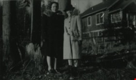
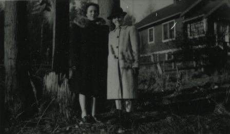
Annette Thompson and Ruth Hollands
https://search.heritageburnaby.ca/link/archivedescription37836
- Repository
- City of Burnaby Archives
- Date
- 1944 (date of original), copied 1991
- Collection/Fonds
- Burnaby Historical Society fonds
- Description Level
- Item
- Physical Description
- 1 photograph : b&w ; 2.7 x 4.7 cm print on contact sheet 20.6 x 26.2 cm
- Scope and Content
- Photograph of Annette Thompson and Ruth Hollands standing on the lot of 631 18th Avenue (later renumbered 7865 18th Avenue). The Carpenter family home is visible in the background.
- Repository
- City of Burnaby Archives
- Date
- 1944 (date of original), copied 1991
- Collection/Fonds
- Burnaby Historical Society fonds
- Subseries
- Burnaby Image Bank subseries
- Physical Description
- 1 photograph : b&w ; 2.7 x 4.7 cm print on contact sheet 20.6 x 26.2 cm
- Description Level
- Item
- Record No.
- 370-424
- Access Restriction
- No restrictions
- Reproduction Restriction
- No known restrictions
- Accession Number
- BHS1999-03
- Scope and Content
- Photograph of Annette Thompson and Ruth Hollands standing on the lot of 631 18th Avenue (later renumbered 7865 18th Avenue). The Carpenter family home is visible in the background.
- Media Type
- Photograph
- Notes
- Title based on contents of photograph
- 1 b&w copy negative accompanying
- Negative has a pink cast
- Geographic Access
- 18th Avenue
- Street Address
- 7865 18th Avenue
- Historic Neighbourhood
- Edmonds (Historic Neighbourhood)
- Planning Study Area
- Edmonds Area
Images
![Burnaby Mountain driving range in snow, [2002] thumbnail](/media/hpo/_Data/_Archives_Images/_Unrestricted/535/535-1964.jpg?width=280)
Burnaby Mountain driving range in snow
https://search.heritageburnaby.ca/link/archivedescription96281
- Repository
- City of Burnaby Archives
- Date
- [2002]
- Collection/Fonds
- Burnaby NewsLeader photograph collection
- Description Level
- Item
- Physical Description
- 1 photograph (tiff) : col.
- Scope and Content
- Photograph of Brian Jae preparing a swing at the Burnaby Mountain Golf Club driving range. The grass is covered in snow.
- Repository
- City of Burnaby Archives
- Date
- [2002]
- Collection/Fonds
- Burnaby NewsLeader photograph collection
- Physical Description
- 1 photograph (tiff) : col.
- Description Level
- Item
- Record No.
- 535-1964
- Access Restriction
- No restrictions
- Reproduction Restriction
- No restrictions
- Accession Number
- 2018-12
- Scope and Content
- Photograph of Brian Jae preparing a swing at the Burnaby Mountain Golf Club driving range. The grass is covered in snow.
- Media Type
- Photograph
- Photographer
- Bartel, Mario
- Notes
- Title based on caption
- Collected by editorial for use in a January 2002 issue of the Burnaby NewsLeader
- Caption from metadata: "Brian Jae doesn't let the fresh snow keep him from honing his golf swing at the driving range at Burnaby Mountain Golf Club. He says he uses balls with a red stripe on them so he can spot them against the white ground."
- Geographic Access
- Halifax Street
- Street Address
- 7600 Halifax Street
- Historic Neighbourhood
- Lochdale (Historic Neighbourhood)
- Planning Study Area
- Sperling-Broadway Area
Images
![Burnaby Mountain driving range in snow, [2002] thumbnail](/media/hpo/_Data/_Archives_Images/_Unrestricted/535/535-1964.jpg)
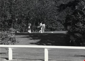
Burnaby Mountain Golf Course
https://search.heritageburnaby.ca/link/archivedescription79685
- Repository
- City of Burnaby Archives
- Date
- October, 1976
- Collection/Fonds
- Burnaby Public Library Contemporary Visual Archive Project
- Description Level
- Item
- Physical Description
- 1 photograph : b&w ; 11 x 16 cm mounted on cardboard
- Scope and Content
- Photograph shows golfers at Burnaby Mountain Golf Course, 7600 Halifax Street. Construction of the course began in September 1965; it opened to the public in May 1969. The course is 18 holes, 5418 yards long and covers 137 acres.
- Repository
- City of Burnaby Archives
- Date
- October, 1976
- Collection/Fonds
- Burnaby Public Library Contemporary Visual Archive Project
- Physical Description
- 1 photograph : b&w ; 11 x 16 cm mounted on cardboard
- Description Level
- Item
- Record No.
- 556-381
- Access Restriction
- No restrictions
- Reproduction Restriction
- Reproduce for fair dealing purposes only
- Accession Number
- 2013-13
- Scope and Content
- Photograph shows golfers at Burnaby Mountain Golf Course, 7600 Halifax Street. Construction of the course began in September 1965; it opened to the public in May 1969. The course is 18 holes, 5418 yards long and covers 137 acres.
- Subjects
- Recreational Activities - Golf
- Media Type
- Photograph
- Photographer
- Salmon, Stu
- Notes
- Scope note taken directly from BPL photograph description.
- Accompanying Burnaby Parks and Recreation Commission - Burnaby Mountain Golf Course informational document attached to verso.
- 1 b&w copy negative : 10 x 12.5 cm accompanying
- Geographic Access
- Halifax Street
- Street Address
- 7600 Halifax Street
- Planning Study Area
- Sperling-Broadway Area
Images
![Burnaby Mountain Golf Course, [2002] thumbnail](/media/hpo/_Data/_Archives_Images/_Unrestricted/535/535-2993.jpg?width=280)
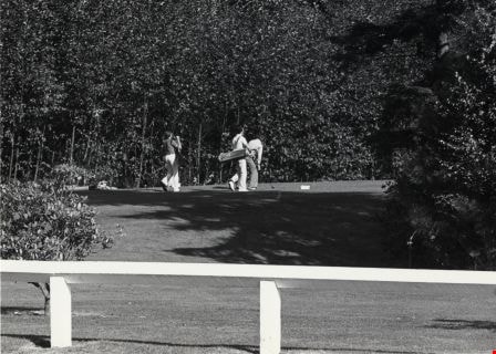
Burnaby Mountain Golf Course
https://search.heritageburnaby.ca/link/archivedescription97719
- Repository
- City of Burnaby Archives
- Date
- [2002]
- Collection/Fonds
- Burnaby NewsLeader photograph collection
- Description Level
- Item
- Physical Description
- 1 photograph (tiff) : b&w
- Scope and Content
- Photograph of unidentified golfer wheeling a golf caddy under a tree at Burnaby Mountain Golf Course.
- Repository
- City of Burnaby Archives
- Date
- [2002]
- Collection/Fonds
- Burnaby NewsLeader photograph collection
- Physical Description
- 1 photograph (tiff) : b&w
- Description Level
- Item
- Record No.
- 535-2993
- Access Restriction
- No restrictions
- Reproduction Restriction
- No restrictions
- Accession Number
- 2018-12
- Scope and Content
- Photograph of unidentified golfer wheeling a golf caddy under a tree at Burnaby Mountain Golf Course.
- Subjects
- Recreational Activities - Golf
- Media Type
- Photograph
- Photographer
- Bartel, Mario
- Notes
- Title based on caption
- Collected by editorial for use in a November 2002 issue of the Burnaby NewsLeader
- Caption from metadata: "The return of rainy weather doesn't keep intrepid golfers from their rounds at Burnaby Mountain Golf Course."
- Geographic Access
- Halifax Street
- Street Address
- 7600 Halifax Street
- Historic Neighbourhood
- Lochdale (Historic Neighbourhood)
- Planning Study Area
- Sperling-Broadway Area
Images
![Burnaby Mountain Golf Course, [2002] thumbnail](/media/hpo/_Data/_Archives_Images/_Unrestricted/535/535-2993.jpg)
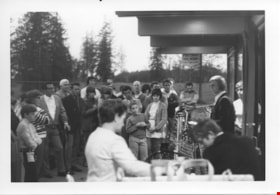
Burnaby Mountain Golf Course concession stand
https://search.heritageburnaby.ca/link/museumdescription2264
- Repository
- Burnaby Village Museum
- Date
- 11 Sept 1971
- Collection/Fonds
- Donald Copan collection
- Description Level
- Item
- Physical Description
- 1 photograph : b&w ; 8.9 x 12.7 cm
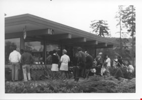
- Scope and Content
- Photograph of people standing outside of the concession stand at Burnaby Mountain Golf Course during the Centennial '71 Golf Tournament that took place on September 11, 1971.
- Repository
- Burnaby Village Museum
- Collection/Fonds
- Donald Copan collection
- Series
- Copan album series
- Description Level
- Item
- Physical Description
- 1 photograph : b&w ; 8.9 x 12.7 cm
- Scope and Content
- Photograph of people standing outside of the concession stand at Burnaby Mountain Golf Course during the Centennial '71 Golf Tournament that took place on September 11, 1971.
- Geographic Access
- Halifax Street
- Street Address
- 7600 Halifax Street
- Accession Code
- BV005.54.310
- Access Restriction
- No restrictions
- Reproduction Restriction
- May be restricted by third party rights
- Date
- 11 Sept 1971
- Media Type
- Photograph
- Historic Neighbourhood
- Lochdale (Historic Neighbourhood)
- Planning Study Area
- Sperling-Broadway Area
- Scan Resolution
- 600
- Scan Date
- July 23, 2020
- Scale
- 100
- Notes
- Title based on contents of photograph
Images
Burnaby Mountain Golf Course concession stand
https://search.heritageburnaby.ca/link/museumdescription13295
- Repository
- Burnaby Village Museum
- Date
- 11 Sept 1971
- Collection/Fonds
- Donald Copan collection
- Description Level
- Item
- Physical Description
- 1 photograph : b&w ; 8.9 x 12.7 cm
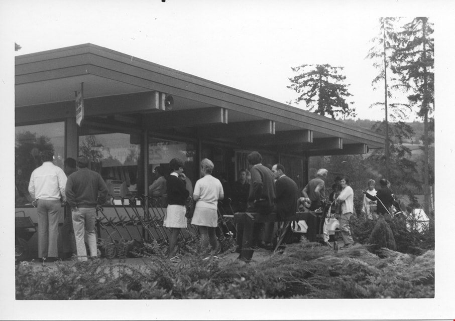
- Scope and Content
- Photograph of people standing outside of the concession stand at Burnaby Mountain Golf Course during the Centennial '71 Golf Tournament that took place on September 11, 1971.
- Repository
- Burnaby Village Museum
- Collection/Fonds
- Donald Copan collection
- Series
- Copan album series
- Description Level
- Item
- Physical Description
- 1 photograph : b&w ; 8.9 x 12.7 cm
- Scope and Content
- Photograph of people standing outside of the concession stand at Burnaby Mountain Golf Course during the Centennial '71 Golf Tournament that took place on September 11, 1971.
- Geographic Access
- Halifax Street
- Street Address
- 7600 Halifax Street
- Accession Code
- BV005.54.311
- Access Restriction
- No restrictions
- Reproduction Restriction
- May be restricted by third party rights
- Date
- 11 Sept 1971
- Media Type
- Photograph
- Historic Neighbourhood
- Lochdale (Historic Neighbourhood)
- Planning Study Area
- Sperling-Broadway Area
- Scan Resolution
- 600
- Scan Date
- July 23, 2020
- Scale
- 100
- Notes
- Title based on contents of photograph
Images
![Burnaby Mountain Golf Course staff, [2001] thumbnail](/media/hpo/_Data/_Archives_Images/_Unrestricted/535/535-2451-1.jpg?width=280)
Burnaby Mountain Golf Course staff
https://search.heritageburnaby.ca/link/archivedescription96893
- Repository
- City of Burnaby Archives
- Date
- [2001]
- Collection/Fonds
- Burnaby NewsLeader photograph collection
- Description Level
- File
- Physical Description
- 2 photographs (tiff) : col.
- Scope and Content
- File contains photographs of two staff members at the Burnaby Mountain Golf Course. Photographs depict teaching pro Lindy Miyashiro at the driving range with a golf club, and Jack Kemp posing in a golf cart.
- Repository
- City of Burnaby Archives
- Date
- [2001]
- Collection/Fonds
- Burnaby NewsLeader photograph collection
- Physical Description
- 2 photographs (tiff) : col.
- Description Level
- File
- Record No.
- 535-2451
- Access Restriction
- No restrictions
- Reproduction Restriction
- No restrictions
- Accession Number
- 2018-12
- Scope and Content
- File contains photographs of two staff members at the Burnaby Mountain Golf Course. Photographs depict teaching pro Lindy Miyashiro at the driving range with a golf club, and Jack Kemp posing in a golf cart.
- Media Type
- Photograph
- Photographer
- Bartel, Mario
- Notes
- Title based on caption
- Collected by editorial for use in an April 2001 issue of the Burnaby NewsLeader
- Caption from metadata for 535-2451-1: "Lindy Miyashiro, one of the teaching pros at Burnaby Mountain Golf Course, is busier than ever as the course is rated the busiest in the Lower Mainland."
- Caption from metadata for 535-2451-2: "Jack Kemp, of the Burnaby Mountain Golf Course, takes a break in a rare moment when their are spare carts. The course is rated the busiest in the Lower Mainland."
- Geographic Access
- Halifax Street
- Street Address
- 7600 Halifax Street
- Historic Neighbourhood
- Lochdale (Historic Neighbourhood)
- Planning Study Area
- Sperling-Broadway Area
Images
![Burnaby Mountain Golf Course staff, [2001] thumbnail](/media/hpo/_Data/_Archives_Images/_Unrestricted/535/535-2451-1.jpg)

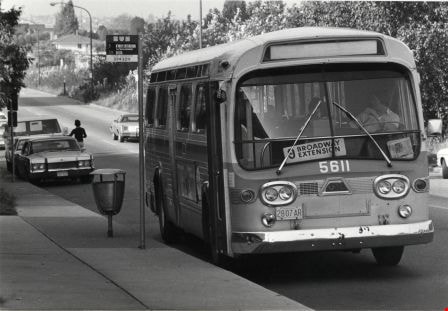
Bus stop on Halifax Street
https://search.heritageburnaby.ca/link/archivedescription79482
- Repository
- City of Burnaby Archives
- Date
- October, 1976
- Collection/Fonds
- Burnaby Public Library Contemporary Visual Archive Project
- Description Level
- Item
- Physical Description
- 1 photograph : b&w ; 11 x 16 cm mounted on cardboard
- Scope and Content
- Photograph shows Broadway Extension bus waiting at the bus stop on Halifax Street, near Willingdon Avenue, across from Brentwood Mall.
- Repository
- City of Burnaby Archives
- Date
- October, 1976
- Collection/Fonds
- Burnaby Public Library Contemporary Visual Archive Project
- Physical Description
- 1 photograph : b&w ; 11 x 16 cm mounted on cardboard
- Description Level
- Item
- Record No.
- 556-314
- Access Restriction
- No restrictions
- Reproduction Restriction
- Reproduce for fair dealing purposes only
- Accession Number
- 2013-13
- Scope and Content
- Photograph shows Broadway Extension bus waiting at the bus stop on Halifax Street, near Willingdon Avenue, across from Brentwood Mall.
- Subjects
- Transportation - Buses
- Media Type
- Photograph
- Photographer
- Cook, Alan
- Notes
- Scope note taken directly from BPL photograph description.
- 1 b&w copy negative : 10 x 12.5 cm accompanying
- Geographic Access
- Halifax Street
- Planning Study Area
- Brentwood Area
Images
![Car in front of Loynes Family Home, [ca. 1973] (date of original), copied 1991 thumbnail](/media/hpo/_Data/_Archives_Images/_Unrestricted/370/370-260.jpg?width=280)
Car in front of Loynes Family Home
https://search.heritageburnaby.ca/link/archivedescription37672
- Repository
- City of Burnaby Archives
- Date
- [ca. 1973] (date of original), copied 1991
- Collection/Fonds
- Burnaby Historical Society fonds
- Description Level
- Item
- Physical Description
- 1 photograph : b&w ; 3.9 x 3.9 cm print on contact sheet 20.2 x 25.3 cm
- Scope and Content
- Photograph of the Loynes family home at 1855 18th Avenue (later renumbered as the 7000 block of 18th Avenue), with a car parked in front. The photo was taken from across the street.
- Repository
- City of Burnaby Archives
- Date
- [ca. 1973] (date of original), copied 1991
- Collection/Fonds
- Burnaby Historical Society fonds
- Subseries
- Burnaby Image Bank subseries
- Physical Description
- 1 photograph : b&w ; 3.9 x 3.9 cm print on contact sheet 20.2 x 25.3 cm
- Description Level
- Item
- Record No.
- 370-260
- Access Restriction
- No restrictions
- Reproduction Restriction
- No restrictions
- Accession Number
- BHS1999-03
- Scope and Content
- Photograph of the Loynes family home at 1855 18th Avenue (later renumbered as the 7000 block of 18th Avenue), with a car parked in front. The photo was taken from across the street.
- Media Type
- Photograph
- Notes
- Title based on contents of photograph
- 1 b&w copy negative accompanying
- Copied from col. photograph
- Negative has a pink cast
- Geographic Access
- 18th Avenue
- Historic Neighbourhood
- Edmonds (Historic Neighbourhood)
- Planning Study Area
- Stride Avenue Area
Images
![Car in front of Loynes Family Home, [ca. 1973] (date of original), copied 1991 thumbnail](/media/hpo/_Data/_Archives_Images/_Unrestricted/370/370-260.jpg)
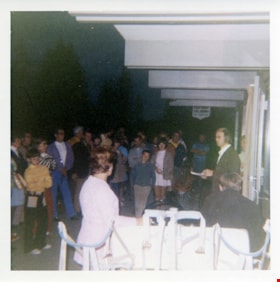
Centennial '71 Golf Tournament
https://search.heritageburnaby.ca/link/museumdescription13299
- Repository
- Burnaby Village Museum
- Date
- 11 Sept 1971
- Collection/Fonds
- Donald Copan collection
- Description Level
- Item
- Physical Description
- 1 photograph : b&w ; 8.9 x 12.7 cm
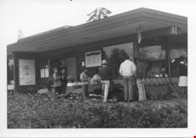
- Scope and Content
- Photograph of a group of people gathered for the Centennial '71 Golf Tournament which took place at Burnaby Mountain Golf Course on September 11, 1971.
- Repository
- Burnaby Village Museum
- Collection/Fonds
- Donald Copan collection
- Series
- Copan album series
- Description Level
- Item
- Physical Description
- 1 photograph : b&w ; 8.9 x 12.7 cm
- Scope and Content
- Photograph of a group of people gathered for the Centennial '71 Golf Tournament which took place at Burnaby Mountain Golf Course on September 11, 1971.
- Geographic Access
- Halifax Street
- Street Address
- 7600 Halifax Street
- Accession Code
- BV005.54.315
- Access Restriction
- No restrictions
- Reproduction Restriction
- May be restricted by third party rights
- Date
- 11 Sept 1971
- Media Type
- Photograph
- Historic Neighbourhood
- Lochdale (Historic Neighbourhood)
- Planning Study Area
- Sperling-Broadway Area
- Scan Resolution
- 600
- Scan Date
- July 23, 2020
- Scale
- 100
- Notes
- Title based on contents of photograph
Images

Centennial '71 Golf Tournament
https://search.heritageburnaby.ca/link/museumdescription13301
- Repository
- Burnaby Village Museum
- Date
- 11 Sept 1971
- Collection/Fonds
- Donald Copan collection
- Description Level
- Item
- Physical Description
- 1 photograph : col. ; 8.9 x 8.9 cm
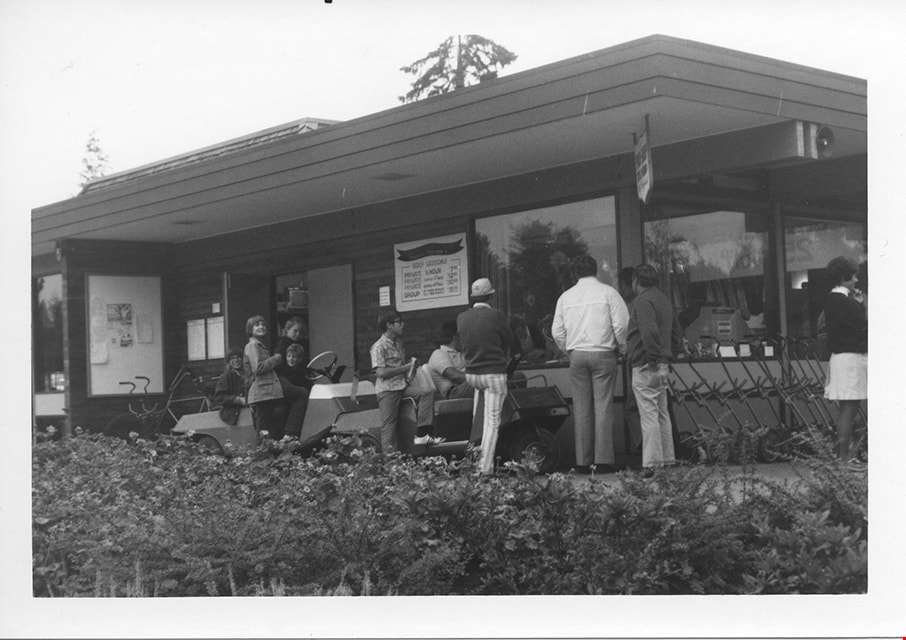
- Scope and Content
- Photograph of a group of people gathered for the Centennial '71 Golf Tournament which took place at Burnaby Mountain Golf Course on September 11, 1971.
- Repository
- Burnaby Village Museum
- Collection/Fonds
- Donald Copan collection
- Series
- Copan album series
- Description Level
- Item
- Physical Description
- 1 photograph : col. ; 8.9 x 8.9 cm
- Scope and Content
- Photograph of a group of people gathered for the Centennial '71 Golf Tournament which took place at Burnaby Mountain Golf Course on September 11, 1971.
- Geographic Access
- Halifax Street
- Street Address
- 7600 Halifax Street
- Accession Code
- BV005.54.317
- Access Restriction
- No restrictions
- Reproduction Restriction
- May be restricted by third party rights
- Date
- 11 Sept 1971
- Media Type
- Photograph
- Historic Neighbourhood
- Lochdale (Historic Neighbourhood)
- Planning Study Area
- Sperling-Broadway Area
- Scan Resolution
- 600
- Scan Date
- July 23, 2020
- Scale
- 100
- Notes
- Title based on contents of photograph
Images
