Skip header and navigation
Heritage Burnaby
  • Home
  • Research
  • What's On
  • About Us
  • Contact Us
  • Help
  • My List

Research

New Search
Print PDF
. . thumbnail
Toggle Detail View

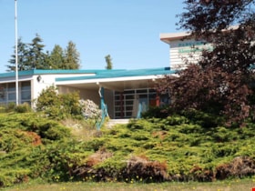
Parkcrest Elementary School

https://search.heritageburnaby.ca/link/landmark784
Repository
Burnaby Heritage Planning
Associated Dates
1960
Street View URL
Google Maps Street View
More detail
1 image
Repository
Burnaby Heritage Planning
Geographic Access
Burnaby - 6055 Halifax Street
Associated Dates
1960
Heritage Value
Parkcrest School was opened in 1960 to accommodate the growing population in the area north of the Lougheed Highway between Holdom and Sperling Avenues. The school was expanded with additional classrooms in 1964 and 1968.
Planning Study Area
Parkcrest-Aubrey Area
Street View URL
Google Maps Street View
Images
. . thumbnail
Less detail
  • Share
    Facebook Facebook Twitter Twitter LinkedIn LinkedIn Pinterest Pinterest
  • Feedback
  • More Like This
  • Permalink
City Hall
4949 Canada Way
Burnaby, BC, Canada
V5G 1M2
  • Careers
  • Contact Us
  • News
  • Your Voice

City of Burnaby is located on the ancestral and unceded homelands of the hən̓q̓əmin̓əm̓ and Sḵwx̱wú7mesh speaking peoples. We are grateful for the opportunity to be on this territory.

  • © 2023 City of Burnaby
  • | 
  • Privacy Statement
  • | 
  • Using Our Website