Narrow Results By
Creator
- Aujla, Kehar Singh 1
- Bekins Moving and Storage Company Limited 1
- Belcastro, Arlene 1
- Bobic, Janice 1
- British Columbia Underwriters' Association 7
- Burnaby Village Museum 25
- Burnaby Village Museum - City of Burnaby 2
- Burnett, Geoffrey K. 1
- Canadian Broadcasting Corporation 3
- Chenatte, Jeff 1
- City Map and White Print Co. 1
- City of Burnaby 11

Film of Ken Yip discussing his family farm in the Big Bend area
https://search.heritageburnaby.ca/link/museumdescription4379
- Repository
- Burnaby Village Museum
- Date
- 6 Oct 2017
- Collection/Fonds
- Burnaby Village Museum fonds
- Description Level
- Item
- Physical Description
- 1 m4v video (14 min., 57 sec.) : digital, 23 fps, col., sd., stereo
- Scope and Content
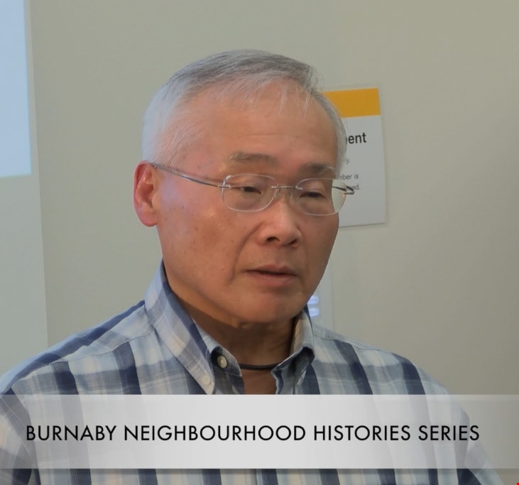
- Film of Ken Yip discussing his family farm in the Big Bend area of Burnaby during a presentation as part of the "Chinese Canadian Stories" Lecture. This lecture was part of the Burnaby Neighbourhood History Series on October 4, 2017 at the Metrotown branch of the Burnaby Public Library. Ken Yip dis…
- Repository
- Burnaby Village Museum
- Collection/Fonds
- Burnaby Village Museum fonds
- Description Level
- Item
- Physical Description
- 1 m4v video (14 min., 57 sec.) : digital, 23 fps, col., sd., stereo
- Scope and Content
- Film of Ken Yip discussing his family farm in the Big Bend area of Burnaby during a presentation as part of the "Chinese Canadian Stories" Lecture. This lecture was part of the Burnaby Neighbourhood History Series on October 4, 2017 at the Metrotown branch of the Burnaby Public Library. Ken Yip discusses what life was like growing up on his family farm in the Big Bend area, on Bryne Road in Burnaby.
- Accession Code
- BV018.6.2
- Reproduction Restriction
- No known restrictions
- Date
- 6 Oct 2017
- Media Type
- Moving Images
- Planning Study Area
- Big Bend Area
- Notes
- Title based on contents of film
Images
Video
Film of Ken Yip discussing his family farm in the Big Bend area, 6 Oct 2017
Film of Ken Yip discussing his family farm in the Big Bend area, 6 Oct 2017
https://search.heritageburnaby.ca/media/hpo/_Data/_BVM_Moving_Images/2018_0006_0002_001.m4v
Fire insurance key plan - Greater Vancouver - Volume XVI - Municipality of Burnaby
https://search.heritageburnaby.ca/link/museumdescription17796
- Repository
- Burnaby Village Museum
- Date
- 1927
- Collection/Fonds
- Burnaby Village Museum Map collection
- Description Level
- Item
- Physical Description
- 2 plans on 2 sheets: col. lithographic print ; 64 x 54 cm
- Scope and Content
- Item consists of a two page fire insurance key plan titled "Greater Vancouver / Volume XVI / Municipality / of Burnaby / Key Plan" surveyed May 1927. Volume XVI includes a two page Key Plan (C and D). .
- Repository
- Burnaby Village Museum
- Collection/Fonds
- Burnaby Village Museum Map collection
- Description Level
- Item
- Physical Description
- 2 plans on 2 sheets: col. lithographic print ; 64 x 54 cm
- Scope and Content
- Item consists of a two page fire insurance key plan titled "Greater Vancouver / Volume XVI / Municipality / of Burnaby / Key Plan" surveyed May 1927. Volume XVI includes a two page Key Plan (C and D). .
- Publisher
- Plan Department of Fire Branch of British Columbia Underwriters Association
- Accession Code
- BV987.1.70
- Access Restriction
- No restrictions
- Reproduction Restriction
- May be restricted by third party rights
- Date
- 1927
- Media Type
- Cartographic Material
- Scan Resolution
- 400
- Scan Date
- 11/17/2021
- Notes
- Title based on contents of item
- Item "GREATER VANCOUVER / VOLUME XVI / MUNICIPALITY OF / BURNABY / KEY PLAN" does not include associated numbered plans (1601 to 1651)
- These plans were removed from a bound book with labels on cover page reading: "Plan No. 90 / THIS INSURANCE PLAN / of / Vancouver VOLUME "8" / IN THE PROPERTY OF THE / British Columbia Insurance Underwriter's Association / Vancouver B.C. / AND IS LOANED / MELVILLE F. THOMSON CO. .../ Date May 26th, 1934"; / "Plan No. 74 / THIS INSURANCE PLAN / OF / VANCOUVER VOLUME "9"" / Plan No. 11 / THIS INSURANCE PLAN / OF / BURNABY VOLUMES 15-19" / "THIS PLAN IS THE PROPERTY OF / THE / BRITISH LAW INSURANCE COMPANY / LIMITED"
Zoomable Images

Fire insurance key plan - Greater Vancouver - Volume XVI - Municipality of Burnaby, 1927
Zoom into Image
Hickory Dickory Dock-What is the time on the clock?
https://search.heritageburnaby.ca/link/museumdescription9679
- Repository
- Burnaby Village Museum
- Date
- 2016
- Collection/Fonds
- Burnaby Village Museum Film and Video collection
- Description Level
- Item
- Physical Description
- 1 video recording (mp4) (14 min., 47 sec.) : digital, 25 fps, col., sd., stereo
- Scope and Content
- In this short film, Yasmin Jamal declares her passion for clocks and fancy watches, but confesses that she has a troubled relationship with them! From her kitchen clock that does not tell the correct time, to her collection of beautiful wrist watches that refuse to do their job, she is beginning to…
- Repository
- Burnaby Village Museum
- Collection/Fonds
- Burnaby Village Museum Film and Video collection
- Description Level
- Item
- Physical Description
- 1 video recording (mp4) (14 min., 47 sec.) : digital, 25 fps, col., sd., stereo
- Scope and Content
- In this short film, Yasmin Jamal declares her passion for clocks and fancy watches, but confesses that she has a troubled relationship with them! From her kitchen clock that does not tell the correct time, to her collection of beautiful wrist watches that refuse to do their job, she is beginning to question this strange relationship. Why does she hold such a love and passion for time pieces that are too stubborn to keep time? She is aware that her attraction to timepieces is about more than needing to know the time. Her touching mediation on the reasons for her attachment reminds her audience that time is a treasure and we should make the most of every moment.
- History
- Yasmin Jamal immigrated from Kenya over 44 years ago. She came to pursue her undergraduate degree at Simon Fraser University. She is a long-time resident of Coquitlam. However, she has always been employed in the Burnaby District. She presently works as a librarian at Burnaby Public Library. Prior to that, she was employed at Simon Fraser University, Burnaby campus. She loves Canada, but still treasures the fond memories of her childhood in Kenya. Yasmin visits Kenya every 8-10 years to feel the warm waters & white sands of the tropical beaches.
- Creator
- Jamal, Yasmin B.
- Other Title Information
- title supplied by film maker
- Subjects
- Timekeeping Tools and Equipment
- Names
- Jamal, Yasmin B.
- Accession Code
- BV016.37.10
- Access Restriction
- No restrictions
- Reproduction Restriction
- May be restricted by third party rights
- Date
- 2016
- Media Type
- Moving Images
- Notes
- Transcribed title
Images

Video
Hickory Dickory Dock-What is the time on the clock?, 2016
Hickory Dickory Dock-What is the time on the clock?, 2016
https://search.heritageburnaby.ca/media/hpo/_Data/_BVM_Moving_Images/2016_0037_0010_001.mp4![Highways map of British Columbia, Alberta and adjacent states, [1930] thumbnail](/media/hpo/_Data/_BVM_Cartographic_Material/1977/1977_0037_0187_001.jpg?width=280)
Highways map of British Columbia, Alberta and adjacent states
https://search.heritageburnaby.ca/link/museumdescription9668
- Repository
- Burnaby Village Museum
- Date
- [1930]
- Collection/Fonds
- Burnaby Village Museum Map collection
- Description Level
- Item
- Physical Description
- 1 map : col. lithographic print ; both sides ; 89.5 x 58 cm, folded to 11.5 x 20 cm
- Scope and Content
- Double sided road map published by Imperial Oil, Ltd. and featuring the main travelled highway routes of British Columbia, Alberta and the Northwestern-most states of the United States of America. The map is a colour lithograph. The main map is green, with the highways highlighted in red. The litho…
- Repository
- Burnaby Village Museum
- Collection/Fonds
- Burnaby Village Museum Map collection
- Description Level
- Item
- Physical Description
- 1 map : col. lithographic print ; both sides ; 89.5 x 58 cm, folded to 11.5 x 20 cm
- Material Details
- Scale 1 inch = 20 miles
- A.R. THOMSON / CHIEF CARTOGRAPHER
- Scope and Content
- Double sided road map published by Imperial Oil, Ltd. and featuring the main travelled highway routes of British Columbia, Alberta and the Northwestern-most states of the United States of America. The map is a colour lithograph. The main map is green, with the highways highlighted in red. The lithograph was created in Canada by Rolph Clark Stone Ltd in Toronto. The opposite side of the map features inset maps of the following: the Trans-Canada Highway, the highway between Prince Rupert and Prince George, the highway through the Canadian Rockies, and the highway through the Peace River District. Small city plan maps of highways through major cities, as well as advertisements for Imperial Oil products, are also found on the opposite side of the main map. This map is one of four produced by Imperial Oil that covered the most populated areas of Canada from coast to coast and paralleled Imperial Oil's distribution service.
- Creator
- Thomson, A.R.
- Publisher
- Imperial Oil Limited
- Accession Code
- HV977.37.187
- Access Restriction
- No restrictions
- Reproduction Restriction
- No known restrictions
- Date
- [1930]
- Media Type
- Cartographic Material
- Scan Resolution
- 600
- Scan Date
- 2023-11-10
- Notes
- Title based on content of map
Zoomable Images
![Highways map of British Columbia, Alberta and adjacent states, [1930] thumbnail](/media/hpo/_Data/_BVM_Cartographic_Material/1977/1977_0037_0187_003_seadragon/1977_0037_0187_003.jpg?w=280)

![Indexed guide map of the City of Vancouver and suburbs, [1920] thumbnail](/media/hpo/_Data/_BVM_Cartographic_Material/1975/1975_0061_0013_001.jpg?width=280)
Indexed guide map of the City of Vancouver and suburbs
https://search.heritageburnaby.ca/link/museumdescription8678
- Repository
- Burnaby Village Museum
- Date
- [1920]
- Collection/Fonds
- Burnaby Village Museum Map collection
- Description Level
- Item
- Physical Description
- 1 map + textual record : col. lithographic print on paper ; 51.5 x 71 cm folded to 21 x 10 cm
- Scope and Content
- Item consists of a fold out map entitled "Indexed Guide Map of Vancouver and Suburbs" with index. Map includes concentric circles raditating out from Vancouver City Hall on corner of Hastings Street and Main Street; electric railways are indicated by heavy red lines in centres of streets. Includes …
- Repository
- Burnaby Village Museum
- Collection/Fonds
- Burnaby Village Museum Map collection
- Description Level
- Item
- Physical Description
- 1 map + textual record : col. lithographic print on paper ; 51.5 x 71 cm folded to 21 x 10 cm
- Material Details
- Scale [1:47520]
- Index on 4 pages within cardstock cover with advertisements on verso
- Scope and Content
- Item consists of a fold out map entitled "Indexed Guide Map of Vancouver and Suburbs" with index. Map includes concentric circles raditating out from Vancouver City Hall on corner of Hastings Street and Main Street; electric railways are indicated by heavy red lines in centres of streets. Includes old and new street names. Index includes a District Lot Index and Street Index.
- Publisher
- Vancouver Map and Blue Print Company
- Accession Code
- HV975.61.13
- Access Restriction
- No restrictions
- Reproduction Restriction
- No known restrictions
- Date
- [1920]
- Media Type
- Cartographic Material
- Textual Record
- Publisher Series
- 6th edition revised June 1920
- Scan Resolution
- 600
- Scan Date
- 2023-11-10
- Notes
- Title based on contents of map
- Cover of booklet reads: "INDEXED / Guide Map / of the CITY of / VANCOUVER / and / SUBURBS / Compiled and Published by / The Vancouver Map & Blue Print Co. / ...."INTERNATIONAL / BOOK SHOP / Cor. Columbia and Hastings Sts._Vancouver, B.C.".
Documents
Zoomable Images
![Indexed guide map of the City of Vancouver and suburbs, [1920] thumbnail](/media/hpo/_Data/_BVM_Cartographic_Material/1975/1975_0061_0013_002_seadragon/1975_0061_0013_002.jpg?w=280)

Indexed guide map of the city of Vancouver and Suburbs
https://search.heritageburnaby.ca/link/museumdescription8694
- Repository
- Burnaby Village Museum
- Date
- 1914
- Collection/Fonds
- Burnaby Village Museum Map collection
- Description Level
- Item
- Physical Description
- 1 map + textual record : col. lithographic print on paper ; 55 x 78 cm on sheet 58.5 x 82 cm folded to 20 x 10 cm
- Scope and Content
- Item consists of a map "Indexed Guide Map of the City of Vancouver and Suburbs compiled and published by The Vancouver Map and Blueprint Co. Ltd. Map shows district lots, blocks and boundaries between City of Vancouver, Point Grey, South Vancouver, Burnaby, New Westminster and parts of Richmond, No…
- Repository
- Burnaby Village Museum
- Collection/Fonds
- Burnaby Village Museum Map collection
- Description Level
- Item
- Physical Description
- 1 map + textual record : col. lithographic print on paper ; 55 x 78 cm on sheet 58.5 x 82 cm folded to 20 x 10 cm
- Material Details
- Scale not defined
- Map is folded into booklet form
- Scope and Content
- Item consists of a map "Indexed Guide Map of the City of Vancouver and Suburbs compiled and published by The Vancouver Map and Blueprint Co. Ltd. Map shows district lots, blocks and boundaries between City of Vancouver, Point Grey, South Vancouver, Burnaby, New Westminster and parts of Richmond, North Vancouver and West Vancouver. Concentric cirlces indicate the distance in miles from the intersection of Main Street and Hastings Street, Vancouver in intervals of 1/2 mile. Map is folded into booklet form and includes a four page index with cardstock cover. Index page 1 is titled "Hotels"; page 2 is titled "District Lot Index"; pages 3-8 "Street Index".
- Publisher
- Vancouver Map and Blueprint Company Limited
- Edition
- 5th Edition revised to June 1914
- Geographic Access
- Vancouver
- Accession Code
- HV983.9.18
- Date
- 1914
- Media Type
- Cartographic Material
- Scan Resolution
- 600
- Scan Date
- 2023-08-17
- Notes
- Transcribed title from map and cover
- Sticker adhered to front cover of index of two lions "Service / "WE GIVE IT" / WESTERN SPECIALTY / LIMITED/ STATIONERS AND PRINTERS / VANCOUVER - B.C."
Documents
Zoomable Images

![Indexed map of Greater Vancouver, [193-] thumbnail](/media/hpo/_Data/_BVM_Cartographic_Material/1976/1976_0026_0001_001.jpg?width=280)
Indexed map of Greater Vancouver
https://search.heritageburnaby.ca/link/museumdescription8201
- Repository
- Burnaby Village Museum
- Date
- [193-]
- Collection/Fonds
- Burnaby Village Museum Map collection
- Description Level
- Item
- Physical Description
- 1 map + 1 p. textual records : b&w lithographic print on 1 sheet ; 46 x 41 cm folded to 23 x 10 cm
- Scope and Content
- Item consists of a promotional brochure for Bekins Moving and Storage, with an indexed map of Greater Vancouver showing distances from the Bekins building located at Pender Street and Beatty Street on one side, and text and images advertising the company's services and facilities on the other side.…
- Repository
- Burnaby Village Museum
- Collection/Fonds
- Burnaby Village Museum Map collection
- Description Level
- Item
- Physical Description
- 1 map + 1 p. textual records : b&w lithographic print on 1 sheet ; 46 x 41 cm folded to 23 x 10 cm
- Material Details
- Scale not defined
- Printing on two sides of sheet
- Folded into eight sections
- Scope and Content
- Item consists of a promotional brochure for Bekins Moving and Storage, with an indexed map of Greater Vancouver showing distances from the Bekins building located at Pender Street and Beatty Street on one side, and text and images advertising the company's services and facilities on the other side. Cover of folded map reads "Indexed Map of Greater Vancouver / The Great Northwest for Opportunity / Compliments of / Bekins Moving and / Storage Co.".
- Responsibility
- Bekins Moving and Storage Company Limited
- Accession Code
- HV976.26.1
- Access Restriction
- No restrictions
- Reproduction Restriction
- No known restrictions
- Date
- [193-]
- Media Type
- Cartographic Material
- Textual Record
- Scan Resolution
- 600
- Scan Date
- 2023-08-17
- Notes
- Title based on contents of map
Zoomable Images
![Indexed map of Greater Vancouver, [193-] thumbnail](/media/hpo/_Data/_BVM_Cartographic_Material/1976/1976_0026_0001_001_seadragon/1976_0026_0001_001.jpg?w=280)
It Took a While to Get There
https://search.heritageburnaby.ca/link/museumdescription10097
- Repository
- Burnaby Village Museum
- Date
- 2016
- Collection/Fonds
- Burnaby Village Museum Film and Video collection
- Description Level
- Item
- Physical Description
- 1 video recording (mp4) (4 min., 40 sec.) : digital, 25 fps, col., sd., stereo
- Scope and Content
- Kathryn Small has lived in Burnaby almost her entire life. In this video she recounts the path she travelled before finding the 27 year career she settled on and from which she retired in 2008. Having faced discrimination (because she was a woman) which blocked her entering her first choice for a…
- Repository
- Burnaby Village Museum
- Collection/Fonds
- Burnaby Village Museum Film and Video collection
- Description Level
- Item
- Physical Description
- 1 video recording (mp4) (4 min., 40 sec.) : digital, 25 fps, col., sd., stereo
- Scope and Content
- Kathryn Small has lived in Burnaby almost her entire life. In this video she recounts the path she travelled before finding the 27 year career she settled on and from which she retired in 2008. Having faced discrimination (because she was a woman) which blocked her entering her first choice for a career, Kathryn found that her subsequent variety of education and experiences over the next decade well-fitted her for her “life’s work”. Kathryn is convinced that all and any education and experience can play a part in preparing one for one’s chosen career. She is also glad that today discrimination based on gender is finally illegal in Canada. That the title of this video is an intentional double-entendre is evident by the end of the video.
- History
- Kathryn Small has a long connection to Burnaby, her grandparents having settled in the Douglas Road area in 1921 and her parents choosing to live in the same area. Kathryn attended Douglas Road Elementary School and graduated from Burnaby Central High School. After a variety of post-secondary education, work and travel experiences, she then worked for 27 years in Burnaby as a Public Health Inspector/Environmental Health Officer before retiring in 2008. Kathryn still lives in Burnaby.
- Creator
- Small, Kathryn
- Other Title Information
- title supplied by film maker
- Names
- Small, Kathryn
- Geographic Access
- Douglas Road
- Accession Code
- BV016.37.5
- Access Restriction
- No restrictions
- Reproduction Restriction
- May be restricted by third party rights
- Date
- 2016
- Media Type
- Moving Images
- Notes
- Transcribed title
Images
Video
It Took a While to Get There, 2016
It Took a While to Get There, 2016
https://search.heritageburnaby.ca/media/hpo/_Data/_BVM_Moving_Images/2016_0037_0005_001.mp4
Janet's Story
https://search.heritageburnaby.ca/link/museumdescription9671
- Repository
- Burnaby Village Museum
- Date
- 2016
- Collection/Fonds
- Burnaby Village Museum Film and Video collection
- Description Level
- Item
- Physical Description
- 1 video recording (mp4) (4 min., 7 sec.) : digital, 25 fps, col., sd., stereo
- Scope and Content
- Film created by Janet Duxbury, who grew up in Burnaby, north of Imperial Street. Janet recounts her family's house that was built in 1940 and had no water or electricity during the early years. The family had chickens, vegetable gardens and used an outhouse until an addition was built a few years l…
- Repository
- Burnaby Village Museum
- Collection/Fonds
- Burnaby Village Museum Film and Video collection
- Description Level
- Item
- Physical Description
- 1 video recording (mp4) (4 min., 7 sec.) : digital, 25 fps, col., sd., stereo
- Scope and Content
- Film created by Janet Duxbury, who grew up in Burnaby, north of Imperial Street. Janet recounts her family's house that was built in 1940 and had no water or electricity during the early years. The family had chickens, vegetable gardens and used an outhouse until an addition was built a few years later. Janet played in the woods by the house as a child. Janet recounts swimming at Deer Lake Lake and walking past Oakalla Prison on the way. Janet attended Windsor Street School. She recounts visiting the Carneige Library in Vancouver and the Burnaby Public Library with her cousin.
- History
- Janet Duxbury grew up in Burnaby, north of Imperial Street. She attended Windsor Street School in Burnaby.
- Creator
- Duxbury, Janet
- Other Title Information
- title supplied by film maker
- Names
- Duxbury, Janet
- Geographic Access
- Imperial Street
- Deer Lake
- Accession Code
- BV016.37.2
- Access Restriction
- No restrictions
- Reproduction Restriction
- May be restricted by third party rights
- Date
- 2016
- Media Type
- Moving Images
- Notes
- Transcribed title
- The film was produced in 2016 as part of the Elders Digital Storytelling project. Digital storytelling is a form of narrative that creates short movies using relatively simple media technology. The project began in 2014 funded by the Social Sciences and Humanities Council of Canada (SSHRC) and AGE-WELL NCE grants. In partnership with the City of Burnaby, digital storytelling workshops were offered in Burnaby. This film was produced at one of those workshops.
Images
Video
Janet's Story, 2016
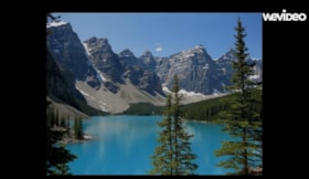
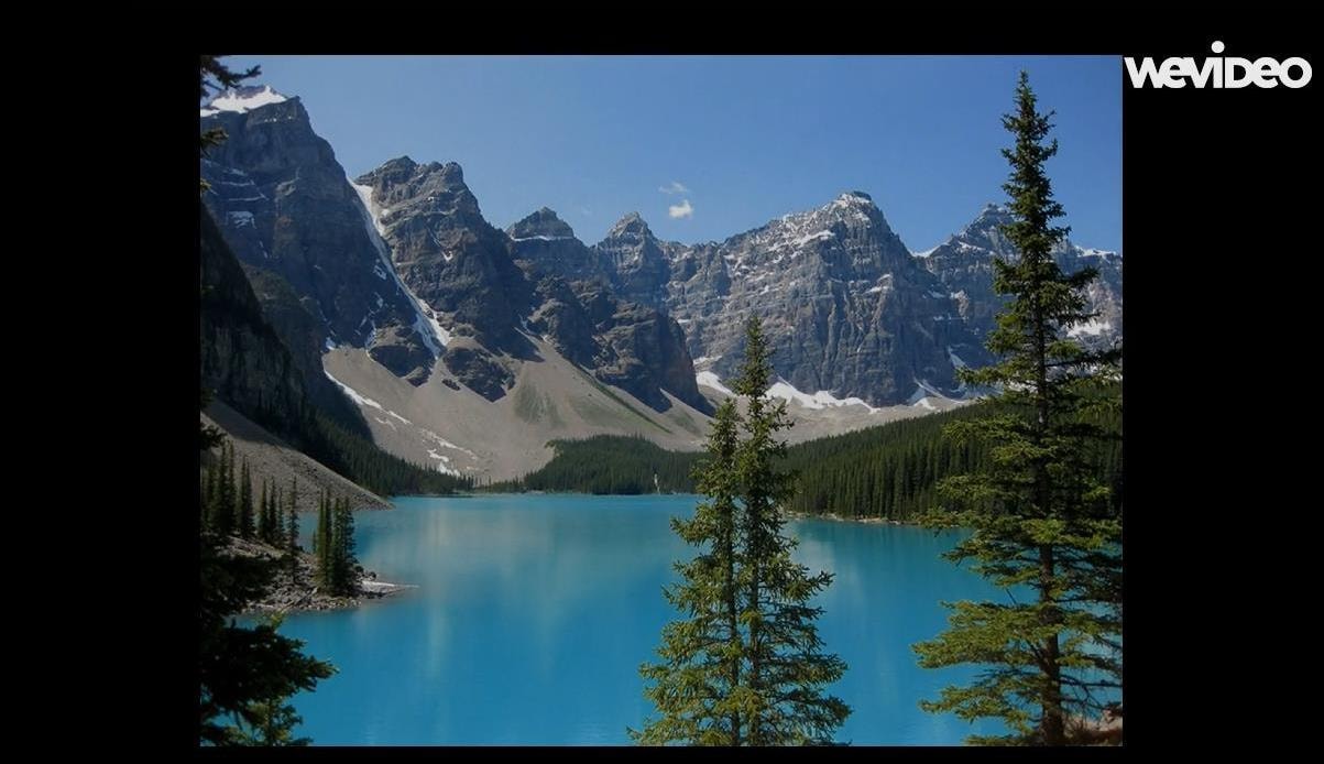
Laying Down My Paddle
https://search.heritageburnaby.ca/link/museumdescription9677
- Repository
- Burnaby Village Museum
- Date
- 2016
- Collection/Fonds
- Burnaby Village Museum Film and Video collection
- Description Level
- Item
- Physical Description
- 1 video recording (mp4) (5 min., 14 sec.) : digital, 25 fps, col., sd., stereo
- Scope and Content
- This film is created was Cindy Gierarch. The film shares happy memories of canoeing with her husband, Lester, on beautiful glacier fed Moraine Lake in the Canadian Rockies in Alberta. This trip, in 2007, was a long dreamt of reward for paying off the mortgage on their Burnaby condo suite. While c…
- Repository
- Burnaby Village Museum
- Collection/Fonds
- Burnaby Village Museum Film and Video collection
- Description Level
- Item
- Physical Description
- 1 video recording (mp4) (5 min., 14 sec.) : digital, 25 fps, col., sd., stereo
- Scope and Content
- This film is created was Cindy Gierarch. The film shares happy memories of canoeing with her husband, Lester, on beautiful glacier fed Moraine Lake in the Canadian Rockies in Alberta. This trip, in 2007, was a long dreamt of reward for paying off the mortgage on their Burnaby condo suite. While canoeing on the lake, Cindy learned a valuable lesson that she would never forget - “life will glide along smoothly and joyfully as long as I keep my paddle on the bottom of our canoe.”
- History
- Cindy Gierach has lived in Burnaby for the past 22 years.
- Creator
- Gierach, Cindy
- Other Title Information
- title supplied by film maker
- Accession Code
- BV016.37.8
- Access Restriction
- No restrictions
- Reproduction Restriction
- May be restricted by third party rights
- Date
- 2016
- Media Type
- Moving Images
- Notes
- Transcribed title
Images
Video
Laying Down My Paddle, 2016
Laying Down My Paddle, 2016
https://search.heritageburnaby.ca/media/hpo/_Data/_BVM_Moving_Images/2016_0037_0008_001.mp4
Lucky Number: A Tribute to my Sisters
https://search.heritageburnaby.ca/link/museumdescription9672
- Repository
- Burnaby Village Museum
- Date
- 2016
- Collection/Fonds
- Burnaby Village Museum Film and Video collection
- Description Level
- Item
- Physical Description
- 1 video recording (mp4) (9 min., 8 sec.) : digital, 25 fps, col., sd., stereo
- Scope and Content
- This film by Jadzia Prenosil follows the life of three sisters. They were born, educated and spent the first two decades of their lives in Communist (Czecho) - Slovakia. In August of 1968 the Warsaw Pact forces/Russian Army invaded the country in order to stop the spread of democracy lead by Presid…
- Repository
- Burnaby Village Museum
- Collection/Fonds
- Burnaby Village Museum Film and Video collection
- Description Level
- Item
- Physical Description
- 1 video recording (mp4) (9 min., 8 sec.) : digital, 25 fps, col., sd., stereo
- Scope and Content
- This film by Jadzia Prenosil follows the life of three sisters. They were born, educated and spent the first two decades of their lives in Communist (Czecho) - Slovakia. In August of 1968 the Warsaw Pact forces/Russian Army invaded the country in order to stop the spread of democracy lead by President Dubcek. In fear of repercussions the family decided to leave their homeland. While they pondered over their fate in nearby Vienna, Austria they received an invitation from their aunt who lived in Vancouver. They were granted the status of refugee and were sponsored by the Canadian government. They arrived to Vancouver in October 1968. The film depicts their life in both countries ( Slovakia/Canada ) and tells a story of their strong relationship that spans for over half a century. It is this bond that helped them to overcome the many challenges and traumas they had to face throughout their lives.
- History
- Jadzia (pron. Ya-dja) Prenosil was born in Trnava, Czecho- Slovakia in 1951. She emigrated to Canada in 1968. After she acquired basic English skills at a night school she entered Grade 11 in Lord Byng High School in Vancouver. She completed her Bachelor degree in French and Spanish at UBC. In order to improve these two languages she spent some time in France to learn French and later travelled across Central and South America. This experience widened her view of the world. She remains an avid explorer, traveller to this day. After travelling and working at different jobs she obtained a teaching degree from SFU. In 1988 she began teaching French and ESL in Killarney Secondary School. For the next thirty years she had worked with refugees from all over the world and developed close friendships with many of them. Her own experience of being once an immigrant herself and learning English as a teenager allowed her to reach out to many students and helped them integrate into Canadian society. In 1991 she moved to an old (1931) character home in North Burnaby where she and her husband live happily to the present day.
- Creator
- Prenosil, Jadzia
- Other Title Information
- title supplied by film maker
- Subjects
- Migration
- Names
- Prenosil, Jadzia
- Accession Code
- BV016.37.3
- Access Restriction
- No restrictions
- Reproduction Restriction
- May be restricted by third party rights
- Date
- 2016
- Media Type
- Moving Images
- Notes
- Transcribed title
Images
Video
Lucky Number: A Tribute to my Sisters, 2016
Lucky Number: A Tribute to my Sisters, 2016
https://search.heritageburnaby.ca/media/hpo/_Data/_BVM_Moving_Images/2016_0037_0003_001.mp4
Map of Municipality of Burnaby
https://search.heritageburnaby.ca/link/museumdescription8200
- Repository
- Burnaby Village Museum
- Date
- 1921
- Collection/Fonds
- Burnaby Village Museum Map collection
- Description Level
- Item
- Physical Description
- 1 map : lithographic print, b&w ; 83 x 56 cm
- Scope and Content
- Item consists of a map of the Municipality of Burnaby compiled and published by Dominion Blueprint & Map Company.
- Repository
- Burnaby Village Museum
- Collection/Fonds
- Burnaby Village Museum Map collection
- Description Level
- Item
- Physical Description
- 1 map : lithographic print, b&w ; 83 x 56 cm
- Material Details
- Scale : 1:24,000 inches
- Scope and Content
- Item consists of a map of the Municipality of Burnaby compiled and published by Dominion Blueprint & Map Company.
- Creator
- Dominion Map and Blueprint Co.
- Publisher
- Blue Printers, Map Publishers and Draughtsmen
- Accession Code
- HV976.11.1
- Access Restriction
- No restrictions
- Reproduction Restriction
- No known restrictions
- Date
- 1921
- Media Type
- Cartographic Material
- Scan Resolution
- 340
- Scan Date
- 22 Dec. 2020
- Scale
- 100
- Notes
- Title based on contents of map
- Cardstock map cover reads: "Map / of the / Municipality of / Burnaby / Published by / Dominion Map & Blue Print Co. / Arts and Crafts Bldg /576 Seymour St., Vancouver, B.C. / Blue Printers, Map Publishers and Draughtsmen / Phone Sey 4670 / Price, 50 c."
- Title on map reads: "Burnaby / Municipality."
Zoomable Images


Map of South Western Part of British Columbia
https://search.heritageburnaby.ca/link/museumdescription8688
- Repository
- Burnaby Village Museum
- Date
- 1897
- Collection/Fonds
- Burnaby Village Museum Map collection
- Description Level
- Item
- Physical Description
- 1 map : col. ink on paper ; 68 x 88 cm
- Scope and Content
- Item consists of a "MAP OF THE SOUTH-WESTERN PART OF BRITISH COLUMBIA”. Map identifies geographic land districts of New Westminster District; Coast District; Lillooet District; Yale District, Kamloops Division, Yale Division and districts on Vancouver Island. Map also includes the northern portions…
- Repository
- Burnaby Village Museum
- Collection/Fonds
- Burnaby Village Museum Map collection
- Description Level
- Item
- Physical Description
- 1 map : col. ink on paper ; 68 x 88 cm
- Material Details
- Scale [1:633600]
- Scope and Content
- Item consists of a "MAP OF THE SOUTH-WESTERN PART OF BRITISH COLUMBIA”. Map identifies geographic land districts of New Westminster District; Coast District; Lillooet District; Yale District, Kamloops Division, Yale Division and districts on Vancouver Island. Map also includes the northern portions of the State of Washington below the 49th parallel.
- Publisher
- The Colonist Litho Victoria B.C.
- Responsibility
- Martin, George Bohun
- Accession Code
- BV993.12.12
- Access Restriction
- No restrictions
- Reproduction Restriction
- No known restrictions
- Date
- 1897
- Media Type
- Cartographic Material
- Scan Resolution
- 600
- Scan Date
- 2023-08-17
- Notes
- Transcribed title
- Scale equals 1 inch to 10 miles
- "Compiled and drawn by direction of the Honouable G.B. Martin, Chief Commissioner of Lands and Works, Victoria, B.C."
- Signed by Surveyor General "Tom Kains"
Zoomable Images

![Map of the Municipality of Burnaby, [ca.1913] thumbnail](/media/hpo/_Data/_BVM_Cartographic_Material/1988/1988_0056_0001_002%20WEB.jpg?width=280)
Map of the Municipality of Burnaby
https://search.heritageburnaby.ca/link/museumdescription14766
- Repository
- Burnaby Village Museum
- Date
- [ca.1913]
- Collection/Fonds
- Burnaby Village Museum Map collection
- Description Level
- Item
- Physical Description
- 1 map : lithographic print, b&w ; 82 x 62 cm
- Scope and Content
- Item is a map of the Municipality of Burnaby, "Published by Archibald Moir and Company, 570 Granville St., Vancouver". Map was published compliments of "Walker Brothers Real Estate Brokers and Insurance Agents", Vancouver.
- Repository
- Burnaby Village Museum
- Collection/Fonds
- Burnaby Village Museum Map collection
- Description Level
- Item
- Physical Description
- 1 map : lithographic print, b&w ; 82 x 62 cm
- Material Details
- Scale 1 inch = 1000 feet
- Scope and Content
- Item is a map of the Municipality of Burnaby, "Published by Archibald Moir and Company, 570 Granville St., Vancouver". Map was published compliments of "Walker Brothers Real Estate Brokers and Insurance Agents", Vancouver.
- Publisher
- Archibald Moir and Company
- Responsibility
- Walker Brothers Real Estate Brokers and Insurance Agents
- Accession Code
- BV988.56.1
- Access Restriction
- No restrictions
- Reproduction Restriction
- No known restrictions
- Date
- [ca.1913]
- Media Type
- Cartographic Material
- Scan Resolution
- 350
- Scan Date
- Dec. 22,2020
- Scale
- 100
- Notes
- Title based on contents of map
Zoomable Images
![Map of the Municipality of Burnaby, [ca.1913] thumbnail](/media/hpo/_Data/_BVM_Cartographic_Material/1988/1988_0056_0001_001_seadragon/1988_0056_0001_001.jpg?w=280)
Mayor's address re COVID-19
https://search.heritageburnaby.ca/link/museumdescription15398
- Repository
- Burnaby Village Museum
- Date
- 23 Mar. 2020
- Collection/Fonds
- Burnaby Village Museum COVID-19 collection
- Description Level
- Item
- Physical Description
- 1 video recording (mp4) (3 min., 14 sec.) : digital, 24 fps, col., sd., stereo
- Scope and Content
- Film clip of Burnaby Mayor Mike Hurley delivering an online address to the citizens of Burnaby. The Mayor is seated at his desk at Burnaby City Hall. The Mayor provides his comments and concerns regarding the impact the COVID-19 pandemic is having on the City of Burnaby and it's citizens. He speaks…
- Repository
- Burnaby Village Museum
- Collection/Fonds
- Burnaby Village Museum COVID-19 collection
- Description Level
- Item
- Physical Description
- 1 video recording (mp4) (3 min., 14 sec.) : digital, 24 fps, col., sd., stereo
- Scope and Content
- Film clip of Burnaby Mayor Mike Hurley delivering an online address to the citizens of Burnaby. The Mayor is seated at his desk at Burnaby City Hall. The Mayor provides his comments and concerns regarding the impact the COVID-19 pandemic is having on the City of Burnaby and it's citizens. He speaks about facility and community event closures as well as the financial concerns for home and business owners, renters and the unemployed.
- History
- Video taken by the City of Burnaby Marketing Department in 2020. The original intent of the clip was to produce communications about the pandemic and changes throughout the City that residents needed to be aware of.
- Creator
- City of Burnaby
- Geographic Access
- Canada Way
- Street Address
- 4949 Canada Way
- Accession Code
- BV021.2.11
- Access Restriction
- No restrictions
- Reproduction Restriction
- May be restricted by third party rights
- Date
- 23 Mar. 2020
- Media Type
- Moving Images
- Historic Neighbourhood
- Burnaby Lake (Historic Neighbourhood)
- Planning Study Area
- Douglas-Gilpin Area
- Notes
- Title based on contents of film
Images
Video
Mayor's address re COVID-19, 23 Mar. 2020
Mayor's address re COVID-19, 23 Mar. 2020
https://search.heritageburnaby.ca/media/hpo/_Data/_BVM_Moving_Images/2021_0002_0011_001.mp4![Municipality of Burnaby, [ca. 1909] thumbnail](/media/hpo/_Data/_BVM_Cartographic_Material/1976/1976_0158_0006_002%20WEB.jpg?width=280)
Municipality of Burnaby
https://search.heritageburnaby.ca/link/museumdescription13095
- Repository
- Burnaby Village Museum
- Date
- [ca. 1909]
- Collection/Fonds
- Burnaby Village Museum Map collection
- Description Level
- Item
- Physical Description
- 1 map : b&w lithographic print on linen, b&w ; 40 x 43.5 cm
- Scope and Content
- Map of the Municipality of Burnaby issued by Mahon, McFarland and Mahon (Real Estate, Insurance and Loans, Vancouver B.C.). A handrawn red line runs south of Burnaby Lake and between North Road and Boundary Road.
- Repository
- Burnaby Village Museum
- Collection/Fonds
- Burnaby Village Museum Map collection
- Description Level
- Item
- Physical Description
- 1 map : b&w lithographic print on linen, b&w ; 40 x 43.5 cm
- Scope and Content
- Map of the Municipality of Burnaby issued by Mahon, McFarland and Mahon (Real Estate, Insurance and Loans, Vancouver B.C.). A handrawn red line runs south of Burnaby Lake and between North Road and Boundary Road.
- Creator
- Mahon, McFarland & Mahon
- Publisher
- The Angel Engraving Co.
- Accession Code
- HV976.158.6
- Access Restriction
- No restrictions
- Reproduction Restriction
- No known restrictions
- Date
- [ca. 1909]
- Media Type
- Cartographic Material
- Scan Resolution
- 420
- Scan Date
- Dec. 22, 2020
- Scale
- 100
- Notes
- Title based on content of map
- Title on map reads: "Map / of The / Municipality / of / BURNABY / ISSUED BY / Mahon, McFarland & Mahon"
- Map contains the initals "F.R.G." [sic]
- Circular insignia in left corner reads: "THE ANGEL ENGRAVING CO."
Zoomable Images
![Municipality of Burnaby, [ca. 1909] thumbnail](/media/hpo/_Data/_BVM_Cartographic_Material/1976/1976_0158_0006_001_seadragon/1976_0158_0006_001.jpg?w=280)

Municipality of Burnaby
https://search.heritageburnaby.ca/link/museumdescription13096
- Repository
- Burnaby Village Museum
- Date
- 1936
- Collection/Fonds
- Burnaby Village Museum Map collection
- Description Level
- Item
- Physical Description
- 1 map : b&w print on paper ; 59 x 43 cm
- Scope and Content
- Map of the Municipality of Burnaby compiled and published by City Map and White Print Co.
- Repository
- Burnaby Village Museum
- Collection/Fonds
- Burnaby Village Museum Map collection
- Description Level
- Item
- Physical Description
- 1 map : b&w print on paper ; 59 x 43 cm
- Scope and Content
- Map of the Municipality of Burnaby compiled and published by City Map and White Print Co.
- Creator
- City Map and White Print Co.
- Publisher
- City Map and White Print Co.
- Accession Code
- HV976.158.7
- Access Restriction
- No restrictions
- Reproduction Restriction
- No known restrictions
- Date
- 1936
- Media Type
- Cartographic Material
- Scan Resolution
- 600
- Scan Date
- 2022-04-06
- Scale
- 100
- Notes
- Title based on content of map
- Title on map reads: "MUNICIPALITY / OF / BURNABY / BRITISH COLUMBIA / Compiled and Published by / CITY MAP AND WHITE PRINT CO."
- Stamp on map reads: "SFU LIBRARY / SEP 1974 / G. 3514 / B87 / 1936"
- Stamp on map reads: "SFU LIBRARY / AUG 1973 / G. 3514 / B87 / 1936"
- Cirular seal stamp on map reads: "The University of / Library / British Columbia"
Zoomable Images


Municipality of Burnaby - Volume XV and Volume XVIII
https://search.heritageburnaby.ca/link/museumdescription8680
- Repository
- Burnaby Village Museum
- Date
- May 1927
- Collection/Fonds
- Burnaby Village Museum Map collection
- Description Level
- File
- Physical Description
- 4 plans on 4 sheets : col. lithographic prints ; 63.5 x 53.5 cm folded to 53 x 31.5 cm
- Scope and Content
- File consists of four pages of plans removed from a bound book containing a series of fire insurance plans of the Municipality of Burnaby. The first two pages are numbered "A" and "B" and are key plans from "GREATER VANCOUVER B.C. / VOLUME XV / Surveyed _ May 1927 / MUNICIPALITY OF / BURNABY", "PLA…
- Repository
- Burnaby Village Museum
- Collection/Fonds
- Burnaby Village Museum Map collection
- Description Level
- File
- Physical Description
- 4 plans on 4 sheets : col. lithographic prints ; 63.5 x 53.5 cm folded to 53 x 31.5 cm
- Material Details
- Scales [1:1200] and [1:6000]
- Scope and Content
- File consists of four pages of plans removed from a bound book containing a series of fire insurance plans of the Municipality of Burnaby. The first two pages are numbered "A" and "B" and are key plans from "GREATER VANCOUVER B.C. / VOLUME XV / Surveyed _ May 1927 / MUNICIPALITY OF / BURNABY", "PLAN DEPT. FIRE BRANCH _ B.C. INSURANCE UNDERWRITERS ASSN.". Key Plan "B" covers plans: 1505; 1506; 1512 to 1516; 1540 to 1544; 1550 to 1557 and District Lots: 129 to 132; 135 to 138; 205 to 208 and 215 to 218. Key Plan "A" covers plans: 1501 to 1504; 1507 to 1511; 1517 to 1525; 1531 to 1539; 1545 to 1550 and District Lots: 116 to 127 and 186 to 189. Plan "1806" is part of "GREATER VANCOUVER B.C. / VOLUME XVIII / Municipality of Burnaby / May, 1927" and covers District Lot 153. Plan "1807" is from "GREATER VANCOUVER B.C. / VOLUME XVIII / Municipality of Burnaby / May, 1927" and covers District Lots: 99,149 and 152.
- Responsibility
- British Columbia Underwriters' Association
- Accession Code
- HV972.111.2
- Access Restriction
- No restrictions
- Reproduction Restriction
- May be restricted by third party rights
- Date
- May 1927
- Media Type
- Cartographic Material
- Historic Neighbourhood
- Vancouver Heights (Historic Neighbourhood)
- Lochdale (Historic Neighbourhood)
- Capitol Hill (Historic Neighbourhood)
- Central Park (Historic Neighbourhood)
- Alta Vista (Historic Neighbourhood)
- Planning Study Area
- Burnaby Heights Area
- Sperling-Broadway Area
- Lochdale Area
- Parkcrest-Aubrey Area
- Westridge Area
- Willingdon Heights Area
- Capitol Hill Area
- Maywood Area
- Marlborough Area
- Scan Resolution
- 400
- Scan Date
- 2021-11-18
- Notes
- Title based on content of plans
- Scales are measured 1 inch = 100 feet and 1 inch = 500 feet
- See also BV987.1.70d for revised versions of plans
Zoomable Images


Municipality of Burnaby- Volume XV and Volume XVIII
https://search.heritageburnaby.ca/link/museumdescription8686
- Repository
- Burnaby Village Museum
- Date
- May 1927
- Collection/Fonds
- Burnaby Village Museum Map collection
- Description Level
- File
- Physical Description
- 4 plans on 4 sheets : col. lithographic prints ; 63.5 x 53.5 cm folded to 53 x 31.5 cm
- Scope and Content
- File consists of four pages of plans removed from a bound book containing a series of fire insurance plans of the Municipality of Burnaby. Plan "1520" is part of "GREATER VANCOUVER B.C. / VOLUME XV / Municipality of Burnaby / May 1927" and covers District Lots: 121 and 187. Plann "1521" is part of …
- Repository
- Burnaby Village Museum
- Collection/Fonds
- Burnaby Village Museum Map collection
- Description Level
- File
- Physical Description
- 4 plans on 4 sheets : col. lithographic prints ; 63.5 x 53.5 cm folded to 53 x 31.5 cm
- Material Details
- Scale [1:600] and [1:1200]
- Scope and Content
- File consists of four pages of plans removed from a bound book containing a series of fire insurance plans of the Municipality of Burnaby. Plan "1520" is part of "GREATER VANCOUVER B.C. / VOLUME XV / Municipality of Burnaby / May 1927" and covers District Lots: 121 and 187. Plann "1521" is part of "GREATER VANCOUVER B.C. / VOLUME XV / Municipality of Burnaby / May 1927" and covers District Lots: 121 and 187. Key plan "H" reads: "GREATER VANCOUVER B.C. / VOLUME XVIII / Surveyed _ May 1927 / MUNICIPALITY OF / BURNABY" and covers plans: 1813 to 1822; 1824 to 1832; 1839; 1840; 1853 to 1865 and District Lots: 28; 30; 53; 90 to 93; 95 to 97; 155a; 155b; 155c; 159; 160; 171 to 173. Plan "1801" is part of "GREATER VANCOUVER B.C. / VOLUME XVIII / Municipality of Burnaby / May 1927" and covers District Lot 153.
- Responsibility
- British Columbia Underwriters' Association
- Accession Code
- HV972.111.8
- Access Restriction
- No restrictions
- Reproduction Restriction
- May be restricted by third party rights
- Date
- May 1927
- Media Type
- Cartographic Material
- Historic Neighbourhood
- Fraser Arm (Historic Neighbourhood)
- Vancouver Heights (Historic Neighbourhood)
- East Burnaby (Historic Neighbourhood)
- Edmonds (Historic Neighbourhood)
- Planning Study Area
- Marlborough Area
- Kingsway-Beresford Area
- Windsor Area
- Big Bend Area
- Clinton-Glenwood Area
- Burnaby Heights Area
- Edmonds Area
- Stride Avenue Area
- Scan Resolution
- 400
- Scan Date
- 2021-11-18
- Notes
- Title based on content of plans
- See also BV987.1.70d for revised versions of plans
- Scale is measured 1 inch = 500 feet
Zoomable Images


Municipality of Burnaby - Volume XVI and Volume XVII
https://search.heritageburnaby.ca/link/museumdescription8684
- Repository
- Burnaby Village Museum
- Date
- May 1927
- Collection/Fonds
- Burnaby Village Museum Map collection
- Description Level
- File
- Physical Description
- 4 plans on 4 sheets : col. lithographic prints ; 63.5 x 53.5 cm folded to 53 x 31.5 cm
- Scope and Content
- File consists of four pages of plans removed from a bound book containing a series of fire insurance plans of the Municipality of Burnaby. Page "D" is titled: "GREATER VANCOUVER B.C. / VOLUME XVI / Surveyed _ May 1927 / MUNICIPALITY OF / BURNABY / PLAN DEPT. FIRE BRANCH _ B.C. INSURANCE UNDERWRITE…
- Repository
- Burnaby Village Museum
- Collection/Fonds
- Burnaby Village Museum Map collection
- Description Level
- File
- Physical Description
- 4 plans on 4 sheets : col. lithographic prints ; 63.5 x 53.5 cm folded to 53 x 31.5 cm
- Material Details
- Scale [1:1200] and [1:6000]
- Scope and Content
- File consists of four pages of plans removed from a bound book containing a series of fire insurance plans of the Municipality of Burnaby. Page "D" is titled: "GREATER VANCOUVER B.C. / VOLUME XVI / Surveyed _ May 1927 / MUNICIPALITY OF / BURNABY / PLAN DEPT. FIRE BRANCH _ B.C. INSURANCE UNDERWRITERS ASSN." / KEY PLAN". Plans covered in this "Key Plan" are numbered 1601 to 1626, 1632 and 1651 covering District Lots: 15; 31; 100 to 102; 114; 141 to 144; 147 and 148; 209 to 214. Plan "E" is part of "GREATER VANCOUVER B.C. / VOLUME XVII / Municipality of Burnaby / May 1927" and covers plans: 1701 to 1705; 1711 to 1715; 1723 to 1727; 1729 to 1733; 1737 to 1742 and District Lots: 68 to 74; 80 to 84; 32 to 35 and 38 to 39. Plan marked "F" is a key plan titled: "GREATER VANCOUVER B.C. / VOLUME XVII / Surveyed _ May 1927 / MUNICIPALITY OF / BURNABY and covers plans: 1706 to 1710; 1716 to 1722; 1734 and 1735; 1743 to 1752 and District Lots: 42 to 44; 59; 75 to 80; 83 to 87; 89 to 93 and 130. Plan "1729" is part of "GREATER VANCOUVER B.C. / VOLUME XVII / Municipality of Burnaby / May 1927" and covers District Lots 34 and 35.
- Responsibility
- British Columbia Underwriters' Association
- Accession Code
- HV972.111.6
- Access Restriction
- No restrictions
- Reproduction Restriction
- May be restricted by third party rights
- Date
- May 1927
- Media Type
- Cartographic Material
- Historic Neighbourhood
- Barnet (Historic Neighbourhood)
- Burquitlam (Historic Neighbourhood)
- Central Park (Historic Neighbourhood)
- Burnaby Lake (Historic Neighbourhood)
- Broadview (Historic Neighbourhood)
- Planning Study Area
- Burnaby Mountain Area
- Lyndhurst Area
- Lake City Area
- Cascade-Schou Area
- Garden Village Area
- Douglas-Gilpin Area
- Oakalla Area
- Scan Resolution
- 400
- Scan Date
- 2021-11-18
- Notes
- Title based on content of plans
- See also BV987.1.70d for revised versions of plans
- Scale is measured 1 inch = 500 feet


