Narrow Results By
Subject
- Advertising Medium - Signs and Signboards 2
- Agriculture - Farms 1
- Animals - Horses 1
- Buildings 1
- Buildings - Commercial 1
- Buildings - Commercial - General Stores 1
- Buildings - Industrial - Factories 1
- Buildings - Recreational - Community Halls 1
- Buildings - Religious - Churches 1
- Buildings - Residential - Boathouses 2
- Buildings - Residential - Houses 5
- Buildings - Schools 3
7818 6th Street
https://search.heritageburnaby.ca/link/archivedescription93731
- Repository
- City of Burnaby Archives
- Date
- 1989
- Collection/Fonds
- Grover, Elliott & Co. Ltd. fonds
- Description Level
- File
- Physical Description
- 26 photographs : col. negatives ; 35 mm
- Scope and Content
- Photographs of the exterior of a Benjamin Moore Paints store and surrounding area. The store is located on a corner opposite Microtel and outside the store, a sign for the Skytrain Operations and Maintenance Centre is visible.
- Repository
- City of Burnaby Archives
- Date
- 1989
- Collection/Fonds
- Grover, Elliott & Co. Ltd. fonds
- Physical Description
- 26 photographs : col. negatives ; 35 mm
- Description Level
- File
- Record No.
- 622-019
- Access Restriction
- No restrictions
- Reproduction Restriction
- No restrictions
- Accession Number
- 2017-39
- Scope and Content
- Photographs of the exterior of a Benjamin Moore Paints store and surrounding area. The store is located on a corner opposite Microtel and outside the store, a sign for the Skytrain Operations and Maintenance Centre is visible.
- Media Type
- Photograph
- Notes
- Transcribed title
- Title transcribed from original print envelope
- File no. 89v-004-O
- Property address could not be confirmed at time of description.
- Geographic Access
- 6th Street
- 12th Avenue
- Street Address
- 7818 6th Street
- Historic Neighbourhood
- East Burnaby (Historic Neighbourhood)
- Planning Study Area
- Second Street Area
![Boathouse on Burnaby Lake, [1902] thumbnail](/media/hpo/_Data/_Archives_Images/_Unrestricted/477/477-855.jpg?width=280)
Boathouse on Burnaby Lake
https://search.heritageburnaby.ca/link/archivedescription39536
- Repository
- City of Burnaby Archives
- Date
- [1902]
- Collection/Fonds
- Peers Family and Hill Family fonds
- Description Level
- Item
- Physical Description
- 1 photograph : b&w 5.5 x 7.5 cm on page 21.5 x 28 cm (pasted in album)
- Scope and Content
- Photograph of Bernard Hill's boathouse on Burnaby Lake. Built in 1902, the boathouse was located on Deer Lake Brook at the southwestern tip of Burnaby Lake.
- Repository
- City of Burnaby Archives
- Date
- [1902]
- Collection/Fonds
- Peers Family and Hill Family fonds
- Physical Description
- 1 photograph : b&w 5.5 x 7.5 cm on page 21.5 x 28 cm (pasted in album)
- Description Level
- Item
- Record No.
- 477-855
- Access Restriction
- No restrictions
- Reproduction Restriction
- No known restrictions
- Accession Number
- 2007-12
- Scope and Content
- Photograph of Bernard Hill's boathouse on Burnaby Lake. Built in 1902, the boathouse was located on Deer Lake Brook at the southwestern tip of Burnaby Lake.
- Subjects
- Buildings - Residential - Boathouses
- Media Type
- Photograph
- Notes
- Title based on caption accompanying photograph
- Geographic Access
- Burnaby Lake
- Deer Lake Brook
- Historic Neighbourhood
- Burnaby Lake (Historic Neighbourhood)
Images
![Boathouse on Burnaby Lake, [1902] thumbnail](/media/hpo/_Data/_Archives_Images/_Unrestricted/477/477-855.jpg)

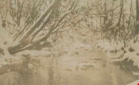
Bridge over Deer Lake Brook
https://search.heritageburnaby.ca/link/archivedescription39323
- Repository
- City of Burnaby Archives
- Date
- 1922
- Collection/Fonds
- Peers Family and Hill Family fonds
- Description Level
- Item
- Physical Description
- 1 photograph : b&w ; 6.2 x 9.8 cm on page 24.5 x 32.5 cm (pasted in album)
- Scope and Content
- Photograph of a bridge over Deer Lake Brook, covered with snow. This photograph was probably taken on the property belonging to Claude Hill, known as "Brookfield."
- Repository
- City of Burnaby Archives
- Date
- 1922
- Collection/Fonds
- Peers Family and Hill Family fonds
- Physical Description
- 1 photograph : b&w ; 6.2 x 9.8 cm on page 24.5 x 32.5 cm (pasted in album)
- Description Level
- Item
- Record No.
- 477-642
- Access Restriction
- No restrictions
- Reproduction Restriction
- No known restrictions
- Accession Number
- 2007-12
- Scope and Content
- Photograph of a bridge over Deer Lake Brook, covered with snow. This photograph was probably taken on the property belonging to Claude Hill, known as "Brookfield."
- Media Type
- Photograph
- Notes
- Title based on contents of photograph
- Geographic Access
- Deer Lake Brook
- Deer Lake Avenue
- Street Address
- 6501 Deer Lake Avenue
- Historic Neighbourhood
- Burnaby Lake (Historic Neighbourhood)
- Planning Study Area
- Morley-Buckingham Area
Images

![Burnaby rivers, [2002] thumbnail](/media/hpo/_Data/_Archives_Images/_Unrestricted/535/535-2800-1.jpg?width=280)
Burnaby rivers
https://search.heritageburnaby.ca/link/archivedescription97440
- Repository
- City of Burnaby Archives
- Date
- [2002]
- Collection/Fonds
- Burnaby NewsLeader photograph collection
- Description Level
- File
- Physical Description
- 4 photographs (tiff) : col.
- Scope and Content
- File contains photographs of people with Burnaby rivers and creeks. Photographs depict BCIT river conservationist Mark Angelo posing in Deer Lake Brook by Burnaby Village Museum, and Lorna Johnson, Gordie Cook, and Jack McAfee enjoying Fraser Foreshore Park by the Fraser River.
- Repository
- City of Burnaby Archives
- Date
- [2002]
- Collection/Fonds
- Burnaby NewsLeader photograph collection
- Physical Description
- 4 photographs (tiff) : col.
- Description Level
- File
- Record No.
- 535-2800
- Access Restriction
- No restrictions
- Reproduction Restriction
- No restrictions
- Accession Number
- 2018-12
- Scope and Content
- File contains photographs of people with Burnaby rivers and creeks. Photographs depict BCIT river conservationist Mark Angelo posing in Deer Lake Brook by Burnaby Village Museum, and Lorna Johnson, Gordie Cook, and Jack McAfee enjoying Fraser Foreshore Park by the Fraser River.
- Media Type
- Photograph
- Photographer
- Bartel, Mario
- Notes
- Title based on caption
- Collected by editorial for use in a September 2002 issue of the Burnaby NewsLeader
- Caption from metadata for 535-2800-1 and 535-2800-2: "Mark Angelo, of BCIT, who's made it his mission to save and preserve Burnaby's rivers and creeks, says he's particularly proud of Deer Lake Brook, as it babbles through Burnaby Village Museum, on its way to Burnaby Lake."
- Caption from metadata for 535-2800-3: "Lorna Johnson hits a tennis ball out into the Fraser River at Fraser Foreshore Park, to her dog, Keiko."
- Caption from metadata for 535-2800-4: "Gordie Cook and Jack McAfee shoot the breeze and enjoy the sunshine along the Fraser River, at Fraser Foreshore Park in Burnaby."
- Geographic Access
- Deer Lake Brook
- Burnaby Fraser Foreshore Park
- Fraser River
- Historic Neighbourhood
- Fraser Arm (Historic Neighbourhood)
- Burnaby Lake (Historic Neighbourhood)
- Planning Study Area
- Morley-Buckingham Area
- Big Bend Area
Images
![Burnaby rivers, [2002] thumbnail](/media/hpo/_Data/_Archives_Images/_Unrestricted/535/535-2800-1.jpg)
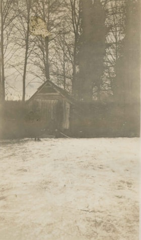
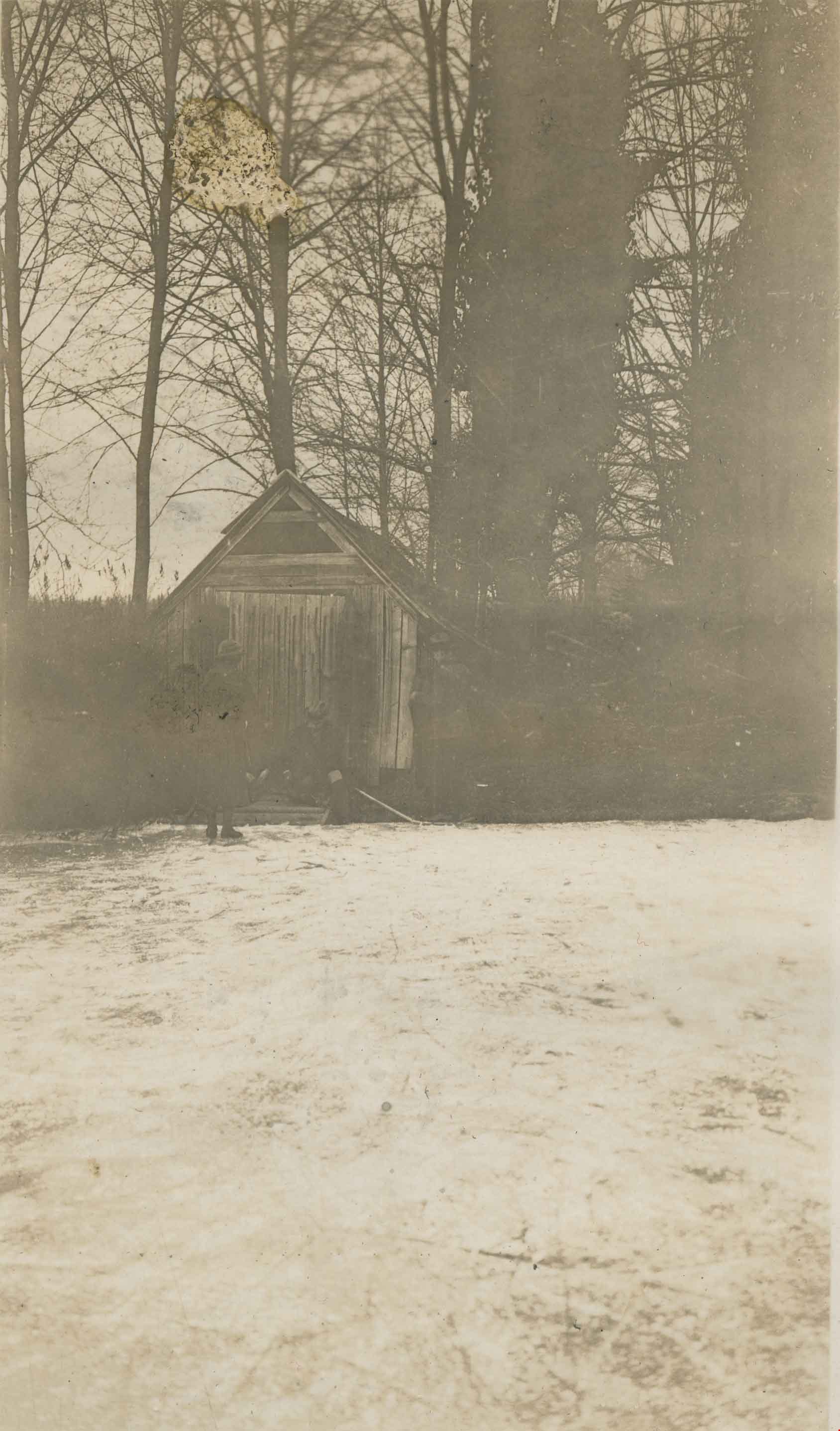
Claude Hill's Boathouse
https://search.heritageburnaby.ca/link/archivedescription34310
- Repository
- City of Burnaby Archives
- Date
- 1924
- Collection/Fonds
- Burnaby Historical Society fonds
- Description Level
- Item
- Physical Description
- 1 photograph : b&w ; 8 x 13.3 cm on page 17.5 x 24.5 cm
- Scope and Content
- Photograph of three people outside Claude Hill's boathouse - all unidentified. The boathouse was located at the mouth of Deer Lake Creek (historically known as Deer Lake Brook) This photograph was taken during the winter of 1924 and the water is frozen over with ice.
- Repository
- City of Burnaby Archives
- Date
- 1924
- Collection/Fonds
- Burnaby Historical Society fonds
- Subseries
- Peers family subseries
- Physical Description
- 1 photograph : b&w ; 8 x 13.3 cm on page 17.5 x 24.5 cm
- Description Level
- Item
- Record No.
- 020-017
- Access Restriction
- No restrictions
- Reproduction Restriction
- No known restrictions
- Accession Number
- BHS2007-04
- Scope and Content
- Photograph of three people outside Claude Hill's boathouse - all unidentified. The boathouse was located at the mouth of Deer Lake Creek (historically known as Deer Lake Brook) This photograph was taken during the winter of 1924 and the water is frozen over with ice.
- Media Type
- Photograph
- Notes
- Title based on caption accompanying photograph
- Geographic Access
- Deer Lake Brook
- Historic Neighbourhood
- Burnaby Lake (Historic Neighbourhood)
- Planning Study Area
- Morley-Buckingham Area
Images

Deer Lake
https://search.heritageburnaby.ca/link/museumdescription3102
- Repository
- Burnaby Village Museum
- Date
- 1914
- Collection/Fonds
- Burnaby Village Museum Photograph collection
- Description Level
- Item
- Physical Description
- 1 photograph : b&w glass negative ; 16.0 x 20.9 cm
- Scope and Content
- Photograph of Deer Lake. An earlier catalogue record from 1988 notes that the view is of the north shore of Deer Lake, looking northeast. Also noted is that the Hart's boathouse is in view at the mouth of Deer Lake Brook, and that the Anderson and Mathers houses on can be seen on Deer Lake Avenue
- Repository
- Burnaby Village Museum
- Collection/Fonds
- Burnaby Village Museum Photograph collection
- Description Level
- Item
- Physical Description
- 1 photograph : b&w glass negative ; 16.0 x 20.9 cm
- Scope and Content
- Photograph of Deer Lake. An earlier catalogue record from 1988 notes that the view is of the north shore of Deer Lake, looking northeast. Also noted is that the Hart's boathouse is in view at the mouth of Deer Lake Brook, and that the Anderson and Mathers houses on can be seen on Deer Lake Avenue
- Geographic Access
- Deer Lake Avenue
- Deer Lake Brook
- Street Address
- 6490 Deer Lake Avenue
- 6344 Deer Lake Avenue
- 6450 Deer Lake Avenue
- Accession Code
- HV972.11.16
- Access Restriction
- No restrictions
- Reproduction Restriction
- No known restrictions
- Date
- 1914
- Media Type
- Photograph
- Historic Neighbourhood
- Burnaby Lake (Historic Neighbourhood)
- Planning Study Area
- Douglas-Gilpin Area
- Related Material
- For other shots of the Deer Lake in the same accession, see HV972.11.6 and HV972.11.18
- Scan Resolution
- 300
- Scan Date
- 14/8/2006
- Scale
- 100
- Notes
- Title based on contents of photograph
- 1 b&w contact print accompanying negative
Images


Deer Lake
https://search.heritageburnaby.ca/link/archivedescription34551
- Repository
- City of Burnaby Archives
- Date
- 1914
- Collection/Fonds
- Burnaby Historical Society fonds
- Description Level
- Item
- Physical Description
- 1 photograph : sepia ; 16.1 x 21.3 cm mounted on 25.1 x 30.1 cm cardboard
- Scope and Content
- Photograph of Deer Lake. An earlier catalogue record from 1988 notes that the view is of the north shore of Deer Lake, looking northeast. Also noted is that the Hart's boathouse is in view at the mouth of Deer Lake Brook, and that the Anderson and Mather houses on can be seen on Deer Lake Avenue.
- Repository
- City of Burnaby Archives
- Date
- 1914
- Collection/Fonds
- Burnaby Historical Society fonds
- Subseries
- Photographs subseries
- Physical Description
- 1 photograph : sepia ; 16.1 x 21.3 cm mounted on 25.1 x 30.1 cm cardboard
- Description Level
- Item
- Record No.
- 044-011
- Access Restriction
- No restrictions
- Reproduction Restriction
- No known restrictions
- Accession Number
- BHS2007-04
- Scope and Content
- Photograph of Deer Lake. An earlier catalogue record from 1988 notes that the view is of the north shore of Deer Lake, looking northeast. Also noted is that the Hart's boathouse is in view at the mouth of Deer Lake Brook, and that the Anderson and Mather houses on can be seen on Deer Lake Avenue.
- Media Type
- Photograph
- Notes
- Title based on contents of photograph
- Geographic Access
- Deer Lake Avenue
- Deer Lake Brook
- Street Address
- 6344 Deer Lake Avenue
- 6490 Deer Lake Avenue
- Historic Neighbourhood
- Burnaby Lake (Historic Neighbourhood)
- Planning Study Area
- Douglas-Gilpin Area
Images

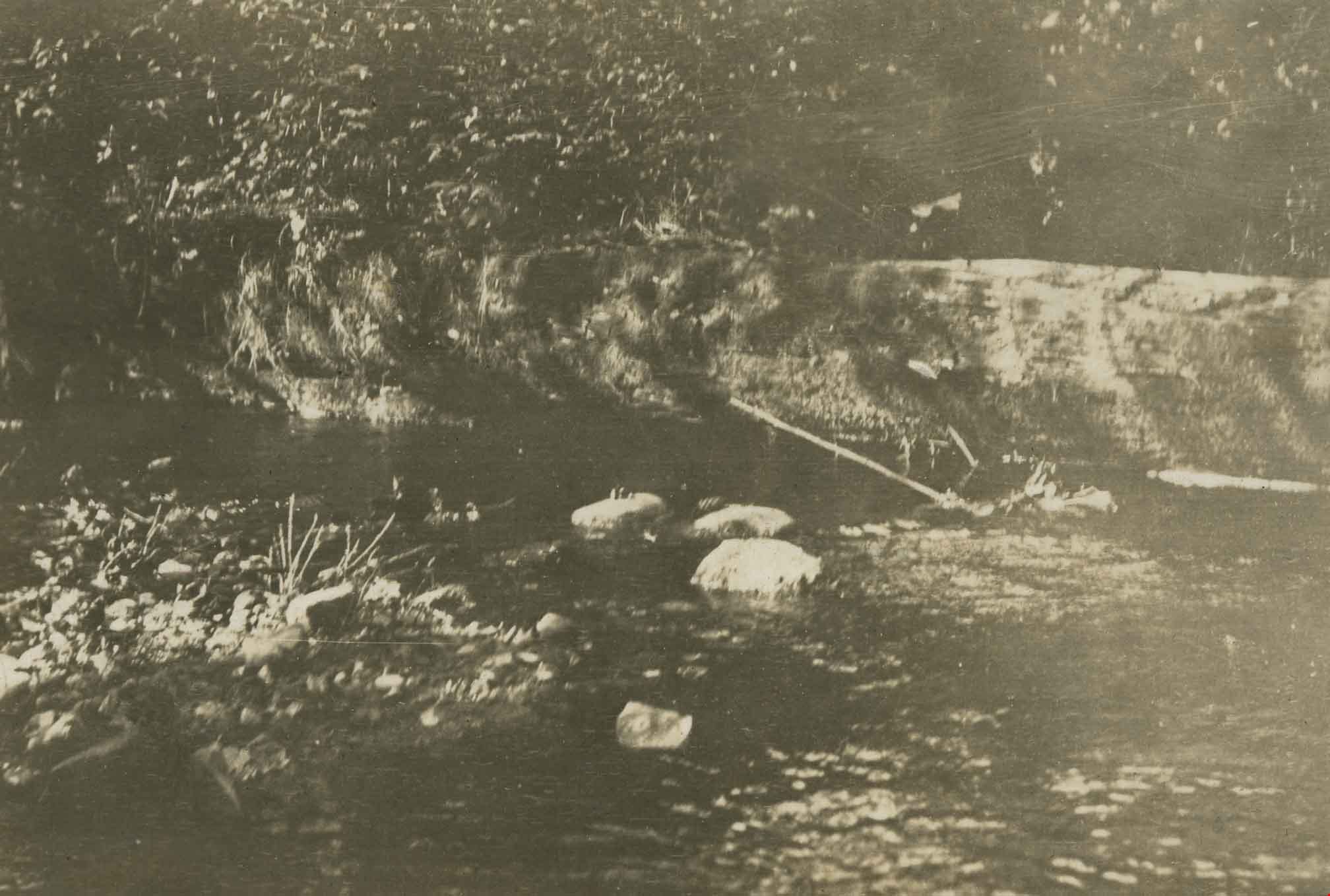
![Deer Lake Brook, [1937 or 1938] (date of original), copied 1991 thumbnail](/media/hpo/_Data/_Archives_Images/_Unrestricted/370/370-540.jpg?width=280)
Deer Lake Brook
https://search.heritageburnaby.ca/link/archivedescription37953
- Repository
- City of Burnaby Archives
- Date
- [1937 or 1938] (date of original), copied 1991
- Collection/Fonds
- Burnaby Historical Society fonds
- Description Level
- Item
- Physical Description
- 1 photograph : b&w ; 2.8 x 3.8 cm print on contact sheet 20.6 x 26.1 cm
- Scope and Content
- Photograph of Deer Lake Creek; historically known as Deer Lake Brook. A bridge can be seen in the background.
- Repository
- City of Burnaby Archives
- Date
- [1937 or 1938] (date of original), copied 1991
- Collection/Fonds
- Burnaby Historical Society fonds
- Subseries
- Burnaby Image Bank subseries
- Physical Description
- 1 photograph : b&w ; 2.8 x 3.8 cm print on contact sheet 20.6 x 26.1 cm
- Description Level
- Item
- Record No.
- 370-540
- Access Restriction
- No restrictions
- Reproduction Restriction
- No known restrictions
- Accession Number
- BHS1999-03
- Scope and Content
- Photograph of Deer Lake Creek; historically known as Deer Lake Brook. A bridge can be seen in the background.
- Subjects
- Geographic Features - Streams
- Media Type
- Photograph
- Notes
- Title based on contents of photograph
- 1 b&w copy negative accompanying
- Geographic Access
- Deer Lake Brook
- Historic Neighbourhood
- Burnaby Lake (Historic Neighbourhood)
- Planning Study Area
- Morley-Buckingham Area
Images
![Deer Lake Brook, [1937 or 1938] (date of original), copied 1991 thumbnail](/media/hpo/_Data/_Archives_Images/_Unrestricted/370/370-540.jpg)
Deer Lake Brook
https://search.heritageburnaby.ca/link/archivedescription39321
- Repository
- City of Burnaby Archives
- Date
- 1922
- Collection/Fonds
- Peers Family and Hill Family fonds
- Description Level
- Item
- Physical Description
- 1 photograph : b&w ; 6 x 9.8 cm on page 24.5 x 32.5 cm (pasted in album)
- Scope and Content
- Photograph of Deer Lake Creek; historically known as Deer Lake Brook. The banks and trees are covered with snow.
- Repository
- City of Burnaby Archives
- Date
- 1922
- Collection/Fonds
- Peers Family and Hill Family fonds
- Physical Description
- 1 photograph : b&w ; 6 x 9.8 cm on page 24.5 x 32.5 cm (pasted in album)
- Description Level
- Item
- Record No.
- 477-640
- Access Restriction
- No restrictions
- Reproduction Restriction
- No known restrictions
- Accession Number
- 2007-12
- Scope and Content
- Photograph of Deer Lake Creek; historically known as Deer Lake Brook. The banks and trees are covered with snow.
- Media Type
- Photograph
- Notes
- Title based on contents of photograph
- Geographic Access
- Deer Lake Brook
Images

Deer Lake Brook
https://search.heritageburnaby.ca/link/archivedescription39322
- Repository
- City of Burnaby Archives
- Date
- 1922
- Collection/Fonds
- Peers Family and Hill Family fonds
- Description Level
- Item
- Physical Description
- 1 photograph : b&w ; 5.8 x 8.5 cm on page 24.5 x 32.5 cm (pasted in album)
- Scope and Content
- Photograph of Deer Lake Creek, historically known as Deer Lake Brook.
- Repository
- City of Burnaby Archives
- Date
- 1922
- Collection/Fonds
- Peers Family and Hill Family fonds
- Physical Description
- 1 photograph : b&w ; 5.8 x 8.5 cm on page 24.5 x 32.5 cm (pasted in album)
- Description Level
- Item
- Record No.
- 477-641
- Access Restriction
- No restrictions
- Reproduction Restriction
- No known restrictions
- Accession Number
- 2007-12
- Scope and Content
- Photograph of Deer Lake Creek, historically known as Deer Lake Brook.
- Subjects
- Geographic Features - Creeks
- Media Type
- Photograph
- Notes
- Title based on contents of photograph
- Geographic Access
- Deer Lake Brook
Images

Deer Lake Brook in flood
https://search.heritageburnaby.ca/link/archivedescription39387
- Repository
- City of Burnaby Archives
- Date
- 1916
- Collection/Fonds
- Peers Family and Hill Family fonds
- Description Level
- Item
- Physical Description
- 1 photograph : b&w ; 6 x 10.4 cm on page 24.5 x 32.5 cm (pasted in album)
- Scope and Content
- Photograph of Deer Lake Creek; historically known as Deer Lake Brook, during a flood.
- Repository
- City of Burnaby Archives
- Date
- 1916
- Collection/Fonds
- Peers Family and Hill Family fonds
- Physical Description
- 1 photograph : b&w ; 6 x 10.4 cm on page 24.5 x 32.5 cm (pasted in album)
- Description Level
- Item
- Record No.
- 477-706
- Access Restriction
- No restrictions
- Reproduction Restriction
- No known restrictions
- Accession Number
- 2007-12
- Scope and Content
- Photograph of Deer Lake Creek; historically known as Deer Lake Brook, during a flood.
- Media Type
- Photograph
- Notes
- Title based on caption accompanying photograph
- Geographic Access
- Deer Lake Brook
- Historic Neighbourhood
- Burnaby Lake (Historic Neighbourhood)
Images


Deer Lake Brook in flood
https://search.heritageburnaby.ca/link/archivedescription39389
- Repository
- City of Burnaby Archives
- Date
- 1916
- Collection/Fonds
- Peers Family and Hill Family fonds
- Description Level
- Item
- Physical Description
- 1 photograph : b&w ; 6 x 9.8 cm on page 24.5 x 32.5 cm (pasted in album)
- Scope and Content
- Photograph of Deer Lake Creek; historically known as Deer Lake Creek, in flood.
- Repository
- City of Burnaby Archives
- Date
- 1916
- Collection/Fonds
- Peers Family and Hill Family fonds
- Physical Description
- 1 photograph : b&w ; 6 x 9.8 cm on page 24.5 x 32.5 cm (pasted in album)
- Description Level
- Item
- Record No.
- 477-708
- Access Restriction
- No restrictions
- Reproduction Restriction
- No known restrictions
- Accession Number
- 2007-12
- Scope and Content
- Photograph of Deer Lake Creek; historically known as Deer Lake Creek, in flood.
- Media Type
- Photograph
- Notes
- Title based on caption accompanying photograph
- Geographic Access
- Deer Lake Brook
- Historic Neighbourhood
- Burnaby Lake (Historic Neighbourhood)
Images


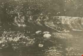
Deer Lake Gibraltar
https://search.heritageburnaby.ca/link/archivedescription34312
- Repository
- City of Burnaby Archives
- Date
- 1924
- Collection/Fonds
- Burnaby Historical Society fonds
- Description Level
- Item
- Physical Description
- 1 photograph : b&w ; 8.1 x 13.2 cm
- Scope and Content
- Photograph of the "Gibraltar" rock at mouth of Deer Lake Creek. This photograph was taken during the winter of 1924 and the lake is frozen over with ice. The surface of the lake is covered with marks made by ice skates. Deer Lake Creek is historically known as Deer Lake Brook.
- Repository
- City of Burnaby Archives
- Date
- 1924
- Collection/Fonds
- Burnaby Historical Society fonds
- Subseries
- Peers family subseries
- Physical Description
- 1 photograph : b&w ; 8.1 x 13.2 cm
- Description Level
- Item
- Record No.
- 020-019
- Access Restriction
- No restrictions
- Reproduction Restriction
- No known restrictions
- Accession Number
- BHS2007-04
- Scope and Content
- Photograph of the "Gibraltar" rock at mouth of Deer Lake Creek. This photograph was taken during the winter of 1924 and the lake is frozen over with ice. The surface of the lake is covered with marks made by ice skates. Deer Lake Creek is historically known as Deer Lake Brook.
- Subjects
- Geographic Features - Creeks
- Geographic Features - Lakes and Ponds
- Geographic Features - Rock Formations
- Media Type
- Photograph
- Notes
- Title based on caption accompanying photograph
- Geographic Access
- Deer Lake Brook
- Historic Neighbourhood
- Burnaby Lake (Historic Neighbourhood)
- Planning Study Area
- Morley-Buckingham Area
Images

![East Burnaby Methodist Church, [192-] (date of original), copied 1986 thumbnail](/media/hpo/_Data/_Archives_Images/_Unrestricted/204/204-497.jpg?width=280)
East Burnaby Methodist Church
https://search.heritageburnaby.ca/link/archivedescription35639
- Repository
- City of Burnaby Archives
- Date
- [192-] (date of original), copied 1986
- Collection/Fonds
- Burnaby Historical Society fonds
- Description Level
- Item
- Physical Description
- 1 photograph : b&w ; 12.7 x 17.8 cm print
- Scope and Content
- Photograph of East Burnaby Methodist Church, dedicated in June, 1910, and located at the corner of Douglas Road (later Canada Way) and 12th Avenue. It was raised during the time Rev. William Beamish was minister, 1924-1930, and also became part of the United Church of Canada. On the left, the man…
- Repository
- City of Burnaby Archives
- Date
- [192-] (date of original), copied 1986
- Collection/Fonds
- Burnaby Historical Society fonds
- Subseries
- Pioneer Tales subseries
- Physical Description
- 1 photograph : b&w ; 12.7 x 17.8 cm print
- Description Level
- Item
- Record No.
- 204-497
- Access Restriction
- No restrictions
- Reproduction Restriction
- No known restrictions
- Accession Number
- BHS1988-03
- Scope and Content
- Photograph of East Burnaby Methodist Church, dedicated in June, 1910, and located at the corner of Douglas Road (later Canada Way) and 12th Avenue. It was raised during the time Rev. William Beamish was minister, 1924-1930, and also became part of the United Church of Canada. On the left, the manse can be seen on the same lot. The church was torn down in 1956 and a new one built on another property.
- Subjects
- Buildings - Religious - Churches
- Media Type
- Photograph
- Notes
- Title based on contents of photograph
- Geographic Access
- 12th Avenue
- Street Address
- 7707 12th Avenue
- Historic Neighbourhood
- Edmonds (Historic Neighbourhood)
- Planning Study Area
- Edmonds Area
Images
![East Burnaby Methodist Church, [192-] (date of original), copied 1986 thumbnail](/media/hpo/_Data/_Archives_Images/_Unrestricted/204/204-497.jpg)
![East Burnaby Owls Lacrosse team, [1936] thumbnail](/media/hpo/_Data/_BVM_Images/1976/1976_0036_0028_001.jpg?width=280)
East Burnaby Owls Lacrosse team
https://search.heritageburnaby.ca/link/museumdescription666
- Repository
- Burnaby Village Museum
- Date
- [1936]
- Collection/Fonds
- Burnaby Village Museum Photograph collection
- Description Level
- Item
- Physical Description
- 1 photograph : b&w ; 17.5 x 23.5 cm (sight), in mat 29 x 33 cm
- Scope and Content
- Photograph of the East Burnaby Owls Lacrosse team and officials. The players are in the front three rows, in uniform and holding their lacrosse sticks. Most of the men standing in the back row are wearing suits. Standing in the back row are; J. Fox, J. G. Mill, Richard Bolton, D.P. Gray, team manag…
- Repository
- Burnaby Village Museum
- Collection/Fonds
- Burnaby Village Museum Photograph collection
- Description Level
- Item
- Physical Description
- 1 photograph : b&w ; 17.5 x 23.5 cm (sight), in mat 29 x 33 cm
- Scope and Content
- Photograph of the East Burnaby Owls Lacrosse team and officials. The players are in the front three rows, in uniform and holding their lacrosse sticks. Most of the men standing in the back row are wearing suits. Standing in the back row are; J. Fox, J. G. Mill, Richard Bolton, D.P. Gray, team manager George Leaf, Commissioner Hugh M. Fraser, Clifton G. Brown, Charles B. Brown, Dr. Sager, F. Copland and G.H. Moore. Second row: S. Shannon, Toebart, B. Cosh, Wynn, N. Beaton, A. Murray, J. Tuka, Shaflik, Jack Leaf (George Leaf's son), [unidentified] and H. McMillan. Third row: Bob McMillan, Whittles, C. Thomson, R. Turner, A. Williams, C. Middleton, J. Douglas, M. Bowes, G. Tuka, A. Wood and F. Douglas. Front Row: Bill Clark, J. Cowie, J. Odin, J. McLachlan, Doug McCallum, N. Pederson, H. Pederson and R. Douglas. This photograph was believed to be taken at the opening of the Twelfth Avenue and Wright Street Lacrosse box in 1936.
- Names
- East Burnaby Owls
- Fox, J.
- Mill, J.G.
- Bolton, Richard
- Gray, D.P.
- Leaf, George
- Fraser, Hugh M.
- Brown, Clifton Gilbert, 1889-1960
- Brown, Charles B. "Charlie"
- Sager, Dr.
- Copland, F.
- Moore, G.H.
- Shannon, S.
- Cosh, B.
- Beaton, N.
- Murray, A.
- Tuka, J.
- Leaf, Jack
- McMillan, H.
- McMillan, Bob
- Thomson, C.
- Turner, R.
- Williams, A.
- Middleton, C.
- Douglas, J.
- Bowes, M.
- Tuka, G.
- Wood, A.
- Douglas, F.
- Clark, Bill
- Cowie, J.
- Odin, J.
- McLachlan, J.
- McCallum, Doug
- Pederson, N.
- Pederson, H.
- Douglas, R.
- Geographic Access
- 12th Avenue
- Wright Street
- Accession Code
- HV976.36.28
- Access Restriction
- No restrictions
- Reproduction Restriction
- No known restrictions
- Date
- [1936]
- Media Type
- Photograph
- Historic Neighbourhood
- East Burnaby (Historic Neighbourhood)
- Planning Study Area
- Cariboo-Armstrong Area
- Scan Resolution
- 600
- Scan Date
- 1/7/2010
- Scale
- 100
- Photographer
- Stride, Charles Edgar
- Notes
- Title based on contents of photograph
- Type written note glued to verso of card mount reads: "Top row: J. Fox, J. G. Mill, R. Bolton, D.P. Gray, Geo. Leaf, Cmr. Fraser, C.G. Brown, C.B. Brown, Dr. Sager, F. Copland, G.H. Moore. Second row: S. Shannon, Toebart, B. Cosh, Wynn, N. Beaton, A. Murray, J. Tuka, Shaflik, J. Leaf, [unidentified] , H. McMillan. Third row: Bob McMillan, Whittles, C. Thomson, R. Turner, A. Williams, C. Middleton, J. Douglas, M. Bowes, G. Tuka, A Wood, F. Douglas Front Row: Bill Clark, J. Cowie, J. Odin, J. McLachlan, D. McCallum, N. Pederson, H. Pederson, R. Douglas"
- Window mat and backing are glued together
- Photographer's stamp on recto of mat reads: "The Stride Studios / New Westminster BC"
- This photograph was believed to be taken at the opening of the Twelfth Avenue and Wright Street Lacrosse box in 1936.
Images
![East Burnaby Owls Lacrosse team, [1936] thumbnail](/media/hpo/_Data/_BVM_Images/1976/1976_0036_0028_001.jpg)
![E.B. Wetenhall and Kitty Hill, [1902] thumbnail](/media/hpo/_Data/_Archives_Images/_Unrestricted/477/477-100.jpg?width=280)
E.B. Wetenhall and Kitty Hill
https://search.heritageburnaby.ca/link/archivedescription38781
- Repository
- City of Burnaby Archives
- Date
- [1902]
- Collection/Fonds
- Peers Family and Hill Family fonds
- Description Level
- Item
- Physical Description
- 1 photograph : b&w ; 6 x 8 cm on page 11.5 x 14 cm (pasted in album)
- Scope and Content
- Photograph of E.B. Wetenhall leading a horse to water. Kitty Hill is the foreground and a wooden trestle bridge spans Deer Lake Brook in the background.
- Repository
- City of Burnaby Archives
- Date
- [1902]
- Collection/Fonds
- Peers Family and Hill Family fonds
- Physical Description
- 1 photograph : b&w ; 6 x 8 cm on page 11.5 x 14 cm (pasted in album)
- Description Level
- Item
- Record No.
- 477-100
- Access Restriction
- No restrictions
- Reproduction Restriction
- No known restrictions
- Accession Number
- 2007-12
- Scope and Content
- Photograph of E.B. Wetenhall leading a horse to water. Kitty Hill is the foreground and a wooden trestle bridge spans Deer Lake Brook in the background.
- Media Type
- Photograph
- Notes
- Title based on contents of photograph
- Geographic Access
- Deer Lake Brook
- Deer Lake Avenue
- Street Address
- 6501 Deer Lake Avenue
- Historic Neighbourhood
- Burnaby Lake (Historic Neighbourhood)
- Planning Study Area
- Morley-Buckingham Area
Images
![E.B. Wetenhall and Kitty Hill, [1902] thumbnail](/media/hpo/_Data/_Archives_Images/_Unrestricted/477/477-100.jpg)
![First house on Twelfth Avenue, [194-?] (date of original), copied 1991 thumbnail](/media/hpo/_Data/_Archives_Images/_Unrestricted/370/370-782.jpg?width=280)
First house on Twelfth Avenue
https://search.heritageburnaby.ca/link/archivedescription38195
- Repository
- City of Burnaby Archives
- Date
- [194-?] (date of original), copied 1991
- Collection/Fonds
- Burnaby Historical Society fonds
- Description Level
- Item
- Physical Description
- 1 photograph : b&w ; 3.3 x 5.1 cm print on contact sheet 20.3 x 26.6 cm
- Scope and Content
- Photograph of the first house on 12th Avenue, at 160 12th Avenue (later renumbered 8142 12th Avenue).
- Repository
- City of Burnaby Archives
- Date
- [194-?] (date of original), copied 1991
- Collection/Fonds
- Burnaby Historical Society fonds
- Subseries
- Burnaby Image Bank subseries
- Physical Description
- 1 photograph : b&w ; 3.3 x 5.1 cm print on contact sheet 20.3 x 26.6 cm
- Description Level
- Item
- Record No.
- 370-782
- Access Restriction
- No restrictions
- Reproduction Restriction
- Reproduce for fair dealing purposes only
- Accession Number
- BHS1999-03
- Scope and Content
- Photograph of the first house on 12th Avenue, at 160 12th Avenue (later renumbered 8142 12th Avenue).
- Subjects
- Buildings - Residential - Houses
- Media Type
- Photograph
- Notes
- Title based on contents of photograph
- 1 b&w copy negative accompanying
- Geographic Access
- 12th Avenue
- Street Address
- 8142 12th Avenue
- Historic Neighbourhood
- East Burnaby (Historic Neighbourhood)
- Planning Study Area
- Second Street Area
Images
![First house on Twelfth Avenue, [194-?] (date of original), copied 1991 thumbnail](/media/hpo/_Data/_Archives_Images/_Unrestricted/370/370-782.jpg)
![Football player Jon Cornish, [2004] thumbnail](/media/hpo/_Data/_Archives_Images/_Unrestricted/535/535-1968-1.jpg?width=280)
Football player Jon Cornish
https://search.heritageburnaby.ca/link/archivedescription96285
- Repository
- City of Burnaby Archives
- Date
- [2004]
- Collection/Fonds
- Burnaby NewsLeader photograph collection
- Description Level
- File
- Physical Description
- 2 photographs (tiff) : col.
- Scope and Content
- File contains photographs of graduating St. Thomas More Collegiate football player Jon Cornish. Cornish poses with a football and a STM polo shirt on the STM football field.
- Repository
- City of Burnaby Archives
- Date
- [2004]
- Collection/Fonds
- Burnaby NewsLeader photograph collection
- Physical Description
- 2 photographs (tiff) : col.
- Description Level
- File
- Record No.
- 535-1968
- Access Restriction
- No restrictions
- Reproduction Restriction
- No restrictions
- Accession Number
- 2018-12
- Scope and Content
- File contains photographs of graduating St. Thomas More Collegiate football player Jon Cornish. Cornish poses with a football and a STM polo shirt on the STM football field.
- Media Type
- Photograph
- Photographer
- Bartel, Mario
- Notes
- Title based on caption
- Collected by editorial for use in a February 2004 issue of the Burnaby NewsLeader
- Caption from metadata: "Graduating running back, Jon Cornish, of St. Thomas More, has signed a letter of intent to ply at the University of Kansas in the Fall."
- Geographic Access
- 12th Avenue
- Street Address
- 7450 12th Avenue
- Historic Neighbourhood
- Edmonds (Historic Neighbourhood)
- Planning Study Area
- Edmonds Area
Images
![Football player Jon Cornish, [2004] thumbnail](/media/hpo/_Data/_Archives_Images/_Unrestricted/535/535-1968-1.jpg)
![Football player Marek Seta, [2005] thumbnail](/media/hpo/_Data/_Archives_Images/_Unrestricted/535/535-1869-2.jpg?width=280)
Football player Marek Seta
https://search.heritageburnaby.ca/link/archivedescription96172
- Repository
- City of Burnaby Archives
- Date
- [2005]
- Collection/Fonds
- Burnaby NewsLeader photograph collection
- Description Level
- File
- Physical Description
- 2 photographs (tiff) : col.
- Scope and Content
- File contains photographs of St. Thomas More Collegiate football player Marek Seta. Seta is posing with a football on STM's football field and wearing a University of Minnesota at Duluth T-shirt.
- Repository
- City of Burnaby Archives
- Date
- [2005]
- Collection/Fonds
- Burnaby NewsLeader photograph collection
- Physical Description
- 2 photographs (tiff) : col.
- Description Level
- File
- Record No.
- 535-1869
- Access Restriction
- No restrictions
- Reproduction Restriction
- No restrictions
- Accession Number
- 2018-12
- Scope and Content
- File contains photographs of St. Thomas More Collegiate football player Marek Seta. Seta is posing with a football on STM's football field and wearing a University of Minnesota at Duluth T-shirt.
- Subjects
- Sports - Football
- Persons - Students
- Media Type
- Photograph
- Photographer
- Bartel, Mario
- Notes
- Title based on caption
- Collected by editorial for use in a January 2005 issue of the Burnaby NewsLeader
- Caption from metadata: "St. Thomas More running back Marek Seta has decided he'll be playing his college football at the University of Minnesota at Duluth, beginning next Fall."
- Geographic Access
- 12th Avenue
- Street Address
- 7450 12th Avenue
- Historic Neighbourhood
- Edmonds (Historic Neighbourhood)
- Planning Study Area
- Edmonds Area
Images
![Football player Marek Seta, [2005] thumbnail](/media/hpo/_Data/_Archives_Images/_Unrestricted/535/535-1869-2.jpg)

House at 7945 12th Avenue
https://search.heritageburnaby.ca/link/archivedescription78890
- Repository
- City of Burnaby Archives
- Date
- February 7, 1977
- Collection/Fonds
- Burnaby Public Library Contemporary Visual Archive Project
- Description Level
- Item
- Physical Description
- 1 photograph : b&w ; 11 x 16 cm mounted on cardboard
- Scope and Content
- Photograph shows the house at 7945 12th Avenue.
- Repository
- City of Burnaby Archives
- Date
- February 7, 1977
- Collection/Fonds
- Burnaby Public Library Contemporary Visual Archive Project
- Physical Description
- 1 photograph : b&w ; 11 x 16 cm mounted on cardboard
- Description Level
- Item
- Record No.
- 556-016
- Access Restriction
- No restrictions
- Reproduction Restriction
- Reproduce for fair dealing purposes only
- Accession Number
- 2013-13
- Scope and Content
- Photograph shows the house at 7945 12th Avenue.
- Media Type
- Photograph
- Notes
- Scope note taken directly from BPL photograph description.
- 1 b&w copy negative : 10 x 12.5 cm accompanying
- Photographers identified by surnames only: Carr and Vardeman
- Geographic Access
- 12th Avenue
- Street Address
- 7945 12th Avenue
- Historic Neighbourhood
- East Burnaby (Historic Neighbourhood)
- Planning Study Area
- Second Street Area
Images
