Narrow Results By
Subject
- Agriculture - Fruit and Berries 3
- Buildings - Commercial - Department Stores 10
- Buildings - Commercial - Grocery Stores 2
- Buildings - Heritage 10
- Buildings - Industrial - Factories 1
- Buildings - Other 1
- Buildings - Religious - Churches 12
- Buildings - Residential 1
- Buildings - Residential - Houses 6
- Buildings - Schools 18
- Businesses - Real Estate Agencies 1
- Documentary Artifacts - Architectural Drawings 1
Creator
- Adams, Edith 1
- Associated Factory Mutual Fire Insurance Cos 1
- Atkinson, R. 1
- Bateman, Caroline Mary Wettenhall 1
- B.C. Tree Fruits Limited 1
- Bekins Moving and Storage Company Limited 1
- Burnaby Centennial '71 Committee 1
- Burnaby Village Museum 2
- Burnett and McGugan B.C. Land Surveyors, New Westminster 5
- Burnett, Geoffrey K. 3
- Burnett & McGugan, Engineers and Surveyors 23
- Carr, William Harold 2
Person / Organization
- All Saints Anglican Church 1
- Armstrong Avenue School 1
- Barnet School 1
- Broadview Presbyterian Church 1
- Burnaby Historical Society 2
- Burnaby Village Museum 5
- Carr, William Harold 1
- Century Park Museum Association 2
- Chamberlain, Annie McKenzie 2
- Dominion Bridge Company 1
- Douglas Road School 1
- Dundonald United Church 1
Corrections standards
https://search.heritageburnaby.ca/link/museumdescription16667
- Repository
- Burnaby Village Museum
- Date
- 1978
- Collection/Fonds
- Oakalla Prison collection
- Description Level
- File
- Physical Description
- 2 cm of textual records
- Scope and Content
- File consists of copies of records regarding Standards of Correctional Facilties for Juvenile and Adult Containment Facilties including memorandums between D. DeBelle; Ken Nygaard, Facilties Management; A.G. Gilmore, Client co-ordinator Planning and Leasing B.C. Buildings Corporation; meeting minut…
- Repository
- Burnaby Village Museum
- Collection/Fonds
- Oakalla Prison collection
- Description Level
- File
- Physical Description
- 2 cm of textual records
- Material Details
- File enclosed in brown duotang cover
- Scope and Content
- File consists of copies of records regarding Standards of Correctional Facilties for Juvenile and Adult Containment Facilties including memorandums between D. DeBelle; Ken Nygaard, Facilties Management; A.G. Gilmore, Client co-ordinator Planning and Leasing B.C. Buildings Corporation; meeting minutes re Security Systems and Hardware -- New Westminster Courthouse (April 7, 1978); hardware and furniture catalgues for prisons; prison floor plans for washrooms, dormitories and holding cells along with a series of handwritten notes.
- Subjects
- Public Services - Correctional
- Accession Code
- BV991.45.170
- Access Restriction
- Restricted access
- Reproduction Restriction
- May be restricted by third party rights
- Date
- 1978
- Media Type
- Textual Record
- Notes
- Title based on cover title
Duplex joist hangers & post caps : underwriters' type steel post caps and wall hangers, booklet number twenty-five
https://search.heritageburnaby.ca/link/museumlibrary5571
- Repository
- Burnaby Village Museum
- Author
- Duplex Hanger Co.
- Publication Date
- 1910
- Call Number
- 691 DUP
- Repository
- Burnaby Village Museum
- Collection
- Special Collection
- Material Type
- Textual Record
- Accession Code
- BV985.6032.1
- Call Number
- 691 DUP
- Author
- Duplex Hanger Co.
- Place of Publication
- Cleveland
- Publisher
- Duplex Hanger Co.
- Publication Date
- 1910
- Physical Description
- 14 p. : ill. : 23 cm.
- Inscription
- "Buildings" [Handwritten in pencil on front cover] "Wm. N. O'NEIL CO. LTD. 530-536 HOWE STREET VANCOUVER, B. C." [Stamped in black ink on front cover] "H-12" [Typed and stuck to front cover] "B 3719 R." [Handwritten in pencil on cover verso]
- Library Subject (LOC)
- Building materials
- Catalogs
Eclipse tempting recipes
https://search.heritageburnaby.ca/link/museumlibrary7432
- Repository
- Burnaby Village Museum
- Author
- Riley, Dickson
- Publication Date
- c1931
- Call Number
- 641.59 RIL
- Repository
- Burnaby Village Museum
- Collection
- Special Collection
- Material Type
- Textual Record
- Accession Code
- BV019.37.3
- Call Number
- 641.59 RIL
- Author
- Riley, Dickson
- Place of Publication
- Winnipeg, [Manitoba]
- Publisher
- Western Pure Foods Ltd.
- Publication Date
- c1931
- Physical Description
- 32 pages : ill.; 18 cm.
- Inscription
- Handwritten text on front cover reads: "Mrs. EW Martin".
- Library Subject (LOC)
- Cooking, Canadian
- Cooking
- Desserts
- Cake
- Cookies
- Cookbooks--1930-1939
- Object History
- Elmer Wilson Martin was a professional engineer who lived much of his life in Burnaby. He married Ellen Renetta "Reta" (Boyd) Martin in approx. 1930 and the couple moved to Burnaby in 1931 for him to attend UBC. He later enlisted in the RCAF during WWII where he served as a pilot and wing commander. Elmer ran Martin's Auto Villa at 6604 East Hastings Street (later 6574 East Hastings Street) and was heavily involved in local Burnaby politics and with the North Burnaby Board of Trade. The donor states that he ran for Burnaby mayor in 1959 and also donated land to S.F.U. in the late 1960's. He had many businesses throughout his life including Paneloc Buildings, a pre-fab building manufacturing company. His last position was as Director with the construction company Webb & Knapp Canada Ltd.
Envelope re letter from Department of Municipal Affairs
https://search.heritageburnaby.ca/link/museumdescription15072
- Repository
- Burnaby Village Museum
- Date
- 1968
- Collection/Fonds
- Elmer Wilson Martin fonds
- Description Level
- Item
- Physical Description
- 1 envelope
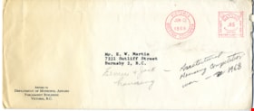
- Scope and Content
- Item consists of an envelope for a letter addressed to Mr. E.W. Martin at 7231 Sutliff Street, Burnaby from Department of Municipal Affairs, Parliament Buildings, Victoria B.C.
- Repository
- Burnaby Village Museum
- Collection/Fonds
- Elmer Wilson Martin fonds
- Description Level
- Item
- Physical Description
- 1 envelope
- Scope and Content
- Item consists of an envelope for a letter addressed to Mr. E.W. Martin at 7231 Sutliff Street, Burnaby from Department of Municipal Affairs, Parliament Buildings, Victoria B.C.
- Names
- Martin, Elmer Wilson
- Accession Code
- BV019.40.4
- Access Restriction
- No restrictions
- Reproduction Restriction
- No known restrictions
- Date
- 1968
- Media Type
- Textual Record
- Scan Resolution
- 600
- Scan Date
- February 4, 2021
- Scale
- 100
- Notes
- Title based on contents of item
Images

Facilities program for the Lower Mainland Regional Correctional Centre : corrections branch Ministry of Attorney - general British Columbia
https://search.heritageburnaby.ca/link/museumdescription16664
- Repository
- Burnaby Village Museum
- Date
- March 1981
- Collection/Fonds
- Oakalla Prison collection
- Description Level
- Item
- Physical Description
- 3 cm of textual records (214 p.)
- Scope and Content
- Item consists of a bound report titled: "Facilities Program", "Lower Mainland Regional Correctional Centre" "Advance Planning and Research for Architecture for the Lower Mainland Regional Correctional Centre" "Corrections Branch" "Ministry of Attorney-General British Columbia"; prepared for B.C. Bu…
- Repository
- Burnaby Village Museum
- Collection/Fonds
- Oakalla Prison collection
- Description Level
- Item
- Physical Description
- 3 cm of textual records (214 p.)
- Material Details
- illustrated
- Scope and Content
- Item consists of a bound report titled: "Facilities Program", "Lower Mainland Regional Correctional Centre" "Advance Planning and Research for Architecture for the Lower Mainland Regional Correctional Centre" "Corrections Branch" "Ministry of Attorney-General British Columbia"; prepared for B.C. Buildings Corporation by APRA, for March 1981.
- Subjects
- Public Services - Correctional
- Accession Code
- BV991.45.166
- Access Restriction
- No restrictions
- Reproduction Restriction
- May be restricted by third party rights
- Date
- March 1981
- Media Type
- Textual Record
- Notes
- Title based on contents of item
Heritage Village
https://search.heritageburnaby.ca/link/museumdescription13997
- Repository
- Burnaby Village Museum
- Date
- 1971
- Collection/Fonds
- Burnaby Centennial '71 Committee collection
- Description Level
- File
- Physical Description
- 7 p.
- Scope and Content
- File consists of a seven page document titled "Heritage Village" which includes site plan of buildings. This document provides a synopsis of the project and may have been provided to visitors and officials on opening day, November 19, 1971.
- Repository
- Burnaby Village Museum
- Collection/Fonds
- Burnaby Centennial '71 Committee collection
- Description Level
- File
- Physical Description
- 7 p.
- Scope and Content
- File consists of a seven page document titled "Heritage Village" which includes site plan of buildings. This document provides a synopsis of the project and may have been provided to visitors and officials on opening day, November 19, 1971.
- Accession Code
- BV020.5.1025
- Access Restriction
- Subject to FIPPA
- Reproduction Restriction
- Reproductions subject to FIPPA
- Date
- 1971
- Media Type
- Textual Record
- Notes
- Title based on contents of file
Heritage Village
https://search.heritageburnaby.ca/link/museumdescription17074
- Repository
- Burnaby Village Museum
- Date
- Nov. 1971
- Collection/Fonds
- Burnaby Centennial '71 Committee collection
- Description Level
- Item
- Physical Description
- 7 p.
- Scope and Content
- Item consists of a seven page document titled "Heritage Village". Document provides specifics regarding Burnaby's Centennial '71 Commemorative Project including committee and commission members, project consultants, a draft overview of proposed buildings and site plan along with details.
- Repository
- Burnaby Village Museum
- Collection/Fonds
- Burnaby Centennial '71 Committee collection
- Description Level
- Item
- Physical Description
- 7 p.
- Scope and Content
- Item consists of a seven page document titled "Heritage Village". Document provides specifics regarding Burnaby's Centennial '71 Commemorative Project including committee and commission members, project consultants, a draft overview of proposed buildings and site plan along with details.
- Accession Code
- BV011.50.26
- Access Restriction
- No restrictions
- Reproduction Restriction
- No known restrictions
- Date
- Nov. 1971
- Media Type
- Textual Record
- Notes
- Title based on contents of item
Heritage Village Museum exhibits and artifacts series
https://search.heritageburnaby.ca/link/museumdescription14281
- Repository
- Burnaby Village Museum
- Date
- 1971-1989
- Collection/Fonds
- Century Park Museum Association fonds
- Description Level
- Series
- Physical Description
- 707 photographs + 1 audio reel + 3 audio cassettes + 2 maps
- Scope and Content
- Series consists of records documenting Heritage Village (1971-1983) and Burnaby Village Museum (1984-1989) exhibits and artifacts while it was under the governance and administration of the Century Park Museum Association (Burnaby Village Museum Association) between November 1971 and December 1989.…
- Repository
- Burnaby Village Museum
- Collection/Fonds
- Century Park Museum Association fonds
- Description Level
- Series
- Physical Description
- 707 photographs + 1 audio reel + 3 audio cassettes + 2 maps
- Scope and Content
- Series consists of records documenting Heritage Village (1971-1983) and Burnaby Village Museum (1984-1989) exhibits and artifacts while it was under the governance and administration of the Century Park Museum Association (Burnaby Village Museum Association) between November 1971 and December 1989. Series includes photographs and textual records pertaining to exhibits and artifacts including buildings that form part of the museum's collection along with interpretive maps, audio recordings of samplings from the collection and registers from the Village Church.
- Accession Code
- BV985.6028
- BV005.14
- BV016.56
- BV017.46
- BV020.4
- BV020.5
- BV021.5
- Date
- 1971-1989
- Media Type
- Photograph
- Sound Recording
- Cartographic Material
- Related Material
- See also Don Copan fonds; Burnaby Centennial '71 Committee collection
- Arrangement
- Item level descriptions available
- Notes
- Title based on contents of series
- Further accruals are expected
Heritage Village Museum staff adminstrative files series
https://search.heritageburnaby.ca/link/museumdescription18671
- Repository
- Burnaby Village Museum
- Date
- 1972-1989
- Collection/Fonds
- Century Park Museum Association fonds
- Description Level
- Series
- Physical Description
- 4.5 cm of textual records
- Scope and Content
- Series consists of administrative records created by staff of Heritage Village Museum (Burnaby Village Museum) while it was under the governance and administration of the Century Park Museum Association (Burnaby Village Museum Association) between November 1971 and December 1989. Records include co…
- Repository
- Burnaby Village Museum
- Collection/Fonds
- Century Park Museum Association fonds
- Description Level
- Series
- Physical Description
- 4.5 cm of textual records
- Scope and Content
- Series consists of administrative records created by staff of Heritage Village Museum (Burnaby Village Museum) while it was under the governance and administration of the Century Park Museum Association (Burnaby Village Museum Association) between November 1971 and December 1989. Records include correspondence, reports, and administrative records created and filed by the Executive Director, Curator and other employees regarding staffing, volunteers, collections management, exhibits, special events, buildings, visitor statistics and day to day operations.
- Names
- Burnaby Village Museum
- Accession Code
- BV011.50
- BV020.5
- Access Restriction
- No restrictions
- Reproduction Restriction
- May be restricted by third party rights
- Date
- 1972-1989
- Media Type
- Textual Record
- Notes
- Title based on contents of series
- Further accruals are expected
Joseph H.C. Corsbie fonds
https://search.heritageburnaby.ca/link/museumdescription20275
- Repository
- Burnaby Village Museum
- Date
- [1941-1988]
- Collection/Fonds
- Joseph H.C. Corsbie fonds
- Description Level
- Fonds
- Physical Description
- 35 photographs + 1.5 cm textual records + 1 map + 1 book
- Scope and Content
- Fonds consists of photographs and documents relating to Joseph (Joe) Hardcastle Cumberland Corsbie during his service with the RCAF during World War II (1942-1945) along with photographs and docments relating to his personal and professional life (. Fonds is arranged into series: 1) Joseph H.C. Co…
- Repository
- Burnaby Village Museum
- Collection/Fonds
- Joseph H.C. Corsbie fonds
- Description Level
- Fonds
- Physical Description
- 35 photographs + 1.5 cm textual records + 1 map + 1 book
- Scope and Content
- Fonds consists of photographs and documents relating to Joseph (Joe) Hardcastle Cumberland Corsbie during his service with the RCAF during World War II (1942-1945) along with photographs and docments relating to his personal and professional life (. Fonds is arranged into series: 1) Joseph H.C. Corsbie RCAF records series 2) Joseph H.C. Corsbie personal and professional records series
- History
- Joseph “Joe” Hardcastle Cumberland Corsbie was born in 1913 in Peace River (Doe River) to parents Joseph Hardcastle Cumberland Corsbie and Winnifred Ann Mapleton Corsbie. As an adult Joe trained and served with the Royal Canadian Air Force as a navigator between 1942 and 1945. In 1945, while serving with the RCAF during World War II, Joe was awarded the Distinguished Flying Cross. After World War II, Joe returned to Peace River where he was elected as a Member of the Legislative Assembly serving as a Co-operative Commonwealth Federation MLA for one term between 1945 and 1948. In April 1948, Joe Corsbie married Margaret Carr in the Metropolitan United Church in Victoria followed by a reception held at the B.C. Legislature buildings. On their wedding day, the couple were honoured with a hand painted congratulatory certificate signed by members of the B.C. Legislature. In late, 1948, Joe lost the election and moved with his wife Margaret to Black Creek, B.C. to manage a co-op store. In 1949, the couple welcome their first child who they named Margaret after her mother. In 1950, Joe, Margaret and their daughter moved to a home on Charles Street in Burnaby and Joe began working as the General Manager of the Gulf and Fraser Fishermen’s Credit Union. In 1951, Joe and Margaret welcomed their second child, named Josesph after his father and in 1952, Joe, Margaret and family moved to 84 Springer Avenue, Burnaby where they lived until 1989. Between 1959 and 1976, Joe worked as a General Manager for the CU & C Health Services Society (later became Pacific Blue Cross). While working there, he focused on organizing both extended healthcare benefits and dental coverage for employee groups. In 1964, Joe Corsbie was elected to Burnaby Municipal Council and served one term between 1964 and 1968. Joe also served on the Burnaby Parks Commission (after 1968); served on the Board of Directors for Heritage Village, worked for a short period as a temporary curator for Heritage Village, represented the United Church in organizing and building St. Michael’s Care Centre and served on the Board of Director's. Joe Corsbie died in 1992 and his wife Margaret Corsbie died in 2004.
- Accession Code
- BV020.31
- Access Restriction
- No restrictions
- Reproduction Restriction
- No known restrictions
- Date
- [1941-1988]
- Media Type
- Photograph
- Textual Record
- Cartographic Material
- Arrangement
- Arrangement of fonds is based on the original arrangement by donor.
- Notes
- Title based on contents of fonds
Letter re entry in Provincial Housing Plans Competition
https://search.heritageburnaby.ca/link/museumdescription15073
- Repository
- Burnaby Village Museum
- Date
- 13 Jun. 1968
- Collection/Fonds
- Elmer Wilson Martin fonds
- Description Level
- Item
- Physical Description
- 1 p.
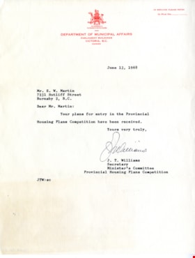
- Scope and Content
- Item consists of a letter addressed to Mr. E.W. Martin from the Department of Municipal Affairs, Parliament Buildings, Victoria B.C. regarding his receipt of entry in the Provincial Housing Plans Competition.
- Repository
- Burnaby Village Museum
- Collection/Fonds
- Elmer Wilson Martin fonds
- Description Level
- Item
- Physical Description
- 1 p.
- Scope and Content
- Item consists of a letter addressed to Mr. E.W. Martin from the Department of Municipal Affairs, Parliament Buildings, Victoria B.C. regarding his receipt of entry in the Provincial Housing Plans Competition.
- Names
- Martin, Elmer Wilson
- Accession Code
- BV019.40.5
- Access Restriction
- No restrictions
- Reproduction Restriction
- May be restricted by third party rights
- Date
- 13 Jun. 1968
- Media Type
- Textual Record
- Scan Resolution
- 600
- Scan Date
- February 4, 2021
- Scale
- 100
- Notes
- Title based on contents of item
Images

![Map of proposed provincial exhibition site at Burnaby Lake, [between 1929 and 1931] thumbnail](/media/hpo/_Data/_BVM_Cartographic_Material/2017/2017_0002_0009_005.jpg?width=280)
Map of proposed provincial exhibition site at Burnaby Lake
https://search.heritageburnaby.ca/link/museumdescription8703
- Repository
- Burnaby Village Museum
- Date
- [between 1929 and 1931]
- Collection/Fonds
- Burnaby Village Museum Map collection
- Description Level
- Item
- Physical Description
- 1 map : photostat print ; 3 parts 45 x 33.7 cm totalling 45 x 101 cm
- Scope and Content
- Item consists of a tri-part folding map of a proposed Provincial Exhibition site located along the southern and western shore of Burnaby Lake. Exhibtion site on map identifies proposed locations for a golf course, pier, hydroplane landing ramp, sports ground, one-mile horse racing track and various…
- Repository
- Burnaby Village Museum
- Collection/Fonds
- Burnaby Village Museum Map collection
- Description Level
- Item
- Physical Description
- 1 map : photostat print ; 3 parts 45 x 33.7 cm totalling 45 x 101 cm
- Material Details
- Scale [1:1800]
- Scope and Content
- Item consists of a tri-part folding map of a proposed Provincial Exhibition site located along the southern and western shore of Burnaby Lake. Exhibtion site on map identifies proposed locations for a golf course, pier, hydroplane landing ramp, sports ground, one-mile horse racing track and various buildings for mechanical, agricultural and botanical displays.
- Subjects
- Exhibitions
- Accession Code
- BV017.2.9
- Access Restriction
- No restrictions
- Reproduction Restriction
- No known restrictions
- Date
- [between 1929 and 1931]
- Media Type
- Cartographic Material
- Historic Neighbourhood
- Burnaby Lake (Historic Neighbourhood)
- Planning Study Area
- Burnaby Lake Area
- Scan Resolution
- 400
- Scan Date
- 2021-11-18
- Notes
- Title based on contents of map
- Scale on map reads: "150 feet to 1 inch"
- Overall measurements when fully opened: L: 98.0 cm x H: 45.3 cm ; Individual map parts: L: 32.7 cm x H: 45.0 cm
- Commercially printed label on front of portfolio card reads "PLOWRIGHT PRINTING COMPANY / TELEPHONE N.W. 1942 / 39 McKENZIE STREET NEW WESTMINSTER, B.C. / TO: [illegible writing in pencil]" in blue ink. Red typewritten text reads: "PHOTOSTAT OF BURNABY LAKE".
Images
![Map of proposed provincial exhibition site at Burnaby Lake, [between 1929 and 1931] thumbnail](/media/hpo/_Data/_BVM_Cartographic_Material/2017/2017_0002_0009_005.jpg)


Museum architectural records series
https://search.heritageburnaby.ca/link/museumdescription16033
- Repository
- Burnaby Village Museum
- Date
- 1990-2014
- Collection/Fonds
- Burnaby Village Museum fonds
- Description Level
- Series
- Physical Description
- over 100 architectural drawings + 6 technical drawings + textual records
- Scope and Content
- Series consists of architectural and technical drawings and site plans regarding the buildings and site of Burnaby Village Museum.
- Repository
- Burnaby Village Museum
- Collection/Fonds
- Burnaby Village Museum fonds
- Description Level
- Series
- Physical Description
- over 100 architectural drawings + 6 technical drawings + textual records
- Scope and Content
- Series consists of architectural and technical drawings and site plans regarding the buildings and site of Burnaby Village Museum.
- Names
- Burnaby Village Museum
- Accession Code
- BV019.52
- Access Restriction
- Restricted access
- Reproduction Restriction
- Reproductions subject to FIPPA
- Date
- 1990-2014
- Media Type
- Architectural Drawing
- Technical Drawing
- Textual Record
- Notes
- Title based on contents of series
- Further accruals are expected
- Content within this series is subject to FIPPA and have reproduction and access restrictions have been closed on Heritage Burnaby
Oakalla Prison collection
https://search.heritageburnaby.ca/link/museumdescription16696
- Repository
- Burnaby Village Museum
- Date
- [1974]-1991
- Collection/Fonds
- Oakalla Prison collection
- Description Level
- Fonds
- Physical Description
- 37.5 cm of textual records + 125 photographs + 1 videocassette
- Scope and Content
- Collection consists of a selection of Oakalla correctional facility records including reports, correspondence, photographs and a video tour of the death row incarceration cells inside Oakalla Prison taken by Burnaby Village Museum curator after the facility was closed. Most of the photographs docum…
- Repository
- Burnaby Village Museum
- Collection/Fonds
- Oakalla Prison collection
- Description Level
- Fonds
- Physical Description
- 37.5 cm of textual records + 125 photographs + 1 videocassette
- Scope and Content
- Collection consists of a selection of Oakalla correctional facility records including reports, correspondence, photographs and a video tour of the death row incarceration cells inside Oakalla Prison taken by Burnaby Village Museum curator after the facility was closed. Most of the photographs document Oakalla Prison in 1991 and were taken during the Open House event or when Burnaby Village Museum staff were granted access to retreive items prior to demolition. A small selection of facility photographs of site and staff are also included.
- Records are arranged into series:
- 1) Oakalla correctional facility records series
- 2) Oakalla correctional facility photographs series
- 3) Oakalla documentary photographs and video series
- History
- The Oakalla Prison Farm (also known as the Lower Mainland Regional Correctional Centre) was a model prison farm on 185 acres of land next to Deer Lake in Burnaby. The Oakalla Prison Farm opened in 1912 and was initially designed to hold 150 men and 50 women. By the 1950s, the population was well over one thousand. The prison included a working farm which included a dairy, vegetable gardens and livestock. In 1959 the last execution in British Columbia took place at Oakalla. Following a riot and mass escape in the late 1980s, poor conditions, and public outcry, Oakalla closed down in 1991. In the fall of 1991, the prison was opened up to the public whereby tours were conducted of the site. Not long after, buildings were demolished and a residential housing development took it's place. A playground now sits on the former site of the main building. In 1991, staff from Burnaby Village Museum were granted access, documenting the site prior to it's demolition. Many Oakalla artifacts and records were salvaged and accessioned into the Burnaby Village Museum's permanent collection.
- Responsibility
- Oakalla Prison Farm
- Accession Code
- BV991.45
- Date
- [1974]-1991
- Media Type
- Photograph
- Textual Record
- Moving Images
- Related Material
- See also Oakalla artifacts - BV991.45
- Arrangement
- Arrangement of records and series of this collection is based on record creators and subject that. Facility records and photographs were created and collected by Oakalla correctional facility staff and documentary photographs and a video from 1991 were created by Burnaby Village Museum staff.
- Notes
- Title based on content of collection
- Some records within this collection are closed. Contact Burnaby Village Museum for access.
Paneloc price list
https://search.heritageburnaby.ca/link/museumdescription15077
- Repository
- Burnaby Village Museum
- Date
- 1 Feb. 1972
- Collection/Fonds
- Elmer Wilson Martin fonds
- Description Level
- Item
- Physical Description
- 1 p.
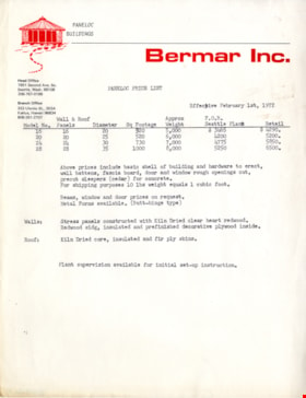
- Scope and Content
- Item consists of a price list for Paneloc Buildings from Bermar Inc. Seattle Washington.
- Repository
- Burnaby Village Museum
- Collection/Fonds
- Elmer Wilson Martin fonds
- Description Level
- Item
- Physical Description
- 1 p.
- Scope and Content
- Item consists of a price list for Paneloc Buildings from Bermar Inc. Seattle Washington.
- Accession Code
- BV019.40.9
- Access Restriction
- No restrictions
- Reproduction Restriction
- May be restricted by third party rights
- Date
- 1 Feb. 1972
- Media Type
- Textual Record
- Scan Resolution
- 600
- Scan Date
- February 8, 2021
- Scale
- 100
- Notes
- Title based on contents of item
Images

Paneloc price list
https://search.heritageburnaby.ca/link/museumdescription15078
- Repository
- Burnaby Village Museum
- Date
- 1 Feb. 1972
- Collection/Fonds
- Elmer Wilson Martin fonds
- Description Level
- Item
- Physical Description
- 1 p.
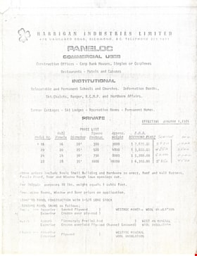
- Scope and Content
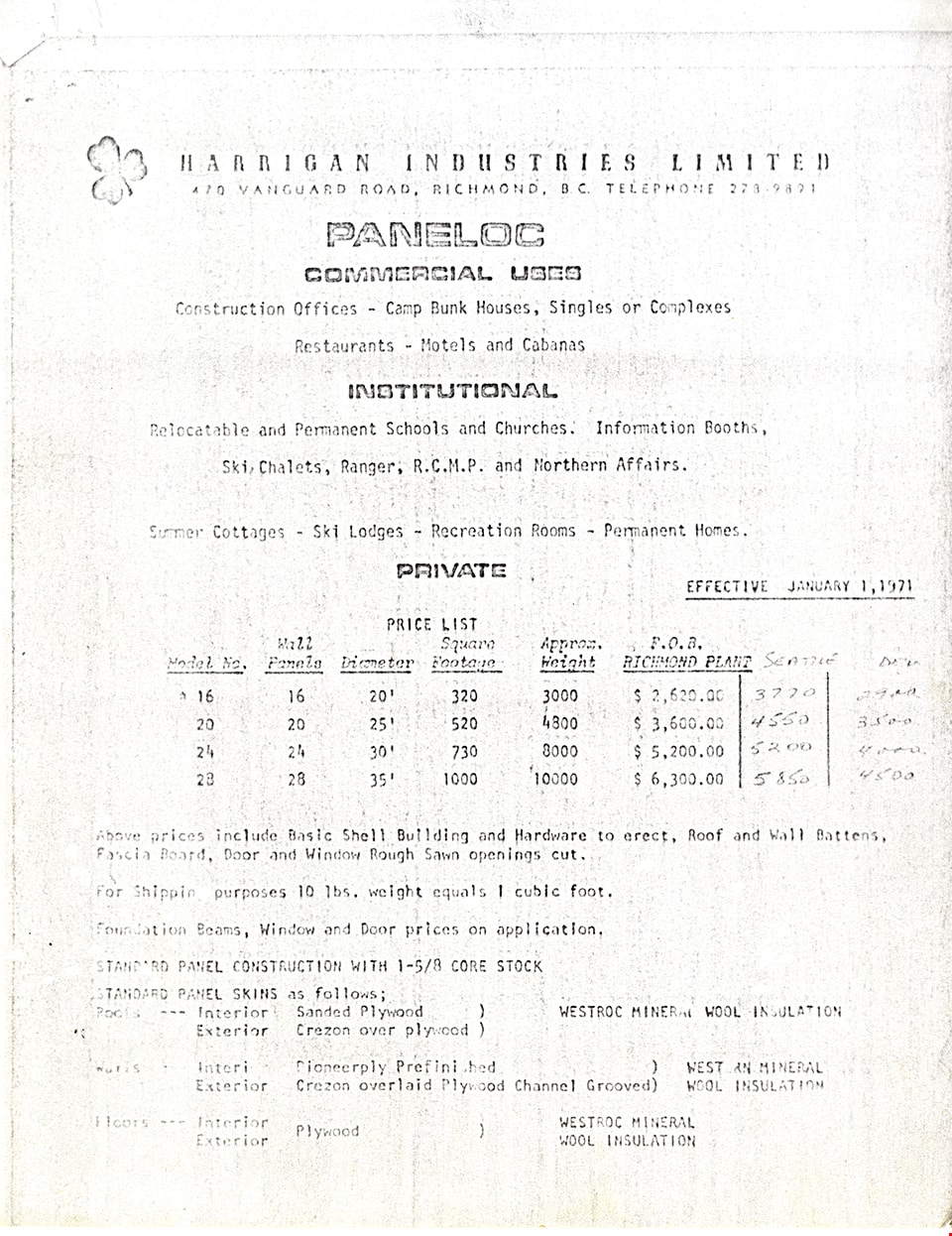
- Item consists of a copy of a price list for Paneloc Buildings from Harrigan Industries Limited, Richmond, B.C.
- Repository
- Burnaby Village Museum
- Collection/Fonds
- Elmer Wilson Martin fonds
- Description Level
- Item
- Physical Description
- 1 p.
- Scope and Content
- Item consists of a copy of a price list for Paneloc Buildings from Harrigan Industries Limited, Richmond, B.C.
- Creator
- Harrigan Industries Limited
- Accession Code
- BV019.40.10
- Access Restriction
- No restrictions
- Reproduction Restriction
- May be restricted by third party rights
- Date
- 1 Feb. 1972
- Media Type
- Textual Record
- Scan Resolution
- 600
- Scan Date
- February 8, 2021
- Scale
- 100
- Notes
- Title based on contents of item
Images
Paneloc price list
https://search.heritageburnaby.ca/link/museumdescription15079
- Repository
- Burnaby Village Museum
- Date
- 1 Feb. 1972
- Collection/Fonds
- Elmer Wilson Martin fonds
- Description Level
- Item
- Physical Description
- 2 p.
- Scope and Content
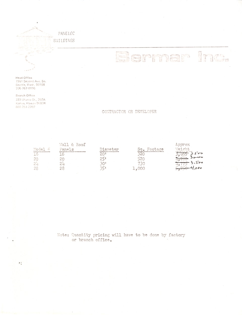
- Item consists of a two page copy of a price list for Paneloc Buildings from Bermar Inc. Seattle, Washington.
- Repository
- Burnaby Village Museum
- Collection/Fonds
- Elmer Wilson Martin fonds
- Description Level
- Item
- Physical Description
- 2 p.
- Scope and Content
- Item consists of a two page copy of a price list for Paneloc Buildings from Bermar Inc. Seattle, Washington.
- Accession Code
- BV019.40.11
- Access Restriction
- No restrictions
- Reproduction Restriction
- May be restricted by third party rights
- Date
- 1 Feb. 1972
- Media Type
- Textual Record
- Scan Resolution
- 600
- Scan Date
- February 8, 2021
- Scale
- 100
- Notes
- Title based on contents of item
Images

![Sectional map and street directory of Vancouver : Dial map of greater Vancouver including adjacent municipalities, [ca. 1950] thumbnail](/media/hpo/_Data/_BVM_Cartographic_Material/2000/2000_0003_0011_001%20WEB.jpg?width=280)
Sectional map and street directory of Vancouver : Dial map of greater Vancouver including adjacent municipalities
https://search.heritageburnaby.ca/link/museumdescription8697
- Repository
- Burnaby Village Museum
- Date
- [ca. 1950]
- Collection/Fonds
- Burnaby Village Museum Map collection
- Description Level
- Item
- Physical Description
- 2 maps and 1 p. of textual records on 1 sheet : lithographic prints, col. ; 55.5 x 75 cm + 2 dials and 25 x 72 cm + directory on sheet 55.5 x 75 cm, folded to 28.5 x 12.5 cm
- Scope and Content
- Item is a sectional map and street directory titled "Dial Map of Greater Vancouver and adjacent Municipalities" with a map on one side titled "Dial Map of Greater Vancouver and Suburbs" including Vancouver, West Vancouver, North Vancouver and Burnaby and includes street car and bus lines, railways,…
- Repository
- Burnaby Village Museum
- Collection/Fonds
- Burnaby Village Museum Map collection
- Description Level
- Item
- Physical Description
- 2 maps and 1 p. of textual records on 1 sheet : lithographic prints, col. ; 55.5 x 75 cm + 2 dials and 25 x 72 cm + directory on sheet 55.5 x 75 cm, folded to 28.5 x 12.5 cm
- Material Details
- Scales 1:42240, 1:144823
- 2 alphabetic dials on narrow strips of paper attached to map by grommets
- Scope and Content
- Item is a sectional map and street directory titled "Dial Map of Greater Vancouver and adjacent Municipalities" with a map on one side titled "Dial Map of Greater Vancouver and Suburbs" including Vancouver, West Vancouver, North Vancouver and Burnaby and includes street car and bus lines, railways, hospitals, parks, block nos. and street indexes with two alphabetic dials, one for Vancouver, the other for New Westminster. The other side of the map includes a map of "Fraser Valley" along with a directory of Vancouver street car and bus routes, business blocks, public buildings, hospitals, bathing beaches, locations of Vancouver fire halls and Vancouver city schools.
- Creator
- Dominion Map and Blueprint Co.
- Publisher
- Sectional Map and Street Directory Company
- Geographic Access
- Vancouver
- Accession Code
- BV000.3.11
- Access Restriction
- No restrictions
- Reproduction Restriction
- No known restrictions
- Date
- [ca. 1950]
- Media Type
- Cartographic Material
- Scan Resolution
- 380
- Scan Date
- 22-Dec-2020
- Scale
- 100
- Notes
- Title based on contents of map
Images
![Sectional map and street directory of Vancouver : Dial map of greater Vancouver including adjacent municipalities, [ca. 1950] thumbnail](/media/hpo/_Data/_BVM_Cartographic_Material/2000/2000_0003_0011_001%20WEB.jpg)


Selected illustrations typical of the use of the Kahn System in Canadian structures from coast to coast : illustrating maximum fireproofness, permanence, economy, efficiency, light and beauty
https://search.heritageburnaby.ca/link/museumlibrary7225
- Repository
- Burnaby Village Museum
- Collection
- Special Collection
- Material Type
- Textual Record
- Accession Code
- BV018.11.27
- Call Number
- 691 TRU
- Place of Publication
- Walkerville, Ont.
- Publisher
- Trussed Concrete Steel Company of Canada, Limited
- Publication Date
- n.d.
- Physical Description
- 1 vol. : ill. ; 27 cm.
- Inscription
- "D"XXX"6-D" [handwritten in blue pencil on cover] "Vancouver Branch TRUSSED CONCRETE STEEL CO. OF CANADA LIMITED. 52 Hutchinson Building PHONE SEYMOUR 3535 Vancouver,B.C. O.E. Harman. BRANCH MANAGER" [stamped in purple ink near bottom of the title page]
- Library Subject (LOC)
- Concrete
- Concrete constrcution
- Notes
- Pictures of bridges, tunnels, and buildings that had applied the Kahn System in construction across Canada.
![Survey and Subdivision plans in New Westminster District Group 1 – Burnaby
, [1861]-[1910] thumbnail](/media/hpo/_Data/_BVM_Cartographic_Material/1977/1977_0093_0019a_001.jpg?width=280)
Survey and Subdivision plans in New Westminster District Group 1 – Burnaby
https://search.heritageburnaby.ca/link/museumdescription6988
- Repository
- Burnaby Village Museum
- Date
- [1861]-[1910]
- Collection/Fonds
- Burnaby Village Museum Map collection
- Description Level
- File
- Physical Description
- 14 plans : 3 plans : black ink on paper hand col. + 7 plans : black ink on paper + 4 plans : graphite on paper mounted on 2 sides of cardboard 76 x 102 cm
- Scope and Content
- Item consists of a large board of four New Westminster District Gp 1 - subdivision plans mounted on one side and ten New Westminster District Gp 1 - subdivision plans mounted on the other side. Side A: 1. "Plan /of / Lots 166A, 166 and 167 /, Gr.1, N.W.D. / Showing Misconstructed Roads in Gree…
- Repository
- Burnaby Village Museum
- Collection/Fonds
- Burnaby Village Museum Map collection
- Description Level
- File
- Physical Description
- 14 plans : 3 plans : black ink on paper hand col. + 7 plans : black ink on paper + 4 plans : graphite on paper mounted on 2 sides of cardboard 76 x 102 cm
- Material Details
- Scales [between 1:2376 and 1:7920]
- Index number on edge of board reads: "19"
- Scope and Content
- Item consists of a large board of four New Westminster District Gp 1 - subdivision plans mounted on one side and ten New Westminster District Gp 1 - subdivision plans mounted on the other side. Side A: 1. "Plan /of / Lots 166A, 166 and 167 /, Gr.1, N.W.D. / Showing Misconstructed Roads in Green / 5 chs = 1 in.". (plan is drawn in black ink and hand coloured in red, green and orange ink). A section in the centre of the plan is coloured in red ink and identified as "C.S. Richmond" running from the North Arm of Fraser River to Wiggins Road and divided by "New Wiggins Rd. (as gazetted)" (coloured in orange ink) and two"Constructed Road(s)" (coloured in green ink). Plan is initialed by: "RB" [sic] (in blue pencil crayon) 2. Plan of / Subdivision of / Lot 166 / Group One / New Westminster District / Scale 4 chs = 1 in. / Map No 524". Plan is drawn in graphite and signed by "Surrig [sic] Welhams [sic] / P.L.S." Plan is initialed by: "RB" [sic] (in blue pencil crayon) 3. Plan of "Survey / of Highway / For / Burnaby Council / in / Lots 13 _14 / Group One / Scale 4 chs = 1 in." Signed by "Albert J. Hill, P.L.S." Caribou Street and Caribou Road run through the centre of the plan. Plan is stamped: "Albert J. Hill, Civil Engineer / and / Provincial Land Surveyor, / New Westminster, / B.C.". Plan is initialed by: "RB" [sic] (in blue pencil crayon) 4. A Plan of Lots 166A, 166 and 167, Group One, New Westminster District (drawn in graphite). A section in the centre of the plan is identified as "C.S. Richmond" running from the North Arm of Fraser River and divided by "New Wiggins Rd. (as gazetted)" and two "Constructed Road(s)". Plan is initialed by: "RB" [sic] (in blue pencil crayon) Side B: 1. Small plan drawn in black ink (no title) identifying lots north of the "North Arm" of the Fraser River. Lots identified include: Lot 99, Lot 98, Lot 157, Lot 158, Lot 163, Lot 162, Lot 159, Lot 163, Lot 162, Lot 165, Lot 166A, Lot 155B, Lot 155A and Lot 159. "Scale 40 chains to one inch" . Plan is initialed by: "RB" [sic] (in blue pencil crayon) (Geographic location: Burnaby) 2. Small plan drawn in black ink (no title) identifying lots north of the North Arm of the Fraser River as "Lots 155, 155A, 155B, 155C, 162, 163, 164, 165, 166A and 167". Plan is initialed by: "RB" [sic] (in blue pencil crayon) (Geographic location: Burnaby) 3. Small plan drawn in black ink (no title) which identifies "Lot 151 / Reserve/ for / Race Course"; "Reserve / 64 A / L. 152 G.1"; and other Lots: 32, 33, 34, 35, 36, 38, 39. The plan is signed "Surveyor G.Turn [sic] July / 61 / from Vol 40 R.L. notes [sic]" Plan is stamped: "Albert J. Hill, Civil Engineer / and / Provincial Land Surveyor, / New Westminster, / B.C." Plan is initialed by: "RB" [sic] (in blue pencil crayon) (Geographic location: Burnaby) 4. Small plan drawn in black in with faded red colouring on centre lot identified as "Lot 34" running north from "Vancouver Road" . Plan is stamped: "Albert J. Hill, Civil Engineer / and / Provincial Land Surveyor, / New Westminster, / B.C." Plan is initialed by: "RB" [sic] (in blue pencil crayon) (Geographic location: Burnaby) 5. Plan drawn in graphite and identified as "Lot 98, Gr.1," along with the intials "RB" [sic] (both are handwritten in blue crayon pencil on top of plan) The B.C.E.Railway is identified running through the plan along with Jubilee Road and Royal Oak Road. The plan is signed with the name "Wm. Murray" and the Plan is stamped: "Albert J. Hill, Civil Engineer / and / Provincial Land Surveyor, / New Westminster, / B.C.". (Geographic location: Burnaby) 6. Plan drawn in graphite identified as "Port Lot 13, Gr.1" along with the intials "RB" [sic] (both are handwritten in blue crayon pencil on top of plan) Plan is stamped: "Albert J. Hill, Civil Engineer / and / Provincial Land Surveyor, / New Westminster, / B.C.". (Geographic location: Burnaby) 7.Plan drawn in black ink and identified as "Lot 98 G.1" along with the intials "RB" [sic] (both are handwritten in blue crayon pencil on top of plan). A "Road Reservation" is identified running north between "Electric Tramway" and connecting with "Royal Oak Road". Plan is stamped: "Albert J. Hill, Civil Engineer / and / Provincial Land Surveyor, / New Westminster, / B.C." (Geographic location: Burnaby) 8. Plan drawn in black ink and divided into two sections, the upper plan is identified as "Portion / Lots 100 / area / 101, Gr.1" and the lower plan is identified as "Portion L. 3 G. 1" along with the intials "RB" [sic] (these identifiers are handwritten in blue crayon pencil on top of the plan). Portions of Lot 100 and Lot 101 are each divided into 6 sections and the Portion of Lot 3 plan is divided into 24 sections. The plan includes a note in black ink that reads: " Received from Wm Fromme [sic] / from Wm. Trapp / Nov. 28, 1895 / A. J. T...[sic]". (Geographic location: Burnaby) 9. Plan drawn in black ink (no title) identifying soil, buildings and geographic features in southern Burnaby. The plan is bordered by "New Westminster City" (Tenth Avenue and DL 172) to the south east and DL 173 to the south, DL 158 to the west and the B.C.E. Tramway to the north. Plan includes District Lots: 155A, 158, 159, 171, 160, 53 and 95 and identifies soil, marshland and ravines throughout. Plan identifies the following features: a "Team Road" running through Lots 158 and 159 along with "Fair Orchard Soil / Even Surface Throughout / No Ravines", "Gravel and Shingle" (bottom of Lot 158), "North Arm Road" crossing "Byrne Road" and connecting with "Power House Road" which runs north to connect with "Highland Park Station" and the B.C.E. Tramway, "Power Ho" in the northeast corner of DL 160, a "Brook" connected with a "Deep Ravine" running between DL 53, DL 95 and DL 160 along with "Good Soil" and "Fair Orchard Soil" identified nearby in DL 95. Scale is identified as "10 chs = 1 in." Plan is stamped: "Albert J. Hill, Civil Engineer / and / Provincial Land Surveyor, / New Westminster, / B.C." Plan is initialed by: "RB" [sic] (in blue pencil crayon) (Geographic location: Burnaby) 10. Plan drawn in black ink (no title) with Burnaby Lake and Deer Lake at the centre. The plan is bordered by the following District Lots identified as: 117, 118 and 68 to the west, Lots 80, 79 and 85 to the southwest, Lots 11, 13, and 1 (City of New Westminster) to the south east, the North Road boundary to the east and Lots 8, 56, 57, 59, and 136 to the North. The lower right hand corner of the plan has a small inset which reads: "Burnaby Lake" and "Page 19 R.B. Notes". Plan is initialed by: "RB" [sic] (in blue pencil crayon) (Geographic location: Burnaby)
- Creator
- Hill, Albert James
- Accession Code
- HV977.93.19
- Access Restriction
- No restrictions
- Reproduction Restriction
- No known restrictions
- Date
- [1861]-[1910]
- Media Type
- Cartographic Material
- Scan Resolution
- 300
- Scale
- 72
- Notes
- Title based on contents of file
- Scale is measured in chains. (One chain equals 792 inches)
- The term "Lot" can also refer to a "District Lot”
- Some plans are stamped: "Albert J. Hill, Civil Engineer / and / Provincial Land Surveyor, / New Westminster, / B.C." and intialed: "RB" [sic]
Images
![Survey and Subdivision plans in New Westminster District Group 1 – Burnaby
, [1861]-[1910] thumbnail](/media/hpo/_Data/_BVM_Cartographic_Material/1977/1977_0093_0019a_001.jpg)
