Narrow Results By
Subject
- Advertising Medium - Signs and Signboards 7
- Aerial Photographs 3
- Agricultural Tools and Equipment - Plows 1
- Agriculture - Crops 4
- Agriculture - Farms 12
- Animals - Cats 1
- Animals - Cows 2
- Animals - Dogs 2
- Buildings - Agricultural - Barns 6
- Buildings - Commercial 6
- Buildings - Commercial - Grocery Stores 1
- Buildings - Commercial - Offices 4
Person / Organization
- Allard, Nancy Davis 1
- Armstrong Avenue School 9
- Bosa Properties 1
- Boundary Road Lumber Mill 1
- British Columbia Electric Railway Company 1
- British Columbia Telephone Company 2
- Cariboo Hill Grocery 1
- Charles, Prince of Wales, 1948- 1
- Dell, George 2
- Diana, Princess of Wales, 1961-1997 1
- Dominion Bridge Company 3
- Glenburn Dairy 1
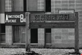
Armstrong Avenue Baptist Church
https://search.heritageburnaby.ca/link/archivedescription79054
- Repository
- City of Burnaby Archives
- Date
- October, 1976
- Collection/Fonds
- Burnaby Public Library Contemporary Visual Archive Project
- Description Level
- Item
- Physical Description
- 1 photograph : b&w ; 11 x 16 cm mounted on cardboard
- Scope and Content
- Photograph shows the Armstrong Avenue Baptist Church at 8585 Armstrong Avenue. At the time of the photograph it was also the Korean Baptist Church.
- Repository
- City of Burnaby Archives
- Date
- October, 1976
- Collection/Fonds
- Burnaby Public Library Contemporary Visual Archive Project
- Physical Description
- 1 photograph : b&w ; 11 x 16 cm mounted on cardboard
- Description Level
- Item
- Record No.
- 556-120
- Access Restriction
- No restrictions
- Reproduction Restriction
- Reproduce for fair dealing purposes only
- Accession Number
- 2013-13
- Scope and Content
- Photograph shows the Armstrong Avenue Baptist Church at 8585 Armstrong Avenue. At the time of the photograph it was also the Korean Baptist Church.
- Subjects
- Buildings - Religious - Churches
- Names
- Korean Baptist Church
- Media Type
- Photograph
- Photographer
- Salmon, Stu
- Notes
- Scope note taken directly from BPL photograph description.
- 1 b&w copy negative : 10 x 12.5 cm accompanying
- Geographic Access
- Armstrong Avenue
- Street Address
- 8585 Armstrong Avenue
- Historic Neighbourhood
- East Burnaby (Historic Neighbourhood)
- Planning Study Area
- Cariboo-Armstrong Area
Images
Armstrong Avenue School
https://search.heritageburnaby.ca/link/archivedescription35043
- Repository
- City of Burnaby Archives
- Date
- 1949 (date of original), copied 1986
- Collection/Fonds
- Burnaby Historical Society fonds
- Description Level
- Item
- Physical Description
- 1 photograph : col. ; 8.8 x 12.5 cm print
- Scope and Content
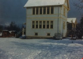
- Photograph of the exterior of Armstrong Avenue School in the snow. A car is parked outside.
- Repository
- City of Burnaby Archives
- Date
- 1949 (date of original), copied 1986
- Collection/Fonds
- Burnaby Historical Society fonds
- Subseries
- Chamberlain family subseries
- Physical Description
- 1 photograph : col. ; 8.8 x 12.5 cm print
- Description Level
- Item
- Record No.
- 179-014
- Access Restriction
- No restrictions
- Reproduction Restriction
- Reproduce for fair dealing purposes only
- Accession Number
- BHS1986-27
- Scope and Content
- Photograph of the exterior of Armstrong Avenue School in the snow. A car is parked outside.
- Names
- Armstrong Avenue School
- Media Type
- Photograph
- Notes
- Title based on contents of photograph
- Print made from col. slide
- Geographic Access
- Armstrong Avenue
- Street Address
- 8757 Armstrong Avenue
- Historic Neighbourhood
- East Burnaby (Historic Neighbourhood)
- Planning Study Area
- Cariboo-Armstrong Area
Images
Armstrong Avenue School
https://search.heritageburnaby.ca/link/archivedescription37144
- Repository
- City of Burnaby Archives
- Date
- [between 1911 and 1919]
- Collection/Fonds
- Burnaby Historical Society fonds
- Description Level
- Item
- Physical Description
- 1 photograph : b&w ; 8.5 x 12.5 cm print
- Scope and Content
- Photograph of the side elevation of Armstrong Avenue School. A man is visible walking along the sidewalk, near the school.
- Repository
- City of Burnaby Archives
- Date
- [between 1911 and 1919]
- Collection/Fonds
- Burnaby Historical Society fonds
- Subseries
- Disney family subseries
- Physical Description
- 1 photograph : b&w ; 8.5 x 12.5 cm print
- Description Level
- Item
- Record No.
- 325-016
- Access Restriction
- No restrictions
- Reproduction Restriction
- No known restrictions
- Accession Number
- BHS1996-04
- Scope and Content
- Photograph of the side elevation of Armstrong Avenue School. A man is visible walking along the sidewalk, near the school.
- Subjects
- Buildings - Schools
- Names
- Armstrong Avenue School
- Media Type
- Photograph
- Photographer
- Disney, John Harold "Jack"
- Notes
- Title based on contents of photograph
- Geographic Access
- Armstrong Avenue
- Street Address
- 8757 Armstrong Avenue
- Historic Neighbourhood
- East Burnaby (Historic Neighbourhood)
- Planning Study Area
- Cariboo-Armstrong Area
Images
Armstrong Avenue School
https://search.heritageburnaby.ca/link/archivedescription37145
- Repository
- City of Burnaby Archives
- Date
- [between 1911 and 1919]
- Collection/Fonds
- Burnaby Historical Society fonds
- Description Level
- Item
- Physical Description
- 1 photograph : b&w ; 8.5 x 12.5 cm print
- Scope and Content
- Photograph of the front of Armstrong Avenue School.
- Repository
- City of Burnaby Archives
- Date
- [between 1911 and 1919]
- Collection/Fonds
- Burnaby Historical Society fonds
- Subseries
- Disney family subseries
- Physical Description
- 1 photograph : b&w ; 8.5 x 12.5 cm print
- Description Level
- Item
- Record No.
- 325-017
- Access Restriction
- No restrictions
- Reproduction Restriction
- No known restrictions
- Accession Number
- BHS1996-04
- Scope and Content
- Photograph of the front of Armstrong Avenue School.
- Subjects
- Buildings - Schools
- Names
- Armstrong Avenue School
- Media Type
- Photograph
- Photographer
- Disney, John Harold "Jack"
- Notes
- Title based on contents of photograph
- Geographic Access
- Armstrong Avenue
- Street Address
- 8757 Armstrong Avenue
- Historic Neighbourhood
- East Burnaby (Historic Neighbourhood)
- Planning Study Area
- Cariboo-Armstrong Area
Images
Armstrong Avenue School
https://search.heritageburnaby.ca/link/museumdescription26
- Repository
- Burnaby Village Museum
- Date
- [1913]
- Collection/Fonds
- Burnaby Village Museum Photograph collection
- Description Level
- Item
- Physical Description
- 1 photograph : b&w ; 11.2 x 15.8 cm mounted on cardboard 19.9 x 25.1 cm
- Scope and Content
- Photograph of school children with their teacher, who is standing to the right of the picture. An annotation on the back and an earlier catalogue record from 1971 indicates that the donor identified the photograph as the first class at Armstrong Avenue School, 1913, with Miss L. Crake as the teache…
- Repository
- Burnaby Village Museum
- Collection/Fonds
- Burnaby Village Museum Photograph collection
- Description Level
- Item
- Physical Description
- 1 photograph : b&w ; 11.2 x 15.8 cm mounted on cardboard 19.9 x 25.1 cm
- Scope and Content
- Photograph of school children with their teacher, who is standing to the right of the picture. An annotation on the back and an earlier catalogue record from 1971 indicates that the donor identified the photograph as the first class at Armstrong Avenue School, 1913, with Miss L. Crake as the teacher. However, the first two-room Armstrong Avenue School was built in 1911 with Miss Lilly Mackenzie as the teacher. The present Armstrong school was built in 1955 with eleven classrooms. Later additions to the school occurred in 1962 (two classrooms), 1964 (four classrooms), 1967 (four classrooms), and 1969 (four classrooms). Annotation in blue ballpoint pen on back of photographs reads, "1st class of Armstrong Ave School. 1913 / Miss L Crake teacher."
- History
- The first Armstrong Avenue School was built in 1911 and it consisted of two rooms. The present school was built in 1955 with 11 classrooms. Additions: 1962 - two classrooms, 1964 - four classrooms, 1967 - four classrooms.
- Subjects
- Sports - Lacrosse
- Occupations - Teachers
- Names
- Armstrong Avenue School
- Geographic Access
- Armstrong Avenue
- Street Address
- 8757 Armstrong Avenue
- Accession Code
- HV971.75.1
- Access Restriction
- No restrictions
- Reproduction Restriction
- No known restrictions
- Date
- [1913]
- Media Type
- Photograph
- Historic Neighbourhood
- East Burnaby (Historic Neighbourhood)
- Planning Study Area
- Cariboo-Armstrong Area
- Scan Resolution
- 600
- Scan Date
- 2023-03-21
- Notes
- Title based on contents of photograph
Images
Armstrong Avenue school site
https://search.heritageburnaby.ca/link/archivedescription34064
- Repository
- City of Burnaby Archives
- Date
- 1911
- Collection/Fonds
- Burnaby Historical Society fonds
- Description Level
- Item
- Physical Description
- 1 photograph : b&w postcard ; 6.2 x 10.4 cm
- Scope and Content
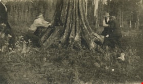
- Photographic postcard of men sawing down a tree at the Armstrong Avenue School site at 8757 Armstrong Avenue. The accompanying description refers to it as the "bee tree."
- Repository
- City of Burnaby Archives
- Date
- 1911
- Collection/Fonds
- Burnaby Historical Society fonds
- Subseries
- Photographs subseries
- Physical Description
- 1 photograph : b&w postcard ; 6.2 x 10.4 cm
- Description Level
- Item
- Record No.
- 007-001
- Access Restriction
- No restrictions
- Reproduction Restriction
- No known restrictions
- Accession Number
- BHS2007-04
- Scope and Content
- Photographic postcard of men sawing down a tree at the Armstrong Avenue School site at 8757 Armstrong Avenue. The accompanying description refers to it as the "bee tree."
- Names
- Armstrong Avenue School
- Media Type
- Photograph
- Notes
- Title based on contents of photograph
- Postcard has been cropped
- Geographic Access
- Armstrong Avenue
- Street Address
- 8757 Armstrong Avenue
- Historic Neighbourhood
- East Burnaby (Historic Neighbourhood)
- Planning Study Area
- Cariboo-Armstrong Area
Images
Armstrong Elementary School
https://search.heritageburnaby.ca/link/archivedescription79605
- Repository
- City of Burnaby Archives
- Date
- October, 1976
- Collection/Fonds
- Burnaby Public Library Contemporary Visual Archive Project
- Description Level
- Item
- Physical Description
- 1 photograph : b&w ; 11 x 16 cm mounted on cardboard
- Scope and Content
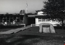
- Photograph shows Armstrong Avenue Elementary School at 8757 Armstrong Avenue.
- Repository
- City of Burnaby Archives
- Date
- October, 1976
- Collection/Fonds
- Burnaby Public Library Contemporary Visual Archive Project
- Physical Description
- 1 photograph : b&w ; 11 x 16 cm mounted on cardboard
- Description Level
- Item
- Record No.
- 556-349
- Access Restriction
- No restrictions
- Reproduction Restriction
- Reproduce for fair dealing purposes only
- Accession Number
- 2013-13
- Scope and Content
- Photograph shows Armstrong Avenue Elementary School at 8757 Armstrong Avenue.
- Subjects
- Buildings - Schools
- Names
- Armstrong Avenue School
- Media Type
- Photograph
- Photographer
- Salmon, Stu
- Notes
- Scope note taken directly from BPL photograph description.
- 1 b&w copy negative : 10 x 12.5 cm accompanying
- Geographic Access
- Armstrong Avenue
- Street Address
- 8757 Armstrong Avenue
- Historic Neighbourhood
- East Burnaby (Historic Neighbourhood)
- Planning Study Area
- Cariboo-Armstrong Area
Images
Armstrong Elementary school supplies drive
https://search.heritageburnaby.ca/link/archivedescription97992
- Repository
- City of Burnaby Archives
- Date
- [2000]
- Collection/Fonds
- Burnaby NewsLeader photograph collection
- Description Level
- Item
- Physical Description
- 1 photograph (tiff) : col.
- Scope and Content
- Photograph of Armstrong Elementary School students Eugenia Wu and Candice Bachra in a classroom sorting through school supplies that were collected by students.
- Repository
- City of Burnaby Archives
- Date
- [2000]
- Collection/Fonds
- Burnaby NewsLeader photograph collection
- Physical Description
- 1 photograph (tiff) : col.
- Description Level
- Item
- Record No.
- 535-3096
- Access Restriction
- No restrictions
- Reproduction Restriction
- No restrictions
- Accession Number
- 2018-12
- Scope and Content
- Photograph of Armstrong Elementary School students Eugenia Wu and Candice Bachra in a classroom sorting through school supplies that were collected by students.
- Names
- Armstrong Avenue School
- Media Type
- Photograph
- Photographer
- Bartel, Mario
- Notes
- Title based on caption
- Collected by editorial for use in a February 2000 issue of the Burnaby NewsLeader
- Caption from metadata: "Eugenia Wu, 9, and Candice Bachra, 10, sort through some of the school supplies collected by students at Armstrong Elementary, to be sent to refugee children in Bosnia."
- Geographic Access
- Armstrong Avenue
- Street Address
- 8757 Armstrong Avenue
- Historic Neighbourhood
- East Burnaby (Historic Neighbourhood)
- Planning Study Area
- Cariboo-Armstrong Area
Images
Armstrong Street School site
https://search.heritageburnaby.ca/link/museumdescription11133
- Repository
- Burnaby Village Museum
- Date
- 1915
- Collection/Fonds
- Ronald G. Scobbie collection
- Description Level
- Item
- Physical Description
- 1 survey plan : blueprint on paper ; 56 x 54 cm
- Scope and Content
- Survey plan of "Armstrong Street School Site / Burnaby Municipality" "Being a 2 acre portion of Lot 13 Group 1, & according to map 1722 which shows this as Lot E. Block 2 of subdivision of a portion, of Lot 13, Group 1, New Westminster District".
- Repository
- Burnaby Village Museum
- Collection/Fonds
- Ronald G. Scobbie collection
- Description Level
- Item
- Physical Description
- 1 survey plan : blueprint on paper ; 56 x 54 cm
- Material Details
- Scale 40 feet = 1 inch
- Scope and Content
- Survey plan of "Armstrong Street School Site / Burnaby Municipality" "Being a 2 acre portion of Lot 13 Group 1, & according to map 1722 which shows this as Lot E. Block 2 of subdivision of a portion, of Lot 13, Group 1, New Westminster District".
- Creator
- Burnett, Geoffrey K.
- Subjects
- Buildings - Schools
- Names
- Armstrong Avenue School
- Responsibility
- Burnett & McGugan, Engineers and Surveyors
- Geographic Access
- Armstrong Avenue
- Street Address
- 8757 Armstrong Avenue
- Accession Code
- BV003.83.12
- Access Restriction
- No restrictions
- Reproduction Restriction
- No known restrictions
- Date
- 1915
- Media Type
- Cartographic Material
- Historic Neighbourhood
- East Burnaby (Historic Neighbourhood)
- Planning Study Area
- Cariboo-Armstrong Area
- Scan Resolution
- 440
- Scan Date
- 22-Dec-2020
- Scale
- 100
- Notes
- Title based on contents of plan
- Note in black ink on verso of plan reads: "1746"
- Oath on plan reads: "I, Geoffrey K. Burnett...and did personally superintend the survey represented..." "Completed on the 18th day of March 1915"; signed by Geoffrey K. Burnett and notarized by "K.A. Eastman", sworn "...19th day of April 1915"; "Burnett and McGugan., B.C. Land Surveyors. Etc.. New Westminster, B.C.."
Zoomable Images
BC Tel Building
https://search.heritageburnaby.ca/link/archivedescription93609
- Repository
- City of Burnaby Archives
- Date
- October 16, 1977
- Collection/Fonds
- Burnaby Public Library Contemporary Visual Archive Project
- Description Level
- Item
- Physical Description
- 1 photograph : b&w ; 12.5 x 17.5 cm
- Scope and Content
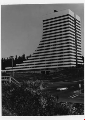
- Photograph of the BC Tel Building (now the Brian Canfield Centre), located at Kingsway and Boundary Road. The photograph is taken facing north and shows the pedestrian overpass over Kingsway and the mountains in the background.
- Repository
- City of Burnaby Archives
- Date
- October 16, 1977
- Collection/Fonds
- Burnaby Public Library Contemporary Visual Archive Project
- Physical Description
- 1 photograph : b&w ; 12.5 x 17.5 cm
- Description Level
- Item
- Record No.
- 556-566
- Access Restriction
- No restrictions
- Reproduction Restriction
- Reproduce for fair dealing purposes only
- Accession Number
- 2017-57
- Scope and Content
- Photograph of the BC Tel Building (now the Brian Canfield Centre), located at Kingsway and Boundary Road. The photograph is taken facing north and shows the pedestrian overpass over Kingsway and the mountains in the background.
- Media Type
- Photograph
- Photographer
- McGillivray, Don
- Notes
- Title taken from project information form
- Accompanied by a project information form and 1 photograph (b&w negative ; 9.5 x 12.5 cm)
- BPL no. 10
- Geographic Access
- Boundary Road
- Kingsway
- Street Address
- 3777 Kingsway
- Historic Neighbourhood
- Central Park (Historic Neighbourhood)
- Planning Study Area
- Garden Village Area
Images
BC Tel Building
https://search.heritageburnaby.ca/link/archivedescription93678
- Repository
- City of Burnaby Archives
- Date
- June 4, 1978
- Collection/Fonds
- Burnaby Public Library Contemporary Visual Archive Project
- Description Level
- Item
- Physical Description
- 1 photograph : b&w ; 17.5 x 12.5 cm
- Scope and Content
- Photograph of the exterior of the BC Tel Building, located at Kingsway and Boundary Road, and the lawn and roads in front of the building. The photograph is taken from a high point across the intersection, facing southeast.
- Repository
- City of Burnaby Archives
- Date
- June 4, 1978
- Collection/Fonds
- Burnaby Public Library Contemporary Visual Archive Project
- Physical Description
- 1 photograph : b&w ; 17.5 x 12.5 cm
- Description Level
- Item
- Record No.
- 556-635
- Access Restriction
- No restrictions
- Reproduction Restriction
- Reproduce for fair dealing purposes only
- Accession Number
- 2017-57
- Scope and Content
- Photograph of the exterior of the BC Tel Building, located at Kingsway and Boundary Road, and the lawn and roads in front of the building. The photograph is taken from a high point across the intersection, facing southeast.
- Subjects
- Buildings - Commercial - Offices
- Media Type
- Photograph
- Photographer
- Chapman, Fred
- Notes
- Title taken from project information form
- Accompanied by a project information form and 1 photograph (b&w negative ; 12.5 x 9.5 cm)
- BPL no. 84
- Geographic Access
- Boundary Road
- Kingsway
- Street Address
- 3777 Kingsway
- Historic Neighbourhood
- Central Park (Historic Neighbourhood)
- Planning Study Area
- Garden Village Area
Images
BC Tel Building
https://search.heritageburnaby.ca/link/archivedescription93679
- Repository
- City of Burnaby Archives
- Date
- June 4, 1978
- Collection/Fonds
- Burnaby Public Library Contemporary Visual Archive Project
- Description Level
- Item
- Physical Description
- 1 photograph : b&w ; 12.5 x 17.5 cm
- Scope and Content
- Photograph of the exterior of the BC Tel Building, located at Kingsway and Boundary Road. The photograph is taken from across a lawn and railway tracks, facing southeast. The railway tracks are visible in the bottom left corner of the photograph.
- Repository
- City of Burnaby Archives
- Date
- June 4, 1978
- Collection/Fonds
- Burnaby Public Library Contemporary Visual Archive Project
- Physical Description
- 1 photograph : b&w ; 12.5 x 17.5 cm
- Description Level
- Item
- Record No.
- 556-636
- Access Restriction
- No restrictions
- Reproduction Restriction
- Reproduce for fair dealing purposes only
- Accession Number
- 2017-57
- Scope and Content
- Photograph of the exterior of the BC Tel Building, located at Kingsway and Boundary Road. The photograph is taken from across a lawn and railway tracks, facing southeast. The railway tracks are visible in the bottom left corner of the photograph.
- Media Type
- Photograph
- Photographer
- Chapman, Fred
- Notes
- Title taken from project information form
- Accompanied by a project information form and 1 photograph (b&w negative ; 9.5 x 12.5 cm)
- BPL no. 85
- Geographic Access
- Boundary Road
- Kingsway
- Street Address
- 3777 Kingsway
- Historic Neighbourhood
- Central Park (Historic Neighbourhood)
- Planning Study Area
- Garden Village Area
Images
BC Tel Building
https://search.heritageburnaby.ca/link/archivedescription93680
- Repository
- City of Burnaby Archives
- Date
- June 4, 1978
- Collection/Fonds
- Burnaby Public Library Contemporary Visual Archive Project
- Description Level
- Item
- Physical Description
- 1 photograph : b&w ; 12.5 x 17.5 cm
- Scope and Content
- Photograph of the exterior of the BC Tel Building, located at Kingsway and Boundary Road, and the lawn and neighbourhood surrounding the building. The photograph is taken from across the lawn, facing north. Boundary Road is on the left side of the photograph and the mountains are visible in the bac…
- Repository
- City of Burnaby Archives
- Date
- June 4, 1978
- Collection/Fonds
- Burnaby Public Library Contemporary Visual Archive Project
- Physical Description
- 1 photograph : b&w ; 12.5 x 17.5 cm
- Description Level
- Item
- Record No.
- 556-637
- Access Restriction
- No restrictions
- Reproduction Restriction
- Reproduce for fair dealing purposes only
- Accession Number
- 2017-57
- Scope and Content
- Photograph of the exterior of the BC Tel Building, located at Kingsway and Boundary Road, and the lawn and neighbourhood surrounding the building. The photograph is taken from across the lawn, facing north. Boundary Road is on the left side of the photograph and the mountains are visible in the background.
- Media Type
- Photograph
- Photographer
- Chapman, Fred
- Notes
- Title taken from project information form
- Accompanied by a project information form and 1 photograph (b&w negative ; 9.5 x 12.5 cm)
- BPL no. 86
- Geographic Access
- Kingsway
- Boundary Road
- Street Address
- 3777 Kingsway
- Historic Neighbourhood
- Central Park (Historic Neighbourhood)
- Planning Study Area
- Garden Village Area
Images
Bearn sisters
https://search.heritageburnaby.ca/link/archivedescription37076
- Repository
- City of Burnaby Archives
- Date
- 1926 (date of original), copied 1992
- Collection/Fonds
- Burnaby Historical Society fonds
- Description Level
- Item
- Physical Description
- 1 photograph : b&w ; 7.1 x 11.8 cm print
- Scope and Content
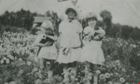
- Photograph of three of the daughters of William "Bill" and Lavinia Bearn in their mother's flower garden. Mrs. Bearn sold the flowers in her flower shop. Two of the girls are holding cats. There were seven daughters: Ruth, Gladys, Doris, Helen, Jean, Audrey, and Shirley.
- Repository
- City of Burnaby Archives
- Date
- 1926 (date of original), copied 1992
- Collection/Fonds
- Burnaby Historical Society fonds
- Subseries
- Burnaby Centennial Anthology subseries
- Physical Description
- 1 photograph : b&w ; 7.1 x 11.8 cm print
- Description Level
- Item
- Record No.
- 315-539
- Access Restriction
- No restrictions
- Reproduction Restriction
- No known restrictions
- Accession Number
- BHS1994-04
- Scope and Content
- Photograph of three of the daughters of William "Bill" and Lavinia Bearn in their mother's flower garden. Mrs. Bearn sold the flowers in her flower shop. Two of the girls are holding cats. There were seven daughters: Ruth, Gladys, Doris, Helen, Jean, Audrey, and Shirley.
- Subjects
- Animals - Cats
- Plants - Flowers
- Media Type
- Photograph
- Notes
- Title based on contents of photograph
- Geographic Access
- Marine Drive
- Boundary Road
- Historic Neighbourhood
- Fraser Arm (Historic Neighbourhood)
- Planning Study Area
- Big Bend Area
Images
Billboards at Hastings and Boundary
https://search.heritageburnaby.ca/link/archivedescription79163
- Repository
- City of Burnaby Archives
- Date
- November 1, 1976
- Collection/Fonds
- Burnaby Public Library Contemporary Visual Archive Project
- Description Level
- Item
- Physical Description
- 1 photograph : b&w ; 11 x 16 cm mounted on cardboard
- Scope and Content
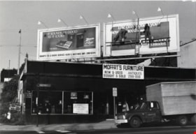
- Photograph shows men working on billboards above Moffat's Furniture at the corner of Hastings Street and Boundary Road.
- Repository
- City of Burnaby Archives
- Date
- November 1, 1976
- Collection/Fonds
- Burnaby Public Library Contemporary Visual Archive Project
- Physical Description
- 1 photograph : b&w ; 11 x 16 cm mounted on cardboard
- Description Level
- Item
- Record No.
- 556-182
- Access Restriction
- No restrictions
- Reproduction Restriction
- Reproduce for fair dealing purposes only
- Accession Number
- 2013-13
- Scope and Content
- Photograph shows men working on billboards above Moffat's Furniture at the corner of Hastings Street and Boundary Road.
- Names
- Moffat's Furniture
- Media Type
- Photograph
- Notes
- Scope note taken directly from BPL photograph description.
- 1 b&w copy negative : 10 x 12.5 cm accompanying
- Photographers identified by surnames only: Carr and Vardeman
- Geographic Access
- Hastings Street
- Boundary Road
- Historic Neighbourhood
- Vancouver Heights (Historic Neighbourhood)
- Planning Study Area
- Willingdon Heights Area
Images
Bob and Olive Urquhart beside Boundary Road
https://search.heritageburnaby.ca/link/archivedescription36759
- Repository
- City of Burnaby Archives
- Date
- March 19, 1913 (date of original), copied 1992
- Collection/Fonds
- Burnaby Historical Society fonds
- Description Level
- Item
- Physical Description
- 1 photograph : b&w ; 10 x 8 cm print
- Scope and Content
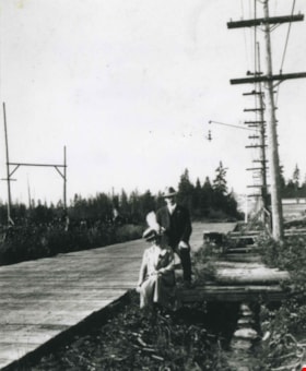
- Photograph of Bob and Olive Urquhart soon after their marriage, (they were married March 15). Note the new wood planking on Boundary Road and the train track crossing sign past the house in the distance for the Burnaby Lake Interurban tram line. This photograph was taken looking north on Boundary…
- Repository
- City of Burnaby Archives
- Date
- March 19, 1913 (date of original), copied 1992
- Collection/Fonds
- Burnaby Historical Society fonds
- Subseries
- Burnaby Centennial Anthology subseries
- Physical Description
- 1 photograph : b&w ; 10 x 8 cm print
- Description Level
- Item
- Record No.
- 315-114
- Access Restriction
- No restrictions
- Reproduction Restriction
- No known restrictions
- Accession Number
- BHS1994-04
- Scope and Content
- Photograph of Bob and Olive Urquhart soon after their marriage, (they were married March 15). Note the new wood planking on Boundary Road and the train track crossing sign past the house in the distance for the Burnaby Lake Interurban tram line. This photograph was taken looking north on Boundary Road just south of the railway tracks.
- Subjects
- Geographic Features - Roads
- Media Type
- Photograph
- Notes
- Title based on contents of photograph
- Geographic Access
- Boundary Road
- Myrtle Street
- Historic Neighbourhood
- Broadview (Historic Neighbourhood)
- Planning Study Area
- West Central Valley Area
Images
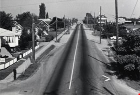
Boundary Road
https://search.heritageburnaby.ca/link/archivedescription79966
- Repository
- City of Burnaby Archives
- Date
- September 27, 1976
- Collection/Fonds
- Burnaby Public Library Contemporary Visual Archive Project
- Description Level
- Item
- Physical Description
- 1 photograph : b&w ; 11 x 16 cm mounted on cardboard
- Scope and Content
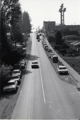
- Photograph shows a view of Boundary Road looking south from the railway trestle just north of Kingsway.
- Repository
- City of Burnaby Archives
- Date
- September 27, 1976
- Collection/Fonds
- Burnaby Public Library Contemporary Visual Archive Project
- Physical Description
- 1 photograph : b&w ; 11 x 16 cm mounted on cardboard
- Description Level
- Item
- Record No.
- 556-529
- Access Restriction
- No restrictions
- Reproduction Restriction
- Reproduce for fair dealing purposes only
- Accession Number
- 2013-13
- Scope and Content
- Photograph shows a view of Boundary Road looking south from the railway trestle just north of Kingsway.
- Subjects
- Aerial Photographs
- Media Type
- Photograph
- Photographer
- Norton, Paul
- Notes
- Scope note taken directly from BPL photograph description.
- 1 b&w copy negative : 10 x 12.5 cm accompanying
- Geographic Access
- Boundary Road
- Historic Neighbourhood
- Central Park (Historic Neighbourhood)
- Planning Study Area
- Garden Village Area
Images
Boundary Road
https://search.heritageburnaby.ca/link/archivedescription79967
- Repository
- City of Burnaby Archives
- Date
- September 27, 1976
- Collection/Fonds
- Burnaby Public Library Contemporary Visual Archive Project
- Description Level
- Item
- Physical Description
- 1 photograph : b&w ; 11 x 16 cm mounted on cardboard
- Scope and Content
- Photograph shows a view of Boundary Road looking north from the railway trestle just north of Kingsway.
- Repository
- City of Burnaby Archives
- Date
- September 27, 1976
- Collection/Fonds
- Burnaby Public Library Contemporary Visual Archive Project
- Physical Description
- 1 photograph : b&w ; 11 x 16 cm mounted on cardboard
- Description Level
- Item
- Record No.
- 556-530
- Access Restriction
- No restrictions
- Reproduction Restriction
- Reproduce for fair dealing purposes only
- Accession Number
- 2013-13
- Scope and Content
- Photograph shows a view of Boundary Road looking north from the railway trestle just north of Kingsway.
- Subjects
- Aerial Photographs
- Media Type
- Photograph
- Photographer
- Norton, Paul
- Notes
- Scope note taken directly from BPL photograph description.
- 1 b&w copy negative : 10 x 12.5 cm accompanying
- Geographic Access
- Boundary Road
- Historic Neighbourhood
- Central Park (Historic Neighbourhood)
- Planning Study Area
- Garden Village Area
Images
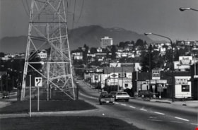
Boundary Road
https://search.heritageburnaby.ca/link/archivedescription79989
- Repository
- City of Burnaby Archives
- Date
- October, 1976
- Collection/Fonds
- Burnaby Public Library Contemporary Visual Archive Project
- Description Level
- Item
- Physical Description
- 1 photograph : b&w ; 11 x 16 cm mounted on cardboard
- Scope and Content
- Photograph shows view of Boundary Road and the North Shore mountains from 1st Avenue.
- Repository
- City of Burnaby Archives
- Date
- October, 1976
- Collection/Fonds
- Burnaby Public Library Contemporary Visual Archive Project
- Physical Description
- 1 photograph : b&w ; 11 x 16 cm mounted on cardboard
- Description Level
- Item
- Record No.
- 556-545
- Access Restriction
- No restrictions
- Reproduction Restriction
- Reproduce for fair dealing purposes only
- Accession Number
- 2013-13
- Scope and Content
- Photograph shows view of Boundary Road and the North Shore mountains from 1st Avenue.
- Subjects
- Aerial Photographs
- Media Type
- Photograph
- Photographer
- Cook, Alan
- Notes
- Scope note taken directly from BPL photograph description.
- 1 b&w copy negative : 10 x 12.5 cm accompanying
- Geographic Access
- Boundary Road
- Historic Neighbourhood
- Broadview (Historic Neighbourhood)
- Planning Study Area
- West Central Valley Area
Images
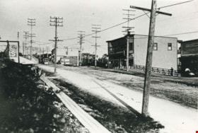
Boundary Road and Hastings Street Intersection
https://search.heritageburnaby.ca/link/archivedescription37641
- Repository
- City of Burnaby Archives
- Date
- [1943 or 1944] (date of original), copied 1991
- Collection/Fonds
- Burnaby Historical Society fonds
- Description Level
- Item
- Physical Description
- 1 photograph : b&w ; 3.2 x 5.3 cm print on contact sheet 20.2 x 25.3 cm
- Scope and Content
- Photograph of the intersection of Boundary Road and Hastings Street facing east from the southwest corner. A streetcar has a sign advertising Victory Bonds.
- Repository
- City of Burnaby Archives
- Date
- [1943 or 1944] (date of original), copied 1991
- Collection/Fonds
- Burnaby Historical Society fonds
- Subseries
- Burnaby Image Bank subseries
- Physical Description
- 1 photograph : b&w ; 3.2 x 5.3 cm print on contact sheet 20.2 x 25.3 cm
- Description Level
- Item
- Record No.
- 370-229
- Access Restriction
- No restrictions
- Reproduction Restriction
- No known restrictions
- Accession Number
- BHS1999-03
- Scope and Content
- Photograph of the intersection of Boundary Road and Hastings Street facing east from the southwest corner. A streetcar has a sign advertising Victory Bonds.
- Media Type
- Photograph
- Notes
- Title based on contents of photograph
- 1 b&w copy negative accompanying
- Geographic Access
- Boundary Road
- Hastings Street
- Historic Neighbourhood
- Vancouver Heights (Historic Neighbourhood)
- Planning Study Area
- Burnaby Heights Area
- Willingdon Heights Area
Images
Boundary Road and Hastings Street vicinity
https://search.heritageburnaby.ca/link/archivedescription35447
- Repository
- City of Burnaby Archives
- Date
- 1915 (date of original), copied 1986
- Collection/Fonds
- Burnaby Historical Society fonds
- Description Level
- Item
- Physical Description
- 1 photograph : b&w ; 12.7 x 17.8 cm print
- Scope and Content
- Photograph taken in Vancouver on Hastings Street looking east toward Burnaby and Boundary Road. The Hastings Street British Columbia Electric Railway (BCER) cars can be seen labouring up the hill.
- Repository
- City of Burnaby Archives
- Date
- 1915 (date of original), copied 1986
- Collection/Fonds
- Burnaby Historical Society fonds
- Subseries
- Pioneer Tales subseries
- Physical Description
- 1 photograph : b&w ; 12.7 x 17.8 cm print
- Description Level
- Item
- Record No.
- 204-305
- Access Restriction
- No restrictions
- Reproduction Restriction
- No restrictions
- Accession Number
- BHS1988-03
- Scope and Content
- Photograph taken in Vancouver on Hastings Street looking east toward Burnaby and Boundary Road. The Hastings Street British Columbia Electric Railway (BCER) cars can be seen labouring up the hill.
- Media Type
- Photograph
- Photographer
- Eaton, Dr. Carl
- Notes
- Title based on contents of photograph
- Geographic Access
- Boundary Road
- Hastings Street
- Historic Neighbourhood
- Vancouver Heights (Historic Neighbourhood)
- Planning Study Area
- Willingdon Heights Area
Images
Boundary Road and Kingsway
https://search.heritageburnaby.ca/link/archivedescription34709
- Repository
- City of Burnaby Archives
- Date
- [1959]
- Collection/Fonds
- Burnaby Historical Society fonds
- Description Level
- Item
- Physical Description
- 1 photograph : b&w ; 16.0 x 25.3 cm
- Scope and Content
- Photograph of buildings at Boundary Road and Kingsway, southwest corner. A typed description on the back of the photograph reads, "The new Hemlock (automatic) and old Dexter (manual) exchanges. / B.C. Telephone Company."
- Repository
- City of Burnaby Archives
- Date
- [1959]
- Collection/Fonds
- Burnaby Historical Society fonds
- Subseries
- Photographs subseries
- Physical Description
- 1 photograph : b&w ; 16.0 x 25.3 cm
- Description Level
- Item
- Record No.
- 113-001
- Access Restriction
- No restrictions
- Reproduction Restriction
- Reproduce for fair dealing purposes only
- Accession Number
- BHS2007-04
- Scope and Content
- Photograph of buildings at Boundary Road and Kingsway, southwest corner. A typed description on the back of the photograph reads, "The new Hemlock (automatic) and old Dexter (manual) exchanges. / B.C. Telephone Company."
- Media Type
- Photograph
- Photographer
- Williams Brothers Photographers Limited
- Notes
- Title based on contents of photograph
- Stamp on back of photograph reads, "Williams Bros. Photographers Ltd. / 413 Granville St. Vancouver 2, B.C. / Phone Tatlow 8588"
- Geographic Access
- Boundary Road
- Kingsway
- Historic Neighbourhood
- Central Park (Historic Neighbourhood)
- Planning Study Area
- Garden Village Area
Images
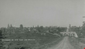
Boundary Road and Park Avenue station
https://search.heritageburnaby.ca/link/archivedescription36670
- Repository
- City of Burnaby Archives
- Date
- 1912 (date of original), copied 1992
- Collection/Fonds
- Burnaby Historical Society fonds
- Description Level
- Item
- Physical Description
- 1 photograph : b&w ; 10.1 x 14.9 cm print
- Scope and Content
- Photograph of Boundary Road, Park Avenue Interurban station, and the surrounding area, looking north from Kingsway. The Coburn house, built in 1906, is at the top of the hill on the right, current address 5170 Boundary Road.
- Repository
- City of Burnaby Archives
- Date
- 1912 (date of original), copied 1992
- Collection/Fonds
- Burnaby Historical Society fonds
- Subseries
- Burnaby Centennial Anthology subseries
- Physical Description
- 1 photograph : b&w ; 10.1 x 14.9 cm print
- Description Level
- Item
- Record No.
- 315-025
- Access Restriction
- No restrictions
- Reproduction Restriction
- No known restrictions
- Accession Number
- BHS1994-04
- Scope and Content
- Photograph of Boundary Road, Park Avenue Interurban station, and the surrounding area, looking north from Kingsway. The Coburn house, built in 1906, is at the top of the hill on the right, current address 5170 Boundary Road.
- Media Type
- Photograph
- Notes
- Title based on contents of photograph
- Annotation at bottom of photograph reads; "Boundary Rd and Park Ave Station"
- Geographic Access
- Boundary Road
- Kingsway
- Historic Neighbourhood
- Central Park (Historic Neighbourhood)
- Planning Study Area
- Garden Village Area
Images
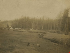
Boundary Road Lumber Mill
https://search.heritageburnaby.ca/link/archivedescription38262
- Repository
- City of Burnaby Archives
- Date
- 1908
- Collection/Fonds
- Burnaby Historical Society fonds
- Description Level
- Item
- Physical Description
- 1 photograph : sepia ; 9 x 12 cm on 12.5 x 15 cm backing
- Scope and Content
- Photograph of an unidentified man standing in the forefront with a jersey cow to the right, while a row of cabins and cleared tress can be seen in the background. A caption written above the photograph reads: "Boundary Road Lumber Mill owned by E.W. Nicholson." Underneath the photograph is writte…
- Repository
- City of Burnaby Archives
- Date
- 1908
- Collection/Fonds
- Burnaby Historical Society fonds
- Subseries
- Margaret McCallum subseries
- Physical Description
- 1 photograph : sepia ; 9 x 12 cm on 12.5 x 15 cm backing
- Description Level
- Item
- Record No.
- 375-024
- Access Restriction
- No restrictions
- Reproduction Restriction
- No known restrictions
- Accession Number
- BHS1986-42
- Scope and Content
- Photograph of an unidentified man standing in the forefront with a jersey cow to the right, while a row of cabins and cleared tress can be seen in the background. A caption written above the photograph reads: "Boundary Road Lumber Mill owned by E.W. Nicholson." Underneath the photograph is written: "The first Jersey cow on the farm." On the back of the photograph it is noted that the buildings in the background were workmen's buildings.
- Media Type
- Photograph
- Notes
- Title based on caption
- Geographic Access
- Boundary Road
- Still Creek
- Street Address
- 2550 Boundary Road
- Historic Neighbourhood
- Broadview (Historic Neighbourhood)
- Planning Study Area
- West Central Valley Area
Images
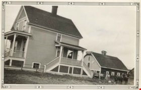
Broadway Jersey Ranch
https://search.heritageburnaby.ca/link/archivedescription38259
- Repository
- City of Burnaby Archives
- Date
- 1931
- Collection/Fonds
- Burnaby Historical Society fonds
- Description Level
- Item
- Physical Description
- 1 photograph : b&w ; 10.5 x 15.4 cm
- Scope and Content
- Photograph of a house and barn identified as E.W. Nicholson's "Broadway Jersey Ranch." Three men and a team of horses can be seen to the right of the house. The men may be E.W. Nicholoson, John McCallum and George Dell.
- Repository
- City of Burnaby Archives
- Date
- 1931
- Collection/Fonds
- Burnaby Historical Society fonds
- Subseries
- Margaret McCallum subseries
- Physical Description
- 1 photograph : b&w ; 10.5 x 15.4 cm
- Description Level
- Item
- Record No.
- 375-021
- Access Restriction
- No restrictions
- Reproduction Restriction
- No known restrictions
- Accession Number
- BHS1986-42
- Scope and Content
- Photograph of a house and barn identified as E.W. Nicholson's "Broadway Jersey Ranch." Three men and a team of horses can be seen to the right of the house. The men may be E.W. Nicholoson, John McCallum and George Dell.
- Media Type
- Photograph
- Notes
- Title based on caption
- Geographic Access
- Boundary Road
- Street Address
- 2550 Boundary Road
- Historic Neighbourhood
- Broadview (Historic Neighbourhood)
- Planning Study Area
- West Central Valley Area
![Armstrong Avenue School, [between 1911 and 1919] thumbnail](/media/hpo/_Data/_Archives_Images/_Unrestricted/316/325-016.jpg?width=280)
![Armstrong Avenue School, [between 1911 and 1919] thumbnail](/media/hpo/_Data/_Archives_Images/_Unrestricted/316/325-017.jpg?width=280)
![Armstrong Avenue School, [1913] thumbnail](/media/hpo/_Data/_BVM_Images/1971/197100750001.jpg?width=280)
![Armstrong Elementary school supplies drive, [2000] thumbnail](/media/hpo/_Data/_Archives_Images/_Unrestricted/535/535-3096.jpg?width=280)




![Boundary Road and Hastings Street Intersection, [1943 or 1944] (date of original), copied 1991 thumbnail](/media/hpo/_Data/_Archives_Images/_Unrestricted/370/370-229.jpg?width=280)
![Boundary Road and Kingsway, [1959] thumbnail](/media/Hpo/_Data/_Archives_Images/_Unrestricted/001/113-001.jpg?width=280)
