Narrow Results By
Subject
- Documentary Artifacts 7
- Documentary Artifacts - Maps 1
- Documentary Artifacts - Photographs 2
- Documentary Artifacts - Postcards 6
- First Nations reserves - British Columbia 1
- Geographic Features 5
- Geographic Features - Forests 1
- Geographic Features - Parks 6
- Geographic Features - Roads 1
- Indigenous peoples - Indian Territory 1
- Recreational Activities 1
- Recreational Activities - Camping 1
postcard
https://search.heritageburnaby.ca/link/museumartifact35477
- Repository
- Burnaby Village Museum
- Accession Code
- BV993.43.1
- Description
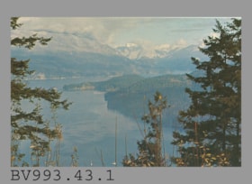
- The postcard face is a colour photo of Indian Arm from Burnaby Mountain Centennial Park in landscape format. Printed in navy on reverse at at upper left, "V-104" "INDIAN ARM FROM BURNABY MOUNTAIN" "Burnaby, B.C." "Looking North-West..."; illustration at left of R.C.M.P. officer; Printed at bottom left, "Photo by H. D. von Tiesenhausen" "S-1464"; This is a navy bar up centre with "PUB. BY NATURAL COLOR PRODUCTIONS, LTD., VANCOUVER, B.C."; at bottom, "MADE IN CANADA" "GRANT-MANN", logo of man, "LITHOGRAPHY" "PHOTOGRAPHY" "DESIGN" Printed at the upper right side of card is an illustration of mounted R.C.M.P. officer to the left of "POST CARD" "ADDRESS" and rectangle for stamp, "USE CANADIAN POSTAGE"; The card is unused
- Object History
- Purchased 1980/1981
- Classification
- Written Communication T&E - - Writing Media
- Object Term
- Postcard
- Country Made
- Canada
- Province Made
- British Columbia
- Site/City Made
- Vancouver
- Title
- Indian Arm from Burnaby Mountain S-1464
- Subjects
- Documentary Artifacts
- Documentary Artifacts - Postcards
- Geographic Features
- Geographic Features - Parks
Images

postcard
https://search.heritageburnaby.ca/link/museumartifact35478
- Repository
- Burnaby Village Museum
- Accession Code
- BV993.43.2
- Description
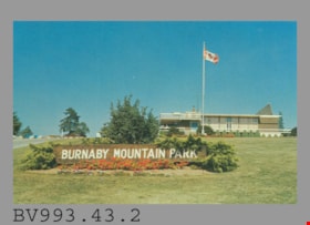
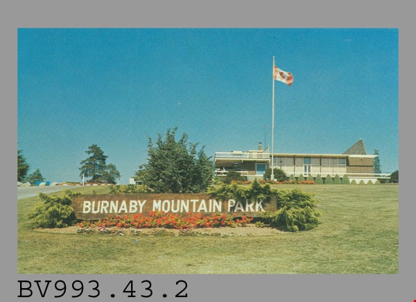
- Postcard: colour photo of Burnaby Mountain Park, Burnaby, BC, including the wooden Burnaby Mountain Park sign and Centennial Pavilion, built for the BC Centennial in 1958; horizontal; on reverse in blue, "2" "BURNABY MOUNTAIN PARK" "Burnaby, B.C., Canada" "The Centennial Pavilion..."; drawing of R.C.M.P. officer at left, mounted officer at right; at lower left, "Photo by George Allen Aerial Photos Ltd. For the Burnaby Parks & Recreation Commission" "S-2773"; blue line up centre with "PUB. BY NATURAL COLOR PRODUCTIONS, LTD., VANCOUVER, B.C."; at bottom, "MADE IN CANADA" "GRANT-MANN"; at upper right, "POST CARD" and rectangle for stamp, "USE CANADIAN POSTAGE"; "ADDRESS" below; unused
- Object History
- Purchased 1980/1981
- Classification
- Written Communication T&E - - Writing Media
- Object Term
- Postcard
- Country Made
- Canada
- Province Made
- British Columbia
- Site/City Made
- Vancouver
- Title
- Burnaby Mountain Park
- Subjects
- Documentary Artifacts
- Documentary Artifacts - Postcards
- Geographic Features
- Geographic Features - Parks
Images
postcard
https://search.heritageburnaby.ca/link/museumartifact44486
- Repository
- Burnaby Village Museum
- Accession Code
- BV002.30.1
- Description
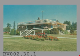
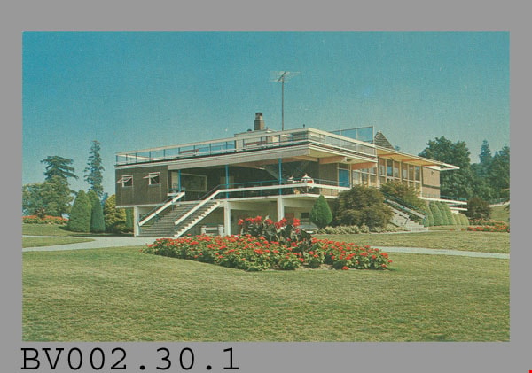
- Postcard: colour photo of Centennial Pavilion, Burnaby Mountain Park; horizontal; on reverse in navy, "4" "CENTENNIAL PAVILION" "Burnaby, B.C., Canada" "The Centennial Pavilion located..."; illustration at left of R.C.M.P. officer; at bottom, "Photo by George Allen Aerial Photos Ltd. For the Burnaby Parks & Recreation Commission" "S-2775"; navy bar up centre with "NATURAL COLOR PRODUCTIONS, LTD., VANCOUVER, B.C."; at bottom, "MADE IN CANADA" "GRANT-MANN", logo; at upper right, illustration of mounted R.C.M.P. officer, "POST CARD" "ADDRESS", and rectangle "USE CANADIAN POSTAGE"; in blue pen on left side, "July, 1977"
- Classification
- Written Communication T&E - - Writing Media
- Object Term
- Postcard
- Country Made
- Canada
- Province Made
- British Columbia
- Site/City Made
- Vancouver
- Title
- Centennial Pavilion Burnaby, B.C., Canada S-2775
- Publication Date
- July 1977
- Subjects
- Documentary Artifacts
- Documentary Artifacts - Postcards
- Documentary Artifacts - Photographs
- Geographic Features
- Geographic Features - Parks
Images

postcard
https://search.heritageburnaby.ca/link/museumartifact48137
- Repository
- Burnaby Village Museum
- Accession Code
- BV004.113.1
- Description
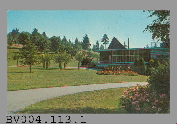
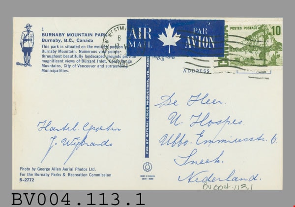
- Postcard: colour photograph of Burnaby Mountain Park including Centennial Pavilion; horizontal; on reverse in blue: "1" "BURNABY MOUNTAIN PARK" "Burnaby, B.C., Canada" "This park...", drawing of R.C.M.P. officer at left; photo by "George Allen Aerial Photos Ltd. For the Burnaby Parks & Recreation Commission" "S-2772"; blue bar up centre with "PUB. BY NATURAL COLOR PRODUCTIONS, LTD. VANC.-", rest covered; at bottom "MADE IN CANADA" "GRANT-MANN"; green 10 cent stamp at upper right; blue and white "AIR MAIL PAR AVION" label top centre; postmarked "NEW WESTMINSTER B.C. CANADA" "6 -" "17 -" "19--"; cancelled with 7 wavy lines; under "ADDRESS" at right side, in blue pen, "De Heer" "U. Hospes." "Uffo. Emmiresstr. 6." "Sneet"? "Nederland."; message "Hantel Cproetin"? "J. Wisbrands"?; corners slightly worn
- Classification
- Written Communication T&E - - Writing Media
- Object Term
- Postcard
- Marks/Labels
- Burnaby Mountain Park / Burnaby, B.C., Canada / George Allen Aerial Photos Ltd. / Burnaby Parks and Recreation Commission / S-2772
- Country Made
- Canada
- Province Made
- British Columbia
- Site/City Made
- Vancouver
- Title
- Burnaby Mountain Park 1 S-2772
- Publication Date
- [ca. 1970]
- Subjects
- Documentary Artifacts
- Documentary Artifacts - Postcards
- Documentary Artifacts - Photographs
- Geographic Features
- Geographic Features - Parks
Images

postcard
https://search.heritageburnaby.ca/link/museumartifact84669
- Repository
- Burnaby Village Museum
- Accession Code
- BV007.43.2
- Description
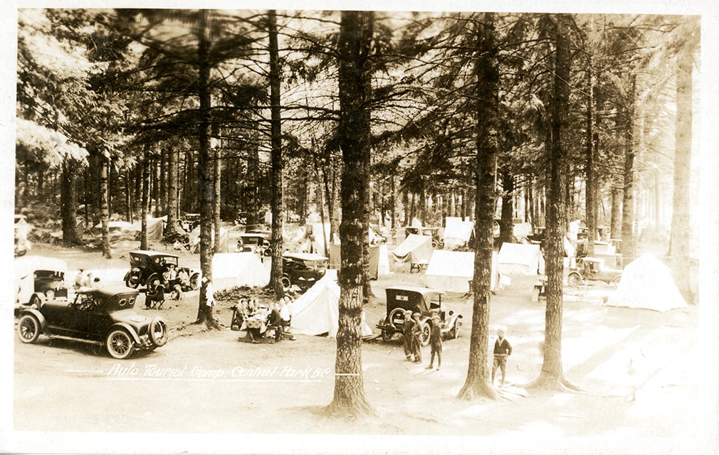
- postcard; Auto Tourist Camp - Postcard -- [1926]. Postcard with a black and white photograph; inscription in white at bottom reads: "Auto Tourist Camp, Central Park B.C." The postcard was published by the Gowen Sutton Company Limited of Vancouver, BC. Verso of postcard includes a postage stamp with King George in the upper right corner and is post marked Sept. 6 and includes a handwritten letter by "Violet" and is addressed to "Roseline Rondeau.../ Oregon".
- Classification
- Written Communication T&E - - Writing Media
- Object Term
- Postcard
- Colour
- Brown
- Black
- White
- Measurements
- w: 14 cm h: 9 cm
- Country Made
- Canada
- Province Made
- British Columbia
- Site/City Made
- Vancouver
- Subjects
- Documentary Artifacts
- Documentary Artifacts - Postcards
- Geographic Features
- Geographic Features - Parks
- Recreational Activities
- Recreational Activities - Camping
- Names
- Central Park Auto Camp
- Historic Neighbourhood
- Central Park (Historic Neighbourhood)
Images
![Copy of Official British Columbia Road Maps, [193-] thumbnail](/media/hpo/_Data/_BVM_Cartographic_Material/1972/1972_0179_0001_001.jpg?width=280)
Copy of Official British Columbia Road Maps
https://search.heritageburnaby.ca/link/museumdescription18945
- Repository
- Burnaby Village Museum
- Date
- [193-]
- Collection/Fonds
- Burnaby Village Museum Map collection
- Physical Description
- 1 map : lithographic print on sheet ; 43 x 56 cm folded to 22 x 11 cm
- Scope and Content
- Item consists of Road maps of British Columbia presented by Union Oil Company of Canada Limited. Includes seventeen maps printed on both sides of sheet. One side of sheet includes ten separate road maps titled "Cariboo"; "Chilcotin Plateau"; "150 Mile House to Prince George"; "Prince George - Burns…
- Repository
- Burnaby Village Museum
- Collection/Fonds
- Burnaby Village Museum Map collection
- Physical Description
- 1 map : lithographic print on sheet ; 43 x 56 cm folded to 22 x 11 cm
- Material Details
- Scale not defined
- Scope and Content
- Item consists of Road maps of British Columbia presented by Union Oil Company of Canada Limited. Includes seventeen maps printed on both sides of sheet. One side of sheet includes ten separate road maps titled "Cariboo"; "Chilcotin Plateau"; "150 Mile House to Prince George"; "Prince George - Burns Lake"; "Burns Lake - Hazelton"; "Similkameen - Nicola"; "Salmon Arm to Revelstoke"; "Ashcroft to Salmon Arm / Kamloops to Vernon"; "Okanagan Valley"; "Boundary District". Other side of sheet includes seven road maps titled "Vancouver Island"; "Vancouver to Yale"' "Fraser Canyon Section Cariboo Road"; "Lytton to 150 Mile House"; "Arrow and Kootenay Lakes"; "The Kootenays"; "Columbia Valley". When folded, cover of maps reads "COPY OF / OFFICIAL / BRITISH COLUMBIA / ROAD-MAPS" / Presented by / UNION OIL / COMPANY / of Canada Ltd."; verso of cover includes advertisement for Union Motor oil "MOTORITE"; inside cover includes advertisement for Union Gasoline with title reading "See Canada's Evergreen Playground".
- Responsibility
- Union Oil Company of Canada Limited
- Accession Code
- HV972.179.1
- Access Restriction
- No restrictions
- Reproduction Restriction
- No known restrictions
- Date
- [193-]
- Media Type
- Cartographic Material
- Scan Resolution
- 600
- Scan Date
- 2023-08-17
- Notes
- Title based on contents of map
Images
![Copy of Official British Columbia Road Maps, [193-] thumbnail](/media/hpo/_Data/_BVM_Cartographic_Material/1972/1972_0179_0001_001.jpg)

postcard
https://search.heritageburnaby.ca/link/museumartifact84668
- Repository
- Burnaby Village Museum
- Accession Code
- BV007.43.1
- Description
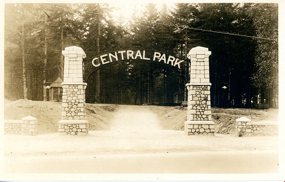
- postcard; black and white photograph of entrance arches to Central Park in Burnaby - [192-]. The postcard was published by the Gowen Sutton Company Limited of Vancouver, BC. Stamp in black ink on verso of postcard reads "PUBLISHED BY THE GOWEN SUTTON CO. LTD. VANCOUVER, B.C. / POSTCARD / CORRESPONDENCE_ADDRESS"
- Object History
- Souvenir postcard of Burnaby Central Park entrance arch.
- Classification
- Written Communication T&E - - Writing Media
- Object Term
- Postcard
- Colour
- Brown
- White
- Measurements
- w: 14 cm h: 9 cm
- Country Made
- Canada
- Province Made
- British Columbia
- Site/City Made
- Vancouver
- Subjects
- Structures - Arches
- Documentary Artifacts
- Documentary Artifacts - Postcards
- Geographic Features - Parks
- Geographic Access
- Central Park
- Imperial Street
- Street Address
- 3883 Imperial Street
- Historic Neighbourhood
- Central Park (Historic Neighbourhood)
- Planning Study Area
- Maywood Area
Images
![Survey and Subdivision plans in New Westminster District Group 1 – Burnaby
, [1908] thumbnail](/media/hpo/_Data/_BVM_Cartographic_Material/1977/1977_0093_0004a_001.jpg?width=280)
Survey and Subdivision plans in New Westminster District Group 1 – Burnaby
https://search.heritageburnaby.ca/link/museumdescription6973
- Repository
- Burnaby Village Museum
- Date
- [1908]
- Collection/Fonds
- Burnaby Village Museum Map collection
- Description Level
- File
- Physical Description
- 10 plans : blueprint ink on paper mounted on 2 sides of cardboard ; 76 cm x 102 cm
- Scope and Content
- Item consists of a large board of four New Westminster District Gp 1 - subdivision plans mounted on one side and six New Westminster District Gp 1 - subdivision plans mounted on the other side. Side A: 1. Blueprint "Plan / of - ReSubdivision / of / Lots 1-18 inclusive / Blocks 20 and 21 / in Sub…
- Repository
- Burnaby Village Museum
- Collection/Fonds
- Burnaby Village Museum Map collection
- Description Level
- File
- Physical Description
- 10 plans : blueprint ink on paper mounted on 2 sides of cardboard ; 76 cm x 102 cm
- Material Details
- Scales [between 1:792 and 1:4752]
- Index number on edge of board reads: "4"
- Scope and Content
- Item consists of a large board of four New Westminster District Gp 1 - subdivision plans mounted on one side and six New Westminster District Gp 1 - subdivision plans mounted on the other side. Side A: 1. Blueprint "Plan / of - ReSubdivision / of / Lots 1-18 inclusive / Blocks 20 and 21 / in Subdivision / of / Lot 53 -Gr.1 / New Westminster District" / "Subdivision Lot Numbers - Shown in Red". Plan is bordered by First Street / Jorgenson's Line / Fourth Avenue and Second Street with Fifith Avenue running through the centre. There is an index in the upper right corner of the plan. Planned is signed by "Peter Byrne" and "William R. Phillips" and dated July 28, 1908. (Geographic location: Burnaby) 2. Blueprint "Plan / of Subdivision / of / Lot 159 / and a Portion of Lot 158 / Group One / New Westminster District". Plan is bordered by Lots 96 and 97; South Wilson Street; North Arm Road and Lot 160 / Power House Road (Lot 155 A). B.C.E.R. Gilley Station is identified in the upper right corner of the plan. (Geographic location: Burnaby) 3. Blueprint plan identified as "Subdvs 10, L 88 and Lot 25, G. 1" Plan identifies Cumberland Street running from top to the bottom and a Ravine running alongside with the Jensen house, stable and barn. (Geographic location: Burnaby) 4. Blueprint Plan of "Lot 153. G. 1 /New Westminster District". Plan identifies the "New Westminster & Vancouver Tramway" and the "New Westminster and Vancouver Road" running through the plan of Lot 53. (Geographic location: Burnaby) Side B: 1. Blueprint plan of "Profile on Proposed North Rd. Diversion". 2. Blueprint plan (no title) showing wood lots north of Burnaby Lake and Brunette River and west of North Road. Various lots are identified as "Heavily Timbered" (Lot 57); "Splendid Fir and Cedar / Heavy Fir etc. / Fine Cedar" (Lots 143, 148); "Rough Light Timber," (Lot 56); "Some Fir and Cedar" (Lot 40). (Geographic location: Burnaby) 3. Blueprint "Plan / of Subdivision / of a Portion / of Lot 87, Gr.1 / New Westminster District". Plan is bordered by Burnaby Lake at the top and Hastings Road / Lot 86 at the bottom and Lot 90 to the east. "Albert J. Hill B.C.LotS." Annotation in ink reads: " J.A. Brownlee, B.C.L.S. / Subdivision / Map 1494 / Bd. 248". Plan is signed by "Peter Byrne, Reeve" (Geographic location: Burnaby) 4. Blueprint plan of Subdivisions along either side of Douglas Road including Lots 117; 119; 74; 80; 79 and 77. (Geographic location: Burnaby) 5. Blueprint "Plan / of / Subdivision of / Lot 27 / in Subdivision / of / Lot 30 / Group One / New Westminster District" Plan is bordered by Lot 26, Lot 28 and Hastings Rd. Lot 27 runs north of Edmonds Street. , "Albert J. Hill, B.C.LotS." (Geographic location: Burnaby) 6. Blueprint plan identified as a "Cultivated Orchard" including the names "W. Grace" and "G. Mead" located north of the North Arm Fraser River and west of "Twentieth Street_ City Boundary". Handwritten annotation in coloured pencil reads: "Portion of Lot 172" (Geographic location: Burnaby)
- Subjects
- Geographic Features - Forests
- Geographic Access
- Cumberland Street
- North Road
- Hastings Street
- Douglas Road
- Accession Code
- HV977.93.4
- Access Restriction
- No restrictions
- Reproduction Restriction
- No known restrictions
- Date
- [1908]
- Media Type
- Cartographic Material
- Historic Neighbourhood
- Burnaby Lake (Historic Neighbourhood)
- Fraser Arm (Historic Neighbourhood)
- Planning Study Area
- Douglas-Gilpin Area
- Burnaby Lake Area
- Scan Resolution
- 300
- Scale
- 72
- Notes
- Title based on contents of file
- Scale is measured in chains. (One chain equals 792 inches)
- The term "Lot" can also refer to a "District Lot”-
Images
![Survey and Subdivision plans in New Westminster District Group 1 – Burnaby
, [1908] thumbnail](/media/hpo/_Data/_BVM_Cartographic_Material/1977/1977_0093_0004a_001.jpg)

drawing
https://search.heritageburnaby.ca/link/museumartifact91041
- Repository
- Burnaby Village Museum
- Accession Code
- BV020.5.1688
- Description
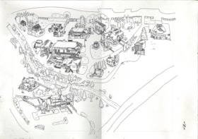
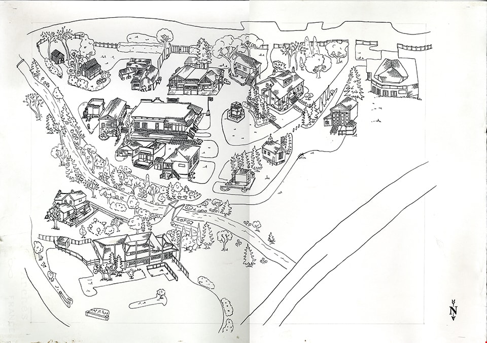
- Drawing; black ink and pencil on Arches white paper; drawn by Carly Bouwman (unsigned); bird's eye view (site plan) of Burnaby Village Museum site; illustration includes buildings on the site including Adminstration building and parking lot (in foreground); the Love farmhouse; bridge across creek; Tom Irvine house; Village Church; Tram barn; Carousel building; Elworth house; bandstand; Elworth garage; buildings on west side of Hill Street including Japanese Ofuro; Log Cabin; Steam Shed; Blacksmith shop; Old Curly Locomotive; Deer Lake Auto; General Store; Stride Studios; Drug Store and McKay Barbershop and east side of Hill Street including the Real Estate Office; Royal Bank; Music Shop; Burnaby Post; Chinese Herbalist shop; Home Bakery and Ice Cream Parlour; Vancouver Heights Sheet Metal Works; Bell's Dry Goods; Seaforth School; illustration also includes geographic features such as roads; trees; gardens and creek [ca. 2000]
- Object History
- Part of Burnaby Village Museum Administrative Design collection.
- Category
- 08. Communication Artifacts
- Classification
- Documentary Artifacts - - Other Documents
- Object Term
- Drawing
- Colour
- Black
- White
- Measurements
- 39.5 cm x 57 cm
- Maker
- Bouwman, Carly
- Province Made
- British Columbia
- Subjects
- Documentary Artifacts
Images
![Survey and Subdivision plans in New Westminster District Group 1 – Burnaby
, [1861]-[1910] thumbnail](/media/hpo/_Data/_BVM_Cartographic_Material/1977/1977_0093_0019a_001.jpg?width=280)
Survey and Subdivision plans in New Westminster District Group 1 – Burnaby
https://search.heritageburnaby.ca/link/museumdescription6988
- Repository
- Burnaby Village Museum
- Date
- [1861]-[1910]
- Collection/Fonds
- Burnaby Village Museum Map collection
- Description Level
- File
- Physical Description
- 14 plans : 3 plans : black ink on paper hand col. + 7 plans : black ink on paper + 4 plans : graphite on paper mounted on 2 sides of cardboard 76 x 102 cm
- Scope and Content
- Item consists of a large board of four New Westminster District Gp 1 - subdivision plans mounted on one side and ten New Westminster District Gp 1 - subdivision plans mounted on the other side. Side A: 1. "Plan /of / Lots 166A, 166 and 167 /, Gr.1, N.W.D. / Showing Misconstructed Roads in Gree…
- Repository
- Burnaby Village Museum
- Collection/Fonds
- Burnaby Village Museum Map collection
- Description Level
- File
- Physical Description
- 14 plans : 3 plans : black ink on paper hand col. + 7 plans : black ink on paper + 4 plans : graphite on paper mounted on 2 sides of cardboard 76 x 102 cm
- Material Details
- Scales [between 1:2376 and 1:7920]
- Index number on edge of board reads: "19"
- Scope and Content
- Item consists of a large board of four New Westminster District Gp 1 - subdivision plans mounted on one side and ten New Westminster District Gp 1 - subdivision plans mounted on the other side. Side A: 1. "Plan /of / Lots 166A, 166 and 167 /, Gr.1, N.W.D. / Showing Misconstructed Roads in Green / 5 chs = 1 in.". (plan is drawn in black ink and hand coloured in red, green and orange ink). A section in the centre of the plan is coloured in red ink and identified as "C.S. Richmond" running from the North Arm of Fraser River to Wiggins Road and divided by "New Wiggins Rd. (as gazetted)" (coloured in orange ink) and two"Constructed Road(s)" (coloured in green ink). Plan is initialed by: "RB" [sic] (in blue pencil crayon) 2. Plan of / Subdivision of / Lot 166 / Group One / New Westminster District / Scale 4 chs = 1 in. / Map No 524". Plan is drawn in graphite and signed by "Surrig [sic] Welhams [sic] / P.L.S." Plan is initialed by: "RB" [sic] (in blue pencil crayon) 3. Plan of "Survey / of Highway / For / Burnaby Council / in / Lots 13 _14 / Group One / Scale 4 chs = 1 in." Signed by "Albert J. Hill, P.L.S." Caribou Street and Caribou Road run through the centre of the plan. Plan is stamped: "Albert J. Hill, Civil Engineer / and / Provincial Land Surveyor, / New Westminster, / B.C.". Plan is initialed by: "RB" [sic] (in blue pencil crayon) 4. A Plan of Lots 166A, 166 and 167, Group One, New Westminster District (drawn in graphite). A section in the centre of the plan is identified as "C.S. Richmond" running from the North Arm of Fraser River and divided by "New Wiggins Rd. (as gazetted)" and two "Constructed Road(s)". Plan is initialed by: "RB" [sic] (in blue pencil crayon) Side B: 1. Small plan drawn in black ink (no title) identifying lots north of the "North Arm" of the Fraser River. Lots identified include: Lot 99, Lot 98, Lot 157, Lot 158, Lot 163, Lot 162, Lot 159, Lot 163, Lot 162, Lot 165, Lot 166A, Lot 155B, Lot 155A and Lot 159. "Scale 40 chains to one inch" . Plan is initialed by: "RB" [sic] (in blue pencil crayon) (Geographic location: Burnaby) 2. Small plan drawn in black ink (no title) identifying lots north of the North Arm of the Fraser River as "Lots 155, 155A, 155B, 155C, 162, 163, 164, 165, 166A and 167". Plan is initialed by: "RB" [sic] (in blue pencil crayon) (Geographic location: Burnaby) 3. Small plan drawn in black ink (no title) which identifies "Lot 151 / Reserve/ for / Race Course"; "Reserve / 64 A / L. 152 G.1"; and other Lots: 32, 33, 34, 35, 36, 38, 39. The plan is signed "Surveyor G.Turn [sic] July / 61 / from Vol 40 R.L. notes [sic]" Plan is stamped: "Albert J. Hill, Civil Engineer / and / Provincial Land Surveyor, / New Westminster, / B.C." Plan is initialed by: "RB" [sic] (in blue pencil crayon) (Geographic location: Burnaby) 4. Small plan drawn in black in with faded red colouring on centre lot identified as "Lot 34" running north from "Vancouver Road" . Plan is stamped: "Albert J. Hill, Civil Engineer / and / Provincial Land Surveyor, / New Westminster, / B.C." Plan is initialed by: "RB" [sic] (in blue pencil crayon) (Geographic location: Burnaby) 5. Plan drawn in graphite and identified as "Lot 98, Gr.1," along with the intials "RB" [sic] (both are handwritten in blue crayon pencil on top of plan) The B.C.E.Railway is identified running through the plan along with Jubilee Road and Royal Oak Road. The plan is signed with the name "Wm. Murray" and the Plan is stamped: "Albert J. Hill, Civil Engineer / and / Provincial Land Surveyor, / New Westminster, / B.C.". (Geographic location: Burnaby) 6. Plan drawn in graphite identified as "Port Lot 13, Gr.1" along with the intials "RB" [sic] (both are handwritten in blue crayon pencil on top of plan) Plan is stamped: "Albert J. Hill, Civil Engineer / and / Provincial Land Surveyor, / New Westminster, / B.C.". (Geographic location: Burnaby) 7.Plan drawn in black ink and identified as "Lot 98 G.1" along with the intials "RB" [sic] (both are handwritten in blue crayon pencil on top of plan). A "Road Reservation" is identified running north between "Electric Tramway" and connecting with "Royal Oak Road". Plan is stamped: "Albert J. Hill, Civil Engineer / and / Provincial Land Surveyor, / New Westminster, / B.C." (Geographic location: Burnaby) 8. Plan drawn in black ink and divided into two sections, the upper plan is identified as "Portion / Lots 100 / area / 101, Gr.1" and the lower plan is identified as "Portion L. 3 G. 1" along with the intials "RB" [sic] (these identifiers are handwritten in blue crayon pencil on top of the plan). Portions of Lot 100 and Lot 101 are each divided into 6 sections and the Portion of Lot 3 plan is divided into 24 sections. The plan includes a note in black ink that reads: " Received from Wm Fromme [sic] / from Wm. Trapp / Nov. 28, 1895 / A. J. T...[sic]". (Geographic location: Burnaby) 9. Plan drawn in black ink (no title) identifying soil, buildings and geographic features in southern Burnaby. The plan is bordered by "New Westminster City" (Tenth Avenue and DL 172) to the south east and DL 173 to the south, DL 158 to the west and the B.C.E. Tramway to the north. Plan includes District Lots: 155A, 158, 159, 171, 160, 53 and 95 and identifies soil, marshland and ravines throughout. Plan identifies the following features: a "Team Road" running through Lots 158 and 159 along with "Fair Orchard Soil / Even Surface Throughout / No Ravines", "Gravel and Shingle" (bottom of Lot 158), "North Arm Road" crossing "Byrne Road" and connecting with "Power House Road" which runs north to connect with "Highland Park Station" and the B.C.E. Tramway, "Power Ho" in the northeast corner of DL 160, a "Brook" connected with a "Deep Ravine" running between DL 53, DL 95 and DL 160 along with "Good Soil" and "Fair Orchard Soil" identified nearby in DL 95. Scale is identified as "10 chs = 1 in." Plan is stamped: "Albert J. Hill, Civil Engineer / and / Provincial Land Surveyor, / New Westminster, / B.C." Plan is initialed by: "RB" [sic] (in blue pencil crayon) (Geographic location: Burnaby) 10. Plan drawn in black ink (no title) with Burnaby Lake and Deer Lake at the centre. The plan is bordered by the following District Lots identified as: 117, 118 and 68 to the west, Lots 80, 79 and 85 to the southwest, Lots 11, 13, and 1 (City of New Westminster) to the south east, the North Road boundary to the east and Lots 8, 56, 57, 59, and 136 to the North. The lower right hand corner of the plan has a small inset which reads: "Burnaby Lake" and "Page 19 R.B. Notes". Plan is initialed by: "RB" [sic] (in blue pencil crayon) (Geographic location: Burnaby)
- Creator
- Hill, Albert James
- Accession Code
- HV977.93.19
- Access Restriction
- No restrictions
- Reproduction Restriction
- No known restrictions
- Date
- [1861]-[1910]
- Media Type
- Cartographic Material
- Scan Resolution
- 300
- Scale
- 72
- Notes
- Title based on contents of file
- Scale is measured in chains. (One chain equals 792 inches)
- The term "Lot" can also refer to a "District Lot”
- Some plans are stamped: "Albert J. Hill, Civil Engineer / and / Provincial Land Surveyor, / New Westminster, / B.C." and intialed: "RB" [sic]
Images
![Survey and Subdivision plans in New Westminster District Group 1 – Burnaby
, [1861]-[1910] thumbnail](/media/hpo/_Data/_BVM_Cartographic_Material/1977/1977_0093_0019a_001.jpg)

![Survey and Subdivision plans in New Westminster District Group 1 & Group 2 - Port Moody, Surrey
, [1898-1910] thumbnail](/media/hpo/_Data/_BVM_Cartographic_Material/1977/1977_0093_0073_001.jpg?width=280)
Survey and Subdivision plans in New Westminster District Group 1 & Group 2 - Port Moody, Surrey
https://search.heritageburnaby.ca/link/museumdescription7042
- Repository
- Burnaby Village Museum
- Date
- [1898-1910]
- Collection/Fonds
- Burnaby Village Museum Map collection
- Description Level
- File
- Physical Description
- 10 plans : graphite and ink on paper and linen; various sizes mounted on 2 sides of cardboard 76 x 102 cm
- Scope and Content
- File consists of a large board with four plans in New Westminster District mounted on one side and six plans mounted on the other side. Side A: 1. Plan : black ink and graphite on paper ; 46.5 x 37.5 cm. Title reads: "Bon Accord Hatchery / Sec 6 B5N R1W". Signed by Albert J. Hill P.L.S. August 1…
- Repository
- Burnaby Village Museum
- Collection/Fonds
- Burnaby Village Museum Map collection
- Description Level
- File
- Physical Description
- 10 plans : graphite and ink on paper and linen; various sizes mounted on 2 sides of cardboard 76 x 102 cm
- Material Details
- Scales vary (One chain equals 792 inches)
- Indexed number on tape on edge of board reads "73"
- Scope and Content
- File consists of a large board with four plans in New Westminster District mounted on one side and six plans mounted on the other side. Side A: 1. Plan : black ink and graphite on paper ; 46.5 x 37.5 cm. Title reads: "Bon Accord Hatchery / Sec 6 B5N R1W". Signed by Albert J. Hill P.L.S. August 12, 1903. Plan covers land identified as Section 6, Section 7, Located along the south shore of the Fraser River in Port Mann (Geographic location: Surrey). 2. Plan : black ink and graphite on paper ; 36 x 31 cm. Title reads: "Survey of Portions of Sec. 20 B5N R2W". Plan is stamped in red ink: "Albert J. Hill, Civil Engineer". Scale 4 chains = 1 inch. 3. Plan : black ink on linen ; 14 x 23 cm. Title reads:"Port Moody". Plan covers sections in Lot 191 (District Lot 191) bordered by Burrard Inlet to the west and Lot 235 and Lot 233 to the south. Streets identified include Water Street, Beauregard Street, Yonge Street, Clinton Street and Oxford Street. 4. Plan: graphite and ink on paper ; 43.5 x 64.5 cm. Title reads: "Sketch Plan Approved by Council [sic] / _[sic]1898". (No identifying geographic landmarks provided) Side B: 1. Plan : graphite on paper ; 53.5 x 31 cm. Title reads: "Plan of Lot 13, Gr. II, N.W. Dist". Sketch plan covers area along the Fraser River in District Lot 13, New Westminster District, Group 2. District Lot 13 is bordered by District Lot 14 (to the west) and Lot 12 (to the east). Natural geographic features within District Lot 13 are noted as "dense brush and fallen timber / sallal / rough spruce and cedar / swamp / fine alder / sallal / fine alder bottom land / fine brook". Scale: 3 chains = 1 inch (Geographic location: Surrey) 2. Plan : black ink on paper ; 50.5 x 34.5 cm. Title reads: "Indian Reserve / Opposite / New Westminster". Plan covers area on the south shore of the Fraser River in New Westminster District Group 2 in an area known as Brownsville. Lots are identified as District Lots 1, 2, 3, 4, 18, 17 and 8 and Sections A and B. Two areas of land are noted as "Indian Reserve"; one 6.3 acre parcel and one 104.25 acre parcel, both within District Lot 1. Note on plan reads: "N.B. this plan shows reserves and adjacent properties as they are on the ground". (Geographic location: Surrey) 3. Plan : black and col. ink on paper ; 19.5 x 31.5 cm. Title reads: "Bon Accord Road". Plan shows elevation. "Average section 10 feet = 1 inch". Plan is stamped in red ink: "Albert J. Hill, Civil Engineer and Provincial Land Surveyor, New Westminster, B.C." (Geographic location: Surrey) 4. Plan : black and col. ink on linen ; 16.5 x 25.5 cm. (no formal title) Plan covers area of Section 35, south of Yale Wagon Road and east of Quible Road. Plan is signed by "Albert J. Hill / B.C.L.S." (Geographic location: Surrey) 5. Plan: black and col. ink on linen ; 22.5 x 22.5 cm. (no formal title) Plan covers area between Yale Road and Townline Road in Surrey. Scale: 4 chains = 1 inch. Plan is signed by Albert J. Hill B.C.L.S. [190-] (Geographic location: Surrey) 6. Plan : graphite on paper ; 24 x 54 cm. (no formal title) Plan covers sectioned areas along Bon Accord Road. Sections are identified as " Sec. 8 / T.F. Patterson"; "Sec. 9 / Russell"; "Elliott_Burnett_Crean / Sec. 16"; "Dom. Govt. / Sec. 17". (Geographic location: Surrey, beneath the Port Mann bridge)
- Names
- ʷməθkʷəy̓əm (Musqueam)
- Accession Code
- HV977.93.73
- Access Restriction
- No restrictions
- Reproduction Restriction
- No known restrictions
- Date
- [1898-1910]
- Media Type
- Cartographic Material
- Scan Resolution
- 600
- Scan Date
- 2023-06-26
- Notes
- Title based on contents of file
- Note re plan 2B: The sight of Brownsville was also the former site of the Qayqayt First Nation and one of the main summer villages of the Kwantlen and ʷməθkʷəy̓əm (Musqueam) peoples
Zoomable Images
![Survey and Subdivision plans in New Westminster District Group 1 & Group 2 - Port Moody, Surrey
, [1898-1910] thumbnail](/media/hpo/_Data/_BVM_Cartographic_Material/1977/1977_0093_0073_003_seadragon/1977_0093_0073_003.jpg?w=280)
Survey and Subdivision plans in New Westminster District Group 1 & Group 2 - Port Moody, Surrey , [1898-1910]
Zoom into Image