Narrow Results By
Creator
- Adams, John 2
- British Columbia Underwriters' Association 1
- Burnaby Village Museum 4
- Burnett & McGugan, Engineers and Surveyors 1
- Damer, Eric 3
- Draper, William Nelson 1
- Fong, Denise 1
- Garden, Hermon and Burwell 1
- Hill, Albert James 2
- McGugan, Donald Johnston 1
- Plan Department, British Columbia Insurance Underwriters' Association 1
- Smith, H. Neville 1
Person / Organization
- Barnet Park 1
- Bateman, Edwin W. 2
- Bateman, Marianne May 2
- Bateman, Mary Dale 1
- Bingham, Alfred "Alf" 3
- Bossort, Kathy 2
- Bradbury, Dr. Bettina 3
- British Columbia Electric Railway Company 1
- British Columbia Hydro and Power Authority 1
- Brown, Donald N. "Don" 1
- Brownlee, James Harrison 1
- Burnaby Arts Council 4

Interview with Warren McWilliams - Track 1
https://search.heritageburnaby.ca/link/oralhistory202
- Repository
- City of Burnaby Archives
- Date Range
- 1920-1930
- Length
- 0:08:32
- Summary
- This portion of the interview pertains to Warren McWilliam's memories of his grandparent's home, Elworth and his grandmother, Mary (Dale) Bateman. He also mentions his childhood friends in the neighbourhood.
- Repository
- City of Burnaby Archives
- Summary
- This portion of the interview pertains to Warren McWilliam's memories of his grandparent's home, Elworth and his grandmother, Mary (Dale) Bateman. He also mentions his childhood friends in the neighbourhood.
- Date Range
- 1920-1930
- Photo Info
- Warren McWilliams in E. W. Bateman's McLaughlin-Buick, 1919. Item no. BV994.22.4
- Length
- 0:08:32
- Names
- Bateman, Mary Dale
- Geographic Access
- Deer Lake Avenue
- Historic Neighbourhood
- Burnaby Lake (Historic Neighbourhood)
- Planning Study Area
- Morley-Buckingham Area
- Scope and Content
- Recording is of an interview with Warren McWilliams. Major themes discussed are: Elworth and his grandparents, Edwin and Mary (Dale) Bateman.
- Biographical Notes
- When Warren McWilliam's grandfather, Edwin Bateman was twenty-one he immigrated to Manitoba, Canada where he met Catherine “Cassie” Dale. They were married in 1886 and had seven children, the eldest Edna Caroline Annie (Corner) born in 1889, George, Mamie Dale (McWilliams) born in Portage La Prairie in 1892, Marianne May “May” Bateman born in Hartney, Manitoba in 1894, Jessie (Fox Kemp), Carey, and the youngest Warren Stafford born in 1901. Cassie died in Portage La Prairie in 1909. Edwin was transferred to Vancouver by the CPR where he married Cassie’s younger sister Mary Dale and moved his six children to Vancouver. In 1920 Edwin Bateman moved his wife and youngest daughter May to Deer Lake and commissioned 'Elworth' house, designed by English-born and trained architect Enoch Evans. The house was completed by contractor William Dodson in 1922 and located at the site of what would become Burnaby Village Museum, 6501 Deer Lake Avenue. Mamie Bateman married George Lloyd McWilliams May 19, 1915 and had one child, Warren McWilliams. When Warren was very young, the McWilliams family moved into a small house just across Douglas Road from the Bateman’s and Mamie and Warren were daily visitors to Elworth house for ten years. Warren McWilliams attended Douglas Road School and spent a lot of time at Deer Lake swimming and skating. E.W. Bateman died in 1957 at the age of ninety-nine. George Lloyd McWilliams died June 30, 1961 at the age of seventy-four, his wife Mamie Dale (Bateman) McWilliams died June 1, 1979 at the age of eight-seven.
- Total Tracks
- 2
- Total Length
- 0:14:18
- Interviewee Name
- McWilliams, Warren
- Collection/Fonds
- Burnaby Historical Society fonds
- Subseries
- Oral history subseries
- Media Type
- Sound Recording
- Web Notes
- Interview was digitized in 2010 allowing it to be accessible on Heritage Burnaby. The digitization project was initiated by the Community Heritage Commission with support from City of Burnaby Council and the BC History Digitization Program of the Irving K. Barber Learning Centre, University of British Columbia. It was recognized by the Heritage Society of BC with an award in 2012.
Images

Audio Tracks
Track one of interview with Warren McWilliams
Track one of interview with Warren McWilliams
https://search.heritageburnaby.ca/media/hpo/_Data/_Archives_Oral_Histories/_Unrestricted/MSS137-018-2/MSS137-018-2_Track_1.mp3
Interview with Warren McWilliams - Track 2
https://search.heritageburnaby.ca/link/oralhistory203
- Repository
- City of Burnaby Archives
- Date Range
- 1920-1930
- Length
- 0:05:46
- Summary
- This portion of the interview pertains to Warren McWilliam's memories of his grandparent's home, Elworth and his grandfather Edwin W. Bateman.
- Repository
- City of Burnaby Archives
- Summary
- This portion of the interview pertains to Warren McWilliam's memories of his grandparent's home, Elworth and his grandfather Edwin W. Bateman.
- Date Range
- 1920-1930
- Photo Info
- Warren McWilliams in E. W. Bateman's McLaughlin-Buick, 1919. Item no. BV994.22.4
- Length
- 0:05:46
- Names
- Bateman, Edwin W.
- Geographic Access
- Deer Lake Avenue
- Historic Neighbourhood
- Burnaby Lake (Historic Neighbourhood)
- Planning Study Area
- Morley-Buckingham Area
- Scope and Content
- Recording is of an interview with Warren McWilliams. Major themes discussed are: Elworth and his grandparents, Edwin and Mary (Dale) Bateman.
- Biographical Notes
- When Warren McWilliam's grandfather, Edwin Bateman was twenty-one he immigrated to Manitoba, Canada where he met Catherine “Cassie” Dale. They were married in 1886 and had seven children, the eldest Edna Caroline Annie (Corner) born in 1889, George, Mamie Dale (McWilliams) born in Portage La Prairie in 1892, Marianne May “May” Bateman born in Hartney, Manitoba in 1894, Jessie (Fox Kemp), Carey, and the youngest Warren Stafford born in 1901. Cassie died in Portage La Prairie in 1909. Edwin was transferred to Vancouver by the CPR where he married Cassie’s younger sister Mary Dale and moved his six children to Vancouver. In 1920 Edwin Bateman moved his wife and youngest daughter May to Deer Lake and commissioned 'Elworth' house, designed by English-born and trained architect Enoch Evans. The house was completed by contractor William Dodson in 1922 and located at the site of what would become Burnaby Village Museum, 6501 Deer Lake Avenue. Mamie Bateman married George Lloyd McWilliams May 19, 1915 and had one child, Warren McWilliams. When Warren was very young, the McWilliams family moved into a small house just across Douglas Road from the Bateman’s and Mamie and Warren were daily visitors to Elworth house for ten years. Warren McWilliams attended Douglas Road School and spent a lot of time at Deer Lake swimming and skating. E.W. Bateman died in 1957 at the age of ninety-nine. George Lloyd McWilliams died June 30, 1961 at the age of seventy-four, his wife Mamie Dale (Bateman) McWilliams died June 1, 1979 at the age of eight-seven.
- Total Tracks
- 2
- Total Length
- 0:14:18
- Interviewee Name
- McWilliams, Warren
- Collection/Fonds
- Burnaby Historical Society fonds
- Subseries
- Oral history subseries
- Media Type
- Sound Recording
- Web Notes
- Interview was digitized in 2010 allowing it to be accessible on Heritage Burnaby. The digitization project was initiated by the Community Heritage Commission with support from City of Burnaby Council and the BC History Digitization Program of the Irving K. Barber Learning Centre, University of British Columbia. It was recognized by the Heritage Society of BC with an award in 2012.
Images
Audio Tracks
Track two of interview with Warren McWilliams
Track two of interview with Warren McWilliams
https://search.heritageburnaby.ca/media/hpo/_Data/_Archives_Oral_Histories/_Unrestricted/MSS137-018-2/MSS137-018-2_Track_2.mp3
Lettering Guide
https://search.heritageburnaby.ca/link/museumartifact90811
- Repository
- Burnaby Village Museum
- Accession Code
- BV020.40.2
- Description
- Wooden box with a hinged lid and base with slats for rules and holes for lettering tips. The box contains lettering materials, including white rulers,ink pens in green cardboard cylindrical tubes, guiding stencils for lettering in different fonts, metal tool to hold ink nibs.
- Object History
- This lettering guide was used in the City of Burnaby's Planning Department, in the late 1950s. A lettering guide template is a special type of template used to write uniform characters. It consists of a sheet of plastic or other material with cut-outs of letters, numbers, and other shapes used especially for creating technical drawings. For decades they have been essential for lettering a drawing nameplate so text and other designs could be made quickly and uniformly. Although they have been superseded by the use of computers, during the greater part of the last century they were used to relatively ease the lettering process in the creation of technical drawings. They were an indispensable tool for architects and technical illustrators.
- Classification
- Written Communication T&E - - Writing Devices
- Object Term
- Guide, Lettering
- Marks/Labels
- WRICO LETTERING PEN
- Maker
- WRICO
- Subjects
- Construction Tools and Equipment
- Documentary Artifacts - Architectural Drawings
- Government - Local Government
- Land - Land Surveying
- Occupations - Civic Workers
- Historic Neighbourhood
- Burnaby Lake (Historic Neighbourhood)
- Planning Study Area
- Douglas-Gilpin Area
Images

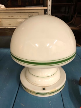
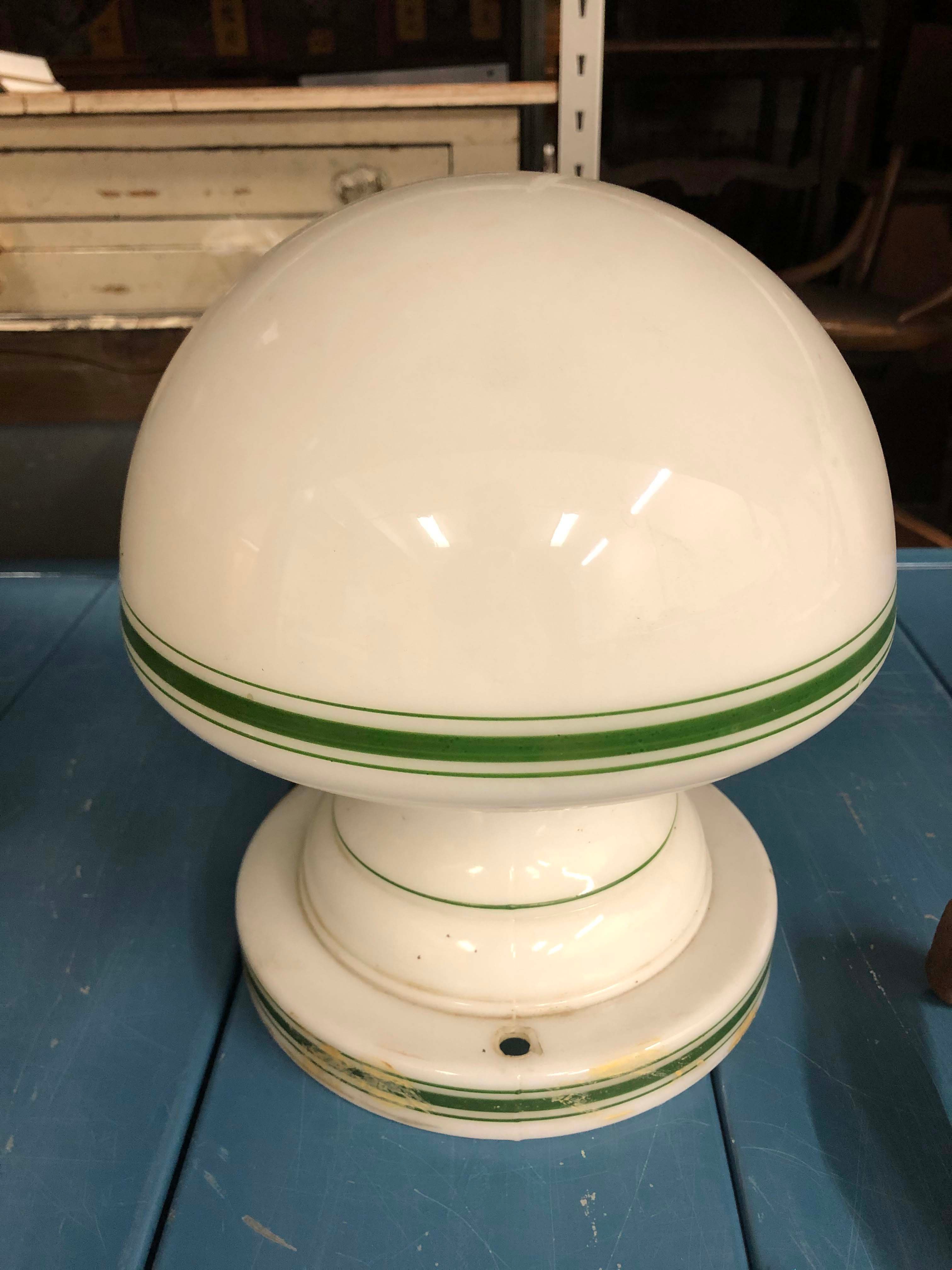
Light Fixture
https://search.heritageburnaby.ca/link/museumartifact90872
- Repository
- Burnaby Village Museum
- Accession Code
- BV020.40.23
- Description
- White glass light fixture with rounded bulb shape. The lamp and the base of the fixture hae a thick green line with two thin lines on either side. There are two holes in the base on opposite sides of each other. There is some tan/beige paint strokes around the base. An additional part is required to actually afix the lamp to the ceiling.
- Object History
- This is an original light fixture for the Eagles House. This house is located on Sperling Avenue and is under the care of the City of Burnaby Planning Department.
- Category
- 02. Furnishings
- Classification
- Lighting Equipment - - Lighting Devices
- Object Term
- Fixture, Lighting
- Colour
- White
- Green
- Historic Neighbourhood
- Burnaby Lake (Historic Neighbourhood)
- Planning Study Area
- Morley-Buckingham Area
Images
![Map of proposed provincial exhibition site at Burnaby Lake, [between 1929 and 1931] thumbnail](/media/hpo/_Data/_BVM_Cartographic_Material/2017/2017_0002_0009_005.jpg?width=280)
Map of proposed provincial exhibition site at Burnaby Lake
https://search.heritageburnaby.ca/link/museumdescription8703
- Repository
- Burnaby Village Museum
- Date
- [between 1929 and 1931]
- Collection/Fonds
- Burnaby Village Museum Map collection
- Description Level
- Item
- Physical Description
- 1 map : photostat print ; 3 parts 45 x 33.7 cm totalling 45 x 101 cm
- Scope and Content
- Item consists of a tri-part folding map of a proposed Provincial Exhibition site located along the southern and western shore of Burnaby Lake. Exhibtion site on map identifies proposed locations for a golf course, pier, hydroplane landing ramp, sports ground, one-mile horse racing track and various…
- Repository
- Burnaby Village Museum
- Collection/Fonds
- Burnaby Village Museum Map collection
- Description Level
- Item
- Physical Description
- 1 map : photostat print ; 3 parts 45 x 33.7 cm totalling 45 x 101 cm
- Material Details
- Scale [1:1800]
- Scope and Content
- Item consists of a tri-part folding map of a proposed Provincial Exhibition site located along the southern and western shore of Burnaby Lake. Exhibtion site on map identifies proposed locations for a golf course, pier, hydroplane landing ramp, sports ground, one-mile horse racing track and various buildings for mechanical, agricultural and botanical displays.
- Subjects
- Exhibitions
- Accession Code
- BV017.2.9
- Access Restriction
- No restrictions
- Reproduction Restriction
- No known restrictions
- Date
- [between 1929 and 1931]
- Media Type
- Cartographic Material
- Historic Neighbourhood
- Burnaby Lake (Historic Neighbourhood)
- Planning Study Area
- Burnaby Lake Area
- Scan Resolution
- 400
- Scan Date
- 2021-11-18
- Notes
- Title based on contents of map
- Scale on map reads: "150 feet to 1 inch"
- Overall measurements when fully opened: L: 98.0 cm x H: 45.3 cm ; Individual map parts: L: 32.7 cm x H: 45.0 cm
- Commercially printed label on front of portfolio card reads "PLOWRIGHT PRINTING COMPANY / TELEPHONE N.W. 1942 / 39 McKENZIE STREET NEW WESTMINSTER, B.C. / TO: [illegible writing in pencil]" in blue ink. Red typewritten text reads: "PHOTOSTAT OF BURNABY LAKE".
Images
![Map of proposed provincial exhibition site at Burnaby Lake, [between 1929 and 1931] thumbnail](/media/hpo/_Data/_BVM_Cartographic_Material/2017/2017_0002_0009_005.jpg)


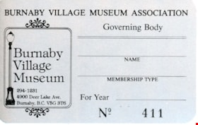
membership card
https://search.heritageburnaby.ca/link/museumartifact83550
- Repository
- Burnaby Village Museum
- Accession Code
- BV013.24.1
- Description
- Annual membership card for Burnaby Village Museum Association. this is card number 411 The card is silver on the face with black text and the BVM logo of a street lamp. The corners are rounded and the card is 8.5 cm wide X 5.5cm high. The early contact information is telephone, 294-1231 and address 4900 Deer Lake Ave., Burnaby, BC, V5G 3T6.
- Object History
- The Burnaby Village Museum Association was the volunteer group that developed from the Century Park Museum Association (CPMA) that operated the Heritage Village from 1971-1992.
- Marks/Labels
- "BURNABY VILLAGE MUSEUM ASSOCIATION / Governing Body / NAME / MEMBERSHIP TYPE / For Year / No 411" text in body of card. "Burnaby / Village / Museum / 294-1231 / 4900 Deer Lake Ave. / Buranby, B.C. V5G 3T6" contact information in the logo printed on the card.
- Names
- Burnaby Village Museum
- Historic Neighbourhood
- Burnaby Lake (Historic Neighbourhood)
Images


Municipality of Burnaby - Volume XVI and Volume XVII
https://search.heritageburnaby.ca/link/museumdescription8684
- Repository
- Burnaby Village Museum
- Date
- May 1927
- Collection/Fonds
- Burnaby Village Museum Map collection
- Description Level
- File
- Physical Description
- 4 plans on 4 sheets : col. lithographic prints ; 63.5 x 53.5 cm folded to 53 x 31.5 cm
- Scope and Content
- File consists of four pages of plans removed from a bound book containing a series of fire insurance plans of the Municipality of Burnaby. Page "D" is titled: "GREATER VANCOUVER B.C. / VOLUME XVI / Surveyed _ May 1927 / MUNICIPALITY OF / BURNABY / PLAN DEPT. FIRE BRANCH _ B.C. INSURANCE UNDERWRITE…
- Repository
- Burnaby Village Museum
- Collection/Fonds
- Burnaby Village Museum Map collection
- Description Level
- File
- Physical Description
- 4 plans on 4 sheets : col. lithographic prints ; 63.5 x 53.5 cm folded to 53 x 31.5 cm
- Material Details
- Scale [1:1200] and [1:6000]
- Scope and Content
- File consists of four pages of plans removed from a bound book containing a series of fire insurance plans of the Municipality of Burnaby. Page "D" is titled: "GREATER VANCOUVER B.C. / VOLUME XVI / Surveyed _ May 1927 / MUNICIPALITY OF / BURNABY / PLAN DEPT. FIRE BRANCH _ B.C. INSURANCE UNDERWRITERS ASSN." / KEY PLAN". Plans covered in this "Key Plan" are numbered 1601 to 1626, 1632 and 1651 covering District Lots: 15; 31; 100 to 102; 114; 141 to 144; 147 and 148; 209 to 214. Plan "E" is part of "GREATER VANCOUVER B.C. / VOLUME XVII / Municipality of Burnaby / May 1927" and covers plans: 1701 to 1705; 1711 to 1715; 1723 to 1727; 1729 to 1733; 1737 to 1742 and District Lots: 68 to 74; 80 to 84; 32 to 35 and 38 to 39. Plan marked "F" is a key plan titled: "GREATER VANCOUVER B.C. / VOLUME XVII / Surveyed _ May 1927 / MUNICIPALITY OF / BURNABY and covers plans: 1706 to 1710; 1716 to 1722; 1734 and 1735; 1743 to 1752 and District Lots: 42 to 44; 59; 75 to 80; 83 to 87; 89 to 93 and 130. Plan "1729" is part of "GREATER VANCOUVER B.C. / VOLUME XVII / Municipality of Burnaby / May 1927" and covers District Lots 34 and 35.
- Responsibility
- British Columbia Underwriters' Association
- Accession Code
- HV972.111.6
- Access Restriction
- No restrictions
- Reproduction Restriction
- May be restricted by third party rights
- Date
- May 1927
- Media Type
- Cartographic Material
- Historic Neighbourhood
- Barnet (Historic Neighbourhood)
- Burquitlam (Historic Neighbourhood)
- Central Park (Historic Neighbourhood)
- Burnaby Lake (Historic Neighbourhood)
- Broadview (Historic Neighbourhood)
- Planning Study Area
- Burnaby Mountain Area
- Lyndhurst Area
- Lake City Area
- Cascade-Schou Area
- Garden Village Area
- Douglas-Gilpin Area
- Oakalla Area
- Scan Resolution
- 400
- Scan Date
- 2021-11-18
- Notes
- Title based on content of plans
- See also BV987.1.70d for revised versions of plans
- Scale is measured 1 inch = 500 feet
Zoomable Images


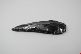
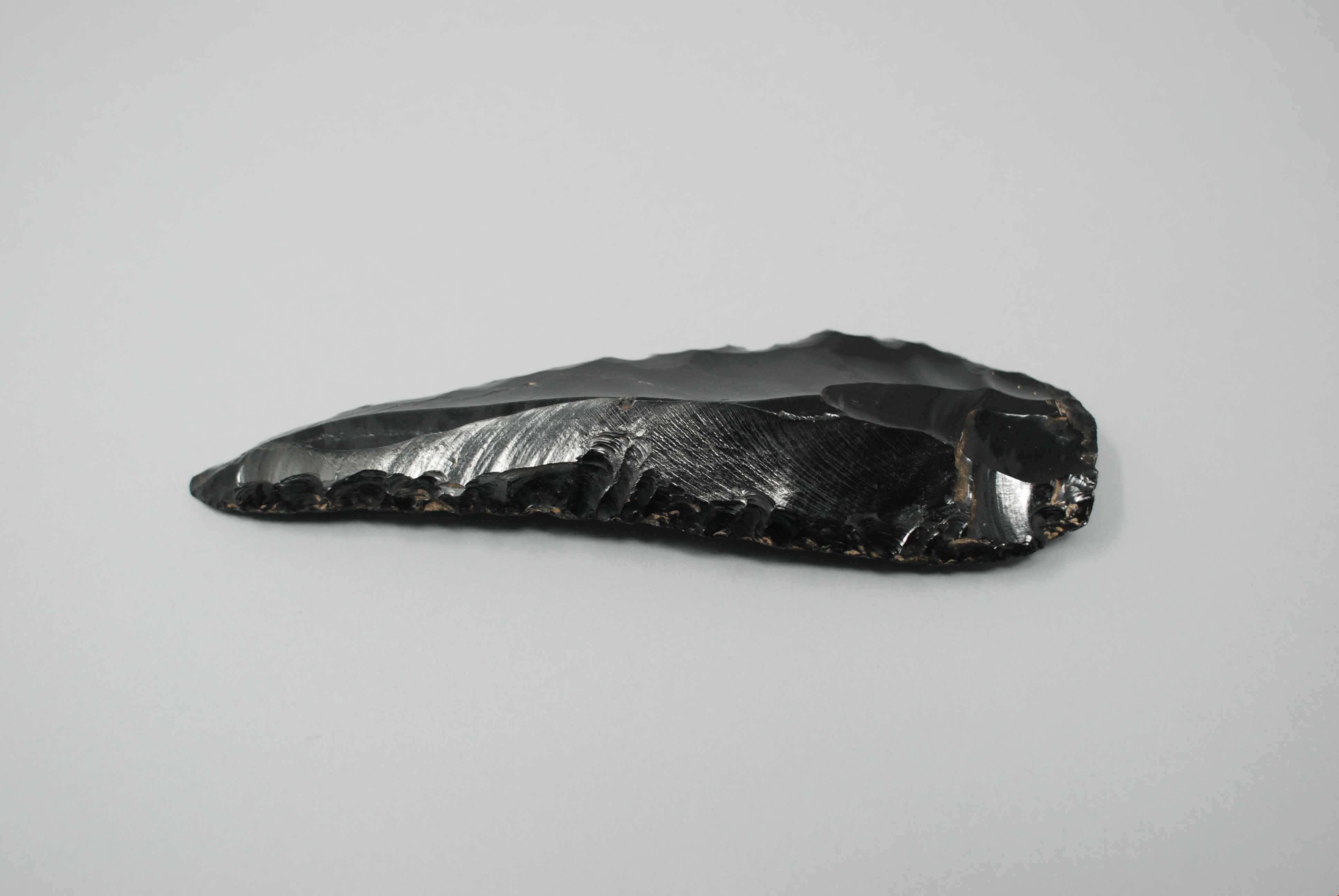
obsidian knife
https://search.heritageburnaby.ca/link/museumartifact44869
- Repository
- Burnaby Village Museum
- Accession Code
- BV002.57.20
- Description
- Butchering knife, obsidian; sharpened edges.
- Object History
- The donor inherited this artifact from his mother, Katherine Maude (Kitty) Peers, who inherited them from her father, Louis Claude Hill. The artifacts were found on his farm, Brookfield Farm, at Douglas Road and Sperling Avenue (now site of Burnaby Village Museum).
- Historic Neighbourhood
- Burnaby Lake (Historic Neighbourhood)
Images
Documents
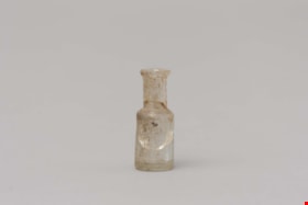
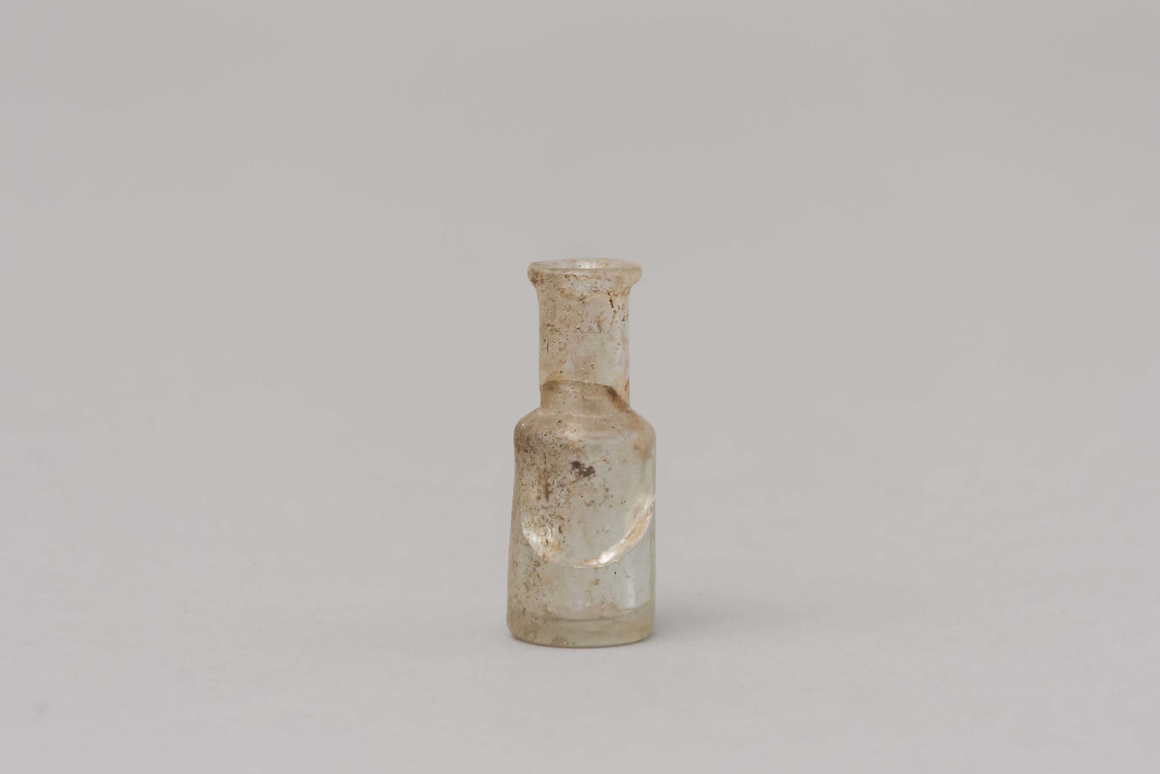
opium bottle
https://search.heritageburnaby.ca/link/museumartifact85450
- Repository
- Burnaby Village Museum
- Accession Code
- BV015.23.1
- Description
- Small shouldered bottle with a lip and it would have had a cork. The body of the bottle is cracked
- Object History
- These items were found under the Ceperley House Gardener's/Chauffeurs Cottage during repairs in the 1990's.
- Category
- 04.Tools & Equipment for Materials
- Classification
- Medical & Psychological T&E - - Medical Accessories
- Object Term
- Bottle, Medicine
- Measurements
- Measurements: diameter of bottle 1.9 cm, diameter of neck 1.1 cm. height 4.6 cm
- Historic Neighbourhood
- Burnaby Lake (Historic Neighbourhood)
- Planning Study Area
- Douglas-Gilpin Area
Images
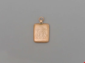
Pendant
https://search.heritageburnaby.ca/link/museumartifact90870
- Repository
- Burnaby Village Museum
- Accession Code
- BV020.40.22
- Description
- Gold (10K) rectangular pendant, with rounded edges. "BAE" is engraved in cursive on the front, standing for Blyth Alfred Eagles. On the back in cursive reads "From Grandma Tidy on occasion of matriculation 1918." A small hoop is at the top for threading through a neckalce or other chain.
- Object History
- Blythe Eagles's paternal grandparents, Charles and Maude Eagles, immigrated to New Westminster in 1887. Blythe and Violet Eagles purchased property at Deer Lake in 1929 and began construction of their home shortly before their marriage on June 25, 1930.Violet was an enthusiastic amateur gardener, maintaining and continually developing the garden. The Eagles were active volunteers in the local community as well as at UBC. When Simon Fraser University opened in Burnaby, they became well-known for entertaining dignitaries and special guests of the university in their lavish garden. After Violet's death in 1993, the estate was sold to the City of Burnaby.
- Category
- 03. Personal Artifacts
- Classification
- Adornment - - Body Adornments
- Object Term
- Pendant
- Colour
- Bronze
- Measurements
- 1" h x 3/4" w
- Subjects
- Ceremonial Artifacts
- Historic Neighbourhood
- Burnaby Lake (Historic Neighbourhood)
- Planning Study Area
- Douglas-Gilpin Area
Images


postal scale
https://search.heritageburnaby.ca/link/museumartifact15965
- Repository
- Burnaby Village Museum
- Accession Code
- HV983.61.3
- Description
- Postal scale, "IDEAL POSTAL SCALE"
- Object History
- Postal scale used by Harriet Woodward at the Burnaby Lake Post Office. The Burnaby Lake Post Office was run out of the Woodward cottage, owned by Harriet and Maude Woodward. The cottage was a prefabricated cottage erected in 1904. Harriet also began a small private school in the cottage, the first in Burnaby Lake. The cottage was enlarged with several additions until 1912 when the Woodwards built a new house.
- Classification
- Weights and Measurements Tools and Equipment - Scales
- Object Term
- Scale, Postal
- Geographic Access
- Sperling Avenue
- Street Address
- 5141 Sperling Avenue
- Historic Neighbourhood
- Burnaby Lake (Historic Neighbourhood)
- Planning Study Area
- Morley-Buckingham Area
Images
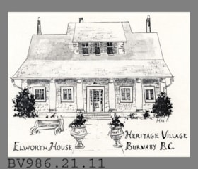
postcard
https://search.heritageburnaby.ca/link/museumartifact5636
- Repository
- Burnaby Village Museum
- Accession Code
- BV986.21.11
- Description
- Elworth House - Postcard - [197-?]. Advertising or souvenir card produced by Heritage Village Museum (Burnaby Village Museum) to promote Elworth House. The front of the card has an illustration by Max F of Elworth House. The back of the card gives a short description of Elworth House and its owner, Edwin Bateman.
- Classification
- Written Communication T&E - - Writing Media
- Object Term
- Postcard
- Geographic Access
- Deer Lake Avenue
- Street Address
- 6501 Deer Lake Avenue
- Historic Neighbourhood
- Burnaby Lake (Historic Neighbourhood)
- Planning Study Area
- Morley-Buckingham Area
Images


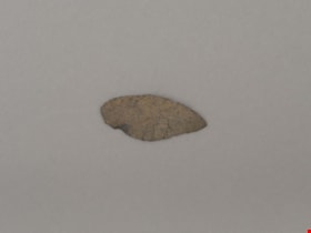
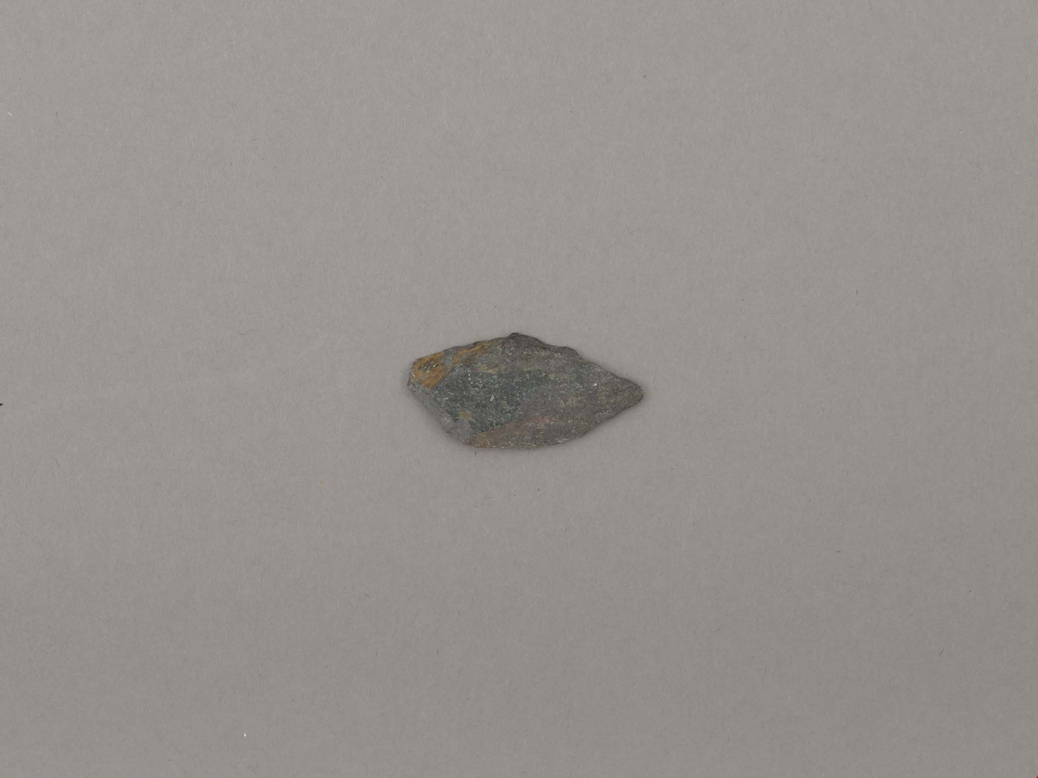
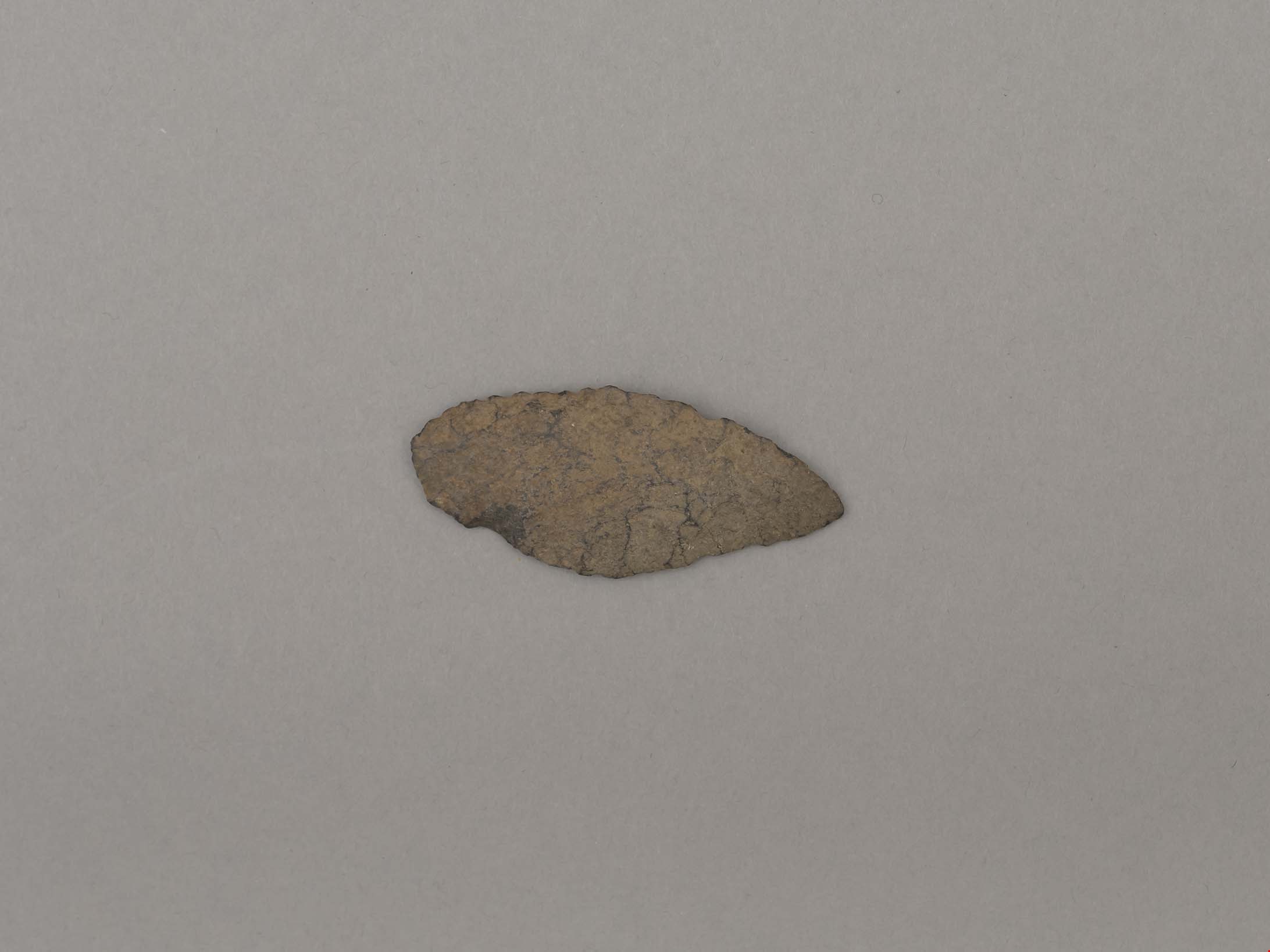
projectile point
https://search.heritageburnaby.ca/link/museumartifact19193
- Repository
- Burnaby Village Museum
- Accession Code
- BV002.57.6
- Description
- Projectile point, stone; rounded end. Bifacially flaked – stone removed on both sides of the point; basalt and lead shaped
- Object History
- The donor inherited this artifact from his mother, Katherine Maude (Kitty) Peers, who inherited them from her father, Louis Claude Hill. The artifacts were found on his farm, Brookfield Farm, at Douglas Road and Sperling Avenue (now site of Burnaby Village Museum).
- Culture Phase: Possibly Locarno Beach phase (3520 -2200 Before Present)
- Historic Neighbourhood
- Burnaby Lake (Historic Neighbourhood)
Images
Documents
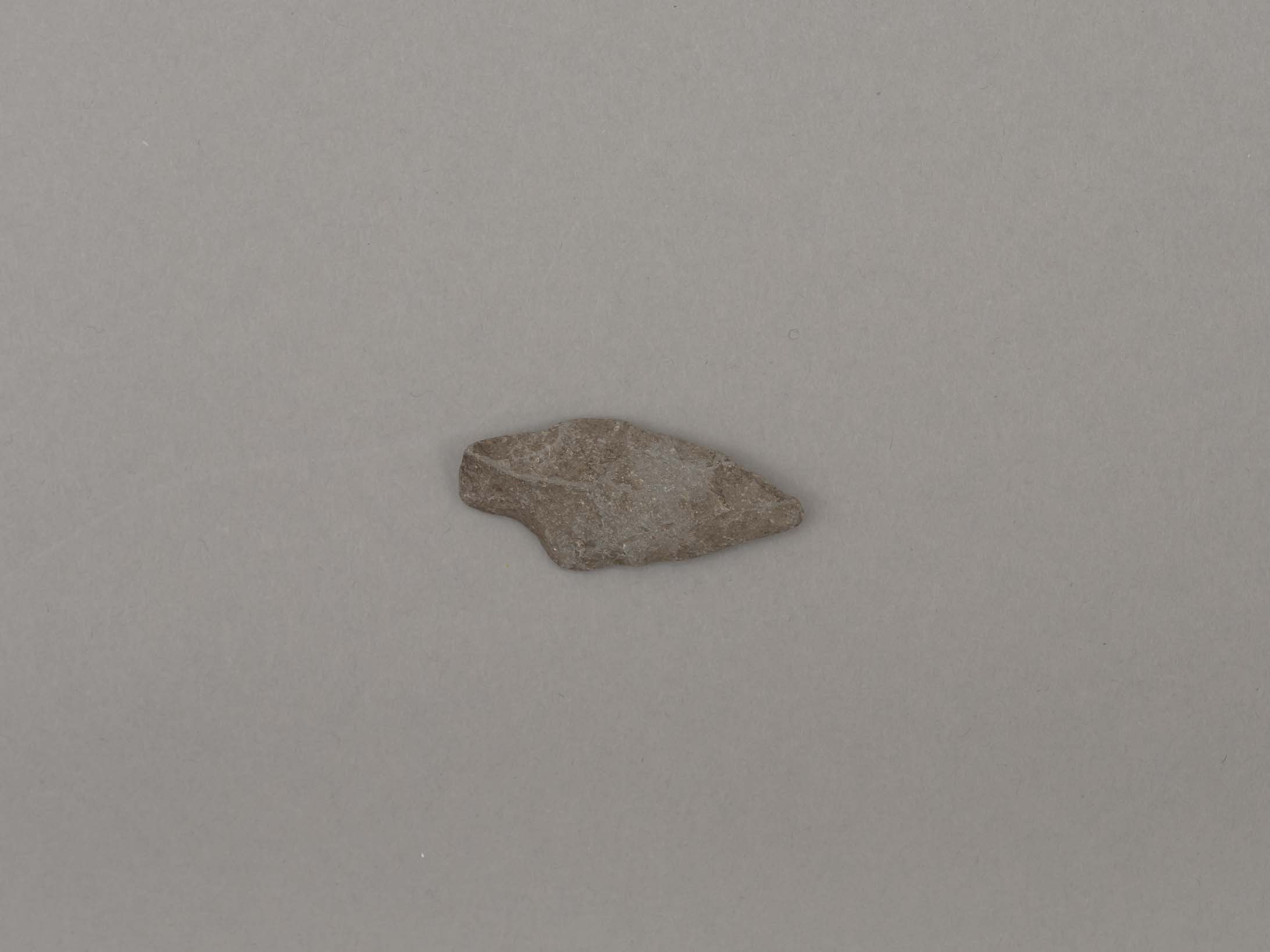
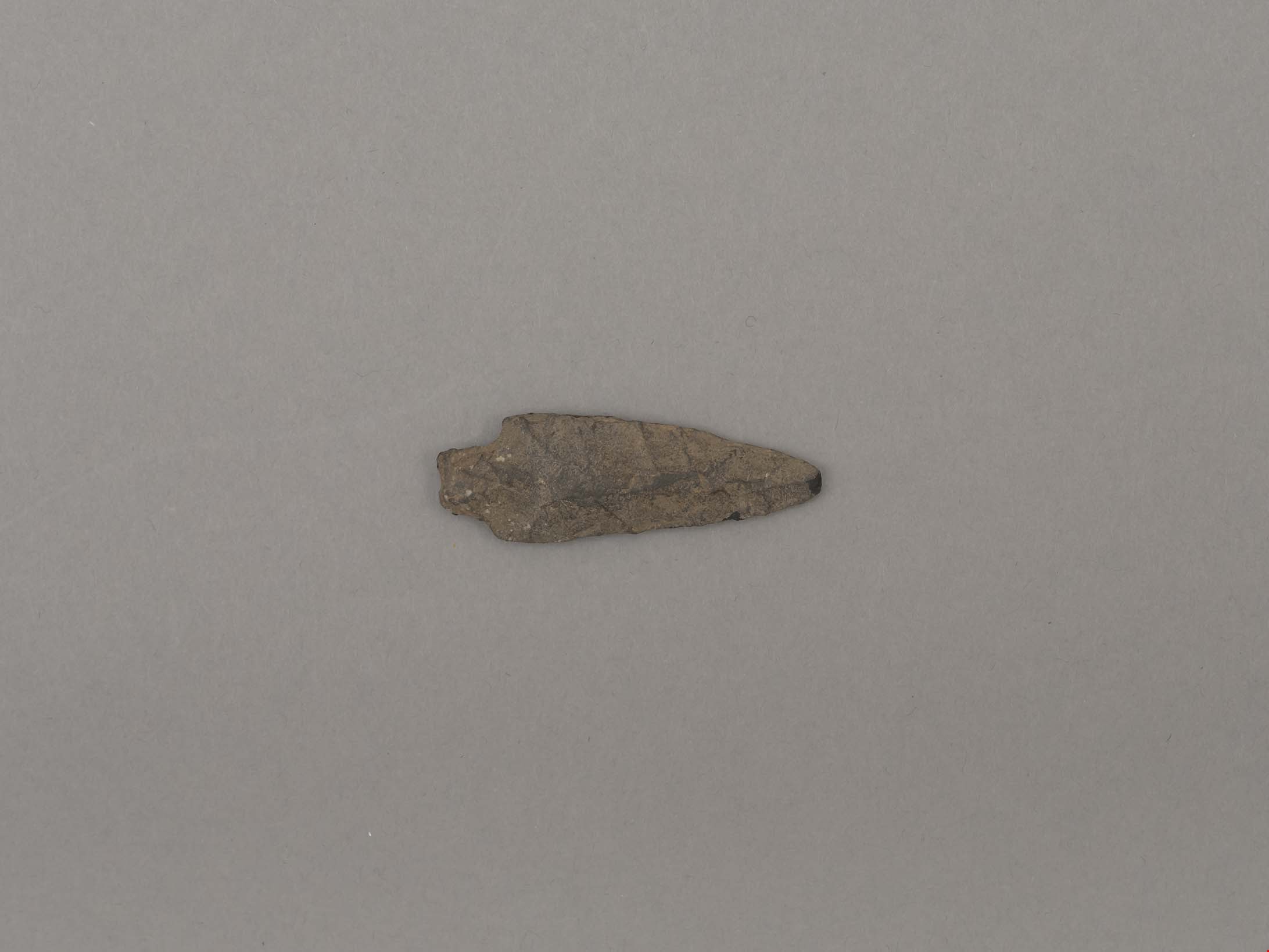
projectile point
https://search.heritageburnaby.ca/link/museumartifact19194
- Repository
- Burnaby Village Museum
- Accession Code
- BV002.57.7
- Description
- Projectile point, stone; indented on one side. Triangular stemmed projectile point
- Object History
- The donor inherited this artifact from his mother, Katherine Maude (Kitty) Peers, who inherited them from her father, Louis Claude Hill. The artifacts were found on his farm, Brookfield Farm, at Douglas Road and Sperling Avenue (now site of Burnaby Village Museum).
- Culture Phase: Possibly Locarno Beach phase (3520 -2200 Before Present)
- Geographic Access
- Deer Lake Avenue
- Historic Neighbourhood
- Burnaby Lake (Historic Neighbourhood)
- Planning Study Area
- Burnaby Lake Area
Images
Documents
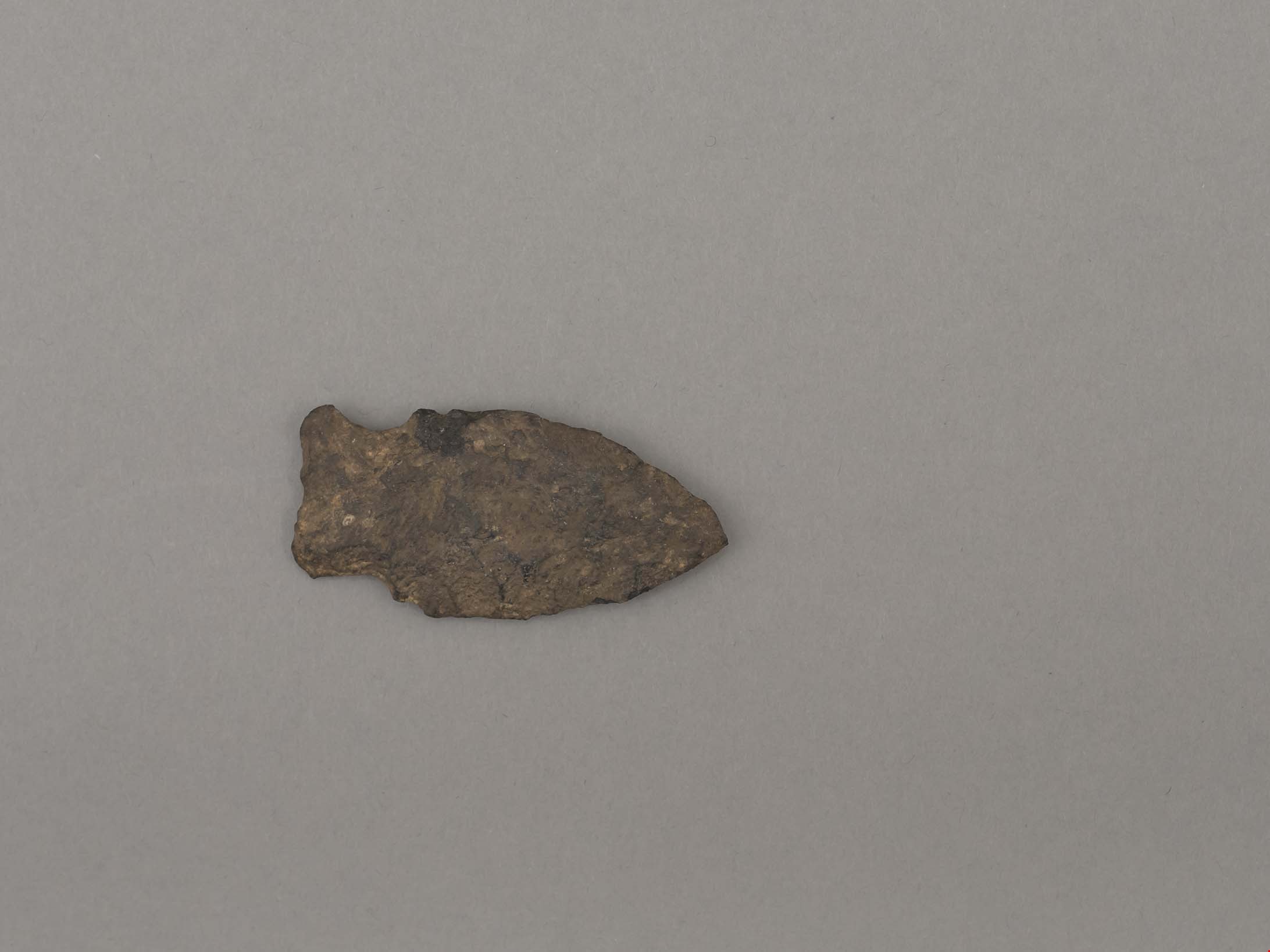
projectile point
https://search.heritageburnaby.ca/link/museumartifact19195
- Repository
- Burnaby Village Museum
- Accession Code
- BV002.57.8
- Description
- Projectile point, stone. Lancelot, parallel stemmed – stem has straight sides (squared off appearance).
- Object History
- The donor inherited this artifact from his mother, Katherine Maude (Kitty) Peers, who inherited them from her father, Louis Claude Hill. The artifacts were found on his farm, Brookfield Farm, at Douglas Road and Sperling Avenue (now site of Burnaby Village Museum).
- Longer points like this were used on spears; sometimes in combination with a tool called an atl atl (spear thrower).
- Culture Phase: Possibly Locarno Beach phase (3520 -2200 Before Present)
- Historic Neighbourhood
- Burnaby Lake (Historic Neighbourhood)
Images
Documents

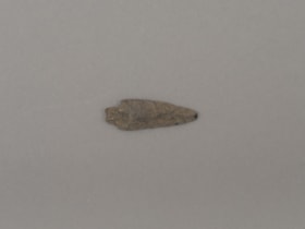
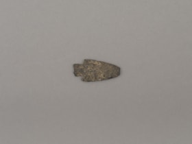
projectile point
https://search.heritageburnaby.ca/link/museumartifact44857
- Repository
- Burnaby Village Museum
- Accession Code
- BV002.57.5
- Description
- Projectile point, stone; both sides slightly indented towards end. Side notched with expanding stem Notches are wear hafting to an arrow or spear shaft would occur.
- Object History
- The donor inherited this artifact from his mother, Katherine Maude (Kitty) Peers, who inherited them from her father, Louis Claude Hill. The artifacts were found on his farm, Brookfield Farm, at Douglas Road and Sperling Avenue (now site of Burnaby Village Museum).
- Culture Phase: Marpole. Marpole Culture type dates from 400BC - 400AD
- Historic Neighbourhood
- Burnaby Lake (Historic Neighbourhood)
Images
Documents
projectile point
https://search.heritageburnaby.ca/link/museumartifact44858
- Repository
- Burnaby Village Museum
- Accession Code
- BV002.57.9
- Description
- Corner notched, stemmed projectile point
- Object History
- The donor inherited this artifact from his mother, Katherine Maude (Kitty) Peers, who inherited them from her father, Louis Claude Hill. The artifacts were found on his farm, Brookfield Farm, at Douglas Road and Sperling Avenue (now site of Burnaby Village Museum).
- Culture Phase: Marpole. Marpole Culture type dates from 400BC - 400AD
- Historic Neighbourhood
- Burnaby Lake (Historic Neighbourhood)
Images

Documents
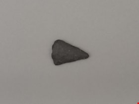
projectile point
https://search.heritageburnaby.ca/link/museumartifact44859
- Repository
- Burnaby Village Museum
- Accession Code
- BV002.57.10
- Description
- Triangular shaped tip of projectile point; flaked not ground
- Object History
- The donor inherited this artifact from his mother, Katherine Maude (Kitty) Peers, who inherited them from her father, Louis Claude Hill. The artifacts were found on his farm, Brookfield Farm, at Douglas Road and Sperling Avenue (now site of Burnaby Village Museum).
- Culture Phase: Marpole. Marpole Culture type dates from 400BC - 400AD
- Historic Neighbourhood
- Burnaby Lake (Historic Neighbourhood)
Images
Documents
projectile point
https://search.heritageburnaby.ca/link/museumartifact44860
- Repository
- Burnaby Village Museum
- Accession Code
- BV002.57.11
- Description
- Projectile point, stone; one rounded end. Leaf shaped, bifacially worked points, appear in both Locarno Beach and Marpole assemblages.
- Object History
- The donor inherited this artifact from his mother, Katherine Maude (Kitty) Peers, who inherited them from her father, Louis Claude Hill. The artifacts were found on his farm, Brookfield Farm, at Douglas Road and Sperling Avenue (now site of Burnaby Village Museum).
- Culture Phase: Possibly Locarno Beach phase (3520 -2200 Before Present)
- Historic Neighbourhood
- Burnaby Lake (Historic Neighbourhood)
Images
Documents
projectile point
https://search.heritageburnaby.ca/link/museumartifact44861
- Repository
- Burnaby Village Museum
- Accession Code
- BV002.57.12
- Description
- Debitage? (Waste material from flint knapping)
- Object History
- The donor inherited this artifact from his mother, Katherine Maude (Kitty) Peers, who inherited them from her father, Louis Claude Hill. The artifacts were found on his farm, Brookfield Farm, at Douglas Road and Sperling Avenue (now site of Burnaby Village Museum).
- Historic Neighbourhood
- Burnaby Lake (Historic Neighbourhood)
Images