Narrow Results By

Drs. Blythe and Violet Eagles Estate
https://search.heritageburnaby.ca/link/landmark535
- Repository
- Burnaby Heritage Planning
- Description
- The Drs. Blythe and Violet Eagles Estate is a one hectare property located within Deer Lake Park in Burnaby. The property encompasses a carefully conceived garden of local, non-conventional, and exotic plantings. Conceived as a series of rockeries and terraces, the garden cascades from the house do…
- Associated Dates
- 1929
- Formal Recognition
- Heritage Designation, Community Heritage Register
- Other Names
- Eagles Estate Heritage Garden
- Street View URL
- Google Maps Street View
- Repository
- Burnaby Heritage Planning
- Other Names
- Eagles Estate Heritage Garden
- Geographic Access
- Sperling Avenue
- Associated Dates
- 1929
- Formal Recognition
- Heritage Designation, Community Heritage Register
- Enactment Type
- Bylaw No. 11592
- Enactment Date
- 15/09/2003
- Description
- The Drs. Blythe and Violet Eagles Estate is a one hectare property located within Deer Lake Park in Burnaby. The property encompasses a carefully conceived garden of local, non-conventional, and exotic plantings. Conceived as a series of rockeries and terraces, the garden cascades from the house down towards the waterfront, divided by paths and strips of plantings.
- Heritage Value
- The Eagles Estate is significant because of its unique character within Burnaby’s Deer Lake Park heritage precinct, and the people who were its creators and residents. The garden is a unique expression of the talents and tastes of both the Eagles and Frank Ebenezer Buck (1875-1970). Buck served as the Assistant Dominion Horticulturist in charge of landscape horticulture and floriculture in Ottawa from 1912. In 1920, he was head of the Horticultural Department and the Campus Landscape Architect at the University of British Columbia. He established the plan for the Eagles garden while Dr. Blythe Alfred Eagles (1902-1990), the long-time Dean of the Faculty of Agriculture at UBC, selected many of the plantings. The Eagles themselves designed the house as a romantic cottage inspired by the British Arts and Crafts style. Trained in enzyme chemistry, Dr. Violet Evelyn (Dunbar) Eagles (1899-1994) was an enthusiastic amateur gardener, and was perhaps the driving force behind the maintenance and continued development of the garden. The Eagles were also well known in Burnaby for their active volunteerism in the local community as well as at UBC. When Simon Fraser University opened in Burnaby as the Greater Vancouver’s second university, the Eagles, in particular Violet, became well-known for entertaining dignitaries and special guests of the university in their lavish garden. Drs. Blythe and Violet Eagles were recognized for their good citizenship and the ongoing use of their garden for charitable Burnaby-based functions and celebrations.
- Defining Elements
- Due to the extensive and varied nature of the garden, the character-defining elements of the Eagles Estate are many and complex. The elements that encompass the character of the site include its: - British Arts and Crafts-inspired house with original exterior features such as a picturesque roofline, stucco cladding and six- and eight-paned steel-frame casement windows, and original interior features such as the central fireplace, wood floors and kitchen cabinetry - formal staircase leading to the north (formal entry) side of the house - carefully planned yet informal garden design, with 'garden rooms' used to create intimacy - terraced landscape cascading from the house down to the garden - incorporation of local, exotic, flowering and non-flowering plants. - contrast of manicured versus freely growing landscape elements - use of wood lattice fencing gates, arbors and trellis
- Historic Neighbourhood
- Burnaby Lake (Historic Neighbourhood)
- Planning Study Area
- Morley-Buckingham Area
- Community
- Burnaby
- Cadastral Identifier
- P.I.D. No. 007-302-801 Legal Description: Lot 143, District Lot 85, Group 1, New Westminster District, Plan 36335
- Boundaries
- The Eagles Estate is comprised of a single municipally-owned property located at 5655 Sperling Avenue, Burnaby.
- Area
- 6,403.91
- Contributing Resource
- Building
- Landscape Feature
- Documentation
- Heritage Site Files: PC77000 20. City of Burnaby Planning and Building Department, 4949 Canada Way, Burnaby, B.C., V5G 1M2
- Street Address
- 5655 Sperling Avenue
- Street View URL
- Google Maps Street View
Images


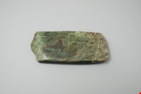
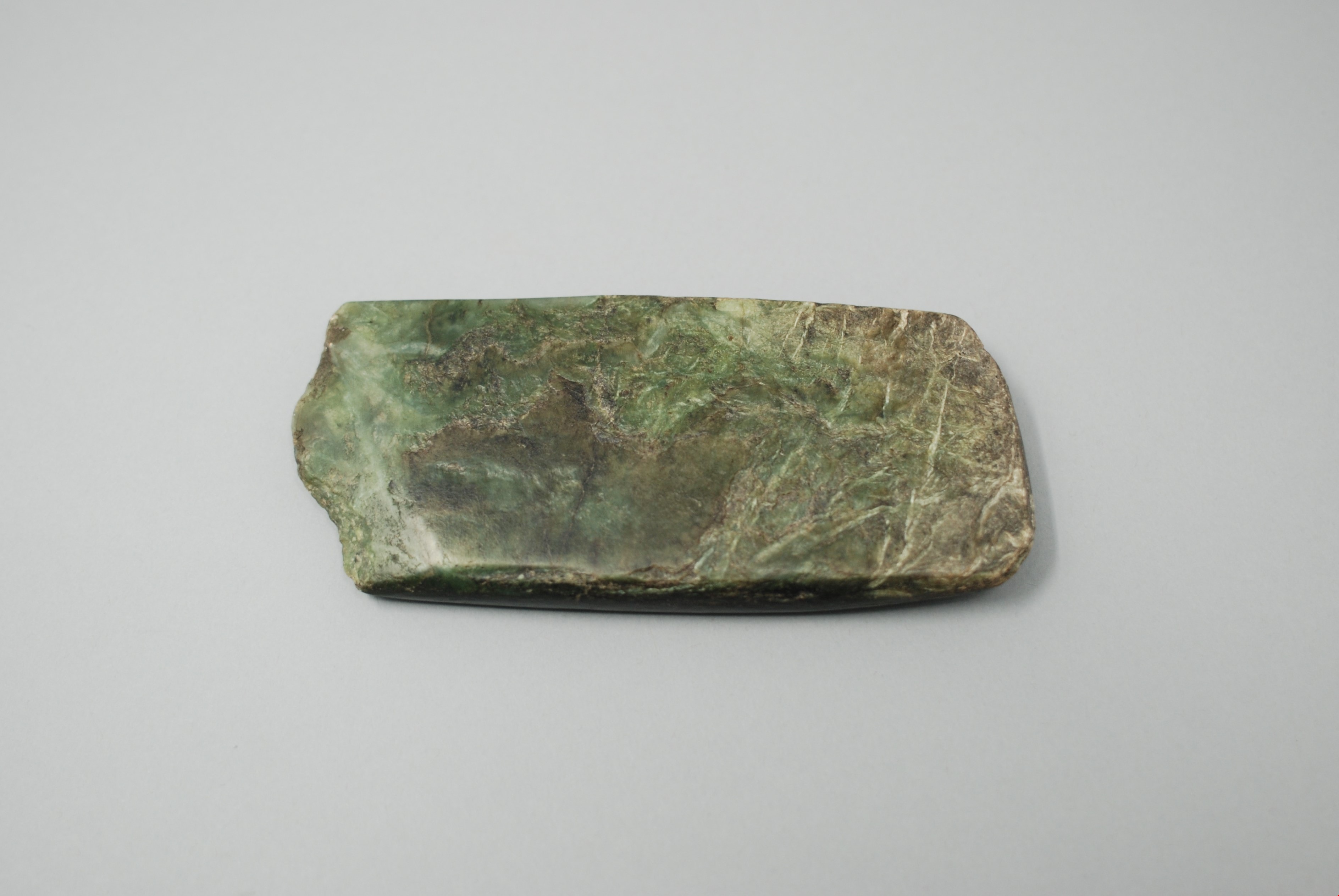
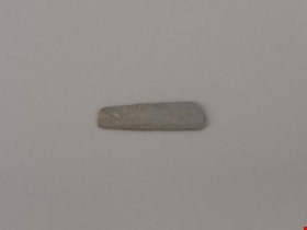
adze blade
https://search.heritageburnaby.ca/link/museumartifact44868
- Repository
- Burnaby Village Museum
- Accession Code
- BV002.57.19
- Description
- Nephrite adze blade; chipped on one end; rectangular shaped.
- Object History
- The donor inherited this artifact from his mother, Katherine Maude (Kitty) Peers, who inherited them from her father, Louis Claude Hill. The artifacts were found on his farm, Brookfield Farm, at Douglas Road and Sperling Avenue (now site of Burnaby Village Museum).
- Nephrite is found in the Fraser Canyon
- Culture Phase: Possibly Locarno Beach phase (3520-2200 Before Present) or Marpole (400BC - 400AD)
- Historic Neighbourhood
- Burnaby Lake (Historic Neighbourhood)
Images
Documents
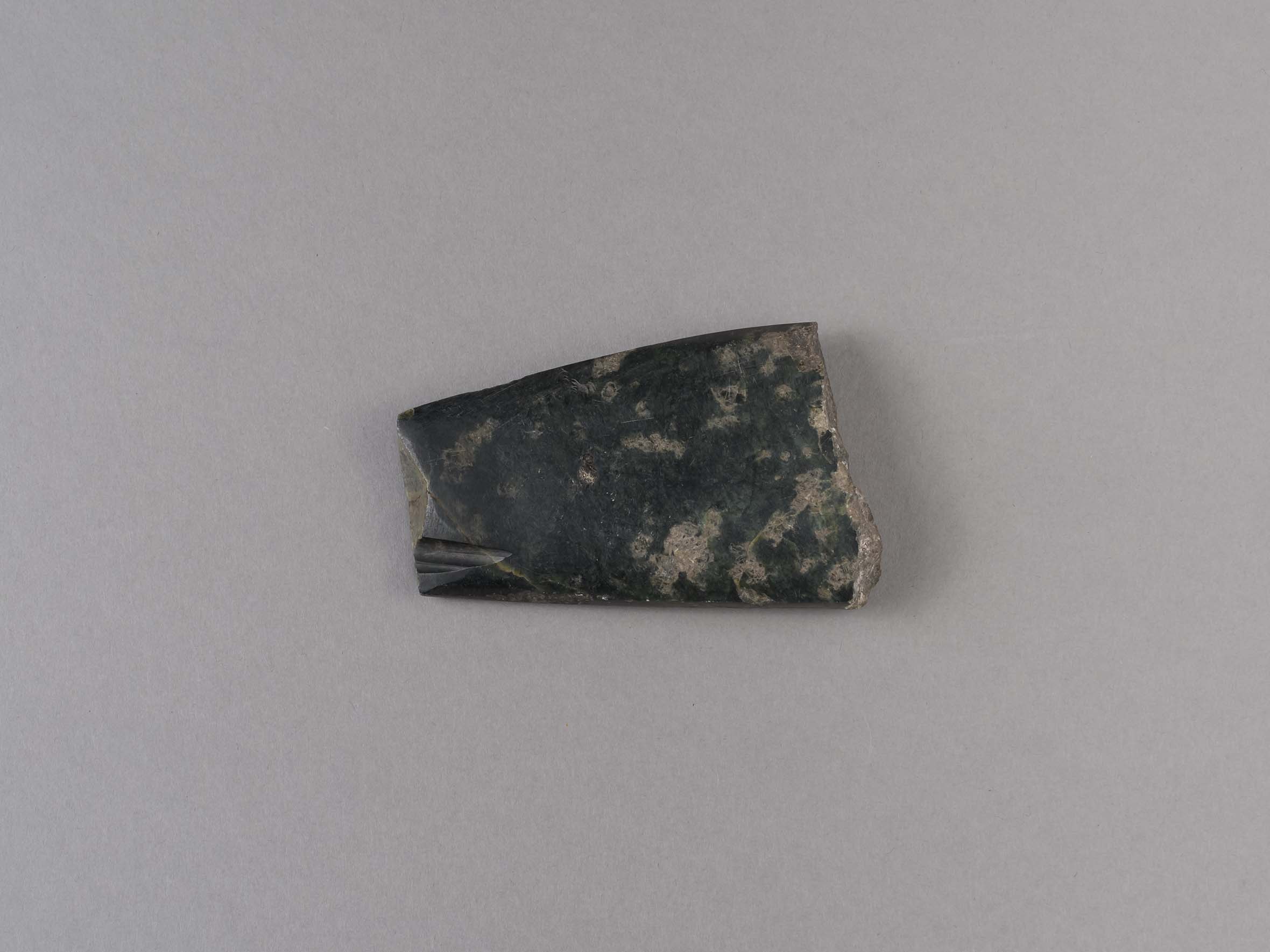
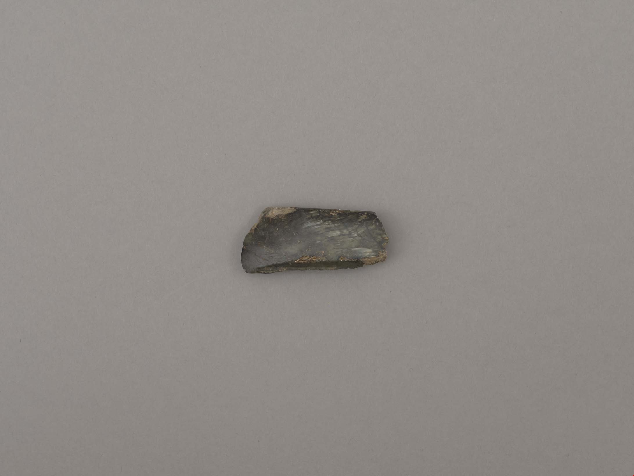
adze blade
https://search.heritageburnaby.ca/link/museumartifact44870
- Repository
- Burnaby Village Museum
- Accession Code
- BV002.57.21
- Description
- Chisel, adze or axe blade made of serpentine; black; ends broken off; tapered rectangle shape.
- Object History
- The donor inherited this artifact from his mother, Katherine Maude (Kitty) Peers, who inherited them from her father, Louis Claude Hill. The artifacts were found on his farm, Brookfield Farm, at Douglas Road and Sperling Avenue (now site of Burnaby Village Museum).
- Culture Phase: Locarno Beach (3520-2200 Before Present) or Marpole (400BC - 400AD)
- Historic Neighbourhood
- Burnaby Lake (Historic Neighbourhood)
Images
Documents
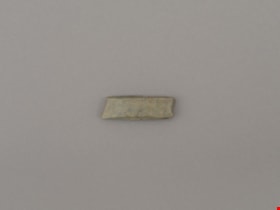
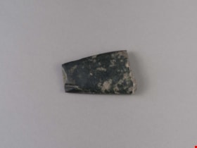
adze blade
https://search.heritageburnaby.ca/link/museumartifact44872
- Repository
- Burnaby Village Museum
- Accession Code
- BV002.57.23
- Description
- Chisel, adze or axe blade made of serpentine; small
- Object History
- The donor inherited this artifact from his mother, Katherine Maude (Kitty) Peers, who inherited them from her father, Louis Claude Hill. The artifacts were found on his farm, Brookfield Farm, at Douglas Road and Sperling Avenue (now site of Burnaby Village Museum).
- Culture Phase: Locarno Beach (3520-2200 Before Present) or Marpole (400BC - 400AD)
- Historic Neighbourhood
- Burnaby Lake (Historic Neighbourhood)
Images

Documents
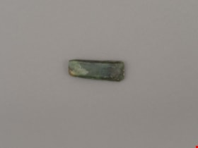
adze blade
https://search.heritageburnaby.ca/link/museumartifact44873
- Repository
- Burnaby Village Museum
- Accession Code
- BV002.57.24
- Description
- Nephrite adze blade; small
- Object History
- The donor inherited this artifact from his mother, Katherine Maude (Kitty) Peers, who inherited them from her father, Louis Claude Hill. The artifacts were found on his farm, Brookfield Farm, at Douglas Road and Sperling Avenue (now site of Burnaby Village Museum).
- Nephrite is found in the Fraser Canyon
- Culture Phase: Locarno Beach (3520-2200 Before Present) or Marpole (400BC - 400AD)
- Historic Neighbourhood
- Burnaby Lake (Historic Neighbourhood)
Images

Documents
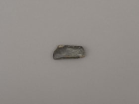
adze blade
https://search.heritageburnaby.ca/link/museumartifact44874
- Repository
- Burnaby Village Museum
- Accession Code
- BV002.57.25
- Description
- Adze blade; small; possibly nephrite.
- Object History
- The donor inherited this artifact from his mother, Katherine Maude (Kitty) Peers, who inherited them from her father, Louis Claude Hill. The artifacts were found on his farm, Brookfield Farm, at Douglas Road and Sperling Avenue (now site of Burnaby Village Museum).
- Nephrite is found in the Fraser Canyon
- Culture Phase: Locarno Beach (3520-2200 Before Present) or Marpole (400BC - 400AD)
- Historic Neighbourhood
- Burnaby Lake (Historic Neighbourhood)
Images
Documents

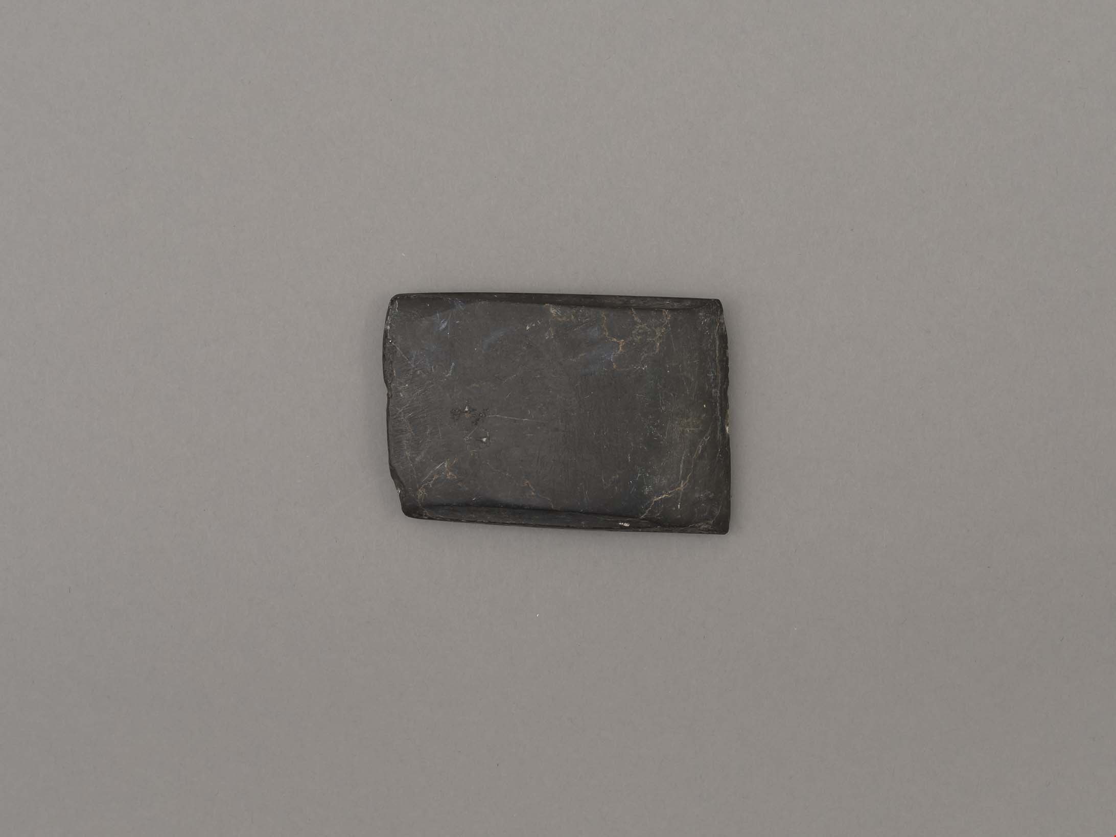
adze blade
https://search.heritageburnaby.ca/link/museumartifact44876
- Repository
- Burnaby Village Museum
- Accession Code
- BV002.57.27
- Description
- Nephrite adze blade; rectangular; chipped on one side; slightly grooved on longer edges.
- Object History
- The donor inherited this artifact from his mother, Katherine Maude (Kitty) Peers, who inherited them from her father, Louis Claude Hill. The artifacts were found on his farm, Brookfield Farm, at Douglas Road and Sperling Avenue (now site of Burnaby Village Museum).
- Nephrite is found in the Fraser Canyon
- Marpole Culture (400BC - 400AD) or Gulf of Georgia Culture (400 AD – 1800); essentially these archaeological materials date to the last 2400 years.
- Historic Neighbourhood
- Burnaby Lake (Historic Neighbourhood)
Images
Documents
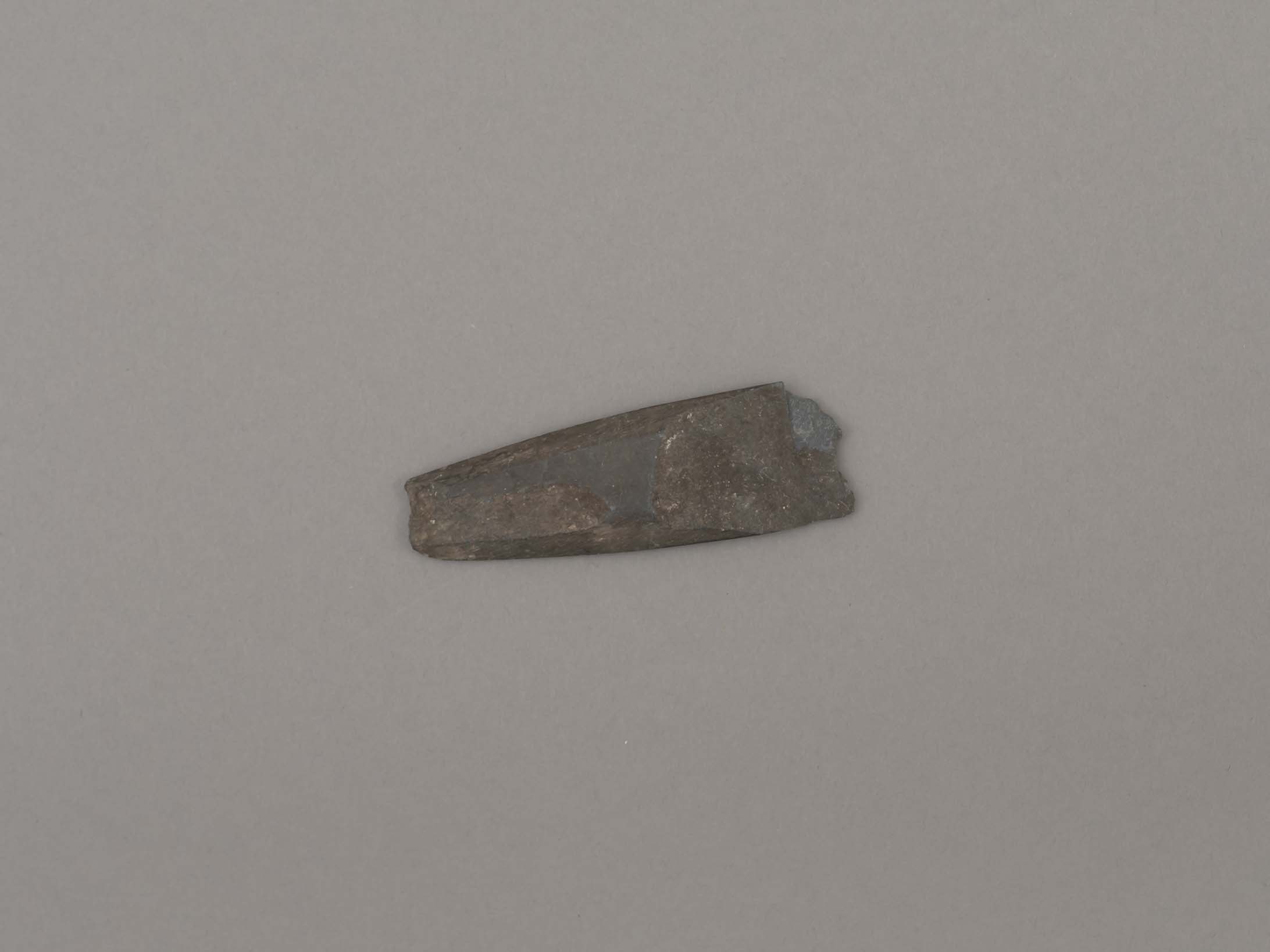
blade or projectile
https://search.heritageburnaby.ca/link/museumartifact44879
- Repository
- Burnaby Village Museum
- Accession Code
- BV002.57.30
- Description
- Ground slate point
- Object History
- The donor inherited this artifact from his mother, Katherine Maude (Kitty) Peers, who inherited them from her father, Louis Claude Hill. The artifacts were found on his farm, Brookfield Farm, at Douglas Road and Sperling Avenue (now site of Burnaby Village Museum).
- Culture Phase: Locarno Beach phase (3520-2200 Before Present)
- Historic Neighbourhood
- Burnaby Lake (Historic Neighbourhood)
Images
Documents
blade or projectile point
https://search.heritageburnaby.ca/link/museumartifact44878
- Repository
- Burnaby Village Museum
- Accession Code
- BV002.57.29
- Description
- Ground and faceted stone point
- Object History
- The donor inherited this artifact from his mother, Katherine Maude (Kitty) Peers, who inherited them from her father, Louis Claude Hill. The artifacts were found on his farm, Brookfield Farm, at Douglas Road and Sperling Avenue (now site of Burnaby Village Museum).
- Culture Phase: Locarno Beach phase (3520-2200 Before Present)
- Historic Neighbourhood
- Burnaby Lake (Historic Neighbourhood)
Images

Documents
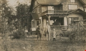
![Brookfield, [1900] thumbnail](/media/hpo/_Data/_BVM_Images/1976/1976_0139_0005_001.jpg?width=280)
Brookfield
https://search.heritageburnaby.ca/link/museumdescription754
- Repository
- Burnaby Village Museum
- Date
- [1900]
- Collection/Fonds
- Burnaby Village Museum Photograph collection
- Description Level
- Item
- Physical Description
- 1 photograph : b&w ; 9.9 x 14.0 cm mounted on cardboard 17.8 x 23.0 cm
- Scope and Content
- Photograph of "Brookfield", the first home of Mr. and Mrs. Louis Claude Hill. The Hills, including the daughter Kitty Hill, are on the lawn on the lower right corner. The man sitting on the steps is identified by the inscription on the photograph card mount as Mr. Wetenhall. Annotations on the back…
- Repository
- Burnaby Village Museum
- Collection/Fonds
- Burnaby Village Museum Photograph collection
- Description Level
- Item
- Physical Description
- 1 photograph : b&w ; 9.9 x 14.0 cm mounted on cardboard 17.8 x 23.0 cm
- Scope and Content
- Photograph of "Brookfield", the first home of Mr. and Mrs. Louis Claude Hill. The Hills, including the daughter Kitty Hill, are on the lawn on the lower right corner. The man sitting on the steps is identified by the inscription on the photograph card mount as Mr. Wetenhall. Annotations on the back of the card read: "'Brookfield' / Burnaby Lake" and "L.C. Hill & Kitty M. Hill, Mr. Wetenhall." Another annotation reads: "App. 1900."
- Subjects
- Buildings - Residential - Houses
- Geographic Access
- Deer Lake Avenue
- Street Address
- 6501 Deer Lake Avenue
- Accession Code
- HV976.139.5
- Access Restriction
- No restrictions
- Reproduction Restriction
- No known restrictions
- Date
- [1900]
- Media Type
- Photograph
- Historic Neighbourhood
- Burnaby Lake (Historic Neighbourhood)
- Planning Study Area
- Morley-Buckingham Area
- Related Material
- For another view of Brookfield home, see HV976.139.53
- Scan Resolution
- 600
- Scan Date
- 2023-06-27
- Notes
- Title based on contents of photograph
Images
![Brookfield, [1900] thumbnail](/media/hpo/_Data/_BVM_Images/1976/1976_0139_0005_001.jpg)

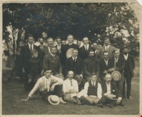
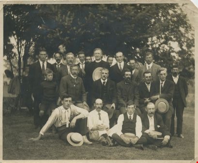
Burnaby Lake residents
https://search.heritageburnaby.ca/link/archivedescription34058
- Repository
- City of Burnaby Archives
- Date
- 1912
- Collection/Fonds
- Burnaby Historical Society fonds
- Description Level
- Item
- Physical Description
- 1 photograph : b&w ; 9.5 x 11.6 cm
- Scope and Content
- Photograph of a group of male Burnaby Lake residents posed outside near Deer Lake Drive. Identified, standing: B.R. Hill (3rd from left), Rev. D. Dunlop (6th from left), Harry Ramsay (8th from left), Louis "Edgar" Sprott (9th from left), and George Every-Clayton (10th from left). Sitting on bench…
- Repository
- City of Burnaby Archives
- Date
- 1912
- Collection/Fonds
- Burnaby Historical Society fonds
- Subseries
- Photographs subseries
- Physical Description
- 1 photograph : b&w ; 9.5 x 11.6 cm
- Description Level
- Item
- Record No.
- 003-001
- Access Restriction
- No restrictions
- Reproduction Restriction
- No known restrictions
- Accession Number
- BHS2007-04
- Scope and Content
- Photograph of a group of male Burnaby Lake residents posed outside near Deer Lake Drive. Identified, standing: B.R. Hill (3rd from left), Rev. D. Dunlop (6th from left), Harry Ramsay (8th from left), Louis "Edgar" Sprott (9th from left), and George Every-Clayton (10th from left). Sitting on bench: [first name unknown] Clayton (1st from left), Robert Pontifex (2nd from left), Mr. Clay (4th from left), and Frank Hill (6th from left). Sitting on ground: Claude Hill (1st from left) and Percy Boyer Brown (2nd from left).
- Names
- Brown, Percy Boyer
- Every-Clayton, George
- Dunlop, Rev. D.
- Hill, Bernard R.
- Hill, Frank
- Brown, Alex
- Hill, Louis Claude "Claude"
- Pontifex, Robert
- Ramsay, Harry
- Sprott, Louis "Edgar"
- Media Type
- Photograph
- Notes
- Title based on contents of photograph
- Identification key accompanying in the envelope for photo 003-001 (labeled BHS 3.1)
- Geographic Access
- Deer Lake
- Deer Lake Avenue
- Historic Neighbourhood
- Vancouver Heights (Historic Neighbourhood)
- Burnaby Lake (Historic Neighbourhood)
- Planning Study Area
- Douglas-Gilpin Area
Images

Camp at Oakalla Site
https://search.heritageburnaby.ca/link/archivedescription39575
- Repository
- City of Burnaby Archives
- Date
- 1910
- Collection/Fonds
- Peers Family and Hill Family fonds
- Description Level
- Item
- Physical Description
- 1 photograph : b&w ; 7.7 x 10.4 cm on page 21.5 x 28 cm (pasted in album)
- Scope and Content
- Photograph of the land clearing operation at the Oakalla Prison site in the Deer Lake area. Claude Hill is in the centre between two unidentified men. A line of clothes is hanging in the background.
- Repository
- City of Burnaby Archives
- Date
- 1910
- Collection/Fonds
- Peers Family and Hill Family fonds
- Physical Description
- 1 photograph : b&w ; 7.7 x 10.4 cm on page 21.5 x 28 cm (pasted in album)
- Description Level
- Item
- Record No.
- 477-894
- Access Restriction
- No restrictions
- Reproduction Restriction
- No known restrictions
- Accession Number
- 2007-12
- Scope and Content
- Photograph of the land clearing operation at the Oakalla Prison site in the Deer Lake area. Claude Hill is in the centre between two unidentified men. A line of clothes is hanging in the background.
- Subjects
- Land Clearing
- Media Type
- Photograph
- Notes
- Title based on contents of photograph
- Geographic Access
- Oakmount Crescent
- Street Address
- 5220 Oakmount Crescent
- Historic Neighbourhood
- Burnaby Lake (Historic Neighbourhood)
- Planning Study Area
- Oakalla Area
Images

![Claude and Kitty, [between 1892 and 1914] thumbnail](/media/hpo/_Data/_Archives_Images/_Unrestricted/477/477-897.jpg?width=280)
Claude and Kitty
https://search.heritageburnaby.ca/link/archivedescription39578
- Repository
- City of Burnaby Archives
- Date
- [between 1892 and 1914]
- Collection/Fonds
- Peers Family and Hill Family fonds
- Description Level
- Item
- Physical Description
- 1 photograph : sepia ; 5.5 x 8 cm on page 21.5 x 28 cm (pasted in album)
- Scope and Content
- Photograph of a man in a hat and a young child riding in a horse-drawn carriage; possibly Mr. L.C. Hill and Kitty Hill being pulled by Kitty's horse Tom.
- Repository
- City of Burnaby Archives
- Date
- [between 1892 and 1914]
- Collection/Fonds
- Peers Family and Hill Family fonds
- Physical Description
- 1 photograph : sepia ; 5.5 x 8 cm on page 21.5 x 28 cm (pasted in album)
- Description Level
- Item
- Record No.
- 477-897
- Access Restriction
- No restrictions
- Reproduction Restriction
- No known restrictions
- Accession Number
- 2007-12
- Scope and Content
- Photograph of a man in a hat and a young child riding in a horse-drawn carriage; possibly Mr. L.C. Hill and Kitty Hill being pulled by Kitty's horse Tom.
- Media Type
- Photograph
- Notes
- Title based on contents of photograph
- Geographic Access
- Deer Lake Avenue
- Street Address
- 6501 Deer Lake Avenue
- Historic Neighbourhood
- Burnaby Lake (Historic Neighbourhood)
- Planning Study Area
- Morley-Buckingham Area
Images
![Claude and Kitty, [between 1892 and 1914] thumbnail](/media/hpo/_Data/_Archives_Images/_Unrestricted/477/477-897.jpg)

Claude and Kitty on a footbridge
https://search.heritageburnaby.ca/link/archivedescription39558
- Repository
- City of Burnaby Archives
- Date
- 1910
- Collection/Fonds
- Peers Family and Hill Family fonds
- Description Level
- Item
- Physical Description
- 1 photograph : b&w ; 7.5 x 10 cm on page 21.5 x 28 cm (pasted in album)
- Scope and Content
- Photograph of Claude Hill with his daughter Kitty standing on a foot bridge over a small creek. In the background directly behind Kitty can be seen the Hill family home known as Broadview which was located on Buckingham Avenue. The Pole Line Road (later renamed Sperling Avenue) can also be seen. …
- Repository
- City of Burnaby Archives
- Date
- 1910
- Collection/Fonds
- Peers Family and Hill Family fonds
- Physical Description
- 1 photograph : b&w ; 7.5 x 10 cm on page 21.5 x 28 cm (pasted in album)
- Description Level
- Item
- Record No.
- 477-877
- Access Restriction
- No restrictions
- Reproduction Restriction
- No known restrictions
- Accession Number
- 2007-12
- Scope and Content
- Photograph of Claude Hill with his daughter Kitty standing on a foot bridge over a small creek. In the background directly behind Kitty can be seen the Hill family home known as Broadview which was located on Buckingham Avenue. The Pole Line Road (later renamed Sperling Avenue) can also be seen. At the far left, top corner of the photograph another house is visible. This was the home of Francis J. Peers, on what is now Rugby Avenue (5289 Rugby). This house was known as Greyfriars. Kitty Hill would later marry Bob Peers, son of Francis.
- Subjects
- Structures - Bridges
- Media Type
- Photograph
- Notes
- Title based on contents of photograph
- Geographic Access
- Buckingham Avenue
- Sperling Avenue
- Street Address
- 5730 Buckingham Avenue
- Historic Neighbourhood
- Burnaby Lake (Historic Neighbourhood)
- Planning Study Area
- Morley-Buckingham Area
Images

![Claude Hill, [1915] thumbnail](/media/hpo/_Data/_Archives_Images/_Unrestricted/477/477-655.jpg?width=280)
Claude Hill
https://search.heritageburnaby.ca/link/archivedescription39336
- Repository
- City of Burnaby Archives
- Date
- [1915]
- Collection/Fonds
- Peers Family and Hill Family fonds
- Description Level
- Item
- Physical Description
- 1 photograph : b&w ; 5.9 x 10.4 cm on page 24.5 x 32.5 cm (pasted in album)
- Scope and Content
- Photograph of Claude Hill in his fields, standing next to a row of bushes and fence posts.
- Repository
- City of Burnaby Archives
- Date
- [1915]
- Collection/Fonds
- Peers Family and Hill Family fonds
- Physical Description
- 1 photograph : b&w ; 5.9 x 10.4 cm on page 24.5 x 32.5 cm (pasted in album)
- Description Level
- Item
- Record No.
- 477-655
- Access Restriction
- No restrictions
- Reproduction Restriction
- No known restrictions
- Accession Number
- 2007-12
- Scope and Content
- Photograph of Claude Hill in his fields, standing next to a row of bushes and fence posts.
- Subjects
- Agriculture - Farms
- Media Type
- Photograph
- Notes
- Title based on contents of photograph
- Historic Neighbourhood
- Burnaby Lake (Historic Neighbourhood)
- Planning Study Area
- Morley-Buckingham Area
Images
![Claude Hill, [1915] thumbnail](/media/hpo/_Data/_Archives_Images/_Unrestricted/477/477-655.jpg)

Claude Hill beside a large felled tree
https://search.heritageburnaby.ca/link/archivedescription39517
- Repository
- City of Burnaby Archives
- Date
- 1900
- Collection/Fonds
- Peers Family and Hill Family fonds
- Description Level
- Item
- Physical Description
- 1 photograph : b&w ; 10.5 x 15 cm on page 21.5 x 28 cm (pasted in album)
- Scope and Content
- Photograph of Louis Claude Hill standing by a ladder placed in a ditch. The ladder is leaning against a giant tree upturned by the roots. The ditch appears to be created from uprooting the tree. There is a pile of firewood visible to the right, and a barn to the left in the distance.
- Repository
- City of Burnaby Archives
- Date
- 1900
- Collection/Fonds
- Peers Family and Hill Family fonds
- Physical Description
- 1 photograph : b&w ; 10.5 x 15 cm on page 21.5 x 28 cm (pasted in album)
- Description Level
- Item
- Record No.
- 477-836
- Access Restriction
- No restrictions
- Reproduction Restriction
- No known restrictions
- Accession Number
- 2007-12
- Scope and Content
- Photograph of Louis Claude Hill standing by a ladder placed in a ditch. The ladder is leaning against a giant tree upturned by the roots. The ditch appears to be created from uprooting the tree. There is a pile of firewood visible to the right, and a barn to the left in the distance.
- Subjects
- Land Clearing
- Plants - Trees
- Media Type
- Photograph
- Notes
- Title based on contents of photograph
- Geographic Access
- Deer Lake Avenue
- Historic Neighbourhood
- Burnaby Lake (Historic Neighbourhood)
Images

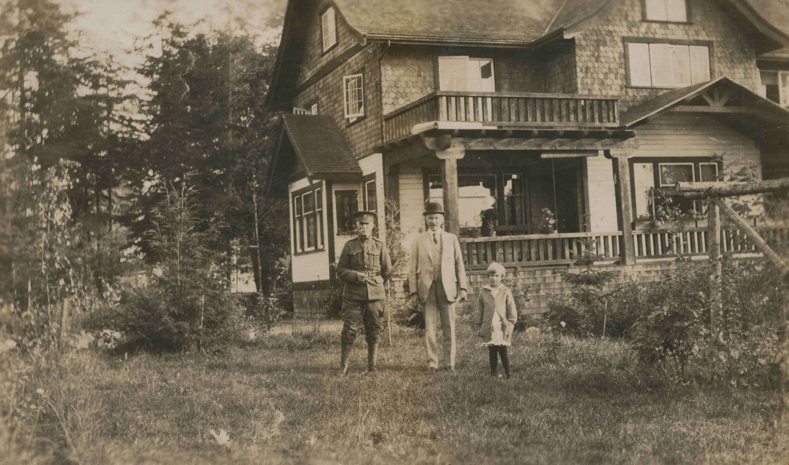
Claude Hill, John Kenrick and Edith Clayton
https://search.heritageburnaby.ca/link/archivedescription38894
- Repository
- City of Burnaby Archives
- Date
- 1916
- Collection/Fonds
- Peers Family and Hill Family fonds
- Description Level
- Item
- Physical Description
- 1 photograph : b&w ; 8 x 13.5 cm on page 14 x 17.5 cm (pasted in album)
- Scope and Content
- Photograph of Claude Hill (in military uniform), John P. Kenrick (Claude's brother-in-law) and Edith Clayton standing in front of the Clayton house on Buckingham Avenue in the Burnaby Lake area.
- Repository
- City of Burnaby Archives
- Date
- 1916
- Collection/Fonds
- Peers Family and Hill Family fonds
- Physical Description
- 1 photograph : b&w ; 8 x 13.5 cm on page 14 x 17.5 cm (pasted in album)
- Description Level
- Item
- Record No.
- 477-213
- Access Restriction
- No restrictions
- Reproduction Restriction
- No known restrictions
- Accession Number
- 2007-12
- Scope and Content
- Photograph of Claude Hill (in military uniform), John P. Kenrick (Claude's brother-in-law) and Edith Clayton standing in front of the Clayton house on Buckingham Avenue in the Burnaby Lake area.
- Subjects
- Buildings - Residential - Houses
- Clothing - Military Uniforms
- Occupations - Military Personnel
- Media Type
- Photograph
- Notes
- Title based on caption accompanying photograph
- Geographic Access
- Buckingham Avenue
- Historic Neighbourhood
- Burnaby Lake (Historic Neighbourhood)
- Planning Study Area
- Morley-Buckingham Area
Images
![Claude Hill leading a cow, [1910] thumbnail](/media/hpo/_Data/_Archives_Images/_Unrestricted/477/477-075.jpg?width=280)
Claude Hill leading a cow
https://search.heritageburnaby.ca/link/archivedescription38756
- Repository
- City of Burnaby Archives
- Date
- [1910]
- Collection/Fonds
- Peers Family and Hill Family fonds
- Description Level
- Item
- Physical Description
- 1 photograph : b&w ; 5 x 8 cm on page 11.5 x 14 cm (pasted in album)
- Scope and Content
- Photograph of Claude Hill leading a cow with a rope. The photograph was likely taken at the Hill family home, known as Broadview, on Buckingham Avenue.
- Repository
- City of Burnaby Archives
- Date
- [1910]
- Collection/Fonds
- Peers Family and Hill Family fonds
- Physical Description
- 1 photograph : b&w ; 5 x 8 cm on page 11.5 x 14 cm (pasted in album)
- Description Level
- Item
- Record No.
- 477-075
- Access Restriction
- No restrictions
- Reproduction Restriction
- No known restrictions
- Accession Number
- 2007-12
- Scope and Content
- Photograph of Claude Hill leading a cow with a rope. The photograph was likely taken at the Hill family home, known as Broadview, on Buckingham Avenue.
- Subjects
- Animals - Cows
- Occupations - Farmers
- Media Type
- Photograph
- Notes
- Title based on contents of photograph
- Geographic Access
- Buckingham Avenue
- Street Address
- 5730 Buckingham Avenue
- Historic Neighbourhood
- Burnaby Lake (Historic Neighbourhood)
- Planning Study Area
- Morley-Buckingham Area
Images
![Claude Hill leading a cow, [1910] thumbnail](/media/hpo/_Data/_Archives_Images/_Unrestricted/477/477-075.jpg)
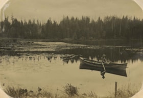
Claude Hill on Deer Lake
https://search.heritageburnaby.ca/link/archivedescription39521
- Repository
- City of Burnaby Archives
- Date
- 1906
- Collection/Fonds
- Peers Family and Hill Family fonds
- Description Level
- Item
- Physical Description
- 1 photograph : b&w ; 11.3 x 16.3 cm on page 21.5 x 28 cm (pasted in album)
- Scope and Content
- Photograph of Claude Hill sitting in a rowboat on Deer Lake. The photograph was taken looking southwest across Deer Lake.
- Repository
- City of Burnaby Archives
- Date
- 1906
- Collection/Fonds
- Peers Family and Hill Family fonds
- Physical Description
- 1 photograph : b&w ; 11.3 x 16.3 cm on page 21.5 x 28 cm (pasted in album)
- Description Level
- Item
- Record No.
- 477-840
- Access Restriction
- No restrictions
- Reproduction Restriction
- No known restrictions
- Accession Number
- 2007-12
- Scope and Content
- Photograph of Claude Hill sitting in a rowboat on Deer Lake. The photograph was taken looking southwest across Deer Lake.
- Media Type
- Photograph
- Photographer
- Cooksley, William Thomas
- Notes
- Title based on caption accompanying photograph
- Geographic Access
- Deer Lake
- Historic Neighbourhood
- Burnaby Lake (Historic Neighbourhood)
Images


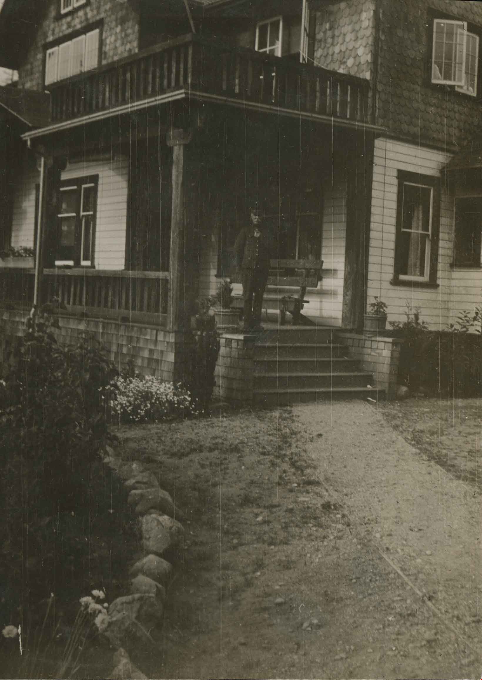
Claude Hill on the steps of the Clayton House
https://search.heritageburnaby.ca/link/archivedescription38899
- Repository
- City of Burnaby Archives
- Date
- 1916
- Collection/Fonds
- Peers Family and Hill Family fonds
- Description Level
- Item
- Physical Description
- 1 photograph : b&w ; 7 x 10 cm on page 14 x 17.5 cm (pasted in album)
- Scope and Content
- Photograph of Claude Hill, in uniform, on the steps of the Clayton home, on Buckingham Avenue.
- Repository
- City of Burnaby Archives
- Date
- 1916
- Collection/Fonds
- Peers Family and Hill Family fonds
- Physical Description
- 1 photograph : b&w ; 7 x 10 cm on page 14 x 17.5 cm (pasted in album)
- Description Level
- Item
- Record No.
- 477-218
- Access Restriction
- No restrictions
- Reproduction Restriction
- No known restrictions
- Accession Number
- 2007-12
- Scope and Content
- Photograph of Claude Hill, in uniform, on the steps of the Clayton home, on Buckingham Avenue.
- Media Type
- Photograph
- Notes
- Title based on contents of photograph
- Geographic Access
- Buckingham Avenue
- Historic Neighbourhood
- Burnaby Lake (Historic Neighbourhood)
- Planning Study Area
- Morley-Buckingham Area
Images