Narrow Results By

H.T. Ceperley Estate 'Fairacres' Mansion
https://search.heritageburnaby.ca/link/landmark526
- Repository
- Burnaby Heritage Planning
- Description
- 'Fairacres' is a large, two-and-one-half storey estate house in the British Arts and Crafts style, located in Deer Lake Park, with four associated original outbuildings.
- Associated Dates
- 1911
- Formal Recognition
- Heritage Designation, Community Heritage Register
- Other Names
- Henry Tracy & Grace Ceperley Estate
- Burnaby Art Gallery
- Street View URL
- Google Maps Street View
- Repository
- Burnaby Heritage Planning
- Other Names
- Henry Tracy & Grace Ceperley Estate
- Burnaby Art Gallery
- Geographic Access
- Deer Lake Avenue
- Associated Dates
- 1911
- Formal Recognition
- Heritage Designation, Community Heritage Register
- Enactment Type
- Bylaw No. 9807
- Enactment Date
- 23/11/1992
- Description
- 'Fairacres' is a large, two-and-one-half storey estate house in the British Arts and Crafts style, located in Deer Lake Park, with four associated original outbuildings.
- Heritage Value
- 'Fairacres' is important as a record of the early years of Burnaby, specifically the Deer Lake area, as a place of tranquility and beautiful scenery in which the wealthy and successful in the burgeoning cities of New Westminster and Vancouver chose to retire or to make their family homes. The main house, which anchors in style and setting the outbuildings on the estate, demonstrates the social, cultural, and aesthetic values of local wealthy businessmen and women of the early twentieth century - values such as appreciation of architectural elegance and grand interior spaces, leisure and recreation, formal landscaped gardens and scenic views. Also important is the association with the English-born and trained architect Robert Mackay Fripp (1858-1917), as this was one of his grandest residential commissions. Steeped in the current architectural trends in Great Britain, Fripp designed this sprawling mansion in the Arts and Crafts style, reflected in the architectural detailing and proportions. The style was common at the time and was often used for estate mansions as a symbol of affluence and good, modern taste as well as an affinity for all things British. Quality is displayed inside and out in the finishes and materials, orchestrated by prominent local contractor, James Charles Allen, including imported English materials of specific value such as imported Medmenham tiles in the fireplace surrounds, one of the earliest documented use of these tiles outside the United Kingdom. Detailed features of the interior woodwork were carved by Scottish-born master wood carver George Selkirk Gibson (1867-1942), who was best known for his many commissions for prominent British Columbia architect Samuel Maclure. The outbuildings at 'Fairacres' are an important record of the functioning of a large estate of the time. The Garage and Stables and the Chauffeur’s Cottage accommodated the use of automobiles, horses and carriages, and in concert with the estate's location near the new British Columbia Electric Railway 'Burnaby Lake' interurban line, illustrate the evolving nature of regional transportation and the growing bedroom communities and estates made possible by increasing options for transportation. Other outbuildings accommodated the agricultural activities that helped support the Ceperley estate. The estate was conceived and funded by American-born Grace E. Dixon Ceperley (1863-1917), who had achieved significant wealth through a bequest from her brother-in-law, Vancouver pioneer Arthur Ferguson. Her husband, Henry Tracy Ceperley (1850-1929), also American-born, was a successful and well-respected businessman who made a significant contribution to the development of the City of Vancouver. The construction of 'Fairacres' spawned the transformation of the Deer Lake area from a farming community into a preferred location for elite suburban homes. 'Fairacres' is significant to the City of Burnaby as its first civic heritage conservation project. Acquired in 1966 for conversion to Burnaby’s first art gallery, it was dedicated in 1967 to mark Canada’s Centennial of Confederation.
- Defining Elements
- Key elements that define the heritage character of the ‘Fairacres’ mansion include its: - setting in relation to the gardens, its former market garden, and the vistas to Deer Lake and other grand homes in the area - side gable roof with prominent dormers and cedar shingle cladding - verandah across the eastern (garden) facade, with its view over the landscaped gardens and the distant mountains - porte cochere with its side steps for those arriving by automobile, and central raised step for those alighting from horse-drawn carriages - rich variety of exterior elements that demonstrate the typical Arts and Crafts use of local materials such as cobble stone chimneys and foundations, wide wooden siding and half-timbering - mixture of double-hung and casement wooden-sash windows, many with multi-paned sash - lavish interior spaces, designed for entertaining on a grand scale, including a billiard room with a beamed ceiling and an inglenook fireplace, and generous living and dining rooms arranged off a central hall - quality of the interior materials such as imported Medmenham tiles in fireplace surrounds, window hardware by Hope and Sons, and leaded stained glass - interior wood work including the staircase, and carvings by George Selkirk Gibson - remaining formal Edwardian garden landscape elements, including the cross-axial plan that reflects the relationship of the mansion to its 'outdoor rooms'
- Locality
- Deer Lake Park
- Historic Neighbourhood
- Burnaby Lake (Historic Neighbourhood)
- Planning Study Area
- Douglas-Gilpin Area
- Architect
- Robert Mackay Fripp
- Function
- Primary Current--Museum
- Primary Historic--Estate
- Community
- Burnaby
- Cadastral Identifier
- P.I.D. No. 004-493-311 Legal Description: Block 3 Except: Part subdivided by Plan 26865, District Lot 79, Group 1, New Westminster District, Plan 536
- Boundaries
- ‘Fairacres’ is comprised of a single municipally-owned property located at 6344 Deer Lake Avenue, Burnaby.
- Area
- 17,065.00
- Contributing Resource
- Building
- Landscape Feature
- Ownership
- Public (local)
- Other Collection
- City of Burnaby, Visual Art Collection: Original rendering by R.P.S. Twizell Burnaby Historical Society, Community Archives: Ceperley Photograph Album Burnaby Village Museum, Collection: Carved dining room panels by G.S. Gibson and other hardware items
- Documentation
- Heritage Site Files: PC77000 20. City of Burnaby Planning and Building Department, 4949 Canada Way, Burnaby, B.C., V5G 1M2
- Names
- Ceperley, Grace
- Ceperley, H.T.
- Fripp, Robert Mackay
- Allen, James Charles
- Gibson, George Selkirk
- Street Address
- 6344 Deer Lake Avenue
- Street View URL
- Google Maps Street View
Images


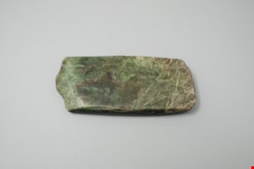
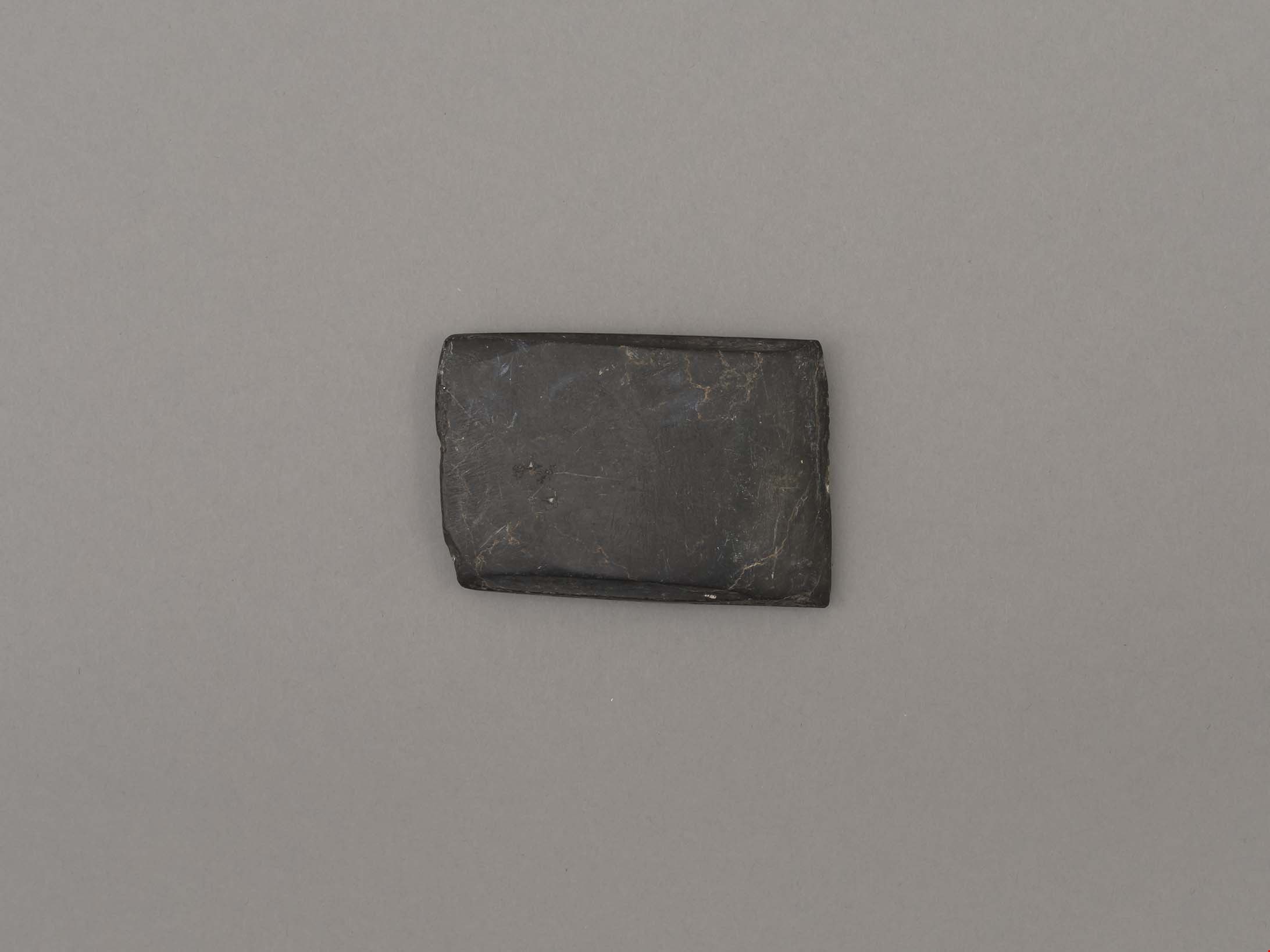
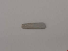
adze blade
https://search.heritageburnaby.ca/link/museumartifact44868
- Repository
- Burnaby Village Museum
- Accession Code
- BV002.57.19
- Description
- Nephrite adze blade; chipped on one end; rectangular shaped.
- Object History
- The donor inherited this artifact from his mother, Katherine Maude (Kitty) Peers, who inherited them from her father, Louis Claude Hill. The artifacts were found on his farm, Brookfield Farm, at Douglas Road and Sperling Avenue (now site of Burnaby Village Museum).
- Nephrite is found in the Fraser Canyon
- Culture Phase: Possibly Locarno Beach phase (3520-2200 Before Present) or Marpole (400BC - 400AD)
- Historic Neighbourhood
- Burnaby Lake (Historic Neighbourhood)
Images
Documents
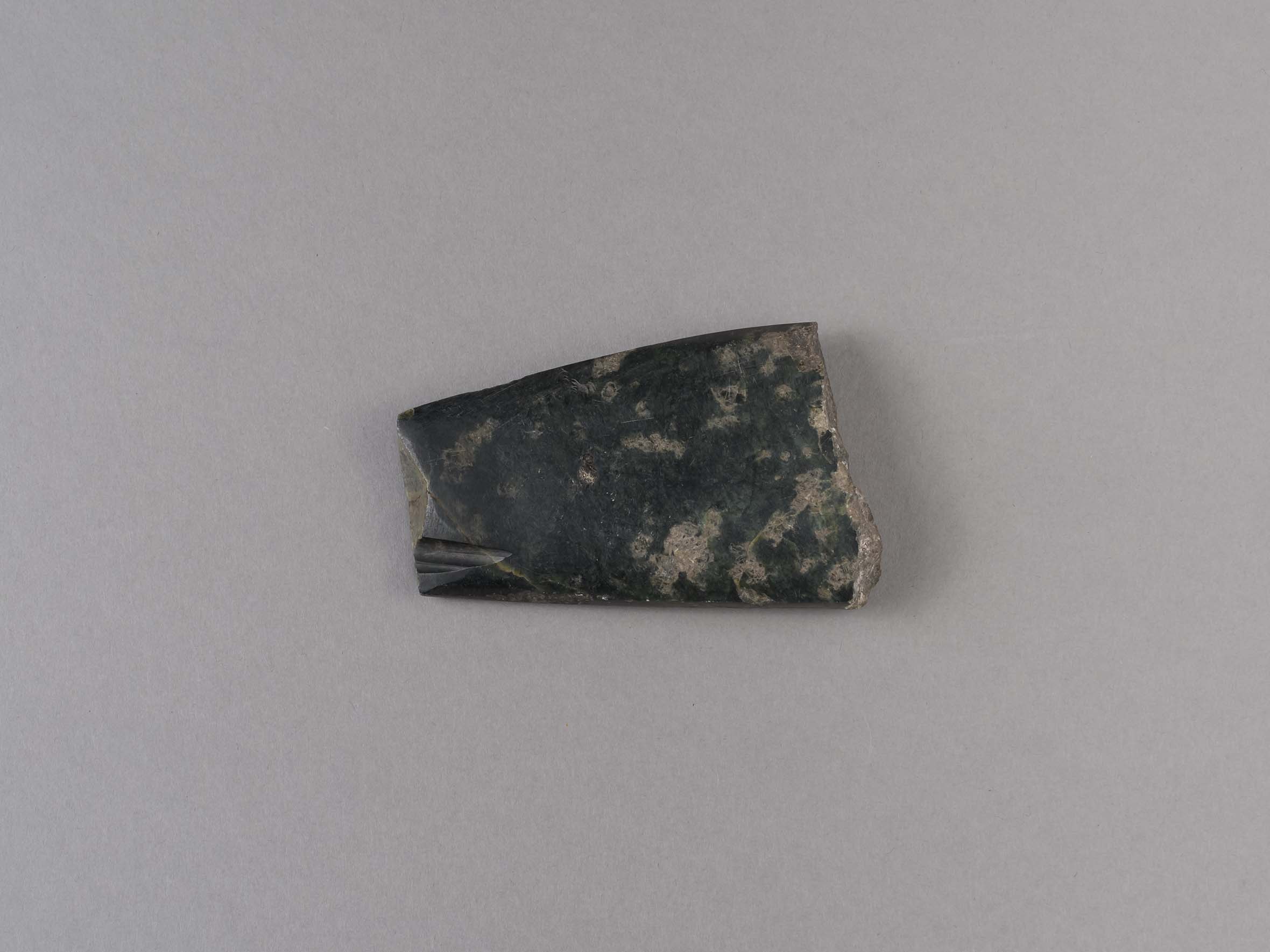
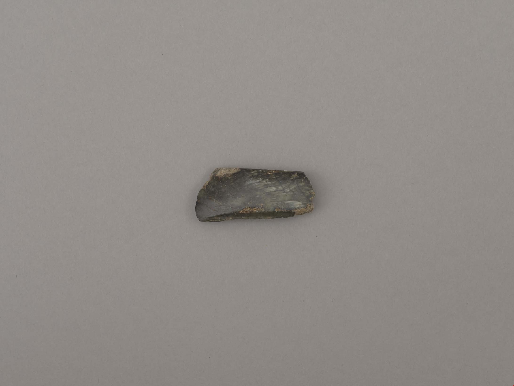
adze blade
https://search.heritageburnaby.ca/link/museumartifact44870
- Repository
- Burnaby Village Museum
- Accession Code
- BV002.57.21
- Description
- Chisel, adze or axe blade made of serpentine; black; ends broken off; tapered rectangle shape.
- Object History
- The donor inherited this artifact from his mother, Katherine Maude (Kitty) Peers, who inherited them from her father, Louis Claude Hill. The artifacts were found on his farm, Brookfield Farm, at Douglas Road and Sperling Avenue (now site of Burnaby Village Museum).
- Culture Phase: Locarno Beach (3520-2200 Before Present) or Marpole (400BC - 400AD)
- Historic Neighbourhood
- Burnaby Lake (Historic Neighbourhood)
Images
Documents
adze blade
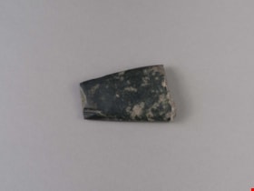
https://search.heritageburnaby.ca/link/museumartifact44872
- Repository
- Burnaby Village Museum
- Accession Code
- BV002.57.23
- Description
- Chisel, adze or axe blade made of serpentine; small
- Object History
- The donor inherited this artifact from his mother, Katherine Maude (Kitty) Peers, who inherited them from her father, Louis Claude Hill. The artifacts were found on his farm, Brookfield Farm, at Douglas Road and Sperling Avenue (now site of Burnaby Village Museum).
- Culture Phase: Locarno Beach (3520-2200 Before Present) or Marpole (400BC - 400AD)
- Historic Neighbourhood
- Burnaby Lake (Historic Neighbourhood)
Images

Documents
adze blade
https://search.heritageburnaby.ca/link/museumartifact44873
- Repository
- Burnaby Village Museum
- Accession Code
- BV002.57.24
- Description
- Nephrite adze blade; small
- Object History
- The donor inherited this artifact from his mother, Katherine Maude (Kitty) Peers, who inherited them from her father, Louis Claude Hill. The artifacts were found on his farm, Brookfield Farm, at Douglas Road and Sperling Avenue (now site of Burnaby Village Museum).
- Nephrite is found in the Fraser Canyon
- Culture Phase: Locarno Beach (3520-2200 Before Present) or Marpole (400BC - 400AD)
- Historic Neighbourhood
- Burnaby Lake (Historic Neighbourhood)
Images

Documents
adze blade
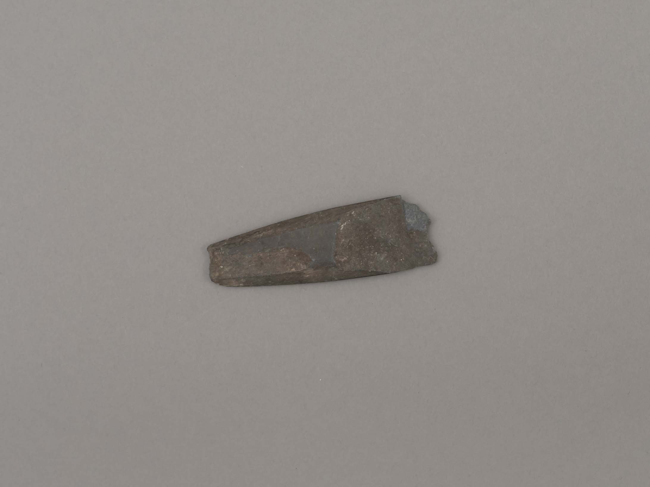
https://search.heritageburnaby.ca/link/museumartifact44874
- Repository
- Burnaby Village Museum
- Accession Code
- BV002.57.25
- Description
- Adze blade; small; possibly nephrite.
- Object History
- The donor inherited this artifact from his mother, Katherine Maude (Kitty) Peers, who inherited them from her father, Louis Claude Hill. The artifacts were found on his farm, Brookfield Farm, at Douglas Road and Sperling Avenue (now site of Burnaby Village Museum).
- Nephrite is found in the Fraser Canyon
- Culture Phase: Locarno Beach (3520-2200 Before Present) or Marpole (400BC - 400AD)
- Historic Neighbourhood
- Burnaby Lake (Historic Neighbourhood)
Images
Documents

adze blade
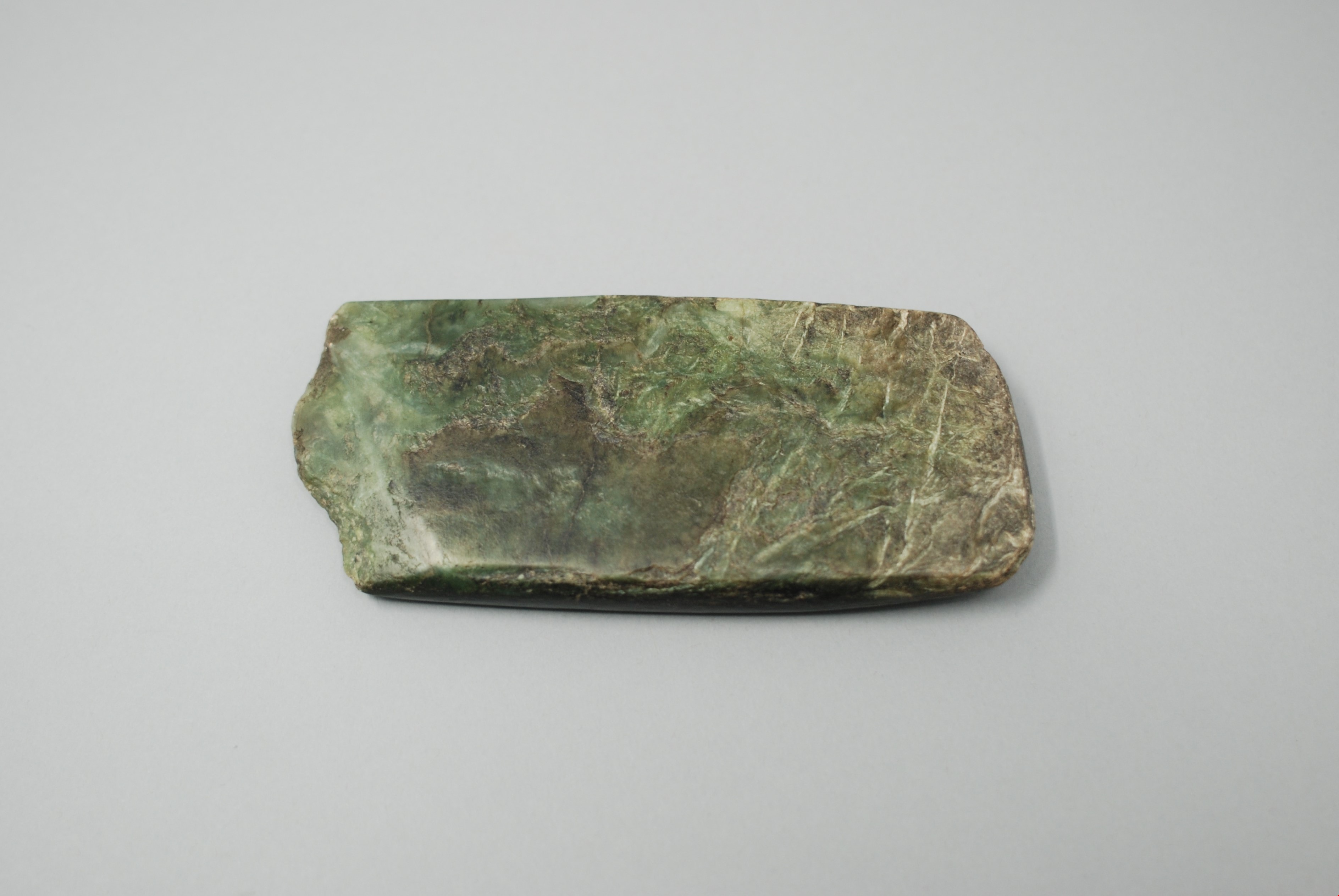
https://search.heritageburnaby.ca/link/museumartifact44876
- Repository
- Burnaby Village Museum
- Accession Code
- BV002.57.27
- Description
- Nephrite adze blade; rectangular; chipped on one side; slightly grooved on longer edges.
- Object History
- The donor inherited this artifact from his mother, Katherine Maude (Kitty) Peers, who inherited them from her father, Louis Claude Hill. The artifacts were found on his farm, Brookfield Farm, at Douglas Road and Sperling Avenue (now site of Burnaby Village Museum).
- Nephrite is found in the Fraser Canyon
- Marpole Culture (400BC - 400AD) or Gulf of Georgia Culture (400 AD – 1800); essentially these archaeological materials date to the last 2400 years.
- Historic Neighbourhood
- Burnaby Lake (Historic Neighbourhood)
Images
Documents
blade or projectile
https://search.heritageburnaby.ca/link/museumartifact44879
- Repository
- Burnaby Village Museum
- Accession Code
- BV002.57.30
- Description
- Ground slate point
- Object History
- The donor inherited this artifact from his mother, Katherine Maude (Kitty) Peers, who inherited them from her father, Louis Claude Hill. The artifacts were found on his farm, Brookfield Farm, at Douglas Road and Sperling Avenue (now site of Burnaby Village Museum).
- Culture Phase: Locarno Beach phase (3520-2200 Before Present)
- Historic Neighbourhood
- Burnaby Lake (Historic Neighbourhood)
Images
Documents
blade or projectile point
https://search.heritageburnaby.ca/link/museumartifact44878
- Repository
- Burnaby Village Museum
- Accession Code
- BV002.57.29
- Description
- Ground and faceted stone point
- Object History
- The donor inherited this artifact from his mother, Katherine Maude (Kitty) Peers, who inherited them from her father, Louis Claude Hill. The artifacts were found on his farm, Brookfield Farm, at Douglas Road and Sperling Avenue (now site of Burnaby Village Museum).
- Culture Phase: Locarno Beach phase (3520-2200 Before Present)
- Historic Neighbourhood
- Burnaby Lake (Historic Neighbourhood)
Images

Documents
![Brookfield, [1900] thumbnail](/media/hpo/_Data/_BVM_Images/1976/1976_0139_0005_001.jpg?width=280)
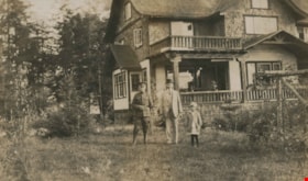
Brookfield
https://search.heritageburnaby.ca/link/museumdescription754
- Repository
- Burnaby Village Museum
- Date
- [1900]
- Collection/Fonds
- Burnaby Village Museum Photograph collection
- Description Level
- Item
- Physical Description
- 1 photograph : b&w ; 9.9 x 14.0 cm mounted on cardboard 17.8 x 23.0 cm
- Scope and Content
- Photograph of "Brookfield", the first home of Mr. and Mrs. Louis Claude Hill. The Hills, including the daughter Kitty Hill, are on the lawn on the lower right corner. The man sitting on the steps is identified by the inscription on the photograph card mount as Mr. Wetenhall. Annotations on the back…
- Repository
- Burnaby Village Museum
- Collection/Fonds
- Burnaby Village Museum Photograph collection
- Description Level
- Item
- Physical Description
- 1 photograph : b&w ; 9.9 x 14.0 cm mounted on cardboard 17.8 x 23.0 cm
- Scope and Content
- Photograph of "Brookfield", the first home of Mr. and Mrs. Louis Claude Hill. The Hills, including the daughter Kitty Hill, are on the lawn on the lower right corner. The man sitting on the steps is identified by the inscription on the photograph card mount as Mr. Wetenhall. Annotations on the back of the card read: "'Brookfield' / Burnaby Lake" and "L.C. Hill & Kitty M. Hill, Mr. Wetenhall." Another annotation reads: "App. 1900."
- Subjects
- Buildings - Residential - Houses
- Geographic Access
- Deer Lake Avenue
- Street Address
- 6501 Deer Lake Avenue
- Accession Code
- HV976.139.5
- Access Restriction
- No restrictions
- Reproduction Restriction
- No known restrictions
- Date
- [1900]
- Media Type
- Photograph
- Historic Neighbourhood
- Burnaby Lake (Historic Neighbourhood)
- Planning Study Area
- Morley-Buckingham Area
- Related Material
- For another view of Brookfield home, see HV976.139.53
- Scan Resolution
- 600
- Scan Date
- 2023-06-27
- Notes
- Title based on contents of photograph
Images
![Brookfield, [1900] thumbnail](/media/hpo/_Data/_BVM_Images/1976/1976_0139_0005_001.jpg)

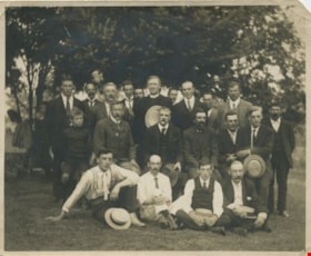
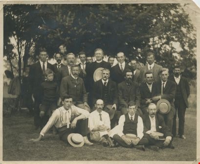
Burnaby Lake residents
https://search.heritageburnaby.ca/link/archivedescription34058
- Repository
- City of Burnaby Archives
- Date
- 1912
- Collection/Fonds
- Burnaby Historical Society fonds
- Description Level
- Item
- Physical Description
- 1 photograph : b&w ; 9.5 x 11.6 cm
- Scope and Content
- Photograph of a group of male Burnaby Lake residents posed outside near Deer Lake Drive. Identified, standing: B.R. Hill (3rd from left), Rev. D. Dunlop (6th from left), Harry Ramsay (8th from left), Louis "Edgar" Sprott (9th from left), and George Every-Clayton (10th from left). Sitting on bench…
- Repository
- City of Burnaby Archives
- Date
- 1912
- Collection/Fonds
- Burnaby Historical Society fonds
- Subseries
- Photographs subseries
- Physical Description
- 1 photograph : b&w ; 9.5 x 11.6 cm
- Description Level
- Item
- Record No.
- 003-001
- Access Restriction
- No restrictions
- Reproduction Restriction
- No known restrictions
- Accession Number
- BHS2007-04
- Scope and Content
- Photograph of a group of male Burnaby Lake residents posed outside near Deer Lake Drive. Identified, standing: B.R. Hill (3rd from left), Rev. D. Dunlop (6th from left), Harry Ramsay (8th from left), Louis "Edgar" Sprott (9th from left), and George Every-Clayton (10th from left). Sitting on bench: [first name unknown] Clayton (1st from left), Robert Pontifex (2nd from left), Mr. Clay (4th from left), and Frank Hill (6th from left). Sitting on ground: Claude Hill (1st from left) and Percy Boyer Brown (2nd from left).
- Names
- Brown, Percy Boyer
- Every-Clayton, George
- Dunlop, Rev. D.
- Hill, Bernard R.
- Hill, Frank
- Brown, Alex
- Hill, Louis Claude "Claude"
- Pontifex, Robert
- Ramsay, Harry
- Sprott, Louis "Edgar"
- Media Type
- Photograph
- Notes
- Title based on contents of photograph
- Identification key accompanying in the envelope for photo 003-001 (labeled BHS 3.1)
- Geographic Access
- Deer Lake
- Deer Lake Avenue
- Historic Neighbourhood
- Vancouver Heights (Historic Neighbourhood)
- Burnaby Lake (Historic Neighbourhood)
- Planning Study Area
- Douglas-Gilpin Area
Images

Camp at Oakalla Site
https://search.heritageburnaby.ca/link/archivedescription39575
- Repository
- City of Burnaby Archives
- Date
- 1910
- Collection/Fonds
- Peers Family and Hill Family fonds
- Description Level
- Item
- Physical Description
- 1 photograph : b&w ; 7.7 x 10.4 cm on page 21.5 x 28 cm (pasted in album)
- Scope and Content
- Photograph of the land clearing operation at the Oakalla Prison site in the Deer Lake area. Claude Hill is in the centre between two unidentified men. A line of clothes is hanging in the background.
- Repository
- City of Burnaby Archives
- Date
- 1910
- Collection/Fonds
- Peers Family and Hill Family fonds
- Physical Description
- 1 photograph : b&w ; 7.7 x 10.4 cm on page 21.5 x 28 cm (pasted in album)
- Description Level
- Item
- Record No.
- 477-894
- Access Restriction
- No restrictions
- Reproduction Restriction
- No known restrictions
- Accession Number
- 2007-12
- Scope and Content
- Photograph of the land clearing operation at the Oakalla Prison site in the Deer Lake area. Claude Hill is in the centre between two unidentified men. A line of clothes is hanging in the background.
- Subjects
- Land Clearing
- Media Type
- Photograph
- Notes
- Title based on contents of photograph
- Geographic Access
- Oakmount Crescent
- Street Address
- 5220 Oakmount Crescent
- Historic Neighbourhood
- Burnaby Lake (Historic Neighbourhood)
- Planning Study Area
- Oakalla Area
Images

![Claude and Kitty, [between 1892 and 1914] thumbnail](/media/hpo/_Data/_Archives_Images/_Unrestricted/477/477-897.jpg?width=280)
Claude and Kitty
https://search.heritageburnaby.ca/link/archivedescription39578
- Repository
- City of Burnaby Archives
- Date
- [between 1892 and 1914]
- Collection/Fonds
- Peers Family and Hill Family fonds
- Description Level
- Item
- Physical Description
- 1 photograph : sepia ; 5.5 x 8 cm on page 21.5 x 28 cm (pasted in album)
- Scope and Content
- Photograph of a man in a hat and a young child riding in a horse-drawn carriage; possibly Mr. L.C. Hill and Kitty Hill being pulled by Kitty's horse Tom.
- Repository
- City of Burnaby Archives
- Date
- [between 1892 and 1914]
- Collection/Fonds
- Peers Family and Hill Family fonds
- Physical Description
- 1 photograph : sepia ; 5.5 x 8 cm on page 21.5 x 28 cm (pasted in album)
- Description Level
- Item
- Record No.
- 477-897
- Access Restriction
- No restrictions
- Reproduction Restriction
- No known restrictions
- Accession Number
- 2007-12
- Scope and Content
- Photograph of a man in a hat and a young child riding in a horse-drawn carriage; possibly Mr. L.C. Hill and Kitty Hill being pulled by Kitty's horse Tom.
- Media Type
- Photograph
- Notes
- Title based on contents of photograph
- Geographic Access
- Deer Lake Avenue
- Street Address
- 6501 Deer Lake Avenue
- Historic Neighbourhood
- Burnaby Lake (Historic Neighbourhood)
- Planning Study Area
- Morley-Buckingham Area
Images
![Claude and Kitty, [between 1892 and 1914] thumbnail](/media/hpo/_Data/_Archives_Images/_Unrestricted/477/477-897.jpg)

Claude and Kitty on a footbridge
https://search.heritageburnaby.ca/link/archivedescription39558
- Repository
- City of Burnaby Archives
- Date
- 1910
- Collection/Fonds
- Peers Family and Hill Family fonds
- Description Level
- Item
- Physical Description
- 1 photograph : b&w ; 7.5 x 10 cm on page 21.5 x 28 cm (pasted in album)
- Scope and Content
- Photograph of Claude Hill with his daughter Kitty standing on a foot bridge over a small creek. In the background directly behind Kitty can be seen the Hill family home known as Broadview which was located on Buckingham Avenue. The Pole Line Road (later renamed Sperling Avenue) can also be seen. …
- Repository
- City of Burnaby Archives
- Date
- 1910
- Collection/Fonds
- Peers Family and Hill Family fonds
- Physical Description
- 1 photograph : b&w ; 7.5 x 10 cm on page 21.5 x 28 cm (pasted in album)
- Description Level
- Item
- Record No.
- 477-877
- Access Restriction
- No restrictions
- Reproduction Restriction
- No known restrictions
- Accession Number
- 2007-12
- Scope and Content
- Photograph of Claude Hill with his daughter Kitty standing on a foot bridge over a small creek. In the background directly behind Kitty can be seen the Hill family home known as Broadview which was located on Buckingham Avenue. The Pole Line Road (later renamed Sperling Avenue) can also be seen. At the far left, top corner of the photograph another house is visible. This was the home of Francis J. Peers, on what is now Rugby Avenue (5289 Rugby). This house was known as Greyfriars. Kitty Hill would later marry Bob Peers, son of Francis.
- Subjects
- Structures - Bridges
- Media Type
- Photograph
- Notes
- Title based on contents of photograph
- Geographic Access
- Buckingham Avenue
- Sperling Avenue
- Street Address
- 5730 Buckingham Avenue
- Historic Neighbourhood
- Burnaby Lake (Historic Neighbourhood)
- Planning Study Area
- Morley-Buckingham Area
Images

![Claude Hill, [1915] thumbnail](/media/hpo/_Data/_Archives_Images/_Unrestricted/477/477-655.jpg?width=280)
Claude Hill
https://search.heritageburnaby.ca/link/archivedescription39336
- Repository
- City of Burnaby Archives
- Date
- [1915]
- Collection/Fonds
- Peers Family and Hill Family fonds
- Description Level
- Item
- Physical Description
- 1 photograph : b&w ; 5.9 x 10.4 cm on page 24.5 x 32.5 cm (pasted in album)
- Scope and Content
- Photograph of Claude Hill in his fields, standing next to a row of bushes and fence posts.
- Repository
- City of Burnaby Archives
- Date
- [1915]
- Collection/Fonds
- Peers Family and Hill Family fonds
- Physical Description
- 1 photograph : b&w ; 5.9 x 10.4 cm on page 24.5 x 32.5 cm (pasted in album)
- Description Level
- Item
- Record No.
- 477-655
- Access Restriction
- No restrictions
- Reproduction Restriction
- No known restrictions
- Accession Number
- 2007-12
- Scope and Content
- Photograph of Claude Hill in his fields, standing next to a row of bushes and fence posts.
- Subjects
- Agriculture - Farms
- Media Type
- Photograph
- Notes
- Title based on contents of photograph
- Historic Neighbourhood
- Burnaby Lake (Historic Neighbourhood)
- Planning Study Area
- Morley-Buckingham Area
Images
![Claude Hill, [1915] thumbnail](/media/hpo/_Data/_Archives_Images/_Unrestricted/477/477-655.jpg)

Claude Hill beside a large felled tree
https://search.heritageburnaby.ca/link/archivedescription39517
- Repository
- City of Burnaby Archives
- Date
- 1900
- Collection/Fonds
- Peers Family and Hill Family fonds
- Description Level
- Item
- Physical Description
- 1 photograph : b&w ; 10.5 x 15 cm on page 21.5 x 28 cm (pasted in album)
- Scope and Content
- Photograph of Louis Claude Hill standing by a ladder placed in a ditch. The ladder is leaning against a giant tree upturned by the roots. The ditch appears to be created from uprooting the tree. There is a pile of firewood visible to the right, and a barn to the left in the distance.
- Repository
- City of Burnaby Archives
- Date
- 1900
- Collection/Fonds
- Peers Family and Hill Family fonds
- Physical Description
- 1 photograph : b&w ; 10.5 x 15 cm on page 21.5 x 28 cm (pasted in album)
- Description Level
- Item
- Record No.
- 477-836
- Access Restriction
- No restrictions
- Reproduction Restriction
- No known restrictions
- Accession Number
- 2007-12
- Scope and Content
- Photograph of Louis Claude Hill standing by a ladder placed in a ditch. The ladder is leaning against a giant tree upturned by the roots. The ditch appears to be created from uprooting the tree. There is a pile of firewood visible to the right, and a barn to the left in the distance.
- Subjects
- Land Clearing
- Plants - Trees
- Media Type
- Photograph
- Notes
- Title based on contents of photograph
- Geographic Access
- Deer Lake Avenue
- Historic Neighbourhood
- Burnaby Lake (Historic Neighbourhood)
Images

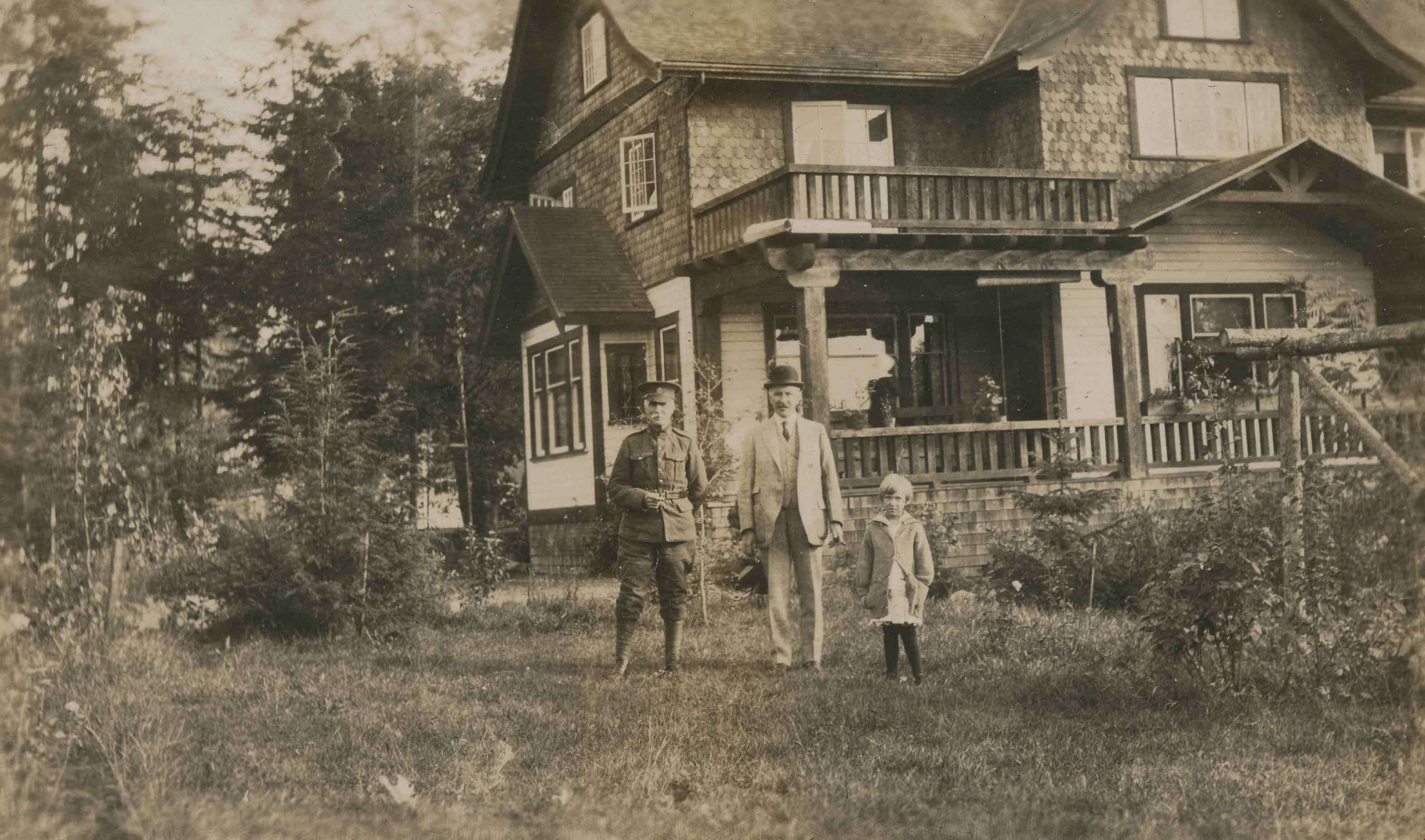
Claude Hill, John Kenrick and Edith Clayton
https://search.heritageburnaby.ca/link/archivedescription38894
- Repository
- City of Burnaby Archives
- Date
- 1916
- Collection/Fonds
- Peers Family and Hill Family fonds
- Description Level
- Item
- Physical Description
- 1 photograph : b&w ; 8 x 13.5 cm on page 14 x 17.5 cm (pasted in album)
- Scope and Content
- Photograph of Claude Hill (in military uniform), John P. Kenrick (Claude's brother-in-law) and Edith Clayton standing in front of the Clayton house on Buckingham Avenue in the Burnaby Lake area.
- Repository
- City of Burnaby Archives
- Date
- 1916
- Collection/Fonds
- Peers Family and Hill Family fonds
- Physical Description
- 1 photograph : b&w ; 8 x 13.5 cm on page 14 x 17.5 cm (pasted in album)
- Description Level
- Item
- Record No.
- 477-213
- Access Restriction
- No restrictions
- Reproduction Restriction
- No known restrictions
- Accession Number
- 2007-12
- Scope and Content
- Photograph of Claude Hill (in military uniform), John P. Kenrick (Claude's brother-in-law) and Edith Clayton standing in front of the Clayton house on Buckingham Avenue in the Burnaby Lake area.
- Subjects
- Buildings - Residential - Houses
- Clothing - Military Uniforms
- Occupations - Military Personnel
- Media Type
- Photograph
- Notes
- Title based on caption accompanying photograph
- Geographic Access
- Buckingham Avenue
- Historic Neighbourhood
- Burnaby Lake (Historic Neighbourhood)
- Planning Study Area
- Morley-Buckingham Area
Images
![Claude Hill leading a cow, [1910] thumbnail](/media/hpo/_Data/_Archives_Images/_Unrestricted/477/477-075.jpg?width=280)
Claude Hill leading a cow
https://search.heritageburnaby.ca/link/archivedescription38756
- Repository
- City of Burnaby Archives
- Date
- [1910]
- Collection/Fonds
- Peers Family and Hill Family fonds
- Description Level
- Item
- Physical Description
- 1 photograph : b&w ; 5 x 8 cm on page 11.5 x 14 cm (pasted in album)
- Scope and Content
- Photograph of Claude Hill leading a cow with a rope. The photograph was likely taken at the Hill family home, known as Broadview, on Buckingham Avenue.
- Repository
- City of Burnaby Archives
- Date
- [1910]
- Collection/Fonds
- Peers Family and Hill Family fonds
- Physical Description
- 1 photograph : b&w ; 5 x 8 cm on page 11.5 x 14 cm (pasted in album)
- Description Level
- Item
- Record No.
- 477-075
- Access Restriction
- No restrictions
- Reproduction Restriction
- No known restrictions
- Accession Number
- 2007-12
- Scope and Content
- Photograph of Claude Hill leading a cow with a rope. The photograph was likely taken at the Hill family home, known as Broadview, on Buckingham Avenue.
- Subjects
- Animals - Cows
- Occupations - Farmers
- Media Type
- Photograph
- Notes
- Title based on contents of photograph
- Geographic Access
- Buckingham Avenue
- Street Address
- 5730 Buckingham Avenue
- Historic Neighbourhood
- Burnaby Lake (Historic Neighbourhood)
- Planning Study Area
- Morley-Buckingham Area
Images
![Claude Hill leading a cow, [1910] thumbnail](/media/hpo/_Data/_Archives_Images/_Unrestricted/477/477-075.jpg)
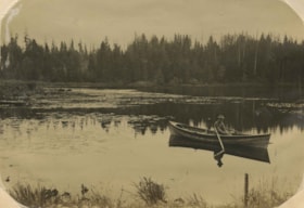
Claude Hill on Deer Lake
https://search.heritageburnaby.ca/link/archivedescription39521
- Repository
- City of Burnaby Archives
- Date
- 1906
- Collection/Fonds
- Peers Family and Hill Family fonds
- Description Level
- Item
- Physical Description
- 1 photograph : b&w ; 11.3 x 16.3 cm on page 21.5 x 28 cm (pasted in album)
- Scope and Content
- Photograph of Claude Hill sitting in a rowboat on Deer Lake. The photograph was taken looking southwest across Deer Lake.
- Repository
- City of Burnaby Archives
- Date
- 1906
- Collection/Fonds
- Peers Family and Hill Family fonds
- Physical Description
- 1 photograph : b&w ; 11.3 x 16.3 cm on page 21.5 x 28 cm (pasted in album)
- Description Level
- Item
- Record No.
- 477-840
- Access Restriction
- No restrictions
- Reproduction Restriction
- No known restrictions
- Accession Number
- 2007-12
- Scope and Content
- Photograph of Claude Hill sitting in a rowboat on Deer Lake. The photograph was taken looking southwest across Deer Lake.
- Media Type
- Photograph
- Photographer
- Cooksley, William Thomas
- Notes
- Title based on caption accompanying photograph
- Geographic Access
- Deer Lake
- Historic Neighbourhood
- Burnaby Lake (Historic Neighbourhood)
Images


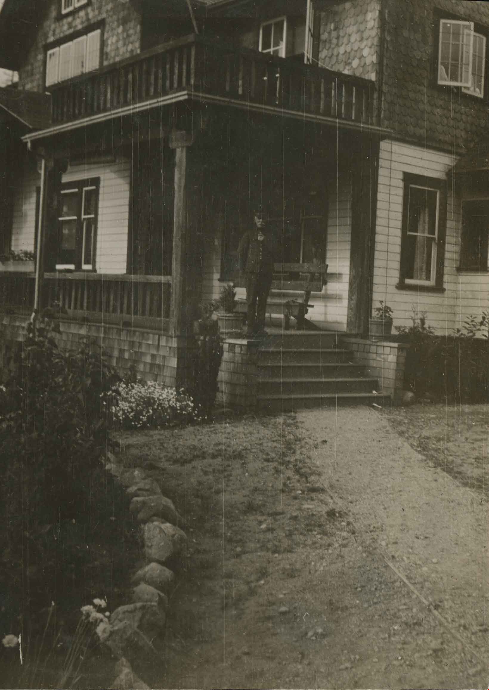
Claude Hill on the steps of the Clayton House
https://search.heritageburnaby.ca/link/archivedescription38899
- Repository
- City of Burnaby Archives
- Date
- 1916
- Collection/Fonds
- Peers Family and Hill Family fonds
- Description Level
- Item
- Physical Description
- 1 photograph : b&w ; 7 x 10 cm on page 14 x 17.5 cm (pasted in album)
- Scope and Content
- Photograph of Claude Hill, in uniform, on the steps of the Clayton home, on Buckingham Avenue.
- Repository
- City of Burnaby Archives
- Date
- 1916
- Collection/Fonds
- Peers Family and Hill Family fonds
- Physical Description
- 1 photograph : b&w ; 7 x 10 cm on page 14 x 17.5 cm (pasted in album)
- Description Level
- Item
- Record No.
- 477-218
- Access Restriction
- No restrictions
- Reproduction Restriction
- No known restrictions
- Accession Number
- 2007-12
- Scope and Content
- Photograph of Claude Hill, in uniform, on the steps of the Clayton home, on Buckingham Avenue.
- Media Type
- Photograph
- Notes
- Title based on contents of photograph
- Geographic Access
- Buckingham Avenue
- Historic Neighbourhood
- Burnaby Lake (Historic Neighbourhood)
- Planning Study Area
- Morley-Buckingham Area
Images