More like 'Building site'
Narrow Results By
Subject
- Accidents - Automobile Accidents 1
- Advertising Medium 3
- Advertising Medium - Signs and Signboards 83
- Aerial Photographs 31
- Agricultural Tools and Equipment - Plows 3
- Agriculture 2
- Agriculture - Crops 2
- Agriculture - Farms 49
- Agriculture - Fruit and Berries 5
- Agriculture - Poultry 4
- Animals - Birds 2
- Animals - Cats 5
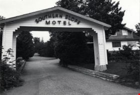
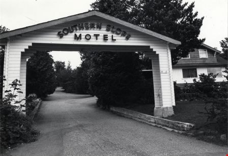
Southern Slope Motel
https://search.heritageburnaby.ca/link/archivedescription79335
- Repository
- City of Burnaby Archives
- Date
- September 10, 1976
- Collection/Fonds
- Burnaby Public Library Contemporary Visual Archive Project
- Description Level
- Item
- Physical Description
- 1 photograph : b&w ; 11 x 16 cm mounted on cardboard
- Scope and Content
- Photograph shows arch at entrance to Southern Slope Motel located at 4653 Marine Drive.
- Repository
- City of Burnaby Archives
- Date
- September 10, 1976
- Collection/Fonds
- Burnaby Public Library Contemporary Visual Archive Project
- Physical Description
- 1 photograph : b&w ; 11 x 16 cm mounted on cardboard
- Description Level
- Item
- Record No.
- 556-249
- Access Restriction
- No restrictions
- Reproduction Restriction
- Reproduce for fair dealing purposes only
- Accession Number
- 2013-13
- Scope and Content
- Photograph shows arch at entrance to Southern Slope Motel located at 4653 Marine Drive.
- Names
- Southern Slope Motel
- Media Type
- Photograph
- Photographer
- Ross, Martha
- Notes
- Scope note taken directly from BPL photograph description.
- 1 b&w copy negative : 10 x 12.5 cm accompanying
- Geographic Access
- Marine Drive
- Street Address
- 4653 Marine Drive
- Historic Neighbourhood
- Alta-Vista (Historic Neighbourhood)
- Planning Study Area
- Sussex-Nelson Area
Images
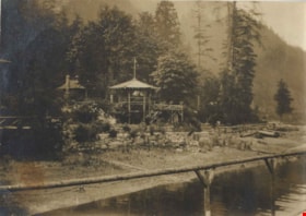
Wigwam Inn
https://search.heritageburnaby.ca/link/archivedescription82513
- Repository
- City of Burnaby Archives
- Date
- 1918
- Collection/Fonds
- Hill family and Vidal family fonds
- Description Level
- Item
- Physical Description
- 1 photograph : sepia ; 5.5 x 7.5 cm
- Scope and Content
- Photograph shows a building surrounded by trees and mountains.
- Repository
- City of Burnaby Archives
- Date
- 1918
- Collection/Fonds
- Hill family and Vidal family fonds
- Physical Description
- 1 photograph : sepia ; 5.5 x 7.5 cm
- Description Level
- Item
- Record No.
- 550-087
- Access Restriction
- No restrictions
- Reproduction Restriction
- No known restrictions
- Accession Number
- 2013-03
- Scope and Content
- Photograph shows a building surrounded by trees and mountains.
- Media Type
- Photograph
- Notes
- Title based on note accompanying photograph
- Note in pencil on album page reads: "1918 / Wigwam Inn"
Images

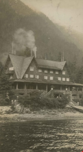
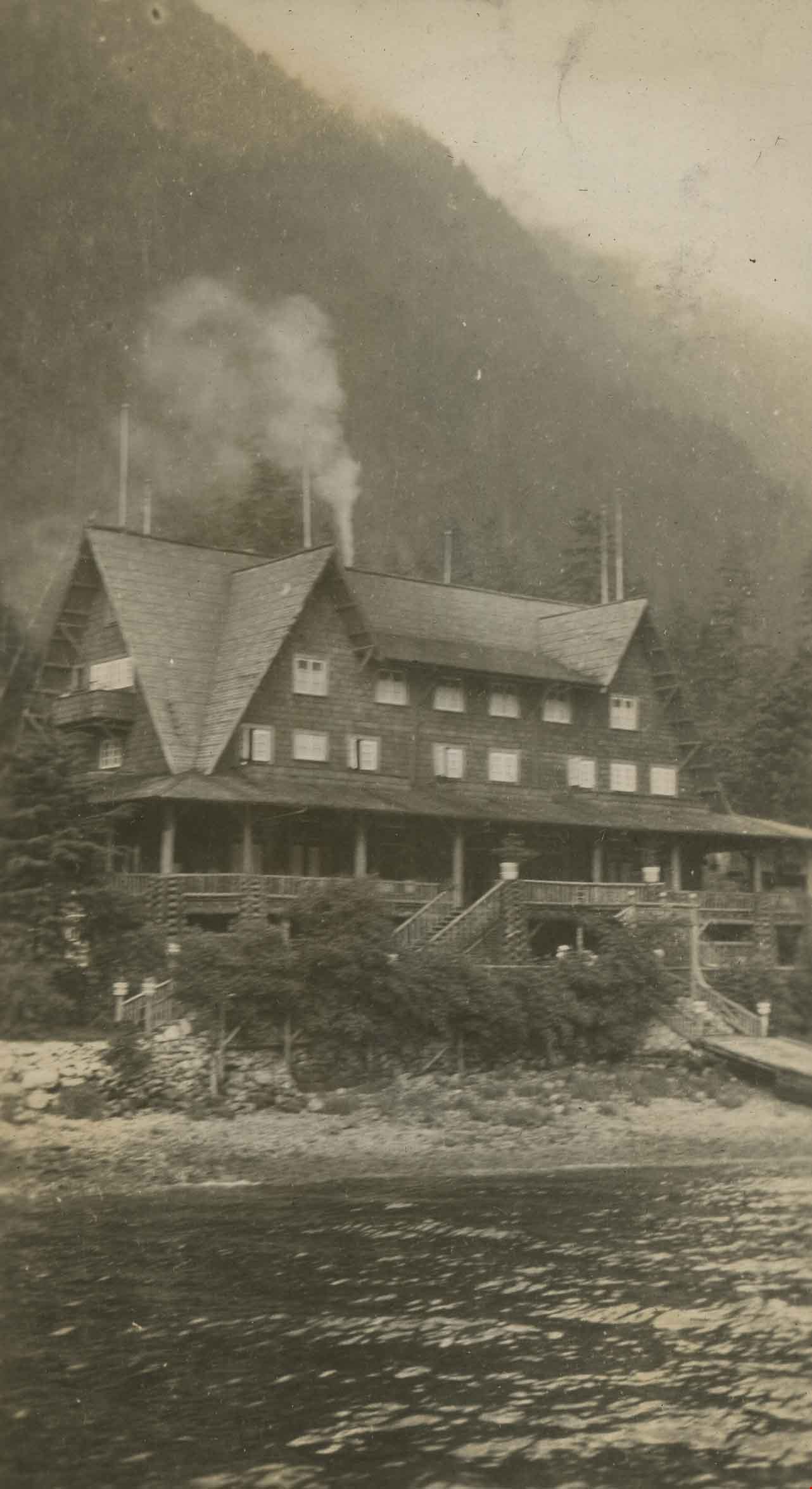
Wigwam Inn
https://search.heritageburnaby.ca/link/archivedescription39237
- Repository
- City of Burnaby Archives
- Date
- 1923
- Collection/Fonds
- Peers Family and Hill Family fonds
- Description Level
- Item
- Physical Description
- 1 photograph : b&w ; 5.5 x 10 cm on page 24.5 x 32.5 cm (pasted in album)
- Scope and Content
- Photograph of the Wigwam Inn, which is located at the northern end of Indian Arm of Burrard Inlet.
- Repository
- City of Burnaby Archives
- Date
- 1923
- Collection/Fonds
- Peers Family and Hill Family fonds
- Physical Description
- 1 photograph : b&w ; 5.5 x 10 cm on page 24.5 x 32.5 cm (pasted in album)
- Description Level
- Item
- Record No.
- 477-556
- Access Restriction
- No restrictions
- Reproduction Restriction
- No known restrictions
- Accession Number
- 2007-12
- Scope and Content
- Photograph of the Wigwam Inn, which is located at the northern end of Indian Arm of Burrard Inlet.
- Names
- Wigwam Inn
- Media Type
- Photograph
- Notes
- Title based on caption accompanying photograph
Images

Metrotown Station Square
https://search.heritageburnaby.ca/link/archivedescription93745
- Repository
- City of Burnaby Archives
- Date
- November 1989
- Collection/Fonds
- Grover, Elliott & Co. Ltd. fonds
- Description Level
- File
- Physical Description
- 83 photographs : col. negatives ; 35 mm + 2 computer disks ; 14 x 14 cm
- Scope and Content
- Photographs of Metrotown Station Square during construction. Businesses visible in the photographs include: Eastons, Holiday Inn, Future Shop, Great Canadian Superstore, and Toy City Consumers.
- Repository
- City of Burnaby Archives
- Date
- November 1989
- Collection/Fonds
- Grover, Elliott & Co. Ltd. fonds
- Physical Description
- 83 photographs : col. negatives ; 35 mm + 2 computer disks ; 14 x 14 cm
- Description Level
- File
- Record No.
- 622-030
- Access Restriction
- No restrictions
- Reproduction Restriction
- No restrictions
- Accession Number
- 2017-39
- Scope and Content
- Photographs of Metrotown Station Square during construction. Businesses visible in the photographs include: Eastons, Holiday Inn, Future Shop, Great Canadian Superstore, and Toy City Consumers.
- Media Type
- Photograph
- Notes
- Transcribed title
- Title transcribed from print envelopes photographs were originally housed in
- File no. 89-512-B
- Computer disks are labelled "Station Square Metro Town Nov /89". Computer disk envelopes are labelled "Suite 660-1380 Burrard ST / Van, BC"
- Geographic Access
- McKay Avenue
- Street Address
- 6200 McKay Avenue
- Historic Neighbourhood
- Central Park (Historic Neighbourhood)
- Planning Study Area
- Maywood Area
Images

![Harry Rensmaag, [2001] thumbnail](/media/hpo/_Data/_Archives_Images/_Unrestricted/535/535-2207.jpg?width=280)
Harry Rensmaag
https://search.heritageburnaby.ca/link/archivedescription96585
- Repository
- City of Burnaby Archives
- Date
- [2001]
- Collection/Fonds
- Burnaby NewsLeader photograph collection
- Description Level
- Item
- Physical Description
- 1 photograph (tiff) : col.
- Scope and Content
- Photograph of Harry Rensmaag, the site supervisor at the Brentwood development. Behind Rensmaag, an under-construction condo tower and crane are visible, next to a Winners store that is advertising its grand opening.
- Repository
- City of Burnaby Archives
- Date
- [2001]
- Collection/Fonds
- Burnaby NewsLeader photograph collection
- Physical Description
- 1 photograph (tiff) : col.
- Description Level
- Item
- Record No.
- 535-2207
- Access Restriction
- No restrictions
- Reproduction Restriction
- No restrictions
- Accession Number
- 2018-12
- Scope and Content
- Photograph of Harry Rensmaag, the site supervisor at the Brentwood development. Behind Rensmaag, an under-construction condo tower and crane are visible, next to a Winners store that is advertising its grand opening.
- Media Type
- Photograph
- Photographer
- Bartel, Mario
- Notes
- Title based on caption
- Collected by editorial for use in a March 2001 issue of the Burnaby NewsLeader
- Caption from metadata: "Harry Rensmaag is the site supervisor of the new shopping/office/condo development being built in the Brentwood area."
- Geographic Access
- Lougheed Highway
- Planning Study Area
- Brentwood Area
Images
![Harry Rensmaag, [2001] thumbnail](/media/hpo/_Data/_Archives_Images/_Unrestricted/535/535-2207.jpg)
![New development at Brentwood, [2000] thumbnail](/media/hpo/_Data/_Archives_Images/_Unrestricted/535/535-2632-1.jpg?width=280)
New development at Brentwood
https://search.heritageburnaby.ca/link/archivedescription97105
- Repository
- City of Burnaby Archives
- Date
- [2000]
- Collection/Fonds
- Burnaby NewsLeader photograph collection
- Description Level
- File
- Physical Description
- 3 photographs (tiff) : col.
- Scope and Content
- File contains photographs of the new construction and development in the Brentwood area. Photographs depict: Paul Kiidumae, general manager of Brentwood Mall, holding plans and viewing the progress of the new London Drugs wing; the interior of Brentwood Mall with the new Sears outlet visible in the…
- Repository
- City of Burnaby Archives
- Date
- [2000]
- Collection/Fonds
- Burnaby NewsLeader photograph collection
- Physical Description
- 3 photographs (tiff) : col.
- Description Level
- File
- Record No.
- 535-2632
- Access Restriction
- No restrictions
- Reproduction Restriction
- No restrictions
- Accession Number
- 2018-12
- Scope and Content
- File contains photographs of the new construction and development in the Brentwood area. Photographs depict: Paul Kiidumae, general manager of Brentwood Mall, holding plans and viewing the progress of the new London Drugs wing; the interior of Brentwood Mall with the new Sears outlet visible in the background; and the construction site with an advertising sign for the residential and commercial Madison Centre complex.
- Media Type
- Photograph
- Photographer
- Bartel, Mario
- Notes
- Title based on caption
- Collected by editorial for use in a July 2000 issue of the Burnaby NewsLeader
- Caption from metadata for 535-2632-1: "Paul Kiidumae, the general manager of Brentwood Mall, checks on the progress of the new London Drugs wing being constructed on the north side of the mall."
- Caption from metadata for 535-2632-2: "Explosive growth in the area, and the arrival of Skytrain service, allowed Brentwood Mall to quickly replace its departed Eaton's store with a new Sears outlet."
- Caption from metadata for 535-2632-3: "Burnaby's Brentwood area is booming, with the construction of Skytrain attracting new development, like the Madison Centre, a residential, commercial and business complex being built on the site of the old Lougheed Hotel."
- Geographic Access
- Lougheed Highway
- Street Address
- 4567 Lougheed Highway
- Planning Study Area
- Brentwood Area
Images
![New development at Brentwood, [2000] thumbnail](/media/hpo/_Data/_Archives_Images/_Unrestricted/535/535-2632-1.jpg)
3650 Bonneville Place
https://search.heritageburnaby.ca/link/archivedescription93737
- Repository
- City of Burnaby Archives
- Date
- March 1989
- Collection/Fonds
- Grover, Elliott & Co. Ltd. fonds
- Description Level
- File
- Physical Description
- 8 photographs : col. ; 10 cm x 15 cm
- Scope and Content
- Photographs of the commercial complex located at 3650 Bonneville Place. Phase I of the complex is complete and Phase II is under construction. Businesses visible in the photographs include Four Seasons Greenhouses and Shaw.
- Repository
- City of Burnaby Archives
- Date
- March 1989
- Collection/Fonds
- Grover, Elliott & Co. Ltd. fonds
- Physical Description
- 8 photographs : col. ; 10 cm x 15 cm
- Description Level
- File
- Record No.
- 622-022
- Access Restriction
- No restrictions
- Reproduction Restriction
- No restrictions
- Accession Number
- 2017-39
- Scope and Content
- Photographs of the commercial complex located at 3650 Bonneville Place. Phase I of the complex is complete and Phase II is under construction. Businesses visible in the photographs include Four Seasons Greenhouses and Shaw.
- Subjects
- Buildings - Commercial
- Construction
- Media Type
- Photograph
- Notes
- Transcribed title
- Title transcribed from sticky note adhered to photograph 622-022-1
- File no. 89-124-B
- Photograph 622-022-1 captions reads: "3650 Bonneville - south view"
- Photograph 622-022-2 caption reads: "North and east facade"
- Photograph 622-022-3 caption reads: "View north along Broadway Street; Note entry bridges"
- Photograph 622-022-4 caption reads: "Southern view along Broadway Street"
- Photograph 622-022-5 caption reads: "Front facade and main entry for Phase I"
- Photograph 622-022-6 caption reads: "Rear and loading facilities for Phase I"
- Photograph 622-022-7 caption reads: "View west to Phase II from entry driveway"
- Photograph 622-022-8 caption reads: "Site preparation for Phase I
- Photograph captions transcribed from the paper on which the photographs were originally adhered.
- Geographic Access
- Bonneville Place
- Street Address
- 3650 Bonneville Place
- Planning Study Area
- Lake City Area
![Business staff affected by SkyTrain construction, [2000] thumbnail](/media/hpo/_Data/_Archives_Images/_Unrestricted/535/535-2422-1.jpg?width=280)
Business staff affected by SkyTrain construction
https://search.heritageburnaby.ca/link/archivedescription96864
- Repository
- City of Burnaby Archives
- Date
- [2000]
- Collection/Fonds
- Burnaby NewsLeader photograph collection
- Description Level
- File
- Physical Description
- 2 photographs (tiff) : col.
- Scope and Content
- File contains photographs of employees of businesses affected by the SkyTrain construction along the Lougheed Highway. Photographs depict Javed Mufti setting up a patio umbrella at the Cactus Club, and Tanya Frackladge, a manager at the Canadian Tire at Lougheed and Rosser, tending to plants outsid…
- Repository
- City of Burnaby Archives
- Date
- [2000]
- Collection/Fonds
- Burnaby NewsLeader photograph collection
- Physical Description
- 2 photographs (tiff) : col.
- Description Level
- File
- Record No.
- 535-2422
- Access Restriction
- No restrictions
- Reproduction Restriction
- No restrictions
- Accession Number
- 2018-12
- Scope and Content
- File contains photographs of employees of businesses affected by the SkyTrain construction along the Lougheed Highway. Photographs depict Javed Mufti setting up a patio umbrella at the Cactus Club, and Tanya Frackladge, a manager at the Canadian Tire at Lougheed and Rosser, tending to plants outside of the Canadian Tire.
- Media Type
- Photograph
- Photographer
- Bartel, Mario
- Notes
- Title based on caption
- Collected by editorial for use in a May 2000 issue of the Burnaby NewsLeader
- Caption from metadata for 535-2422-1: "Javed Mufti, of the Cactus Club, says he's worried his restaurant's patio business will disappear as the Skytrain construction moves west along the Lougheed."
- Caption from metadata for 535-2422-2: "Tanya Frackladge, a manager at the Canadian Tire at Lougheed and Rosser, says she's had plenty of time to tend to the geraniums since the highway was shut down for Skytrain constructions."
- Geographic Access
- Lougheed Highway
- Rosser Avenue
- Historic Neighbourhood
- Vancouver Heights (Historic Neighbourhood)
- Planning Study Area
- Brentwood Area
- Willingdon Heights Area
Images
![Business staff affected by SkyTrain construction, [2000] thumbnail](/media/hpo/_Data/_Archives_Images/_Unrestricted/535/535-2422-1.jpg)
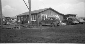
Charles Street and Madison Avenue
https://search.heritageburnaby.ca/link/archivedescription34129
- Repository
- City of Burnaby Archives
- Date
- April 2, 1947
- Collection/Fonds
- Burnaby Historical Society fonds
- Description Level
- Item
- Physical Description
- 1 photograph : b&w negative ; 6.8 x 11.4 cm
- Scope and Content
- Photograph of the field office at Charles Street and Madison Avenue. Cars and a bicycle are parked outside, and a sign reads "Whitsell Construction." This is part of the Willingdon Heights subdivision site.
- Repository
- City of Burnaby Archives
- Date
- April 2, 1947
- Collection/Fonds
- Burnaby Historical Society fonds
- Subseries
- Alfred Bingham subseries
- Physical Description
- 1 photograph : b&w negative ; 6.8 x 11.4 cm
- Description Level
- Item
- Record No.
- 010-045
- Access Restriction
- No restrictions
- Reproduction Restriction
- No known restrictions
- Accession Number
- BHS2007-04
- Scope and Content
- Photograph of the field office at Charles Street and Madison Avenue. Cars and a bicycle are parked outside, and a sign reads "Whitsell Construction." This is part of the Willingdon Heights subdivision site.
- Media Type
- Photograph
- Photographer
- Bingham, Alfred "Alf"
- Notes
- Title based on contents of photograph
- Geographic Access
- Charles Street
- Madison Avenue
Images

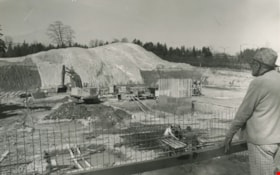
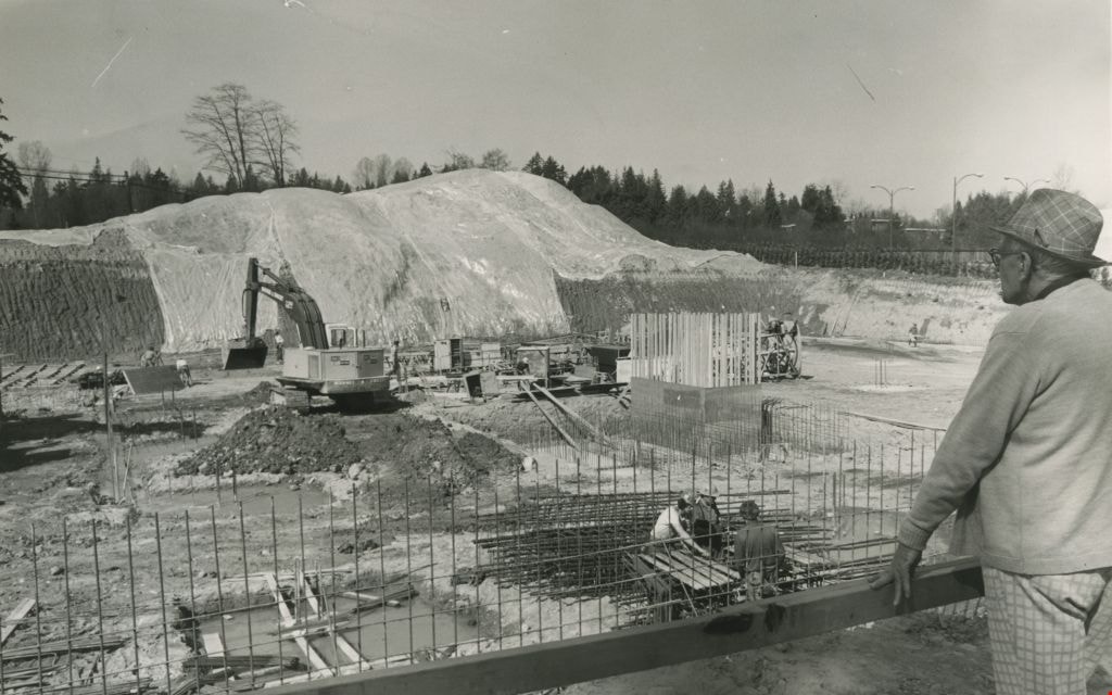
Construction of an office complex
https://search.heritageburnaby.ca/link/archivedescription45419
- Repository
- City of Burnaby Archives
- Date
- April 1977
- Collection/Fonds
- Columbian Newspaper collection
- Description Level
- Item
- Physical Description
- 1 photograph : b&w ; 12.5 x 19.5 cm
- Scope and Content
- Photograph of the site of the first office complex built in Burnaby by Marathon Realty just as construction began. A man in a plaid fedora stands to the right, watching the men work below. The site is situated across the street from the Municipal Hall on Canada Way, and consists of a number buildin…
- Repository
- City of Burnaby Archives
- Date
- April 1977
- Collection/Fonds
- Columbian Newspaper collection
- Physical Description
- 1 photograph : b&w ; 12.5 x 19.5 cm
- Description Level
- Item
- Record No.
- 480-314
- Access Restriction
- No restrictions
- Reproduction Restriction
- No restrictions
- Accession Number
- 2003-02
- Scope and Content
- Photograph of the site of the first office complex built in Burnaby by Marathon Realty just as construction began. A man in a plaid fedora stands to the right, watching the men work below. The site is situated across the street from the Municipal Hall on Canada Way, and consists of a number buildings.
- Subjects
- Buildings - Commercial
- Construction
- Names
- Marathon Realty
- Media Type
- Photograph
- Photographer
- King, Basil
- Notes
- Title based on contents of photograph
- Newspaper clipping attached to verso of photograph reads: "NEW COMPLEX NOW UNDERWAY A giant hole and a pile of earth are all that mark the site of a new Burnaby office complex being built on Edgar Avenue across from the Municipal Hall. the project is being built by Marathon Realty, the real estate arm of Canadian Pacific."
- Geographic Access
- Canada Way
- Historic Neighbourhood
- Burnaby Lake (Historic Neighbourhood)
- Planning Study Area
- Douglas-Gilpin Area
Images
Construction site
https://search.heritageburnaby.ca/link/archivedescription34214
- Repository
- City of Burnaby Archives
- Date
- June 30, 1947
- Collection/Fonds
- Burnaby Historical Society fonds
- Description Level
- Item
- Physical Description
- 1 photograph : b&w negative ; 6.8 x 11.6 cm
- Scope and Content
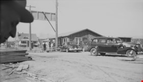
- Photograph of the construction site, including what may be the site office, with cars parked outside. A group of men are standing outside a building. A man's face can be seen in the left foreground. This is part of the Willingdon Heights subdivision site.
- Repository
- City of Burnaby Archives
- Date
- June 30, 1947
- Collection/Fonds
- Burnaby Historical Society fonds
- Subseries
- Alfred Bingham subseries
- Physical Description
- 1 photograph : b&w negative ; 6.8 x 11.6 cm
- Description Level
- Item
- Record No.
- 010-130
- Access Restriction
- No restrictions
- Reproduction Restriction
- Reproduce for fair dealing purposes only
- Accession Number
- BHS2007-04
- Scope and Content
- Photograph of the construction site, including what may be the site office, with cars parked outside. A group of men are standing outside a building. A man's face can be seen in the left foreground. This is part of the Willingdon Heights subdivision site.
- Media Type
- Photograph
- Photographer
- Bingham, Alfred "Alf"
- Notes
- Title based on contents of photograph
Images

![Crystal Mall, [1999] thumbnail](/media/hpo/_Data/_Archives_Images/_Unrestricted/535/535-3217.jpg?width=280)
Crystal Mall
https://search.heritageburnaby.ca/link/archivedescription98138
- Repository
- City of Burnaby Archives
- Date
- [1999]
- Collection/Fonds
- Burnaby NewsLeader photograph collection
- Description Level
- Item
- Physical Description
- 1 photograph (tiff) : col.
- Scope and Content
- Photograph of an unidentified construction worker pushing a wheelbarrow in front of the new Crystal Mall, toward the completion of its construction.
- Repository
- City of Burnaby Archives
- Date
- [1999]
- Collection/Fonds
- Burnaby NewsLeader photograph collection
- Physical Description
- 1 photograph (tiff) : col.
- Description Level
- Item
- Record No.
- 535-3217
- Access Restriction
- No restrictions
- Reproduction Restriction
- No restrictions
- Accession Number
- 2018-12
- Scope and Content
- Photograph of an unidentified construction worker pushing a wheelbarrow in front of the new Crystal Mall, toward the completion of its construction.
- Media Type
- Photograph
- Notes
- Title based on original file name
- Collected by editorial for use in a June 1999 issue of the Burnaby NewsLeader
- Geographic Access
- Kingsway
- Street Address
- 4500 Kingsway
- Historic Neighbourhood
- Central Park (Historic Neighbourhood)
- Planning Study Area
- Maywood Area
Images
![Crystal Mall, [1999] thumbnail](/media/hpo/_Data/_Archives_Images/_Unrestricted/535/535-3217.jpg)
![Dismantling the Eaton Centre sign, [2000] thumbnail](/media/hpo/_Data/_Archives_Images/_Unrestricted/535/535-2901.jpg?width=280)
Dismantling the Eaton Centre sign
https://search.heritageburnaby.ca/link/archivedescription97562
- Repository
- City of Burnaby Archives
- Date
- [2000]
- Collection/Fonds
- Burnaby NewsLeader photograph collection
- Description Level
- Item
- Physical Description
- 1 photograph (tiff) : col.
- Scope and Content
- Photograph of a construction worker dismantling the Eaton Centre sign at the new Metropolis at Metrotown mall.
- Repository
- City of Burnaby Archives
- Date
- [2000]
- Collection/Fonds
- Burnaby NewsLeader photograph collection
- Physical Description
- 1 photograph (tiff) : col.
- Description Level
- Item
- Record No.
- 535-2901
- Access Restriction
- No restrictions
- Reproduction Restriction
- No restrictions
- Accession Number
- 2018-12
- Scope and Content
- Photograph of a construction worker dismantling the Eaton Centre sign at the new Metropolis at Metrotown mall.
- Names
- Metrotown
- Media Type
- Photograph
- Photographer
- Bartel, Mario
- Notes
- Title based on caption
- Collected by editorial for use in an October 2000 issue of the Burnaby NewsLeader
- Caption from metadata: "Workers dismantle the Eaton Centre sign as the mall at Metrotown begins its new life as Metropolis at Metrotown."
- Geographic Access
- Kingsway
- Street Address
- 4700 Kingsway
- Historic Neighbourhood
- Central Park (Historic Neighbourhood)
- Planning Study Area
- Maywood Area
Images
![Dismantling the Eaton Centre sign, [2000] thumbnail](/media/hpo/_Data/_Archives_Images/_Unrestricted/535/535-2901.jpg)
![Highgate Village construction, [2004] thumbnail](/media/hpo/_Data/_Archives_Images/_Unrestricted/535/535-1768-1.jpg?width=280)
Highgate Village construction
https://search.heritageburnaby.ca/link/archivedescription96017
- Repository
- City of Burnaby Archives
- Date
- [2004]
- Collection/Fonds
- Burnaby NewsLeader photograph collection
- Description Level
- File
- Physical Description
- 2 photographs (tiff) : col.
- Scope and Content
- File contains photographs of a construction worker working on a concrete pillar on the site of the new Highgate Village. A crane is visible in the background.
- Repository
- City of Burnaby Archives
- Date
- [2004]
- Collection/Fonds
- Burnaby NewsLeader photograph collection
- Physical Description
- 2 photographs (tiff) : col.
- Description Level
- File
- Record No.
- 535-1768
- Access Restriction
- No restrictions
- Reproduction Restriction
- No restrictions
- Accession Number
- 2018-12
- Scope and Content
- File contains photographs of a construction worker working on a concrete pillar on the site of the new Highgate Village. A crane is visible in the background.
- Media Type
- Photograph
- Photographer
- Bartel, Mario
- Notes
- Title based on caption
- Collected by editorial for use in a January 2004 issue of the Burnaby NewsLeader
- Caption from metadata: "A worker prepares a mold for a concrete pillar at the site of the new Highgate Village, in the Edmonds area. Construction workers and cranes are becoming a familiar sight around Burnaby, as the city enjoys a building boom."
- Geographic Access
- Kingsway
- Historic Neighbourhood
- Edmonds (Historic Neighbourhood)
- Planning Study Area
- Richmond Park Area
Images
![Highgate Village construction, [2004] thumbnail](/media/hpo/_Data/_Archives_Images/_Unrestricted/535/535-1768-1.jpg)
![Lougheed Town Centre skylights, [2002] thumbnail](/media/hpo/_Data/_Archives_Images/_Unrestricted/535/535-2824.jpg?width=280)
Lougheed Town Centre skylights
https://search.heritageburnaby.ca/link/archivedescription97485
- Repository
- City of Burnaby Archives
- Date
- [2002]
- Collection/Fonds
- Burnaby NewsLeader photograph collection
- Description Level
- Item
- Physical Description
- 1 photograph (tiff) : col.
- Scope and Content
- Photograph of AJ Smith from Action Glass caulking new glass panes in Lougheed Town Centre's skylights, as part of the mall's large renovation.
- Repository
- City of Burnaby Archives
- Date
- [2002]
- Collection/Fonds
- Burnaby NewsLeader photograph collection
- Physical Description
- 1 photograph (tiff) : col.
- Description Level
- Item
- Record No.
- 535-2824
- Access Restriction
- No restrictions
- Reproduction Restriction
- No restrictions
- Accession Number
- 2018-12
- Scope and Content
- Photograph of AJ Smith from Action Glass caulking new glass panes in Lougheed Town Centre's skylights, as part of the mall's large renovation.
- Names
- Lougheed Town Centre
- Media Type
- Photograph
- Photographer
- Bartel, Mario
- Notes
- Title based on caption
- Collected by editorial for use in an October 2002 issue of the Burnaby NewsLeader
- Caption from metadata: "AJ Smith, of Action Glass, steps carefully as he caulks new glass panes in the skylights at Lougheed Town Centre. The mall is nearing completion of a $20 million renovation."
- Geographic Access
- Austin Road
- Street Address
- 9855 Austin Avenue
- Historic Neighbourhood
- Burquitlam (Historic Neighbourhood)
- Planning Study Area
- Cameron Area
Images
![Lougheed Town Centre skylights, [2002] thumbnail](/media/hpo/_Data/_Archives_Images/_Unrestricted/535/535-2824.jpg)
Safeway construction
https://search.heritageburnaby.ca/link/archivedescription38680
- Repository
- City of Burnaby Archives
- Date
- 1941
- Collection/Fonds
- Burnaby Historical Society fonds
- Description Level
- Item
- Physical Description
- 1 photograph : b&w ; 11.5 x 17 cm
- Scope and Content
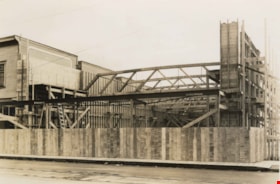
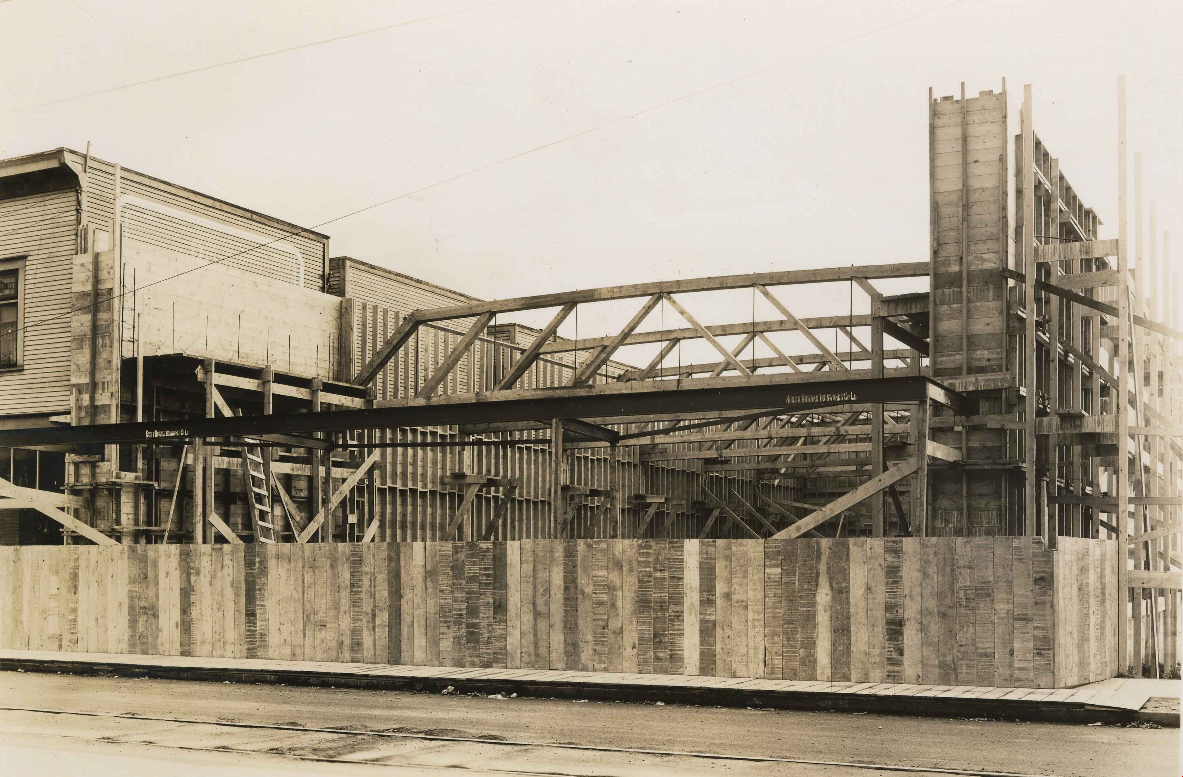
- Photograph of the construction of the Safeway building at Hastings and Gilmore.
- Repository
- City of Burnaby Archives
- Date
- 1941
- Collection/Fonds
- Burnaby Historical Society fonds
- Subseries
- North Burnaby Board of Trade subseries
- Physical Description
- 1 photograph : b&w ; 11.5 x 17 cm
- Description Level
- Item
- Record No.
- 476-023
- Access Restriction
- No restrictions
- Reproduction Restriction
- No known restrictions
- Accession Number
- BHS2005-8
- Scope and Content
- Photograph of the construction of the Safeway building at Hastings and Gilmore.
- Names
- Safeway
- Media Type
- Photograph
- Photographer
- Pinkerton, Gordon
- Notes
- Title based on contents of photograph
- Geographic Access
- Hastings Street
- Gilmore Avenue
- Historic Neighbourhood
- Vancouver Heights (Historic Neighbourhood)
- Planning Study Area
- Burnaby Heights Area
Images
![Sears construction, [between 1948 and 1950] (date of original), copied 1992 thumbnail](/media/hpo/_Data/_Archives_Images/_Unrestricted/315/315-411.jpg?width=280)
Sears construction
https://search.heritageburnaby.ca/link/archivedescription36953
- Repository
- City of Burnaby Archives
- Date
- [between 1948 and 1950] (date of original), copied 1992
- Collection/Fonds
- Burnaby Historical Society fonds
- Description Level
- Item
- Physical Description
- 1 photograph : b&w ; 8.8 x 9.6 cm print
- Scope and Content
- Photograph of the beginning of the construction of Simpson Sears.
- Repository
- City of Burnaby Archives
- Date
- [between 1948 and 1950] (date of original), copied 1992
- Collection/Fonds
- Burnaby Historical Society fonds
- Subseries
- Burnaby Centennial Anthology subseries
- Physical Description
- 1 photograph : b&w ; 8.8 x 9.6 cm print
- Description Level
- Item
- Record No.
- 315-411
- Access Restriction
- No restrictions
- Reproduction Restriction
- No known restrictions
- Accession Number
- BHS1994-04
- Scope and Content
- Photograph of the beginning of the construction of Simpson Sears.
- Names
- Simpsons-Sears Limited
- Media Type
- Photograph
- Notes
- Title based on contents of photograph
- Geographic Access
- Kingsway
- Sussex Avenue
- Historic Neighbourhood
- Central Park (Historic Neighbourhood)
- Planning Study Area
- Maywood Area
Images
![Sears construction, [between 1948 and 1950] (date of original), copied 1992 thumbnail](/media/hpo/_Data/_Archives_Images/_Unrestricted/315/315-411.jpg)
![Sears construction, [between 1948 and 1950] (date of original), copied 1992 thumbnail](/media/hpo/_Data/_Archives_Images/_Unrestricted/315/315-412.jpg?width=280)
Sears construction
https://search.heritageburnaby.ca/link/archivedescription36954
- Repository
- City of Burnaby Archives
- Date
- [between 1948 and 1950] (date of original), copied 1992
- Collection/Fonds
- Burnaby Historical Society fonds
- Description Level
- Item
- Physical Description
- 1 photograph : b&w ; 7.3 x 9.6 cm print
- Scope and Content
- Photograph of the beginning of the construction of Simpson Sears.
- Repository
- City of Burnaby Archives
- Date
- [between 1948 and 1950] (date of original), copied 1992
- Collection/Fonds
- Burnaby Historical Society fonds
- Subseries
- Burnaby Centennial Anthology subseries
- Physical Description
- 1 photograph : b&w ; 7.3 x 9.6 cm print
- Description Level
- Item
- Record No.
- 315-412
- Access Restriction
- No restrictions
- Reproduction Restriction
- No known restrictions
- Accession Number
- BHS1994-04
- Scope and Content
- Photograph of the beginning of the construction of Simpson Sears.
- Names
- Simpsons-Sears Limited
- Media Type
- Photograph
- Notes
- Title based on contents of photograph
- Geographic Access
- Kingsway
- Sussex Avenue
- Historic Neighbourhood
- Central Park (Historic Neighbourhood)
- Planning Study Area
- Maywood Area
Images
![Sears construction, [between 1948 and 1950] (date of original), copied 1992 thumbnail](/media/hpo/_Data/_Archives_Images/_Unrestricted/315/315-412.jpg)

Parkcrest Plaza
https://search.heritageburnaby.ca/link/archivedescription93653
- Repository
- City of Burnaby Archives
- Date
- October 23, 1977
- Collection/Fonds
- Burnaby Public Library Contemporary Visual Archive Project
- Description Level
- Item
- Physical Description
- 1 photograph : b&w ; 12.5 x 17.5 cm
- Scope and Content
- Photograph of the Parkcrest Plaza shopping centre at Sperling and Broadway. The photograph is taken from across the parking lot and lawn, facing west. Signs for the plaza's businesses include Fresh Foods and Bank of Nova Scotia, and homes and apartment buildings are in the distance.
- Repository
- City of Burnaby Archives
- Date
- October 23, 1977
- Collection/Fonds
- Burnaby Public Library Contemporary Visual Archive Project
- Physical Description
- 1 photograph : b&w ; 12.5 x 17.5 cm
- Description Level
- Item
- Record No.
- 556-610
- Access Restriction
- No restrictions
- Reproduction Restriction
- Reproduce for fair dealing purposes only
- Accession Number
- 2017-57
- Scope and Content
- Photograph of the Parkcrest Plaza shopping centre at Sperling and Broadway. The photograph is taken from across the parking lot and lawn, facing west. Signs for the plaza's businesses include Fresh Foods and Bank of Nova Scotia, and homes and apartment buildings are in the distance.
- Subjects
- Buildings - Commercial - Grocery Stores
- Buildings - Commercial - Malls
- Buildings - Commercial - Banks
- Buildings - Commercial - Stores
- Media Type
- Photograph
- Photographer
- Chapman, Fred
- Notes
- Title taken from project information form
- Accompanied by a project information form and 1 photograph (b&w negative ; 9.5 x 12.5 cm)
- BPL no. 60
- Geographic Access
- Sperling Avenue
- Broadway
- Street Address
- 5901 Sperling Avenue
- Planning Study Area
- Parkcrest-Aubrey Area
Images

7641-7651 Royal Oak Ave
https://search.heritageburnaby.ca/link/archivedescription93769
- Repository
- City of Burnaby Archives
- Date
- July 30, 1992
- Collection/Fonds
- Grover, Elliott & Co. Ltd. fonds
- Description Level
- File
- Physical Description
- 25 photographs : col. negatives ; 35 mm
- Scope and Content
- Photographs of the commercial properties located between 7641 and 7651 Royal Oak Avenue. Stores visible in the photographs include: Buy Low Foods, Mega Movies, and Chevron service station.
- Repository
- City of Burnaby Archives
- Date
- July 30, 1992
- Collection/Fonds
- Grover, Elliott & Co. Ltd. fonds
- Physical Description
- 25 photographs : col. negatives ; 35 mm
- Description Level
- File
- Record No.
- 622-053
- Access Restriction
- No restrictions
- Reproduction Restriction
- No restrictions
- Accession Number
- 2017-39
- Scope and Content
- Photographs of the commercial properties located between 7641 and 7651 Royal Oak Avenue. Stores visible in the photographs include: Buy Low Foods, Mega Movies, and Chevron service station.
- Subjects
- Buildings - Commercial
- Buildings - Commercial - Service Stations
- Buildings - Commercial - Stores
- Geographic Features - Roads
- Media Type
- Photograph
- Photographer
- Young, Richard
- Notes
- Transcribed title
- Title transcribed from envelope photographs were originally housed in
- File no. 92-287-B
- Geographic Access
- Royal Oak Avenue
- Historic Neighbourhood
- Alta Vista (Historic Neighbourhood)
- Planning Study Area
- Maywood Area