More like 'Canadian Pacific Railway Depot'
Narrow Results By
7641-7651 Royal Oak Ave
https://search.heritageburnaby.ca/link/archivedescription93769
- Repository
- City of Burnaby Archives
- Date
- July 30, 1992
- Collection/Fonds
- Grover, Elliott & Co. Ltd. fonds
- Description Level
- File
- Physical Description
- 25 photographs : col. negatives ; 35 mm
- Scope and Content
- Photographs of the commercial properties located between 7641 and 7651 Royal Oak Avenue. Stores visible in the photographs include: Buy Low Foods, Mega Movies, and Chevron service station.
- Repository
- City of Burnaby Archives
- Date
- July 30, 1992
- Collection/Fonds
- Grover, Elliott & Co. Ltd. fonds
- Physical Description
- 25 photographs : col. negatives ; 35 mm
- Description Level
- File
- Record No.
- 622-053
- Access Restriction
- No restrictions
- Reproduction Restriction
- No restrictions
- Accession Number
- 2017-39
- Scope and Content
- Photographs of the commercial properties located between 7641 and 7651 Royal Oak Avenue. Stores visible in the photographs include: Buy Low Foods, Mega Movies, and Chevron service station.
- Subjects
- Buildings - Commercial
- Buildings - Commercial - Service Stations
- Buildings - Commercial - Stores
- Geographic Features - Roads
- Media Type
- Photograph
- Photographer
- Young, Richard
- Notes
- Transcribed title
- Title transcribed from envelope photographs were originally housed in
- File no. 92-287-B
- Geographic Access
- Royal Oak Avenue
- Historic Neighbourhood
- Alta Vista (Historic Neighbourhood)
- Planning Study Area
- Maywood Area
6900 [and] 7000 bk Hastings St. / 7000 blk Pandora St. 200 [and] 300 blks Cliff Ave Burnaby
https://search.heritageburnaby.ca/link/archivedescription94205
- Repository
- City of Burnaby Archives
- Date
- November 1993 - December 1993
- Collection/Fonds
- Grover, Elliott & Co. Ltd. fonds
- Description Level
- File
- Physical Description
- 96 photographs : col. negatives ; 35 mm
- Scope and Content
- Photographs of various residential and commercial streets in Burnaby.
- Repository
- City of Burnaby Archives
- Date
- November 1993 - December 1993
- Collection/Fonds
- Grover, Elliott & Co. Ltd. fonds
- Physical Description
- 96 photographs : col. negatives ; 35 mm
- Description Level
- File
- Record No.
- 622-080
- Access Restriction
- No restrictions
- Reproduction Restriction
- No restrictions
- Accession Number
- 2017-39
- Scope and Content
- Photographs of various residential and commercial streets in Burnaby.
- Subjects
- Geographic Features - Roads
- Buildings - Residential - Apartments
- Buildings - Residential - Houses
- Buildings - Commercial
- Media Type
- Photograph
- Notes
- Transcribed title
- Title transcribed from envelope photographs were originally housed in
- File no. 93-455-B
- Note on negative envelope housing photographs 622-080-1 : 622-080-74 reads: "93-11-26 / Inlet Dr/Hastings, Bby, / 93-455-B"
- Note on negative envelope housing photographs 622-080-75 : 622-080-96 reads: "93-12-01 / Comp's / 93-455"
- Photographer identified as "K.H."
- Geographic Access
- Hastings Street
- Cliff Avenue
- Pandora Street
6979 Hastings St / 6941 Hastings St / 6951 Hastings St / 6939 Hastings St
https://search.heritageburnaby.ca/link/archivedescription94169
- Repository
- City of Burnaby Archives
- Date
- July 30, 1993
- Collection/Fonds
- Grover, Elliott & Co. Ltd. fonds
- Description Level
- File
- Physical Description
- 141 photographs : col. negatives ; 35 mm
- Scope and Content
- Photographs of various residential and commercial properties located throughout Burnaby. Stores visible in the photographs include Cafe Classico at 4293 Hastings Street, Firestone at 6941 Hastings Street, Coast Automatic Transmissions at 4700 Imperial Street, and Bill's Tune Up at 6979 Hastings St…
- Repository
- City of Burnaby Archives
- Date
- July 30, 1993
- Collection/Fonds
- Grover, Elliott & Co. Ltd. fonds
- Physical Description
- 141 photographs : col. negatives ; 35 mm
- Description Level
- File
- Record No.
- 622-077
- Access Restriction
- No restrictions
- Reproduction Restriction
- No restrictions
- Accession Number
- 2017-39
- Scope and Content
- Photographs of various residential and commercial properties located throughout Burnaby. Stores visible in the photographs include Cafe Classico at 4293 Hastings Street, Firestone at 6941 Hastings Street, Coast Automatic Transmissions at 4700 Imperial Street, and Bill's Tune Up at 6979 Hastings Street.
- Media Type
- Photograph
- Notes
- Transcribed title
- File nos. 93-309-B, 93-310-B, 39-308-B, and 93-307-B
- Title and file numbers transcribed from manilla envelope photographs were originally housed in.
- Date transcribed from manilla envelope photographs were originally housed in.
- File no. 93-309-B is titled "6979 Hastings St."
- File no. 93-310-B is titled "6941 Hastings St."
- File no. 93-308-B is titled "6951 Hastings St."
- File no. 93-307-B is titled "3939 Hastings St."
- It is not known which photographs were originally contained in each file.
- Photographer identified as "H., Karl"
- Geographic Access
- Hastings Street
- Imperial Street
2040-2074 Alpha Ave
https://search.heritageburnaby.ca/link/archivedescription93883
- Repository
- City of Burnaby Archives
- Date
- March 8, 1993
- Collection/Fonds
- Grover, Elliott & Co. Ltd. fonds
- Description Level
- File
- Physical Description
- 26 photographs : col. negatives ; 35 mm
- Scope and Content
- Photographs of the commercial buildings located at 2040-2074 Alpha Avenue. Stores visible in the photographs include E.B. Horsman and Bellevue.
- Repository
- City of Burnaby Archives
- Date
- March 8, 1993
- Collection/Fonds
- Grover, Elliott & Co. Ltd. fonds
- Physical Description
- 26 photographs : col. negatives ; 35 mm
- Description Level
- File
- Record No.
- 622-066
- Access Restriction
- No restrictions
- Reproduction Restriction
- No restrictions
- Accession Number
- 2017-39
- Scope and Content
- Photographs of the commercial buildings located at 2040-2074 Alpha Avenue. Stores visible in the photographs include E.B. Horsman and Bellevue.
- Media Type
- Photograph
- Notes
- Transcribed title
- Title transcribed from envelope photographs were originally housed in
- File no. 93-103-B
- Geographic Access
- Alpha Avenue
- Planning Study Area
- Dawson-Delta Area
3710 1st Ave
https://search.heritageburnaby.ca/link/archivedescription94330
- Repository
- City of Burnaby Archives
- Date
- February 1995
- Collection/Fonds
- Grover, Elliott & Co. Ltd. fonds
- Description Level
- File
- Physical Description
- 22 photographs : col. negatives ; 35 mm
- Scope and Content
- Photographs of the commercial property located at 3710 1st Avenue and the intersection at 1st Avenue and Boundary Road.
- Repository
- City of Burnaby Archives
- Date
- February 1995
- Collection/Fonds
- Grover, Elliott & Co. Ltd. fonds
- Physical Description
- 22 photographs : col. negatives ; 35 mm
- Description Level
- File
- Record No.
- 622-115
- Access Restriction
- No restrictions
- Reproduction Restriction
- No restrictions
- Accession Number
- 2017-39
- Scope and Content
- Photographs of the commercial property located at 3710 1st Avenue and the intersection at 1st Avenue and Boundary Road.
- Media Type
- Photograph
- Photographer
- Young, Richard
- Notes
- Transcribed title
- Title transcribed from envelope photographs were originally housed in
- File no. 95-054-B
- Geographic Access
- 1st Avenue
- Boundary Road
- Street Address
- 3710 1st Avenue
- Historic Neighbourhood
- Broadview (Historic Neighbourhood)
- Planning Study Area
- West Central Valley Area
3737 2nd Ave
https://search.heritageburnaby.ca/link/archivedescription94203
- Repository
- City of Burnaby Archives
- Date
- August 1993
- Collection/Fonds
- Grover, Elliott & Co. Ltd. fonds
- Description Level
- File
- Physical Description
- 22 photographs : col. negatives ; 35 mm
- Scope and Content
- Photographs of the exterior of a commercial building located at 3737 2nd Avenue.
- Repository
- City of Burnaby Archives
- Date
- August 1993
- Collection/Fonds
- Grover, Elliott & Co. Ltd. fonds
- Physical Description
- 22 photographs : col. negatives ; 35 mm
- Description Level
- File
- Record No.
- 622-078
- Access Restriction
- No restrictions
- Reproduction Restriction
- No restrictions
- Accession Number
- 2017-39
- Scope and Content
- Photographs of the exterior of a commercial building located at 3737 2nd Avenue.
- Media Type
- Photograph
- Notes
- Transcribed title
- Title transcribed from envelope photographs were originally housed in
- File no. 93-329-B
- Photographer identified as "L.D."
- Geographic Access
- 2nd Avenue
- Street Address
- 3737 2nd Avenue
- Historic Neighbourhood
- Broadview (Historic Neighbourhood)
- Planning Study Area
- West Central Valley Area
3900-3978 Hastings
https://search.heritageburnaby.ca/link/archivedescription93809
- Repository
- City of Burnaby Archives
- Date
- September 12, 1992
- Collection/Fonds
- Grover, Elliott & Co. Ltd. fonds
- Description Level
- File
- Physical Description
- 4 photographs : col. ; 10 cm x 15 cm
- Scope and Content
- Photographs of a two-storey commercial building located at 3900 through 3978 Hastings Street, with a residential tower visible behind it. Stores visible in the photograph include: Budget Video, a dental centre, a produce store, Autoplan Insurance, Da Vinci Travel, Great Pacific Management, and Hea…
- Repository
- City of Burnaby Archives
- Date
- September 12, 1992
- Collection/Fonds
- Grover, Elliott & Co. Ltd. fonds
- Physical Description
- 4 photographs : col. ; 10 cm x 15 cm
- Description Level
- File
- Record No.
- 622-057
- Access Restriction
- No restrictions
- Reproduction Restriction
- No restrictions
- Accession Number
- 2017-39
- Scope and Content
- Photographs of a two-storey commercial building located at 3900 through 3978 Hastings Street, with a residential tower visible behind it. Stores visible in the photograph include: Budget Video, a dental centre, a produce store, Autoplan Insurance, Da Vinci Travel, Great Pacific Management, and Head Waze Hair and Skin Studio.
- Media Type
- Photograph
- Notes
- Transcribed title
- Title transcribed from envelope photographs were originally housed in
- File no. 92-336-B
- Photographer identified as "J.C."
- Geographic Access
- Hastings Street
- Historic Neighbourhood
- Vancouver Heights (Historic Neighbourhood)
- Planning Study Area
- Burnaby Heights Area
5608-5628 Imperial Street
https://search.heritageburnaby.ca/link/archivedescription94343
- Repository
- City of Burnaby Archives
- Date
- July 1995
- Collection/Fonds
- Grover, Elliott & Co. Ltd. fonds
- Description Level
- File
- Physical Description
- 25 photographs : col. negatives ; 35 mm
- Scope and Content
- Photographs of the commerical buildings located along the 5600 block of Imperial Street and the intersection at Imperial Street and Macpherson Avenue.
- Repository
- City of Burnaby Archives
- Date
- July 1995
- Collection/Fonds
- Grover, Elliott & Co. Ltd. fonds
- Physical Description
- 25 photographs : col. negatives ; 35 mm
- Description Level
- File
- Record No.
- 622-128
- Access Restriction
- No restrictions
- Reproduction Restriction
- No restrictions
- Accession Number
- 2017-39
- Scope and Content
- Photographs of the commerical buildings located along the 5600 block of Imperial Street and the intersection at Imperial Street and Macpherson Avenue.
- Media Type
- Photograph
- Notes
- Transcribed title
- Title transcribed from envelope photographs were originally housed in
- File no. 95-263-B
- Geographic Access
- Imperial Street
- MacPherson Avenue
- Street Address
- 5608 Imperial Street
- 5628 Imperial Street
- Historic Neighbourhood
- Central Park (Historic Neighbourhood)
- Planning Study Area
- Windsor Area
7973-7993 Enterprise St
https://search.heritageburnaby.ca/link/archivedescription94296
- Repository
- City of Burnaby Archives
- Date
- December 1993
- Collection/Fonds
- Grover, Elliott & Co. Ltd. fonds
- Description Level
- File
- Physical Description
- 46 photographs : col. negatives ; 35 mm
- Scope and Content
- Photographs of the commercial complex located at 7973-7993 Enterprise Street.
- Repository
- City of Burnaby Archives
- Date
- December 1993
- Collection/Fonds
- Grover, Elliott & Co. Ltd. fonds
- Physical Description
- 46 photographs : col. negatives ; 35 mm
- Description Level
- File
- Record No.
- 622-081
- Access Restriction
- No restrictions
- Reproduction Restriction
- No restrictions
- Accession Number
- 2017-39
- Scope and Content
- Photographs of the commercial complex located at 7973-7993 Enterprise Street.
- Media Type
- Photograph
- Notes
- Transcribed title
- Title transcribed from envelope photographs were originally housed in
- File no. 93-464-B
- Photographer identified as "K.H."
- Geographic Access
- Enterprise Street
- Street Address
- 7973 Enterprise Street
- 7993 Enterprise Street
- Historic Neighbourhood
- Lozells (Historic Neighbourhood)
- Planning Study Area
- Government Road Area
8525 Baxter Place
https://search.heritageburnaby.ca/link/archivedescription93768
- Repository
- City of Burnaby Archives
- Date
- August 4, 1992
- Collection/Fonds
- Grover, Elliott & Co. Ltd. fonds
- Description Level
- File
- Physical Description
- 36 photographs : col. negatives ; 35 mm
- Scope and Content
- Photographs of the exterior of a commercial building located at 8525 Baxter Place.
- Repository
- City of Burnaby Archives
- Date
- August 4, 1992
- Collection/Fonds
- Grover, Elliott & Co. Ltd. fonds
- Physical Description
- 36 photographs : col. negatives ; 35 mm
- Description Level
- File
- Record No.
- 622-052
- Access Restriction
- No restrictions
- Reproduction Restriction
- No restrictions
- Accession Number
- 2017-39
- Scope and Content
- Photographs of the exterior of a commercial building located at 8525 Baxter Place.
- Media Type
- Photograph
- Photographer
- Young, Richard
- Notes
- Transcribed title
- Title transcribed from envelope photographs were originally housed in
- File no. 92-285-B
- Geographic Access
- Baxter Place
- Street Address
- 8525 Baxter Place
- Planning Study Area
- Lake City Area
8555 Baxter Place
https://search.heritageburnaby.ca/link/archivedescription93767
- Repository
- City of Burnaby Archives
- Date
- July 28, 1992
- Collection/Fonds
- Grover, Elliott & Co. Ltd. fonds
- Description Level
- File
- Physical Description
- 23 photographs : col. negatives ; 35 mm
- Scope and Content
- Photographs of commercial buildings along Baxter Place and an undeveloped property located at 8555 Baxter Place.
- Repository
- City of Burnaby Archives
- Date
- July 28, 1992
- Collection/Fonds
- Grover, Elliott & Co. Ltd. fonds
- Physical Description
- 23 photographs : col. negatives ; 35 mm
- Description Level
- File
- Record No.
- 622-051
- Access Restriction
- No restrictions
- Reproduction Restriction
- No restrictions
- Accession Number
- 2017-39
- Scope and Content
- Photographs of commercial buildings along Baxter Place and an undeveloped property located at 8555 Baxter Place.
- Media Type
- Photograph
- Photographer
- Young, Richard
- Notes
- Transcribed title
- Title transcribed from envelope photographs were originally housed in
- File no. 92-278-B
- Geographic Access
- Baxter Place
- Street Address
- 8555 Baxter Place
- Planning Study Area
- Lake City Area
Hotel guys
https://search.heritageburnaby.ca/link/archivedescription98195
- Repository
- City of Burnaby Archives
- Date
- [1999]
- Collection/Fonds
- Burnaby NewsLeader photograph collection
- Description Level
- File
- Physical Description
- 2 photographs (tiff) : col.
- Scope and Content
- File contains photographs of two unidentified people standing inside of an emptied-out hotel room and posing in the parking lot in front of an unmarked building.
- Repository
- City of Burnaby Archives
- Date
- [1999]
- Collection/Fonds
- Burnaby NewsLeader photograph collection
- Physical Description
- 2 photographs (tiff) : col.
- Description Level
- File
- Record No.
- 535-3273
- Access Restriction
- No restrictions
- Reproduction Restriction
- No restrictions
- Accession Number
- 2018-12
- Scope and Content
- File contains photographs of two unidentified people standing inside of an emptied-out hotel room and posing in the parking lot in front of an unmarked building.
- Media Type
- Photograph
- Notes
- Title based on original file name
- Collected by editorial for use in a July 1999 issue of the Burnaby NewsLeader
Images
7837 CA Way Burnaby
https://search.heritageburnaby.ca/link/archivedescription93813
- Repository
- City of Burnaby Archives
- Date
- November 1992
- Collection/Fonds
- Grover, Elliott & Co. Ltd. fonds
- Description Level
- File
- Physical Description
- 48 photographs : col. negatives ; 35 mm + 5 photographs : col. ; 10 cm x 15 cm
- Scope and Content
- Photographs of the residential buildings located at 7837 Canada Way. Buildings include a two-storey blue-shingled house, single-storey addition, and a guest house. File also contains photographs of the Capilano suspension bridge and Capilano Suspension Bridge Park in North Vancouver.
- Repository
- City of Burnaby Archives
- Date
- November 1992
- Collection/Fonds
- Grover, Elliott & Co. Ltd. fonds
- Physical Description
- 48 photographs : col. negatives ; 35 mm + 5 photographs : col. ; 10 cm x 15 cm
- Description Level
- File
- Record No.
- 622-061
- Access Restriction
- No restrictions
- Reproduction Restriction
- No restrictions
- Accession Number
- 2017-39
- Scope and Content
- Photographs of the residential buildings located at 7837 Canada Way. Buildings include a two-storey blue-shingled house, single-storey addition, and a guest house. File also contains photographs of the Capilano suspension bridge and Capilano Suspension Bridge Park in North Vancouver.
- Media Type
- Photograph
- Notes
- Transcribed title
- Title transcribed from envelope photographs were originally housed in
- File no. 92-437-B
- Sticky note adhered to 622-061-9 print reads: "7 / View of the building looking northeast across the site".
- Sticky note adhered to 622-061-13 print reads: "6 / View of the original house and the single storey addition looking north west across the property".
- Sticky note adhered to 622-061-17 print reads: "8 / View northeast across the property from the southeast corner".
- Sticky note adhered to 622-061-21 print reads: "9 / View west from the property along the lane at the south side".
- Sticky note adhered to 622-061-26 reads: "3 / The original house now part of the guest home and the view south along the east property line".
- Sticky note adhered to 622-061-27 reads: "4 / View west along Canada Way [illegible] the subject".
- Sticky note adhered to 622-061-28 reads: "5 / The most recent addition - the single storey L shaped structure at the west end of the guesthouse".
- Sticky note adhere to 622-061-29 reads: "5A / The original house"."
- Photographer identified as "D.E."
- Geographic Access
- Canada Way
- Street Address
- 7837 Canada Way
- Planning Study Area
- Lake City Area
9886 and 9940 Broadway
https://search.heritageburnaby.ca/link/archivedescription94331
- Repository
- City of Burnaby Archives
- Date
- March 1995
- Collection/Fonds
- Grover, Elliott & Co. Ltd. fonds
- Description Level
- File
- Physical Description
- 70 photographs : col. negatives ; 35 mm
- Scope and Content
- Photographs of Broadway, various residential houses and towers, and undeveloped properties at unidentified locations.
- Repository
- City of Burnaby Archives
- Date
- March 1995
- Collection/Fonds
- Grover, Elliott & Co. Ltd. fonds
- Physical Description
- 70 photographs : col. negatives ; 35 mm
- Description Level
- File
- Record No.
- 622-116
- Access Restriction
- No restrictions
- Reproduction Restriction
- No restrictions
- Accession Number
- 2017-39
- Scope and Content
- Photographs of Broadway, various residential houses and towers, and undeveloped properties at unidentified locations.
- Media Type
- Photograph
- Notes
- Transcribed title
- Title transcribed from envelope photographs were originally housed in
- File no. 95-069-B
- Photographer identified as "K.H."
- Geographic Access
- Broadway
- Street Address
- 9886 Broadway
- 9940 Broadway
- Historic Neighbourhood
- Burquitlam (Historic Neighbourhood)
- Planning Study Area
- Lyndhurst Area
Aftermath of a snowfall
https://search.heritageburnaby.ca/link/archivedescription98045
- Repository
- City of Burnaby Archives
- Date
- [1999]
- Collection/Fonds
- Burnaby NewsLeader photograph collection
- Description Level
- File
- Physical Description
- 4 photographs (tiff) : b&w
- Scope and Content
- File contains photographs of the aftermath of a large snowfall. Photographs depict an unidentified person moving snow with a wheelbarrow; people shovelling out cars stuck on roads in the snow; and a crane and snow-covered park.
- Repository
- City of Burnaby Archives
- Date
- [1999]
- Collection/Fonds
- Burnaby NewsLeader photograph collection
- Physical Description
- 4 photographs (tiff) : b&w
- Description Level
- File
- Record No.
- 535-3125
- Access Restriction
- No restrictions
- Reproduction Restriction
- No restrictions
- Accession Number
- 2018-12
- Scope and Content
- File contains photographs of the aftermath of a large snowfall. Photographs depict an unidentified person moving snow with a wheelbarrow; people shovelling out cars stuck on roads in the snow; and a crane and snow-covered park.
- Subjects
- Natural Phenomena - Snow
- Geographic Features - Parks
- Geographic Features - Roads
- Transportation - Automobiles
- Media Type
- Photograph
- Notes
- Title based on contents of file
- Collected by editorial for use in a February 1999 issue of the Burnaby NewsLeader
Images
Burnaby Lake Pilot Dredging Project
https://search.heritageburnaby.ca/link/archivedescription91710
- Repository
- City of Burnaby Archives
- Date
- August 1999 - September 1999
- Collection/Fonds
- Doreen Lawson fonds
- Description Level
- File
- Physical Description
- 19 photographs : col. slides ; 35 mm
- Scope and Content
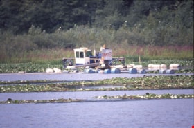
- File consists of photographs documenting the Burnaby Lake Pilot Dredging Project undertaken by the City of Burnaby between August 20 and September 16, 1999. Photographs depict silt-laded water in Still Creek prior to the dredging, mechanical dredging equipment on land and in use on the lake, and t…
- Repository
- City of Burnaby Archives
- Date
- August 1999 - September 1999
- Collection/Fonds
- Doreen Lawson fonds
- Physical Description
- 19 photographs : col. slides ; 35 mm
- Description Level
- File
- Record No.
- 618-029
- Access Restriction
- No restrictions
- Reproduction Restriction
- No restrictions
- Accession Number
- 2015-15
- Scope and Content
- File consists of photographs documenting the Burnaby Lake Pilot Dredging Project undertaken by the City of Burnaby between August 20 and September 16, 1999. Photographs depict silt-laded water in Still Creek prior to the dredging, mechanical dredging equipment on land and in use on the lake, and the adjacent water treatment facility. Also contained in the file are photographs of Deputy Director of Engineering, Lambert Chu, speaking at the dredging site and vials containing two water samples: one clear and one opaque with brown sediment.
- Media Type
- Photograph
- Photographer
- Lawson, Doreen A.
- Notes
- Title based on contents of photographs
- Geographic Access
- Burnaby Lake
- Still Creek
- Historic Neighbourhood
- Burnaby Lake (Historic Neighbourhood)
- Planning Study Area
- Burnaby Lake Area
Images
Burnaby Lake Show / originals
https://search.heritageburnaby.ca/link/archivedescription91683
- Repository
- City of Burnaby Archives
- Date
- 1962-1995
- Collection/Fonds
- Doreen Lawson fonds
- Description Level
- File
- Physical Description
- 71 photographs : col. slides ; 35 mm
- Scope and Content
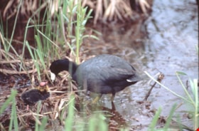
- File consists of photographs compiled by Doreen Lawson for a slideshow presentation about Burnaby Lake. Slideshow primarily depicts the wildlife and foliage of Burnaby Lake, including: the American coot, green-winged teal, bufflehead, heron, american bittern, barn swallow, barn owl, painted turtle,…
- Repository
- City of Burnaby Archives
- Date
- 1962-1995
- Collection/Fonds
- Doreen Lawson fonds
- Physical Description
- 71 photographs : col. slides ; 35 mm
- Description Level
- File
- Record No.
- 618-001
- Access Restriction
- No restrictions
- Reproduction Restriction
- May be restricted by third party rights
- Accession Number
- 2015-15
- Scope and Content
- File consists of photographs compiled by Doreen Lawson for a slideshow presentation about Burnaby Lake. Slideshow primarily depicts the wildlife and foliage of Burnaby Lake, including: the American coot, green-winged teal, bufflehead, heron, american bittern, barn swallow, barn owl, painted turtle, muskrat, Canadian goose, beaver, wood duck, bullrushes, yellow and white waterlilies, yellow iris, and loosestrife. Also included in the slideshow are photographs of the BC Wildlife rescue and fisherman working in the Brunette River.
- Subjects
- Geographic Features - Lakes and Ponds
- Animals - Birds
- Animals
- Geographic Features - Forests
- Media Type
- Photograph
- Photographer
- Lawson, Doreen A.
- Chapman, Fred
- Notes
- Transcribed title
- Title transcribed from sheets slides
- Photographs contents are identified on many of the slide cases within the file.
- Historic Neighbourhood
- Burnaby Lake (Historic Neighbourhood)
- Planning Study Area
- Burnaby Lake Area
Images
Burnaby Lake slide show
https://search.heritageburnaby.ca/link/archivedescription91684
- Repository
- City of Burnaby Archives
- Date
- 1976-1999
- Collection/Fonds
- Doreen Lawson fonds
- Description Level
- File
- Physical Description
- 85 photographs : col. slides ; 35 mm
- Scope and Content
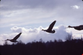
- File consists of photographs compiled by Doreen Lawson for slideshow presentations about Burnaby Lake. Slideshow primarily depicts the wildlife and foliage of Burnaby Lake, including: the painted turtle, heron, American coot, coyote, barn owl, rainbow fry, Canadian goose, and beaver, as well as a v…
- Repository
- City of Burnaby Archives
- Date
- 1976-1999
- Collection/Fonds
- Doreen Lawson fonds
- Physical Description
- 85 photographs : col. slides ; 35 mm
- Description Level
- File
- Record No.
- 618-002
- Access Restriction
- No restrictions
- Reproduction Restriction
- May be restricted by third party rights
- Accession Number
- 2015-15
- Scope and Content
- File consists of photographs compiled by Doreen Lawson for slideshow presentations about Burnaby Lake. Slideshow primarily depicts the wildlife and foliage of Burnaby Lake, including: the painted turtle, heron, American coot, coyote, barn owl, rainbow fry, Canadian goose, and beaver, as well as a variety of scenic photographs of the Burnaby Lake shoreline with mountains and the Metrotown skyline in distance. Also included in file are photographs of people canoeing, kayaking, feeding geese, and participating in conservation activities including fencing trees and testing water levels. Photographs also depict the pipeline leading into Burnaby Lake, lake dredging equipment, and an oil slick.
- Subjects
- Geographic Features - Lakes and Ponds
- Animals - Birds
- Animals
- Geographic Features - Forests
- Media Type
- Photograph
- Photographer
- Lawson, Doreen A.
- Notes
- Title based on contents of photographs
- Note in black ink on recto of slide sheet photographs 618-002-1 : 618-002-9 originally housed in read: "Burnby Lake Slideshow"
- Note in black ink on recto of slide sheet photographs 618-002-10 : 608-002-19 originally housed in read: "Burnaby Lake / Rejects (My Fav!)"
- Photographs contents are identified on many of the slide cases within the file.
- Historic Neighbourhood
- Burnaby Lake (Historic Neighbourhood)
- Planning Study Area
- Burnaby Lake Area
Images
Burnaby Lake wildlife
https://search.heritageburnaby.ca/link/archivedescription91577
- Repository
- City of Burnaby Archives
- Date
- 1991-1997
- Collection/Fonds
- Doreen Lawson fonds
- Description Level
- File
- Physical Description
- 51 photographs : col. slides ; 35 mm
- Scope and Content
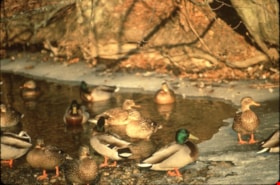
- File consists of photographs of Burnaby Lake and its wildlife. Wildlife species depicted include: heron, geese, mallards and bufflehead mallards, fuzzy green bullfrogs, a red-tailed hawk, and barn owl. Also included in the file are photographs of Cariboo Dam and purple loosestrife.
- Repository
- City of Burnaby Archives
- Date
- 1991-1997
- Collection/Fonds
- Doreen Lawson fonds
- Physical Description
- 51 photographs : col. slides ; 35 mm
- Description Level
- File
- Record No.
- 605-010
- Access Restriction
- No restrictions
- Reproduction Restriction
- No restrictions
- Accession Number
- 2003-30
- Scope and Content
- File consists of photographs of Burnaby Lake and its wildlife. Wildlife species depicted include: heron, geese, mallards and bufflehead mallards, fuzzy green bullfrogs, a red-tailed hawk, and barn owl. Also included in the file are photographs of Cariboo Dam and purple loosestrife.
- Subjects
- Geographic Features - Lakes and Ponds
- Animals - Birds
- Animals
- Geographic Features - Forests
- Names
- Lawson, Doreen A.
- Media Type
- Photograph
- Photographer
- Lawson, Doreen A.
- Notes
- Title based on contents of photographs
- Wildlife species are identified on slide cases
- Historic Neighbourhood
- Burnaby Lake (Historic Neighbourhood)
- Planning Study Area
- Burnaby Lake Area
Images
Deer Lake
https://search.heritageburnaby.ca/link/archivedescription91583
- Repository
- City of Burnaby Archives
- Date
- May 10, 1997
- Collection/Fonds
- Doreen Lawson fonds
- Description Level
- File
- Physical Description
- 15 photographs : col. slides ; 35 mm
- Scope and Content
- File consists of photographs of Deer Lake. Photographs depict foliage, primarily consisting of long grasses and deciduous tress, along the lake's shore and in the forest.
- Repository
- City of Burnaby Archives
- Date
- May 10, 1997
- Collection/Fonds
- Doreen Lawson fonds
- Physical Description
- 15 photographs : col. slides ; 35 mm
- Description Level
- File
- Record No.
- 605-016
- Access Restriction
- No restrictions
- Reproduction Restriction
- No restrictions
- Accession Number
- 2003-30
- Scope and Content
- File consists of photographs of Deer Lake. Photographs depict foliage, primarily consisting of long grasses and deciduous tress, along the lake's shore and in the forest.
- Names
- Lawson, Doreen A.
- Media Type
- Photograph
- Photographer
- Lawson, Doreen A.
- Notes
- Title based on contents of photographs
- Note in black ink on recto of slide frame of photograph 605-015-3 reads: "Deer Lake"
- Note in black ink on recto of slide fram of photograph 605-015-15 reads: "Deer Lake Park Tour / with Dinty Moore"
- Geographic Access
- Deer Lake Park
- Historic Neighbourhood
- Burnaby Lake (Historic Neighbourhood)
- Planning Study Area
- Oakalla Area
![Hotel guys, [1999] thumbnail](/media/hpo/_Data/_Archives_Images/_Unrestricted/535/535-3273-1.jpg?width=280)
![Aftermath of a snowfall, [1999] thumbnail](/media/hpo/_Data/_Archives_Images/_Unrestricted/535/535-3125-1.jpg?width=280)
