Edmonds Neighbourhood
https://search.heritageburnaby.ca/link/landmark704
- Repository
- Burnaby Heritage Planning
- Associated Dates
- 1925-1954
- Heritage Value
- The historic growth of Edmonds as a neighbourhood was based on its strategic location on the early interurban line between Vancouver and New Westminster. Even by 1980 when a survey of the residential neighbourhoods was conducted, a full 25% of homes in the area predated 1930. The 1950s was a period of strong housing development, with both single-family and multi-family units being constructed. Although Burnaby's City Hall was moved from Kingsway and Edmonds in the early 1950s, Edmonds remained an important centre in the community.
- Historic Neighbourhood
- Edmonds (Historic Neighbourhood)
- Planning Study Area
- Stride Avenue Area
Images
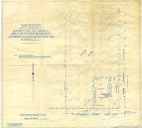
Plan of Survey Lot A of Block 1 District Lot 42
https://search.heritageburnaby.ca/link/museumdescription18823
- Repository
- Burnaby Village Museum
- Date
- June 1957
- Collection/Fonds
- Seaforth School fonds
- Description Level
- Item
- Physical Description
- 1 survey plan : blueline print ; 42.5 x 47 cm
- Scope and Content
- Item consists of a survey plan of Lot A, of Block 1, District Lot 42, Group 1, New Westminster District. According to Explanatory Plan 5421 Burnaby, B.C. Seaforth School and grounds are noted on plan on the corner of Piper Avenue and Government Street.
- Repository
- Burnaby Village Museum
- Collection/Fonds
- Seaforth School fonds
- Description Level
- Item
- Physical Description
- 1 survey plan : blueline print ; 42.5 x 47 cm
- Material Details
- Scale: 1 inch = 50 feet
- Scope and Content
- Item consists of a survey plan of Lot A, of Block 1, District Lot 42, Group 1, New Westminster District. According to Explanatory Plan 5421 Burnaby, B.C. Seaforth School and grounds are noted on plan on the corner of Piper Avenue and Government Street.
- Creator
- Burnett, David H.
- Names
- Seaforth School
- Accession Code
- BV987.2.3
- Access Restriction
- No restrictions
- Reproduction Restriction
- No known restrictions
- Date
- June 1957
- Media Type
- Cartographic Material
- Scan Resolution
- 600
- Scan Date
- 2022-07-07
- Notes
- Title based on contents of item
- Title reads: "PLAN OF SURVEY / LOT "A", OF BLOCK 1 / DISTRICT LOT 42, 'GROUP 1 , / NEW WESTMINSTER DISTRICT / ACCORDING TO EXPLANATORY PLAN 5421 / BURNABY, B.C."
Images
Planning Map of Chinese Market Gardens on Marine Drive
https://search.heritageburnaby.ca/link/museumdescription4297
- Repository
- Burnaby Village Museum
- Date
- [between 1950 and 1959] (date of original), 2017 (date of duplication)
- Collection/Fonds
- Herbert Yee Law family fonds
- Description Level
- Item
- Physical Description
- 1 photograph (tiff) : col. ; 300 dpi
- Scope and Content
- Scanned copy of a survey plan of district lots 163, 162, 157, 158, and 165, near the Chinese Market Gardens along Marine Drive.
- Repository
- Burnaby Village Museum
- Collection/Fonds
- Herbert Yee Law family fonds
- Description Level
- Item
- Physical Description
- 1 photograph (tiff) : col. ; 300 dpi
- Scope and Content
- Scanned copy of a survey plan of district lots 163, 162, 157, 158, and 165, near the Chinese Market Gardens along Marine Drive.
- History
- Survey plan of district lots 163, 162, 157, 158, and 165, which is primarily the area farmed by Chinese and Chinese-Canadian market gardeners around Marine Drive between Royal Oak and Mandeville (present-day Nelson). Two Chinese/Chinese Canadian land owners can be seen on the map: N.G. Wah Sing (or Ng Wah Sing) and Yee Law (or Herbert Law).
- Geographic Access
- Marine Drive
- Accession Code
- BV017.40.2
- Access Restriction
- No restrictions
- Reproduction Restriction
- No known restrictions
- Date
- [between 1950 and 1959] (date of original), 2017 (date of duplication)
- Media Type
- Cartographic Material
- Historic Neighbourhood
- Fraser Arm (Historic Neighbourhood)
- Planning Study Area
- Big Bend Area
- Scan Resolution
- 300
- Scan Date
- 11/19/2017
- Scale
- 100
- Notes
- Title based on contents of copy scan of map
- Herbert Yee Law was donor's father and this map may have originally been his copy of the city planning/engineering documents.
Images
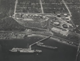
Standard Oil Company
https://search.heritageburnaby.ca/link/archivedescription34568
- Repository
- City of Burnaby Archives
- Date
- 1958
- Collection/Fonds
- Burnaby Historical Society fonds
- Description Level
- Item
- Physical Description
- 1 photograph : b&w ; 27.8 x 35.5 cm
- Scope and Content
- Aerial photograph of the Standard Oil Company Stanovan Refinery, Burrard Inlet.
- Repository
- City of Burnaby Archives
- Date
- 1958
- Collection/Fonds
- Burnaby Historical Society fonds
- Subseries
- Photographs subseries
- Physical Description
- 1 photograph : b&w ; 27.8 x 35.5 cm
- Description Level
- Item
- Record No.
- 052-004
- Access Restriction
- No restrictions
- Reproduction Restriction
- Reproduce for fair dealing purposes only
- Accession Number
- BHS2007-04
- Scope and Content
- Aerial photograph of the Standard Oil Company Stanovan Refinery, Burrard Inlet.
- Media Type
- Photograph
- Photographer
- Aero Surveys Limited
- Notes
- Title based on contents of photograph
- Back of photo stamped: "Photo by Aero Surveys Limited, Vancouver, BC, Canada / Identification No.: BO-58-444"
- Geographic Access
- Eton Street
- Street Address
- 4403 Eton Street
- Historic Neighbourhood
- Vancouver Heights (Historic Neighbourhood)
- Planning Study Area
- Burnaby Heights Area


![Planning Map of Chinese Market Gardens on Marine Drive, [between 1950 and 1959] (date of original), 2017 (date of duplication) thumbnail](/media/hpo/_Data/_BVM_Images/2017/2017_0040_0002_001.jpg?width=280)
