Narrow Results By
Subject
- Agriculture - Crops 1
- Agriculture - Farms 1
- Animals - Cats 1
- Animals - Dogs 4
- Buildings - Commercial - Malls 2
- Buildings - Commercial - Stores 1
- Buildings - Heritage 1
- Buildings - Industrial - Factories 1
- Buildings - Recreational - Bowling Alleys 3
- Ceremonies - Weddings 3
- Events - May Day 1
- Events - Parades 3
Creator
- Associated Factory Mutual Fire Insurance Cos 1
- British Columbia Underwriters' Association 2
- Burnaby Village Museum 1
- Burnett, David H. 1
- Canadian Broadcasting Corporation 1
- Digney, Andy 20
- Digney, Ernest Frank "Dig" 1
- Dominion Map and Blueprint Co. 1
- Green, Susan 1
- Schwabb, C.L. Jr. 1
- Scott, A.F. 1
- Stevens, Colin 1
Andy Digney Film
https://search.heritageburnaby.ca/link/archivedescription85335
- Repository
- City of Burnaby Archives
- Date
- [between 1934 and 1961]
- Collection/Fonds
- Digney Family fonds
- Description Level
- Item
- Physical Description
- 2 optical discs (approx. 2 hrs, 40 min) : digital, b&w, col., si.
- Scope and Content
- Item is a collection of 18 short films on DVD. These films were created by Andy Digney using his 8 mm camera and provide views of the Digney family gatherings, trips, vacations at home and abroad. They also provide glimpses of Burnaby parades, celebrations and the Digney Speedway. The 18 segments h…
- Repository
- City of Burnaby Archives
- Date
- [between 1934 and 1961]
- Collection/Fonds
- Digney Family fonds
- Physical Description
- 2 optical discs (approx. 2 hrs, 40 min) : digital, b&w, col., si.
- Description Level
- Item
- Record No.
- 562-003
- Access Restriction
- No restrictions
- Reproduction Restriction
- May be restricted by third party rights
- Accession Number
- 2014-04
- Scope and Content
- Item is a collection of 18 short films on DVD. These films were created by Andy Digney using his 8 mm camera and provide views of the Digney family gatherings, trips, vacations at home and abroad. They also provide glimpses of Burnaby parades, celebrations and the Digney Speedway. The 18 segments have all been described at item level.
- Subjects
- Animals - Dogs
- Recreational Activities - Fishing
- Recreational Activities - Camping
- Recreational Activities - Picnics
- Geographic Features - Rivers
- Events - Parades
- Media Type
- Moving Images
- Photographer
- Digney, Andy
- Creator
- Digney, Andy
- Notes
- Title based on contents of film
- The original 8mm film footage was digitized and broken down into 18 segments, reflecting the original order. Items are described as 562-003-1 : 562-003-18
BC Electric Guide to Greater Vancouver
https://search.heritageburnaby.ca/link/archivedescription65826
- Repository
- City of Burnaby Archives
- Date
- April 1952
- Collection/Fonds
- Burnaby Historical Society fonds
- Description Level
- Item
- Physical Description
- 1 map : col. ; on paper ; 54 x 85 cm folded to 21 x 9 cm
- Scope and Content
- Item is the BC Electric Guide to Greater Vancouver consisting of a transit system map of Greater Vancouver, a Greater Vancouver Street Index along with listings for Parks, Golf and Country Clubs, etc.
- Repository
- City of Burnaby Archives
- Date
- April 1952
- Collection/Fonds
- Burnaby Historical Society fonds
- Subseries
- Pixie McGeachie subseries
- Physical Description
- 1 map : col. ; on paper ; 54 x 85 cm folded to 21 x 9 cm
- Material Details
- Scale : one inch equals approximately 0.57 miles
- Description Level
- Item
- Record No.
- 42686
- Accession Number
- BHS1996-08
- Scope and Content
- Item is the BC Electric Guide to Greater Vancouver consisting of a transit system map of Greater Vancouver, a Greater Vancouver Street Index along with listings for Parks, Golf and Country Clubs, etc.
- Media Type
- Cartographic Material

Burnaby Mountain sod turning
https://search.heritageburnaby.ca/link/museumdescription11934
- Repository
- Burnaby Village Museum
- Date
- October 7, 1957 (date of original), digitized in 2020
- Collection/Fonds
- Burnaby Village Museum Film and Video collection
- Description Level
- Item
- Physical Description
- 1 film reel (1 min., 22 sec.) : acetate, b&w, silent ; 16 mm
- Scope and Content
- Item consists of a silent CBUT News item from October 7, 1957 titled "Burnaby Mountain Sod Turning". The film documents the memorable occasion of the Burnaby Mountain Centennial Project with Lieutenant Governor Frank M. Ross providing a brief address to the attendees before taking a shovel to turn…
- Repository
- Burnaby Village Museum
- Collection/Fonds
- Burnaby Village Museum Film and Video collection
- Description Level
- Item
- Physical Description
- 1 film reel (1 min., 22 sec.) : acetate, b&w, silent ; 16 mm
- Material Details
- Label around film container reads: "CBUT NEWS ITEM of October 7, 1957 "BURNABY MOUNTAIN SOD TURNING" ( Duncan) on permanent loan to Burnaby Centennial Comm."
- Scope and Content
- Item consists of a silent CBUT News item from October 7, 1957 titled "Burnaby Mountain Sod Turning". The film documents the memorable occasion of the Burnaby Mountain Centennial Project with Lieutenant Governor Frank M. Ross providing a brief address to the attendees before taking a shovel to turn the sod. Other attendees identified include, Councillor Sam Hughes of the Centennial Committee and British Columbia Recreation Minister, Honourable Earl C. Westwood. This event marks the development of a portion of Burnaby Mountain park including the erection of a Centennial building which opened in 1958. The film footage captures views of Burrard Inlet from the mountain top as well as newly erected roads on Burnaby mountain. According to the Burnaby Adverstiser (Vol. 25 No. 27 - October 10, 1957 p.1), Lieutenant Governor Frank M. Ross provided a brief address for the sod turning ceremony which is quoted; "What Burnaby has undertaken is not merely to celebrate the Centennial observance, but it has started something which will last down through the years and provide a lot of pleasure for future generations."
- History
- This event marks the beginning of a Centennial project to develop a park and erect a pavillion as part of the British Columbia Centennial in 1958. In October 1956, a Burnaby Centennial Committee was appointed to govern over the project with the Reeve and Council at the head of the committee. Councillor S.E. Hughes was appointed as Chairman and W.M. Morrison as Vice Chairman with the organizational structure to include the provision for Honorary Vice Chairman, secretary, treasurer, advisory staff and representative delegates from community groups and working committees. In September 1957, the Centennial Committee submitted detailed plans for a proposed building to be located on the Centennial site on Burnaby Mountain together with a recommendation to create a Building Committee as part of the Centennial Committee. In November 1957, the Burnaby Centennial Committee recommended that the new road from Badger Street and Hastings Street to the Burnaby Mountain site be named Centennial Way. January 1958, councillors Mather and Jamieson were appointed to the committee by council to replace former council members that were no longer in office. Councillor Mather was appointed as Vice Chairman. CBUT station was owned by CBC and was first broadcast on December 16, 1953. "In 1975, the CBC consolidated its Vancouver radio and television operations into one building. Prior to this, CBC's Vancouver radio properties – CBU (690 AM), CBU-FM (105.7) and CBUF-FM (97.7) – had operated from a separate studio facility at 701 Hornby Street, within the basement of the Hotel Vancouver. Together, those stations formed the basis of the Regional Broadcast Centre at 700 Hamilton Street, a few blocks east of its previous radio and television facilities.
- Responsibility
- Canadian Broadcasting Corporation
- Geographic Access
- Burnaby Mountain Conservation Area
- Accession Code
- HV971.30.2
- Access Restriction
- No restrictions
- Reproduction Restriction
- May be restricted by third party rights
- Date
- October 7, 1957 (date of original), digitized in 2020
- Media Type
- Moving Images
- Notes
- Transcribed title
- Copyright is held by CBC
Images

Video
Burnaby Mountain sod turning, October 7, 1957 (date of original), digitized in 2020
Burnaby Mountain sod turning, October 7, 1957 (date of original), digitized in 2020
https://search.heritageburnaby.ca/media/hpo/_Data/_BVM_Moving_Images/1971_0030_0002_001.mp4Dial map of Greater Vancouver and Suburbs
https://search.heritageburnaby.ca/link/archivedescription65840
- Repository
- City of Burnaby Archives
- Date
- 1958
- Collection/Fonds
- Burnaby Historical Society fonds
- Description Level
- Item
- Physical Description
- 1 map : col. ; ink on sheet 55 x 73 cm folded to 28 x 14 cm
- Scope and Content
- Item is a Dial map of Greater Vancouver and Suburbs, published by Dominion Map and Blueprint Ltd. in Vancouver. Map includes both old and new street names.
- Repository
- City of Burnaby Archives
- Date
- 1958
- Collection/Fonds
- Burnaby Historical Society fonds
- Subseries
- Municipal record subseries
- Physical Description
- 1 map : col. ; ink on sheet 55 x 73 cm folded to 28 x 14 cm
- Material Details
- Scale : 1 1/4 inches = 1 mile
- Description Level
- Item
- Record No.
- 42695
- Access Restriction
- Open access
- Accession Number
- BHS1999-05
- Scope and Content
- Item is a Dial map of Greater Vancouver and Suburbs, published by Dominion Map and Blueprint Ltd. in Vancouver. Map includes both old and new street names.
- Media Type
- Cartographic Material
![Digney family in Burnaby, [between 1939 and 1959] thumbnail](/media/Hpo/_Data/_Archives_Moving_Images/_Unrestricted/562-003-12.jpg?width=280)
Digney family in Burnaby
https://search.heritageburnaby.ca/link/archivedescription85249
- Repository
- City of Burnaby Archives
- Date
- [between 1939 and 1959]
- Collection/Fonds
- Digney Family fonds
- Description Level
- Item
- Physical Description
- 1 film clip (5 min., 17sec.) : digital, col., si.
- Scope and Content
- Item is a digitized film colour segment identified as Reel 12. The film is a compilation of Digney family events. The film opens with children Paul and Bruce Digney running around the Digney family yard at their home on Bonsor Avenue with Andy and Ernest (Dig) Digney looking on. This is followed by…
- Repository
- City of Burnaby Archives
- Date
- [between 1939 and 1959]
- Collection/Fonds
- Digney Family fonds
- Physical Description
- 1 film clip (5 min., 17sec.) : digital, col., si.
- Description Level
- Item
- Record No.
- 562-003-12
- Access Restriction
- No restrictions
- Reproduction Restriction
- May be restricted by third party rights
- Accession Number
- 2014-04
- Scope and Content
- Item is a digitized film colour segment identified as Reel 12. The film is a compilation of Digney family events. The film opens with children Paul and Bruce Digney running around the Digney family yard at their home on Bonsor Avenue with Andy and Ernest (Dig) Digney looking on. This is followed by interspersed footage of the family's pet dog Nero and puppies along with some brief glimpses of the Royal visit (King George VI and Queen Elizabeth) and cavilicade in 1939 along Kingsway. The film then switches to footage of Digney family Christmas festivities, a cat playing with a fish in a bowl and summer time at Pelican Lake in the 1940s and ends with a dog playing with a ball.
- Media Type
- Moving Images
- Photographer
- Digney, Andy
- Creator
- Digney, Andy
- Notes
- Title based on contents of film
- Geographic Access
- Bonsor Avenue
- Kingsway
- Historic Neighbourhood
- Central Park (Historic Neighbourhood)
- Planning Study Area
- Maywood Area
Images
![Digney family in Burnaby, [between 1939 and 1959] thumbnail](/media/Hpo/_Data/_Archives_Moving_Images/_Unrestricted/562-003-12.jpg)
Video
Digney family in Burnaby, [between 1939 and 1959]
Digney family in Burnaby, [between 1939 and 1959]
https://search.heritageburnaby.ca/media/hpo/_Data/_Archives_Moving_Images/_Unrestricted/562-003-12.m4v![Digney film 1 - Bruce Digney and Tawny, [between 1958 and 1959] (date of original), copied 2019 thumbnail](/media/hpo/_Data/_BVM_Moving_Images/2019_0018_0003_011.jpg?width=280)
Digney film 1 - Bruce Digney and Tawny
https://search.heritageburnaby.ca/link/museumdescription10614
- Repository
- Burnaby Village Museum
- Date
- [between 1958 and 1959] (date of original), copied 2019
- Collection/Fonds
- Digney Family fonds
- Description Level
- Item
- Physical Description
- 1 video recording (mp4) (1 min., 13 sec.) : digital, 23 fps, col., si.
- Scope and Content
- Film clip of Bruce Digney playing with family dog named Tawny in a pool of water in the front yard of Digney home located at 6521 Bonsor Avenue. Bruce Digney is using a hose to spray water on the dog.
- Repository
- Burnaby Village Museum
- Collection/Fonds
- Digney Family fonds
- Description Level
- Item
- Physical Description
- 1 video recording (mp4) (1 min., 13 sec.) : digital, 23 fps, col., si.
- Scope and Content
- Film clip of Bruce Digney playing with family dog named Tawny in a pool of water in the front yard of Digney home located at 6521 Bonsor Avenue. Bruce Digney is using a hose to spray water on the dog.
- Creator
- Digney, Andy
- Names
- Digney, Bruce
- Geographic Access
- Bonsor Avenue
- Street Address
- 6521 Bonsor Avenue
- Accession Code
- BV019.18.3.11
- Access Restriction
- No restrictions
- Reproduction Restriction
- No known restrictions
- Date
- [between 1958 and 1959] (date of original), copied 2019
- Media Type
- Moving Images
- Historic Neighbourhood
- Central Park (Historic Neighbourhood)
- Planning Study Area
- Maywood Area
- Notes
- Title based on contents of film segment
- Film segment originates from digitized version of original 8 mm film (See BV019.18.3)
Images
![Digney film 1 - Bruce Digney and Tawny, [between 1958 and 1959] (date of original), copied 2019 thumbnail](/media/hpo/_Data/_BVM_Moving_Images/2019_0018_0003_011.jpg)
Video
Digney film 1 - Bruce Digney and Tawny, [between 1958 and 1959] (date of original), copied 2019
Digney film 1 - Bruce Digney and Tawny, [between 1958 and 1959] (date of original), copied 2019
https://search.heritageburnaby.ca/media/hpo/_Data/_BVM_Moving_Images/2019_0018_0003_011.mp4![Digney film 1 - Christmas tree, [1955] (date of original), copied 2019 thumbnail](/media/hpo/_Data/_BVM_Moving_Images/2019_0018_0003_016.jpg?width=280)
Digney film 1 - Christmas tree
https://search.heritageburnaby.ca/link/museumdescription10619
- Repository
- Burnaby Village Museum
- Date
- [1955] (date of original), copied 2019
- Collection/Fonds
- Digney Family fonds
- Description Level
- Item
- Physical Description
- 1 video recording (mp4) (21 sec.) : digital, 23 fps, col., si.
- Scope and Content
- Film clip of a silver foil Christmas tree decorated with lights and balls. The tree is on display in the living room of Andy and Alice Digney's home on Kaymar Drive. The tree is spinning slowly on a motorized stand.
- Repository
- Burnaby Village Museum
- Collection/Fonds
- Digney Family fonds
- Description Level
- Item
- Physical Description
- 1 video recording (mp4) (21 sec.) : digital, 23 fps, col., si.
- Scope and Content
- Film clip of a silver foil Christmas tree decorated with lights and balls. The tree is on display in the living room of Andy and Alice Digney's home on Kaymar Drive. The tree is spinning slowly on a motorized stand.
- Creator
- Digney, Andy
- Subjects
- Holidays - Christmas
- Geographic Access
- Kaymar Drive
- Accession Code
- BV019.18.3.16
- Access Restriction
- No restrictions
- Reproduction Restriction
- No known restrictions
- Date
- [1955] (date of original), copied 2019
- Media Type
- Moving Images
- Notes
- Title based on contents of film segment
- Film segment originates from digitized version of original 8 mm film (See BV019.18.3)
Images
![Digney film 1 - Christmas tree, [1955] (date of original), copied 2019 thumbnail](/media/hpo/_Data/_BVM_Moving_Images/2019_0018_0003_016.jpg)
Video
Digney film 1 - Christmas tree, [1955] (date of original), copied 2019
Digney film 1 - Christmas tree, [1955] (date of original), copied 2019
https://search.heritageburnaby.ca/media/hpo/_Data/_BVM_Moving_Images/2019_0018_0003_016.mp4![Digney film 1 - Digney family Christmas, [1955] (date of original), copied 2019 thumbnail](/media/hpo/_Data/_BVM_Moving_Images/2019_0018_0003_015.jpg?width=280)
Digney film 1 - Digney family Christmas
https://search.heritageburnaby.ca/link/museumdescription10618
- Repository
- Burnaby Village Museum
- Date
- [1955] (date of original), copied 2019
- Collection/Fonds
- Digney Family fonds
- Description Level
- Item
- Physical Description
- 1 video recording (mp4) (41 sec.) : digital, 23 fps, col., si.
- Scope and Content
- Film clip of Digney family gathered in the basement of Andy and Alice Digney's home on Kaymar Drive for Christmas dinner. Family members are identified as: Andy Digney, Alice Digney, Joyce Digney, Sydney Swan, Connie Swan, Bruce Digney, Paul Digney, Mel and June Arthur.
- Repository
- Burnaby Village Museum
- Collection/Fonds
- Digney Family fonds
- Description Level
- Item
- Physical Description
- 1 video recording (mp4) (41 sec.) : digital, 23 fps, col., si.
- Scope and Content
- Film clip of Digney family gathered in the basement of Andy and Alice Digney's home on Kaymar Drive for Christmas dinner. Family members are identified as: Andy Digney, Alice Digney, Joyce Digney, Sydney Swan, Connie Swan, Bruce Digney, Paul Digney, Mel and June Arthur.
- Creator
- Digney, Andy
- Subjects
- Holidays - Christmas
- Names
- Digney, Alice Swan
- Digney, Andy
- Digney, Bruce
- Digney, Ernest Frank "Dig"
- Digney, Joyce
- Digney, Paul
- Arthur, Malcolm "Mel"
- Arthur, June
- Accession Code
- BV019.18.3.15
- Access Restriction
- No restrictions
- Reproduction Restriction
- No known restrictions
- Date
- [1955] (date of original), copied 2019
- Media Type
- Moving Images
- Notes
- Title based on contents of film segment
- Film segment originates from digitized version of original 8 mm film (See BV019.18.3)
Images
![Digney film 1 - Digney family Christmas, [1955] (date of original), copied 2019 thumbnail](/media/hpo/_Data/_BVM_Moving_Images/2019_0018_0003_015.jpg)
Video
Digney film 1 - Digney family Christmas, [1955] (date of original), copied 2019
Digney film 1 - Digney family Christmas, [1955] (date of original), copied 2019
https://search.heritageburnaby.ca/media/hpo/_Data/_BVM_Moving_Images/2019_0018_0003_015.mp4![Digney film 1 - Newlyweds, [1958] (date of original), copied 2019 thumbnail](/media/hpo/_Data/_BVM_Moving_Images/2019_0018_0003_002.jpg?width=280)
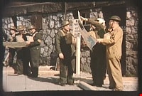
Digney film 1 - Newlyweds
https://search.heritageburnaby.ca/link/museumdescription10599
- Repository
- Burnaby Village Museum
- Date
- [1958] (date of original), copied 2019
- Collection/Fonds
- Digney Family fonds
- Description Level
- Item
- Physical Description
- 1 video recording (mp4) (25 sec.) : digital, 24 fps, col., si.
- Scope and Content
- Film clip of what appears to be newlyweds standing outside houses in an unidentifed neighbourhood in Burnaby. The couple is unidentified. A group of unidentified men are looking on and standing near automobiles. Ernest "Dig" Digney can be seen in the foreground holding a camera.
- Repository
- Burnaby Village Museum
- Collection/Fonds
- Digney Family fonds
- Description Level
- Item
- Physical Description
- 1 video recording (mp4) (25 sec.) : digital, 24 fps, col., si.
- Scope and Content
- Film clip of what appears to be newlyweds standing outside houses in an unidentifed neighbourhood in Burnaby. The couple is unidentified. A group of unidentified men are looking on and standing near automobiles. Ernest "Dig" Digney can be seen in the foreground holding a camera.
- Creator
- Digney, Andy
- Subjects
- Ceremonies - Weddings
- Accession Code
- BV019.18.3.2
- Access Restriction
- No restrictions
- Reproduction Restriction
- No known restrictions
- Date
- [1958] (date of original), copied 2019
- Media Type
- Moving Images
- Notes
- Title based on contents of film segment
- Film segment originates from digitized version of original 8 mm film (See BV019.18.3)
Images
![Digney film 1 - Newlyweds, [1958] (date of original), copied 2019 thumbnail](/media/hpo/_Data/_BVM_Moving_Images/2019_0018_0003_002.jpg)
Video
Digney film 1 - Newlyweds, [1958] (date of original), copied 2019
Digney film 1 - Newlyweds, [1958] (date of original), copied 2019
https://search.heritageburnaby.ca/media/hpo/_Data/_BVM_Moving_Images/2019_0018_0003_002.mp4![Digney film 1 - Outdoor Christmas display, [between 1954 and 1963] (date of original), copied 2019 thumbnail](/media/hpo/_Data/_BVM_Moving_Images/2019_0018_0003_001.jpg?width=280)
Digney film 1 - Outdoor Christmas display
https://search.heritageburnaby.ca/link/museumdescription10592
- Repository
- Burnaby Village Museum
- Date
- [between 1954 and 1963] (date of original), copied 2019
- Collection/Fonds
- Digney Family fonds
- Description Level
- Item
- Physical Description
- 1 video recording (mp4) (25 sec.) : digital, 23 fps, col., si.
- Scope and Content
- Film clip of an outdoor Christmas display with a mechanical Santa, his sleigh and two reindeer with "Merry Xmas Happy New Year" in behind. Reindeer part of the display rotates on a motor. This could be in Burnaby outside of the Digney's home on Kaymar Drive. The wooden display was created by Andy D…
- Repository
- Burnaby Village Museum
- Collection/Fonds
- Digney Family fonds
- Description Level
- Item
- Physical Description
- 1 video recording (mp4) (25 sec.) : digital, 23 fps, col., si.
- Scope and Content
- Film clip of an outdoor Christmas display with a mechanical Santa, his sleigh and two reindeer with "Merry Xmas Happy New Year" in behind. Reindeer part of the display rotates on a motor. This could be in Burnaby outside of the Digney's home on Kaymar Drive. The wooden display was created by Andy Digney.
- Creator
- Digney, Andy
- Subjects
- Holidays - Christmas
- Names
- Digney, Andy
- Geographic Access
- Kaymar Drive
- Accession Code
- BV019.18.3.1
- Access Restriction
- No restrictions
- Reproduction Restriction
- No known restrictions
- Date
- [between 1954 and 1963] (date of original), copied 2019
- Media Type
- Moving Images
- Notes
- Title based on contents of film segment
- Film segment originates from digitized version of original 8 mm film (See BV019.18.3)
Images
![Digney film 1 - Outdoor Christmas display, [between 1954 and 1963] (date of original), copied 2019 thumbnail](/media/hpo/_Data/_BVM_Moving_Images/2019_0018_0003_001.jpg)
Video
Digney film 1 - Outdoor Christmas display, [between 1954 and 1963] (date of original), copied 2019
Digney film 1 - Outdoor Christmas display, [between 1954 and 1963] (date of original), copied 2019
https://search.heritageburnaby.ca/media/hpo/_Data/_BVM_Moving_Images/2019_0018_0003_001.mp4![Digney film 2 - Construction of Simpsons-Sears, [1954] (date of original), copied 2019 thumbnail](/media/hpo/_Data/_BVM_Moving_Images/2019_0018_0004_009.jpg?width=280)
Digney film 2 - Construction of Simpsons-Sears
https://search.heritageburnaby.ca/link/museumdescription10640
- Repository
- Burnaby Village Museum
- Date
- [1954] (date of original), copied 2019
- Collection/Fonds
- Digney Family fonds
- Description Level
- Item
- Physical Description
- 1 video recording (mp4) (5 sec.) : digital, 23 fps, col., si.
- Scope and Content
- Short Film clip of a view from the Digney's backyard at 3698 Bonsor Avenue (address changed to 6521 Bonsor Ave. after 1958) of the construction of the Simpsons-Sears building on Kingsway in Burnaby.
- Repository
- Burnaby Village Museum
- Collection/Fonds
- Digney Family fonds
- Description Level
- Item
- Physical Description
- 1 video recording (mp4) (5 sec.) : digital, 23 fps, col., si.
- Scope and Content
- Short Film clip of a view from the Digney's backyard at 3698 Bonsor Avenue (address changed to 6521 Bonsor Ave. after 1958) of the construction of the Simpsons-Sears building on Kingsway in Burnaby.
- Creator
- Digney, Andy
- Subjects
- Buildings - Commercial - Malls
- Names
- Simpsons-Sears Limited
- Geographic Access
- Bonsor Avenue
- Street Address
- 6521 Bonsor Avenue
- Accession Code
- BV019.18.4.9
- Access Restriction
- No restrictions
- Reproduction Restriction
- No known restrictions
- Date
- [1954] (date of original), copied 2019
- Media Type
- Moving Images
- Historic Neighbourhood
- Central Park (Historic Neighbourhood)
- Planning Study Area
- Maywood Area
- Photographer
- Digney, Andy
- Notes
- Title based on contents of film segment
- Film segment originates from digitized version of original 8 mm film (See BV019.18.4)
Images
![Digney film 2 - Construction of Simpsons-Sears, [1954] (date of original), copied 2019 thumbnail](/media/hpo/_Data/_BVM_Moving_Images/2019_0018_0004_009.jpg)
Video
Digney film 2 - Construction of Simpsons-Sears, [1954] (date of original), copied 2019
Digney film 2 - Construction of Simpsons-Sears, [1954] (date of original), copied 2019
https://search.heritageburnaby.ca/media/hpo/_Data/_BVM_Moving_Images/2019_0018_0004_009.mp4![Digney film 2 - Construction of Simpsons-Sears building, [1954] (date of original), copied 2019 thumbnail](/media/hpo/_Data/_BVM_Moving_Images/2019_0018_0004_013.jpg?width=280)
Digney film 2 - Construction of Simpsons-Sears building
https://search.heritageburnaby.ca/link/museumdescription10644
- Repository
- Burnaby Village Museum
- Date
- [1954] (date of original), copied 2019
- Collection/Fonds
- Digney Family fonds
- Description Level
- Item
- Physical Description
- 1 video recording (mp4) (1 min., 30 sec.) : digital, 23 fps, col., si.
- Scope and Content
- Film segment documenting the construction of the Simpsons-Sears building located at 3660 Kingsway in Burnaby (address changed to 4750 Kingsway after 1958). The film footage is shot by Andy Digney from his backyard at 2698 Bonsor Avenue (address changed to 6521 Bonsor Avenue after 1958).
- Repository
- Burnaby Village Museum
- Collection/Fonds
- Digney Family fonds
- Description Level
- Item
- Physical Description
- 1 video recording (mp4) (1 min., 30 sec.) : digital, 23 fps, col., si.
- Scope and Content
- Film segment documenting the construction of the Simpsons-Sears building located at 3660 Kingsway in Burnaby (address changed to 4750 Kingsway after 1958). The film footage is shot by Andy Digney from his backyard at 2698 Bonsor Avenue (address changed to 6521 Bonsor Avenue after 1958).
- Creator
- Digney, Andy
- Names
- Simpsons-Sears Limited
- Geographic Access
- Kingsway
- Street Address
- 4750 Kingsway
- Accession Code
- BV019.18.4.13
- Access Restriction
- No restrictions
- Reproduction Restriction
- No known restrictions
- Date
- [1954] (date of original), copied 2019
- Media Type
- Moving Images
- Historic Neighbourhood
- Central Park (Historic Neighbourhood)
- Planning Study Area
- Maywood Area
- Photographer
- Digney, Andy
- Notes
- Title based on contents of film segment
- Film segment originates from digitized version of original 8 mm film (See BV019.18.4)
Images
![Digney film 2 - Construction of Simpsons-Sears building, [1954] (date of original), copied 2019 thumbnail](/media/hpo/_Data/_BVM_Moving_Images/2019_0018_0004_013.jpg)
Video
Digney film 2 - Construction of Simpsons-Sears building, [1954] (date of original), copied 2019
Digney film 2 - Construction of Simpsons-Sears building, [1954] (date of original), copied 2019
https://search.heritageburnaby.ca/media/hpo/_Data/_BVM_Moving_Images/2019_0018_0004_013.mp4![Digney film 2 - Five pin bowling, [1955] (date of original), copied 2019 thumbnail](/media/hpo/_Data/_BVM_Moving_Images/2019_0018_0004_007.jpg?width=280)
Digney film 2 - Five pin bowling
https://search.heritageburnaby.ca/link/museumdescription10638
- Repository
- Burnaby Village Museum
- Date
- [1955] (date of original), copied 2019
- Collection/Fonds
- Digney Family fonds
- Description Level
- Item
- Physical Description
- 1 video recording (mp4) (7 min., 11 sec.) : digital, 23 fps, col., si.
- Scope and Content
- Film close up of five pin bowling at the Digney Bowling Alley at 6521 Bonsor Avenue in Burnaby. Footage cuts everytime pins are reset. The Digney Bowling Alley opened in 1955.
- Repository
- Burnaby Village Museum
- Collection/Fonds
- Digney Family fonds
- Description Level
- Item
- Physical Description
- 1 video recording (mp4) (7 min., 11 sec.) : digital, 23 fps, col., si.
- Material Details
- Poor quality - dark
- Scope and Content
- Film close up of five pin bowling at the Digney Bowling Alley at 6521 Bonsor Avenue in Burnaby. Footage cuts everytime pins are reset. The Digney Bowling Alley opened in 1955.
- Creator
- Digney, Andy
- Subjects
- Sports - Bowling
- Names
- Digney Bowling Alley
- Geographic Access
- Bonsor Avenue
- Street Address
- 6521 Bonsor Avenue
- Accession Code
- BV019.18.4.7
- Access Restriction
- No restrictions
- Reproduction Restriction
- No known restrictions
- Date
- [1955] (date of original), copied 2019
- Media Type
- Moving Images
- Historic Neighbourhood
- Central Park (Historic Neighbourhood)
- Planning Study Area
- Maywood Area
- Photographer
- Digney, Andy
- Notes
- Title based on contents of film segment
- Film segment originates from digitized version of original 8 mm film (See BV019.18.4)
Images
![Digney film 2 - Five pin bowling, [1955] (date of original), copied 2019 thumbnail](/media/hpo/_Data/_BVM_Moving_Images/2019_0018_0004_007.jpg)
Video
Digney film 2 - Five pin bowling, [1955] (date of original), copied 2019
Digney film 2 - Five pin bowling, [1955] (date of original), copied 2019
https://search.heritageburnaby.ca/media/hpo/_Data/_BVM_Moving_Images/2019_0018_0004_007.mp4![Digney film 2 - Garden wedding, [195_] (date of original), copied 2019 thumbnail](/media/hpo/_Data/_BVM_Moving_Images/2019_0018_0004_011.jpg?width=280)
Digney film 2 - Garden wedding
https://search.heritageburnaby.ca/link/museumdescription10642
- Repository
- Burnaby Village Museum
- Date
- [195_] (date of original), copied 2019
- Collection/Fonds
- Digney Family fonds
- Description Level
- Item
- Physical Description
- 1 video recording (mp4) (1 min., 52 sec.) : digital, 23 fps, b&w, si.
- Scope and Content
- Film clip of a garden wedding of an unidentified couple at an unidentified location.Several men and women are standing around with glasses to watch the ceremony and toast the bride and groom. Alice Digney and Sydney and Connie Swan are identifed as guests.
- Repository
- Burnaby Village Museum
- Collection/Fonds
- Digney Family fonds
- Description Level
- Item
- Physical Description
- 1 video recording (mp4) (1 min., 52 sec.) : digital, 23 fps, b&w, si.
- Scope and Content
- Film clip of a garden wedding of an unidentified couple at an unidentified location.Several men and women are standing around with glasses to watch the ceremony and toast the bride and groom. Alice Digney and Sydney and Connie Swan are identifed as guests.
- Creator
- Digney, Andy
- Subjects
- Ceremonies - Weddings
- Accession Code
- BV019.18.4.11
- Access Restriction
- No restrictions
- Reproduction Restriction
- May be restricted by third party rights
- Date
- [195_] (date of original), copied 2019
- Media Type
- Moving Images
- Related Material
- See also BV019.18.3.12
- Photographer
- Digney, Andy
- Notes
- Title based on contents of film segment
- Film segment originates from digitized version of original 8 mm film (See BV019.18.4)
Images
![Digney film 2 - Garden wedding, [195_] (date of original), copied 2019 thumbnail](/media/hpo/_Data/_BVM_Moving_Images/2019_0018_0004_011.jpg)
Video
Digney film 2 - Garden wedding, [195_] (date of original), copied 2019
Digney film 2 - Garden wedding, [195_] (date of original), copied 2019
https://search.heritageburnaby.ca/media/hpo/_Data/_BVM_Moving_Images/2019_0018_0004_011.mp4![Digney film 2 - Garden wedding, [195_] (date of original), copied 2019 thumbnail](/media/hpo/_Data/_BVM_Moving_Images/2019_0018_0004_012.jpg?width=280)
Digney film 2 - Garden wedding
https://search.heritageburnaby.ca/link/museumdescription10643
- Repository
- Burnaby Village Museum
- Date
- [195_] (date of original), copied 2019
- Collection/Fonds
- Digney Family fonds
- Description Level
- Item
- Physical Description
- 1 video recording (mp4) (3 min., 49 sec.) : digital, 23 fps, b&w, col., si.
- Scope and Content
- Film clip of a garden wedding of an unidentified couple at an unidentified location. Several guests are gathered together outside to watch the ceremony. Alice Digney (blue suit with pink hat) and Sydney and Connie Swan are identifed as guests.
- Repository
- Burnaby Village Museum
- Collection/Fonds
- Digney Family fonds
- Description Level
- Item
- Physical Description
- 1 video recording (mp4) (3 min., 49 sec.) : digital, 23 fps, b&w, col., si.
- Scope and Content
- Film clip of a garden wedding of an unidentified couple at an unidentified location. Several guests are gathered together outside to watch the ceremony. Alice Digney (blue suit with pink hat) and Sydney and Connie Swan are identifed as guests.
- Creator
- Digney, Andy
- Subjects
- Ceremonies - Weddings
- Accession Code
- BV019.18.4.12
- Access Restriction
- No restrictions
- Reproduction Restriction
- No known restrictions
- Date
- [195_] (date of original), copied 2019
- Media Type
- Moving Images
- Related Material
- See also BV019.18.3.11
- Photographer
- Digney, Andy
- Notes
- Title based on contents of film segment
- Film segment originates from digitized version of original 8 mm film (See BV019.18.4)
Images
![Digney film 2 - Garden wedding, [195_] (date of original), copied 2019 thumbnail](/media/hpo/_Data/_BVM_Moving_Images/2019_0018_0004_012.jpg)
Video
Digney film 2 - Garden wedding, [195_] (date of original), copied 2019
Digney film 2 - Garden wedding, [195_] (date of original), copied 2019
https://search.heritageburnaby.ca/media/hpo/_Data/_BVM_Moving_Images/2019_0018_0004_012.mp4![Digney film 2 - Great Dane, [between 1955 and 1958] (date of original), copied 2019 thumbnail](/media/hpo/_Data/_BVM_Moving_Images/2019_0018_0004_001.jpg?width=280)
Digney film 2 - Great Dane
https://search.heritageburnaby.ca/link/museumdescription10632
- Repository
- Burnaby Village Museum
- Date
- [between 1955 and 1958] (date of original), copied 2019
- Collection/Fonds
- Digney Family fonds
- Description Level
- Item
- Physical Description
- 1 video recording (mp4) (2 min., 2 sec.) : digital, 23 fps, col., si.
- Scope and Content
- Film clip of Andy Digney's Great Dane playing in the yard of the Digney home at 6521 Bonsor Street. The elaborate dog house was built by Andy Digney.
- Repository
- Burnaby Village Museum
- Collection/Fonds
- Digney Family fonds
- Description Level
- Item
- Physical Description
- 1 video recording (mp4) (2 min., 2 sec.) : digital, 23 fps, col., si.
- Scope and Content
- Film clip of Andy Digney's Great Dane playing in the yard of the Digney home at 6521 Bonsor Street. The elaborate dog house was built by Andy Digney.
- Creator
- Digney, Andy
- Subjects
- Animals - Dogs
- Names
- Digney, Andy
- Geographic Access
- Bonsor Avenue
- Street Address
- 6521 Bonsor Avenue
- Accession Code
- BV019.18.4.1
- Access Restriction
- No restrictions
- Reproduction Restriction
- No known restrictions
- Date
- [between 1955 and 1958] (date of original), copied 2019
- Media Type
- Moving Images
- Historic Neighbourhood
- Central Park (Historic Neighbourhood)
- Planning Study Area
- Maywood Area
- Notes
- Title based on contents of film segment
- Film segment originates from digitized version of original 8 mm film (See BV019.18.4)
Images
![Digney film 2 - Great Dane, [between 1955 and 1958] (date of original), copied 2019 thumbnail](/media/hpo/_Data/_BVM_Moving_Images/2019_0018_0004_001.jpg)
Video
Digney film 2 - Great Dane, [between 1955 and 1958] (date of original), copied 2019
Digney film 2 - Great Dane, [between 1955 and 1958] (date of original), copied 2019
https://search.heritageburnaby.ca/media/hpo/_Data/_BVM_Moving_Images/2019_0018_0004_001.mp4![Digney film 2 - Plants in sunroom, [between 1958 and 1964] (date of original), copied 2019 thumbnail](/media/hpo/_Data/_BVM_Moving_Images/2019_0018_0004_010.jpg?width=280)
Digney film 2 - Plants in sunroom
https://search.heritageburnaby.ca/link/museumdescription10641
- Repository
- Burnaby Village Museum
- Date
- [between 1958 and 1964] (date of original), copied 2019
- Collection/Fonds
- Digney Family fonds
- Description Level
- Item
- Physical Description
- 1 video recording (mp4) (1 min., 3 sec.) : digital, 23 fps, col., si.
- Scope and Content
- Film clip of Andy Digney's plants in his sunroom at the rear of his house on Kaymar Drive.
- Repository
- Burnaby Village Museum
- Collection/Fonds
- Digney Family fonds
- Description Level
- Item
- Physical Description
- 1 video recording (mp4) (1 min., 3 sec.) : digital, 23 fps, col., si.
- Scope and Content
- Film clip of Andy Digney's plants in his sunroom at the rear of his house on Kaymar Drive.
- Creator
- Digney, Andy
- Geographic Access
- Kaymar Drive
- Street Address
- 7749 Kaymar Drive
- Accession Code
- BV019.18.4.10
- Access Restriction
- No restrictions
- Reproduction Restriction
- No known restrictions
- Date
- [between 1958 and 1964] (date of original), copied 2019
- Media Type
- Moving Images
- Photographer
- Digney, Andy
- Notes
- Title based on contents of film segment
- Film segment originates from digitized version of original 8 mm film (See BV019.18.4)
Images
![Digney film 2 - Plants in sunroom, [between 1958 and 1964] (date of original), copied 2019 thumbnail](/media/hpo/_Data/_BVM_Moving_Images/2019_0018_0004_010.jpg)
Video
Digney film 2 - Plants in sunroom, [between 1958 and 1964] (date of original), copied 2019
Digney film 2 - Plants in sunroom, [between 1958 and 1964] (date of original), copied 2019
https://search.heritageburnaby.ca/media/hpo/_Data/_BVM_Moving_Images/2019_0018_0004_010.mp4![Digney film 2 - Yard and back of house, [between 1958 and 1964] (date of original), copied 2019 thumbnail](/media/hpo/_Data/_BVM_Moving_Images/2019_0018_0004_005.jpg?width=280)
Digney film 2 - Yard and back of house
https://search.heritageburnaby.ca/link/museumdescription10636
- Repository
- Burnaby Village Museum
- Date
- [between 1958 and 1964] (date of original), copied 2019
- Collection/Fonds
- Digney Family fonds
- Description Level
- Item
- Physical Description
- 1 video recording (mp4) (33 sec.) : digital, 23 fps, col., si.
- Scope and Content
- Film clip of the back porch and yard of Alice and Andy Digney's home at 7749 Kaymur Drive in Burnaby.
- Repository
- Burnaby Village Museum
- Collection/Fonds
- Digney Family fonds
- Description Level
- Item
- Physical Description
- 1 video recording (mp4) (33 sec.) : digital, 23 fps, col., si.
- Scope and Content
- Film clip of the back porch and yard of Alice and Andy Digney's home at 7749 Kaymur Drive in Burnaby.
- Creator
- Digney, Andy
- Geographic Access
- Kaymar Drive
- Street Address
- 7749 Kaymar Drive
- Accession Code
- BV019.18.4.5
- Access Restriction
- No restrictions
- Reproduction Restriction
- No known restrictions
- Date
- [between 1958 and 1964] (date of original), copied 2019
- Media Type
- Moving Images
- Historic Neighbourhood
- Alta Vista (Historic Neighbourhood)
- Planning Study Area
- Suncrest Area
- Photographer
- Digney, Andy
- Notes
- Title based on contents of film segment
- Film segment originates from digitized version of original 8 mm film (See BV019.18.4)
Images
![Digney film 2 - Yard and back of house, [between 1958 and 1964] (date of original), copied 2019 thumbnail](/media/hpo/_Data/_BVM_Moving_Images/2019_0018_0004_005.jpg)
Video
Digney film 2 - Yard and back of house, [between 1958 and 1964] (date of original), copied 2019
Digney film 2 - Yard and back of house, [between 1958 and 1964] (date of original), copied 2019
https://search.heritageburnaby.ca/media/hpo/_Data/_BVM_Moving_Images/2019_0018_0004_005.mp4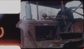
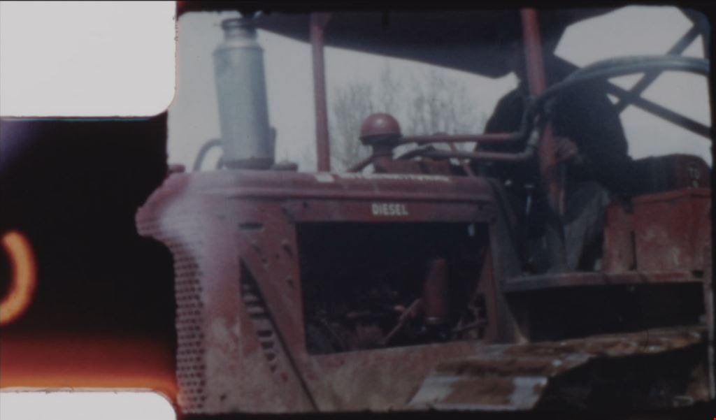
Digney Film 3 - Construction of Digney Bowling Alley
https://search.heritageburnaby.ca/link/museumdescription10648
- Repository
- Burnaby Village Museum
- Date
- 1955 (date of original), copied 2019
- Collection/Fonds
- Digney Family fonds
- Description Level
- Item
- Physical Description
- 1 video recording (mp4) (8 min., 40 sec.) : digital, 23 fps, col., si.
- Scope and Content
- Film segment documenting the construction of the Digney Bowling Alley in Burnaby. The bowling alley was built on the west side of the Digney family home located at 2698 Bonsor Avenue (address became 6521 Bonsor Avenue after 1958). The film documents Ozzie Cavello using his bulldozer to clear the la…
- Repository
- Burnaby Village Museum
- Collection/Fonds
- Digney Family fonds
- Description Level
- Item
- Physical Description
- 1 video recording (mp4) (8 min., 40 sec.) : digital, 23 fps, col., si.
- Scope and Content
- Film segment documenting the construction of the Digney Bowling Alley in Burnaby. The bowling alley was built on the west side of the Digney family home located at 2698 Bonsor Avenue (address became 6521 Bonsor Avenue after 1958). The film documents Ozzie Cavello using his bulldozer to clear the land followed by construction workers laying cinder block walls, a large crane helping to lay steel girders and lumber for the roof. The opening footage is taken from the parking lot of the Simpsons-Sears store on Kingsway. The Film segment closes with large flower arrangements gathered around the entrance of the Digney Bowling Alley in honour of the grand opening with Andy Digney and his brother in law Sydney Swan at the entrance.
- Creator
- Digney, Andy
- Geographic Access
- Bonsor Avenue
- Street Address
- 6521 Bonsor Avenue
- Accession Code
- BV019.18.5.1
- Access Restriction
- No restrictions
- Reproduction Restriction
- No known restrictions
- Date
- 1955 (date of original), copied 2019
- Media Type
- Moving Images
- Historic Neighbourhood
- Central Park (Historic Neighbourhood)
- Planning Study Area
- Maywood Area
- Photographer
- Digney, Andy
- Digney, Ernest Frank "Dig"
- Notes
- Title based on contents of film segment
- Film segment originates from digitized version of original 8 mm film (See BV019.18.5)
Images
Video
Digney Film 3 - Construction of Digney Bowling Alley, 1955 (date of original), copied 2019
Digney Film 3 - Construction of Digney Bowling Alley, 1955 (date of original), copied 2019
https://search.heritageburnaby.ca/media/hpo/_Data/_BVM_Moving_Images/2019_0018_0005_001.mp4![Digney Film 3 - Inside Digney Bowling Alley, [1955] (date of original), copied 2019 thumbnail](/media/hpo/_Data/_BVM_Moving_Images/2019_0018_0005_003.jpg?width=280)
Digney Film 3 - Inside Digney Bowling Alley
https://search.heritageburnaby.ca/link/museumdescription10650
- Repository
- Burnaby Village Museum
- Date
- [1955] (date of original), copied 2019
- Collection/Fonds
- Digney Family fonds
- Description Level
- Item
- Physical Description
- 1 video recording (mp4) (48 sec.) : digital, 23 fps, col., si.
- Scope and Content
- Film segment documenting the inside of the Digney Bowling Alley. Views of kitchen and counter staff working and serving customers who are gathered at the bar. The camera pans back outside and shows buses parked outside from "Channel / Chan TV. 8". Sign on roof of building reads: "BOWL" and "DIGNE…
- Repository
- Burnaby Village Museum
- Collection/Fonds
- Digney Family fonds
- Description Level
- Item
- Physical Description
- 1 video recording (mp4) (48 sec.) : digital, 23 fps, col., si.
- Scope and Content
- Film segment documenting the inside of the Digney Bowling Alley. Views of kitchen and counter staff working and serving customers who are gathered at the bar. The camera pans back outside and shows buses parked outside from "Channel / Chan TV. 8". Sign on roof of building reads: "BOWL" and "DIGNEY" sign hangs vertically out front.
- Creator
- Digney, Andy
- Names
- Digney Bowling Alley
- Geographic Access
- Bonsor Avenue
- Street Address
- 6521 Bonsor Avenue
- Accession Code
- BV019.18.5.3
- Access Restriction
- No restrictions
- Reproduction Restriction
- No known restrictions
- Date
- [1955] (date of original), copied 2019
- Media Type
- Moving Images
- Historic Neighbourhood
- Central Park (Historic Neighbourhood)
- Planning Study Area
- Maywood Area
- Photographer
- Digney, Andy
- Notes
- Title based on contents of film segment
- Film segment originates from digitized version of original 8 mm film (See BV019.18.5)
- Film segment may have been taken on the same day as BV019.18.4.2
Images
![Digney Film 3 - Inside Digney Bowling Alley, [1955] (date of original), copied 2019 thumbnail](/media/hpo/_Data/_BVM_Moving_Images/2019_0018_0005_003.jpg)
Video
Digney Film 3 - Inside Digney Bowling Alley, [1955] (date of original), copied 2019
Digney Film 3 - Inside Digney Bowling Alley, [1955] (date of original), copied 2019
https://search.heritageburnaby.ca/media/hpo/_Data/_BVM_Moving_Images/2019_0018_0005_003.mp4![Digney Film 3 - Tournament at Digney Bowling Alley, [1955] (date of original), copied 2019 thumbnail](/media/hpo/_Data/_BVM_Moving_Images/2019_0018_0005_002.jpg?width=280)
Digney Film 3 - Tournament at Digney Bowling Alley
https://search.heritageburnaby.ca/link/museumdescription10649
- Repository
- Burnaby Village Museum
- Date
- [1955] (date of original), copied 2019
- Collection/Fonds
- Digney Family fonds
- Description Level
- Item
- Physical Description
- 1 video recording (mp4) (3 min., 12 sec.) : digital, 23 fps, col., si.
- Scope and Content
- Film segment documenting a bowling tournament at the Digney Bowling Alley at 2698 Bonsor Avenue (address became 6521 Bonsor Avenue after 1958). Two male and female pairs appear to be competing against each other and a camera man and camera from Channel 8 - Chan TV are filming the event. One of the …
- Repository
- Burnaby Village Museum
- Collection/Fonds
- Digney Family fonds
- Description Level
- Item
- Physical Description
- 1 video recording (mp4) (3 min., 12 sec.) : digital, 23 fps, col., si.
- Scope and Content
- Film segment documenting a bowling tournament at the Digney Bowling Alley at 2698 Bonsor Avenue (address became 6521 Bonsor Avenue after 1958). Two male and female pairs appear to be competing against each other and a camera man and camera from Channel 8 - Chan TV are filming the event. One of the couples are wearing shirts with "Digney Bowl" printed on the back. Ernest "Dig" Digney assists in handing out awards at the end. Joyce Digney is identified working in the kitchen. The camera pans outside where there are two "Channel 8 - Chan TV" buses parked in the parking lot of the Digney Bowl.
- Creator
- Digney, Andy
- Geographic Access
- Bonsor Avenue
- Street Address
- 6521 Bonsor Avenue
- Accession Code
- BV019.18.5.2
- Access Restriction
- No restrictions
- Reproduction Restriction
- No known restrictions
- Date
- [1955] (date of original), copied 2019
- Media Type
- Moving Images
- Historic Neighbourhood
- Central Park (Historic Neighbourhood)
- Planning Study Area
- Maywood Area
- Photographer
- Digney, Andy
- Notes
- Title based on contents of film segment
- Film segment originates from digitized version of original 8 mm film (See BV019.18.5)
Images
![Digney Film 3 - Tournament at Digney Bowling Alley, [1955] (date of original), copied 2019 thumbnail](/media/hpo/_Data/_BVM_Moving_Images/2019_0018_0005_002.jpg)
Video
Digney Film 3 - Tournament at Digney Bowling Alley, [1955] (date of original), copied 2019
Digney Film 3 - Tournament at Digney Bowling Alley, [1955] (date of original), copied 2019
https://search.heritageburnaby.ca/media/hpo/_Data/_BVM_Moving_Images/2019_0018_0005_002.mp4Dominion Bridge Company Limited - Burnaby Plant
https://search.heritageburnaby.ca/link/museumdescription17538
- Repository
- Burnaby Village Museum
- Date
- 29 Aug. 1957
- Collection/Fonds
- Burnaby Village Museum Map collection
- Description Level
- Item
- Physical Description
- 1 plan : col. lithographic print ; 50.5 x 84 cm
- Scope and Content
- Item consists of a fire insurance plan of the Dominion Bridge Company Burnaby Plant located on the east side of Boundary Road near Lougheed Highway. The plan is in two sheets mounted on a backing board. The buildings are located and colour coded. The plan includes profiles of the buildings. Title o…
- Repository
- Burnaby Village Museum
- Collection/Fonds
- Burnaby Village Museum Map collection
- Description Level
- Item
- Physical Description
- 1 plan : col. lithographic print ; 50.5 x 84 cm
- Material Details
- Scale [1:960]
- Scope and Content
- Item consists of a fire insurance plan of the Dominion Bridge Company Burnaby Plant located on the east side of Boundary Road near Lougheed Highway. The plan is in two sheets mounted on a backing board. The buildings are located and colour coded. The plan includes profiles of the buildings. Title on plan reads "DOMINION BRIDGE COMPANY, LIMITED / "BURNABY PLANT" / Burnaby, B.C.". The site plan was surveyed by C. L. Schwaab Jr.
- History
- Dominion Bridge Company was a major enterprise in Burnaby operating from the 1930 until the mid 1970s. Dominion Bridge constructed steel structures ranging from portions of the Golden Gate and Lions Gate Bridges to holding tanks for pulp mills. Beginning in the mid-1970s, unused areas of the site were used for filming on a temporary basis and in 1987 the site was established as a dedicated studio production facility named Bridge Studios.
- Creator
- Schwabb, C.L. Jr.
- Subjects
- Buildings - Industrial - Factories
- Names
- Dominion Bridge Company
- Responsibility
- Associated Factory Mutual Fire Insurance Cos
- Geographic Access
- Boundary Road
- Street Address
- 2400 Boundary Road
- Accession Code
- BV015.10.1
- Access Restriction
- Restricted access
- Reproduction Restriction
- May be restricted by third party rights
- Date
- 29 Aug. 1957
- Media Type
- Cartographic Material
- Historic Neighbourhood
- Broadview (Historic Neighbourhood)
- Planning Study Area
- West Central Valley Area
- Scan Resolution
- 400
- Scan Date
- 2021-11-28
- Notes
- Title based on contents of plan
- Scale on plan reads "1 inch = 80 ft / By V. Pitkin"
- Identfication information in bottom right corner of plan reads: "FACTORY MUTUAL ENGINEERING DIVISION / Associated Factory Mutual Fire Insurance Cos. / Norwood, Mass. / SERIAl 47330 / Replacing 35238 / INDEX 3994"
Fire insurance plans - Greater Vancouver - Volume XVIII - Municipality of Burnaby
https://search.heritageburnaby.ca/link/museumdescription17798
- Repository
- Burnaby Village Museum
- Date
- 1927-1950
- Collection/Fonds
- Burnaby Village Museum Map collection
- Description Level
- Item
- Physical Description
- 22 plans on 12 sheets : col. lithographic print ; 64 x 54 cm
- Scope and Content
- Item consists of fire insurance plans titled "Greater Vancouver / Volume XVIII / Municipality / of Burnaby" surveyed May 1927, revised in October 1940 and September 1950. Includes a two page key plan (G and H) and twenty associated plans numbered; 1801; 1802; 1803; 1804; 1805; 1806; 1807; 1808; 18…
- Repository
- Burnaby Village Museum
- Collection/Fonds
- Burnaby Village Museum Map collection
- Description Level
- Item
- Physical Description
- 22 plans on 12 sheets : col. lithographic print ; 64 x 54 cm
- Material Details
- Scales between [1:600] and [1:6000]
- Scope and Content
- Item consists of fire insurance plans titled "Greater Vancouver / Volume XVIII / Municipality / of Burnaby" surveyed May 1927, revised in October 1940 and September 1950. Includes a two page key plan (G and H) and twenty associated plans numbered; 1801; 1802; 1803; 1804; 1805; 1806; 1807; 1808; 1809; 1810; 1811; 1812; 1813; 1814; 1815; 1819; 1820; 1821; 1822 and 1832.
- Publisher
- Plan Department of Fire Branch of British Columbia Underwriters' Association
- Accession Code
- BV987.1.70
- Access Restriction
- No restrictions
- Reproduction Restriction
- May be restricted by third party rights
- Date
- 1927-1950
- Media Type
- Cartographic Material
- Scan Resolution
- 400
- Scan Date
- 11/17/2021
- Notes
- Title based on contents of item
- Scale 1 inch = 50 feet
- These plans were removed from a bound book with labels on cover page reading: "Plan No. 90 / THIS INSURANCE PLAN / of / Vancouver VOLUME "8" / IN THE PROPERTY OF THE / British Columbia Insurance Underwriter's Association / Vancouver B.C. / AND IS LOANED / MELVILLE F. THOMSON CO. .../ Date May 26th, 1934"; / "Plan No. 74 / THIS INSURANCE PLAN / OF / VANCOUVER VOLUME "9"" / Plan No. 11 / THIS INSURANCE PLAN / OF / BURNABY VOLUMES 15-19" / "THIS PLAN IS THE PROPERTY OF / THE / BRITISH LAW INSURANCE COMPANY / LIMITED"
- Contact Burnaby Village Museum to view associated fire insurance plans
Fire insurance plans - Greater Vancouver - Volume XVII - Municipality of Burnaby
https://search.heritageburnaby.ca/link/museumdescription17797
- Repository
- Burnaby Village Museum
- Date
- 1927-1950
- Collection/Fonds
- Burnaby Village Museum Map collection
- Description Level
- Item
- Physical Description
- 4 plans on 4 sheets : col. lithographic prints
- Scope and Content
- Item consists of fire insurance plans titled "Greater Vancouver / Volume XVII / Municipality / of Burnaby" surveyed May 1927, revised in October 1940 and September 1950. Includes a two page key plan (E and F) and two associated plans numbered 1729 and 1738 (located within District Lot 35).
- Repository
- Burnaby Village Museum
- Collection/Fonds
- Burnaby Village Museum Map collection
- Description Level
- Item
- Physical Description
- 4 plans on 4 sheets : col. lithographic prints
- Scope and Content
- Item consists of fire insurance plans titled "Greater Vancouver / Volume XVII / Municipality / of Burnaby" surveyed May 1927, revised in October 1940 and September 1950. Includes a two page key plan (E and F) and two associated plans numbered 1729 and 1738 (located within District Lot 35).
- Publisher
- Plan Department of Fire Branch of British Columbia Underwriters' Association
- Accession Code
- BV987.1.70
- Access Restriction
- No restrictions
- Reproduction Restriction
- May be restricted by third party rights
- Date
- 1927-1950
- Media Type
- Cartographic Material
- Historic Neighbourhood
- Central Park (Historic Neighbourhood)
- Planning Study Area
- Garden Village Area
- Scan Resolution
- 400
- Scan Date
- 2021-11-17
- Notes
- Title based on contents of item
- These plans were removed from a bound book with labels on cover page reading: "Plan No. 90 / THIS INSURANCE PLAN / of / Vancouver VOLUME "8" / IN THE PROPERTY OF THE / British Columbia Insurance Underwriter's Association / Vancouver B.C. / AND IS LOANED / MELVILLE F. THOMSON CO. .../ Date May 26th, 1934"; / "Plan No. 74 / THIS INSURANCE PLAN / OF / VANCOUVER VOLUME "9"" / Plan No. 11 / THIS INSURANCE PLAN / OF / BURNABY VOLUMES 15-19" / "THIS PLAN IS THE PROPERTY OF / THE / BRITISH LAW INSURANCE COMPANY / LIMITED"
- Contact Burnaby Village Museum to view associated fire insurance plans XVIII
Game Regulation Map of British Columbia
https://search.heritageburnaby.ca/link/archivedescription65823
- Repository
- City of Burnaby Archives
- Date
- 1954
- Collection/Fonds
- Burnaby Historical Society fonds
- Description Level
- Item
- Physical Description
- 1 map : col. ; on sheet 55 x 70 cm folded to 23 x 11 cm + 1 p. (newsprint)
- Scope and Content
- Item is the "Game Regulation Map of British Columbia" for the 1954-1955 hunting season showing provincial electoral districts.
- Repository
- City of Burnaby Archives
- Date
- 1954
- Collection/Fonds
- Burnaby Historical Society fonds
- Subseries
- Ephemera subseries
- Physical Description
- 1 map : col. ; on sheet 55 x 70 cm folded to 23 x 11 cm + 1 p. (newsprint)
- Material Details
- 1 p. accompanying is a newspaper clipping from the Vancouver Sun dated August 6, 1954 that pertains to the "new" game regulations
- Scale : 1 inch = 40 miles
- Description Level
- Item
- Record No.
- 42684
- Accession Number
- BHS2007-04
- Scope and Content
- Item is the "Game Regulation Map of British Columbia" for the 1954-1955 hunting season showing provincial electoral districts.
- Media Type
- Cartographic Material
Graphic Map and Street Guide of Vancouver British Columbia / Graphic Publishers Canada
https://search.heritageburnaby.ca/link/archivedescription46977
- Repository
- City of Burnaby Archives
- Date
- [ca. 1950]
- Collection/Fonds
- Burnaby Historical Society fonds
- Description Level
- Item
- Physical Description
- 1 map
- Scope and Content
- Map and street guide of Vancouver, including North Vancouver, West Vancouver, Burnaby, New Westminster and Lulu Island. Map also includes an index of parks, schools, hospitals and other places of interest.
- Repository
- City of Burnaby Archives
- Date
- [ca. 1950]
- Collection/Fonds
- Burnaby Historical Society fonds
- Subseries
- Ephemera subseries
- Physical Description
- 1 map
- Description Level
- Item
- Record No.
- 37274
- Accession Number
- 2008-19
- Scope and Content
- Map and street guide of Vancouver, including North Vancouver, West Vancouver, Burnaby, New Westminster and Lulu Island. Map also includes an index of parks, schools, hospitals and other places of interest.
- Media Type
- Cartographic Material

Interviews with Bill and Albert Parker by Colin Stevens January 17, 1992
https://search.heritageburnaby.ca/link/museumdescription9840
- Repository
- Burnaby Village Museum
- Date
- 1920-1930 (interview content), interviewed January 17, 1992 (date of original), digitized 2020
- Collection/Fonds
- Burnaby Village Museum fonds
- Description Level
- Item
- Physical Description
- 1 videocassette (53 min., 14 sec.) : col. , sd.
- Scope and Content
- Film footage documenting informal interviews with brothers William “Bill” and Albert Parker conducted by Burnaby Village Museum curator, Colin Stevens. The footage opens in the administration building of the Burnaby Village Museum where Bill Parker describes a pair of cross country skis that he is …
- Repository
- Burnaby Village Museum
- Collection/Fonds
- Burnaby Village Museum fonds
- Series
- Jesse Love farmhouse series
- Description Level
- Item
- Physical Description
- 1 videocassette (53 min., 14 sec.) : col. , sd.
- Material Details
- Interviewer: Colin Stevens
- Interviewee:William (Bill) Parker; Albert Parker; Mrs. William Parker
- Location of Interview: Jesse Love farmhouse at the Burnaby Village Museum
- Camera: Susan Green and Colin Stevens
- Scope and Content
- Film footage documenting informal interviews with brothers William “Bill” and Albert Parker conducted by Burnaby Village Museum curator, Colin Stevens. The footage opens in the administration building of the Burnaby Village Museum where Bill Parker describes a pair of cross country skis that he is donating to the museum. Bill recollects how he constructed the skis out of cedar in the late 1920s when he was about 9 or 10 years old. Bill tells of how he skied in the neighbourhood of the Jesse Love farmhouse on Cumberland Road, using the skis until the mid to late 1930s. The film continues with a tour of the Jesse Love farmhouse which is under restoration on site of the Burnaby Village Museum. Curator Colin Stevens takes Albert and Bill Parker through various rooms inside of the house sharing details of what staff have discovered during the restoration process and gathers informative details by interviewing them. During the interviews, the brothers recollect what it was like living in the house in the 1920s. They provide details on the house’s construction, fixtures, heating and water systems along with particulars regarding furnishings and décor. Information that was gathered through interviews such as this, supported the restoration to be completed as accurately as possible.
- History
- Albert and William Charles “Bill” Parker are the sons of Sarah Parker (nee Love) and William Parker. Sarah Parker was the daughter of Jesse and Martha Love and grew up in the Love farmhouse located at 1390 Cumberland Road in Burnaby. Sarah and William Parker and their three children (Albert, Bill and Elsie) moved into the Love farmhouse in about 1925, eventually buying it in 1928 following the death of Sarah’s father Jesse Love. Sarah continued to live in the house until after her husband William died and eventually sold the house to her daughter Elsie Hughes and her husband John Hughes in 1966.
- Creator
- Burnaby Village Museum
- Subjects
- Sports - Skiing
- Buildings - Heritage
- Accession Code
- BV018.41.50
- Access Restriction
- Restricted access
- Reproduction Restriction
- May be restricted by third party rights
- Date
- 1920-1930 (interview content), interviewed January 17, 1992 (date of original), digitized 2020
- Media Type
- Moving Images
- Photographer
- Green, Susan
- Stevens, Colin
- Notes
- Title based on contents of video
- Video was digitized to mp4 in March 2020 from original VHS tape
Images

Video
Interviews with Bill and Albert Parker by Colin Stevens January 17, 1992, 1920-1930 (interview content), interviewed January 17, 1992 (date of original), digitized 2020
Interviews with Bill and Albert Parker by Colin Stevens January 17, 1992, 1920-1930 (interview content), interviewed January 17, 1992 (date of original), digitized 2020
https://search.heritageburnaby.ca/media/hpo/_Data/_BVM_Moving_Images/2018_0041_0050_001.mp4Map of the Fraser Valley
https://search.heritageburnaby.ca/link/archivedescription66719
- Repository
- City of Burnaby Archives
- Date
- 1950
- Collection/Fonds
- Maurice Phillips collection
- Description Level
- Item
- Physical Description
- 1 map : col. on paper ; 35 x 86 cm, folded to 18 x 23 cm
- Scope and Content
- Item is a Map of The Fraser Valley, compiled, published, and copyright held by T.W. McKenzie, Chilliwack B.C., with the assistance of road foremen and municipal engineers.
- Repository
- City of Burnaby Archives
- Date
- 1950
- Collection/Fonds
- Maurice Phillips collection
- Physical Description
- 1 map : col. on paper ; 35 x 86 cm, folded to 18 x 23 cm
- Material Details
- Scale : 1 inch = 2.5 miles
- Description Level
- Item
- Record No.
- MSS158-002
- Accession Number
- 2011-13
- Scope and Content
- Item is a Map of The Fraser Valley, compiled, published, and copyright held by T.W. McKenzie, Chilliwack B.C., with the assistance of road foremen and municipal engineers.
- Media Type
- Cartographic Material
- Notes
- Transcribed title
- Advertisement at front of map reads: "T.C. Polson / Special Representative / Fraser Valley Farms / Bell-Irving Insurance Agencies Ltd. / Real Estate Department / 930 West Pender St., Vancouver 1, B.C. / 24 hour phone: PA cific-4341 / Competent Service since 1894"
Operation Mink Farm
https://search.heritageburnaby.ca/link/archivedescription72207
- Repository
- City of Burnaby Archives
- Date
- April 24, 1955
- Collection/Fonds
- Planning Department fonds
- Description Level
- Item
- Physical Description
- 1 film reel ( 6 min., 8 sec.) : col. , si. ; 16 mm
- Scope and Content
- Item consists of a silent motion picture civil defense film entitled, "Operation Mink Farm" produced by the Corporation of the District of Burnaby. The film footage was shot in Burnaby, B.C. on April 24th, 1955. A resolution was passed in February 1955 by the Corporation of the District of Burnaby …
- Repository
- City of Burnaby Archives
- Date
- April 24, 1955
- Collection/Fonds
- Planning Department fonds
- Physical Description
- 1 film reel ( 6 min., 8 sec.) : col. , si. ; 16 mm
- Description Level
- Item
- Record No.
- 566-001
- Access Restriction
- No restrictions
- Reproduction Restriction
- No known restrictions
- Accession Number
- 2009-08
- Scope and Content
- Item consists of a silent motion picture civil defense film entitled, "Operation Mink Farm" produced by the Corporation of the District of Burnaby. The film footage was shot in Burnaby, B.C. on April 24th, 1955. A resolution was passed in February 1955 by the Corporation of the District of Burnaby to create a Civil Defense Board comprised of council members and appointees, whereby the Reeve would act as the chair of the board. Several municipal employees and council members went through Civil Defense training in preparation for an attack or catastrophe. The first portion of the film takes place at the old City Hall (the stone building) with uniformed Air Raid Precaution (A.R.P.) members performing civil defense exercises in the case of a nuclear war and how to care for and rescue injured civilians. Volunteers pose as the injured as they are cared for and transported on stretchers. In the second portion of the film, the local fire department and civil defense members endeavor to get a fire under control with water hoses. The film takes place at a former mink farm in North Burnaby as referred to in the title.
- Media Type
- Moving Images
- Photographer
- Scott, A.F.
- Notes
- Transcribed title
Images

Video
Operation Mink Farm, April 24, 1955
Operation Mink Farm, April 24, 1955
https://search.heritageburnaby.ca/media/hpo/_Data/_Archives_Moving_Images/_Unrestricted/566-001.m4v![Planning Map of Chinese Market Gardens on Marine Drive, [between 1950 and 1959] (date of original), 2017 (date of duplication) thumbnail](/media/hpo/_Data/_BVM_Images/2017/2017_0040_0002_001.jpg?width=280)
Planning Map of Chinese Market Gardens on Marine Drive
https://search.heritageburnaby.ca/link/museumdescription4297
- Repository
- Burnaby Village Museum
- Date
- [between 1950 and 1959] (date of original), 2017 (date of duplication)
- Collection/Fonds
- Herbert Yee Law family fonds
- Description Level
- Item
- Physical Description
- 1 photograph (tiff) : col. ; 300 dpi
- Scope and Content
- Scanned copy of a survey plan of district lots 163, 162, 157, 158, and 165, near the Chinese Market Gardens along Marine Drive.
- Repository
- Burnaby Village Museum
- Collection/Fonds
- Herbert Yee Law family fonds
- Description Level
- Item
- Physical Description
- 1 photograph (tiff) : col. ; 300 dpi
- Scope and Content
- Scanned copy of a survey plan of district lots 163, 162, 157, 158, and 165, near the Chinese Market Gardens along Marine Drive.
- History
- Survey plan of district lots 163, 162, 157, 158, and 165, which is primarily the area farmed by Chinese and Chinese-Canadian market gardeners around Marine Drive between Royal Oak and Mandeville (present-day Nelson). Two Chinese/Chinese Canadian land owners can be seen on the map: N.G. Wah Sing (or Ng Wah Sing) and Yee Law (or Herbert Law).
- Geographic Access
- Marine Drive
- Accession Code
- BV017.40.2
- Access Restriction
- No restrictions
- Reproduction Restriction
- No known restrictions
- Date
- [between 1950 and 1959] (date of original), 2017 (date of duplication)
- Media Type
- Cartographic Material
- Historic Neighbourhood
- Fraser Arm (Historic Neighbourhood)
- Planning Study Area
- Big Bend Area
- Scan Resolution
- 300
- Scan Date
- 11/19/2017
- Scale
- 100
- Notes
- Title based on contents of copy scan of map
- Herbert Yee Law was donor's father and this map may have originally been his copy of the city planning/engineering documents.
Images
![Planning Map of Chinese Market Gardens on Marine Drive, [between 1950 and 1959] (date of original), 2017 (date of duplication) thumbnail](/media/hpo/_Data/_BVM_Images/2017/2017_0040_0002_001.jpg)

Plan of Survey Lot A of Block 1 District Lot 42
https://search.heritageburnaby.ca/link/museumdescription18823
- Repository
- Burnaby Village Museum
- Date
- June 1957
- Collection/Fonds
- Seaforth School fonds
- Description Level
- Item
- Physical Description
- 1 survey plan : blueline print ; 42.5 x 47 cm
- Scope and Content
- Item consists of a survey plan of Lot A, of Block 1, District Lot 42, Group 1, New Westminster District. According to Explanatory Plan 5421 Burnaby, B.C. Seaforth School and grounds are noted on plan on the corner of Piper Avenue and Government Street.
- Repository
- Burnaby Village Museum
- Collection/Fonds
- Seaforth School fonds
- Description Level
- Item
- Physical Description
- 1 survey plan : blueline print ; 42.5 x 47 cm
- Material Details
- Scale: 1 inch = 50 feet
- Scope and Content
- Item consists of a survey plan of Lot A, of Block 1, District Lot 42, Group 1, New Westminster District. According to Explanatory Plan 5421 Burnaby, B.C. Seaforth School and grounds are noted on plan on the corner of Piper Avenue and Government Street.
- Creator
- Burnett, David H.
- Names
- Seaforth School
- Accession Code
- BV987.2.3
- Access Restriction
- No restrictions
- Reproduction Restriction
- No known restrictions
- Date
- June 1957
- Media Type
- Cartographic Material
- Scan Resolution
- 600
- Scan Date
- 2022-07-07
- Notes
- Title based on contents of item
- Title reads: "PLAN OF SURVEY / LOT "A", OF BLOCK 1 / DISTRICT LOT 42, 'GROUP 1 , / NEW WESTMINSTER DISTRICT / ACCORDING TO EXPLANATORY PLAN 5421 / BURNABY, B.C."
Images

Provincial Prison Farm - Oakalla - Plan Showing Central Areas of the Property / Planning Department
https://search.heritageburnaby.ca/link/archivedescription6015
- Repository
- City of Burnaby Archives
- Date
- 1954
- Collection/Fonds
- Planning Department fonds
- Description Level
- Item
- Physical Description
- 1 plan : b&w ink on paper ; 148 x 92 cm folded to 39 x 23 cm
- Scope and Content
- One large plan of Oakalla and the surrounding areas, Plan no. 4436-1.
- Repository
- City of Burnaby Archives
- Date
- 1954
- Collection/Fonds
- Planning Department fonds
- Series
- Facilities series
- Physical Description
- 1 plan : b&w ink on paper ; 148 x 92 cm folded to 39 x 23 cm
- Material Details
- Scale : 1 inch = 50 feet
- Description Level
- Item
- Record No.
- 8966
- Accession Number
- 2001-02
- Scope and Content
- One large plan of Oakalla and the surrounding areas, Plan no. 4436-1.
- Media Type
- Cartographic Material
![San Francisco Trip, [between 1935 and 1952] thumbnail](/media/Hpo/_Data/_Archives_Moving_Images/_Unrestricted/562-003-18.jpg?width=280)
San Francisco Trip
https://search.heritageburnaby.ca/link/archivedescription85312
- Repository
- City of Burnaby Archives
- Date
- [between 1935 and 1952]
- Collection/Fonds
- Digney Family fonds
- Description Level
- Item
- Physical Description
- 1 film clip ( 9 min., 43 sec.) : digital, b&w, col., si.
- Scope and Content
- Item is a digitized silent film segment identified as Reel 18 and contains footage interchanging between colour and black and white, showing the Digney family trip to San Francisco and California. The footage starts off rather poor. It provides views of; the islands surrounding San Francisco; cactu…
- Repository
- City of Burnaby Archives
- Date
- [between 1935 and 1952]
- Collection/Fonds
- Digney Family fonds
- Physical Description
- 1 film clip ( 9 min., 43 sec.) : digital, b&w, col., si.
- Description Level
- Item
- Record No.
- 562-003-18
- Access Restriction
- No restrictions
- Reproduction Restriction
- May be restricted by third party rights
- Accession Number
- 2014-04
- Scope and Content
- Item is a digitized silent film segment identified as Reel 18 and contains footage interchanging between colour and black and white, showing the Digney family trip to San Francisco and California. The footage starts off rather poor. It provides views of; the islands surrounding San Francisco; cactus gardens; the Pismo Beach zoo; a Circus; the Aurora Speedway in Seattle; a beach; garden sculptures; views from Telegraph Hill; clearing a California hwy and closes with Paul, Joyce and Dot Digney.
- Media Type
- Moving Images
- Photographer
- Digney, Andy
- Creator
- Digney, Andy
- Notes
- Title based on contents of film
Images
![San Francisco Trip, [between 1935 and 1952] thumbnail](/media/Hpo/_Data/_Archives_Moving_Images/_Unrestricted/562-003-18.jpg)
Video
San Francisco Trip, [between 1935 and 1952]
San Francisco Trip, [between 1935 and 1952]
https://search.heritageburnaby.ca/media/hpo/_Data/_Archives_Moving_Images/_Unrestricted/562-003-18.m4v![Sectional map and street directory of Vancouver : Dial map of greater Vancouver including adjacent municipalities, [ca. 1950] thumbnail](/media/hpo/_Data/_BVM_Cartographic_Material/2000/2000_0003_0011_001%20WEB.jpg?width=280)
Sectional map and street directory of Vancouver : Dial map of greater Vancouver including adjacent municipalities
https://search.heritageburnaby.ca/link/museumdescription8697
- Repository
- Burnaby Village Museum
- Date
- [ca. 1950]
- Collection/Fonds
- Burnaby Village Museum Map collection
- Description Level
- Item
- Physical Description
- 2 maps and 1 p. of textual records on 1 sheet : lithographic prints, col. ; 55.5 x 75 cm + 2 dials and 25 x 72 cm + directory on sheet 55.5 x 75 cm, folded to 28.5 x 12.5 cm
- Scope and Content
- Item is a sectional map and street directory titled "Dial Map of Greater Vancouver and adjacent Municipalities" with a map on one side titled "Dial Map of Greater Vancouver and Suburbs" including Vancouver, West Vancouver, North Vancouver and Burnaby and includes street car and bus lines, railways,…
- Repository
- Burnaby Village Museum
- Collection/Fonds
- Burnaby Village Museum Map collection
- Description Level
- Item
- Physical Description
- 2 maps and 1 p. of textual records on 1 sheet : lithographic prints, col. ; 55.5 x 75 cm + 2 dials and 25 x 72 cm + directory on sheet 55.5 x 75 cm, folded to 28.5 x 12.5 cm
- Material Details
- Scales 1:42240, 1:144823
- 2 alphabetic dials on narrow strips of paper attached to map by grommets
- Scope and Content
- Item is a sectional map and street directory titled "Dial Map of Greater Vancouver and adjacent Municipalities" with a map on one side titled "Dial Map of Greater Vancouver and Suburbs" including Vancouver, West Vancouver, North Vancouver and Burnaby and includes street car and bus lines, railways, hospitals, parks, block nos. and street indexes with two alphabetic dials, one for Vancouver, the other for New Westminster. The other side of the map includes a map of "Fraser Valley" along with a directory of Vancouver street car and bus routes, business blocks, public buildings, hospitals, bathing beaches, locations of Vancouver fire halls and Vancouver city schools.
- Creator
- Dominion Map and Blueprint Co.
- Publisher
- Sectional Map and Street Directory Company
- Geographic Access
- Vancouver
- Accession Code
- BV000.3.11
- Access Restriction
- No restrictions
- Reproduction Restriction
- No known restrictions
- Date
- [ca. 1950]
- Media Type
- Cartographic Material
- Scan Resolution
- 380
- Scan Date
- 22-Dec-2020
- Scale
- 100
- Notes
- Title based on contents of map
Images
![Sectional map and street directory of Vancouver : Dial map of greater Vancouver including adjacent municipalities, [ca. 1950] thumbnail](/media/hpo/_Data/_BVM_Cartographic_Material/2000/2000_0003_0011_001%20WEB.jpg)


![Through the Lens of Andy Digney, [between 1934 and 1964] (date of original film), edited and narrated in 2016 thumbnail](/media/hpo/_Data/_BVM_Moving_Images/2019_0018_0001_001.JPG?width=280)
Through the Lens of Andy Digney
https://search.heritageburnaby.ca/link/museumdescription10099
- Repository
- Burnaby Village Museum
- Date
- [between 1934 and 1964] (date of original film), edited and narrated in 2016
- Collection/Fonds
- Burnaby Village Museum fonds
- Description Level
- Item
- Physical Description
- 1 video recording (mp4) (12 min., 17 sec.) : digital, 23 fps, col., sd., stereo
- Scope and Content
- Item consists of a short film featuring a compilation of film footage created by Andy Digney that was edited and narrated by the Burnaby Village Museum. Burnaby resident Andy Digney captured footage of Burnaby and beyond from 1934 to 1964. Highlights within this film compilaton include the constru…
- Repository
- Burnaby Village Museum
- Collection/Fonds
- Burnaby Village Museum fonds
- Description Level
- Item
- Physical Description
- 1 video recording (mp4) (12 min., 17 sec.) : digital, 23 fps, col., sd., stereo
- Material Details
- Research and Narration: Lisa Codd
- Editing and Audio Recording: Matthew Ball
- Special thanks to Paul Digney
- Scope and Content
- Item consists of a short film featuring a compilation of film footage created by Andy Digney that was edited and narrated by the Burnaby Village Museum. Burnaby resident Andy Digney captured footage of Burnaby and beyond from 1934 to 1964. Highlights within this film compilaton include the construction and events held at the Oak Theatre; Royal visit motorcade of King George VI and Queen Elizabeth; Sports Day at Central Park; Gymcana event at Burnaby Lake Riding Stables; lawn bowling at Central Park; a Depression-era May Day workers’ parade in 1936; May Day celebrations in Burnaby; visits to locations throughout the Lower Mainland, including Stanley Park, Capilano Suspension Bridge, Grouse Mountain and boat trip up Burrard Inlet; the Digney Speedway; the Digney family at their home on Bonsor Avenue and the Digney Bowling Alley.
- Creator
- Digney, Andy
- Names
- Digney, Andy
- Digney Bowling Alley
- Digney Speedway
- Codd, Lisa
- Oak Theatre
- Burnaby Lawn Bowling Club
- Geographic Access
- Kingsway
- Central Park
- Street Address
- 6521 Bonsor Avenue
- Accession Code
- BV019.18.1
- Access Restriction
- No restrictions
- Reproduction Restriction
- No known restrictions
- Date
- [between 1934 and 1964] (date of original film), edited and narrated in 2016
- Media Type
- Moving Images
- Related Material
- See also the City of Burnaby Archives "Digney Family fonds" MI catalogue 562.003 for film masters
- Notes
- Title based on contents
- City of Burnaby Archives holds the original Digney film masters (562.003) that this narrated segment was disseminated from. See Digney family fonds
Images
![Through the Lens of Andy Digney, [between 1934 and 1964] (date of original film), edited and narrated in 2016 thumbnail](/media/hpo/_Data/_BVM_Moving_Images/2019_0018_0001_001.JPG)
Video
Through the Lens of Andy Digney, [between 1934 and 1964] (date of original film), edited and narrated in 2016
Through the Lens of Andy Digney, [between 1934 and 1964] (date of original film), edited and narrated in 2016
https://search.heritageburnaby.ca/media/hpo/_Data/_BVM_Moving_Images/2019_0018_0001_001.mp4Traffic Flow Map of Greater Vancouver
https://search.heritageburnaby.ca/link/archivedescription90140
- Repository
- City of Burnaby Archives
- Date
- 1959
- Collection/Fonds
- Planning Department fonds
- Description Level
- Item
- Physical Description
- 1 map : col ; 53 x 82.5 cm on sheet 47 x 86 cm
- Scope and Content
- Map laying out traffic flow of Greater Vancouver Regional District which includes Burnaby.
- Repository
- City of Burnaby Archives
- Date
- 1959
- Collection/Fonds
- Planning Department fonds
- Series
- Planning General series
- Physical Description
- 1 map : col ; 53 x 82.5 cm on sheet 47 x 86 cm
- Material Details
- Scale : 1 inch = .57 miles
- Description Level
- Item
- Record No.
- 59930
- Access Restriction
- Open access
- Accession Number
- 2016-09
- Scope and Content
- Map laying out traffic flow of Greater Vancouver Regional District which includes Burnaby.
- Media Type
- Cartographic Material
- Publisher
- Prepared for Neon Products of Canada Ltd.
- Notes
- Transcribed title
Vancouver
https://search.heritageburnaby.ca/link/archivedescription65739
- Repository
- City of Burnaby Archives
- Date
- 1951
- Collection/Fonds
- Burnaby Historical Society fonds
- Description Level
- Item
- Physical Description
- 1 map : col. ; on paper ; 51 x 71 cm folded to 29 x 18 cm
- Scope and Content
- Item is a map of Vancouver produced by the Geographic Division, Surveys and Mapping Service, Department of Lands and Forests, British Columbia.
- Repository
- City of Burnaby Archives
- Date
- 1951
- Collection/Fonds
- Burnaby Historical Society fonds
- Subseries
- Anne Sievenpiper subseries
- Physical Description
- 1 map : col. ; on paper ; 51 x 71 cm folded to 29 x 18 cm
- Material Details
- Scale 1 : 250,000 - Approximately 4 miles to 1 inch
- Description Level
- Item
- Record No.
- 42661
- Accession Number
- BHS2001-02
- Scope and Content
- Item is a map of Vancouver produced by the Geographic Division, Surveys and Mapping Service, Department of Lands and Forests, British Columbia.
- Media Type
- Cartographic Material
- Notes
- Transcribed title