Narrow Results By
Subject
- Agriculture - Farms 1
- Buildings - Commercial - Grocery Stores 1
- Government - Colonial Government 1
- Indigenous peoples - British Columbia 3
- Indigenous peoples - British Columbia - First contact with Europeans 1
- Indigenous peoples - British Columbia - Languages 2
- Indigenous peoples - Canada - Government relations 3
- Indigenous peoples - Canada - , Treatment of 3
- Monuments 1
- Persons - Chinese Canadians 1
- Persons - Pioneers 1
- Social Issues - Discrimination 1
Creator
- British Columbia Electric Company 1
- British Columbia Underwriters' Association 4
- Bureau of Post War Rehabilitation and Reconstruction Regional Planning Division 1
- Burnaby Village Museum 5
- City of Burnaby 3
- Forsyth, Mary 1
- Law, Yee "Herbert" 1
- Lemke, Jane 2
- Love Family 1
- Petrusa, Kate 2
- Plan Department, British Columbia Insurance Underwriters' Association 1
- Seaforth School 1
Lower Mainland Regional Plan
https://search.heritageburnaby.ca/link/archivedescription90139
- Repository
- City of Burnaby Archives
- Date
- 1945
- Collection/Fonds
- Planning Department fonds
- Description Level
- Item
- Physical Description
- 7 maps : col. ; 22.5 x 53.5 cm on sheets 42 x 65 cm
- Scope and Content
- A collection of seven maps titled "Lower Mainland Regional Plan". Maps are numbered and subtitled as: "Light and Power Distribution / Map No. 5"; "Harbour Areas" / Map No. 8"; "Land Use" / Map No. 2"; "Water Supply" / Map No. 6"; "Dykes" / Map No. 7"; "Population Distribution / Map_No._1". All maps…
- Repository
- City of Burnaby Archives
- Date
- 1945
- Collection/Fonds
- Planning Department fonds
- Series
- Planning General series
- Physical Description
- 7 maps : col. ; 22.5 x 53.5 cm on sheets 42 x 65 cm
- Material Details
- Scale : in miles
- Map no. 4 is missing
- Description Level
- Item
- Record No.
- 59929
- Access Restriction
- Open access
- Accession Number
- 2016-09
- Scope and Content
- A collection of seven maps titled "Lower Mainland Regional Plan". Maps are numbered and subtitled as: "Light and Power Distribution / Map No. 5"; "Harbour Areas" / Map No. 8"; "Land Use" / Map No. 2"; "Water Supply" / Map No. 6"; "Dykes" / Map No. 7"; "Population Distribution / Map_No._1". All maps have are marked with boundaries, and landmarks including Historical Monuments, Custom Ports, Airports and Railways.
- Media Type
- Cartographic Material
- Notes
- Transcribed title
- Credit on maps read as: "Bureau_of_Post_War / Rehabilitation_and_Reconstruction / Regional_Planning_Design / Parliament_Buildings_Victoria_BC / Date_Sept_1st_1945 / (signed by ) [A.G._Graham]"
1946 Data Report (supplement) - Burnaby Town Planning Commission
https://search.heritageburnaby.ca/link/archivedescription8844
- Repository
- City of Burnaby Archives
- Date
- 1946
- Collection/Fonds
- Planning Department fonds
- Description Level
- Item
- Physical Description
- Textual record and cartographic material
- Scope and Content
- This data report also contains a supplemental folder of maps.
- Repository
- City of Burnaby Archives
- Date
- 1946
- Collection/Fonds
- Planning Department fonds
- Series
- Planning General series
- Physical Description
- Textual record and cartographic material
- Description Level
- Item
- Record No.
- 11805
- Accession Number
- 2003-17
- Scope and Content
- This data report also contains a supplemental folder of maps.
- Media Type
- Textual Record
- Cartographic Material
Planning Department fonds
https://search.heritageburnaby.ca/link/archivedescription102
- Repository
- City of Burnaby Archives
- Date
- 1940-2016
- Collection/Fonds
- Planning Department fonds
- Description Level
- Fonds
- Physical Description
- 80 m of textual records and other material
- Scope and Content
- Fonds consists of those records created during the regular conduct of business by the Planning Department and its predecessor agencies according to their mandate of providing professional and technical advice to Council on the current and future uses of City land and resources.
- Repository
- City of Burnaby Archives
- Date
- 1940-2016
- Collection/Fonds
- Planning Department fonds
- Physical Description
- 80 m of textual records and other material
- Description Level
- Fonds
- File Class
- 71000 10 (add. 2020)
- 71000 20 (add. 2020)
- 71000 30 (add. 2020)
- 71000 40 (add. 2020)
- Access Restriction
- Subject to FOIPPA
- Reproduction Restriction
- Reproductions subject to FOIPPA.
- Scope and Content
- Fonds consists of those records created during the regular conduct of business by the Planning Department and its predecessor agencies according to their mandate of providing professional and technical advice to Council on the current and future uses of City land and resources.
- History
- The City of Burnaby Planning Department was established on October 9, 1956, when the City Council unanimously carried the motion to create a distinct department to deal with planning issues within the City and appointed Mr. William John Blakely as its head. This decision followed a report and recommendation made by the City’s Chief Administrative Officer which indicated that the role of the Planning Engineer and his staff had quickly expanded to become a separate division within the Engineering Department and that they were functioning as an independent unit in all but name. The proposed separation of the Engineering and Planning departments had been in the works since the early part of 1956 when staff changes and restructuring within the Engineering Department’s Planning Division illustrated the undermanned condition of the Planning Engineer’s office. As a result, Council asked the Chief Administrative Officer to undertake a study examining the feasibility of creating a distinct Planning Department. This report was delivered to Council on July 3, 1956, but was laid over until a Committee of the Council had the opportunity to study the functions of the Planning department to determine the necessity of the proposal. The Committee’s findings were in line with the initial report and the Planning Department was established with a staff of nine (the head Planning Engineer, an Administrative Planner, three Research Planning Assistants, a Draughtsman, a Subdivision Control Clerk, a department Clerk and a Clerk Stenographer). This new department was to offer advice and carry out the work intensive in matters such as zoning and rezoning applications, subdivision control, traffic and transportation planning, and general City planning schemes. Prior to the creation of the Planning Department, a number of bodies within the City had been responsible for fulfilling the functions carried out by this new unit. In the earliest years of the City, the members of Council were responsible for matters of planning and were assisted in their job by the City’s Engineer or any number of hired consultants (e.g. surveyors, cartographers). By 1906, however, the provincial laws surrounding the subdivision process had changed, and local governments were charged with the task of approving all private subdivision plans in their respective Municipalities. In Burnaby, the City Council passed a bylaw decreeing that all subdivision plans were to be submitted to Council for review and the City Engineer was responsible for ensuring compliance with the law. After the first Town Planning Bylaw in 1924 which restricted the type and size of construction that could occur in certain City areas, the Engineering and Building departments were to work together to oversee the enforcement of the Bylaw and the development of City plans. The scope and competence required to carry out this work grew as Burnaby’s population expanded, and in 1930 Council passed the Town Planning Commission Bylaw (No. 1028) that saw the creation of a permanent body – the Town Planning Commission – which was to serve as an advisory body to help direct the planning activities in the City while the actual work continued to be carried out by the Engineering Department. This body was comprised of the Reeve, the Chairman of the School Board, the Chairman of the Park Committee (later, the Board of Parks Commissioners), and six appointed citizens who served three-year terms. Council referred all matters of subdivisions, transportation planning, and rezoning to this Commission, which was later supported in its work by several other special or standing committees such as the Subdivision Committee, the Apartment Committee, the Transportation Committee or the Town Planning Board of Appeal. By 1953, it had become apparent that the advisory committees that were dedicated to these planning issues needed a permanent staff to carry out the work intensive, so a restructuring of the Engineering department resulted in a permanent Planning Engineer’s office being created. The Town Planning Commission continued in its advisory capacity even after the determination came in 1956 to create a separate Planning Department. When Bylaw No. 4473 was passed in 1963, the Town Planning Commission was disbanded in favour of a new Advisory Planning Commission that would turn over all routine matters such as subdivision and rezoning applications to the Planning Department but would offer advice and community input into the more complex planning schemes within the City and act as an intermediary in cases where Council and Planning staff were in disagreement. A new Advisory Planning Commission Bylaw (No. 7600) was adopted in 1980 which allowed for even greater community participation in the planning process. The Planning Department was initially responsible to report directly to Council, but in 1957, the administrative structure of Municipal staff changed with the introduction of the Burnaby Municipal Manager Bylaw (No. 3859) and from that point on, the head of the Planning Department held a direct reporting relationship to the Municipal Manager, who in turn was responsible for reporting the activities of the Department to the City Council. Over the years, the internal structure and the scope of responsibilities of the Department have changed during periods of staff reorganizations. Under the larger umbrella of the Planning and Building Department, Planning has come to be comprised of two divisions: the Current Planning Division and the Long Range Planning Division. The functions of the Current Planning Division include rezoning, subdivision, development plan areas, preliminary plan approvals, urban design, heritage planning, and urban trails and bicycle routes. The Long Range Planning Division is responsible for environmental planning concerns, transportation planning, housing, neighbourhood area planning, social planning and planning information services. In 2022, the Planning and Building Department was reorganized to better align functions with delivery of services. The Climate Action and Engery Division moved from Corporate Services to the Planning and Building Department, while Indigenous Relations and Facilities Management moved to Corporate Services and Lands and Facilities, respectively. The position of Director of Planning and Building was changed to General Manager, Planning and Development. The following individuals have served as Planning Engineer and/or Director of the Planning Department and/or General Manager, Planning and Development for the City of Burnaby: William John Blakely 1954-1956 (as Planning Engineer) 1956-1963 (as Head of the Department) Anthony P. Parr 1964-1993 Don G. Stenson 1993-2001 Jack S. Belhouse 2001-2006 Basil Luksun 2006-2012 Lou Pelletier 2012-2019 Edward Kozak 2019-present
- Formats
- Microforms exist for some records. See series descriptions.
- Media Type
- Textual Record
- Photograph
- Moving Images
- Creator
- City of Burnaby
- Notes
- Title based on contents of fonds
Studies, reports, and conferences series
https://search.heritageburnaby.ca/link/archivedescription186
- Repository
- City of Burnaby Archives
- Date
- 1930-2010
- Collection/Fonds
- Planning Department fonds
- Description Level
- Series
- Scope and Content
- Series consists of the various published and draft reports and studies produced by the Planning Department covering all facets of their operations. During the course of their research and reporting on all planning issues within the City, the Planning Department published or made available studies …
- Repository
- City of Burnaby Archives
- Date
- 1930-2010
- Collection/Fonds
- Planning Department fonds
- Description Level
- Series
- Scope and Content
- Series consists of the various published and draft reports and studies produced by the Planning Department covering all facets of their operations. During the course of their research and reporting on all planning issues within the City, the Planning Department published or made available studies that outlined the findings or proposals that arose from their work and this type of material was all grouped together within this series. These reports and studies ranged from topics such as Burnaby regional studies, transportation and apartment reports, and park and school site needs to Official Community Plans and development schemes related to residential, commercial, and industrial sites. Also found within this series were the records that were created dealing with conferences, workshops, and seminars attended or held by the Burnaby Planning Department staff.
- Media Type
- Textual Record
- Moving Images

Bringing Visibility to the Land: A Tsleil-Waututh Perspective on Community Building
https://search.heritageburnaby.ca/link/museumdescription15665
- Repository
- Burnaby Village Museum
- Date
- 27 Apr. 2021
- Collection/Fonds
- Burnaby Village Museum fonds
- Description Level
- Item
- Physical Description
- 1 video recording (mp4) (47 min., 39 sec.) : digital, col., sd., stereo ; 29 fps
- Scope and Content
- Item consists of a video recording of a live Zoom webinar hosted by Burnaby Village Museum Curator, Jane Lemke. The webinar is titled "Bringing Visibility to the Land: A Tsleil-Waututh Perspective on Community Building" and is presented by Michelle George, Tsleil-Waututh Nation Cultural and Technic…
- Repository
- Burnaby Village Museum
- Collection/Fonds
- Burnaby Village Museum fonds
- Description Level
- Item
- Physical Description
- 1 video recording (mp4) (47 min., 39 sec.) : digital, col., sd., stereo ; 29 fps
- Material Details
- Presenters: Michelle George
- Host: Jane Lemke
- Date of Presentation: Tuesday, April 27, 7:00 pm - 8:00 pm
- Total Number of tracks: 1
- Total Length of all tracks: 47 min., 39 sec.
- Recording Device: Zoom video communication platform
- Recording Note: Film was edited from it's original recorded version (63 min., 29 sec.) to edited version (47 min., 39 sec.) for public viewing on Heritage Burnaby
- Scope and Content
- Item consists of a video recording of a live Zoom webinar hosted by Burnaby Village Museum Curator, Jane Lemke. The webinar is titled "Bringing Visibility to the Land: A Tsleil-Waututh Perspective on Community Building" and is presented by Michelle George, Tsleil-Waututh Nation Cultural and Technical Specialist. The Zoom webinar is the first in a series of six "Neighbourhood Speaker series" webinars exploring a range of topics shared by Indigenous speakers and knowledge keepers that were presented and made available to the public between April 27 and May 12, 2021. The live webinar was also made available on the Burnaby Village Museum's facebook page. Community members were invited to participate by bringing questions during the interactive online sessions. In this webinar, Michelle George explores the importance of bringing Tsleil-Waututh ways of knowing/knowledge of the land to Burnaby. She grounds her talk with her experience of working with the Burnaby Village Museum on producing the Indigenous History of Burnaby Resource Guide, an award-winning illustrated educational guide. Michelle also speaks to some of the devastating experiences that the Tsleil-Waututh Nation and Indigenous Peoples have suffered since Colonial Settlement and how her Nation has begun to grow in a changing environment. In segments of her talk, Michelle refers to a map titled "Tsleil-Waututh Nation Consultation Area". Following the presentation, Michelle George answers questions from the audience that are moderated by the host, Jane Lemke.
- History
- Michelle George is a member of the Tsleil-Waututh Nation (TWN) and currently works as a Tsleil-Waututh Nation Cultural and Technical Specialist for the Treaty, Lands and Resources (TLR) Department. She participates in various projects for the TWN government and community, focusing on Tsleil-Waututh Governance and Community. The goals that she carries in her work are to make sure Tsleil-Waututh culture is included and considered in these Nation-level projects, as well as within the reviews done on external projects within the TWN Consultation area. She has been a member of both the Tsleil-Waututh Land Code Committee and Land Use Planning group. Michelle is also a First Nations Health Authority Traditional Knowledge Keeper, and a past-Elected Councilor for Tsleil-Waututh Nation. Michelle also provides guest lectures at Simon Fraser University, Langara College, and the BC Institute of Technology.
- Creator
- Burnaby Village Museum
- Subjects
- Indigenous peoples - British Columbia
- Indigenous peoples - Canada - Government relations
- Indigenous peoples - British Columbia - Languages
- Indigenous peoples - Canada - , Treatment of
- Indigenous peoples - British Columbia - First contact with Europeans
- Names
- Burnaby Village Museum
- Burnaby Public Library
- George, Michelle
- Tsleil-Waututh Nation
- George, Chief Daniel "Dan"
- Responsibility
- Lemke, Jane
- Geographic Access
- Burrard Inlet
- Accession Code
- BV021.17.1
- Access Restriction
- No restrictions
- Reproduction Restriction
- No known restrictions
- Date
- 27 Apr. 2021
- Media Type
- Moving Images
- Notes
- Title based on contents of video recording
Images

Video
Bringing Visibility to the Land: A Tsleil-Waututh Perspective on Community Building, 27 Apr. 2021
Bringing Visibility to the Land: A Tsleil-Waututh Perspective on Community Building, 27 Apr. 2021
https://search.heritageburnaby.ca/media/hpo/_Data/_BVM_Moving_Images/2021_0017_0001_002.mp4
Eating your way through Burnaby: A look at Chinese Canadian history through food
https://search.heritageburnaby.ca/link/museumdescription14762
- Repository
- Burnaby Village Museum
- Date
- 27 Oct. 2020
- Collection/Fonds
- Burnaby Village Museum fonds
- Description Level
- Item
- Physical Description
- 1 video recording (mp4) (61 min., 56 sec.) : digital, col., sd., stereo ; 29 fps
- Scope and Content
- Item consists of a video recording of a live Zoom webinar hosted by Kate Petrusa, Burnaby Village Museum assistant curator. The webinar is titled "Eating your way through Burnaby: A look at Chinese Canadian history through food" and is presented by Denise Fong, Planning Assistant for the City of Bu…
- Repository
- Burnaby Village Museum
- Collection/Fonds
- Burnaby Village Museum fonds
- Description Level
- Item
- Physical Description
- 1 video recording (mp4) (61 min., 56 sec.) : digital, col., sd., stereo ; 29 fps
- Material Details
- Presenter: Denise Fong
- Host: Kate Petrusa
- Date of Presentation: October 27 7:00 pm - 8:00 pm
- Total Number of tracks: 1
- Total Length of all tracks:61 min., 56 sec.
- Recording Device: Zoom video communication platform
- Scope and Content
- Item consists of a video recording of a live Zoom webinar hosted by Kate Petrusa, Burnaby Village Museum assistant curator. The webinar is titled "Eating your way through Burnaby: A look at Chinese Canadian history through food" and is presented by Denise Fong, Planning Assistant for the City of Burnaby. The zoom webinar is the seventh in a collection of seven "Burnaby Neighbourhood Speaker series" webinars that were presented and made available to the public between September 29 and October 27, 2020. The live webinar and recording was also made available on the Burnaby Village Museum's facebook page. In this webinar, Denise Fong talks about how Chinese Canadians have played a key role in supplying food to Burnaby’s community through their participation in the local market gardening, green grocer, and restaurant industries. The presentation is supported with historical maps, photographs, documents, census records and stories from recent research on the 1960s-1970s period in Burnaby’s Big Bend and Capitol Hill neighborhoods. In her presentation, Denise also talks about the history of Chinese Immigration in Canada including the political circumstances and legal barriers that Chinese migrants faced in the late nineteenth to early twentieth century. Denise highlights specific Chinese Canadian family farms in Burnaby including; the Jung family farm located on 5460 Douglas Road operated by Jung Chong and his wife Jung Gee Shee; "Hop On Farms" located on Marine Drive, operated by Chan Kow Hong, Sui Ha Hong and family; the Tong Yip Farm located on Byrne Road operated by D.T. "George" Yip and his wife, Yip Chow Won Tai. Denise also highlights her recent research regarding Chinese Canadian corner stores and green grocers in Burnaby including; The Lee Kee grocery store located at 3824 East Hastings Street, owned and operated by Yow Lee Ko and his wife Say Jan Chan; the Burnaby Market located at 3942 East Hastings Street, owned and operated by Chin Yin Wong; the Quon Bros. located at 3702 East Hastings Street.; Y. Hoy Produce Co. located at 4092 East Hastings Street operated by Hoy Yen; Louie's Food Basket located at 5886 South East Marine Drive operated by Hoy Bew Louie, his wife Poy Yee and later by thier son Bing Louie and Tommy's Market located in Burnaby's Edmonds neighbourhood, operated by Tommy Chu. Denise also provides a detailed history of Tommy Chu and family who owned and operated Tommy's Market. Denise tells of how in the early 1970s, Chinese grocers in the lower mainland came together and formed the Lower Mainland Independent Grocers Association and Lower Mainland Grocers Co-Op. The organization was formed to protect the rights and promote businesses of independent grocers. In closing, Denise explains how her research of Chinese Canadian history in Burnaby continues and by the end of the project, the information will be made accessible in the form of a publication.
- Creator
- Burnaby Village Museum
- Subjects
- Persons - Chinese Canadians
- Social Issues - Discrimination
- Agriculture - Farms
- Social Issues - Racism
- Buildings - Commercial - Grocery Stores
- Names
- Fong, Denise
- Jung, Chung Chong
- Tommy's Produce
- Lee Kee Grocery
- Louie's Food Basket
- Louie, Hoy Bew
- Jung, Gee Shee
- Hong, Chan Kow
- Hong, Sui Ha
- Yip, D.T. "George"
- Yip, Chow Won Tai
- Ko, Yow Lee
- Ko, Chan Say Jan
- Burnaby Market
- Wong, Chin Yin
- Quon Bros.
- Y. Hoy Produce Co.
- Yen, Hoy
- Louie, Poy Yee
- Louie, Bing
- Chu, Tommy
- Chu, Sharon
- Chu, Calvin
- Responsibility
- Petrusa, Kate
- Geographic Access
- Hastings Street
- Accession Code
- BV020.29.7
- Access Restriction
- No restrictions
- Reproduction Restriction
- No known restrictions
- Date
- 27 Oct. 2020
- Media Type
- Moving Images
- Historic Neighbourhood
- Fraser Arm (Historic Neighbourhood)
- Vancouver Heights (Historic Neighbourhood)
- Planning Study Area
- Big Bend Area
- Burnaby Heights Area
- Notes
- Title based on contents of video recording
- Video recording was edited for publication on Heritage Burnaby. Original mp4 video recording (BV020.29.7.1) is 72 min., 14 sec.
Images

Video
Eating your way through Burnaby: A look at Chinese Canadian history through food, 27 Oct. 2020
Eating your way through Burnaby: A look at Chinese Canadian history through food, 27 Oct. 2020
https://search.heritageburnaby.ca/media/hpo/_Data/_BVM_Moving_Images/2020_0029_0007_002.mp4Engineering Department fonds
https://search.heritageburnaby.ca/link/archivedescription43
- Repository
- City of Burnaby Archives
- Date
- 1912-2014
- Collection/Fonds
- Engineering Department fonds
- Description Level
- Fonds
- Physical Description
- 1m of textual records, approximately 2000 cartographic and architecural drawings
- Scope and Content
- Fonds consists of records created by the Engineering department including environmental service files, physical plant plans, and administrative records.
- Repository
- City of Burnaby Archives
- Date
- 1912-2014
- Collection/Fonds
- Engineering Department fonds
- Physical Description
- 1m of textual records, approximately 2000 cartographic and architecural drawings
- Description Level
- Fonds
- Access Restriction
- Subject to FOIPPA
- Reproduction Restriction
- Reproductions subject to FOIPPA
- Scope and Content
- Fonds consists of records created by the Engineering department including environmental service files, physical plant plans, and administrative records.
- History
- In 2020, responsibility for environmental management transferred to Climate Action and Energy, with Engineering retaining responsibility for geotechnical investigations and graffiti management. In 2022, Engineering became responsible for a consolidated Transportation group that aligns transportation planning and implementation functions. Green Fleet and Equipment also moved from Climate Action and Energy to the Public Works division of the Engineering Department. In 2022, Facilities Management was transferred from Engineering to the newly-created Lands and Facilities Department. James Lota served as General Manager, Engineering from 2021-2022. Jozsef Dioszeghy has served in the role since April 2022.
- Creator
- City of Burnaby
- Notes
- Title based on contents of fonds.
Fire Department fonds
https://search.heritageburnaby.ca/link/archivedescription47
- Repository
- City of Burnaby Archives
- Date
- 1920-2019
- Collection/Fonds
- Fire Department fonds
- Description Level
- Fonds
- Physical Description
- 1 m of textual records, graphic material, and cartographic material
- Scope and Content
- Fonds consists of news clippings; notes correspondence; and layout and research materials used in the development and creation of the Burnaby Fire Department history entitled “Follow that Fire.” Also consists of administrative records created by the Fire Department related to its management, direct…
- Repository
- City of Burnaby Archives
- Date
- 1920-2019
- Collection/Fonds
- Fire Department fonds
- Physical Description
- 1 m of textual records, graphic material, and cartographic material
- Description Level
- Fonds
- Access Restriction
- Subject to FOIPPA
- Reproduction Restriction
- Reproductions subject to FOIPPA
- Scope and Content
- Fonds consists of news clippings; notes correspondence; and layout and research materials used in the development and creation of the Burnaby Fire Department history entitled “Follow that Fire.” Also consists of administrative records created by the Fire Department related to its management, direction, coordination, training services, and planning, including daily record books, emergency preparedness pamphlets, a departmental practice manual, procedural directives, scrapbooks, and an orthophoto map (in 63 pieces) of the City of Burnaby.
- History
- Serving the City since 1911, the Burnaby Fire Department is committed to providing timely, professional, and effective fire-related emergency services to save lives, property and the environment. Their dedicated staff serves the City via seven fire stations located strategically across Burnaby. Each of our stations is equipped with up-to-date vehicles and equipment. Their highly skilled and trained team of men and women provide many services, including fire suppression and prevention, investigation, inspection, training, medical, vehicle extrication, technical and other speciality rescues, hazardous materials response and public education services. The following information pertains to the publication "Follow That Fire": Communities have always lived with the threat of fire. Early Burnaby residents banded together to extinguish out-of-control brush fires. In the 1920s, the Municipal Police were responsible for fire-related matters, earning three dollars for attending a fire. Donations to the Vancouver and New Westminster Fire Departments' Benevolent Funds brought the first fire engines to Burnaby's rescue. As the population increased, by-laws were enacted to develop a full-time fire service. Several members saw the value in jotting down recollections of their experiences as Burnaby firemen, which sparked an interest in completing the History of the Burnaby Fire Department. While researching this project, the author was fortunate in being able to draw from the resources of retired chiefs Fred Blake and Lewis Auvache, who were original members of the Department. The Department's progression includes heated and sometimes humorous debates regarding who should be responsible for fire protection, deciding if there was a need for a fire services, and how taxes would be levied to support the service. Photographs throughout the text represent stages of development which include a pictorial record of Burnaby fire trucks from 1923 to the present platform ladder trucks. From its humble beginning as two separate fire departments operating from a converted police horse stable and a water pumping station, the Burnaby Fire Department has developed into a professional organization serving its citizens from six fire stations.
- Media Type
- Textual Record
- Photograph
- Cartographic Material
- Creator
- City of Burnaby
- Notes
- Title based on contents of fonds.
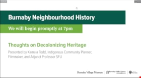
Thoughts on decolonizing heritage
https://search.heritageburnaby.ca/link/museumdescription14757
- Repository
- Burnaby Village Museum
- Date
- 1 Oct. 2020
- Collection/Fonds
- Burnaby Village Museum fonds
- Description Level
- Item
- Physical Description
- 1 video recording (mp4) (88 min., 3 sec.) : digital, col., sd., stereo ; 29 fps
- Scope and Content
- Item consists of a video recording of a live Zoom webinar hosted by Burnaby Village Museum's Kate Petrusa. The webinar is titled "Thoughts on Decolonizing Heritage" and is presented by Kamala Todd - Indigenous Community Planner, Filmmaker, and Adjunct Professor SFU. The zoom webinar is the second i…
- Repository
- Burnaby Village Museum
- Collection/Fonds
- Burnaby Village Museum fonds
- Description Level
- Item
- Physical Description
- 1 video recording (mp4) (88 min., 3 sec.) : digital, col., sd., stereo ; 29 fps
- Material Details
- Presenter: Kamala Todd
- Host: Kate Petrusa
- Date of Presentation: October 1, 7:00 pm - 8:30 pm
- Total Number of tracks: 1
- Total Length of all tracks: 88 min., 3 sec.
- Recording Device: Zoom video communication platform
- Scope and Content
- Item consists of a video recording of a live Zoom webinar hosted by Burnaby Village Museum's Kate Petrusa. The webinar is titled "Thoughts on Decolonizing Heritage" and is presented by Kamala Todd - Indigenous Community Planner, Filmmaker, and Adjunct Professor SFU. The zoom webinar is the second in a collection of seven "Neighbourhood Speaker series" webinars that were presented and made available to the public between September 29 and October 27, 2020. The live webinar and recording was also made available on the Burnaby Village Museum's facebook page. In this webinar, Kamala Todd speaks about how narratives and sense of place shape our connection to the lands we live upon. Kamala highlights how dominant colonial narratives are embedded into the built environment, place names, heritage landscapes, and the very planning of our cities contributing to exclusion and erasure of the hən̓q̓əmin̓əm and Sḵwx̱wú7mesh speaking people, who have lived on their unceded territories since time immemorial.Todd provides her perspectives by asking the questions; How has “Heritage” contributed to colonial harms and erasures? And what will it take to decolonize and re-Indigenize the stories, landscapes, and understandings of the places we call home? The presentation is supported with contemporary and historic photographs. Kamala takes questions from webinar participants and reads from writings of different authors including Stó:lō author, Lee Maracle and Salish poet, Will George.
- Creator
- Burnaby Village Museum
- Subjects
- Indigenous peoples - British Columbia
- Indigenous peoples - Canada - Government relations
- Indigenous peoples - Canada - , Treatment of
- Persons - Pioneers
- Government - Colonial Government
- Monuments
- Responsibility
- Petrusa, Kate
- Geographic Access
- Vancouver
- Accession Code
- BV020.29.2
- Access Restriction
- No restrictions
- Reproduction Restriction
- No known restrictions
- Date
- 1 Oct. 2020
- Media Type
- Moving Images
- Notes
- Title based on contents of video recording
- Video recording was edited for publication on Heritage Burnaby. Original mp4 video recording (BV020.29.2.1) is 103 min., 49 sec.
Images

Video
Thoughts on decolonizing heritage, 1 Oct. 2020
Thoughts on decolonizing heritage, 1 Oct. 2020
https://search.heritageburnaby.ca/media/hpo/_Data/_BVM_Moving_Images/2020_0029_0002_002.mp4
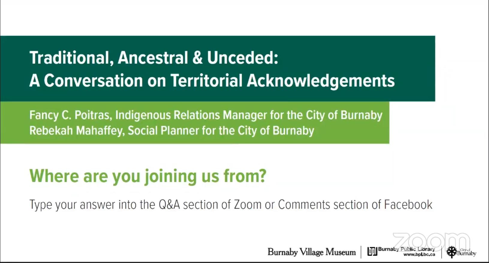
Traditional, Ancestral & Unceded: A Conversation on Territorial Acknowledgements
https://search.heritageburnaby.ca/link/museumdescription15664
- Repository
- Burnaby Village Museum
- Date
- 29 Apr. 2021
- Collection/Fonds
- Burnaby Village Museum fonds
- Description Level
- Item
- Physical Description
- 1 video recording (mp4) (87 min., 17 sec.) : digital, col., sd., stereo ; 29 fps
- Scope and Content
- Item consists of a video recording of a live Zoom webinar hosted by Burnaby Village Museum curator, Jane Lemke. The webinar is titled "Traditional, Ancestral & Unceded: A Conversation on Territorial Acknowledgements" and is presented by Fancy Poitras, Indigenous Relations Manager for the City of Bu…
- Repository
- Burnaby Village Museum
- Collection/Fonds
- Burnaby Village Museum fonds
- Description Level
- Item
- Physical Description
- 1 video recording (mp4) (87 min., 17 sec.) : digital, col., sd., stereo ; 29 fps
- Material Details
- Presenters: Fancy Poitras and Rebekah Mahaffey
- Host: Jane Lemke
- Date of Presentation: Thursday, April 29, 7:00 pm - 8:30 pm
- Total Number of tracks: 1
- Total Length of all tracks: 87 min., 17 sec.
- Recording Device: Zoom video communication platform
- Recording Note: Film was edited from it's original recorded version (95 min., 34 sec.) to edited version (87 min., 17 sec.) for public viewing on Heritage Burnaby. This live recording experienced technical difficulties with the viewer window during the first few minutes of the presentation. This is resolved at 15:36.
- Scope and Content
- Item consists of a video recording of a live Zoom webinar hosted by Burnaby Village Museum curator, Jane Lemke. The webinar is titled "Traditional, Ancestral & Unceded: A Conversation on Territorial Acknowledgements" and is presented by Fancy Poitras, Indigenous Relations Manager for the City of Burnaby and Rebekah Mahaffey, Social Planner for the City of Burnaby. The Zoom webinar is the second in a series of six "Neighbourhood Speaker series" webinars exploring a range of topics shared by Indigenous speakers and knowledge keepers that were presented and made available to the public between April 27 and May 12, 2021. The live webinar was also made available on the Burnaby Village Museum's facebook page. Community members were invited to participate by bringing questions during the interactive online sessions. The webinar opens with host, Jane Lemke providing a Land Acknowlegement "The land on which Burnaby now sits is the ancestral and unceded homelands of the hən̓q̓əmin̓əm and Sḵwx̱wú7mesh speaking peoples". Jane explains that providing a land acknowledgement is part of the City of Burnaby's official policy and that the land is on the shared territory of many Nations including the sq̓əc̓iy̓aɁɬ təməxʷ (Katzie), Kway-quit-lum, Kwantlen, ʷməθkʷəy̓əm (Musqueam), Sḵwx̱wú7mesh, and Tsleil-Waututh Nations. Understanding the definitions of language groups, Nations, shared territory and many of the importance words form a basis of the subject matter for this webinar. Fancy Poitras and Rebekah Mahaffey enter a discussion exploring this topic while posing thought provoking questions to each other. As Burnaby's Indigenous Relations Manager, Fancy Poitras conveys her own experiences and knowledge while providing historical references and recommendations for further educational resources around territorial land acknowledgment. Following their discussion, Fancy and Rebekah take questions from the audience that are moderated by the host, Jane Lemke.
- History
- Fancy Poitras was hired as the City of Burnaby's first Indigenous Relations Manager in 2021. Prior to her role, she worked for the First Nations Health Authority for more than five years, first as a Senior Policy Analyst, then as the Manager and Acting Director of Strategic Policy; throughout her time with FNHA, she worked on an extensive portfolio of health and wellness, and service design and delivery issues, including primary care, cancer, seniors and elders. Fancy has a Master’s degree in Public Policy and a Post-Baccalaureate Diploma in Social Policy Issues from Simon Fraser University, and a Bachelor of Arts in Political Science from University of Alberta. Fancy is a member of Mikisew Cree First Nation, Treaty 8 territory, and she grew up primarily in the Northwest Territories. Rebekah Mahaffey (she, her, hers) is a Social Policy Planner at the City of Burnaby. She is a settler on these lands, and is of mixed French-Scottish-Irish ancestry. She grew up in Indonesia, Libya and England and has called the west coast home for almost 15 years. Rebekah has degrees in International Development, Art History and Urban Planning. In her work she focuses on inter-culturalism, access and inclusion, anti-racism, and working with Burnaby’s 2SLGBTQQIA community. When not at work, she enjoys hiking, reading, and listening to podcasts. She lives in Vancouver with her young child.
- Creator
- Burnaby Village Museum
- Subjects
- Indigenous peoples - British Columbia
- Indigenous peoples - Canada - Government relations
- Indigenous peoples - British Columbia - Languages
- Indigenous peoples - Canada - , Treatment of
- Responsibility
- Lemke, Jane
- Accession Code
- BV021.17.2
- Access Restriction
- No restrictions
- Reproduction Restriction
- No known restrictions
- Date
- 29 Apr. 2021
- Media Type
- Moving Images
- Notes
- Title based on contents of video recording The following links wereshared at the end of the presentation:
- My Conversations with Canadians by Lee Maracle: https://bookhugpress.ca/shop/ebooks/essays-ebooks/conversations-with-canadians-by-lee-maracle/
- 21 Things You May Not Know About the Indian Act by Bob Joseph: https://www.ictinc.ca/books/21-things-you-may-not-know-about-the-indian-act
- CBC documentary series 8th Fire: https://www.cbc.ca/firsthand/blog/8th-fire-wabs-walk-through-history ‘Whose Land’ App: https://apps.apple.com/ca/app/whose-land/id1350310353
- “Unreserved” Podcast, Episode: January 20, 2019, ‘Hayden King’: https://www.cbc.ca/radio/unreserved/redrawing-the-lines-1.4973363/i-regret-it-hayden-king-on-writing-ryerson-university-s-territorial-acknowledgement-1.4973371
- Guidelines for Indigenous Territory Acknowledgement http://www.burnaby.ca/Assets/Burnaby+Interagency/Guidelines+for+Indigenous+Territory+Acknowledgement.pdf
- United Nations Declaration on the Rights of Indigenous Peoples: https://www.un.org/development/desa/indigenouspeoples/declaration-on-the-rights-of-indigenous-peoples.html
- Truth and Reconciliation Commission Calls to Action: http://trc.ca/assets/pdf/Calls_to_Action_English2.pdf
- Missing and Murdered Indigenous Women and Girls Calls for Justice: https://www.mmiwg-ffada.ca/wp-content/uploads/2019/06/Calls_for_Justice.pdf
Images
Video
Traditional, Ancestral & Unceded: A Conversation on Territorial Acknowledgements, 29 Apr. 2021
Traditional, Ancestral & Unceded: A Conversation on Territorial Acknowledgements, 29 Apr. 2021
https://search.heritageburnaby.ca/media/hpo/_Data/_BVM_Moving_Images/2021_0017_0002_002.mp4
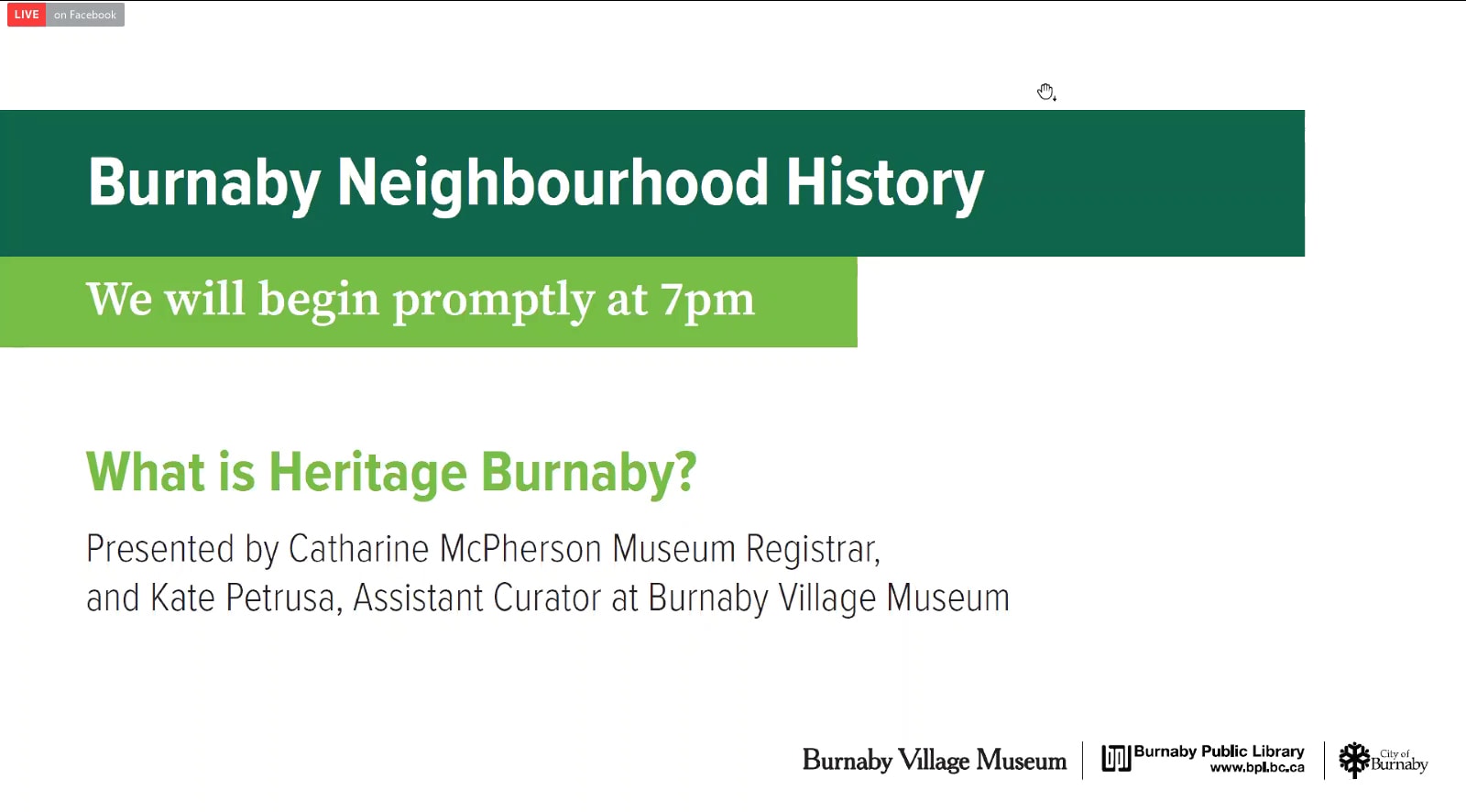
What is heritage burnaby.ca?
https://search.heritageburnaby.ca/link/museumdescription14756
- Repository
- Burnaby Village Museum
- Date
- 29 Sep. 2020
- Collection/Fonds
- Burnaby Village Museum fonds
- Description Level
- Item
- Physical Description
- 1 video recording (mp4) (58 min., 18 sec.) : digital, col., sd., stereo ; 29 fps
- Scope and Content
- Item consists of a video recording of a live Zoom webinar titled "What is heritage burnaby.ca?" presented by Burnaby Village Museum curator, Kate Pertrusa and Burnaby Village Museum registrar, Catharine McPherson. The zoom webinar is the first in a collection of seven "Neighbourhood Speaker series"…
- Repository
- Burnaby Village Museum
- Collection/Fonds
- Burnaby Village Museum fonds
- Description Level
- Item
- Physical Description
- 1 video recording (mp4) (58 min., 18 sec.) : digital, col., sd., stereo ; 29 fps
- Material Details
- Presenters: Kate Petrusa; Catharine McPherson Date of Presentation: Total Number of tracks: 1 Total Length of all tracks: 58 min., 18 sec. Recording Device: Zoom video communication platform
- Scope and Content
- Item consists of a video recording of a live Zoom webinar titled "What is heritage burnaby.ca?" presented by Burnaby Village Museum curator, Kate Pertrusa and Burnaby Village Museum registrar, Catharine McPherson. The zoom webinar is the first in a collection of seven "Neighbourhood Speaker series" webinars that were presented and available to the public between September 29 and October 27, 2020. The live webinar and recording was also made available on the Burnaby Village Museum's facebook page. In this webinar, Kate and Catharine provide an introduction and interactive session of the City of Burnaby's online resource "Heritage Burnaby". Catharine and Kate deliver a tutorial in how to utilize the website’s one search functionality in order to access the over 100,000 heritage resources that are held by the City of Burnaby Archives, the Burnaby Village Museum, Burnaby Heritage Planning and the Office of the City Clerk. Sample searches include how to access photographs, film content, digital content and various collections and how to save and create a list or hyperlink. Kate and Catharine take questions from webinar participants including; how to create a citation?; access and reproduction restrictions; are there any records in other languages?; how to search for Burnaby school records?; how to search for materials from Burnaby Village Museum recent exhibitions and/or furnishings in exhibits?; how to search for heritage buildings and what terms to use?; how to use the atlas page?; are the photographs printable or high resolution? and do you have a system in place to help community groups to create or process files and photographs?.
- Creator
- Burnaby Village Museum
- Accession Code
- BV020.29.1
- Access Restriction
- No restrictions
- Reproduction Restriction
- No known restrictions
- Date
- 29 Sep. 2020
- Media Type
- Moving Images
- Notes
- Title based on contents of video recording
- Video recording was edited for publication on Heritage Burnaby. Original mp4 video recording (BV020.29.1.1) is 71 min., 6 sec.
Images
Video
What is heritage burnaby.ca?, 29 Sep. 2020
What is heritage burnaby.ca?, 29 Sep. 2020
https://search.heritageburnaby.ca/media/hpo/_Data/_BVM_Moving_Images/2020_0029_0001_002.mp4Fire insurance plans - Greater Vancouver - Volume XV - Municipality of Burnaby
https://search.heritageburnaby.ca/link/museumdescription17795
- Repository
- Burnaby Village Museum
- Date
- 1927-1940
- Collection/Fonds
- Burnaby Village Museum Map collection
- Description Level
- Item
- Physical Description
- 11 plans on 8 sheets : col. lithographic print ; 64 x 54 cm
- Scope and Content
- Item consists of fire insurance plans titled "Greater Vancouver / Volume XV / Municipality / of Burnaby" surveyed May 1927 and revised October 1940. Volume XV includes a two page Key Plan (A and B) identifying associated plan numbers and district lots and nine numbered fire insurance plans identifi…
- Repository
- Burnaby Village Museum
- Collection/Fonds
- Burnaby Village Museum Map collection
- Description Level
- Item
- Physical Description
- 11 plans on 8 sheets : col. lithographic print ; 64 x 54 cm
- Material Details
- Scales between [1:600] and [1:6000]
- Scope and Content
- Item consists of fire insurance plans titled "Greater Vancouver / Volume XV / Municipality / of Burnaby" surveyed May 1927 and revised October 1940. Volume XV includes a two page Key Plan (A and B) identifying associated plan numbers and district lots and nine numbered fire insurance plans identified as; 1507; 1508 ; 1517; 1518; 1519; 1520;1521; 1531and 1532.
- Publisher
- Plan Department of Fire Branch of British Columbia Underwriters' Association
- Accession Code
- BV987.1.70
- Access Restriction
- No restrictions
- Reproduction Restriction
- May be restricted by third party rights
- Date
- 1927-1940
- Media Type
- Cartographic Material
- Historic Neighbourhood
- Vancouver Heights (Historic Neighbourhood)
- Planning Study Area
- Burnaby Heights Area
- Willingdon Heights Area
- Scan Resolution
- 400
- Notes
- Title based on contents of item
- These plans are contained within a bound book with labels on cover page reading: "Plan No. 90 / THIS INSURANCE PLAN / of / Vancouver VOLUME "8" / IN THE PROPERTY OF THE / British Columbia Insurance Underwriter's Association / Vancouver B.C. / AND IS LOANED / MELVILLE F. THOMSON CO. .../ Date May 26th, 1934"; / "Plan No. 74 / THIS INSURANCE PLAN / OF / VANCOUVER VOLUME "9"" / Plan No. 11 / THIS INSURANCE PLAN / OF / BURNABY VOLUMES 15-19" / "THIS PLAN IS THE PROPERTY OF / THE / BRITISH LAW INSURANCE COMPANY / LIMITED"
- Fire insurance plans cover various district lots in Burnaby including: District Lot 116,121, 186 and 187.
- Sticker adhered to Key Plan B reads: "
- Contact Burnaby Village Museum to view fire insurance plans that are part of Volume XV
Fire insurance plans - Greater Vancouver - Volume XVIII - Municipality of Burnaby
https://search.heritageburnaby.ca/link/museumdescription17798
- Repository
- Burnaby Village Museum
- Date
- 1927-1950
- Collection/Fonds
- Burnaby Village Museum Map collection
- Description Level
- Item
- Physical Description
- 22 plans on 12 sheets : col. lithographic print ; 64 x 54 cm
- Scope and Content
- Item consists of fire insurance plans titled "Greater Vancouver / Volume XVIII / Municipality / of Burnaby" surveyed May 1927, revised in October 1940 and September 1950. Includes a two page key plan (G and H) and twenty associated plans numbered; 1801; 1802; 1803; 1804; 1805; 1806; 1807; 1808; 18…
- Repository
- Burnaby Village Museum
- Collection/Fonds
- Burnaby Village Museum Map collection
- Description Level
- Item
- Physical Description
- 22 plans on 12 sheets : col. lithographic print ; 64 x 54 cm
- Material Details
- Scales between [1:600] and [1:6000]
- Scope and Content
- Item consists of fire insurance plans titled "Greater Vancouver / Volume XVIII / Municipality / of Burnaby" surveyed May 1927, revised in October 1940 and September 1950. Includes a two page key plan (G and H) and twenty associated plans numbered; 1801; 1802; 1803; 1804; 1805; 1806; 1807; 1808; 1809; 1810; 1811; 1812; 1813; 1814; 1815; 1819; 1820; 1821; 1822 and 1832.
- Publisher
- Plan Department of Fire Branch of British Columbia Underwriters' Association
- Accession Code
- BV987.1.70
- Access Restriction
- No restrictions
- Reproduction Restriction
- May be restricted by third party rights
- Date
- 1927-1950
- Media Type
- Cartographic Material
- Scan Resolution
- 400
- Scan Date
- 11/17/2021
- Notes
- Title based on contents of item
- Scale 1 inch = 50 feet
- These plans were removed from a bound book with labels on cover page reading: "Plan No. 90 / THIS INSURANCE PLAN / of / Vancouver VOLUME "8" / IN THE PROPERTY OF THE / British Columbia Insurance Underwriter's Association / Vancouver B.C. / AND IS LOANED / MELVILLE F. THOMSON CO. .../ Date May 26th, 1934"; / "Plan No. 74 / THIS INSURANCE PLAN / OF / VANCOUVER VOLUME "9"" / Plan No. 11 / THIS INSURANCE PLAN / OF / BURNABY VOLUMES 15-19" / "THIS PLAN IS THE PROPERTY OF / THE / BRITISH LAW INSURANCE COMPANY / LIMITED"
- Contact Burnaby Village Museum to view associated fire insurance plans
Fire insurance plans - Greater Vancouver - Volume XVII - Municipality of Burnaby
https://search.heritageburnaby.ca/link/museumdescription17797
- Repository
- Burnaby Village Museum
- Date
- 1927-1950
- Collection/Fonds
- Burnaby Village Museum Map collection
- Description Level
- Item
- Physical Description
- 4 plans on 4 sheets : col. lithographic prints
- Scope and Content
- Item consists of fire insurance plans titled "Greater Vancouver / Volume XVII / Municipality / of Burnaby" surveyed May 1927, revised in October 1940 and September 1950. Includes a two page key plan (E and F) and two associated plans numbered 1729 and 1738 (located within District Lot 35).
- Repository
- Burnaby Village Museum
- Collection/Fonds
- Burnaby Village Museum Map collection
- Description Level
- Item
- Physical Description
- 4 plans on 4 sheets : col. lithographic prints
- Scope and Content
- Item consists of fire insurance plans titled "Greater Vancouver / Volume XVII / Municipality / of Burnaby" surveyed May 1927, revised in October 1940 and September 1950. Includes a two page key plan (E and F) and two associated plans numbered 1729 and 1738 (located within District Lot 35).
- Publisher
- Plan Department of Fire Branch of British Columbia Underwriters' Association
- Accession Code
- BV987.1.70
- Access Restriction
- No restrictions
- Reproduction Restriction
- May be restricted by third party rights
- Date
- 1927-1950
- Media Type
- Cartographic Material
- Historic Neighbourhood
- Central Park (Historic Neighbourhood)
- Planning Study Area
- Garden Village Area
- Scan Resolution
- 400
- Scan Date
- 2021-11-17
- Notes
- Title based on contents of item
- These plans were removed from a bound book with labels on cover page reading: "Plan No. 90 / THIS INSURANCE PLAN / of / Vancouver VOLUME "8" / IN THE PROPERTY OF THE / British Columbia Insurance Underwriter's Association / Vancouver B.C. / AND IS LOANED / MELVILLE F. THOMSON CO. .../ Date May 26th, 1934"; / "Plan No. 74 / THIS INSURANCE PLAN / OF / VANCOUVER VOLUME "9"" / Plan No. 11 / THIS INSURANCE PLAN / OF / BURNABY VOLUMES 15-19" / "THIS PLAN IS THE PROPERTY OF / THE / BRITISH LAW INSURANCE COMPANY / LIMITED"
- Contact Burnaby Village Museum to view associated fire insurance plans XVIII
![Municipality of Burnaby - Volume XV and Volume XVIII, 1927-[1940] thumbnail](/media/hpo/_Data/_BVM_Artifacts/1972/1972_0111_0004_003.jpg?width=280)
Municipality of Burnaby - Volume XV and Volume XVIII
https://search.heritageburnaby.ca/link/museumdescription8682
- Repository
- Burnaby Village Museum
- Date
- 1927-[1940]
- Collection/Fonds
- Burnaby Village Museum Map collection
- Description Level
- File
- Physical Description
- 4 plans on 4 sheets: col. lithographic prints ; 63.5 x 53.5 cm folded to 53 x 31.5 cm
- Scope and Content
- File consists of four pages of plans removed from a bound book containing a series of fire insurance plans of the Municipality of Burnaby. Plan "1518" and "1519" are from "GREATER VANCOUVER B.C. / VOLUME XV / Municipality of Burnaby / May, 1927". Plan "1518" covers District Lot 116 and Plan "1519"…
- Repository
- Burnaby Village Museum
- Collection/Fonds
- Burnaby Village Museum Map collection
- Description Level
- File
- Physical Description
- 4 plans on 4 sheets: col. lithographic prints ; 63.5 x 53.5 cm folded to 53 x 31.5 cm
- Material Details
- Scale [1:600]
- Scope and Content
- File consists of four pages of plans removed from a bound book containing a series of fire insurance plans of the Municipality of Burnaby. Plan "1518" and "1519" are from "GREATER VANCOUVER B.C. / VOLUME XV / Municipality of Burnaby / May, 1927". Plan "1518" covers District Lot 116 and Plan "1519" covers District Lot 121. Plan "1802" and plan "1803" are from "GREATER VANCOUVER B.C. / VOLUME XVIII / Municipality of Burnaby / May, 1927". Both plans "1802" and "1803" cover District Lot 153.
- Responsibility
- British Columbia Underwriters' Association
- Accession Code
- HV972.111.4
- Access Restriction
- No restrictions
- Reproduction Restriction
- May be restricted by third party rights
- Date
- 1927-[1940]
- Media Type
- Cartographic Material
- Historic Neighbourhood
- Vancouver Heights (Historic Neighbourhood)
- Central Park (Historic Neighbourhood)
- Planning Study Area
- Willingdon Heights Area
- Marlborough Area
- Scan Resolution
- 400
- Scan Date
- 2021-11-18
- Notes
- Title based on content of plans
- See also BV987.1.70d for revised versions of plans
- Scale is measured 1 inch = 50 feet
- Contact Burnaby Village Museum to access plans 1518 and 1519 (these plans have revisions on top - date of revisions is uncertain)
Images
![Municipality of Burnaby - Volume XV and Volume XVIII, 1927-[1940] thumbnail](/media/hpo/_Data/_BVM_Artifacts/1972/1972_0111_0004_003.jpg)

Crossings - Great Northern Railway
https://search.heritageburnaby.ca/link/archivedescription807
- Repository
- City of Burnaby Archives
- Date
- 1913-1951
- Collection/Fonds
- City Council and Office of the City Clerk fonds
- Description Level
- File
- Physical Description
- Textual record and cartographic material
- Scope and Content
- File contains agreement for the construction of a sidewalk by the Railway Company, and correspondence related to these transactions. File also includes blueprint plan of sidewalk over [GNR] tracks and right of way for the Corporation of the District of Burnaby, 1931; blueprint "Sketch Showing Sigh…
- Repository
- City of Burnaby Archives
- Date
- 1913-1951
- Collection/Fonds
- City Council and Office of the City Clerk fonds
- Physical Description
- Textual record and cartographic material
- Description Level
- File
- Record No.
- 2558
- Accession Number
- 2001-02
- Scope and Content
- File contains agreement for the construction of a sidewalk by the Railway Company, and correspondence related to these transactions. File also includes blueprint plan of sidewalk over [GNR] tracks and right of way for the Corporation of the District of Burnaby, 1931; blueprint "Sketch Showing Sight Clearance and Distances and Sperling Avenue Grade Crossing" [c1945]; and blueprint "Plan of Proposed Road Crossing of Phillips Avenue."
- Media Type
- Textual Record
- Cartographic Material
- Notes
- Plans/maps are located in file and have not been moved to map case.
Fire insurance Plans of Greater Vancouver and Burnaby series
https://search.heritageburnaby.ca/link/museumdescription17803
- Repository
- Burnaby Village Museum
- Date
- 1925-1957
- Collection/Fonds
- Burnaby Village Museum Map collection
- Description Level
- Series
- Physical Description
- over 100 plans on multiple sheets : col. lithographic prints
- Scope and Content
- Series consists of fire insurance plans of Greater Vancouver and Burnaby created by the British Columbia Insurance Underwriters Association and a fire insurance plan of the Dominion Bridge Company, Burnaby Plant created by Associated Factory Mutual Fire Insurance Co.
- Repository
- Burnaby Village Museum
- Collection/Fonds
- Burnaby Village Museum Map collection
- Description Level
- Series
- Physical Description
- over 100 plans on multiple sheets : col. lithographic prints
- Scope and Content
- Series consists of fire insurance plans of Greater Vancouver and Burnaby created by the British Columbia Insurance Underwriters Association and a fire insurance plan of the Dominion Bridge Company, Burnaby Plant created by Associated Factory Mutual Fire Insurance Co.
- History
- The British Columbia Underwriters' Association was founded in Victoria in 1880, most likely under the name British Columbia Fire Underwriters Association. In 1928 the organisation changed its name to the British Columbia Insurance Underwriters Association, and again in 1940 to the British Columbia Underwriters Association.
- Accession Code
- HV972.111
- BV987.1.70
- BV015.10.1
- Date
- 1925-1957
- Media Type
- Cartographic Material
- Notes
- Title based on contents of series
Orders of Board of Railway Commission - Gilmore Avenue crossing
https://search.heritageburnaby.ca/link/archivedescription1485
- Repository
- City of Burnaby Archives
- Date
- 1928-1958
- Collection/Fonds
- City Council and Office of the City Clerk fonds
- Description Level
- File
- Physical Description
- 2 folders textual records and cartographic material
- Scope and Content
- Files contains white linen plan that accompanies railway application for highway crossing at Gilmore Avenue (1929) and 2 blueprint plans - one of the railway highway crossing protection at Bell and Sperling Avenue (1952) and the other at Bell and Douglas Avenue (1947).
- Repository
- City of Burnaby Archives
- Date
- 1928-1958
- Collection/Fonds
- City Council and Office of the City Clerk fonds
- Physical Description
- 2 folders textual records and cartographic material
- Description Level
- File
- Record No.
- 3296
- Accession Number
- 2001-02
- Scope and Content
- Files contains white linen plan that accompanies railway application for highway crossing at Gilmore Avenue (1929) and 2 blueprint plans - one of the railway highway crossing protection at Bell and Sperling Avenue (1952) and the other at Bell and Douglas Avenue (1947).
- Media Type
- Textual Record
- Cartographic Material
- Notes
- Plans/maps are located in file and have not been moved to map case.
B.C. Electric Railway cutoff - Highland Park
https://search.heritageburnaby.ca/link/archivedescription751
- Repository
- City of Burnaby Archives
- Date
- 1912-1951
- Collection/Fonds
- City Council and Office of the City Clerk fonds
- Description Level
- File
- Physical Description
- 3 folders textual records and cartographic material
- Scope and Content
- File contains correspondence, reports, Council minutes, and agreements between the Corporation of the District of Burnaby and the B.C. Electric Co. regarding the construction of the Highland Park Cut-off. File also includes 1912 blueprint "Plan of Portion of 20th Street in DL171 and 53, Gp. 1, NWD…
- Repository
- City of Burnaby Archives
- Date
- 1912-1951
- Collection/Fonds
- City Council and Office of the City Clerk fonds
- Physical Description
- 3 folders textual records and cartographic material
- Description Level
- File
- Record No.
- 2489
- Accession Number
- 2001-02
- Scope and Content
- File contains correspondence, reports, Council minutes, and agreements between the Corporation of the District of Burnaby and the B.C. Electric Co. regarding the construction of the Highland Park Cut-off. File also includes 1912 blueprint "Plan of Portion of 20th Street in DL171 and 53, Gp. 1, NWD, Bby."
- Media Type
- Textual Record
- Cartographic Material
- Notes
- Plans/maps are located in file and have not been moved to map case.
North Fraser Harbour Board - Financial statements, reports, bylaws
https://search.heritageburnaby.ca/link/archivedescription1390
- Repository
- City of Burnaby Archives
- Date
- 1926-1958
- Collection/Fonds
- City Council and Office of the City Clerk fonds
- Description Level
- File
- Physical Description
- 2 folders textual records and cartographic material
- Scope and Content
- File includes blueprint plan regarding foreshore application fronting.
- Repository
- City of Burnaby Archives
- Date
- 1926-1958
- Collection/Fonds
- City Council and Office of the City Clerk fonds
- Physical Description
- 2 folders textual records and cartographic material
- Description Level
- File
- Record No.
- 3198
- Accession Number
- 2001-02
- Scope and Content
- File includes blueprint plan regarding foreshore application fronting.
- Media Type
- Textual Record
- Cartographic Material
- Notes
- Plans/maps are located in file and have not been moved to map case.