Narrow Results By
Subject
- Academic Disciplines 1
- Animals - Dogs 1
- Buildings - Civic - City Halls 1
- Buildings - Commercial - Hotels and Motels 1
- Buildings - Commercial - Stores 1
- Buildings - Industrial - Factories 3
- Buildings - Religious - Churches 1
- Buildings - Residential - Apartments 1
- Buildings - Residential - Houses 1
- Buildings - Schools 1
- Construction 3
- Construction Tools and Equipment 2
Person / Organization
- Anderson, Cliff 2
- Baker, Ronald J. "Ron" 3
- Bossort, Kathy 3
- British Columbia Government Employees' Union 2
- British Columbia Institute of Technology 3
- Caldwell, Jim 1
- Canadian National Railway 1
- Continental Can Co. 2
- Damer, Eric 1
- Dominion Bridge Company 1
- Fane, Graham 3
- First United Spiritualist Church 1
Discussion of Air-Supported Structures within the Context of the Northeast Burnaby Library/Recreation Site - Lougheed Town Centre Community Plan Area "G"
https://search.heritageburnaby.ca/link/councilreport23203
- Repository
- City of Burnaby Archives
- Report ID
- 15956
- Meeting Date
- 25-Apr-1977
- Format
- Council - Manager's Report
- Manager's Report No.
- 31
- Item No.
- 13
- Collection/Fonds
- City Council and Office of the City Clerk fonds
- Repository
- City of Burnaby Archives
- Report ID
- 15956
- Meeting Date
- 25-Apr-1977
- Format
- Council - Manager's Report
- Manager's Report No.
- 31
- Item No.
- 13
- Collection/Fonds
- City Council and Office of the City Clerk fonds
Documents
Tenders - 19 Roll Over Protective Structures (ROPS)
https://search.heritageburnaby.ca/link/councilreport25726
- Repository
- City of Burnaby Archives
- Report ID
- 18160
- Meeting Date
- 24-Mar-1975
- Format
- Council - Manager's Report
- Manager's Report No.
- 21
- Item No.
- 15
- Collection/Fonds
- City Council and Office of the City Clerk fonds
- Repository
- City of Burnaby Archives
- Report ID
- 18160
- Meeting Date
- 24-Mar-1975
- Format
- Council - Manager's Report
- Manager's Report No.
- 21
- Item No.
- 15
- Collection/Fonds
- City Council and Office of the City Clerk fonds
Documents
New Brunette River dam construction
https://search.heritageburnaby.ca/link/archivedescription35465
- Repository
- City of Burnaby Archives
- Date
- 1931 (date of original), copied 1986
- Collection/Fonds
- Burnaby Historical Society fonds
- Description Level
- Item
- Physical Description
- 1 photograph : b&w ; 12.7 x 17.8 cm print
- Scope and Content
- Photograph of the construction of new Brunette River dam and Cariboo Road bridge.
- Repository
- City of Burnaby Archives
- Date
- 1931 (date of original), copied 1986
- Collection/Fonds
- Burnaby Historical Society fonds
- Subseries
- Pioneer Tales subseries
- Physical Description
- 1 photograph : b&w ; 12.7 x 17.8 cm print
- Description Level
- Item
- Record No.
- 204-323
- Access Restriction
- No restrictions
- Reproduction Restriction
- No known restrictions
- Accession Number
- BHS1988-03
- Scope and Content
- Photograph of the construction of new Brunette River dam and Cariboo Road bridge.
- Media Type
- Photograph
- Notes
- Title based on contents of photograph
- Historic Neighbourhood
- Burquitlam (Historic Neighbourhood)
- Planning Study Area
- Burnaby Lake Area
Images
Alexandra Bridge in British Columbia
https://search.heritageburnaby.ca/link/archivedescription65748
- Repository
- City of Burnaby Archives
- Date
- 1936
- Collection/Fonds
- Burnaby Historical Society fonds
- Description Level
- Item
- Physical Description
- 1 photograph : b&w hand-tinted into col. ; 17.5 x 24.5 cm [sight] matted in frame 24.5 x 32 cm
- Scope and Content
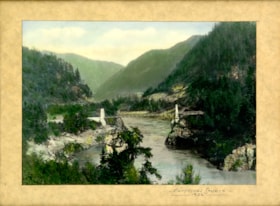
- Photograph of the Alexandra Bridge in British Columbia. The Alexander Bridge crosses the Fraser Canyon, along the Cariboo Highway, two kilometres north of Spuzzum.
- Repository
- City of Burnaby Archives
- Date
- 1936
- Collection/Fonds
- Burnaby Historical Society fonds
- Subseries
- Ettinger family subseries
- Physical Description
- 1 photograph : b&w hand-tinted into col. ; 17.5 x 24.5 cm [sight] matted in frame 24.5 x 32 cm
- Description Level
- Item
- Record No.
- 428-007
- Access Restriction
- No restrictions
- Reproduction Restriction
- No known restrictions
- Accession Number
- BHS2002-03
- Scope and Content
- Photograph of the Alexandra Bridge in British Columbia. The Alexander Bridge crosses the Fraser Canyon, along the Cariboo Highway, two kilometres north of Spuzzum.
- Media Type
- Photograph
- Photographer
- Edmonds Studio
- Notes
- Title based on contents of photograph
- Note on verso of frame reads: "Spuzzum Bridge / Fraser Canyon"
- Note on recto of matte reads: "Edmonds Studio 1936"
Images
Alexandra Bridge in British Columbia
https://search.heritageburnaby.ca/link/archivedescription85920
- Repository
- City of Burnaby Archives
- Date
- 1933
- Collection/Fonds
- Burnaby Historical Society fonds
- Description Level
- Item
- Physical Description
- 1 photograph : sepia ; 5.5 x 10 cm
- Scope and Content
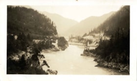
- Photograph of the Alexandra Bridge in British Columbia. The Alexander Bridge crosses the Fraser Canyon, along the Cariboo Highway, two kilometres north of Spuzzum.
- Repository
- City of Burnaby Archives
- Date
- 1933
- Collection/Fonds
- Burnaby Historical Society fonds
- Subseries
- Ettinger family subseries
- Physical Description
- 1 photograph : sepia ; 5.5 x 10 cm
- Description Level
- Item
- Record No.
- 428-008
- Access Restriction
- No restrictions
- Reproduction Restriction
- No known restrictions
- Accession Number
- BHS2002-03
- Scope and Content
- Photograph of the Alexandra Bridge in British Columbia. The Alexander Bridge crosses the Fraser Canyon, along the Cariboo Highway, two kilometres north of Spuzzum.
- Media Type
- Photograph
- Notes
- Title based on contents of photograph
- Note on verso of photograph reads: "Alexander [sic] Bridge / 1933"
Images
Barnet Beach
https://search.heritageburnaby.ca/link/archivedescription93650
- Repository
- City of Burnaby Archives
- Date
- November 20, 1977
- Collection/Fonds
- Burnaby Public Library Contemporary Visual Archive Project
- Description Level
- Item
- Physical Description
- 1 photograph : b&w ; 12.5 x 17.5 cm
- Scope and Content
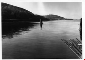
- Photograph of Burrard Inlet, taken facing west from Barnet Beach. Capitol Hill and the Second Narrows Bridge are visible in the distance.
- Repository
- City of Burnaby Archives
- Date
- November 20, 1977
- Collection/Fonds
- Burnaby Public Library Contemporary Visual Archive Project
- Physical Description
- 1 photograph : b&w ; 12.5 x 17.5 cm
- Description Level
- Item
- Record No.
- 556-607
- Access Restriction
- No restrictions
- Reproduction Restriction
- Reproduce for fair dealing purposes only
- Accession Number
- 2017-57
- Scope and Content
- Photograph of Burrard Inlet, taken facing west from Barnet Beach. Capitol Hill and the Second Narrows Bridge are visible in the distance.
- Media Type
- Photograph
- Photographer
- Chapman, Fred
- Notes
- Title taken from project information form
- Accompanied by a project information form and 1 photograph (b&w negative ; 9.5 x 12.5 cm)
- BPL no. 57
- Geographic Access
- Barnet Marine Park
- Historic Neighbourhood
- Barnet (Historic Neighbourhood)
- Planning Study Area
- Burnaby Mountain Area
Images
Bridge and trail in Robert Burnaby Park
https://search.heritageburnaby.ca/link/archivedescription88406
- Repository
- City of Burnaby Archives
- Date
- [between 1933 and 1947] (date of original), copied 2014
- Collection/Fonds
- James Massey family fonds
- Description Level
- Item
- Physical Description
- 1 photograph (tiff) : sepia ; 600 dpi
- Scope and Content
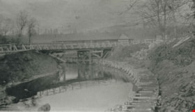
- Photograph of a trail in Robert Burnaby Park with a bridge in the middle ground and stairs leading to higher ground. The bridge and trail are surrounded by lush foliage and trees.
- Repository
- City of Burnaby Archives
- Date
- [between 1933 and 1947] (date of original), copied 2014
- Collection/Fonds
- James Massey family fonds
- Physical Description
- 1 photograph (tiff) : sepia ; 600 dpi
- Description Level
- Item
- Record No.
- 581-012
- Access Restriction
- No restrictions
- Reproduction Restriction
- No known restrictions
- Accession Number
- 2014-34
- Scope and Content
- Photograph of a trail in Robert Burnaby Park with a bridge in the middle ground and stairs leading to higher ground. The bridge and trail are surrounded by lush foliage and trees.
- Media Type
- Photograph
- Notes
- Title based on contents of photograph
- Historic Neighbourhood
- East Burnaby (Historic Neighbourhood)
- Planning Study Area
- Lakeview-Mayfield Area
Images
Bridge over the Cottonwood River
https://search.heritageburnaby.ca/link/archivedescription34356
- Repository
- City of Burnaby Archives
- Date
- [1935]
- Collection/Fonds
- Burnaby Historical Society fonds
- Description Level
- Item
- Physical Description
- 1 photograph : b&w ; 5.9 x 11.7 cm
- Scope and Content
- Photograph of the wooden bridge that spanned the Cottonwood River at Cottonwood Flats (between Quesnel and Barkerville). The bridge was built in the mid-thirties.
- Repository
- City of Burnaby Archives
- Date
- [1935]
- Collection/Fonds
- Burnaby Historical Society fonds
- Subseries
- Peers family subseries
- Physical Description
- 1 photograph : b&w ; 5.9 x 11.7 cm
- Description Level
- Item
- Record No.
- 020-063
- Access Restriction
- No restrictions
- Reproduction Restriction
- No known restrictions
- Accession Number
- BHS2007-04
- Scope and Content
- Photograph of the wooden bridge that spanned the Cottonwood River at Cottonwood Flats (between Quesnel and Barkerville). The bridge was built in the mid-thirties.
- Media Type
- Photograph
- Notes
- Title based on caption accompanying photograph
Images
Bridge over the Cottonwood River at Cottonwood Flats
https://search.heritageburnaby.ca/link/archivedescription34355
- Repository
- City of Burnaby Archives
- Date
- [1935]
- Collection/Fonds
- Burnaby Historical Society fonds
- Description Level
- Item
- Physical Description
- 1 photograph : b&w ; 5.9 x 9 cm
- Scope and Content
- Photograph of the wooden bridge that spanned the Cottonwood River at Cottonwood Flats (between Quesnel and Barkerville). The bridge was built in the mid-thirties.
- Repository
- City of Burnaby Archives
- Date
- [1935]
- Collection/Fonds
- Burnaby Historical Society fonds
- Subseries
- Peers family subseries
- Physical Description
- 1 photograph : b&w ; 5.9 x 9 cm
- Description Level
- Item
- Record No.
- 020-062
- Access Restriction
- No restrictions
- Reproduction Restriction
- No known restrictions
- Accession Number
- BHS2007-04
- Scope and Content
- Photograph of the wooden bridge that spanned the Cottonwood River at Cottonwood Flats (between Quesnel and Barkerville). The bridge was built in the mid-thirties.
- Subjects
- Structures - Bridges
- Media Type
- Photograph
- Notes
- Title based on caption accompanying photograph
Images
Bridges in Robert Burnaby Park
https://search.heritageburnaby.ca/link/archivedescription88407
- Repository
- City of Burnaby Archives
- Date
- [between 1933 and 1947] (date of original), copied 2014
- Collection/Fonds
- James Massey family fonds
- Description Level
- Item
- Physical Description
- 1 photograph (tiff) : sepia ; 600 dpi
- Scope and Content
- Photograph of bridges in Robert Burnaby Park. Photograph is taken from a bridge in the foreground looking onto lush foliage and trees with another bridge in the distance.
- Repository
- City of Burnaby Archives
- Date
- [between 1933 and 1947] (date of original), copied 2014
- Collection/Fonds
- James Massey family fonds
- Physical Description
- 1 photograph (tiff) : sepia ; 600 dpi
- Description Level
- Item
- Record No.
- 581-013
- Access Restriction
- No restrictions
- Reproduction Restriction
- No known restrictions
- Accession Number
- 2014-34
- Scope and Content
- Photograph of bridges in Robert Burnaby Park. Photograph is taken from a bridge in the foreground looking onto lush foliage and trees with another bridge in the distance.
- Subjects
- Structures - Bridges
- Media Type
- Photograph
- Notes
- Title based on contents of photograph
- Historic Neighbourhood
- East Burnaby (Historic Neighbourhood)
- Planning Study Area
- Lakeview-Mayfield Area
Images
Brunette River dam
https://search.heritageburnaby.ca/link/archivedescription35467
- Repository
- City of Burnaby Archives
- Date
- [1930] (date of original), copied 1986
- Collection/Fonds
- Burnaby Historical Society fonds
- Description Level
- Item
- Physical Description
- 1 photograph : b&w ; 12.7 x 17.8 cm print
- Scope and Content
- Photograph of the Brunette River dam. The Picken family home, "Aintree," is faintly visible in the background, with the mailing address of 2600 Cariboo Road, R.R. 2, New Westminster. The number was later changed to 6825 Cariboo Road, and the mail redirected through Burnaby. The Picken family cons…
- Repository
- City of Burnaby Archives
- Date
- [1930] (date of original), copied 1986
- Collection/Fonds
- Burnaby Historical Society fonds
- Subseries
- Pioneer Tales subseries
- Physical Description
- 1 photograph : b&w ; 12.7 x 17.8 cm print
- Description Level
- Item
- Record No.
- 204-325
- Access Restriction
- No restrictions
- Reproduction Restriction
- No known restrictions
- Accession Number
- BHS1988-03
- Scope and Content
- Photograph of the Brunette River dam. The Picken family home, "Aintree," is faintly visible in the background, with the mailing address of 2600 Cariboo Road, R.R. 2, New Westminster. The number was later changed to 6825 Cariboo Road, and the mail redirected through Burnaby. The Picken family consisted of Stanley B. Picken (dam keeper on the Brunette River), his wife Isabel Picken (nee Ponton) and their children.
- Media Type
- Photograph
- Notes
- Title based on contents of photograph
- Geographic Access
- Cariboo Road
- Street Address
- 6825 Cariboo Road
- Historic Neighbourhood
- Burquitlam (Historic Neighbourhood)
- Planning Study Area
- Burnaby Lake Area
Images
Burrard Inlet
https://search.heritageburnaby.ca/link/archivedescription38446
- Repository
- City of Burnaby Archives
- Date
- [1930]
- Collection/Fonds
- Burnaby Historical Society fonds
- Description Level
- Item
- Physical Description
- 1 photograph : b&w ; 6.4 x 9 cm
- Scope and Content
- Photograph looking west from 410 North Hythe Avenue towards Burrard Inlet. The Second Narrows Bridge can be seen faintly in the background.
- Repository
- City of Burnaby Archives
- Date
- [1930]
- Collection/Fonds
- Burnaby Historical Society fonds
- Subseries
- Photographs subseries
- Physical Description
- 1 photograph : b&w ; 6.4 x 9 cm
- Description Level
- Item
- Record No.
- 443-013
- Access Restriction
- No restrictions
- Reproduction Restriction
- No known restrictions
- Accession Number
- BHS2002-13
- Scope and Content
- Photograph looking west from 410 North Hythe Avenue towards Burrard Inlet. The Second Narrows Bridge can be seen faintly in the background.
- Media Type
- Photograph
- Notes
- Title based on contents of photograph
- Geographic Access
- Hythe Avenue North
- Street Address
- 410 Hythe Avenue North
- Historic Neighbourhood
- Capitol Hill (Historic Neighbourhood)
- Planning Study Area
- Capitol Hill Area
Images
Burrard Inlet
https://search.heritageburnaby.ca/link/archivedescription38447
- Repository
- City of Burnaby Archives
- Date
- [1930]
- Collection/Fonds
- Burnaby Historical Society fonds
- Description Level
- Item
- Physical Description
- 1 photograph : b&w ; 6.3 x 9 cm
- Scope and Content
- Photograph taken from 410 North Hythe Avenue looking towards the Burrard Inlet. The Second Narrows Bridge can be seen faintly in the background.
- Repository
- City of Burnaby Archives
- Date
- [1930]
- Collection/Fonds
- Burnaby Historical Society fonds
- Subseries
- Photographs subseries
- Physical Description
- 1 photograph : b&w ; 6.3 x 9 cm
- Description Level
- Item
- Record No.
- 443-014
- Access Restriction
- No restrictions
- Reproduction Restriction
- No known restrictions
- Accession Number
- BHS2002-13
- Scope and Content
- Photograph taken from 410 North Hythe Avenue looking towards the Burrard Inlet. The Second Narrows Bridge can be seen faintly in the background.
- Media Type
- Photograph
- Notes
- Title based on contents of photograph.
- Geographic Access
- Hythe Avenue North
- Street Address
- 410 Hythe Avenue North
- Historic Neighbourhood
- Capitol Hill (Historic Neighbourhood)
- Planning Study Area
- Capitol Hill Area
Images
Canadian National Railway Bridge
https://search.heritageburnaby.ca/link/archivedescription37471
- Repository
- City of Burnaby Archives
- Date
- [between 1930 and 1934] (date of original), copied 1991
- Collection/Fonds
- Burnaby Historical Society fonds
- Description Level
- Item
- Physical Description
- 1 photograph : b&w ; 2.7 x 4.1 cm print on contact sheet 20.2 x 25.3 cm
- Scope and Content
- Photograph of the Canadian National Railway (CNR) Bridge over the Fraser River open to allow ships through. No boats are visible.
- Repository
- City of Burnaby Archives
- Date
- [between 1930 and 1934] (date of original), copied 1991
- Collection/Fonds
- Burnaby Historical Society fonds
- Subseries
- Burnaby Image Bank subseries
- Physical Description
- 1 photograph : b&w ; 2.7 x 4.1 cm print on contact sheet 20.2 x 25.3 cm
- Description Level
- Item
- Record No.
- 370-059
- Access Restriction
- No restrictions
- Reproduction Restriction
- No known restrictions
- Accession Number
- BHS1999-03
- Scope and Content
- Photograph of the Canadian National Railway (CNR) Bridge over the Fraser River open to allow ships through. No boats are visible.
- Media Type
- Photograph
- Photographer
- Bellinger, Bernard
- Notes
- Title based on contents of photograph
- 1 b&w copy negative accompanying
- Historic Neighbourhood
- Fraser Arm (Historic Neighbourhood)
- Planning Study Area
- Big Bend Area
Images
Continental Can Company
https://search.heritageburnaby.ca/link/archivedescription93708
- Repository
- City of Burnaby Archives
- Date
- February 24, 1978
- Collection/Fonds
- Burnaby Public Library Contemporary Visual Archive Project
- Description Level
- Item
- Physical Description
- 1 photograph : b&w ; 12.5 x 17.5 cm
- Scope and Content
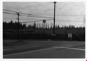
- Photograph of the exterior of Continental Can Company factory, located on Winston Street by Burnaby Lake. The photograph is taken from across Winston Street, facing south, and the railway tracks are visible in front of the manufacturing plant. The Continental Can water tower stands in the backgroun…
- Repository
- City of Burnaby Archives
- Date
- February 24, 1978
- Collection/Fonds
- Burnaby Public Library Contemporary Visual Archive Project
- Physical Description
- 1 photograph : b&w ; 12.5 x 17.5 cm
- Description Level
- Item
- Record No.
- 556-665
- Access Restriction
- No restrictions
- Reproduction Restriction
- Reproduce for fair dealing purposes only
- Accession Number
- 2017-57
- Scope and Content
- Photograph of the exterior of Continental Can Company factory, located on Winston Street by Burnaby Lake. The photograph is taken from across Winston Street, facing south, and the railway tracks are visible in front of the manufacturing plant. The Continental Can water tower stands in the background, and there are signs on the side of the road for a "spindle sale" and Braemar Gardens.
- Names
- Continental Can Co.
- Media Type
- Photograph
- Photographer
- Surridge, Jack
- Notes
- Title taken from project information form
- Accompanied by a project information form and 1 photograph (b&w negative ; 9.5 x 12.5 cm)
- BPL no. 113
- Geographic Access
- Winston Street
- Burnaby Lake
- Historic Neighbourhood
- Lozells (Historic Neighbourhood)
- Planning Study Area
- Government Road Area
Images
Deer Lake
https://search.heritageburnaby.ca/link/archivedescription34924
- Repository
- City of Burnaby Archives
- Date
- [1930] (date of original), copied 1986
- Collection/Fonds
- Burnaby Historical Society fonds
- Description Level
- Item
- Physical Description
- 1 photograph : b&w ; 17.7 x 12.6 cm print
- Scope and Content
- Photograph of swimmers at Deer Lake, some of whom are are standing on a wharf and some of whom are in the water.
- Repository
- City of Burnaby Archives
- Date
- [1930] (date of original), copied 1986
- Collection/Fonds
- Burnaby Historical Society fonds
- Subseries
- Bernard Bellinger subseries
- Physical Description
- 1 photograph : b&w ; 17.7 x 12.6 cm print
- Description Level
- Item
- Record No.
- 160-003
- Access Restriction
- No restrictions
- Reproduction Restriction
- No known restrictions
- Accession Number
- BHS1986-10
- Scope and Content
- Photograph of swimmers at Deer Lake, some of whom are are standing on a wharf and some of whom are in the water.
- Media Type
- Photograph
- Notes
- Title based on contents of photograph
- Geographic Access
- Deer Lake
- Deer Lake Avenue
- Historic Neighbourhood
- Burnaby Lake (Historic Neighbourhood)
- Planning Study Area
- Oakalla Area
Images
Forth Bridge
https://search.heritageburnaby.ca/link/archivedescription82572
- Repository
- City of Burnaby Archives
- Date
- [1900-1930]
- Collection/Fonds
- Hill family and Vidal family fonds
- Description Level
- Item
- Physical Description
- 1 photograph : col. postcard ; 9 x 14 cm
- Scope and Content
- Photographic postcard shows Forth Bridge in Scotland.
- Repository
- City of Burnaby Archives
- Date
- [1900-1930]
- Collection/Fonds
- Hill family and Vidal family fonds
- Physical Description
- 1 photograph : col. postcard ; 9 x 14 cm
- Description Level
- Item
- Record No.
- 550-143
- Access Restriction
- No restrictions
- Reproduction Restriction
- No known restrictions
- Accession Number
- 2013-03
- Scope and Content
- Photographic postcard shows Forth Bridge in Scotland.
- Subjects
- Structures - Bridges
- Media Type
- Photograph
- Notes
- Title based on contents of photograph
- Postcard verso reads: "The Forth Bridge from South Queens Ferry. One of the greatest engineering glories of the age; was constructed by Sir William Arrol. Is about 1 1/2 miles in length, and its highest point is 450 feet from base. It took seven years to build (1883-1890) and cost 3 1/2 million pounds. It is on the main railway route of the L and N E Railway / New Color-crayon / Process from original drawing by Andrew Allan"
Images
Harrison Hotel Club House
https://search.heritageburnaby.ca/link/archivedescription65749
- Repository
- City of Burnaby Archives
- Date
- [between 1935 and 1940]
- Collection/Fonds
- Burnaby Historical Society fonds
- Description Level
- Item
- Physical Description
- 1 photograph : b&w hand-tinted into col. ; 16.5 x 24 cm [sight] matted in frame 24.5 x 32 cm
- Scope and Content
- Photograph of the 'Harrison Hotel Club House' believed to be in the village of Harrison Hot Springs, British Columbia.
- Repository
- City of Burnaby Archives
- Date
- [between 1935 and 1940]
- Collection/Fonds
- Burnaby Historical Society fonds
- Subseries
- Ettinger family subseries
- Physical Description
- 1 photograph : b&w hand-tinted into col. ; 16.5 x 24 cm [sight] matted in frame 24.5 x 32 cm
- Description Level
- Item
- Record No.
- 428-009
- Access Restriction
- No restrictions
- Reproduction Restriction
- No known restrictions
- Accession Number
- BHS2002-03
- Scope and Content
- Photograph of the 'Harrison Hotel Club House' believed to be in the village of Harrison Hot Springs, British Columbia.
- Subjects
- Structures - Bridges
- Geographic Features - Rivers
- Buildings - Commercial - Hotels and Motels
- Media Type
- Photograph
- Notes
- Title taken from note on verso of frame
- Note on verso of frame reads: "Harrison Hotel / Club House"
- 1 reference photograph accompanying
- Note on verso of reference photograph reads: "Harrison / Club House / approx 1935-40"
- 'Edmonds Studios' as possible photographer
Images
Interview with Judy Hagen by Eric Damer November 7, 2012 - Track 6
https://search.heritageburnaby.ca/link/oralhistory337
- Repository
- City of Burnaby Archives
- Date Range
- 1944-2012
- Length
- 0:12:18
- Summary
- This portion of the recording pertains to Judith "Judy" (Robins) Hagen's memories of taking dance lessons and being in Girl Guides. She tells a story of seeing the Second Narrows Bridge collapse in 1958.
- Repository
- City of Burnaby Archives
- Summary
- This portion of the recording pertains to Judith "Judy" (Robins) Hagen's memories of taking dance lessons and being in Girl Guides. She tells a story of seeing the Second Narrows Bridge collapse in 1958.
- Date Range
- 1944-2012
- Photo Info
- Judith "Judy" Robins (later Hagen) posing in a dance costume, 1949. Item no. 549-036.
- Length
- 0:12:18
- Interviewer
- Damer, Eric
- Interview Date
- November 7, 2012
- Scope and Content
- Recording is an interview with Judith "Judy" (Robins) Hagen conducted by Burnaby Village Museum employee Eric Damer, November 7, 2012. Major theme discussed: the neighbourhood of Dover Street.
- Biographical Notes
- Judy Robins (later Hagen) was born in 1941 and grew up in South Burnaby. Her paternal grandfather, a master stone mason from Devon, moved to Vancouver in 1912 to find work before bringing over the rest of the family. He bought three lots in Burnaby and in 1918 moved his family to a small house on Dover Street (formerly Paul Street). Judy’s father, Jack, married, bought one of his father’s lots and built a new home for his family. Judy attended school and church nearby, took dance and piano lessons and participated actively in Girl Guides. After high school, she attended the University of British Columbia (UBC) and then Simon Fraser University (SFU), worked for a few years and then married in 1967 before moving to Courtaney, British Columbia.
- Total Tracks
- 7
- Total Length
- 1:09:51
- Interviewee Name
- Hagen, Judith "Judy" Robins
- Interview Location
- Nanaimo Museum on Vancouver Island
- Interviewer Bio
- Eric Damer is a lifelong British Columbian born in Victoria, raised in Kamloops, and currently residing in Burnaby. After studying philosophy at the University of Victoria, he became interested in the educational forces that had shaped his own life. He completed master’s and doctoral degrees in educational studies at the University of British Columbia with a particular interest in the history of adult and higher education in the province. In 2012, Eric worked for the City of Burnaby as a field researcher and writer, conducting interviews for the City Archives and Museum Oral History Program.
- Collection/Fonds
- Community Heritage Commission Special Projects fonds
- Transcript Available
- None
- Media Type
- Sound Recording
Images
Audio Tracks
Track six of recording of interview with Judy Hagen
Track six of recording of interview with Judy Hagen
https://search.heritageburnaby.ca/media/hpo/_Data/_Archives_Oral_Histories/_Unrestricted/MSS171-011/MSS171-011_Track_6.mp3Kitty and Robert playing croquet
https://search.heritageburnaby.ca/link/archivedescription39012
- Repository
- City of Burnaby Archives
- Date
- [1930]
- Collection/Fonds
- Peers Family and Hill Family fonds
- Description Level
- Item
- Physical Description
- 1 photograph : sepia ; 5.2 x 6.2 cm on page 13.5 x 18.5 cm (pasted in album)
- Scope and Content
- Photograph of Kitty Peers and her son Robert with croquet mallets. Robert is also holding a ball in his right hand. A tent can be seen in the background.
- Repository
- City of Burnaby Archives
- Date
- [1930]
- Collection/Fonds
- Peers Family and Hill Family fonds
- Physical Description
- 1 photograph : sepia ; 5.2 x 6.2 cm on page 13.5 x 18.5 cm (pasted in album)
- Description Level
- Item
- Record No.
- 477-331
- Access Restriction
- No restrictions
- Reproduction Restriction
- No known restrictions
- Accession Number
- 2007-12
- Scope and Content
- Photograph of Kitty Peers and her son Robert with croquet mallets. Robert is also holding a ball in his right hand. A tent can be seen in the background.
- Media Type
- Photograph
- Notes
- Title based on contents of photograph
![Bridge and trail in Robert Burnaby Park, [between 1933 and 1947] (date of original), copied 2014 thumbnail](/media/hpo/_Data/_Archives_Images/_Unrestricted/580/581-012.jpg?width=280)
![Bridge over the Cottonwood River, [1935] thumbnail](/media/hpo/_Data/_Archives_Images/_Unrestricted/001/020-063.jpg?width=280)
![Bridge over the Cottonwood River at Cottonwood Flats, [1935] thumbnail](/media/hpo/_Data/_Archives_Images/_Unrestricted/001/020-062.jpg?width=280)
![Bridges in Robert Burnaby Park, [between 1933 and 1947] (date of original), copied 2014 thumbnail](/media/hpo/_Data/_Archives_Images/_Unrestricted/580/581-013.jpg?width=280)
![Brunette River dam, [1930] (date of original), copied 1986 thumbnail](/media/hpo/_Data/_Archives_Images/_Unrestricted/204/204-325.jpg?width=280)
![Burrard Inlet, [1930] thumbnail](/media/hpo/_Data/_Archives_Images/_Unrestricted/371/443-013.jpg?width=280)
![Burrard Inlet, [1930] thumbnail](/media/hpo/_Data/_Archives_Images/_Unrestricted/371/443-014.jpg?width=280)
![Canadian National Railway Bridge, [between 1930 and 1934] (date of original), copied 1991 thumbnail](/media/hpo/_Data/_Archives_Images/_Unrestricted/370/370-059.jpg?width=280)
![Deer Lake, [1930] (date of original), copied 1986 thumbnail](/media/hpo/_Data/_Archives_Images/_Unrestricted/126/160-003.jpg?width=280)
![Forth Bridge, [1900-1930] thumbnail](/media/hpo/_Data/_Archives_Images/_Unrestricted/550/550-143.jpg?width=280)
![Harrison Hotel Club House, [between 1935 and 1940] thumbnail](/media/hpo/_Data/_Archives_Images/_Unrestricted/371/428-009.jpg?width=280)

![Kitty and Robert playing croquet, [1930] thumbnail](/media/hpo/_Data/_Archives_Images/_Unrestricted/477/477-331.jpg?width=280)