Narrow Results By
Creator
- Adams, Edith 1
- Bekins Moving and Storage Company Limited 1
- British Columbia Underwriters' Association 1
- Burnaby Village Museum 1
- Burnett & McGugan, Engineers and Surveyors 1
- Canada. Office of the Director of Civil Air Raid Precautions 1
- City Map and White Print Co. 1
- Coast Map and Blue Print Co. 1
- Digney, Andy 1
- Gordon & Belyea Limited 1
- Green, George, 1872-1955 1
- Green, Susan 1

Burnaby Park track
https://search.heritageburnaby.ca/link/museumdescription11918
- Repository
- Burnaby Village Museum
- Date
- June 30, 1932
- Collection/Fonds
- Ronald G. Scobbie collection
- Description Level
- Item
- Physical Description
- 1 survey plan : ink on waxed linen sheet ; 27 x 39 cm
- Scope and Content
- Item consists of a survey plan titled “Burnaby Park Track”.
- Repository
- Burnaby Village Museum
- Collection/Fonds
- Ronald G. Scobbie collection
- Description Level
- Item
- Physical Description
- 1 survey plan : ink on waxed linen sheet ; 27 x 39 cm
- Scope and Content
- Item consists of a survey plan titled “Burnaby Park Track”.
- Accession Code
- BV003.83.41
- Access Restriction
- No restrictions
- Reproduction Restriction
- No known restrictions
- Date
- June 30, 1932
- Media Type
- Cartographic Material
- Notes
- Transcribed title
- Note in pencil reads: ‘4222”
Images

![Copy of Official British Columbia Road Maps, [193-] thumbnail](/media/hpo/_Data/_BVM_Cartographic_Material/1972/1972_0179_0001_001.jpg?width=280)
Copy of Official British Columbia Road Maps
https://search.heritageburnaby.ca/link/museumdescription18945
- Repository
- Burnaby Village Museum
- Date
- [193-]
- Collection/Fonds
- Burnaby Village Museum Map collection
- Physical Description
- 1 map : lithographic print on sheet ; 43 x 56 cm folded to 22 x 11 cm
- Scope and Content
- Item consists of Road maps of British Columbia presented by Union Oil Company of Canada Limited. Includes seventeen maps printed on both sides of sheet. One side of sheet includes ten separate road maps titled "Cariboo"; "Chilcotin Plateau"; "150 Mile House to Prince George"; "Prince George - Burns…
- Repository
- Burnaby Village Museum
- Collection/Fonds
- Burnaby Village Museum Map collection
- Physical Description
- 1 map : lithographic print on sheet ; 43 x 56 cm folded to 22 x 11 cm
- Material Details
- Scale not defined
- Scope and Content
- Item consists of Road maps of British Columbia presented by Union Oil Company of Canada Limited. Includes seventeen maps printed on both sides of sheet. One side of sheet includes ten separate road maps titled "Cariboo"; "Chilcotin Plateau"; "150 Mile House to Prince George"; "Prince George - Burns Lake"; "Burns Lake - Hazelton"; "Similkameen - Nicola"; "Salmon Arm to Revelstoke"; "Ashcroft to Salmon Arm / Kamloops to Vernon"; "Okanagan Valley"; "Boundary District". Other side of sheet includes seven road maps titled "Vancouver Island"; "Vancouver to Yale"' "Fraser Canyon Section Cariboo Road"; "Lytton to 150 Mile House"; "Arrow and Kootenay Lakes"; "The Kootenays"; "Columbia Valley". When folded, cover of maps reads "COPY OF / OFFICIAL / BRITISH COLUMBIA / ROAD-MAPS" / Presented by / UNION OIL / COMPANY / of Canada Ltd."; verso of cover includes advertisement for Union Motor oil "MOTORITE"; inside cover includes advertisement for Union Gasoline with title reading "See Canada's Evergreen Playground".
- Responsibility
- Union Oil Company of Canada Limited
- Accession Code
- HV972.179.1
- Access Restriction
- No restrictions
- Reproduction Restriction
- No known restrictions
- Date
- [193-]
- Media Type
- Cartographic Material
- Scan Resolution
- 600
- Scan Date
- 2023-08-17
- Notes
- Title based on contents of map
Images
![Copy of Official British Columbia Road Maps, [193-] thumbnail](/media/hpo/_Data/_BVM_Cartographic_Material/1972/1972_0179_0001_001.jpg)

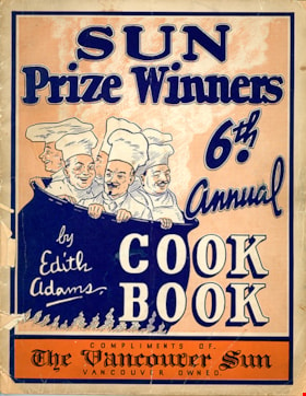
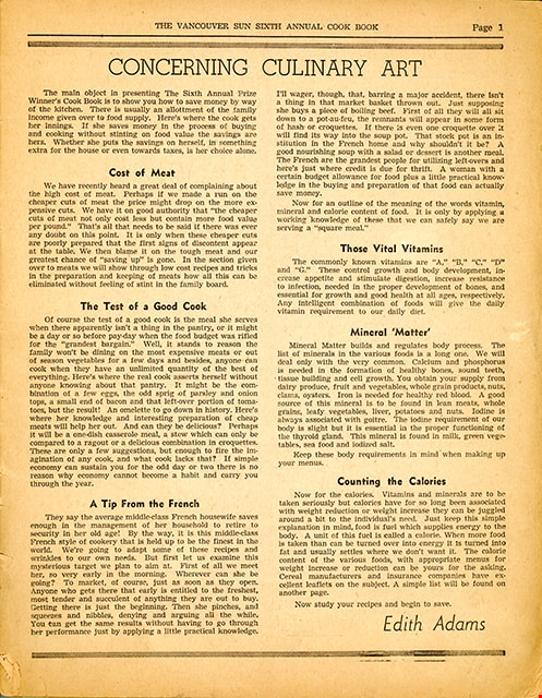
Edith Adams' sixth annual prize cookbook
https://search.heritageburnaby.ca/link/museumlibrary4903
- Repository
- Burnaby Village Museum
- Collection
- Special Collection
- Material Type
- Book
- Accession Code
- HV972.18.7
- Call Number
- 641.5 ADA
- Author
- Adams, Edith
- Place of Publication
- Vancouver
- Publisher
- The Vancouver Sun
- Publication Date
- 1948
- Physical Description
- 64 p. : ill. : 29 cm.
- Library Subject (LOC)
- Cooking
- Baking
- Food
- Formulas, recipes, etc.
- Edith Adams
- Cookbooks--1940-1949
- Object History
- This item was purchased from the St.James United Church.
- Notes
- "Sun prize winners 6th annual cook book" -- Cover
Images
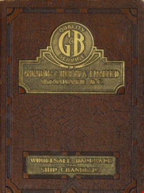
General catalogue
https://search.heritageburnaby.ca/link/museumlibrary5583
- Repository
- Burnaby Village Museum
- Author
- Gordon & Belyea Limited
- Publication Date
- 1935
- Call Number
- 387.2 GOR
- Repository
- Burnaby Village Museum
- Collection
- Special Collection
- Material Type
- Book
- Accession Code
- HV983.89.1
- Call Number
- 387.2 GOR
- Author
- Gordon & Belyea Limited
- Place of Publication
- Vancouver
- Publisher
- Gordon & Belyea Ltd.
- Publication Date
- 1935
- Physical Description
- xxiv, 972 p. : ill. : 31 cm.
- Inscription
- "April 25th, 1935. THIS CATALOGUE is loaned to you with our compliments Gordon & Belyea Limited If at any time you do not require this Catalogue, please advise us and we will have one of our representatives call for it." [Typed in blue ink and pasted to front endpaper]
- Library Subject (LOC)
- Ships
- Hardware
- Wholesale trade
- Ship chandlers
- Catalogs
Images

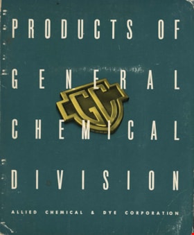
General chemical division Allied Chemical & Dye Corporation
https://search.heritageburnaby.ca/link/museumlibrary7615
- Repository
- Burnaby Village Museum
- Collection
- Special Collection
- Material Type
- Book
- Accession Code
- BV022.22.1
- Call Number
- 661 GEN
- Publisher
- General Chemical Division, Allied Chemical and Dye Corporation
- Publication Date
- 1949
- Physical Description
- 175 p. : illustrations ; 26 cm
- Library Subject (LOC)
- Chemical industry
- Catalogs
- Object History
- Allied Chemical & Dye Corporation catalogue at one time used by the Manager of the The Nichols Chemical Company Limited, William H. Main in Barnet BC. His business card is paper clipped to the first page. Page 106 has an ad from the Nichols company.
Images

The girl's own annual : vol. 51
https://search.heritageburnaby.ca/link/museumlibrary647
- Repository
- Burnaby Village Museum
- Collection
- Special Collection
- Material Type
- Book
- Accession Code
- BV985.1317.1
- Call Number
- 820.8 GIR v.51
- Contributor
- Klickmann, Flora
- Place of Publication
- London
- Publisher
- "Leisure Hour" Office
- Publication Date
- 1930
- Printer
- Wyman & Sons Ltd.
- Physical Description
- 704 p. : ill. ; 29 cm.
- Library Subject (LOC)
- Gift books
- Girls--Great Britain
- Children's literature
- Periodicals
- Notes
- Includes index
- Volume 51
Images
![Highways map of British Columbia, Alberta and adjacent states, [1930] thumbnail](/media/hpo/_Data/_BVM_Cartographic_Material/1977/1977_0037_0187_001.jpg?width=280)
Highways map of British Columbia, Alberta and adjacent states
https://search.heritageburnaby.ca/link/museumdescription9668
- Repository
- Burnaby Village Museum
- Date
- [1930]
- Collection/Fonds
- Burnaby Village Museum Map collection
- Description Level
- Item
- Physical Description
- 1 map : col. lithographic print ; both sides ; 89.5 x 58 cm, folded to 11.5 x 20 cm
- Scope and Content
- Double sided road map published by Imperial Oil, Ltd. and featuring the main travelled highway routes of British Columbia, Alberta and the Northwestern-most states of the United States of America. The map is a colour lithograph. The main map is green, with the highways highlighted in red. The litho…
- Repository
- Burnaby Village Museum
- Collection/Fonds
- Burnaby Village Museum Map collection
- Description Level
- Item
- Physical Description
- 1 map : col. lithographic print ; both sides ; 89.5 x 58 cm, folded to 11.5 x 20 cm
- Material Details
- Scale 1 inch = 20 miles
- A.R. THOMSON / CHIEF CARTOGRAPHER
- Scope and Content
- Double sided road map published by Imperial Oil, Ltd. and featuring the main travelled highway routes of British Columbia, Alberta and the Northwestern-most states of the United States of America. The map is a colour lithograph. The main map is green, with the highways highlighted in red. The lithograph was created in Canada by Rolph Clark Stone Ltd in Toronto. The opposite side of the map features inset maps of the following: the Trans-Canada Highway, the highway between Prince Rupert and Prince George, the highway through the Canadian Rockies, and the highway through the Peace River District. Small city plan maps of highways through major cities, as well as advertisements for Imperial Oil products, are also found on the opposite side of the main map. This map is one of four produced by Imperial Oil that covered the most populated areas of Canada from coast to coast and paralleled Imperial Oil's distribution service.
- Creator
- Thomson, A.R.
- Publisher
- Imperial Oil Limited
- Accession Code
- HV977.37.187
- Access Restriction
- No restrictions
- Reproduction Restriction
- No known restrictions
- Date
- [1930]
- Media Type
- Cartographic Material
- Scan Resolution
- 600
- Scan Date
- 2023-11-10
- Notes
- Title based on content of map
Zoomable Images
![Highways map of British Columbia, Alberta and adjacent states, [1930] thumbnail](/media/hpo/_Data/_BVM_Cartographic_Material/1977/1977_0037_0187_003_seadragon/1977_0037_0187_003.jpg?w=280)


History of Burnaby and vicinity
https://search.heritageburnaby.ca/link/museumlibrary6890
- Repository
- Burnaby Village Museum
- Author
- Green, George, 1872-1955
- Publication Date
- 1947
- Call Number
- 971.133 GRE Copy 2 Ver. 1
- Repository
- Burnaby Village Museum
- Collection
- Digital Reference Collection
- Special Collection
- Material Type
- Book
- Accession Code
- BV017.17.1
- Call Number
- 971.133 GRE Copy 2 Ver. 1
- Author
- Green, George, 1872-1955
- Place of Publication
- [S.l.]
- Publisher
- [s.n.]
- Publication Date
- 1947
- Printer
- Shoemaker , McLean & Veitch
- Physical Description
- 233 p. : ill., maps, ports. ; 23 cm.
- Inscription
- "Presented To my valued fried Rev. D. W. Scott. a former neighbor at Capitol Hill with best wishes of the author George Green Victoria March 1 1947" [handwritten in black ink on page opposing front pastedown] "BMMM-WU SIGNED 1st ED 50.00" [handwritten in pencil on page opposing front pastedown]
- Library Subject (LOC)
- Burnaby (B.C.)--History
- Burnaby (B.C.)
- Biography
- Name Access
- Green, George
- Notes
- Autographed by author
- "By George Green, pioneer resident of Burnaby, and an ex-Councillor. Charter Member of the British Columbia Historical Association, Vancouver Branch, and an Executive Member."
- Copy 2 of 2
Images

Digital Books
![Indexed map of Greater Vancouver, [193-] thumbnail](/media/hpo/_Data/_BVM_Cartographic_Material/1976/1976_0026_0001_001.jpg?width=280)
Indexed map of Greater Vancouver
https://search.heritageburnaby.ca/link/museumdescription8201
- Repository
- Burnaby Village Museum
- Date
- [193-]
- Collection/Fonds
- Burnaby Village Museum Map collection
- Description Level
- Item
- Physical Description
- 1 map + 1 p. textual records : b&w lithographic print on 1 sheet ; 46 x 41 cm folded to 23 x 10 cm
- Scope and Content
- Item consists of a promotional brochure for Bekins Moving and Storage, with an indexed map of Greater Vancouver showing distances from the Bekins building located at Pender Street and Beatty Street on one side, and text and images advertising the company's services and facilities on the other side.…
- Repository
- Burnaby Village Museum
- Collection/Fonds
- Burnaby Village Museum Map collection
- Description Level
- Item
- Physical Description
- 1 map + 1 p. textual records : b&w lithographic print on 1 sheet ; 46 x 41 cm folded to 23 x 10 cm
- Material Details
- Scale not defined
- Printing on two sides of sheet
- Folded into eight sections
- Scope and Content
- Item consists of a promotional brochure for Bekins Moving and Storage, with an indexed map of Greater Vancouver showing distances from the Bekins building located at Pender Street and Beatty Street on one side, and text and images advertising the company's services and facilities on the other side. Cover of folded map reads "Indexed Map of Greater Vancouver / The Great Northwest for Opportunity / Compliments of / Bekins Moving and / Storage Co.".
- Responsibility
- Bekins Moving and Storage Company Limited
- Accession Code
- HV976.26.1
- Access Restriction
- No restrictions
- Reproduction Restriction
- No known restrictions
- Date
- [193-]
- Media Type
- Cartographic Material
- Textual Record
- Scan Resolution
- 600
- Scan Date
- 2023-08-17
- Notes
- Title based on contents of map
Zoomable Images
![Indexed map of Greater Vancouver, [193-] thumbnail](/media/hpo/_Data/_BVM_Cartographic_Material/1976/1976_0026_0001_001_seadragon/1976_0026_0001_001.jpg?w=280)

Interviews with Bill and Albert Parker by Colin Stevens January 17, 1992
https://search.heritageburnaby.ca/link/museumdescription9840
- Repository
- Burnaby Village Museum
- Date
- 1920-1930 (interview content), interviewed January 17, 1992 (date of original), digitized 2020
- Collection/Fonds
- Burnaby Village Museum fonds
- Description Level
- Item
- Physical Description
- 1 videocassette (53 min., 14 sec.) : col. , sd.
- Scope and Content
- Film footage documenting informal interviews with brothers William “Bill” and Albert Parker conducted by Burnaby Village Museum curator, Colin Stevens. The footage opens in the administration building of the Burnaby Village Museum where Bill Parker describes a pair of cross country skis that he is …
- Repository
- Burnaby Village Museum
- Collection/Fonds
- Burnaby Village Museum fonds
- Series
- Jesse Love farmhouse series
- Description Level
- Item
- Physical Description
- 1 videocassette (53 min., 14 sec.) : col. , sd.
- Material Details
- Interviewer: Colin Stevens
- Interviewee:William (Bill) Parker; Albert Parker; Mrs. William Parker
- Location of Interview: Jesse Love farmhouse at the Burnaby Village Museum
- Camera: Susan Green and Colin Stevens
- Scope and Content
- Film footage documenting informal interviews with brothers William “Bill” and Albert Parker conducted by Burnaby Village Museum curator, Colin Stevens. The footage opens in the administration building of the Burnaby Village Museum where Bill Parker describes a pair of cross country skis that he is donating to the museum. Bill recollects how he constructed the skis out of cedar in the late 1920s when he was about 9 or 10 years old. Bill tells of how he skied in the neighbourhood of the Jesse Love farmhouse on Cumberland Road, using the skis until the mid to late 1930s. The film continues with a tour of the Jesse Love farmhouse which is under restoration on site of the Burnaby Village Museum. Curator Colin Stevens takes Albert and Bill Parker through various rooms inside of the house sharing details of what staff have discovered during the restoration process and gathers informative details by interviewing them. During the interviews, the brothers recollect what it was like living in the house in the 1920s. They provide details on the house’s construction, fixtures, heating and water systems along with particulars regarding furnishings and décor. Information that was gathered through interviews such as this, supported the restoration to be completed as accurately as possible.
- History
- Albert and William Charles “Bill” Parker are the sons of Sarah Parker (nee Love) and William Parker. Sarah Parker was the daughter of Jesse and Martha Love and grew up in the Love farmhouse located at 1390 Cumberland Road in Burnaby. Sarah and William Parker and their three children (Albert, Bill and Elsie) moved into the Love farmhouse in about 1925, eventually buying it in 1928 following the death of Sarah’s father Jesse Love. Sarah continued to live in the house until after her husband William died and eventually sold the house to her daughter Elsie Hughes and her husband John Hughes in 1966.
- Creator
- Burnaby Village Museum
- Subjects
- Sports - Skiing
- Buildings - Heritage
- Accession Code
- BV018.41.50
- Access Restriction
- Restricted access
- Reproduction Restriction
- May be restricted by third party rights
- Date
- 1920-1930 (interview content), interviewed January 17, 1992 (date of original), digitized 2020
- Media Type
- Moving Images
- Photographer
- Green, Susan
- Stevens, Colin
- Notes
- Title based on contents of video
- Video was digitized to mp4 in March 2020 from original VHS tape
Images

Video
Interviews with Bill and Albert Parker by Colin Stevens January 17, 1992, 1920-1930 (interview content), interviewed January 17, 1992 (date of original), digitized 2020
Interviews with Bill and Albert Parker by Colin Stevens January 17, 1992, 1920-1930 (interview content), interviewed January 17, 1992 (date of original), digitized 2020
https://search.heritageburnaby.ca/media/hpo/_Data/_BVM_Moving_Images/2018_0041_0050_001.mp4![Map of proposed provincial exhibition site at Burnaby Lake, [between 1929 and 1931] thumbnail](/media/hpo/_Data/_BVM_Cartographic_Material/2017/2017_0002_0009_005.jpg?width=280)
Map of proposed provincial exhibition site at Burnaby Lake
https://search.heritageburnaby.ca/link/museumdescription8703
- Repository
- Burnaby Village Museum
- Date
- [between 1929 and 1931]
- Collection/Fonds
- Burnaby Village Museum Map collection
- Description Level
- Item
- Physical Description
- 1 map : photostat print ; 3 parts 45 x 33.7 cm totalling 45 x 101 cm
- Scope and Content
- Item consists of a tri-part folding map of a proposed Provincial Exhibition site located along the southern and western shore of Burnaby Lake. Exhibtion site on map identifies proposed locations for a golf course, pier, hydroplane landing ramp, sports ground, one-mile horse racing track and various…
- Repository
- Burnaby Village Museum
- Collection/Fonds
- Burnaby Village Museum Map collection
- Description Level
- Item
- Physical Description
- 1 map : photostat print ; 3 parts 45 x 33.7 cm totalling 45 x 101 cm
- Material Details
- Scale [1:1800]
- Scope and Content
- Item consists of a tri-part folding map of a proposed Provincial Exhibition site located along the southern and western shore of Burnaby Lake. Exhibtion site on map identifies proposed locations for a golf course, pier, hydroplane landing ramp, sports ground, one-mile horse racing track and various buildings for mechanical, agricultural and botanical displays.
- Subjects
- Exhibitions
- Accession Code
- BV017.2.9
- Access Restriction
- No restrictions
- Reproduction Restriction
- No known restrictions
- Date
- [between 1929 and 1931]
- Media Type
- Cartographic Material
- Historic Neighbourhood
- Burnaby Lake (Historic Neighbourhood)
- Planning Study Area
- Burnaby Lake Area
- Scan Resolution
- 400
- Scan Date
- 2021-11-18
- Notes
- Title based on contents of map
- Scale on map reads: "150 feet to 1 inch"
- Overall measurements when fully opened: L: 98.0 cm x H: 45.3 cm ; Individual map parts: L: 32.7 cm x H: 45.0 cm
- Commercially printed label on front of portfolio card reads "PLOWRIGHT PRINTING COMPANY / TELEPHONE N.W. 1942 / 39 McKENZIE STREET NEW WESTMINSTER, B.C. / TO: [illegible writing in pencil]" in blue ink. Red typewritten text reads: "PHOTOSTAT OF BURNABY LAKE".
Images
![Map of proposed provincial exhibition site at Burnaby Lake, [between 1929 and 1931] thumbnail](/media/hpo/_Data/_BVM_Cartographic_Material/2017/2017_0002_0009_005.jpg)


![Municipality of Burnaby, [between 1910 and 1930] thumbnail](/media/hpo/_Data/_BVM_Cartographic_Material/2008/2008_0024_0001_002.jpg?width=280)
Municipality of Burnaby
https://search.heritageburnaby.ca/link/museumdescription8702
- Repository
- Burnaby Village Museum
- Date
- [between 1910 and 1930]
- Collection/Fonds
- Burnaby Village Museum Map collection
- Description Level
- Item
- Physical Description
- 1 map : blackline print with col. ; 83 x 53 cm on sheet 92 x 61 cm
- Scope and Content
- Item consists of "Municipality of Burnaby" map outlining waterlines, telephone lines, lights and power lines, and street lights. A section of the upper left corner (borded by Boundary Road to the west; Queens Ave to the east; Burrard Inlet to the north and Parker Avenue to the south) of map is han…
- Repository
- Burnaby Village Museum
- Collection/Fonds
- Burnaby Village Museum Map collection
- Description Level
- Item
- Physical Description
- 1 map : blackline print with col. ; 83 x 53 cm on sheet 92 x 61 cm
- Material Details
- Scale 10 chains = 1 inch
- Scope and Content
- Item consists of "Municipality of Burnaby" map outlining waterlines, telephone lines, lights and power lines, and street lights. A section of the upper left corner (borded by Boundary Road to the west; Queens Ave to the east; Burrard Inlet to the north and Parker Avenue to the south) of map is hand coloured in red with "Queens Avenue" and "Parker Avenue" identified.
- Creator
- Coast Map and Blue Print Co.
- Responsibility
- Municipal Council of Burnaby
- Accession Code
- BV008.24.1
- Access Restriction
- No restrictions
- Reproduction Restriction
- No known restrictions
- Date
- [between 1910 and 1930]
- Media Type
- Cartographic Material
- Scan Resolution
- 300
- Scan Date
- 2022-05-10
- Notes
- Transcribed title
- "COMPILED EXPRESSLY FOR / THE MUNICIPAL COUNCIL OF BURNABY/ BY/ THE COAST MAP AND BLUE PRINT CO/ EMPIRE BLDG VANCOUVER B.C."
Images
![Municipality of Burnaby, [between 1910 and 1930] thumbnail](/media/hpo/_Data/_BVM_Cartographic_Material/2008/2008_0024_0001_002.jpg)

Municipality of Burnaby
https://search.heritageburnaby.ca/link/museumdescription13096
- Repository
- Burnaby Village Museum
- Date
- 1936
- Collection/Fonds
- Burnaby Village Museum Map collection
- Description Level
- Item
- Physical Description
- 1 map : b&w print on paper ; 59 x 43 cm
- Scope and Content
- Map of the Municipality of Burnaby compiled and published by City Map and White Print Co.
- Repository
- Burnaby Village Museum
- Collection/Fonds
- Burnaby Village Museum Map collection
- Description Level
- Item
- Physical Description
- 1 map : b&w print on paper ; 59 x 43 cm
- Scope and Content
- Map of the Municipality of Burnaby compiled and published by City Map and White Print Co.
- Creator
- City Map and White Print Co.
- Publisher
- City Map and White Print Co.
- Accession Code
- HV976.158.7
- Access Restriction
- No restrictions
- Reproduction Restriction
- No known restrictions
- Date
- 1936
- Media Type
- Cartographic Material
- Scan Resolution
- 600
- Scan Date
- 2022-04-06
- Scale
- 100
- Notes
- Title based on content of map
- Title on map reads: "MUNICIPALITY / OF / BURNABY / BRITISH COLUMBIA / Compiled and Published by / CITY MAP AND WHITE PRINT CO."
- Stamp on map reads: "SFU LIBRARY / SEP 1974 / G. 3514 / B87 / 1936"
- Stamp on map reads: "SFU LIBRARY / AUG 1973 / G. 3514 / B87 / 1936"
- Cirular seal stamp on map reads: "The University of / Library / British Columbia"
Zoomable Images

![Municipality of Burnaby - Volume XV and Volume XVIII, 1927-[1940] thumbnail](/media/hpo/_Data/_BVM_Artifacts/1972/1972_0111_0004_003.jpg?width=280)
Municipality of Burnaby - Volume XV and Volume XVIII
https://search.heritageburnaby.ca/link/museumdescription8682
- Repository
- Burnaby Village Museum
- Date
- 1927-[1940]
- Collection/Fonds
- Burnaby Village Museum Map collection
- Description Level
- File
- Physical Description
- 4 plans on 4 sheets: col. lithographic prints ; 63.5 x 53.5 cm folded to 53 x 31.5 cm
- Scope and Content
- File consists of four pages of plans removed from a bound book containing a series of fire insurance plans of the Municipality of Burnaby. Plan "1518" and "1519" are from "GREATER VANCOUVER B.C. / VOLUME XV / Municipality of Burnaby / May, 1927". Plan "1518" covers District Lot 116 and Plan "1519"…
- Repository
- Burnaby Village Museum
- Collection/Fonds
- Burnaby Village Museum Map collection
- Description Level
- File
- Physical Description
- 4 plans on 4 sheets: col. lithographic prints ; 63.5 x 53.5 cm folded to 53 x 31.5 cm
- Material Details
- Scale [1:600]
- Scope and Content
- File consists of four pages of plans removed from a bound book containing a series of fire insurance plans of the Municipality of Burnaby. Plan "1518" and "1519" are from "GREATER VANCOUVER B.C. / VOLUME XV / Municipality of Burnaby / May, 1927". Plan "1518" covers District Lot 116 and Plan "1519" covers District Lot 121. Plan "1802" and plan "1803" are from "GREATER VANCOUVER B.C. / VOLUME XVIII / Municipality of Burnaby / May, 1927". Both plans "1802" and "1803" cover District Lot 153.
- Responsibility
- British Columbia Underwriters' Association
- Accession Code
- HV972.111.4
- Access Restriction
- No restrictions
- Reproduction Restriction
- May be restricted by third party rights
- Date
- 1927-[1940]
- Media Type
- Cartographic Material
- Historic Neighbourhood
- Vancouver Heights (Historic Neighbourhood)
- Central Park (Historic Neighbourhood)
- Planning Study Area
- Willingdon Heights Area
- Marlborough Area
- Scan Resolution
- 400
- Scan Date
- 2021-11-18
- Notes
- Title based on content of plans
- See also BV987.1.70d for revised versions of plans
- Scale is measured 1 inch = 50 feet
- Contact Burnaby Village Museum to access plans 1518 and 1519 (these plans have revisions on top - date of revisions is uncertain)
Images
![Municipality of Burnaby - Volume XV and Volume XVIII, 1927-[1940] thumbnail](/media/hpo/_Data/_BVM_Artifacts/1972/1972_0111_0004_003.jpg)


New instructions on how to fight fire bombs
https://search.heritageburnaby.ca/link/museumlibrary5109
- Repository
- Burnaby Village Museum
- Collection
- Special Collection
- Material Type
- Book
- Accession Code
- BV988.47.20
- Call Number
- 358.3 CAN v.2
- Place of Publication
- Ottawa
- Publisher
- Edmond Cloutier
- Publication Date
- 1942
- Physical Description
- 4 p. : ill. ; 21 cm.
- Library Subject (LOC)
- Canada--Civil defense
- Incendiary bombs
- Fire extinction
- Subjects
- Documentary Artifacts
- Documentary Artifacts - Leaflets
- Wars
- Wars - World War, 1939-1945
- Emergency Measures - Civil Defence
- Notes
- Version 2 of 2
Images


Okanagan Fishing Guide
https://search.heritageburnaby.ca/link/museumdescription11398
- Repository
- Burnaby Village Museum
- Date
- 1948
- Collection/Fonds
- Burnaby Village Museum Map collection
- Description Level
- Item
- Physical Description
- 1 map : col. ink on paper handcol. ; 24 x 35 cm
- Scope and Content
- Item consists of map titled "Okanagan Fishing Guide / Showing / Major Roads / and the / Best Fish Lakes". Hand drawn map compiled and drawn by W.C. Rueber, Kelowna B.C. of Okanagan Lake area. Advertisement at bottom of page indicates that it may have been produced by "OK USED FURNITURE STORE / 239 …
- Repository
- Burnaby Village Museum
- Collection/Fonds
- Burnaby Village Museum Map collection
- Description Level
- Item
- Physical Description
- 1 map : col. ink on paper handcol. ; 24 x 35 cm
- Scope and Content
- Item consists of map titled "Okanagan Fishing Guide / Showing / Major Roads / and the / Best Fish Lakes". Hand drawn map compiled and drawn by W.C. Rueber, Kelowna B.C. of Okanagan Lake area. Advertisement at bottom of page indicates that it may have been produced by "OK USED FURNITURE STORE / 239 BERNARD AVE., KELOWNA, B.C....". The map was copyrighted in Canada on July 20, 1948, No. 79416.
- Creator
- Rueber, W.C.
- Publisher
- OK Used Furniture Store
- Accession Code
- BV006.24.116
- Access Restriction
- No restrictions
- Reproduction Restriction
- May be restricted by third party rights
- Date
- 1948
- Media Type
- Cartographic Material
- Scan Resolution
- 600
- Scan Date
- 2021-11-23
- Notes
- Transcribed title
- Staining on map with creases from being folded and handcoloured markings with blue pencil
Images


Proposed sidewalk on grounds of Kingsway West School
https://search.heritageburnaby.ca/link/museumdescription11917
- Repository
- Burnaby Village Museum
- Date
- March 24, 1932
- Collection/Fonds
- Ronald G. Scobbie collection
- Description Level
- Item
- Physical Description
- 1 survey plan : ink on waxed linen sheet ; 55 x 25 cm
- Scope and Content
- Item consists of a survey plan titled “Plan Showing Proposed / Sidewalk on Grounds of / Kingsway West School”
- Repository
- Burnaby Village Museum
- Collection/Fonds
- Ronald G. Scobbie collection
- Description Level
- Item
- Physical Description
- 1 survey plan : ink on waxed linen sheet ; 55 x 25 cm
- Material Details
- Scale 20’=1”
- Scope and Content
- Item consists of a survey plan titled “Plan Showing Proposed / Sidewalk on Grounds of / Kingsway West School”
- Creator
- McGugan, Donald Johnston
- Names
- Kingsway West School
- Accession Code
- BV003.83.40
- Access Restriction
- No restrictions
- Reproduction Restriction
- No known restrictions
- Date
- March 24, 1932
- Media Type
- Cartographic Material
- Scan Resolution
- 600
- Scan Date
- 15-Jan-2021
- Scale
- 100
- Notes
- Transcribed title
- Note in pencil reads: ‘4222”
Images


RCAF Flying Log Book and navigation maps
https://search.heritageburnaby.ca/link/museumdescription20321
- Repository
- Burnaby Village Museum
- Date
- 1943-1945
- Collection/Fonds
- Joseph H.C. Corsbie fonds
- Description Level
- File
- Physical Description
- 1 book (hardcover) + 1 map : b&w lithograph on paper with annotations in col. ink ; 34.5 x 40.5 cm + 7 maps : b&w lithograph on paper with annotations in col. ink ; 41.5 x 33.5 cm
- Scope and Content
- File consists of a "Royal Canadian Air Force Flying Log Book for Aircrew other than Pilot" assigned to J.H. Corsbie along with eight aircraft navigation maps for flying at night titled; "Newcastle to Prague" and "Hull to Venice" with navigational markings created by Joseph H. Corsbie. Entries in lo…
- Repository
- Burnaby Village Museum
- Collection/Fonds
- Joseph H.C. Corsbie fonds
- Description Level
- File
- Physical Description
- 1 book (hardcover) + 1 map : b&w lithograph on paper with annotations in col. ink ; 34.5 x 40.5 cm + 7 maps : b&w lithograph on paper with annotations in col. ink ; 41.5 x 33.5 cm
- Material Details
- Scale : 1:2,890,000 (approx.)
- Scope and Content
- File consists of a "Royal Canadian Air Force Flying Log Book for Aircrew other than Pilot" assigned to J.H. Corsbie along with eight aircraft navigation maps for flying at night titled; "Newcastle to Prague" and "Hull to Venice" with navigational markings created by Joseph H. Corsbie. Entries in log book provide detailed records of Corsbie's training and flights undertaken on RCAF service aircraft between March 1943 and July 1945 along with units which Corsbie served as observer or air gunner and the aircraft in which he's flown (1943-1944).
- Other Title Information
- Full title of book "Royal Canadian Air Force Flying Log Book for aircrew other than Pilot"
- Responsibility
- Royal Canadian Air Force
- Accession Code
- BV020.31.44
- Access Restriction
- No restrictions
- Reproduction Restriction
- No known restrictions
- Date
- 1943-1945
- Media Type
- Textual Record
- Cartographic Material
- Scan Resolution
- 600
- Scan Date
- 19-09-2023
- Notes
- Title based on contents of file
- 7 maps titled "Hull to Venice / Heights in Feet" include identifier below bottom border reading: "O.R.1373 / Spot-Height Corrections, 1944"_"Compiled and drawn at H.Q./G.S.G.S.-1943"
- 1 map titled "Newcastle to Prague / Heights in Feet" include identifier below bottom border reading: "O.R.1373 / Spot-Height Corrections, 1944"_" H.Q./G.S.G.S.-1943"
Images

Documents
![Through the Lens of Andy Digney, [between 1934 and 1964] (date of original film), edited and narrated in 2016 thumbnail](/media/hpo/_Data/_BVM_Moving_Images/2019_0018_0001_001.JPG?width=280)
Through the Lens of Andy Digney
https://search.heritageburnaby.ca/link/museumdescription10099
- Repository
- Burnaby Village Museum
- Date
- [between 1934 and 1964] (date of original film), edited and narrated in 2016
- Collection/Fonds
- Burnaby Village Museum fonds
- Description Level
- Item
- Physical Description
- 1 video recording (mp4) (12 min., 17 sec.) : digital, 23 fps, col., sd., stereo
- Scope and Content
- Item consists of a short film featuring a compilation of film footage created by Andy Digney that was edited and narrated by the Burnaby Village Museum. Burnaby resident Andy Digney captured footage of Burnaby and beyond from 1934 to 1964. Highlights within this film compilaton include the constru…
- Repository
- Burnaby Village Museum
- Collection/Fonds
- Burnaby Village Museum fonds
- Description Level
- Item
- Physical Description
- 1 video recording (mp4) (12 min., 17 sec.) : digital, 23 fps, col., sd., stereo
- Material Details
- Research and Narration: Lisa Codd
- Editing and Audio Recording: Matthew Ball
- Special thanks to Paul Digney
- Scope and Content
- Item consists of a short film featuring a compilation of film footage created by Andy Digney that was edited and narrated by the Burnaby Village Museum. Burnaby resident Andy Digney captured footage of Burnaby and beyond from 1934 to 1964. Highlights within this film compilaton include the construction and events held at the Oak Theatre; Royal visit motorcade of King George VI and Queen Elizabeth; Sports Day at Central Park; Gymcana event at Burnaby Lake Riding Stables; lawn bowling at Central Park; a Depression-era May Day workers’ parade in 1936; May Day celebrations in Burnaby; visits to locations throughout the Lower Mainland, including Stanley Park, Capilano Suspension Bridge, Grouse Mountain and boat trip up Burrard Inlet; the Digney Speedway; the Digney family at their home on Bonsor Avenue and the Digney Bowling Alley.
- Creator
- Digney, Andy
- Names
- Digney, Andy
- Digney Bowling Alley
- Digney Speedway
- Codd, Lisa
- Oak Theatre
- Burnaby Lawn Bowling Club
- Geographic Access
- Kingsway
- Central Park
- Street Address
- 6521 Bonsor Avenue
- Accession Code
- BV019.18.1
- Access Restriction
- No restrictions
- Reproduction Restriction
- No known restrictions
- Date
- [between 1934 and 1964] (date of original film), edited and narrated in 2016
- Media Type
- Moving Images
- Related Material
- See also the City of Burnaby Archives "Digney Family fonds" MI catalogue 562.003 for film masters
- Notes
- Title based on contents
- City of Burnaby Archives holds the original Digney film masters (562.003) that this narrated segment was disseminated from. See Digney family fonds
Images
![Through the Lens of Andy Digney, [between 1934 and 1964] (date of original film), edited and narrated in 2016 thumbnail](/media/hpo/_Data/_BVM_Moving_Images/2019_0018_0001_001.JPG)
Video
Through the Lens of Andy Digney, [between 1934 and 1964] (date of original film), edited and narrated in 2016
Through the Lens of Andy Digney, [between 1934 and 1964] (date of original film), edited and narrated in 2016
https://search.heritageburnaby.ca/media/hpo/_Data/_BVM_Moving_Images/2019_0018_0001_001.mp4
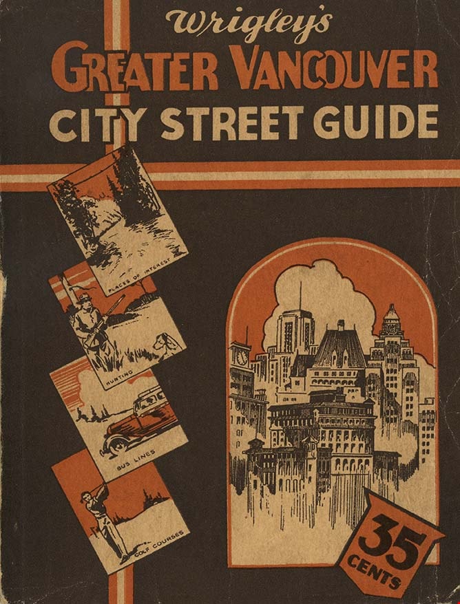
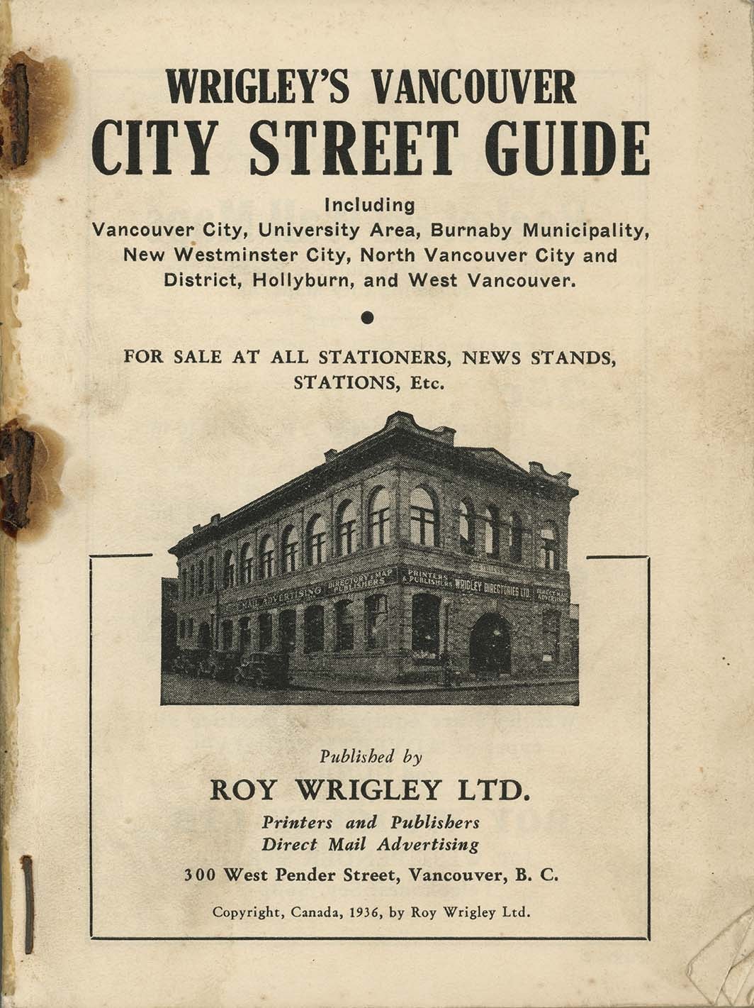
Wrigley's Greater Vancouver City Street Guide
https://search.heritageburnaby.ca/link/museumlibrary421
- Repository
- Burnaby Village Museum
- Collection
- Special Collection
- Material Type
- Book
- Accession Code
- BV988.53.7
- Publisher
- Roy Wrigley Ltd.
- Publication Date
- 1936
- Physical Description
- 160 pages, [1] folded leaf of plates : ill. , map ; 15 cm.
- Inscription
- "Wrigley's Greater Vancouver City Street Guide", printed on cover of book
- Object History
- From Hougland's Drug Store, 45th and Fraser in Vancouver.
Images