Narrow Results By
Creator
- Aveling, Eleanor Marx, 1855-1898 1
- British Columbia Underwriters' Association 9
- Cornish, George A. (George Augustus), 1872- 3
- Funk & Wagnalls Company 1
- G. Borwick & Sons 1
- Girl Guides of Canada 1
- Hall, H.S. (Henry Sinclair), 1848-1934 3
- Ibsen, Henrik, 1828-1906 1
- Johnston, Harry H. 1
- Knight, S.R. (Samuel Ratcliffe) 1
- Lee, Chue Kan "Cecil" 1
- Lee, Julie Cho Chan 1
Person / Organization
- Burnaby North High School 1
- Co-operative Commonwealth Federation "CCF" 1
- Douglas, Tommy 1
- Ehlers, Edith "Edie" Fleming 1
- Fleming, Frances "Fanny" Waplington 1
- Fleming, John "Jack" Reyland 1
- Fleming, John Reyland "Ray" 2
- Girl Guides of Canada 2
- Godwin, Florence Hart 1
- Kidd, Marion 1
- Love Family 1
- MacInnis, Grace 1
Fire insurance plans - Greater Vancouver - Volume XV - Municipality of Burnaby
https://search.heritageburnaby.ca/link/museumdescription17795
- Repository
- Burnaby Village Museum
- Date
- 1927-1940
- Collection/Fonds
- Burnaby Village Museum Map collection
- Description Level
- Item
- Physical Description
- 11 plans on 8 sheets : col. lithographic print ; 64 x 54 cm
- Scope and Content
- Item consists of fire insurance plans titled "Greater Vancouver / Volume XV / Municipality / of Burnaby" surveyed May 1927 and revised October 1940. Volume XV includes a two page Key Plan (A and B) identifying associated plan numbers and district lots and nine numbered fire insurance plans identifi…
- Repository
- Burnaby Village Museum
- Collection/Fonds
- Burnaby Village Museum Map collection
- Description Level
- Item
- Physical Description
- 11 plans on 8 sheets : col. lithographic print ; 64 x 54 cm
- Material Details
- Scales between [1:600] and [1:6000]
- Scope and Content
- Item consists of fire insurance plans titled "Greater Vancouver / Volume XV / Municipality / of Burnaby" surveyed May 1927 and revised October 1940. Volume XV includes a two page Key Plan (A and B) identifying associated plan numbers and district lots and nine numbered fire insurance plans identified as; 1507; 1508 ; 1517; 1518; 1519; 1520;1521; 1531and 1532.
- Publisher
- Plan Department of Fire Branch of British Columbia Underwriters' Association
- Accession Code
- BV987.1.70
- Access Restriction
- No restrictions
- Reproduction Restriction
- May be restricted by third party rights
- Date
- 1927-1940
- Media Type
- Cartographic Material
- Historic Neighbourhood
- Vancouver Heights (Historic Neighbourhood)
- Planning Study Area
- Burnaby Heights Area
- Willingdon Heights Area
- Scan Resolution
- 400
- Notes
- Title based on contents of item
- These plans are contained within a bound book with labels on cover page reading: "Plan No. 90 / THIS INSURANCE PLAN / of / Vancouver VOLUME "8" / IN THE PROPERTY OF THE / British Columbia Insurance Underwriter's Association / Vancouver B.C. / AND IS LOANED / MELVILLE F. THOMSON CO. .../ Date May 26th, 1934"; / "Plan No. 74 / THIS INSURANCE PLAN / OF / VANCOUVER VOLUME "9"" / Plan No. 11 / THIS INSURANCE PLAN / OF / BURNABY VOLUMES 15-19" / "THIS PLAN IS THE PROPERTY OF / THE / BRITISH LAW INSURANCE COMPANY / LIMITED"
- Fire insurance plans cover various district lots in Burnaby including: District Lot 116,121, 186 and 187.
- Sticker adhered to Key Plan B reads: "
- Contact Burnaby Village Museum to view fire insurance plans that are part of Volume XV
Harold Edward Winch collection
https://search.heritageburnaby.ca/link/museumdescription3638
- Repository
- Burnaby Village Museum
- Date
- [1914]-2003
- Collection/Fonds
- Harold Edward Winch collection
- Description Level
- Fonds
- Physical Description
- approx. 23 cm of textual records + approx. 600 photographs (b&w + col.)
- Scope and Content
- Collection consists of records relating to Harold Edward Winch's family life and political career. It includes photographs of Winch's parents, family, and wife Jessie, as well as photographs, correspondence and other textual records from Harold's political work and experiences, a travel diary, gues…
- Repository
- Burnaby Village Museum
- Collection/Fonds
- Harold Edward Winch collection
- Description Level
- Fonds
- Physical Description
- approx. 23 cm of textual records + approx. 600 photographs (b&w + col.)
- Scope and Content
- Collection consists of records relating to Harold Edward Winch's family life and political career. It includes photographs of Winch's parents, family, and wife Jessie, as well as photographs, correspondence and other textual records from Harold's political work and experiences, a travel diary, guest books, and certificates. The collection includes a number of Co-operative Commonwealth Federation and New Democratic Party newspapers. The collection also includes records relating to Winch's death, such as obituaries, memorials, articles, and a guest book. Finally, the collection includes a small number of records relating to Winch's father, Ernie Winch, and his own political career. The collection has been arranged into five series: 1) Harold E. Winch biographical records (1933-2003) 2) Harold E. Winch photographs series (1914-[ca. 1990]) 3) Harold E. Winch political photograph album and records series ([1937]-1993) 4) Harold E. Winch personal records series (1949-1993) 5) Harold E. Winch newspaper collection series (1936-1986)
- History
- Harold Edward Winch (June 18, 1907-February 1, 1993) was born in Loughton, Essex, England to Ernest “Ernie” Edward Winch (March 22, 1879-January 11, 1957) and his wife Linda Marian (nee Hendy). Harold was the eldest of six children; the others were Eileen, Charlie, Grace, Alan, and Eric. Ernest moved to BC in 1909, followed by Linda, Harold, and Eileen in 1910. The remaining children were born in BC. Ernie, a brick mason, built the family a series of homes in the Lower Mainland as the family moved around for a number of years, living in Burnaby, White Rock, Mission, and Vancouver before finally settling back in Burnaby. Ernie Winch joined the Social Democratic Party of Canada in 1911 and became secretary of the party in 1913, and was heavily involved in trade unions and the labour and socialist movements. He helped re-establish the Socialist Party of Canada (BC) in 1932, which soon merged with the Co-operative Commonwealth Federation (CCF). Ernie was a CCF MLA in Burnaby from 1933 until his death in 1957, following which his son-in-law Cedric Cox (husband of Eileen) won the seat in a byelection. Ernie was particularly interested in institutions, including jails, mental hospitals, and industrial schools, and founded the New Vista Society in 1943 to provide a live-in rehabilitation program to women with psychiatric problems. The organization later expanded to focus on low-cost housing for seniors, and an apartment complex was built for this purpose in Burnaby. Both Ernie and Harold were lifelong members of the New Vista Society board of trustees. Harold Winch trained as an electrician, but also followed his father into politics, serving as a CCF MLA in Vancouver East from 1933 to 1953 – Ernie and Harold were two of the first seven CCF MLAs. The Winches set a Guinness world record for the longest father-and-son parliamentary tenure. Like his father, Harold was also highly involved in the labour movement, and acted as a liaison between workers and government during the Depression, particularly during the relief camp strike in Vancouver in 1935 which precipitated the On to Ottawa trek. He was the leader of the BC CCF from 1938 to 1953, and Leader of the Opposition from 1941 to 1953. In 1953, Harold stepped down from provincial politics to enter the federal arena, and served as a CCF MP for Vancouver East from 1953 to 1961, when the CCF became the New Democratic Party (NDP); Harold continued to serve as an NDP MP from 1961 to 1972, when he retired for health reasons. In federal office, Harold remained dedicated to the working class and humanitarian causes, issuing reports on subject such as unemployment, veterans’ rights, low-cost housing for seniors, animal welfare, drug addiction, and mental health concerns. Harold earned honorary law degrees from both UBC (1973) and SFU (1974). He was involved in numerous humanitarian and other organizations and his roles included president and treasurer of the Commonwealth Parliamentary Association; co-founder of the Immigrant Services Society of Vancouver; director of the Boag Foundation; and lifelong member of the Association for Protection of Fur Bearing Animals. Harold married Dorothy Ada Hutchinson (December 1, 1907-October 24, 1974) on May 11, 1929. They had three children: Donald, Gerald ("Jerry"), and Shirley. Following Dorothy’s death, Harold married Jessie Margaret Mendels (nee Sweezey) (June 29, 1913-May 9, 2006) on May 19, 1981. Jessie grew up in Grand Forks, BC, and her family moved to Vancouver when she was in high school. Her first husband was George Edward Mendels (November 2, 1905-September 2, 1978). She had no children. Jessie served as a St. John’s ambulance driver during World War II. She was also active in the CCF and NDP parties in BC, having been Provincial Secretary for the CCF in the 1940s, a vice-president of the party in the 1950s, and Provincial Secretary for the NDP in the 1960s. Like Harold, she later served as a director of the Boag Foundation. Jessie traveled widely throughout her life. The collection contains a small number of Jessie’s photographs. Harold Winch died in White Rock, where he and Jessie had retired, on February 1, 1993.
- Responsibility
- Winch, Harold Edward
- Accession Code
- BV013.12
- Date
- [1914]-2003
- Media Type
- Textual Record
- Photograph
- Arrangement
- Records within fonds have been arranged by subject and format.
- Notes
- Title based on contents of fonds
Library of health : complete guide to prevention and care of disease, containing practical information on anatomy, physiology and preventive medicine; curative medicine, first aid measures, diagnosis, nursing, sexology, simple home remedies, care of the teeth, occupational diseases, garden plant remedies, alcohol and narcotics, treatment by fifteen schools of medicine, beauty culture, physical culture the science of breathing and the dictionary of drugs.
https://search.heritageburnaby.ca/link/museumlibrary3380
- Repository
- Burnaby Village Museum
- Collection
- Special Collection
- Material Type
- Book
- Accession Code
- BV992.46.1
- Call Number
- 616 SCH
- Contributor
- Scholl, B. Frank (Benjamin Franklin), 1860-1933
- Place of Publication
- Philadelphia, PA.
- Publisher
- Historical Publishing Company
- Publication Date
- 1921
- Physical Description
- 1774 p. ill., col. plates, diagrams
- Library Subject (LOC)
- Medicine, Popular
- Notes
- Edited by B. Frank Scholl
- Author's given name and dates : Scholl, B. Frank (Benjamin Franklin), 1860-1933.
- "Twenty books - one volume." --Tp
Library of health : complete guide to prevention and cure of disease, containing practical information on anatomy, physiology and preventive medicine ; curative medicine, first aid measures, diagnosis, nursing, sexology, simple home remedies, care of teeth, occupational diseases, garden plant remedies, alcohol and narcotics, treatment by fifteen schools of medicine, beauty culture, physical culture, the science of breathing and the dictionary of drugs; twenty books - one volume
https://search.heritageburnaby.ca/link/museumlibrary205
- Repository
- Burnaby Village Museum
- Collection
- Special Collection
- Material Type
- Book
- Accession Code
- HV971.136.95
- Call Number
- 603 SCH
- Edition
- 1920 ed.
- Contributor
- Scholl, B. Frank (Benjamin Franklin), 1860-1933
- Place of Publication
- Philadelphia
- Publisher
- Historical Publishing Co.
- Publication Date
- 1920, c1916
- Physical Description
- xvi, 1774 p. : ill. (some col.) ; 26 cm.
- Inscription
- "W27" [handwritten and crossed out in black ink on front pastedown]
- Library Subject (LOC)
- Medicine, Popular
- Medicine
- Notes
- "Edited by B. Frank Scholl, Ph.G., M.D." -- title page
- Author's full given name and dates: Scholl, B. Frank (Benjamin Franklin), 1860-1933
The Literary digest atlas of the world and gazetteer
https://search.heritageburnaby.ca/link/museumlibrary1694
- Repository
- Burnaby Village Museum
- Author
- Funk & Wagnalls Company
- Publication Date
- 1927
- Call Number
- 912 FUN
- Repository
- Burnaby Village Museum
- Collection
- Special Collection
- Material Type
- Book
- Accession Code
- BV985.5211.1
- Call Number
- 912 FUN
- Author
- Funk & Wagnalls Company
- Place of Publication
- New York
- Publisher
- Funk & Wagnalls Company
- Publication Date
- 1927
- Physical Description
- 192 p. : col. maps ; 25 cm.
- Library Subject (LOC)
- Atlases
- Notes
- "Containing new maps of the principal countries of the world and separate maps of each Amercian state and territory, the Canadian provinces, etc., etc.; accompanied by individual indexes of each state, province, etc., and a descriptive gazetteer of the principal countries of the world" --title page.
- Maps by C.S. Hammond Co.

Municipality of Burnaby - Volume XV and Volume XVIII
https://search.heritageburnaby.ca/link/museumdescription8680
- Repository
- Burnaby Village Museum
- Date
- May 1927
- Collection/Fonds
- Burnaby Village Museum Map collection
- Description Level
- File
- Physical Description
- 4 plans on 4 sheets : col. lithographic prints ; 63.5 x 53.5 cm folded to 53 x 31.5 cm
- Scope and Content
- File consists of four pages of plans removed from a bound book containing a series of fire insurance plans of the Municipality of Burnaby. The first two pages are numbered "A" and "B" and are key plans from "GREATER VANCOUVER B.C. / VOLUME XV / Surveyed _ May 1927 / MUNICIPALITY OF / BURNABY", "PLA…
- Repository
- Burnaby Village Museum
- Collection/Fonds
- Burnaby Village Museum Map collection
- Description Level
- File
- Physical Description
- 4 plans on 4 sheets : col. lithographic prints ; 63.5 x 53.5 cm folded to 53 x 31.5 cm
- Material Details
- Scales [1:1200] and [1:6000]
- Scope and Content
- File consists of four pages of plans removed from a bound book containing a series of fire insurance plans of the Municipality of Burnaby. The first two pages are numbered "A" and "B" and are key plans from "GREATER VANCOUVER B.C. / VOLUME XV / Surveyed _ May 1927 / MUNICIPALITY OF / BURNABY", "PLAN DEPT. FIRE BRANCH _ B.C. INSURANCE UNDERWRITERS ASSN.". Key Plan "B" covers plans: 1505; 1506; 1512 to 1516; 1540 to 1544; 1550 to 1557 and District Lots: 129 to 132; 135 to 138; 205 to 208 and 215 to 218. Key Plan "A" covers plans: 1501 to 1504; 1507 to 1511; 1517 to 1525; 1531 to 1539; 1545 to 1550 and District Lots: 116 to 127 and 186 to 189. Plan "1806" is part of "GREATER VANCOUVER B.C. / VOLUME XVIII / Municipality of Burnaby / May, 1927" and covers District Lot 153. Plan "1807" is from "GREATER VANCOUVER B.C. / VOLUME XVIII / Municipality of Burnaby / May, 1927" and covers District Lots: 99,149 and 152.
- Responsibility
- British Columbia Underwriters' Association
- Accession Code
- HV972.111.2
- Access Restriction
- No restrictions
- Reproduction Restriction
- May be restricted by third party rights
- Date
- May 1927
- Media Type
- Cartographic Material
- Historic Neighbourhood
- Vancouver Heights (Historic Neighbourhood)
- Lochdale (Historic Neighbourhood)
- Capitol Hill (Historic Neighbourhood)
- Central Park (Historic Neighbourhood)
- Alta Vista (Historic Neighbourhood)
- Planning Study Area
- Burnaby Heights Area
- Sperling-Broadway Area
- Lochdale Area
- Parkcrest-Aubrey Area
- Westridge Area
- Willingdon Heights Area
- Capitol Hill Area
- Maywood Area
- Marlborough Area
- Scan Resolution
- 400
- Scan Date
- 2021-11-18
- Notes
- Title based on content of plans
- Scales are measured 1 inch = 100 feet and 1 inch = 500 feet
- See also BV987.1.70d for revised versions of plans
Zoomable Images


Municipality of Burnaby - Volume XV and Volume XVIII
https://search.heritageburnaby.ca/link/museumdescription8681
- Repository
- Burnaby Village Museum
- Date
- May 1927
- Collection/Fonds
- Burnaby Village Museum Map collection
- Description Level
- File
- Physical Description
- 4 plans on 4 sheets : col. lithographic prints, ms. annotations in blue ink ; 63.5 x 53.5 cm folded to 53 x 31.5 cm
- Scope and Content
- File consists of four pages of plans removed from a bound book containing a series of fire insurance plans of the Municipality of Burnaby. Plan "1507" and plan "1517" are from "GREATER VANCOUVER B.C. / VOLUME XV / Municipality of Burnaby / May, 1927". Plan "1507" covers District Lot 186 and plan "1…
- Repository
- Burnaby Village Museum
- Collection/Fonds
- Burnaby Village Museum Map collection
- Description Level
- File
- Physical Description
- 4 plans on 4 sheets : col. lithographic prints, ms. annotations in blue ink ; 63.5 x 53.5 cm folded to 53 x 31.5 cm
- Material Details
- Scale [1:600] and [1:1200]
- Scope and Content
- File consists of four pages of plans removed from a bound book containing a series of fire insurance plans of the Municipality of Burnaby. Plan "1507" and plan "1517" are from "GREATER VANCOUVER B.C. / VOLUME XV / Municipality of Burnaby / May, 1927". Plan "1507" covers District Lot 186 and plan "1517" covers District Lot 116. Plan "1804" and plan "1805" are from "GREATER VANCOUVER B.C. / VOLUME XVIII / Municipality of Burnaby / May, 1927". Plans "1804" and "1805" cover District Lot 153.
- Responsibility
- British Columbia Underwriters' Association
- Accession Code
- HV972.111.3
- Access Restriction
- No restrictions
- Reproduction Restriction
- May be restricted by third party rights
- Date
- May 1927
- Media Type
- Cartographic Material
- Historic Neighbourhood
- Central Park (Historic Neighbourhood)
- Vancouver Heights (Historic Neighbourhood)
- Planning Study Area
- Maywood Area
- Willingdon Heights Area
- Scan Resolution
- 400
- Scan Date
- 2021-11-18
- Notes
- Title based on content of plans
- See also BV987.1.70d for revised versions of plans
- Scale is measured 1 inch = 100 feet
Images


![Municipality of Burnaby - Volume XV and Volume XVIII, 1927-[1940] thumbnail](/media/hpo/_Data/_BVM_Artifacts/1972/1972_0111_0004_003.jpg?width=280)
Municipality of Burnaby - Volume XV and Volume XVIII
https://search.heritageburnaby.ca/link/museumdescription8682
- Repository
- Burnaby Village Museum
- Date
- 1927-[1940]
- Collection/Fonds
- Burnaby Village Museum Map collection
- Description Level
- File
- Physical Description
- 4 plans on 4 sheets: col. lithographic prints ; 63.5 x 53.5 cm folded to 53 x 31.5 cm
- Scope and Content
- File consists of four pages of plans removed from a bound book containing a series of fire insurance plans of the Municipality of Burnaby. Plan "1518" and "1519" are from "GREATER VANCOUVER B.C. / VOLUME XV / Municipality of Burnaby / May, 1927". Plan "1518" covers District Lot 116 and Plan "1519"…
- Repository
- Burnaby Village Museum
- Collection/Fonds
- Burnaby Village Museum Map collection
- Description Level
- File
- Physical Description
- 4 plans on 4 sheets: col. lithographic prints ; 63.5 x 53.5 cm folded to 53 x 31.5 cm
- Material Details
- Scale [1:600]
- Scope and Content
- File consists of four pages of plans removed from a bound book containing a series of fire insurance plans of the Municipality of Burnaby. Plan "1518" and "1519" are from "GREATER VANCOUVER B.C. / VOLUME XV / Municipality of Burnaby / May, 1927". Plan "1518" covers District Lot 116 and Plan "1519" covers District Lot 121. Plan "1802" and plan "1803" are from "GREATER VANCOUVER B.C. / VOLUME XVIII / Municipality of Burnaby / May, 1927". Both plans "1802" and "1803" cover District Lot 153.
- Responsibility
- British Columbia Underwriters' Association
- Accession Code
- HV972.111.4
- Access Restriction
- No restrictions
- Reproduction Restriction
- May be restricted by third party rights
- Date
- 1927-[1940]
- Media Type
- Cartographic Material
- Historic Neighbourhood
- Vancouver Heights (Historic Neighbourhood)
- Central Park (Historic Neighbourhood)
- Planning Study Area
- Willingdon Heights Area
- Marlborough Area
- Scan Resolution
- 400
- Scan Date
- 2021-11-18
- Notes
- Title based on content of plans
- See also BV987.1.70d for revised versions of plans
- Scale is measured 1 inch = 50 feet
- Contact Burnaby Village Museum to access plans 1518 and 1519 (these plans have revisions on top - date of revisions is uncertain)
Images
![Municipality of Burnaby - Volume XV and Volume XVIII, 1927-[1940] thumbnail](/media/hpo/_Data/_BVM_Artifacts/1972/1972_0111_0004_003.jpg)


Municipality of Burnaby- Volume XV and Volume XVIII
https://search.heritageburnaby.ca/link/museumdescription8686
- Repository
- Burnaby Village Museum
- Date
- May 1927
- Collection/Fonds
- Burnaby Village Museum Map collection
- Description Level
- File
- Physical Description
- 4 plans on 4 sheets : col. lithographic prints ; 63.5 x 53.5 cm folded to 53 x 31.5 cm
- Scope and Content
- File consists of four pages of plans removed from a bound book containing a series of fire insurance plans of the Municipality of Burnaby. Plan "1520" is part of "GREATER VANCOUVER B.C. / VOLUME XV / Municipality of Burnaby / May 1927" and covers District Lots: 121 and 187. Plann "1521" is part of …
- Repository
- Burnaby Village Museum
- Collection/Fonds
- Burnaby Village Museum Map collection
- Description Level
- File
- Physical Description
- 4 plans on 4 sheets : col. lithographic prints ; 63.5 x 53.5 cm folded to 53 x 31.5 cm
- Material Details
- Scale [1:600] and [1:1200]
- Scope and Content
- File consists of four pages of plans removed from a bound book containing a series of fire insurance plans of the Municipality of Burnaby. Plan "1520" is part of "GREATER VANCOUVER B.C. / VOLUME XV / Municipality of Burnaby / May 1927" and covers District Lots: 121 and 187. Plann "1521" is part of "GREATER VANCOUVER B.C. / VOLUME XV / Municipality of Burnaby / May 1927" and covers District Lots: 121 and 187. Key plan "H" reads: "GREATER VANCOUVER B.C. / VOLUME XVIII / Surveyed _ May 1927 / MUNICIPALITY OF / BURNABY" and covers plans: 1813 to 1822; 1824 to 1832; 1839; 1840; 1853 to 1865 and District Lots: 28; 30; 53; 90 to 93; 95 to 97; 155a; 155b; 155c; 159; 160; 171 to 173. Plan "1801" is part of "GREATER VANCOUVER B.C. / VOLUME XVIII / Municipality of Burnaby / May 1927" and covers District Lot 153.
- Responsibility
- British Columbia Underwriters' Association
- Accession Code
- HV972.111.8
- Access Restriction
- No restrictions
- Reproduction Restriction
- May be restricted by third party rights
- Date
- May 1927
- Media Type
- Cartographic Material
- Historic Neighbourhood
- Fraser Arm (Historic Neighbourhood)
- Vancouver Heights (Historic Neighbourhood)
- East Burnaby (Historic Neighbourhood)
- Edmonds (Historic Neighbourhood)
- Planning Study Area
- Marlborough Area
- Kingsway-Beresford Area
- Windsor Area
- Big Bend Area
- Clinton-Glenwood Area
- Burnaby Heights Area
- Edmonds Area
- Stride Avenue Area
- Scan Resolution
- 400
- Scan Date
- 2021-11-18
- Notes
- Title based on content of plans
- See also BV987.1.70d for revised versions of plans
- Scale is measured 1 inch = 500 feet
Zoomable Images


Municipality of Burnaby - Volume XVI and Volume XVII
https://search.heritageburnaby.ca/link/museumdescription8684
- Repository
- Burnaby Village Museum
- Date
- May 1927
- Collection/Fonds
- Burnaby Village Museum Map collection
- Description Level
- File
- Physical Description
- 4 plans on 4 sheets : col. lithographic prints ; 63.5 x 53.5 cm folded to 53 x 31.5 cm
- Scope and Content
- File consists of four pages of plans removed from a bound book containing a series of fire insurance plans of the Municipality of Burnaby. Page "D" is titled: "GREATER VANCOUVER B.C. / VOLUME XVI / Surveyed _ May 1927 / MUNICIPALITY OF / BURNABY / PLAN DEPT. FIRE BRANCH _ B.C. INSURANCE UNDERWRITE…
- Repository
- Burnaby Village Museum
- Collection/Fonds
- Burnaby Village Museum Map collection
- Description Level
- File
- Physical Description
- 4 plans on 4 sheets : col. lithographic prints ; 63.5 x 53.5 cm folded to 53 x 31.5 cm
- Material Details
- Scale [1:1200] and [1:6000]
- Scope and Content
- File consists of four pages of plans removed from a bound book containing a series of fire insurance plans of the Municipality of Burnaby. Page "D" is titled: "GREATER VANCOUVER B.C. / VOLUME XVI / Surveyed _ May 1927 / MUNICIPALITY OF / BURNABY / PLAN DEPT. FIRE BRANCH _ B.C. INSURANCE UNDERWRITERS ASSN." / KEY PLAN". Plans covered in this "Key Plan" are numbered 1601 to 1626, 1632 and 1651 covering District Lots: 15; 31; 100 to 102; 114; 141 to 144; 147 and 148; 209 to 214. Plan "E" is part of "GREATER VANCOUVER B.C. / VOLUME XVII / Municipality of Burnaby / May 1927" and covers plans: 1701 to 1705; 1711 to 1715; 1723 to 1727; 1729 to 1733; 1737 to 1742 and District Lots: 68 to 74; 80 to 84; 32 to 35 and 38 to 39. Plan marked "F" is a key plan titled: "GREATER VANCOUVER B.C. / VOLUME XVII / Surveyed _ May 1927 / MUNICIPALITY OF / BURNABY and covers plans: 1706 to 1710; 1716 to 1722; 1734 and 1735; 1743 to 1752 and District Lots: 42 to 44; 59; 75 to 80; 83 to 87; 89 to 93 and 130. Plan "1729" is part of "GREATER VANCOUVER B.C. / VOLUME XVII / Municipality of Burnaby / May 1927" and covers District Lots 34 and 35.
- Responsibility
- British Columbia Underwriters' Association
- Accession Code
- HV972.111.6
- Access Restriction
- No restrictions
- Reproduction Restriction
- May be restricted by third party rights
- Date
- May 1927
- Media Type
- Cartographic Material
- Historic Neighbourhood
- Barnet (Historic Neighbourhood)
- Burquitlam (Historic Neighbourhood)
- Central Park (Historic Neighbourhood)
- Burnaby Lake (Historic Neighbourhood)
- Broadview (Historic Neighbourhood)
- Planning Study Area
- Burnaby Mountain Area
- Lyndhurst Area
- Lake City Area
- Cascade-Schou Area
- Garden Village Area
- Douglas-Gilpin Area
- Oakalla Area
- Scan Resolution
- 400
- Scan Date
- 2021-11-18
- Notes
- Title based on content of plans
- See also BV987.1.70d for revised versions of plans
- Scale is measured 1 inch = 500 feet
Zoomable Images


Municipality of Burnaby - Volume XVIII
https://search.heritageburnaby.ca/link/museumdescription8687
- Repository
- Burnaby Village Museum
- Date
- May 1927
- Collection/Fonds
- Burnaby Village Museum Map collection
- Description Level
- File
- Physical Description
- 2 plans on 2 sheets : col. lithographic prints; 63.5 x 53.5 cm folded to 53 x 31.5 cm
- Scope and Content
- File consists of two pages of plans removed from a bound book containing a series of fire insurance plans of the Municipality of Burnaby. Plan "1819" and Plan "1820 are part of "GREATER VANCOUVER B.C. / VOLUME XVIII / Municipality of Burnaby / May 1927. Plan "1819" covers District Lot 95 and plan …
- Repository
- Burnaby Village Museum
- Collection/Fonds
- Burnaby Village Museum Map collection
- Description Level
- File
- Physical Description
- 2 plans on 2 sheets : col. lithographic prints; 63.5 x 53.5 cm folded to 53 x 31.5 cm
- Material Details
- Scales [1:600]
- Scope and Content
- File consists of two pages of plans removed from a bound book containing a series of fire insurance plans of the Municipality of Burnaby. Plan "1819" and Plan "1820 are part of "GREATER VANCOUVER B.C. / VOLUME XVIII / Municipality of Burnaby / May 1927. Plan "1819" covers District Lot 95 and plan "1820" covers District Lots 30 and 95.
- Responsibility
- British Columbia Underwriters' Association
- Accession Code
- HV972.111.38
- Access Restriction
- No restrictions
- Reproduction Restriction
- May be restricted by third party rights
- Date
- May 1927
- Media Type
- Cartographic Material
- Historic Neighbourhood
- Edmonds (Historic Neighbourhood)
- Highland Park (Historic Neighbourhood)
- Planning Study Area
- Stride Hill Area
- Kingsway-Beresford Area
- Scan Resolution
- 400
- Scan Date
- 2021-11-18
- Notes
- Title based on content of plans
- Scales are measured 1 inch = 50 feet
- See also BV987.1.70d for revised versions of plans
Images


Municipality of Burnaby - Volume XVIII and Volume XIX
https://search.heritageburnaby.ca/link/museumdescription8683
- Repository
- Burnaby Village Museum
- Date
- May 1927
- Collection/Fonds
- Burnaby Village Museum Map collection
- Description Level
- File
- Physical Description
- 2 plans on 2 sheets : col. lithographic prints ; 63.5 x 53.5 cm folded to 53 x 31.5 cm
- Scope and Content
- File consists of two pages of plans removed from a bound book containing a series of fire insurance plans of the Municipality of Burnaby. Plan "1832" is from "GREATER VANCOUVER B.C. / VOLUME XVIII / Municipality of Burnaby / May, 1927" and covers District Lots: 98 and 28. Plan "K" is part of a key …
- Repository
- Burnaby Village Museum
- Collection/Fonds
- Burnaby Village Museum Map collection
- Description Level
- File
- Physical Description
- 2 plans on 2 sheets : col. lithographic prints ; 63.5 x 53.5 cm folded to 53 x 31.5 cm
- Material Details
- Scale [1:1200] to [1:6000]
- Scope and Content
- File consists of two pages of plans removed from a bound book containing a series of fire insurance plans of the Municipality of Burnaby. Plan "1832" is from "GREATER VANCOUVER B.C. / VOLUME XVIII / Municipality of Burnaby / May, 1927" and covers District Lots: 98 and 28. Plan "K" is part of a key plan "GREATER VANCOUVER B.C. / Surveyed VOLUME XIX May 1927 / MUNICIPALITY OF / BURNABY / PLAN DEPT. British Columbia Ins. Underwriters Association / FIRE BRANCH / KEY PLAN", "Scale 500 FT = 1 INCH / FOR REPORT SEE VOL. XV" covering plans: 1901 to 1914 and District Lots: 161; 164 to 167; 155c; 155; 172 and 173.
- Responsibility
- British Columbia Underwriters' Association
- Accession Code
- HV972.111.5
- Access Restriction
- No restrictions
- Reproduction Restriction
- May be restricted by third party rights
- Date
- May 1927
- Media Type
- Cartographic Material
- Historic Neighbourhood
- East Burnaby (Historic Neighbourhood)
- Central Park (Historic Neighbourhood)
- Fraser Arm (Historic Neighbourhood)
- Alta Vista (Historic Neighbourhood)
- Planning Study Area
- Windsor Area
- Marlborough Area
- Second Street Area
- Big Bend Area
- Sussex-Nelson Area
- Scan Resolution
- 400
- Scan Date
- 2021-11-18
- Notes
- Title based on content of plans
- See also BV987.1.70d for revised versions of plans
- Scale is measured 1 inch = 500 feet
Zoomable Images


Municipality of Burnaby - Volume XV, Volume XVI, Volume XVII, Volume XVIII
https://search.heritageburnaby.ca/link/museumdescription8685
- Repository
- Burnaby Village Museum
- Date
- May 1927
- Collection/Fonds
- Burnaby Village Museum Map collection
- Description Level
- File
- Physical Description
- 4 plans on 4 sheets : col. lithographic prints ; 63.5 x 53.5 cm folded to 53 x 31.5 cm
- Scope and Content
- File consists of four pages of plans removed from a bound book containing a series of fire insurance plans of the Municipality of Burnaby. Plan "1531" is part of "GREATER VANCOUVER B.C. / VOLUME XV / Municipality of Burnaby / May 1927" and covers District Lots: 116 and 117. Key Plan "C" is part of …
- Repository
- Burnaby Village Museum
- Collection/Fonds
- Burnaby Village Museum Map collection
- Description Level
- File
- Physical Description
- 4 plans on 4 sheets : col. lithographic prints ; 63.5 x 53.5 cm folded to 53 x 31.5 cm
- Material Details
- Scale [1:600] and [1:1200]
- Scope and Content
- File consists of four pages of plans removed from a bound book containing a series of fire insurance plans of the Municipality of Burnaby. Plan "1531" is part of "GREATER VANCOUVER B.C. / VOLUME XV / Municipality of Burnaby / May 1927" and covers District Lots: 116 and 117. Key Plan "C" is part of "GREATER VANCOUVER B.C. / VOLUME XVI / Municipality of Burnaby / May 1927" and covers plans 1623 to 1651 and District Lots: 1 and 2; 4; 6; 8; 10 to 14; 25; 27; 40; 56 to 58; 88 and 89. Plan "1738" is part of "GREATER VANCOUVER B.C. / VOLUME XVII / Municipality of Burnaby / May 1927" and covers District Lots: 34 and 35. Key plan "G" is part of "GREATER VANCOUVER B.C. / VOLUME XVIII / Municipality of Burnaby / May 1927" and covers plans: 1801 to 1813; 1823; 1824; 1833 to 1838; 1841 to 1853 and District Lots: 32; 93; 94; 97 to 99; 149; 150; 152; 155 to 159; 161 to 164.
- Responsibility
- British Columbia Underwriters' Association
- Accession Code
- HV972.111.7
- Access Restriction
- No restrictions
- Reproduction Restriction
- May be restricted by third party rights
- Date
- May 1927
- Media Type
- Cartographic Material
- Historic Neighbourhood
- Central Park (Historic Neighbourhood)
- Fraser Arm (Historic Neighbourhood)
- Alta Vista (Historic Neighbourhood)
- Broadview (Historic Neighbourhood)
- Vancouver Heights (Historic Neighbourhood)
- Burquitlam (Historic Neighbourhood)
- East Burnaby (Historic Neighbourhood)
- Edmonds (Historic Neighbourhood)
- Lozells (Historic Neighbourhood)
- Planning Study Area
- Clinton-Glenwood Area
- Marlborough Area
- Maywood Area
- Windsor Area
- Big Bend Area
- Garden Village Area
- Willingdon Heights Area
- West Central Valley Area
- Cariboo-Armstrong Area
- Lyndhurst Area
- Cameron Area
- Lake City Area
- Edmonds Area
- Second Street Area
- Sperling-Broadway Area
- Lakeview-Mayfield Area
- Scan Resolution
- 400
- Scan Date
- 2021-11-18
- Notes
- Title based on content of plans
- See also BV987.1.70d for revised versions of plans
- Scale is measured 1 inch = 500 feet
Zoomable Images

Municipality of Burnaby - Volume XV, Volume XVI, Volume XVII, Volume XVIII, May 1927
Zoom into Image
Odd Fellows' Funeral aid and rental receipts
https://search.heritageburnaby.ca/link/museumdescription9753
- Repository
- Burnaby Village Museum
- Date
- 1914-1929
- Collection/Fonds
- Hugh H. Stewart fonds
- Description Level
- File
- Physical Description
- 1 file of textual records
- Scope and Content
- File consists "The Odd Fellow's Funeral Aid Association" receipts for monies received from "H.H. Stewart" in December 1, 1916, January 2, 1919, February 15, 1923 and 1925 along with a document from the "HEAD OFFICE OF THE / Odd Fellows' Funeral Aid Association / of British Columbia" dated March 1, …
- Repository
- Burnaby Village Museum
- Collection/Fonds
- Hugh H. Stewart fonds
- Description Level
- File
- Physical Description
- 1 file of textual records
- Scope and Content
- File consists "The Odd Fellow's Funeral Aid Association" receipts for monies received from "H.H. Stewart" in December 1, 1916, January 2, 1919, February 15, 1923 and 1925 along with a document from the "HEAD OFFICE OF THE / Odd Fellows' Funeral Aid Association / of British Columbia" dated March 1, 1929 regarding "Assessment No. 28" which includes a list of deceased members whose claims have been paid since June 1, 1928. The file also contains five rental receipts from "Vancouver Lodge No. 8, I.O.O.F." made out to H.H. Stewart for rent of Hastings Street and Cambie Street property in 1914.
- Names
- Stewart, Hugh Henry
- Accession Code
- HV979.50.262
- Access Restriction
- Restricted access
- Reproduction Restriction
- Reproductions subject to FIPPA
- Date
- 1914-1929
- Media Type
- Textual Record
- Notes
- Title based on content of file
Sale account of Ann Elisabeth Love
https://search.heritageburnaby.ca/link/museumdescription10076
- Repository
- Burnaby Village Museum
- Date
- 1920
- Collection/Fonds
- Love family fonds
- Description Level
- Item
- Physical Description
- 2 p. of textual records
- Scope and Content
- Hand written document supporting the Last Will and Testament of Ann Elisabeth Love, of Kent, England. The document is two pages and contains a listing of expenses and receipts for the estate with the title "The Executors of Miss A.E. Love deceased / Sale Account / 1919".
- Repository
- Burnaby Village Museum
- Collection/Fonds
- Love family fonds
- Description Level
- Item
- Physical Description
- 2 p. of textual records
- Scope and Content
- Hand written document supporting the Last Will and Testament of Ann Elisabeth Love, of Kent, England. The document is two pages and contains a listing of expenses and receipts for the estate with the title "The Executors of Miss A.E. Love deceased / Sale Account / 1919".
- History
- See extensive history of Love Family and Love farmhouse located at Burnaby Village Museum.
- Accession Code
- BV012.31.8
- Access Restriction
- No restrictions
- Reproduction Restriction
- No known restrictions
- Date
- 1920
- Media Type
- Textual Record
- Notes
- Title based on content of file
Test cricket: a unique record of England v. Australia matches (1877-1921)
https://search.heritageburnaby.ca/link/museumlibrary1557
- Repository
- Burnaby Village Museum
- Author
- Sparks, William P.H.
- Edition
- 2nd ed.
- Publication Date
- 1924
- Call Number
- 796.35875 SPA
- Repository
- Burnaby Village Museum
- Collection
- Special Collection
- Material Type
- Book
- Accession Code
- BV985.3856.1
- Call Number
- 796.35875 SPA
- Edition
- 2nd ed.
- Author
- Sparks, William P.H.
- Place of Publication
- London
- Publisher
- J. M. Ouseley & Son
- Publication Date
- 1924
- Printer
- Chance and Bland
- Physical Description
- ix, 198 p. ; 19 cm.
- Library Subject (LOC)
- Sports
- Notes
- Contains index.
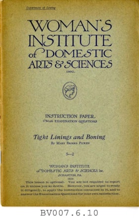
Tight linings and boning
https://search.heritageburnaby.ca/link/museumlibrary4996
- Repository
- Burnaby Village Museum
- Collection
- Special Collection
- Material Type
- Book
- Accession Code
- BV007.6.10
- Call Number
- 646 WOM
- Place of Publication
- Scranton, Pa.
- Publisher
- Education Corp. General
- Publication Date
- 1923
- c1915
- Physical Description
- 43 p. : ill. : 23 cm.
- Inscription
- "This instruction book is not included in your course of study, but is sent to show you just how to prepare your dress form for use. You will not be asked to report on this book." [Typed in purple ink and pasted to first page]
- Library Subject (LOC)
- Dressmaking
- Sewing
- Linings (Sewing)
- Woman's Institute of Domestic Arts and Sciences
- Subjects
- Documentary Artifacts - Booklets
- Object History
- Home sewing course used by Burnaby residents in the 1920's
- Notes
- "Department of sewing" -- cover
- "Instruction paper with examination questions ; 5-2" -- Cover
- "This lesson is optional. You are not required to report on it unless you so desire. However, you are urged to study it diligently, to apply the instruction contained in it, and to answer the Examination Questions for your own satisfaction." -- Cover
Images


Waplington and Fleming families album series
https://search.heritageburnaby.ca/link/museumdescription18958
- Repository
- Burnaby Village Museum
- Date
- [1900-2004]
- Collection/Fonds
- Waplington family fonds
- Description Level
- Series
- Physical Description
- 1 album (88 photographs, textual records, graphic material)
- Scope and Content
- Series consists of an album about the Waplington and Fleming families. The album contains photographs, family documents, stories, poems, biographies and genealogy about family members.
- Repository
- Burnaby Village Museum
- Collection/Fonds
- Waplington family fonds
- Description Level
- Series
- Physical Description
- 1 album (88 photographs, textual records, graphic material)
- Scope and Content
- Series consists of an album about the Waplington and Fleming families. The album contains photographs, family documents, stories, poems, biographies and genealogy about family members.
- Date
- [1900-2004]
- Media Type
- Photograph
- Textual Record
- Graphic Material
- Notes
- Title based on contents of series
The Waplingtons and Flemings
https://search.heritageburnaby.ca/link/museumdescription4027
- Repository
- Burnaby Village Museum
- Date
- [1911] - 2002
- Collection/Fonds
- Waplington family fonds
- Description Level
- File
- Physical Description
- 1 album (77 photographs + textual records + ephemera)
- Scope and Content
- File consists of an album about the Waplington and Fleming families. The album contains photographs, original family documents; including marriage and birth certificates and school awards, report cards and diplomas, a family tree as well as histories, stories, poems and biographies about the family…
- Repository
- Burnaby Village Museum
- Collection/Fonds
- Waplington family fonds
- Description Level
- File
- Physical Description
- 1 album (77 photographs + textual records + ephemera)
- Scope and Content
- File consists of an album about the Waplington and Fleming families. The album contains photographs, original family documents; including marriage and birth certificates and school awards, report cards and diplomas, a family tree as well as histories, stories, poems and biographies about the family. John (Jack) Bancroft Waplington and Sarah Alice Cogswell Waplington (nee Nickerson) were the owners of the house and property located at 3813 Deer Lake Avenue from 1925 to 1946. Ray and Frances Louise Fleming (nee Waplington) owned the home from 1947 to 1958. In 1959 the Burnaby Municipality purchased the Fleming property at this location and rented it out for several years prior to it's demolition around 1970 to make way for Burnaby Heritage Village.
- Names
- Waplington, John "Jack"
- Waplington, Sarah Alice Cogswell Nickerson "Cutie"
- Fleming, John Reyland "Ray"
- Fleming, John "Jack" Reyland
- Ehlers, Edith "Edie" Fleming
- Fleming, Frances "Fanny" Waplington
- Accession Code
- BV016.46.52
- Date
- [1911] - 2002
- Media Type
- Textual Record
- Photograph
- Notes
- Title based on contents of file
- Photographs are described at item level. Photographs and documents were removed from Family history album for conservation purposes