More like '6100 Block Kathleen Avenue'
Narrow Results By

Barnet Road
https://search.heritageburnaby.ca/link/archivedescription35635
- Repository
- City of Burnaby Archives
- Date
- 1921 (date of original), copied 1986
- Collection/Fonds
- Burnaby Historical Society fonds
- Description Level
- Item
- Physical Description
- 1 photograph : b&w ; 12.7 x 17.8 cm print
- Scope and Content
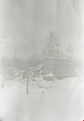
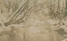
- Photograph of Barnet Road covered with November snows. The road was always treacherous in winter with snow and rock slides. In the upper right corner of the photograph is Barnet School and caretaker's cottage. Barnet School was located at 7820 Barnet Road.
- Repository
- City of Burnaby Archives
- Date
- 1921 (date of original), copied 1986
- Collection/Fonds
- Burnaby Historical Society fonds
- Subseries
- Pioneer Tales subseries
- Physical Description
- 1 photograph : b&w ; 12.7 x 17.8 cm print
- Description Level
- Item
- Record No.
- 204-493
- Access Restriction
- No restrictions
- Reproduction Restriction
- No known restrictions
- Accession Number
- BHS1988-03
- Scope and Content
- Photograph of Barnet Road covered with November snows. The road was always treacherous in winter with snow and rock slides. In the upper right corner of the photograph is Barnet School and caretaker's cottage. Barnet School was located at 7820 Barnet Road.
- Names
- Barnet School
- Media Type
- Photograph
- Notes
- Title based on contents of photograph
- Geographic Access
- Barnet Road
- Street Address
- 7820 Barnet Road
- Historic Neighbourhood
- Barnet (Historic Neighbourhood)
- Planning Study Area
- Burnaby Mountain Area
Images


Road cleared through a forest
https://search.heritageburnaby.ca/link/archivedescription34400
- Repository
- City of Burnaby Archives
- Date
- 1926
- Collection/Fonds
- Burnaby Historical Society fonds
- Description Level
- Item
- Physical Description
- 1 photograph : b&w ; 6.5 x 10 cm on page 17.5 x 26.5 cm
- Scope and Content
- Photograph of a roadway that has been cut through the forest. Tree stumps are lining the road and the ground is covered with snow. A caption adjacent to the photograph reads "Tony's Work." This photograph appears to have been taken by Arthur Peers, who travelled through the Fraser River Valley and…
- Repository
- City of Burnaby Archives
- Date
- 1926
- Collection/Fonds
- Burnaby Historical Society fonds
- Subseries
- Peers family subseries
- Physical Description
- 1 photograph : b&w ; 6.5 x 10 cm on page 17.5 x 26.5 cm
- Description Level
- Item
- Record No.
- 020-107
- Access Restriction
- No restrictions
- Reproduction Restriction
- No known restrictions
- Accession Number
- BHS2007-04
- Scope and Content
- Photograph of a roadway that has been cut through the forest. Tree stumps are lining the road and the ground is covered with snow. A caption adjacent to the photograph reads "Tony's Work." This photograph appears to have been taken by Arthur Peers, who travelled through the Fraser River Valley and worked on the construction of the Trans-Provincial Highway during the later 1920s.
- Media Type
- Photograph
- Photographer
- Peers, Arthur Francis "Mike"
- Notes
- Title based on contents of photograph
Images

![Allanson family home, [192-] (date of original), copied 1986 thumbnail](/media/hpo/_Data/_Archives_Images/_Unrestricted/204/204-652.jpg?width=280)
Allanson family home
https://search.heritageburnaby.ca/link/archivedescription35794
- Repository
- City of Burnaby Archives
- Date
- [192-] (date of original), copied 1986
- Collection/Fonds
- Burnaby Historical Society fonds
- Description Level
- Item
- Physical Description
- 1 photograph : b&w ; 12.7 x 17.8 cm print
- Scope and Content
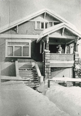
- Photograph of the Allanson family home, 12 Warwick Avenue, Capitol Hill, North Burnaby.
- Repository
- City of Burnaby Archives
- Date
- [192-] (date of original), copied 1986
- Collection/Fonds
- Burnaby Historical Society fonds
- Subseries
- Pioneer Tales subseries
- Physical Description
- 1 photograph : b&w ; 12.7 x 17.8 cm print
- Description Level
- Item
- Record No.
- 204-652
- Access Restriction
- No restrictions
- Reproduction Restriction
- No known restrictions
- Accession Number
- BHS1988-03
- Scope and Content
- Photograph of the Allanson family home, 12 Warwick Avenue, Capitol Hill, North Burnaby.
- Media Type
- Photograph
- Notes
- Title based on contents of photograph
- Geographic Access
- Warwick Avenue
- Street Address
- 12 Warwick Avenue
- Historic Neighbourhood
- Capitol Hill (Historic Neighbourhood)
- Planning Study Area
- Capitol Hill Area
Images
![Allanson family home, [192-] (date of original), copied 1986 thumbnail](/media/hpo/_Data/_Archives_Images/_Unrestricted/204/204-652.jpg)
Boberg family home
https://search.heritageburnaby.ca/link/archivedescription35771
- Repository
- City of Burnaby Archives
- Date
- 1922 (date of original), copied 1986
- Collection/Fonds
- Burnaby Historical Society fonds
- Description Level
- Item
- Physical Description
- 1 photograph : b&w ; 12.7 x 17.8 cm print
- Scope and Content
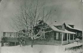
- Photograph of the first Boberg family home after a heavy snowfall, on Douglas Road in the Still Creek lowlands where the creek flows into Burnaby Lake. The Bobergs moved here in 1920.
- Repository
- City of Burnaby Archives
- Date
- 1922 (date of original), copied 1986
- Collection/Fonds
- Burnaby Historical Society fonds
- Subseries
- Pioneer Tales subseries
- Physical Description
- 1 photograph : b&w ; 12.7 x 17.8 cm print
- Description Level
- Item
- Record No.
- 204-629
- Access Restriction
- No restrictions
- Reproduction Restriction
- No known restrictions
- Accession Number
- BHS1988-03
- Scope and Content
- Photograph of the first Boberg family home after a heavy snowfall, on Douglas Road in the Still Creek lowlands where the creek flows into Burnaby Lake. The Bobergs moved here in 1920.
- Media Type
- Photograph
- Notes
- Title based on contents of photograph
- Historic Neighbourhood
- Burnaby Lake (Historic Neighbourhood)
- Planning Study Area
- Ardingley-Sprott Area
Images

![Bob Peers shovelling snow, [1929] thumbnail](/media/hpo/_Data/_Archives_Images/_Unrestricted/477/477-318.jpg?width=280)
Bob Peers shovelling snow
https://search.heritageburnaby.ca/link/archivedescription38999
- Repository
- City of Burnaby Archives
- Date
- [1929]
- Collection/Fonds
- Peers Family and Hill Family fonds
- Description Level
- Item
- Physical Description
- 1 photograph : b&w ; 6 x 10.5 cm on page 13.5 x 18.5 cm (pasted in album)
- Scope and Content
- Photograph of Bob Peers shovelling snow outside of house. His son Robert is standing to the right, wearing winter coat and hat. This photograph was likely taken at the home of Claude and Annie Hill, parents of Bob's wife Kitty.
- Repository
- City of Burnaby Archives
- Date
- [1929]
- Collection/Fonds
- Peers Family and Hill Family fonds
- Physical Description
- 1 photograph : b&w ; 6 x 10.5 cm on page 13.5 x 18.5 cm (pasted in album)
- Description Level
- Item
- Record No.
- 477-318
- Access Restriction
- No restrictions
- Reproduction Restriction
- No known restrictions
- Accession Number
- 2007-12
- Scope and Content
- Photograph of Bob Peers shovelling snow outside of house. His son Robert is standing to the right, wearing winter coat and hat. This photograph was likely taken at the home of Claude and Annie Hill, parents of Bob's wife Kitty.
- Media Type
- Photograph
- Notes
- Title based on contents of photograph
- Geographic Access
- Deer Lake Avenue
- Street Address
- 6570 Deer Lake Avenue
- Historic Neighbourhood
- Burnaby Lake (Historic Neighbourhood)
- Planning Study Area
- Douglas-Gilpin Area
Images
![Bob Peers shovelling snow, [1929] thumbnail](/media/hpo/_Data/_Archives_Images/_Unrestricted/477/477-318.jpg)
Butler family home
https://search.heritageburnaby.ca/link/archivedescription35477
- Repository
- City of Burnaby Archives
- Date
- 1928 (date of original), copied 1986
- Collection/Fonds
- Burnaby Historical Society fonds
- Description Level
- Item
- Physical Description
- 1 photograph : b&w ; 12.7 x 17.8 cm print
- Scope and Content
- Photograph of the Butler family home at 7790 Buller Avenue in the snow. This was the home of Edwin Butler, his wife Margaret Butler, and their children.
- Repository
- City of Burnaby Archives
- Date
- 1928 (date of original), copied 1986
- Collection/Fonds
- Burnaby Historical Society fonds
- Subseries
- Pioneer Tales subseries
- Physical Description
- 1 photograph : b&w ; 12.7 x 17.8 cm print
- Description Level
- Item
- Record No.
- 204-335
- Access Restriction
- No restrictions
- Reproduction Restriction
- No known restrictions
- Accession Number
- BHS1988-03
- Scope and Content
- Photograph of the Butler family home at 7790 Buller Avenue in the snow. This was the home of Edwin Butler, his wife Margaret Butler, and their children.
- Media Type
- Photograph
- Notes
- Title based on contents of photograph
- Geographic Access
- Buller Avenue
- Street Address
- 7790 Buller Avenue
- Historic Neighbourhood
- Alta-Vista (Historic Neighbourhood)
- Planning Study Area
- Clinton-Glenwood Area
Images

Hardie family home
https://search.heritageburnaby.ca/link/archivedescription35494
- Repository
- City of Burnaby Archives
- Date
- 1926 (date of original), copied 1986
- Collection/Fonds
- Burnaby Historical Society fonds
- Description Level
- Item
- Physical Description
- 1 photograph : b&w ; 12.7 x 17.8 cm print
- Scope and Content
- Photograph of the Hardie family home in wintertime. The house was located at 2930 McKee Street (later renumbered 5850 McKee Street) and was the home of Archie and Marie Hardie and their children: Sabra, Helen, Fred, Ella, Evelyn, and Bea.
- Repository
- City of Burnaby Archives
- Date
- 1926 (date of original), copied 1986
- Collection/Fonds
- Burnaby Historical Society fonds
- Subseries
- Pioneer Tales subseries
- Physical Description
- 1 photograph : b&w ; 12.7 x 17.8 cm print
- Description Level
- Item
- Record No.
- 204-352
- Access Restriction
- No restrictions
- Reproduction Restriction
- No known restrictions
- Accession Number
- BHS1988-03
- Scope and Content
- Photograph of the Hardie family home in wintertime. The house was located at 2930 McKee Street (later renumbered 5850 McKee Street) and was the home of Archie and Marie Hardie and their children: Sabra, Helen, Fred, Ella, Evelyn, and Bea.
- Media Type
- Photograph
- Notes
- Title based on contents of photograph
- Geographic Access
- McKee Street
- Street Address
- 5850 McKee Street
- Historic Neighbourhood
- Alta-Vista (Historic Neighbourhood)
- Planning Study Area
- Clinton-Glenwood Area
Images

House at 5040 Sperling Avenue
https://search.heritageburnaby.ca/link/archivedescription39320
- Repository
- City of Burnaby Archives
- Date
- 1922
- Collection/Fonds
- Peers Family and Hill Family fonds
- Description Level
- Item
- Physical Description
- 1 photograph : b&w ; 6 x 9.8 cm on page 24.5 x 32.5 cm (pasted in album)
- Scope and Content
- Photograph of a house covered with snow. This house was built on the property formerly owned by early Burnaby Lake resident, Bernard Hill. Bernard's brother Claude Hill lived here with his family during the 1920s.
- Repository
- City of Burnaby Archives
- Date
- 1922
- Collection/Fonds
- Peers Family and Hill Family fonds
- Physical Description
- 1 photograph : b&w ; 6 x 9.8 cm on page 24.5 x 32.5 cm (pasted in album)
- Description Level
- Item
- Record No.
- 477-639
- Access Restriction
- No restrictions
- Reproduction Restriction
- No known restrictions
- Accession Number
- 2007-12
- Scope and Content
- Photograph of a house covered with snow. This house was built on the property formerly owned by early Burnaby Lake resident, Bernard Hill. Bernard's brother Claude Hill lived here with his family during the 1920s.
- Media Type
- Photograph
- Notes
- Title based on contents of photograph
- Geographic Access
- Sperling Avenue
- Street Address
- 5040 Sperling Avenue
- Historic Neighbourhood
- Burnaby Lake (Historic Neighbourhood)
- Planning Study Area
- Morley-Buckingham Area
Images

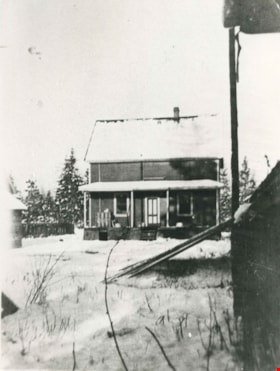
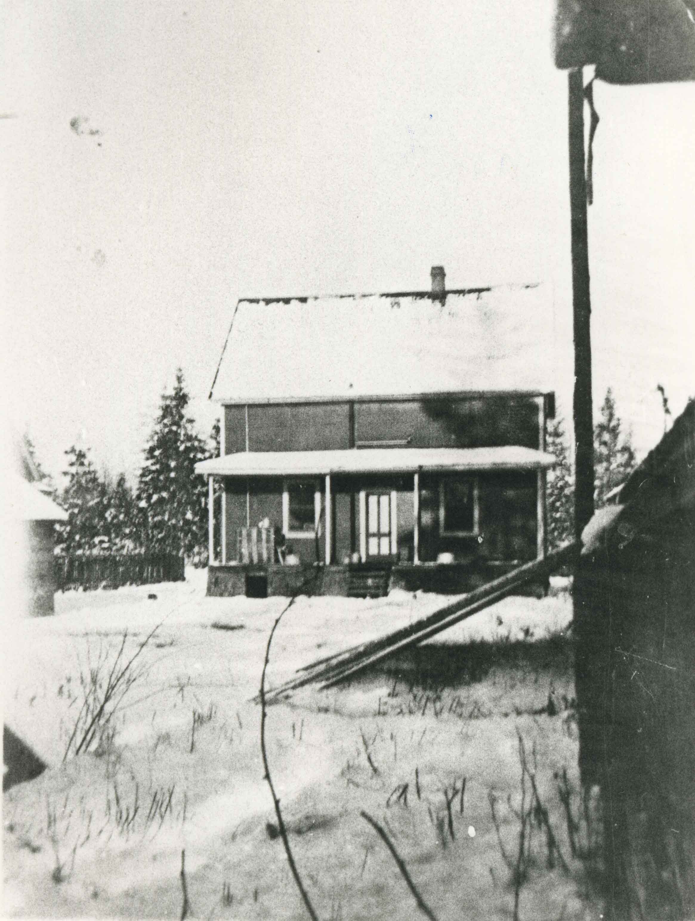
Patience family home
https://search.heritageburnaby.ca/link/archivedescription35574
- Repository
- City of Burnaby Archives
- Date
- 1921 (date of original), copied 1986
- Collection/Fonds
- Burnaby Historical Society fonds
- Description Level
- Item
- Physical Description
- 1 photograph : b&w ; 12.7 x 17.8 cm print
- Scope and Content
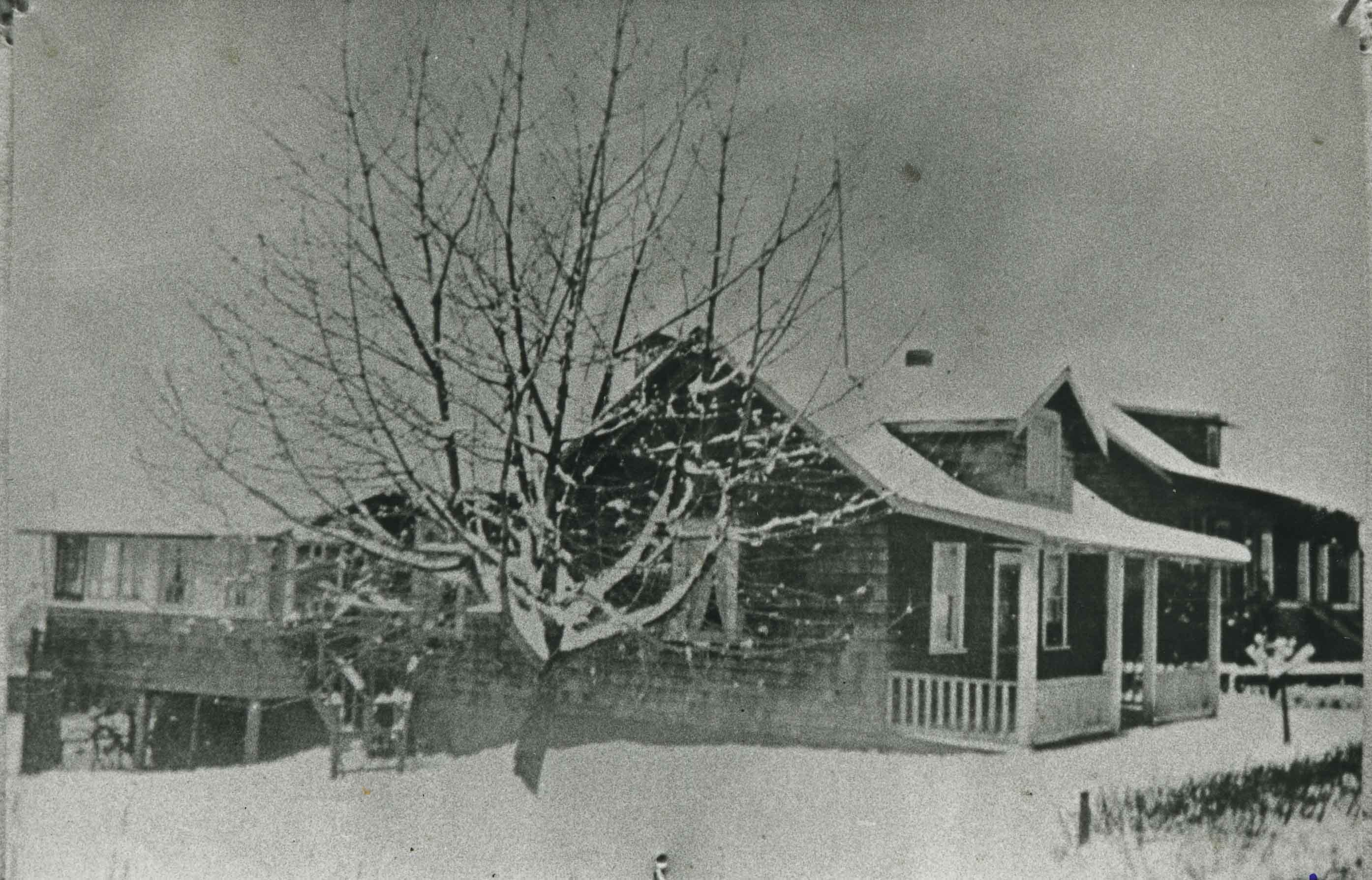
- Photograph of the Patience family home, 240 15th Avenue (later renumbered 8078 15th Avenue), East Burnaby. This photograph was taken during the family's first winter in Burnaby. John Patience (father) had bought an empty house in disrepair and refurbished it little by little. The house had been bui…
- Repository
- City of Burnaby Archives
- Date
- 1921 (date of original), copied 1986
- Collection/Fonds
- Burnaby Historical Society fonds
- Subseries
- Pioneer Tales subseries
- Physical Description
- 1 photograph : b&w ; 12.7 x 17.8 cm print
- Description Level
- Item
- Record No.
- 204-432
- Access Restriction
- No restrictions
- Reproduction Restriction
- No known restrictions
- Accession Number
- BHS1988-03
- Scope and Content
- Photograph of the Patience family home, 240 15th Avenue (later renumbered 8078 15th Avenue), East Burnaby. This photograph was taken during the family's first winter in Burnaby. John Patience (father) had bought an empty house in disrepair and refurbished it little by little. The house had been built in 1910.
- Media Type
- Photograph
- Notes
- Title based on contents of photograph
- Geographic Access
- 15th Avenue
- Street Address
- 8078 15th Avenue
- Historic Neighbourhood
- East Burnaby (Historic Neighbourhood)
- Planning Study Area
- Second Street Area
Images
![Robert in the snow, [1929] thumbnail](/media/hpo/_Data/_Archives_Images/_Unrestricted/477/477-317.jpg?width=280)
Robert in the snow
https://search.heritageburnaby.ca/link/archivedescription38998
- Repository
- City of Burnaby Archives
- Date
- [1929]
- Collection/Fonds
- Peers Family and Hill Family fonds
- Description Level
- Item
- Physical Description
- 1 photograph : b&w ; 6 x 10.5 cm on page 13.5 x 18.5 cm (pasted in album)
- Scope and Content
- Photograph of Robert Peers standing in the snow in front of what appears to be the home of his grandparents, Claude and Annie Hill on Deer Lake Avenue.
- Repository
- City of Burnaby Archives
- Date
- [1929]
- Collection/Fonds
- Peers Family and Hill Family fonds
- Physical Description
- 1 photograph : b&w ; 6 x 10.5 cm on page 13.5 x 18.5 cm (pasted in album)
- Description Level
- Item
- Record No.
- 477-317
- Access Restriction
- No restrictions
- Reproduction Restriction
- No known restrictions
- Accession Number
- 2007-12
- Scope and Content
- Photograph of Robert Peers standing in the snow in front of what appears to be the home of his grandparents, Claude and Annie Hill on Deer Lake Avenue.
- Media Type
- Photograph
- Notes
- Title based on contents of photograph
- Geographic Access
- Deer Lake Avenue
- Street Address
- 6570 Deer Lake Avenue
- Historic Neighbourhood
- Burnaby Lake (Historic Neighbourhood)
- Planning Study Area
- Douglas-Gilpin Area
Images
![Robert in the snow, [1929] thumbnail](/media/hpo/_Data/_Archives_Images/_Unrestricted/477/477-317.jpg)
![Roads and sidewalks, [192-] (date of original), copied 1986 thumbnail](/media/hpo/_Data/_Archives_Images/_Unrestricted/204/204-037.jpg?width=280)
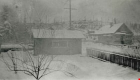
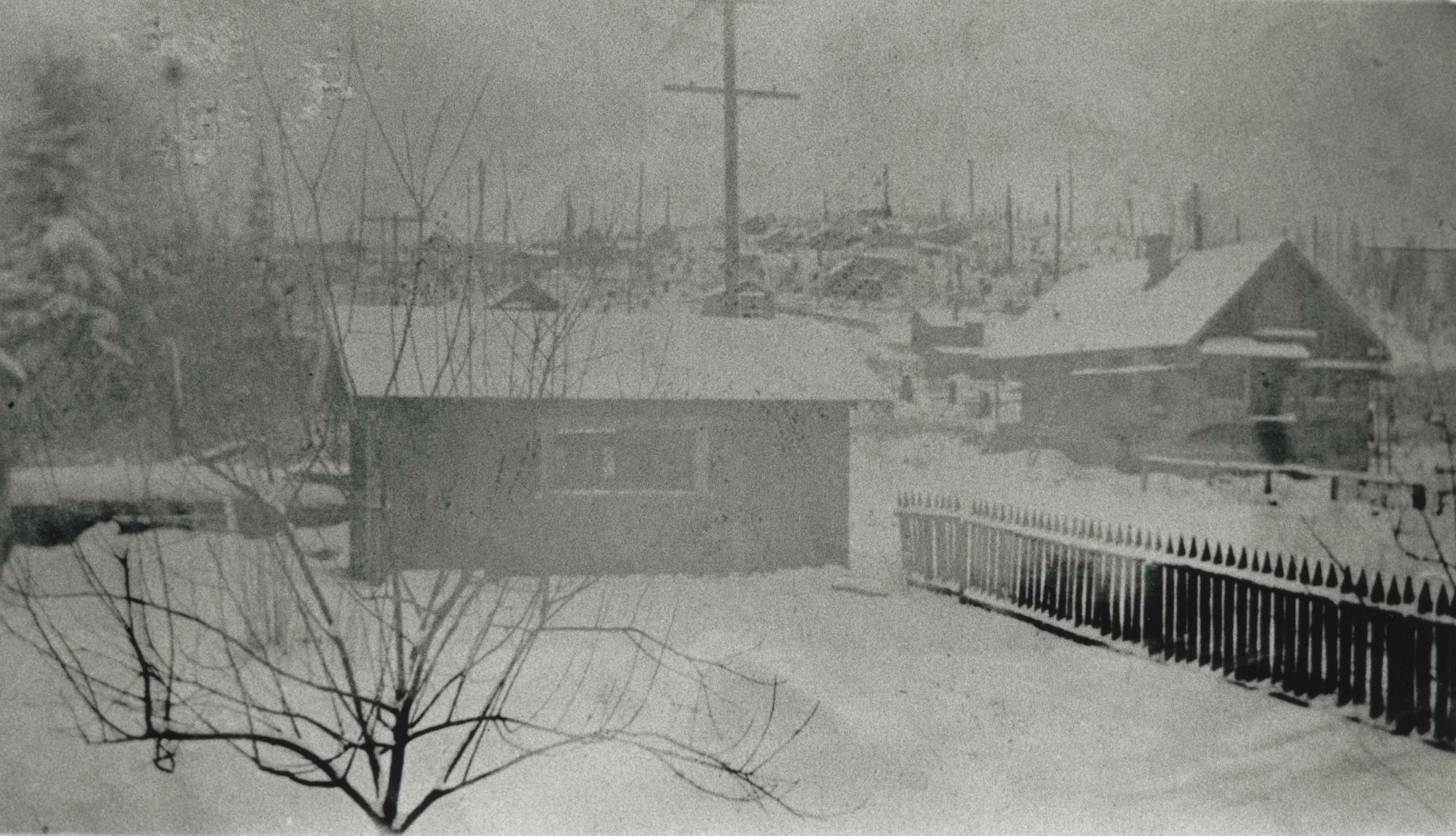
Roads and sidewalks
https://search.heritageburnaby.ca/link/archivedescription35180
- Repository
- City of Burnaby Archives
- Date
- [192-] (date of original), copied 1986
- Collection/Fonds
- Burnaby Historical Society fonds
- Description Level
- Item
- Physical Description
- 1 photograph : b&w ; 12.7 x 17.8 cm print
- Scope and Content
- Photograph of dirt roads and sidewalks in Burnaby in the 1920s. George Pearson supervised cement sidewalk building throughout Burnaby during the Great Depression. St. Helen's Roman Catholic Church may be in the background.
- Repository
- City of Burnaby Archives
- Date
- [192-] (date of original), copied 1986
- Collection/Fonds
- Burnaby Historical Society fonds
- Subseries
- Pioneer Tales subseries
- Physical Description
- 1 photograph : b&w ; 12.7 x 17.8 cm print
- Description Level
- Item
- Record No.
- 204-037
- Access Restriction
- No restrictions
- Reproduction Restriction
- No known restrictions
- Accession Number
- BHS1988-03
- Scope and Content
- Photograph of dirt roads and sidewalks in Burnaby in the 1920s. George Pearson supervised cement sidewalk building throughout Burnaby during the Great Depression. St. Helen's Roman Catholic Church may be in the background.
- Subjects
- Geographic Features - Sidewalks
- Geographic Features - Roads
- Buildings - Residential - Houses
- Media Type
- Photograph
- Notes
- Title based on contents of photograph
Images
![Roads and sidewalks, [192-] (date of original), copied 1986 thumbnail](/media/hpo/_Data/_Archives_Images/_Unrestricted/204/204-037.jpg)

Bridge over a frozen river
https://search.heritageburnaby.ca/link/archivedescription34449
- Repository
- City of Burnaby Archives
- Date
- 1925
- Collection/Fonds
- Burnaby Historical Society fonds
- Description Level
- Item
- Physical Description
- 1 photograph : sepia ; 6.1 x 11.8 cm
- Scope and Content
- Photograph of a railroad bridge spanning a river that has frozen over.
- Repository
- City of Burnaby Archives
- Date
- 1925
- Collection/Fonds
- Burnaby Historical Society fonds
- Subseries
- Peers family subseries
- Physical Description
- 1 photograph : sepia ; 6.1 x 11.8 cm
- Description Level
- Item
- Record No.
- 020-156
- Access Restriction
- No restrictions
- Reproduction Restriction
- No known restrictions
- Accession Number
- BHS2007-04
- Scope and Content
- Photograph of a railroad bridge spanning a river that has frozen over.
- Subjects
- Structures - Bridges
- Transportation - Rail
- Natural Phenomena - Snow
- Geographic Features - Rivers
- Media Type
- Photograph
- Notes
- Title based on contents of photograph
Images


Bridge over Deer Lake Brook
https://search.heritageburnaby.ca/link/archivedescription39323
- Repository
- City of Burnaby Archives
- Date
- 1922
- Collection/Fonds
- Peers Family and Hill Family fonds
- Description Level
- Item
- Physical Description
- 1 photograph : b&w ; 6.2 x 9.8 cm on page 24.5 x 32.5 cm (pasted in album)
- Scope and Content
- Photograph of a bridge over Deer Lake Brook, covered with snow. This photograph was probably taken on the property belonging to Claude Hill, known as "Brookfield."
- Repository
- City of Burnaby Archives
- Date
- 1922
- Collection/Fonds
- Peers Family and Hill Family fonds
- Physical Description
- 1 photograph : b&w ; 6.2 x 9.8 cm on page 24.5 x 32.5 cm (pasted in album)
- Description Level
- Item
- Record No.
- 477-642
- Access Restriction
- No restrictions
- Reproduction Restriction
- No known restrictions
- Accession Number
- 2007-12
- Scope and Content
- Photograph of a bridge over Deer Lake Brook, covered with snow. This photograph was probably taken on the property belonging to Claude Hill, known as "Brookfield."
- Media Type
- Photograph
- Notes
- Title based on contents of photograph
- Geographic Access
- Deer Lake Brook
- Deer Lake Avenue
- Street Address
- 6501 Deer Lake Avenue
- Historic Neighbourhood
- Burnaby Lake (Historic Neighbourhood)
- Planning Study Area
- Morley-Buckingham Area
Images

Capitol Hill neighborhood
https://search.heritageburnaby.ca/link/archivedescription35792
- Repository
- City of Burnaby Archives
- Date
- 1923 (date of original), copied 1986
- Collection/Fonds
- Burnaby Historical Society fonds
- Description Level
- Item
- Physical Description
- 1 photograph : b&w ; 12.7 x 17.8 cm print
- Scope and Content
- Photograph of the Capitol Hill neighborhood taken from Bob Benson's home, 5 Fell Avenue and Dundas Street, looking towards the top of Capitol Hill.
- Repository
- City of Burnaby Archives
- Date
- 1923 (date of original), copied 1986
- Collection/Fonds
- Burnaby Historical Society fonds
- Subseries
- Pioneer Tales subseries
- Physical Description
- 1 photograph : b&w ; 12.7 x 17.8 cm print
- Description Level
- Item
- Record No.
- 204-650
- Access Restriction
- No restrictions
- Reproduction Restriction
- No known restrictions
- Accession Number
- BHS1988-03
- Scope and Content
- Photograph of the Capitol Hill neighborhood taken from Bob Benson's home, 5 Fell Avenue and Dundas Street, looking towards the top of Capitol Hill.
- Media Type
- Photograph
- Notes
- Title based on contents of photograph
- Geographic Access
- Fell Avenue
- Street Address
- 5 Fell Avenue
- Historic Neighbourhood
- Capitol Hill (Historic Neighbourhood)
- Planning Study Area
- Capitol Hill Area
Images
Deer Lake Brook
https://search.heritageburnaby.ca/link/archivedescription39321
- Repository
- City of Burnaby Archives
- Date
- 1922
- Collection/Fonds
- Peers Family and Hill Family fonds
- Description Level
- Item
- Physical Description
- 1 photograph : b&w ; 6 x 9.8 cm on page 24.5 x 32.5 cm (pasted in album)
- Scope and Content
- Photograph of Deer Lake Creek; historically known as Deer Lake Brook. The banks and trees are covered with snow.
- Repository
- City of Burnaby Archives
- Date
- 1922
- Collection/Fonds
- Peers Family and Hill Family fonds
- Physical Description
- 1 photograph : b&w ; 6 x 9.8 cm on page 24.5 x 32.5 cm (pasted in album)
- Description Level
- Item
- Record No.
- 477-640
- Access Restriction
- No restrictions
- Reproduction Restriction
- No known restrictions
- Accession Number
- 2007-12
- Scope and Content
- Photograph of Deer Lake Creek; historically known as Deer Lake Brook. The banks and trees are covered with snow.
- Media Type
- Photograph
- Notes
- Title based on contents of photograph
- Geographic Access
- Deer Lake Brook
Images

Tierney's Camp
https://search.heritageburnaby.ca/link/archivedescription34469
- Repository
- City of Burnaby Archives
- Date
- 1926
- Collection/Fonds
- Burnaby Historical Society fonds
- Description Level
- Item
- Physical Description
- 1 photograph : b&w ; 7 x 12.3 cm on page 17.4 x 26.5 cm
- Scope and Content
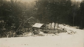
- Photograph of a cabin under construction in a location identified as Emory Creek. The caption accompanying the photograph indicates that cabin belonged to a Mr. Tierney, but no other identification is provided. This photograph appears to have been taken by Arthur Peers, who travelled through the F…
- Repository
- City of Burnaby Archives
- Date
- 1926
- Collection/Fonds
- Burnaby Historical Society fonds
- Subseries
- Peers family subseries
- Physical Description
- 1 photograph : b&w ; 7 x 12.3 cm on page 17.4 x 26.5 cm
- Description Level
- Item
- Record No.
- 020-176
- Access Restriction
- No restrictions
- Reproduction Restriction
- No known restrictions
- Accession Number
- BHS2007-04
- Scope and Content
- Photograph of a cabin under construction in a location identified as Emory Creek. The caption accompanying the photograph indicates that cabin belonged to a Mr. Tierney, but no other identification is provided. This photograph appears to have been taken by Arthur Peers, who travelled through the Fraser River Valley and worked on the construction of the Trans-Provincial Highway during the later 1920s.
- Media Type
- Photograph
- Photographer
- Peers, Arthur Francis "Mike"
- Notes
- Title based on caption accompanying photograph
Images

![Mary Warren and Bill Anthony, [192-] (date of original), copied 1986 thumbnail](/media/hpo/_Data/_Archives_Images/_Unrestricted/204/204-404.jpg?width=280)
Mary Warren and Bill Anthony
https://search.heritageburnaby.ca/link/archivedescription35546
- Repository
- City of Burnaby Archives
- Date
- [192-] (date of original), copied 1986
- Collection/Fonds
- Burnaby Historical Society fonds
- Description Level
- Item
- Physical Description
- 1 photograph : b&w ; 12.7 x 17.8 cm print
- Scope and Content
- Photograph of Mary Warren and Bill Anthony, west of the Warren family home at 4264 Union Street. The street did not extend past the Warren house. A "corduroy" road was used in the early years: split cedar logs placed side by side.
- Repository
- City of Burnaby Archives
- Date
- [192-] (date of original), copied 1986
- Collection/Fonds
- Burnaby Historical Society fonds
- Subseries
- Pioneer Tales subseries
- Physical Description
- 1 photograph : b&w ; 12.7 x 17.8 cm print
- Description Level
- Item
- Record No.
- 204-404
- Access Restriction
- No restrictions
- Reproduction Restriction
- No known restrictions
- Accession Number
- BHS1988-03
- Scope and Content
- Photograph of Mary Warren and Bill Anthony, west of the Warren family home at 4264 Union Street. The street did not extend past the Warren house. A "corduroy" road was used in the early years: split cedar logs placed side by side.
- Media Type
- Photograph
- Notes
- Title based on contents of photograph
- Geographic Access
- Union Street
- Street Address
- 4264 Union Street
- Historic Neighbourhood
- Vancouver Heights (Historic Neighbourhood)
- Planning Study Area
- Willingdon Heights Area
Images
![Mary Warren and Bill Anthony, [192-] (date of original), copied 1986 thumbnail](/media/hpo/_Data/_Archives_Images/_Unrestricted/204/204-404.jpg)
White family home
https://search.heritageburnaby.ca/link/archivedescription35176
- Repository
- City of Burnaby Archives
- Date
- 1920 (date of original), copied 1986
- Collection/Fonds
- Burnaby Historical Society fonds
- Description Level
- Item
- Physical Description
- 1 photograph : b&w ; 12.7 x 17.8 cm print
- Scope and Content
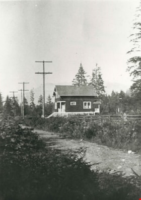
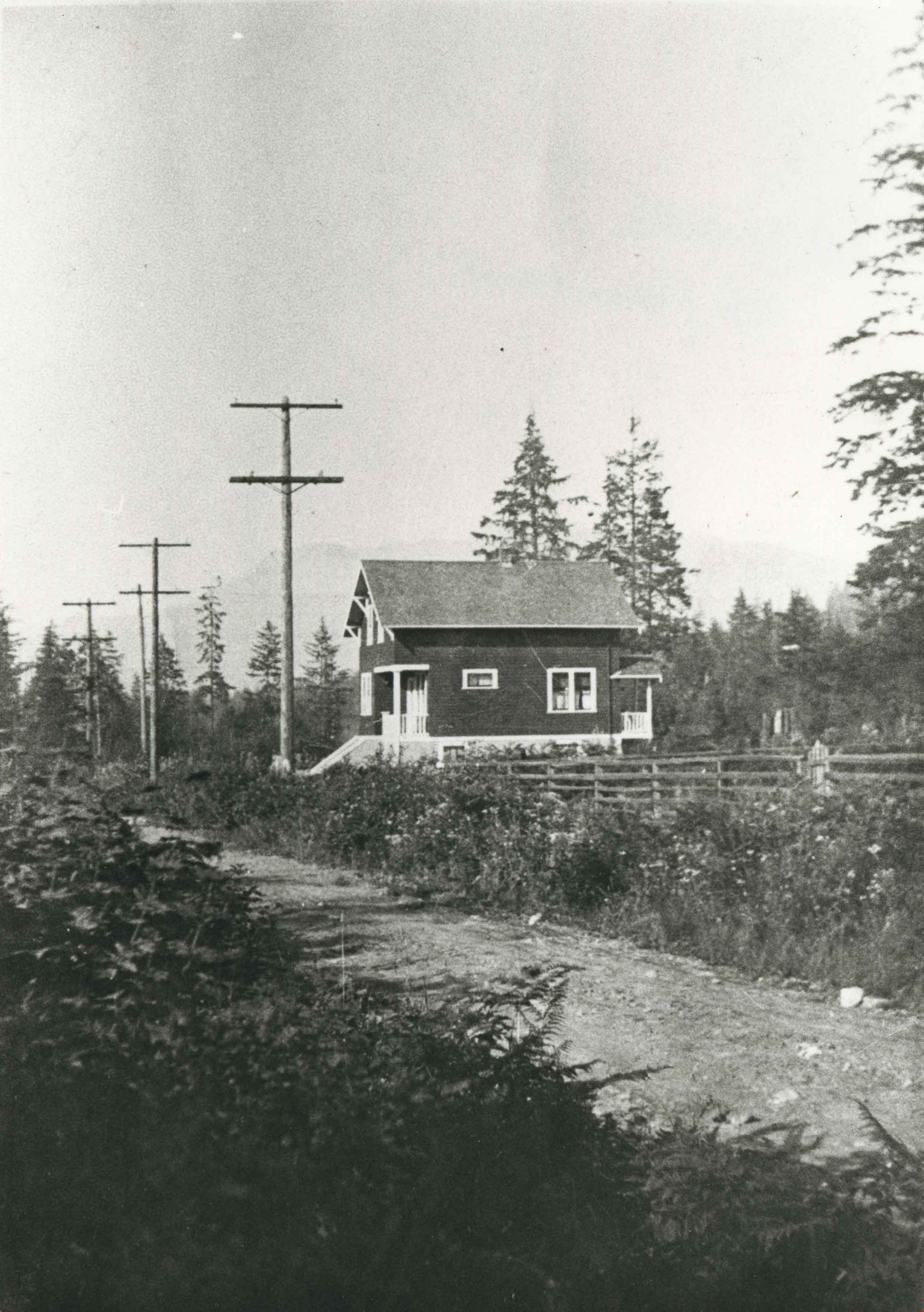
- Photograph of the White family home near the corner of Beta Avenue and Pender Street (506 Beta Avenue) in North Burnaby. The family moved their belongings here with wheelbarrows.
- Repository
- City of Burnaby Archives
- Date
- 1920 (date of original), copied 1986
- Collection/Fonds
- Burnaby Historical Society fonds
- Subseries
- Pioneer Tales subseries
- Physical Description
- 1 photograph : b&w ; 12.7 x 17.8 cm print
- Description Level
- Item
- Record No.
- 204-033
- Access Restriction
- No restrictions
- Reproduction Restriction
- No known restrictions
- Accession Number
- BHS1988-03
- Scope and Content
- Photograph of the White family home near the corner of Beta Avenue and Pender Street (506 Beta Avenue) in North Burnaby. The family moved their belongings here with wheelbarrows.
- Media Type
- Photograph
- Notes
- Title based on contents of photograph
- Geographic Access
- Beta Avenue
- Street Address
- 506 Beta Avenue
- Historic Neighbourhood
- Capitol Hill (Historic Neighbourhood)
- Planning Study Area
- Brentwood Area
Images

Brookes family home, "Normanna"
https://search.heritageburnaby.ca/link/archivedescription35246
- Repository
- City of Burnaby Archives
- Date
- 1927
- Collection/Fonds
- Burnaby Historical Society fonds
- Description Level
- Item
- Physical Description
- 1 photograph : b&w ; 12.7 x 17.8 cm print
- Scope and Content
- Photograph of "Normanna," the Brookes family residence. This new Brookes family home was built in 1927 on the same site as the original house at 441 12th Avenue (later renumbered 7979 12th Avenue). Eventually, this became Normanna Norwegian rest home. The original house was built by Burnaby's firs…
- Repository
- City of Burnaby Archives
- Date
- 1927
- Collection/Fonds
- Burnaby Historical Society fonds
- Subseries
- Pioneer Tales subseries
- Physical Description
- 1 photograph : b&w ; 12.7 x 17.8 cm print
- Description Level
- Item
- Record No.
- 204-103
- Access Restriction
- No restrictions
- Reproduction Restriction
- No known restrictions
- Accession Number
- BHS1988-03
- Scope and Content
- Photograph of "Normanna," the Brookes family residence. This new Brookes family home was built in 1927 on the same site as the original house at 441 12th Avenue (later renumbered 7979 12th Avenue). Eventually, this became Normanna Norwegian rest home. The original house was built by Burnaby's first Reeve, Charles Shaw, and is now a designated heritage site at 7725 4th Street.
- Subjects
- Geographic Features - Gardens
- Buildings - Residential - Houses
- Buildings - Residential - Seniors Housing
- Buildings - Heritage
- Names
- Normanna Rest Home
- Media Type
- Photograph
- Notes
- Title based on contents of photograph
- Geographic Access
- 4th Street
- Street Address
- 7725 4th Street
- Historic Neighbourhood
- East Burnaby (Historic Neighbourhood)
- Planning Study Area
- Second Street Area
Images


Deer Lake
https://search.heritageburnaby.ca/link/archivedescription34297
- Repository
- City of Burnaby Archives
- Date
- 1923
- Collection/Fonds
- Burnaby Historical Society fonds
- Description Level
- Item
- Physical Description
- 1 photograph : sepia
- Scope and Content
- Photograph looking over Deer Lake and snow-covered ground towards buildings and houses. To the left is the cottage and house belonging to the Woodward sisters, Harriet and Maude. The cottage, and later the house, were also used as the Burnaby Lake Post Office and a school run by Harriet Woodward. …
- Repository
- City of Burnaby Archives
- Date
- 1923
- Collection/Fonds
- Burnaby Historical Society fonds
- Subseries
- Peers family subseries
- Physical Description
- 1 photograph : sepia
- Description Level
- Item
- Record No.
- 020-004
- Access Restriction
- No restrictions
- Reproduction Restriction
- No known restrictions
- Accession Number
- BHS2007-04
- Scope and Content
- Photograph looking over Deer Lake and snow-covered ground towards buildings and houses. To the left is the cottage and house belonging to the Woodward sisters, Harriet and Maude. The cottage, and later the house, were also used as the Burnaby Lake Post Office and a school run by Harriet Woodward. At the time of this photograph, it was in use as the Burnaby Lake United Church. In the middle of the picture, numerous boathouses and a diving tower can be seen at the shoreline of the lake. To the right of the copse of trees, on the hill, is the house and post office belonging to the Woodward sisters and right of that is the home built for William J. Walker in 1907 but owned by D.R. Boucher during the 1920s. To the far right the Pole Line Road (later, Sperling Avenue) is visible along with the home of Francis J. Peers, known as Greyfriars.
- Subjects
- Buildings - Heritage
- Buildings - Residential - Houses
- Geographic Features - Lakes and Ponds
- Buildings - Religious - Churches
- Media Type
- Photograph
- Notes
- Title based on caption accompanying photograph
- Geographic Access
- Sperling Avenue
- Deer Lake
- Rugby Street
- Historic Neighbourhood
- Burnaby Lake (Historic Neighbourhood)
- Planning Study Area
- Morley-Buckingham Area
Images
