Narrow Results By

Crabtown
https://search.heritageburnaby.ca/link/landmark674
- Repository
- Burnaby Heritage Planning
- Associated Dates
- 1912-1957
- Heritage Value
- North Burnaby's waterfront was the location of a unique squatter's community known as Crabtown. Although its origins are obscure, it is believed that the first shacks were built before 1912. When the depression of 1913-1917 began, the shacks became permanent homes for impoverished workers. During the Great Depression of the 1930s, the community grew larger. Crabtown was not a slum, but a neighbourhood - the community even rallied together to build a water supply system and trails up the steep bluff with steps and banisters so children could go to school safely. In 1957, the National Harbours Board decided that Crabtown was encroaching on Federal property and evicted all 130 residents. Within a few months, residents were relocated and 114 homes were levelled.
- Historic Neighbourhood
- Vancouver Heights (Historic Neighbourhood)
- Planning Study Area
- Burnaby Heights Area
Images


François & Cezarie Comeau Residence
https://search.heritageburnaby.ca/link/landmark580
- Repository
- Burnaby Heritage Planning
- Description
- Residential building.
- Associated Dates
- c.1925
- Street View URL
- Google Maps Street View
- Repository
- Burnaby Heritage Planning
- Geographic Access
- Esmond Avenue
- Associated Dates
- c.1925
- Description
- Residential building.
- Heritage Value
- This home was built for Francois Xavier “Frank” Comeau (1863-1943), a blacksmith who moved from Quebec to Vancouver in about 1890, and his wife Cezarie Marie (née Fortin, 1860-1950), also from Quebec, whom he married in 1903. Featuring a front gabled roof with decorative triangular eave brackets, this comfortable Craftsman bungalow displays other characteristics typical of the style such as lapped siding at the foundation, a shingle-clad main floor, casement windows and stained glass transoms on the front elevation. The most notable feature of the plan is the inset verandah with subtle segmental-arched openings and tapered square columns.
- Locality
- Vancouver Heights
- Historic Neighbourhood
- Vancouver Heights (Historic Neighbourhood)
- Planning Study Area
- Burnaby Heights Area
- Area
- 566.71
- Contributing Resource
- Building
- Ownership
- Private
- Street Address
- 306 Esmond Avenue
- Street View URL
- Google Maps Street View
Images


George & Rose Nuttall Residence
https://search.heritageburnaby.ca/link/landmark585
- Repository
- Burnaby Heritage Planning
- Description
- Residential building.
- Associated Dates
- 1921
- Other Names
- HILLCREST
- Street View URL
- Google Maps Street View
- Repository
- Burnaby Heritage Planning
- Other Names
- HILLCREST
- Geographic Access
- McGill Street
- Associated Dates
- 1921
- Description
- Residential building.
- Heritage Value
- This house was built for local plumber contractor George Nuttall (1883-1970) and his wife Rose Ann Nuttall (née Clagg, 1881-1955). George continued to live in the house after Rose’s death, until his own death in 1970. Although typical of the Craftsman style and form with its side-gabled roof, triangular eave brackets and front gabled dormer, this house has a number of special details, such as its beautiful art glass transom windows. The front verandah supports are massive stucco columns that contain stained glass lanterns with the house name, Hillcrest, and address.
- Locality
- Vancouver Heights
- Historic Neighbourhood
- Vancouver Heights (Historic Neighbourhood)
- Planning Study Area
- Burnaby Heights Area
- Area
- 566.71
- Contributing Resource
- Building
- Ownership
- Private
- Street Address
- 3756 McGill Street
- Street View URL
- Google Maps Street View
Images


John & Jessie MacLean Residence
https://search.heritageburnaby.ca/link/landmark608
- Repository
- Burnaby Heritage Planning
- Description
- Residential building.
- Associated Dates
- c.1926
- Street View URL
- Google Maps Street View
- Repository
- Burnaby Heritage Planning
- Geographic Access
- Pandora Street
- Associated Dates
- c.1926
- Description
- Residential building.
- Heritage Value
- This cottage illustrates the traditionalism of the interwar years, when domestic ideals were expressed through modest homes displaying period revival influences. Reflecting the influence of the British Arts and Crafts movement, it features a symmetrical plan, a side jerkin-headed roof, a gabled front dormer and twin-coursed shingle siding, and retains its original wooden-sash windows with unusual multi-paned upper sash. It was built for John R. and Jessie MacLean. The house was recently restored by the owners.
- Locality
- Vancouver Heights
- Historic Neighbourhood
- Vancouver Heights (Historic Neighbourhood)
- Planning Study Area
- Burnaby Heights Area
- Area
- 566.71
- Contributing Resource
- Building
- Ownership
- Private
- Street Address
- 3827 Pandora Street
- Street View URL
- Google Maps Street View
Images


Kitchener Elementary School
https://search.heritageburnaby.ca/link/landmark614
- Repository
- Burnaby Heritage Planning
- Description
- School building.
- Associated Dates
- 1925
- Street View URL
- Google Maps Street View
- Repository
- Burnaby Heritage Planning
- Geographic Access
- Gilmore Avenue
- Associated Dates
- 1925
- Description
- School building.
- Heritage Value
- This landmark school was designed by the architectural firm of Bowman & Cullerne, specialists in the design of educational facilities. After Harold Cullerne (1890-1976) returned from service during the First World War, he joined J.H. Bowman (1864-1943) in a partnership that lasted from 1919 to 1934. The firm’s projects include the Seaforth School (1922, now relocated to Burnaby Village Museum), Burnaby North High School (1923), and the Nelson Avenue School (1927). This was originally designed as a two-storey, four-room building in 1925, with two-storey four-room wings added two years later. The building has been altered with the addition of stucco cladding over the original siding and replacement windows, but has retained its original form and massing, as well as its domed roof ventilator.
- Locality
- Vancouver Heights
- Historic Neighbourhood
- Vancouver Heights (Historic Neighbourhood)
- Planning Study Area
- Willingdon Heights Area
- Architect
- Bowman & Cullerne
- Area
- 20478.11
- Contributing Resource
- Building
- Street Address
- 1351 Gilmore Avenue
- Street View URL
- Google Maps Street View
Images


Masonic Cemetery
https://search.heritageburnaby.ca/link/landmark622
- Repository
- Burnaby Heritage Planning
- Description
- Cemetery site.
- Associated Dates
- 1924
- Street View URL
- Google Maps Street View
- Repository
- Burnaby Heritage Planning
- Geographic Access
- Halifax Street
- Associated Dates
- 1924
- Description
- Cemetery site.
- Heritage Value
- Tucked into a sloping site in a zone that is now transitional between light industrial and residential uses, the Masonic Cemetery is a beautifully landscaped oasis. Two outstanding features of this cemetery are the Woodward mausoleum, constructed in 1924, and the 1930s entrance gates. These substantial gates are constructed of random-coursed granite, and mark the cemetery’s main entrance off Douglas Road. An elaborate granite mausoleum, built for the prominent Woodward family, is located on axis with the main entry, at the brow of the slope. The Egyptian Revival style of the mausoleum was inspired by the opening of Tutankamun’s tomb just two years earlier, a discovery that sparked world-wide Egyptomania. The Woodward’s department store dynasty was founded by Charles Woodward (1852-1937), who visited Vancouver in 1891 and bought two lots for a store. Woodward’s drug department opened in 1895. In 1901, he took an option on a lot at the corner of Hastings and Abbott Streets and incorporated as Woodward’s Department Stores, which opened in November 1903. The family continued to run the business until 1993, when it went bankrupt and was sold to the Hudson’s Bay Company. A number of the Woodward family are interred here.
- Locality
- Vancouver Heights
- Historic Neighbourhood
- Vancouver Heights (Historic Neighbourhood)
- Planning Study Area
- Willingdon Heights Area
- Area
- 60137.87
- Contributing Resource
- Building
- Landscape Feature
- Ownership
- Private
- Street Address
- 4305 Halifax Street
- Street View URL
- Google Maps Street View
Images


Rosser Elementary School
https://search.heritageburnaby.ca/link/landmark636
- Repository
- Burnaby Heritage Planning
- Description
- School building.
- Associated Dates
- 1923
- Other Names
- NORTH BURNABY HIGH SCHOOL
- Street View URL
- Google Maps Street View
- Repository
- Burnaby Heritage Planning
- Other Names
- NORTH BURNABY HIGH SCHOOL
- Geographic Access
- Pandora Street
- Associated Dates
- 1923
- Description
- School building.
- Heritage Value
- Originally built as North Burnaby High School, this eight-room school became Rosser Avenue School in 1945. It has been altered with replacement windows, the application of stucco over the original siding and an addition, but has retained its historical form, including a hipped roof with half-timbered gables and a domed roof ventilator. The Rosser Elementary School was designed by the architectural firm of Bowman & Cullerne, who specialized in school design. The firm’s projects include Seaforth School (1922, now relocated to Burnaby Village Museum), Windsor Street School (1923), and Nelson Avenue School (1927).
- Locality
- Vancouver Heights
- Historic Neighbourhood
- Vancouver Heights (Historic Neighbourhood)
- Planning Study Area
- Burnaby Heights Area
- Architect
- Bowman and Cullerne
- Area
- 10579.94
- Contributing Resource
- Building
- Street Address
- 4375 Pandora Street
- Street View URL
- Google Maps Street View
Images


Vancouver Heights Neighbourhood
https://search.heritageburnaby.ca/link/landmark666
- Repository
- Burnaby Heritage Planning
- Associated Dates
- 1925-1954
- Heritage Value
- Vancouver Heights remained an important residential and commercial centre in Burnaby throughout the 1925-1954 period. The area had its own Board of Trade and the North Burnaby Library was created to serve the residents. In 1949, the Hastings streetcars stopped running, but the area retained its reputation as one of the best shopping districts in the city.
- Historic Neighbourhood
- Vancouver Heights (Historic Neighbourhood)
- Planning Study Area
- Burnaby Heights Area
Images


Vancouver Heights Neighbourhood
https://search.heritageburnaby.ca/link/landmark741
- Repository
- Burnaby Heritage Planning
- Associated Dates
- 1905-1924
- Heritage Value
- On December 13, 1912, The British Columbian Weekly described the Vancouver Heights neighbourhood as follows: "The northern portion of the municipality in the vicinity of Boundary Road has during the past three years made tremendous strides towards settlement. At that time Mr. James Herd and Mr. Peters were the only residents of the district...Soon, however, the timber was removed, streets laid out and other conveniences such as water, light and transportation provided... The school population of the district has increased so rapidly that the school has been enlarged twice this year and is at the present time inadequate. About 200 children are attending now. There are three churches in the district and one mission...At present time there are two large blocks containing six stores..."
- Historic Neighbourhood
- Vancouver Heights (Historic Neighbourhood)
- Planning Study Area
- Burnaby Heights Area
Images


Vancouver Heights United Church
https://search.heritageburnaby.ca/link/landmark648
- Repository
- Burnaby Heritage Planning
- Description
- Church building.
- Associated Dates
- 1926
- Street View URL
- Google Maps Street View
- Repository
- Burnaby Heritage Planning
- Geographic Access
- Ingleton Avenue
- Associated Dates
- 1926
- Description
- Church building.
- Heritage Value
- This building was originally built in 1926 as the Vancouver Heights United Church; a Sunday School was added in 1931, which conformed to the church building’s Romanesque influenced style. This unique Burnaby building has retained its remarkable three-storey tower with buttresses and stepped parapet. It now houses the New Apostolic Church.
- Locality
- Vancouver Heights
- Historic Neighbourhood
- Vancouver Heights (Historic Neighbourhood)
- Planning Study Area
- Burnaby Heights Area
- Area
- 1133.42
- Contributing Resource
- Building
- Ownership
- Private
- Street Address
- 271 Ingleton Avenue
- Street View URL
- Google Maps Street View
Images


Eating your way through Burnaby: A look at Chinese Canadian history through food
https://search.heritageburnaby.ca/link/museumdescription14762
- Repository
- Burnaby Village Museum
- Date
- 27 Oct. 2020
- Collection/Fonds
- Burnaby Village Museum fonds
- Description Level
- Item
- Physical Description
- 1 video recording (mp4) (61 min., 56 sec.) : digital, col., sd., stereo ; 29 fps
- Scope and Content
- Item consists of a video recording of a live Zoom webinar hosted by Kate Petrusa, Burnaby Village Museum assistant curator. The webinar is titled "Eating your way through Burnaby: A look at Chinese Canadian history through food" and is presented by Denise Fong, Planning Assistant for the City of Bu…
- Repository
- Burnaby Village Museum
- Collection/Fonds
- Burnaby Village Museum fonds
- Description Level
- Item
- Physical Description
- 1 video recording (mp4) (61 min., 56 sec.) : digital, col., sd., stereo ; 29 fps
- Material Details
- Presenter: Denise Fong
- Host: Kate Petrusa
- Date of Presentation: October 27 7:00 pm - 8:00 pm
- Total Number of tracks: 1
- Total Length of all tracks:61 min., 56 sec.
- Recording Device: Zoom video communication platform
- Scope and Content
- Item consists of a video recording of a live Zoom webinar hosted by Kate Petrusa, Burnaby Village Museum assistant curator. The webinar is titled "Eating your way through Burnaby: A look at Chinese Canadian history through food" and is presented by Denise Fong, Planning Assistant for the City of Burnaby. The zoom webinar is the seventh in a collection of seven "Burnaby Neighbourhood Speaker series" webinars that were presented and made available to the public between September 29 and October 27, 2020. The live webinar and recording was also made available on the Burnaby Village Museum's facebook page. In this webinar, Denise Fong talks about how Chinese Canadians have played a key role in supplying food to Burnaby’s community through their participation in the local market gardening, green grocer, and restaurant industries. The presentation is supported with historical maps, photographs, documents, census records and stories from recent research on the 1960s-1970s period in Burnaby’s Big Bend and Capitol Hill neighborhoods. In her presentation, Denise also talks about the history of Chinese Immigration in Canada including the political circumstances and legal barriers that Chinese migrants faced in the late nineteenth to early twentieth century. Denise highlights specific Chinese Canadian family farms in Burnaby including; the Jung family farm located on 5460 Douglas Road operated by Jung Chong and his wife Jung Gee Shee; "Hop On Farms" located on Marine Drive, operated by Chan Kow Hong, Sui Ha Hong and family; the Tong Yip Farm located on Byrne Road operated by D.T. "George" Yip and his wife, Yip Chow Won Tai. Denise also highlights her recent research regarding Chinese Canadian corner stores and green grocers in Burnaby including; The Lee Kee grocery store located at 3824 East Hastings Street, owned and operated by Yow Lee Ko and his wife Say Jan Chan; the Burnaby Market located at 3942 East Hastings Street, owned and operated by Chin Yin Wong; the Quon Bros. located at 3702 East Hastings Street.; Y. Hoy Produce Co. located at 4092 East Hastings Street operated by Hoy Yen; Louie's Food Basket located at 5886 South East Marine Drive operated by Hoy Bew Louie, his wife Poy Yee and later by thier son Bing Louie and Tommy's Market located in Burnaby's Edmonds neighbourhood, operated by Tommy Chu. Denise also provides a detailed history of Tommy Chu and family who owned and operated Tommy's Market. Denise tells of how in the early 1970s, Chinese grocers in the lower mainland came together and formed the Lower Mainland Independent Grocers Association and Lower Mainland Grocers Co-Op. The organization was formed to protect the rights and promote businesses of independent grocers. In closing, Denise explains how her research of Chinese Canadian history in Burnaby continues and by the end of the project, the information will be made accessible in the form of a publication.
- Creator
- Burnaby Village Museum
- Subjects
- Persons - Chinese Canadians
- Social Issues - Discrimination
- Agriculture - Farms
- Social Issues - Racism
- Buildings - Commercial - Grocery Stores
- Names
- Fong, Denise
- Jung, Chung Chong
- Tommy's Produce
- Lee Kee Grocery
- Louie's Food Basket
- Louie, Hoy Bew
- Jung, Gee Shee
- Hong, Chan Kow
- Hong, Sui Ha
- Yip, D.T. "George"
- Yip, Chow Won Tai
- Ko, Yow Lee
- Ko, Chan Say Jan
- Burnaby Market
- Wong, Chin Yin
- Quon Bros.
- Y. Hoy Produce Co.
- Yen, Hoy
- Louie, Poy Yee
- Louie, Bing
- Chu, Tommy
- Chu, Sharon
- Chu, Calvin
- Responsibility
- Petrusa, Kate
- Geographic Access
- Hastings Street
- Accession Code
- BV020.29.7
- Access Restriction
- No restrictions
- Reproduction Restriction
- No known restrictions
- Date
- 27 Oct. 2020
- Media Type
- Moving Images
- Historic Neighbourhood
- Fraser Arm (Historic Neighbourhood)
- Vancouver Heights (Historic Neighbourhood)
- Planning Study Area
- Big Bend Area
- Burnaby Heights Area
- Notes
- Title based on contents of video recording
- Video recording was edited for publication on Heritage Burnaby. Original mp4 video recording (BV020.29.7.1) is 72 min., 14 sec.
Images

Video
Eating your way through Burnaby: A look at Chinese Canadian history through food, 27 Oct. 2020
Eating your way through Burnaby: A look at Chinese Canadian history through food, 27 Oct. 2020
https://search.heritageburnaby.ca/media/hpo/_Data/_BVM_Moving_Images/2020_0029_0007_002.mp4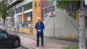
Virtual Hats off Day
https://search.heritageburnaby.ca/link/museumdescription15401
- Repository
- Burnaby Village Museum
- Date
- 6 Jun. 2020
- Collection/Fonds
- Burnaby Village Museum COVID-19 collection
- Description Level
- Item
- Physical Description
- 1 video recording (mp4) (43 sec.) : digital, 24 fps, col., sd., stereo
- Scope and Content
- Film clip of City of Burnaby council members and Mayor Mike Hurley wishing citizens of Burnaby and the public a "Happy Hats Off Day!". They encourage the public to keep the spirit of Burnaby's Hats Off Day alive in their homes since celebrations have been cancelled this year due to the COVID-19 pan…
- Repository
- Burnaby Village Museum
- Collection/Fonds
- Burnaby Village Museum COVID-19 collection
- Description Level
- Item
- Physical Description
- 1 video recording (mp4) (43 sec.) : digital, 24 fps, col., sd., stereo
- Scope and Content
- Film clip of City of Burnaby council members and Mayor Mike Hurley wishing citizens of Burnaby and the public a "Happy Hats Off Day!". They encourage the public to keep the spirit of Burnaby's Hats Off Day alive in their homes since celebrations have been cancelled this year due to the COVID-19 pandemic. Council members include: Sav Dhaliwal, Pietro Calendino, James Wang, Joe Keithley, Colleen Jordan, Dan Johnston and the late Councillor Paul McDonell.
- History
- Video taken by the City of Burnaby Marketing Department in 2020. The original intent of the clip was to produce communications about the pandemic and changes throughout the City that residents needed to be aware of.
- Creator
- City of Burnaby
- Subjects
- Officials - Mayors and Reeves
- Events - Festivals
- Officials - Aldermen and Councillors
- Pandemics - COVID-19
- Names
- Hurley, Mike
- City of Burnaby
- McDonell, Paul
- Jordan, Colleen
- Wang, James
- Calendino, Pietro
- Keithley, Joe
- Dhaliwal, Sav
- Johnston, Dan
- Geographic Access
- Hastings Street
- Accession Code
- BV021.2.15
- Access Restriction
- No restrictions
- Reproduction Restriction
- May be restricted by third party rights
- Date
- 6 Jun. 2020
- Media Type
- Moving Images
- Historic Neighbourhood
- Vancouver Heights (Historic Neighbourhood)
- Planning Study Area
- Burnaby Heights Area
- Notes
- Title based on contents of film
Images

Video
Virtual Hats off Day, 6 Jun. 2020
Virtual Hats off Day, 6 Jun. 2020
https://search.heritageburnaby.ca/media/hpo/_Data/_BVM_Moving_Images/2021_0002_0015_001.mp4