Narrow Results By

Kask Brothers
https://search.heritageburnaby.ca/link/landmark684
- Repository
- Burnaby Heritage Planning
- Geographic Access
- Barnet Road
- Associated Dates
- 1925
- Heritage Value
- In 1925, William Kask Sr. and his family purchased land along the Barnet Road and built what became known as Kask's Camp, where cabins were rented out to families working at the Barnet Mill. The family - William Kask Jr., Dave and Jack - went on to expand their business into a lumber and concrete supply company and in 1936, the company was named the Kask Brothers Building Supply Company. A lumber office was established on Curtis Street and the concrete plant was built at the former site of the cabin camp. To a large degree, the camp catered to Immigrants from Nordic countries who were active in the lumber trade. Many Finns felt at home in the camp, as the Kasks spoke Finnish and there were steam baths available.
- Historic Neighbourhood
- Lochdale (Historic Neighbourhood)
- Planning Study Area
- Westridge Area
- Street Address
- 7501 Barnet Road
Images

![Corner view of Love farmhouse, [between 1966 and 1970] thumbnail](/media/hpo/_Data/_BVM_Images/2019/2019_0003_0005_001.jpg?width=280)
Corner view of Love farmhouse
https://search.heritageburnaby.ca/link/museumdescription9919
- Repository
- Burnaby Village Museum
- Date
- [between 1966 and 1970]
- Collection/Fonds
- Love family fonds
- Description Level
- Item
- Physical Description
- 1 photograph : col. ; 10 x 15 cm print
- Scope and Content
- Photograph of the exterior of the Love farmhouse taken at the corner of Fourteenth Avenue and Cumberland Street. The house is hidden behind large trees at it's orignal address of 7651 Cumberland Street (Address pre 1960: 1390 Cumberland Road). This photograph was taken while Elsie Hughes (nee Love)…
- Repository
- Burnaby Village Museum
- Collection/Fonds
- Love family fonds
- Description Level
- Item
- Physical Description
- 1 photograph : col. ; 10 x 15 cm print
- Material Details
- Copy print was made from re-photographing an original colour slide
- Scope and Content
- Photograph of the exterior of the Love farmhouse taken at the corner of Fourteenth Avenue and Cumberland Street. The house is hidden behind large trees at it's orignal address of 7651 Cumberland Street (Address pre 1960: 1390 Cumberland Road). This photograph was taken while Elsie Hughes (nee Love), her husband John Hughes and son Brent Hughes lived in the house. Elsie is the daughter of Sarah (nee Love) and William Parker. Sarah and William purchased the house in 1928, shortly after the death of Sarah's father, Jesse Love. Sarah and William Parker lived in the house with their three children, Albert, Bill and Elsie. William Parker died in 1961 and Sarah continued to live in the house until 1966 before selling it to her daughter Elsie and son in law John Hughes. Elsie and John lived in the house with their son Brent until 1971.
- Subjects
- Buildings - Heritage
- Geographic Access
- 14th Avenue
- Cumberland Street
- Street Address
- 7651 Cumberland Street
- Accession Code
- BV019.3.5
- Access Restriction
- No restrictions
- Reproduction Restriction
- No known restrictions
- Date
- [between 1966 and 1970]
- Media Type
- Photograph
- Historic Neighbourhood
- East Burnaby (Historic Neighbourhood)
- Planning Study Area
- Cariboo-Armstrong Area
- Scan Resolution
- 600
- Scan Date
- 31-Jan-2019
- Scale
- 96
- Photographer
- Parker, Albert "Bert"
- Notes
- Title based on contents of photograph
- See also BV992.15.12
Images
![Corner view of Love farmhouse, [between 1966 and 1970] thumbnail](/media/hpo/_Data/_BVM_Images/2019/2019_0003_0005_001.jpg)
![Corner view of Love farmhouse, [between 1966 and 1970] thumbnail](/media/hpo/_Data/_BVM_Images/2019/2019_0003_0006_001.jpg?width=280)
Corner view of Love farmhouse
https://search.heritageburnaby.ca/link/museumdescription9920
- Repository
- Burnaby Village Museum
- Date
- [between 1966 and 1970]
- Collection/Fonds
- Love family fonds
- Description Level
- Item
- Physical Description
- 1 photograph : col. ; 10 x 15 cm print
- Scope and Content
- Photograph of the exterior of the Love farmhouse taken at the corner of Fourteenth Avenue and Cumberland Street. The north side of the house and kitchen are in view with large trees covering the front of the house at it's orignal address of 7651 Cumberland Street (Address pre 1960: 1390 Cumberland …
- Repository
- Burnaby Village Museum
- Collection/Fonds
- Love family fonds
- Description Level
- Item
- Physical Description
- 1 photograph : col. ; 10 x 15 cm print
- Material Details
- Copy print was made from re-photographing an original colour slide
- Scope and Content
- Photograph of the exterior of the Love farmhouse taken at the corner of Fourteenth Avenue and Cumberland Street. The north side of the house and kitchen are in view with large trees covering the front of the house at it's orignal address of 7651 Cumberland Street (Address pre 1960: 1390 Cumberland Road). This photograph was taken while Elsie Hughes (nee Love), her husband John Hughes and son Brent Hughes lived in the house. Elsie is the daughter of Sarah (nee Love) and William Parker. Sarah and William purchased the house in 1928, shortly after the death of Sarah's father, Jesse Love. Sarah and William Parker lived in the house with their three children, Albert, Bill and Elsie. William Parker died in 1961 and Sarah continued to live in the house until 1966 before selling it to her daughter Elsie and son in law John Hughes. Elsie and John lived in the house with their son Brent until 1971.
- Subjects
- Buildings - Heritage
- Geographic Access
- 14th Avenue
- Cumberland Street
- Street Address
- 7651 Cumberland Street
- Accession Code
- BV019.3.6
- Access Restriction
- No restrictions
- Reproduction Restriction
- No known restrictions
- Date
- [between 1966 and 1970]
- Media Type
- Photograph
- Historic Neighbourhood
- East Burnaby (Historic Neighbourhood)
- Planning Study Area
- Cariboo-Armstrong Area
- Scan Resolution
- 600
- Scan Date
- 31-Jan-2019
- Scale
- 96
- Photographer
- Parker, Albert "Bert"
- Notes
- Title based on contents of photograph
- See also BV992.15.12
Images
![Corner view of Love farmhouse, [between 1966 and 1970] thumbnail](/media/hpo/_Data/_BVM_Images/2019/2019_0003_0006_001.jpg)
![Jenny and Bill Kask, Jr., at Kask Camp, [1924] (date of original), copied 1991 thumbnail](/media/hpo/_Data/_Archives_Images/_Unrestricted/370/370-010.jpg?width=280)
Jenny and Bill Kask, Jr., at Kask Camp
https://search.heritageburnaby.ca/link/archivedescription37422
- Repository
- City of Burnaby Archives
- Date
- [1924] (date of original), copied 1991
- Collection/Fonds
- Burnaby Historical Society fonds
- Description Level
- Item
- Physical Description
- 1 photograph : b&w ; 3.2 x 5.3 cm print on contact sheet 20.2 x 25.4 cm
- Scope and Content
- Photograph of the front of the first house at Kask Camp. Outside, left to right, are William "Bill" Kask, Jr., and his mother, Jenny Kask.
- Repository
- City of Burnaby Archives
- Date
- [1924] (date of original), copied 1991
- Collection/Fonds
- Burnaby Historical Society fonds
- Subseries
- Burnaby Image Bank subseries
- Physical Description
- 1 photograph : b&w ; 3.2 x 5.3 cm print on contact sheet 20.2 x 25.4 cm
- Description Level
- Item
- Record No.
- 370-010
- Access Restriction
- No restrictions
- Reproduction Restriction
- No known restrictions
- Accession Number
- BHS1999-03
- Scope and Content
- Photograph of the front of the first house at Kask Camp. Outside, left to right, are William "Bill" Kask, Jr., and his mother, Jenny Kask.
- Subjects
- Buildings - Residential - Cabins
- Media Type
- Photograph
- Notes
- Title based on contents of photograph
- 1 b&w copy negative accompanying
- Geographic Access
- Barnet Road
- Street Address
- 7501 Barnet Road
- Historic Neighbourhood
- Barnet (Historic Neighbourhood)
- Planning Study Area
- Burnaby Mountain Area
Images
![Jenny and Bill Kask, Jr., at Kask Camp, [1924] (date of original), copied 1991 thumbnail](/media/hpo/_Data/_Archives_Images/_Unrestricted/370/370-010.jpg)
![Kask family home, [1927] (date of original), copied 1986 thumbnail](/media/hpo/_Data/_Archives_Images/_Unrestricted/204/204-392.jpg?width=280)
Kask family home
https://search.heritageburnaby.ca/link/archivedescription35534
- Repository
- City of Burnaby Archives
- Date
- [1927] (date of original), copied 1986
- Collection/Fonds
- Burnaby Historical Society fonds
- Description Level
- Item
- Physical Description
- 1 photograph : b&w ; 12.7 x 17.8 cm print
- Scope and Content
- Photograph of the original Kask family home, built in 1927 at Kask's Camp.
- Repository
- City of Burnaby Archives
- Date
- [1927] (date of original), copied 1986
- Collection/Fonds
- Burnaby Historical Society fonds
- Subseries
- Pioneer Tales subseries
- Physical Description
- 1 photograph : b&w ; 12.7 x 17.8 cm print
- Description Level
- Item
- Record No.
- 204-392
- Access Restriction
- No restrictions
- Reproduction Restriction
- No known restrictions
- Accession Number
- BHS1988-03
- Scope and Content
- Photograph of the original Kask family home, built in 1927 at Kask's Camp.
- Subjects
- Buildings - Residential - Houses
- Media Type
- Photograph
- Notes
- Title based on contents of photograph
- Geographic Access
- Barnet Road
- Street Address
- 7501 Barnet Road
- Historic Neighbourhood
- Barnet (Historic Neighbourhood)
- Planning Study Area
- Burnaby Mountain Area
Images
![Kask family home, [1927] (date of original), copied 1986 thumbnail](/media/hpo/_Data/_Archives_Images/_Unrestricted/204/204-392.jpg)
![Kask's Camp, [1928] (date of original), copied 1986 thumbnail](/media/hpo/_Data/_Archives_Images/_Unrestricted/204/204-395.jpg?width=280)
Kask's Camp
https://search.heritageburnaby.ca/link/archivedescription35537
- Repository
- City of Burnaby Archives
- Date
- [1928] (date of original), copied 1986
- Collection/Fonds
- Burnaby Historical Society fonds
- Description Level
- Item
- Physical Description
- 1 photograph : b&w ; 12.7 x 17.8 cm print
- Scope and Content
- Photograph of Kask's Camp looking north. (Foreground) rental cabins; (right) outhouse; (background) Pitkethly brick plant located across Barnet Road.
- Repository
- City of Burnaby Archives
- Date
- [1928] (date of original), copied 1986
- Collection/Fonds
- Burnaby Historical Society fonds
- Subseries
- Pioneer Tales subseries
- Physical Description
- 1 photograph : b&w ; 12.7 x 17.8 cm print
- Description Level
- Item
- Record No.
- 204-395
- Access Restriction
- No restrictions
- Reproduction Restriction
- No known restrictions
- Accession Number
- BHS1988-03
- Scope and Content
- Photograph of Kask's Camp looking north. (Foreground) rental cabins; (right) outhouse; (background) Pitkethly brick plant located across Barnet Road.
- Subjects
- Buildings - Residential - Cabins
- Media Type
- Photograph
- Notes
- Title based on contents of photograph
- Geographic Access
- Barnet Road
- Street Address
- 7501 Barnet Road
- Historic Neighbourhood
- Barnet (Historic Neighbourhood)
- Planning Study Area
- Burnaby Mountain Area
Images
![Kask's Camp, [1928] (date of original), copied 1986 thumbnail](/media/hpo/_Data/_Archives_Images/_Unrestricted/204/204-395.jpg)
![Kask's Filling Station and Store, [1927] (date of original), copied 1986 thumbnail](/media/hpo/_Data/_Archives_Images/_Unrestricted/204/204-394.jpg?width=280)
Kask's Filling Station and Store
https://search.heritageburnaby.ca/link/archivedescription35536
- Repository
- City of Burnaby Archives
- Date
- [1927] (date of original), copied 1986
- Collection/Fonds
- Burnaby Historical Society fonds
- Description Level
- Item
- Physical Description
- 1 photograph : b&w ; 12.7 x 17.8 cm print
- Scope and Content
- Photograph of Kask's Filling Station and general store on Barnet Road near Kask's Camp. Bill Kask worked here as boy and encountered fugitive felon Bill Bagley here.
- Repository
- City of Burnaby Archives
- Date
- [1927] (date of original), copied 1986
- Collection/Fonds
- Burnaby Historical Society fonds
- Subseries
- Pioneer Tales subseries
- Physical Description
- 1 photograph : b&w ; 12.7 x 17.8 cm print
- Description Level
- Item
- Record No.
- 204-394
- Access Restriction
- No restrictions
- Reproduction Restriction
- No known restrictions
- Accession Number
- BHS1988-03
- Scope and Content
- Photograph of Kask's Filling Station and general store on Barnet Road near Kask's Camp. Bill Kask worked here as boy and encountered fugitive felon Bill Bagley here.
- Media Type
- Photograph
- Notes
- Title based on contents of photograph
- Geographic Access
- Barnet Road
- Street Address
- 7501 Barnet Road
- Historic Neighbourhood
- Barnet (Historic Neighbourhood)
- Planning Study Area
- Burnaby Mountain Area
Images
![Kask's Filling Station and Store, [1927] (date of original), copied 1986 thumbnail](/media/hpo/_Data/_Archives_Images/_Unrestricted/204/204-394.jpg)
![Nichols Chemical Co. Ltd. - D.D. Coolers Scrubbers and Settling Tanks with Pumps, [1928] thumbnail](/media/hpo/_Data/_BVM_Technical_Drawings/1998_0023_0016_002.jpg?width=280)
Nichols Chemical Co. Ltd. - D.D. Coolers Scrubbers and Settling Tanks with Pumps
https://search.heritageburnaby.ca/link/museumdescription11394
- Repository
- Burnaby Village Museum
- Date
- [1928]
- Collection/Fonds
- Nichols Chemical Company fonds
- Description Level
- Item
- Physical Description
- 1 technical drawing : blueprint ; 75.5 x 105 cm
- Scope and Content
- Item consists of technical drawing "D.D. Coolers Scrubbers and Settling Tanks with Pumps", "Nichols Chemical Co. LTD."; "Drawing No. 6314".
- Repository
- Burnaby Village Museum
- Collection/Fonds
- Nichols Chemical Company fonds
- Description Level
- Item
- Physical Description
- 1 technical drawing : blueprint ; 75.5 x 105 cm
- Material Details
- Scale 1:.25
- Scope and Content
- Item consists of technical drawing "D.D. Coolers Scrubbers and Settling Tanks with Pumps", "Nichols Chemical Co. LTD."; "Drawing No. 6314".
- Subjects
- Buildings - Industrial - Factories
- Responsibility
- General Chemical Company
- Geographic Access
- Barnet Road
- Street Address
- 8655 Barnet Road
- Accession Code
- BV998.23.16
- Access Restriction
- No restrictions
- Reproduction Restriction
- No known restrictions
- Date
- [1928]
- Media Type
- Technical Drawing
- Historic Neighbourhood
- Barnet (Historic Neighbourhood)
- Planning Study Area
- Burnaby Mountain Area
- Scan Resolution
- 300
- Scan Date
- 2022-05-10
- Notes
- Title based on contents of item
- "Scale 1/4" = 1'
- Stamp in lower left corner reads: "Private Design", "This Property Exclusively of General Chemical Company"
- Stamp on lower right reads: "Jul 12, 1946"
Images
![Nichols Chemical Co. Ltd. - D.D. Coolers Scrubbers and Settling Tanks with Pumps, [1928] thumbnail](/media/hpo/_Data/_BVM_Technical_Drawings/1998_0023_0016_002.jpg)
![Nichols Chemical Co. Ltd. - Drawing No. 6312, [1928] thumbnail](/media/hpo/_Data/_BVM_Technical_Drawings/1998_0023_0010_002.jpg?width=280)
Nichols Chemical Co. Ltd. - Drawing No. 6312
https://search.heritageburnaby.ca/link/museumdescription11388
- Repository
- Burnaby Village Museum
- Date
- [1928]
- Collection/Fonds
- Nichols Chemical Company fonds
- Description Level
- Item
- Physical Description
- 1 technical drawing : blueprint ; 73.5 x 104.5 cm
- Scope and Content
- Item consists of technical "Drawing No. 6312" "Nichols Chemical Co. Ltd.".
- Repository
- Burnaby Village Museum
- Collection/Fonds
- Nichols Chemical Company fonds
- Description Level
- Item
- Physical Description
- 1 technical drawing : blueprint ; 73.5 x 104.5 cm
- Material Details
- Scale 1:.25
- Scope and Content
- Item consists of technical "Drawing No. 6312" "Nichols Chemical Co. Ltd.".
- Subjects
- Buildings - Industrial - Factories
- Responsibility
- General Chemical Company
- Geographic Access
- Barnet Road
- Street Address
- 8655 Barnet Road
- Accession Code
- BV998.23.10
- Access Restriction
- No restrictions
- Reproduction Restriction
- No known restrictions
- Date
- [1928]
- Media Type
- Technical Drawing
- Historic Neighbourhood
- Barnet (Historic Neighbourhood)
- Planning Study Area
- Burnaby Mountain Area
- Scan Resolution
- 300
- Scan Date
- 2022-05-10
- Notes
- Title based on contents of item
- Hand-stamped horizontally is "MAR 12 1946"
- Stamp on back reads: "Private Design", "The Property Exclusively of General Chemical Company"
- "Scale 1/4" = 1'
Images
![Nichols Chemical Co. Ltd. - Drawing No. 6312, [1928] thumbnail](/media/hpo/_Data/_BVM_Technical_Drawings/1998_0023_0010_002.jpg)

Nichols Chemical Co. Ltd. - Drawing No. 511726
https://search.heritageburnaby.ca/link/museumdescription11393
- Repository
- Burnaby Village Museum
- Date
- 26 Jan. 1962
- Collection/Fonds
- Nichols Chemical Company fonds
- Description Level
- Item
- Physical Description
- 1 technical drawing : blueline print ; 87.5 x 111 cm
- Scope and Content
- Item consists of technical drawing titled "Assy. Det. No. 3 Ore Burner", "No. 511726" of Nichol's Chemical Plant. Includes "Parts Lists" index.
- Repository
- Burnaby Village Museum
- Collection/Fonds
- Nichols Chemical Company fonds
- Description Level
- Item
- Physical Description
- 1 technical drawing : blueline print ; 87.5 x 111 cm
- Material Details
- Scale 1:.25
- Scope and Content
- Item consists of technical drawing titled "Assy. Det. No. 3 Ore Burner", "No. 511726" of Nichol's Chemical Plant. Includes "Parts Lists" index.
- Subjects
- Buildings - Industrial - Factories
- Responsibility
- General Chemical Company
- Geographic Access
- Barnet Road
- Street Address
- 8655 Barnet Road
- Accession Code
- BV998.23.15
- Access Restriction
- No restrictions
- Reproduction Restriction
- No known restrictions
- Date
- 26 Jan. 1962
- Media Type
- Technical Drawing
- Historic Neighbourhood
- Barnet (Historic Neighbourhood)
- Planning Study Area
- Burnaby Mountain Area
- Scan Resolution
- 300
- Scan Date
- 2022-05-10
- Notes
- Title based on contents of item
- "Scale 1/4" = 1'
- Stamped with Print Date: "Jan 26 1962"
Images

![Pacific Guano Plant, [1920] (date of original), copied 1991 thumbnail](/media/hpo/_Data/_Archives_Images/_Unrestricted/370/370-293.jpg?width=280)
Pacific Guano Plant
https://search.heritageburnaby.ca/link/archivedescription37705
- Repository
- City of Burnaby Archives
- Date
- [1920] (date of original), copied 1991
- Collection/Fonds
- Burnaby Historical Society fonds
- Description Level
- Item
- Physical Description
- 1 photograph : b&w ; 3.1 x 3.9 cm print on contact sheet 20.2 x 25.3 cm
- Scope and Content
- Photograph of the Pacific Guano plant on Burrard Inlet at the foot of Burnaby Mountain. It was also used as chemical plant, processing guano. (Any excrement from birds, seals, or bats, with value to humans as fertilizer, may be referred to as guano).
- Repository
- City of Burnaby Archives
- Date
- [1920] (date of original), copied 1991
- Collection/Fonds
- Burnaby Historical Society fonds
- Subseries
- Burnaby Image Bank subseries
- Physical Description
- 1 photograph : b&w ; 3.1 x 3.9 cm print on contact sheet 20.2 x 25.3 cm
- Description Level
- Item
- Record No.
- 370-293
- Access Restriction
- No restrictions
- Reproduction Restriction
- No known restrictions
- Accession Number
- BHS1999-03
- Scope and Content
- Photograph of the Pacific Guano plant on Burrard Inlet at the foot of Burnaby Mountain. It was also used as chemical plant, processing guano. (Any excrement from birds, seals, or bats, with value to humans as fertilizer, may be referred to as guano).
- Subjects
- Buildings - Industrial
- Names
- Pacific Guano
- Media Type
- Photograph
- Notes
- Title based on contents of photograph
- 1 b&w copy negative accompanying
- Geographic Access
- Barnet Road
- Historic Neighbourhood
- Barnet (Historic Neighbourhood)
- Planning Study Area
- Burnaby Mountain Area
Images
![Pacific Guano Plant, [1920] (date of original), copied 1991 thumbnail](/media/hpo/_Data/_Archives_Images/_Unrestricted/370/370-293.jpg)
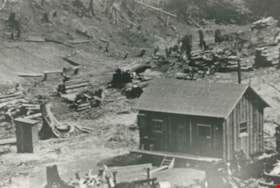
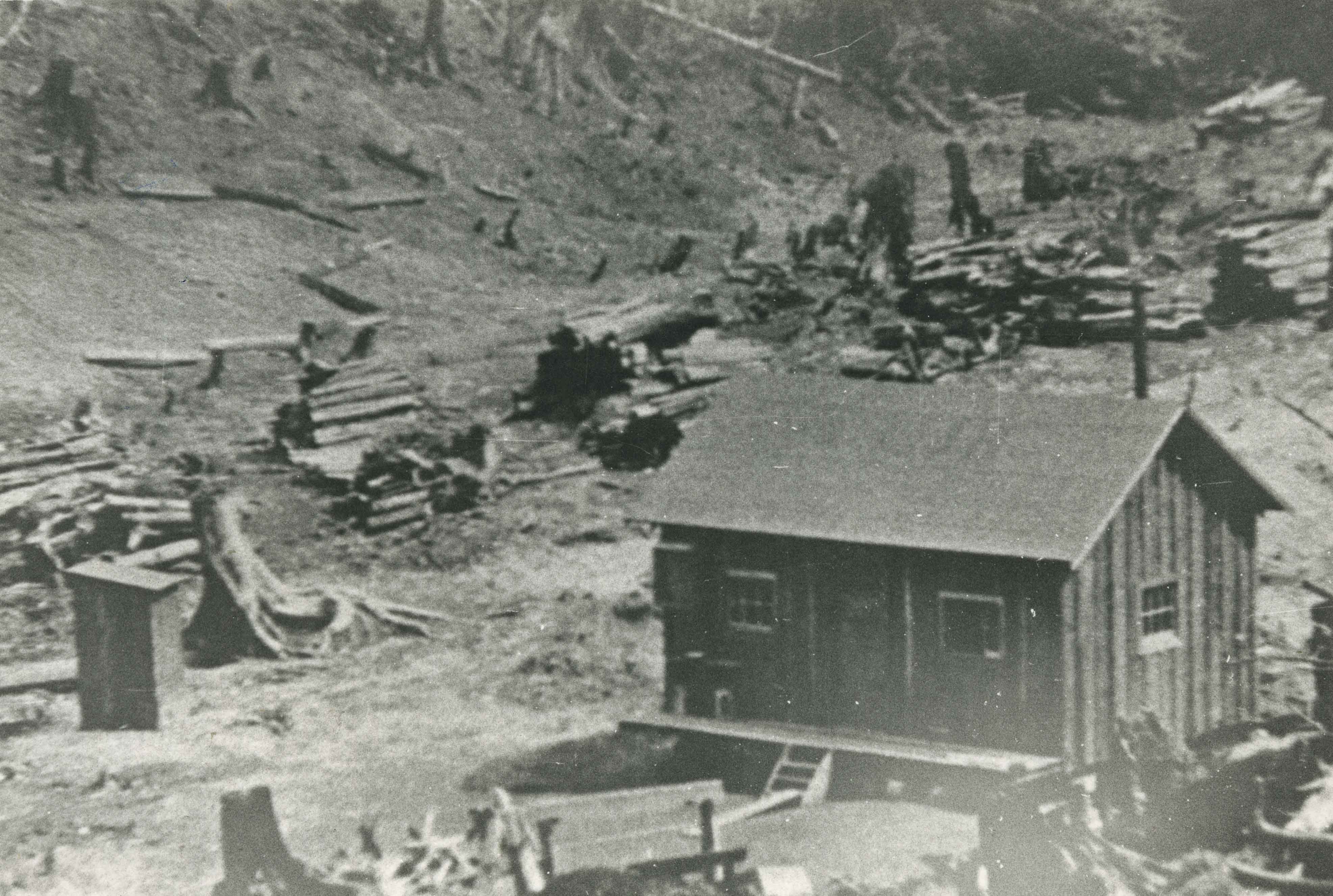
Rental Cabin
https://search.heritageburnaby.ca/link/archivedescription35535
- Repository
- City of Burnaby Archives
- Date
- 1927 (date of original), copied 1986
- Collection/Fonds
- Burnaby Historical Society fonds
- Description Level
- Item
- Physical Description
- 1 photograph : b&w ; 12.7 x 17.8 cm print
- Scope and Content
- Photograph of the first rental cabin at Kask's Camp. An additional 30 to 33 would be built. Note the piles of cord wood in the background and the outhouse to the left. The renters were mainly workers at the nearby Barnet Mill.
- Repository
- City of Burnaby Archives
- Date
- 1927 (date of original), copied 1986
- Collection/Fonds
- Burnaby Historical Society fonds
- Subseries
- Pioneer Tales subseries
- Physical Description
- 1 photograph : b&w ; 12.7 x 17.8 cm print
- Description Level
- Item
- Record No.
- 204-393
- Access Restriction
- No restrictions
- Reproduction Restriction
- No known restrictions
- Accession Number
- BHS1988-03
- Scope and Content
- Photograph of the first rental cabin at Kask's Camp. An additional 30 to 33 would be built. Note the piles of cord wood in the background and the outhouse to the left. The renters were mainly workers at the nearby Barnet Mill.
- Subjects
- Buildings - Residential - Cabins
- Media Type
- Photograph
- Notes
- Title based on contents of photograph
- Geographic Access
- Barnet Road
- Street Address
- 7501 Barnet Road
- Historic Neighbourhood
- Barnet (Historic Neighbourhood)
- Planning Study Area
- Burnaby Mountain Area
Images