Narrow Results By
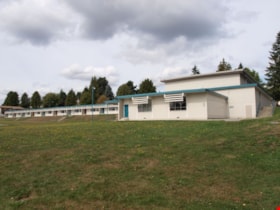
Gilpin Elementary School
https://search.heritageburnaby.ca/link/landmark811
- Repository
- Burnaby Heritage Planning
- Geographic Access
- Eglinton Street
- Associated Dates
- 1966
- Heritage Value
- Gilpin Elementary School was built to serve a new housing development extending out from the Douglas Road school area towards the Oakalla Prison site and the Forest Lawn Cemetery. Built in 1966, the school, like other elementary schools of the era, was one-storey, without basement or high stairs. Additions to the building were made in 1969 and 1973.
- Historic Neighbourhood
- Burnaby Lake (Historic Neighbourhood)
- Planning Study Area
- Douglas-Gilpin Area
- Street Address
- 5490 Eglinton Street
- Street View URL
- Google Maps Street View
Images
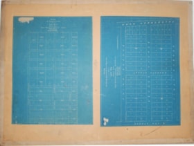
Subdivision plans in New Westminster District Group 1 – Burnaby
https://search.heritageburnaby.ca/link/museumdescription6978
- Repository
- Burnaby Village Museum
- Date
- [1900-1910]
- Collection/Fonds
- Burnaby Village Museum Map collection
- Description Level
- File
- Physical Description
- 4 plans : blueprint ink on paper mounted on 2 sides of cardboard 76 x 102 cm
- Scope and Content
- Item consists of a large board with two New Westminster District Gp 1 - subdivision plans mounted on one side and two New Westminster District Gp 1 - subdivision plans mounted on the other side. Side A: 1. Blueprint "Plan/ of Subdivisions / of portions / of / Lot 91, / Group 1 / New Westminster …
- Repository
- Burnaby Village Museum
- Collection/Fonds
- Burnaby Village Museum Map collection
- Description Level
- File
- Physical Description
- 4 plans : blueprint ink on paper mounted on 2 sides of cardboard 76 x 102 cm
- Material Details
- Scales [between 1:792 and 1:2376]
- Index number on edge of board reads: "9"
- Scope and Content
- Item consists of a large board with two New Westminster District Gp 1 - subdivision plans mounted on one side and two New Westminster District Gp 1 - subdivision plans mounted on the other side. Side A: 1. Blueprint "Plan/ of Subdivisions / of portions / of / Lot 91, / Group 1 / New Westminster Dist. / Scale 3 chs = 1 in / Map Nos 535 & 506". (Geographic location: Burnaby) 2. Blueprint "Plan / of / Subdivision of a Portion / of / Lot 28 / Group One / New Westminster Dist. / Scale 1 chs = 1 in / Map No 274". Lots are identified as "I / II / III / VI / V / IV ". The plan is bordered by First Avenue, Suburban Lands and Cemetery at the bottom, 13th Street at the top, Douglas Road to the west and 4th Street to the east. The plan is signed by "W. Thibaudeau". (Geographic location: Burnaby) Side B: 1. Blueprint "Plan / of the Subdivision of a Portion / of / Lot 29 / Group One / New Westminster District / Scale 1ch = 1 in / Map No 291 _ Subdivision 'L'". (Geographic location: Burnaby) 2. Blueprint " Plan of Subdivision / of / Lot 27 / Group One / New Westminster Dist. / Scale 3 chs = 1 in. / Map No. 697". (Geographic location: Burnaby)
- Accession Code
- HV977.93.9
- Access Restriction
- No restrictions
- Reproduction Restriction
- No known restrictions
- Date
- [1900-1910]
- Media Type
- Cartographic Material
- Scan Resolution
- 300
- Scale
- 72
- Notes
- Title based on contents of file
- Scale is measured in chains. (One chain equals 792 inches)
- The term "Lot" can also refer to a "District Lot”

![Subdivision plans in New Westminster District Group 1 – Burnaby
, [1900-1910] thumbnail](/media/hpo/_Data/_BVM_Cartographic_Material/1977/1977_0093_0009a_001.jpg?width=280)
