Narrow Results By
Decade
- 2020s
- 2010s 4
- 2000s 106
- 1990s 88
- 1980s 22
- 1970s 305
- 1960s 73
- 1950s 82
- 1940s 60
- 1930s 53
- 1920s
- 1910s 65
- 1900s
- 1890s 10
- 1880s 2
- 1870s 1
- 1860s 2
- 1850s 1
- 1840s 1
- 1830s 1
- 1820s 1
- 1810s 1
- 1800s 1
- 1790s 1
- 1780s 1
- 1770s 1
- 1760s 1
- 1750s 1
- 1740s 1
- 1730s 1
- 1720s 1
- 1710s 1
- 1700s 1
- 1690s 1
- 1680s 1
- 1670s 1
- 1660s 1
- 1650s 1
- 1640s 1
- 1630s 1
- 1620s 1
- 1610s 1
- 1600s 1
Robert Peers in the garden
https://search.heritageburnaby.ca/link/archivedescription38973
- Repository
- City of Burnaby Archives
- Date
- 1928
- Collection/Fonds
- Peers Family and Hill Family fonds
- Description Level
- Item
- Physical Description
- 1 photograph : b&w ; 6 x 10 cm on page 13.5 x 18.5 cm (pasted in album)
- Scope and Content
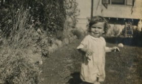
- Photograph of Robert Peers standing next to a flower garden. A toy ball can be seen in the background. The photograph was likely taken in front of the Peers' home on Deer Lake Avenue.
- Repository
- City of Burnaby Archives
- Date
- 1928
- Collection/Fonds
- Peers Family and Hill Family fonds
- Physical Description
- 1 photograph : b&w ; 6 x 10 cm on page 13.5 x 18.5 cm (pasted in album)
- Description Level
- Item
- Record No.
- 477-292
- Access Restriction
- No restrictions
- Reproduction Restriction
- No known restrictions
- Accession Number
- 2007-12
- Scope and Content
- Photograph of Robert Peers standing next to a flower garden. A toy ball can be seen in the background. The photograph was likely taken in front of the Peers' home on Deer Lake Avenue.
- Names
- Peers, Robert C.K.
- Media Type
- Photograph
- Notes
- Title based on contents of photograph
- Geographic Access
- Deer Lake Avenue
- Street Address
- 6588 Deer Lake Avenue
- Historic Neighbourhood
- Burnaby Lake (Historic Neighbourhood)
- Planning Study Area
- Douglas-Gilpin Area
Images

![Robert Peers on snow sled, [1929] thumbnail](/media/hpo/_Data/_Archives_Images/_Unrestricted/477/477-319.jpg?width=280)
Robert Peers on snow sled
https://search.heritageburnaby.ca/link/archivedescription39000
- Repository
- City of Burnaby Archives
- Date
- [1929]
- Collection/Fonds
- Peers Family and Hill Family fonds
- Description Level
- Item
- Physical Description
- 1 photograph : sepia ; 6 x 10.5 cm on page 13.5 x 18.5 cm (pasted in album)
- Scope and Content
- Photograph of Robert Peers sitting on a sled in the snow. This photograph may have been taken at his grandparents, Claude and Annie Hill's home on Deer Lake Avenue.
- Repository
- City of Burnaby Archives
- Date
- [1929]
- Collection/Fonds
- Peers Family and Hill Family fonds
- Physical Description
- 1 photograph : sepia ; 6 x 10.5 cm on page 13.5 x 18.5 cm (pasted in album)
- Description Level
- Item
- Record No.
- 477-319
- Access Restriction
- No restrictions
- Reproduction Restriction
- No known restrictions
- Accession Number
- 2007-12
- Scope and Content
- Photograph of Robert Peers sitting on a sled in the snow. This photograph may have been taken at his grandparents, Claude and Annie Hill's home on Deer Lake Avenue.
- Subjects
- Transportation - Sleds
- Names
- Peers, Robert C.K.
- Media Type
- Photograph
- Notes
- Title based on contents of photograph
- Geographic Access
- Deer Lake Avenue
- Street Address
- 6570 Deer Lake Avenue
- Historic Neighbourhood
- Burnaby Lake (Historic Neighbourhood)
- Planning Study Area
- Douglas-Gilpin Area
Images
![Robert Peers on snow sled, [1929] thumbnail](/media/hpo/_Data/_Archives_Images/_Unrestricted/477/477-319.jpg)
![Robert Peers with his toys, [1928] thumbnail](/media/hpo/_Data/_Archives_Images/_Unrestricted/477/477-336.jpg?width=280)
Robert Peers with his toys
https://search.heritageburnaby.ca/link/archivedescription39017
- Repository
- City of Burnaby Archives
- Date
- [1928]
- Collection/Fonds
- Peers Family and Hill Family fonds
- Description Level
- Item
- Physical Description
- 1 photograph : b&w ; 6.2 x 10.5 cm on page 13.5 x 18.5 cm (pasted in album)
- Scope and Content
- Photograph of Robert Peers sitting on a blanket on the grass, with a number of stuffed toys. Toys include a teddy bear, rocking horse, and dolls. A car and house can be seen in the background. This photograph may have been taken at the home of Annie Hill, Roberts' grandmother, on Deer Lake Avenue.
- Repository
- City of Burnaby Archives
- Date
- [1928]
- Collection/Fonds
- Peers Family and Hill Family fonds
- Physical Description
- 1 photograph : b&w ; 6.2 x 10.5 cm on page 13.5 x 18.5 cm (pasted in album)
- Description Level
- Item
- Record No.
- 477-336
- Access Restriction
- No restrictions
- Reproduction Restriction
- No known restrictions
- Accession Number
- 2007-12
- Scope and Content
- Photograph of Robert Peers sitting on a blanket on the grass, with a number of stuffed toys. Toys include a teddy bear, rocking horse, and dolls. A car and house can be seen in the background. This photograph may have been taken at the home of Annie Hill, Roberts' grandmother, on Deer Lake Avenue.
- Subjects
- Toys
- Media Type
- Photograph
- Notes
- Title based on contents of photograph
- Geographic Access
- Deer Lake Avenue
- Street Address
- 6570 Deer Lake Avenue
- Historic Neighbourhood
- Burnaby Lake (Historic Neighbourhood)
- Planning Study Area
- Douglas-Gilpin Area
Images
![Robert Peers with his toys, [1928] thumbnail](/media/hpo/_Data/_Archives_Images/_Unrestricted/477/477-336.jpg)
![Robert Peers with his toys, [1928] thumbnail](/media/hpo/_Data/_Archives_Images/_Unrestricted/477/477-338.jpg?width=280)
Robert Peers with his toys
https://search.heritageburnaby.ca/link/archivedescription39019
- Repository
- City of Burnaby Archives
- Date
- [1928]
- Collection/Fonds
- Peers Family and Hill Family fonds
- Description Level
- Item
- Physical Description
- 1 photograph : b&w ; 5 x 5.4 cm on page 13.5 x 18.5 cm (pasted in album)
- Scope and Content
- Photograph of Robert Peers seated on a blanket in the front yard of a house. He has next to him a number of stuffed toys, including a teddy bear, dolls and small rocking horse. This photograph may have been taken at the home of Annie Hill, Roberts' grandmother, on Deer Lake Avenue.
- Repository
- City of Burnaby Archives
- Date
- [1928]
- Collection/Fonds
- Peers Family and Hill Family fonds
- Physical Description
- 1 photograph : b&w ; 5 x 5.4 cm on page 13.5 x 18.5 cm (pasted in album)
- Description Level
- Item
- Record No.
- 477-338
- Access Restriction
- No restrictions
- Reproduction Restriction
- No known restrictions
- Accession Number
- 2007-12
- Scope and Content
- Photograph of Robert Peers seated on a blanket in the front yard of a house. He has next to him a number of stuffed toys, including a teddy bear, dolls and small rocking horse. This photograph may have been taken at the home of Annie Hill, Roberts' grandmother, on Deer Lake Avenue.
- Subjects
- Toys
- Media Type
- Photograph
- Notes
- Title based on contents of photograph
- Geographic Access
- Deer Lake Avenue
- Street Address
- 6570 Deer Lake Avenue
- Historic Neighbourhood
- Burnaby Lake (Historic Neighbourhood)
- Planning Study Area
- Douglas-Gilpin Area
Images
![Robert Peers with his toys, [1928] thumbnail](/media/hpo/_Data/_Archives_Images/_Unrestricted/477/477-338.jpg)
![Robert playing in the snow, [1929] thumbnail](/media/hpo/_Data/_Archives_Images/_Unrestricted/477/477-320.jpg?width=280)
Robert playing in the snow
https://search.heritageburnaby.ca/link/archivedescription39001
- Repository
- City of Burnaby Archives
- Date
- [1929]
- Collection/Fonds
- Peers Family and Hill Family fonds
- Description Level
- Item
- Physical Description
- 1 photograph : b&w ; 5.5 x 10 cm on page 13.5 x 18.5 cm (pasted in album)
- Scope and Content
- Photograph of Robert Peers dressed in his winter coat, hat and boots, playing in the snow. He is holding a stick in his hands and is digging in the snow bank. This photograph may have been taken at his grandparents, Claude and Annie Hill's home on Deer Lake Avenue.
- Repository
- City of Burnaby Archives
- Date
- [1929]
- Collection/Fonds
- Peers Family and Hill Family fonds
- Physical Description
- 1 photograph : b&w ; 5.5 x 10 cm on page 13.5 x 18.5 cm (pasted in album)
- Description Level
- Item
- Record No.
- 477-320
- Access Restriction
- No restrictions
- Reproduction Restriction
- No known restrictions
- Accession Number
- 2007-12
- Scope and Content
- Photograph of Robert Peers dressed in his winter coat, hat and boots, playing in the snow. He is holding a stick in his hands and is digging in the snow bank. This photograph may have been taken at his grandparents, Claude and Annie Hill's home on Deer Lake Avenue.
- Subjects
- Natural Phenomena - Snow
- Names
- Peers, Robert C.K.
- Media Type
- Photograph
- Notes
- Title based on contents of photograph
- Geographic Access
- Deer Lake Avenue
- Street Address
- 6570 Deer Lake Avenue
- Historic Neighbourhood
- Burnaby Lake (Historic Neighbourhood)
- Planning Study Area
- Douglas-Gilpin Area
Images
![Robert playing in the snow, [1929] thumbnail](/media/hpo/_Data/_Archives_Images/_Unrestricted/477/477-320.jpg)
![Robert With Dog, [1929] thumbnail](/media/hpo/_Data/_Archives_Images/_Unrestricted/477/477-321.jpg?width=280)
Robert With Dog
https://search.heritageburnaby.ca/link/archivedescription39002
- Repository
- City of Burnaby Archives
- Date
- [1929]
- Collection/Fonds
- Peers Family and Hill Family fonds
- Description Level
- Item
- Physical Description
- 1 photograph : b&w ; 6 x 10 cm on page 13.5 x 18.5 cm (pasted in album)
- Scope and Content
- Photograph of Robert Peers standing next to a dog, which is lying on the ground. This photograph may have been taken at his grandparents, Claude and Annie Hill's home on Deer Lake Avenue.
- Repository
- City of Burnaby Archives
- Date
- [1929]
- Collection/Fonds
- Peers Family and Hill Family fonds
- Physical Description
- 1 photograph : b&w ; 6 x 10 cm on page 13.5 x 18.5 cm (pasted in album)
- Description Level
- Item
- Record No.
- 477-321
- Access Restriction
- No restrictions
- Reproduction Restriction
- No known restrictions
- Accession Number
- 2007-12
- Scope and Content
- Photograph of Robert Peers standing next to a dog, which is lying on the ground. This photograph may have been taken at his grandparents, Claude and Annie Hill's home on Deer Lake Avenue.
- Subjects
- Animals - Dogs
- Media Type
- Photograph
- Notes
- Title based on contents of photograph
- Geographic Access
- Deer Lake Avenue
- Street Address
- 6570 Deer Lake Avenue
- Historic Neighbourhood
- Burnaby Lake (Historic Neighbourhood)
- Planning Study Area
- Douglas-Gilpin Area
Images
![Robert With Dog, [1929] thumbnail](/media/hpo/_Data/_Archives_Images/_Unrestricted/477/477-321.jpg)
![Ross Service Station, Douglas Road and Grandview Highway, 1922 (date of original), copied [1998] thumbnail](/media/hpo/_Data/_Archives_Images/_Unrestricted/316/358-001.jpg?width=280)
Ross Service Station, Douglas Road and Grandview Highway
https://search.heritageburnaby.ca/link/archivedescription37353
- Repository
- City of Burnaby Archives
- Date
- 1922 (date of original), copied [1998]
- Collection/Fonds
- Burnaby Historical Society fonds
- Description Level
- Item
- Physical Description
- 1 photograph : b&w ; 10 x 15 cm print
- Scope and Content
- Photograph of the Ross Service Station, located at Douglas road and Grandview Highway (now Canada Way). This station was built, owned and operated by Fred Ross.
- Repository
- City of Burnaby Archives
- Date
- 1922 (date of original), copied [1998]
- Collection/Fonds
- Burnaby Historical Society fonds
- Subseries
- Ross family subseries
- Physical Description
- 1 photograph : b&w ; 10 x 15 cm print
- Description Level
- Item
- Record No.
- 358-001
- Access Restriction
- No restrictions
- Reproduction Restriction
- No known restrictions
- Accession Number
- BHS1998-05
- Scope and Content
- Photograph of the Ross Service Station, located at Douglas road and Grandview Highway (now Canada Way). This station was built, owned and operated by Fred Ross.
- Names
- Ross Service Station
- Media Type
- Photograph
- Notes
- Title based on contents of photograph.
- The 1925 Burnaby Business Guide provides the address for this building as Douglas Road and Sprott Street.
- Geographic Access
- Douglas Road
- Sprott Street
- Canada Way
- Street Address
- 3355 Douglas Road
- Planning Study Area
- Douglas-Gilpin Area
Images
![Ross Service Station, Douglas Road and Grandview Highway, 1922 (date of original), copied [1998] thumbnail](/media/hpo/_Data/_Archives_Images/_Unrestricted/316/358-001.jpg)
![Rowe - Hill wedding, [1906] thumbnail](/media/hpo/_Data/_Archives_Images/_Unrestricted/477/477-051.jpg?width=280)
Rowe - Hill wedding
https://search.heritageburnaby.ca/link/archivedescription38732
- Repository
- City of Burnaby Archives
- Date
- [1906]
- Collection/Fonds
- Peers Family and Hill Family fonds
- Description Level
- Item
- Physical Description
- 1 photograph : sepia ; 10 x 14.5 cm on mat 11 x 15.5 cm
- Scope and Content
- Photograph taken of the wedding party showing (l to r, standing): Arthur Rowe, Winnie Hill Rowe, Trevor Rowe, and Miss Lister. Kitty Hill, the flower girl, is seated. Winnie Rowe was the daughter of Bernard R. Hill who, with his brother L. Claude Hill, was an early settler of the Burnaby Lake area…
- Repository
- City of Burnaby Archives
- Date
- [1906]
- Collection/Fonds
- Peers Family and Hill Family fonds
- Physical Description
- 1 photograph : sepia ; 10 x 14.5 cm on mat 11 x 15.5 cm
- Description Level
- Item
- Record No.
- 477-051
- Access Restriction
- No restrictions
- Reproduction Restriction
- No known restrictions
- Accession Number
- 2007-12
- Scope and Content
- Photograph taken of the wedding party showing (l to r, standing): Arthur Rowe, Winnie Hill Rowe, Trevor Rowe, and Miss Lister. Kitty Hill, the flower girl, is seated. Winnie Rowe was the daughter of Bernard R. Hill who, with his brother L. Claude Hill, was an early settler of the Burnaby Lake area. The flower girl, Kitty Hill, was Claude's daughter. This photograph may have been taken in front of Bernard Hill's home on Douglas Road.
- Subjects
- Ceremonies - Weddings
- Media Type
- Photograph
- Notes
- Title based on contents of photograph
- Geographic Access
- Canada Way
- Street Address
- 4990 Canada Way
- Historic Neighbourhood
- Burnaby Lake (Historic Neighbourhood)
- Planning Study Area
- Douglas-Gilpin Area
Images
![Rowe - Hill wedding, [1906] thumbnail](/media/hpo/_Data/_Archives_Images/_Unrestricted/477/477-051.jpg)
Skating on Deer Lake
https://search.heritageburnaby.ca/link/archivedescription35884
- Repository
- City of Burnaby Archives
- Date
- 1921 (date of original), copied 1986
- Collection/Fonds
- Burnaby Historical Society fonds
- Description Level
- Item
- Physical Description
- 1 photograph : b&w ; 12.7 x 17.8 cm print
- Scope and Content
- Photograph of people skating on Deer Lake.
- Repository
- City of Burnaby Archives
- Date
- 1921 (date of original), copied 1986
- Collection/Fonds
- Burnaby Historical Society fonds
- Subseries
- Pioneer Tales subseries
- Physical Description
- 1 photograph : b&w ; 12.7 x 17.8 cm print
- Description Level
- Item
- Record No.
- 204-743
- Access Restriction
- No restrictions
- Reproduction Restriction
- No known restrictions
- Accession Number
- BHS1988-03
- Scope and Content
- Photograph of people skating on Deer Lake.
- Media Type
- Photograph
- Notes
- Title based on contents of photograph
- Geographic Access
- Deer Lake
- Deer Lake Park
- Historic Neighbourhood
- Burnaby Lake (Historic Neighbourhood)
- Planning Study Area
- Douglas-Gilpin Area
Images

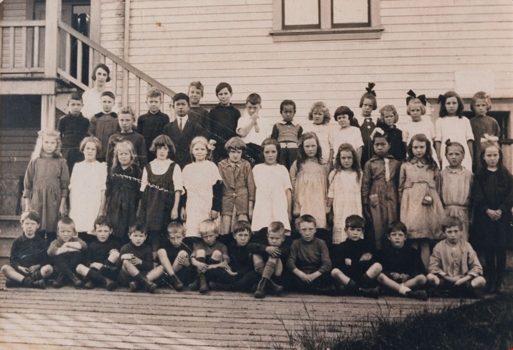
Students at Douglas Road School
https://search.heritageburnaby.ca/link/museumdescription78
- Repository
- Burnaby Village Museum
- Date
- 1925
- Collection/Fonds
- Burnaby Village Museum Photograph collection
- Description Level
- Item
- Physical Description
- 1 photograph : sepia ; 10.5 x 16 cm
- Scope and Content
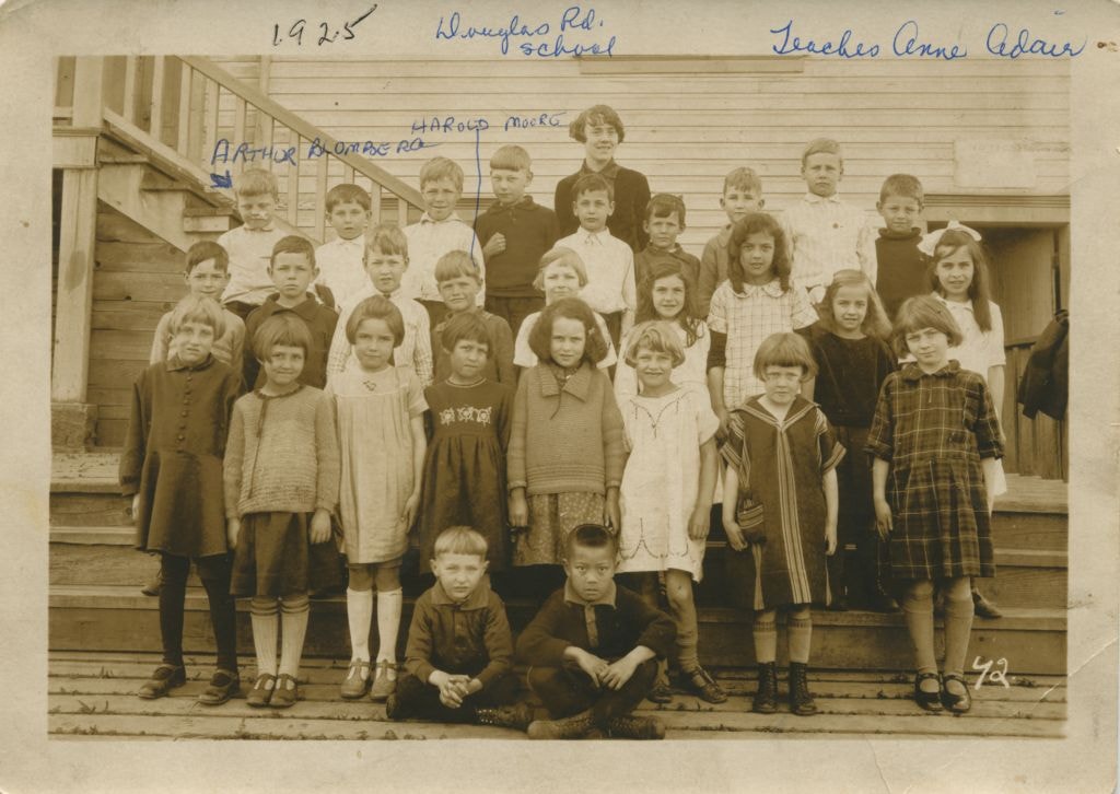
- Photograph of students on the steps of Douglas Road School with their teacher, Annie Adair, standing in the centre at the very back. The boy standing on the extreme left at the back row is identified as Arthur Blomberg and the boy standing 4th from the left in the middle row is Harold Moore. The ot…
- Repository
- Burnaby Village Museum
- Collection/Fonds
- Burnaby Village Museum Photograph collection
- Description Level
- Item
- Physical Description
- 1 photograph : sepia ; 10.5 x 16 cm
- Scope and Content
- Photograph of students on the steps of Douglas Road School with their teacher, Annie Adair, standing in the centre at the very back. The boy standing on the extreme left at the back row is identified as Arthur Blomberg and the boy standing 4th from the left in the middle row is Harold Moore. The other students are not identified.
- Subjects
- Occupations - Teachers
- Geographic Access
- Canada Way
- Street Address
- 4861 Canada Way
- Accession Code
- BV989.28.1
- Access Restriction
- No restrictions
- Date
- 1925
- Media Type
- Photograph
- Historic Neighbourhood
- Burnaby Lake (Historic Neighbourhood)
- Planning Study Area
- Douglas-Gilpin Area
- Scan Resolution
- 600
- Scan Date
- 01-Jun-09
- Scale
- 100
- Notes
- Title based on contents of photograph
- Photographer identifies photograph as no. 42
- Notes on recto of photograph read: "Douglas Rd. school / Teacher Anne Adair / ARTHUR BLOMBERG / HAROLD MOORE" and "1925"
Images

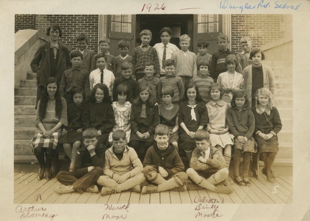
Students at Douglas Road School
https://search.heritageburnaby.ca/link/museumdescription79
- Repository
- Burnaby Village Museum
- Date
- 1926
- Collection/Fonds
- Burnaby Village Museum Photograph collection
- Description Level
- Item
- Physical Description
- 1 photograph : b&w ; 10.5 x 15.5 cm
- Scope and Content
- Photograph of students sitting and standing on the steps of Douglas Road School with their teacher (wearing glasses and an overcoat) on the far left at the back. In the front row, Arthur Blomberg is sitting on the far left, next to him is Harold Moore, with William A. "Dinty" Moore on the far right…
- Repository
- Burnaby Village Museum
- Collection/Fonds
- Burnaby Village Museum Photograph collection
- Description Level
- Item
- Physical Description
- 1 photograph : b&w ; 10.5 x 15.5 cm
- Scope and Content
- Photograph of students sitting and standing on the steps of Douglas Road School with their teacher (wearing glasses and an overcoat) on the far left at the back. In the front row, Arthur Blomberg is sitting on the far left, next to him is Harold Moore, with William A. "Dinty" Moore on the far right. The other students are not identified.
- Subjects
- Occupations - Teachers
- Geographic Access
- Canada Way
- Street Address
- 4861 Canada Way
- Accession Code
- BV989.28.2
- Access Restriction
- No restrictions
- Date
- 1926
- Media Type
- Photograph
- Historic Neighbourhood
- Burnaby Lake (Historic Neighbourhood)
- Planning Study Area
- Douglas-Gilpin Area
- Scan Resolution
- 600
- Scan Date
- 01-Jun-09
- Scale
- 100
- Notes
- Title based on contents of photograph
- Photographer identifies photograph as no. 5
- Notes on recto of photograph read: "Douglas Rd. School" and "1926 / Arthur Blomberg / Harold Moore / (Alister) Dinty Moore"
Images

Students at Douglas Road School
https://search.heritageburnaby.ca/link/museumdescription1377
- Repository
- Burnaby Village Museum
- Date
- 1920
- Collection/Fonds
- Burnaby Village Museum Photograph collection
- Description Level
- Item
- Physical Description
- 1 photograph : sepia ; 17.5 x 25.5 cm print
- Scope and Content
- Photograph of Elsie Rummel (later McMurray) standing behind her students who are sitting and standing in rows outside Douglas Road school. Standing in the back two rows, left to right are; Jack Lort, Billy Mather, Teddy Norman (slightly in front), Ed Gavin, David Jung (slightly in front), Leonard R…
- Repository
- Burnaby Village Museum
- Collection/Fonds
- Burnaby Village Museum Photograph collection
- Description Level
- Item
- Physical Description
- 1 photograph : sepia ; 17.5 x 25.5 cm print
- Scope and Content
- Photograph of Elsie Rummel (later McMurray) standing behind her students who are sitting and standing in rows outside Douglas Road school. Standing in the back two rows, left to right are; Jack Lort, Billy Mather, Teddy Norman (slightly in front), Ed Gavin, David Jung (slightly in front), Leonard Rowley, Dave Banning, Herbert McConnell, Ying Jung, Gwendolyn Matthews, Avis Hart, Florence Cowan, Nancy Burnett, Winona Wood, Leona Smith, Sadie Bowie [or Dorothy Marsden]. Standing in the middle row are; Nora Rowley, Eva Dunnell [or Donnel], Rena Blomberg (later Ostby), Audrey [or Helen] Pontifex, Ruth Cole, Anna Matthews, Agnes Angus, Rhoda Gavin, Ruby Boucher, King Jung, Mary Lee, Frances "Fanny" Waplington (later Fleming), Beryl Hatch. Seated in the front row are; John Burnett [or Freddy Bogardus], John Waplington, Billy Townley, Roddie Saunders, Clive Cunningham, Ken Blott, Carl Banning, Doug Tyre, Bert Dawkins, Montague "Monty" Moore, John Moore and Alistair Westcott.
- Subjects
- Occupations - Teachers
- Names
- Douglas Road School
- McMurray, Elsie Rummel
- Lort, Jack
- Mather, Billy
- Norman, Teddy
- Gavin, Ed
- Jung, David
- Rowley, Leonard
- Banning, Dave
- McConnell, Herbert
- Jung, Suey Ying "Laura"
- Matthews, Gwendolyn
- Hart, Avis
- Cowan, Florence
- Burnett, Nancy
- Wood, Winona
- Smith, Leona
- Rowley, Nora
- Ostby, Rena Blomberg
- Cole, Ruth
- Matthews, Anna
- Angus, Agnes
- Gavin, Rhoda
- Boucher, Ruby
- Jung, King
- Lee, Mary
- Fleming, Frances "Fanny" Waplington
- Hatch, Beryl
- Waplington, John
- Townley, Billy
- Saunders, Roddie
- Cunningham, Clive
- Blott, Ken
- Banning, Carl
- Tyre, Doug
- Dawkins, Bert
- Moore, Montague Hutchings "Monty"
- Moore, John Gifford
- Westcott, Alistair
- Geographic Access
- Canada Way
- Street Address
- 4861 Canada Way
- Accession Code
- BV999.4.1
- Access Restriction
- No restrictions
- Reproduction Restriction
- No known restrictions
- Date
- 1920
- Media Type
- Photograph
- Historic Neighbourhood
- Burnaby Lake (Historic Neighbourhood)
- Planning Study Area
- Douglas-Gilpin Area
- Scan Resolution
- 600
- Scan Date
- 08-Jun-09
- Scale
- 100
- Notes
- Title based on contents of photograph
Images
![Subdivision plans in New Westminster District Group 1 – Burnaby
, [1893-1910] thumbnail](/media/hpo/_Data/_BVM_Cartographic_Material/1977/1977_0093_0016a_001.jpg?width=280)
Subdivision plans in New Westminster District Group 1 – Burnaby
https://search.heritageburnaby.ca/link/museumdescription6985
- Repository
- Burnaby Village Museum
- Date
- [1893-1910]
- Collection/Fonds
- Burnaby Village Museum Map collection
- Description Level
- File
- Physical Description
- 4 plans : blueprint ink on paper mounted on 2 sides of cardboard 76 x 102 cm
- Scope and Content
- Item consists of a large board of two New Westminster District Gp 1 - subdivision plans mounted on one side and two New Westminster District Gp 1 - subdivision plans mounted on the other side. Side A: 1. Blueprint "Plan / of Subdivision / of / Lot 6 / Group One / New Westminster District / Scale…
- Repository
- Burnaby Village Museum
- Collection/Fonds
- Burnaby Village Museum Map collection
- Description Level
- File
- Physical Description
- 4 plans : blueprint ink on paper mounted on 2 sides of cardboard 76 x 102 cm
- Material Details
- Scales [between 1:1584 and 1:3960]
- Index number on edge of board reads: "16"
- Scope and Content
- Item consists of a large board of two New Westminster District Gp 1 - subdivision plans mounted on one side and two New Westminster District Gp 1 - subdivision plans mounted on the other side. Side A: 1. Blueprint "Plan / of Subdivision / of / Lot 6 / Group One / New Westminster District / Scale 5 chs = 1 in. / Map No 748" (Geographic location: Burnaby) 2. Blueprint "Plan / of Subdivision / of a Portion / of / Lot 29 / Group One / New Westminster Dist. / Scale 2 chs = 1 in. / Map No." Name identified in Block H is "Reichenbach" (Geographic location: Burnaby) Side B: 1. Blueprint "Plan / of Subdivision / of North 1/2 of Lot 80 / Group One / New Westminster District / Scale 3 chs = 1 in. / Map No 719" Plan is signed by: "Garden, Hermon & Burwell P.L.S. / Vancouver Jan. 23rd, 1893" (Geographic location: Burnaby) 2. Blueprint "Plan / of Subdivision / of Lot 79, Gr.1 / New Westminster Dist. / Scale 4 chas = 1 in. / Map No 536" Plan is signed by "Garden Hermon & Burwell / Provincial Land Surveyors". (Geographic location: Burnaby)
- Creator
- Garden, Hermon and Burwell
- Accession Code
- HV977.93.16
- Access Restriction
- No restrictions
- Reproduction Restriction
- No known restrictions
- Date
- [1893-1910]
- Media Type
- Cartographic Material
- Historic Neighbourhood
- Edmonds (Historic Neighbourhood)
- Burnaby Lake (Historic Neighbourhood)
- Planning Study Area
- Douglas-Gilpin Area
- Edmonds Area
- Cameron Area
- Scan Resolution
- 300
- Scale
- 72
- Notes
- Title based on contents of file
- Scale is measured in chains. (One chain equals 792 inches)
- The term "Lot" can also refer to a "District Lot”
Images
![Subdivision plans in New Westminster District Group 1 – Burnaby
, [1893-1910] thumbnail](/media/hpo/_Data/_BVM_Cartographic_Material/1977/1977_0093_0016a_001.jpg)

![Survey and Subdivision plans in New Westminster District Group 1 – Burnaby
, [1908] thumbnail](/media/hpo/_Data/_BVM_Cartographic_Material/1977/1977_0093_0004a_001.jpg?width=280)
Survey and Subdivision plans in New Westminster District Group 1 – Burnaby
https://search.heritageburnaby.ca/link/museumdescription6973
- Repository
- Burnaby Village Museum
- Date
- [1908]
- Collection/Fonds
- Burnaby Village Museum Map collection
- Description Level
- File
- Physical Description
- 10 plans : blueprint ink on paper mounted on 2 sides of cardboard ; 76 cm x 102 cm
- Scope and Content
- Item consists of a large board of four New Westminster District Gp 1 - subdivision plans mounted on one side and six New Westminster District Gp 1 - subdivision plans mounted on the other side. Side A: 1. Blueprint "Plan / of - ReSubdivision / of / Lots 1-18 inclusive / Blocks 20 and 21 / in Sub…
- Repository
- Burnaby Village Museum
- Collection/Fonds
- Burnaby Village Museum Map collection
- Description Level
- File
- Physical Description
- 10 plans : blueprint ink on paper mounted on 2 sides of cardboard ; 76 cm x 102 cm
- Material Details
- Scales [between 1:792 and 1:4752]
- Index number on edge of board reads: "4"
- Scope and Content
- Item consists of a large board of four New Westminster District Gp 1 - subdivision plans mounted on one side and six New Westminster District Gp 1 - subdivision plans mounted on the other side. Side A: 1. Blueprint "Plan / of - ReSubdivision / of / Lots 1-18 inclusive / Blocks 20 and 21 / in Subdivision / of / Lot 53 -Gr.1 / New Westminster District" / "Subdivision Lot Numbers - Shown in Red". Plan is bordered by First Street / Jorgenson's Line / Fourth Avenue and Second Street with Fifith Avenue running through the centre. There is an index in the upper right corner of the plan. Planned is signed by "Peter Byrne" and "William R. Phillips" and dated July 28, 1908. (Geographic location: Burnaby) 2. Blueprint "Plan / of Subdivision / of / Lot 159 / and a Portion of Lot 158 / Group One / New Westminster District". Plan is bordered by Lots 96 and 97; South Wilson Street; North Arm Road and Lot 160 / Power House Road (Lot 155 A). B.C.E.R. Gilley Station is identified in the upper right corner of the plan. (Geographic location: Burnaby) 3. Blueprint plan identified as "Subdvs 10, L 88 and Lot 25, G. 1" Plan identifies Cumberland Street running from top to the bottom and a Ravine running alongside with the Jensen house, stable and barn. (Geographic location: Burnaby) 4. Blueprint Plan of "Lot 153. G. 1 /New Westminster District". Plan identifies the "New Westminster & Vancouver Tramway" and the "New Westminster and Vancouver Road" running through the plan of Lot 53. (Geographic location: Burnaby) Side B: 1. Blueprint plan of "Profile on Proposed North Rd. Diversion". 2. Blueprint plan (no title) showing wood lots north of Burnaby Lake and Brunette River and west of North Road. Various lots are identified as "Heavily Timbered" (Lot 57); "Splendid Fir and Cedar / Heavy Fir etc. / Fine Cedar" (Lots 143, 148); "Rough Light Timber," (Lot 56); "Some Fir and Cedar" (Lot 40). (Geographic location: Burnaby) 3. Blueprint "Plan / of Subdivision / of a Portion / of Lot 87, Gr.1 / New Westminster District". Plan is bordered by Burnaby Lake at the top and Hastings Road / Lot 86 at the bottom and Lot 90 to the east. "Albert J. Hill B.C.LotS." Annotation in ink reads: " J.A. Brownlee, B.C.L.S. / Subdivision / Map 1494 / Bd. 248". Plan is signed by "Peter Byrne, Reeve" (Geographic location: Burnaby) 4. Blueprint plan of Subdivisions along either side of Douglas Road including Lots 117; 119; 74; 80; 79 and 77. (Geographic location: Burnaby) 5. Blueprint "Plan / of / Subdivision of / Lot 27 / in Subdivision / of / Lot 30 / Group One / New Westminster District" Plan is bordered by Lot 26, Lot 28 and Hastings Rd. Lot 27 runs north of Edmonds Street. , "Albert J. Hill, B.C.LotS." (Geographic location: Burnaby) 6. Blueprint plan identified as a "Cultivated Orchard" including the names "W. Grace" and "G. Mead" located north of the North Arm Fraser River and west of "Twentieth Street_ City Boundary". Handwritten annotation in coloured pencil reads: "Portion of Lot 172" (Geographic location: Burnaby)
- Subjects
- Geographic Features - Forests
- Geographic Access
- Cumberland Street
- North Road
- Hastings Street
- Douglas Road
- Accession Code
- HV977.93.4
- Access Restriction
- No restrictions
- Reproduction Restriction
- No known restrictions
- Date
- [1908]
- Media Type
- Cartographic Material
- Historic Neighbourhood
- Burnaby Lake (Historic Neighbourhood)
- Fraser Arm (Historic Neighbourhood)
- Planning Study Area
- Douglas-Gilpin Area
- Burnaby Lake Area
- Scan Resolution
- 300
- Scale
- 72
- Notes
- Title based on contents of file
- Scale is measured in chains. (One chain equals 792 inches)
- The term "Lot" can also refer to a "District Lot”-
Images
![Survey and Subdivision plans in New Westminster District Group 1 – Burnaby
, [1908] thumbnail](/media/hpo/_Data/_BVM_Cartographic_Material/1977/1977_0093_0004a_001.jpg)

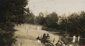
Tennis court
https://search.heritageburnaby.ca/link/archivedescription39217
- Repository
- City of Burnaby Archives
- Date
- 1926
- Collection/Fonds
- Peers Family and Hill Family fonds
- Description Level
- Item
- Physical Description
- 1 photograph : b&w ; 6 x 10.5 cm on page 24.5 x 32.5 cm (pasted in album)
- Scope and Content
- Photograph of the tennis court at the home of Kitty and Bob Peers on Deer Lake Avenue. The people in the photograph are unidentified.
- Repository
- City of Burnaby Archives
- Date
- 1926
- Collection/Fonds
- Peers Family and Hill Family fonds
- Physical Description
- 1 photograph : b&w ; 6 x 10.5 cm on page 24.5 x 32.5 cm (pasted in album)
- Description Level
- Item
- Record No.
- 477-536
- Access Restriction
- No restrictions
- Reproduction Restriction
- No known restrictions
- Accession Number
- 2007-12
- Scope and Content
- Photograph of the tennis court at the home of Kitty and Bob Peers on Deer Lake Avenue. The people in the photograph are unidentified.
- Subjects
- Sports - Tennis
- Media Type
- Photograph
- Notes
- Title based on caption accompanying photograph
- Geographic Access
- Deer Lake Avenue
- Street Address
- 6588 Deer Lake Avenue
- Historic Neighbourhood
- Burnaby Lake (Historic Neighbourhood)
- Planning Study Area
- Douglas-Gilpin Area
Images

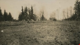
The Tennis Courts Under Construction
https://search.heritageburnaby.ca/link/archivedescription39219
- Repository
- City of Burnaby Archives
- Date
- 1923
- Collection/Fonds
- Peers Family and Hill Family fonds
- Description Level
- Item
- Physical Description
- 1 photograph : b&w ; 6 x 10.8 cm on page 24.5 x 32.5 cm (pasted in album)
- Scope and Content
- Photograph shows the land clearing undertaken in preparation for the construction of tennis courts at the home of Bob and Kitty Peers family on Deer Lake Avenue.
- Repository
- City of Burnaby Archives
- Date
- 1923
- Collection/Fonds
- Peers Family and Hill Family fonds
- Physical Description
- 1 photograph : b&w ; 6 x 10.8 cm on page 24.5 x 32.5 cm (pasted in album)
- Description Level
- Item
- Record No.
- 477-538
- Access Restriction
- No restrictions
- Reproduction Restriction
- No known restrictions
- Accession Number
- 2007-12
- Scope and Content
- Photograph shows the land clearing undertaken in preparation for the construction of tennis courts at the home of Bob and Kitty Peers family on Deer Lake Avenue.
- Subjects
- Land Clearing
- Media Type
- Photograph
- Notes
- Title based on caption accompanying photograph
- Geographic Access
- Deer Lake Avenue
- Street Address
- 6588 Deer Lake Avenue
- Historic Neighbourhood
- Burnaby Lake (Historic Neighbourhood)
- Planning Study Area
- Douglas-Gilpin Area
Images


Thank you from City of Burnaby
https://search.heritageburnaby.ca/link/museumdescription15400
- Repository
- Burnaby Village Museum
- Date
- 9 Apr. 2020
- Collection/Fonds
- Burnaby Village Museum COVID-19 collection
- Description Level
- Item
- Physical Description
- 1 video recording (mp4) (58 sec.) : digital, 24 fps, col., sd., stereo
- Scope and Content
- Film clip of Burnaby Mayor Mike Hurley and Burnaby City staff showing their appreciation to frontline workers, first responders and healthcare workers during the COVID-19 pandemic. Burnaby City Hall and other city facilities have decorated windows with colourful hearts and staff members are standin…
- Repository
- Burnaby Village Museum
- Collection/Fonds
- Burnaby Village Museum COVID-19 collection
- Description Level
- Item
- Physical Description
- 1 video recording (mp4) (58 sec.) : digital, 24 fps, col., sd., stereo
- Scope and Content
- Film clip of Burnaby Mayor Mike Hurley and Burnaby City staff showing their appreciation to frontline workers, first responders and healthcare workers during the COVID-19 pandemic. Burnaby City Hall and other city facilities have decorated windows with colourful hearts and staff members are standing outside buildings holding hearts of appreciation. The film closes with people holding hearts and conveying words of thanks in multiple languages.
- History
- Video taken by the City of Burnaby Marketing Department in 2020. The original intent of the clip was to produce communications about the pandemic and changes throughout the City that residents needed to be aware of.
- Creator
- City of Burnaby
- Subjects
- Officials - Mayors and Reeves
- Public Services - Health Services
- Public Services - Municipal Services
- Pandemics - COVID-19
- Geographic Access
- Canada Way
- Street Address
- 4949 Canada Way
- Accession Code
- BV021.2.14
- Access Restriction
- No restrictions
- Reproduction Restriction
- May be restricted by third party rights
- Date
- 9 Apr. 2020
- Media Type
- Moving Images
- Historic Neighbourhood
- Burnaby Lake (Historic Neighbourhood)
- Planning Study Area
- Douglas-Gilpin Area
- Notes
- Title based on contents of film
Images
Video
Thank you from City of Burnaby, 9 Apr. 2020
Thank you from City of Burnaby, 9 Apr. 2020
https://search.heritageburnaby.ca/media/hpo/_Data/_BVM_Moving_Images/2021_0002_0014_001.mp4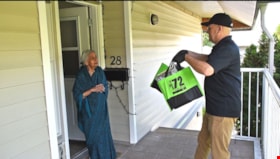
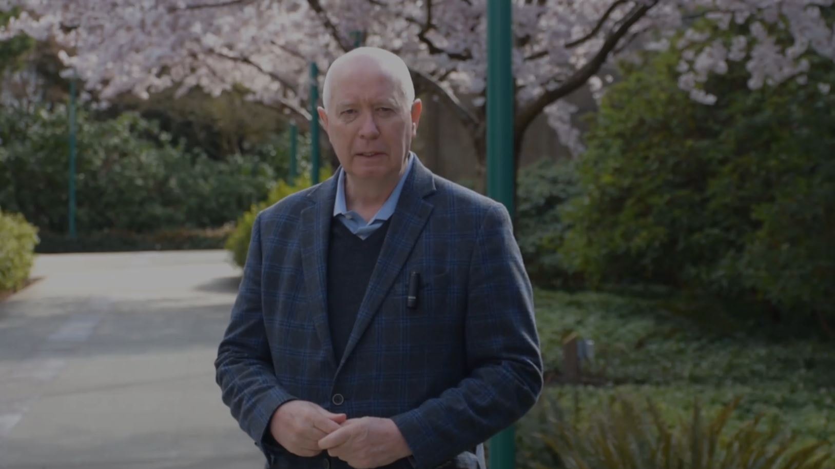
Thank you to citizens of Burnaby
https://search.heritageburnaby.ca/link/museumdescription15399
- Repository
- Burnaby Village Museum
- Date
- May 2020
- Collection/Fonds
- Burnaby Village Museum COVID-19 collection
- Description Level
- Item
- Physical Description
- 1 video recording (mp4) (1 min., 37 sec.) : digital, 24 fps, col., sd., stereo
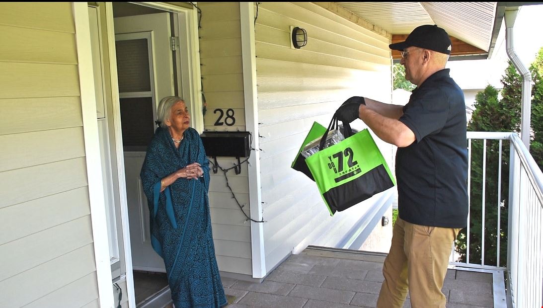
- Scope and Content
- Film clip from the City of Burnaby thanking it's citizens for helping to flatten the curve of the spread of COVID-19 in the community. Mayor Mike Hurley and narrator communicate that commitments made by citizens have helped set the stage for less restrictions whereby some facilities can be reopened…
- Repository
- Burnaby Village Museum
- Collection/Fonds
- Burnaby Village Museum COVID-19 collection
- Description Level
- Item
- Physical Description
- 1 video recording (mp4) (1 min., 37 sec.) : digital, 24 fps, col., sd., stereo
- Scope and Content
- Film clip from the City of Burnaby thanking it's citizens for helping to flatten the curve of the spread of COVID-19 in the community. Mayor Mike Hurley and narrator communicate that commitments made by citizens have helped set the stage for less restrictions whereby some facilities can be reopened in a safe manner by following the guidelines from the Provincial Health Officer, Dr. Bonnie Henry. Film clip includes a compilation of footage taken by the City's marketing department between March and May 2020. Background music "We're all in this together"is written and performed by Joe Keithley and Mayor Mike Hurley.
- History
- Video taken by the City of Burnaby Marketing Department in 2020. The original intent of the clip was to produce communications about the pandemic and changes throughout the City that residents needed to be aware of.
- Creator
- City of Burnaby
- Geographic Access
- Canada Way
- Street Address
- 4949 Canada Way
- Accession Code
- BV021.2.13
- Access Restriction
- No restrictions
- Reproduction Restriction
- May be restricted by third party rights
- Date
- May 2020
- Media Type
- Moving Images
- Historic Neighbourhood
- Burnaby Lake (Historic Neighbourhood)
- Planning Study Area
- Douglas-Gilpin Area
- Notes
- Title based on contents of film
Images
Video
Thank you to citizens of Burnaby, May 2020
Thank you to citizens of Burnaby, May 2020
https://search.heritageburnaby.ca/media/hpo/_Data/_BVM_Moving_Images/2021_0002_0013_001.mp4![Women on the steps, [190-?] (date of original), copied 1977 thumbnail](/media/hpo/_Data/_BVM_Images/1977/1977_0123_0021_001.jpg?width=280)
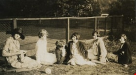
Women on the steps
https://search.heritageburnaby.ca/link/museumdescription615
- Repository
- Burnaby Village Museum
- Date
- [190-?] (date of original), copied 1977
- Collection/Fonds
- Burnaby Village Museum Photograph collection
- Description Level
- Item
- Physical Description
- 1 photograph : b&w ; 25.2 x 20.2 cm print
- Scope and Content
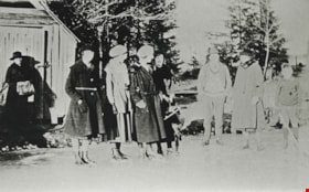
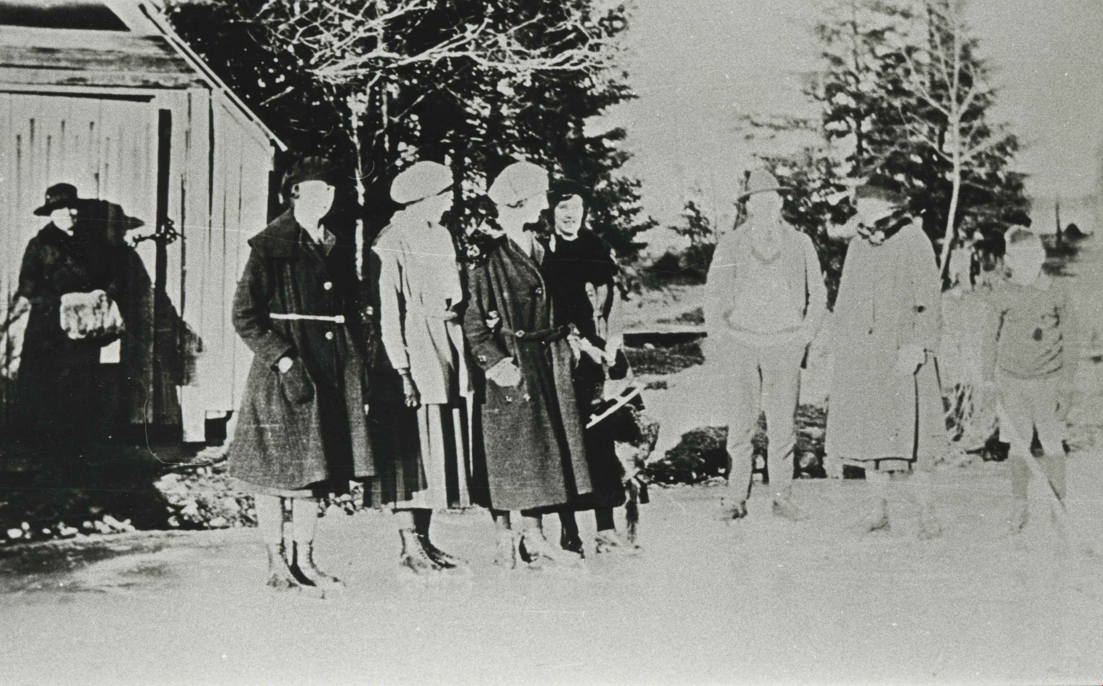
- Photograph of a group of women sitting together on the steps to a house that appears to be Bernard Hill home on Douglas Road (now Canada Way) near Deer Lake. The three women, including Winnie Hill Rowe (daughter of Bernard Hill) on the right are sitting on the step just behind a girl in a sailor sh…
- Repository
- Burnaby Village Museum
- Collection/Fonds
- Burnaby Village Museum Photograph collection
- Description Level
- Item
- Physical Description
- 1 photograph : b&w ; 25.2 x 20.2 cm print
- Scope and Content
- Photograph of a group of women sitting together on the steps to a house that appears to be Bernard Hill home on Douglas Road (now Canada Way) near Deer Lake. The three women, including Winnie Hill Rowe (daughter of Bernard Hill) on the right are sitting on the step just behind a girl in a sailor shirt and pleated skirt sitting in the front, who appears to be Kitty Hill.
- Geographic Access
- Canada Way
- Street Address
- 4990 Canada Way
- Accession Code
- HV977.123.21
- Access Restriction
- No restrictions
- Reproduction Restriction
- No known restrictions
- Date
- [190-?] (date of original), copied 1977
- Media Type
- Photograph
- Historic Neighbourhood
- Burnaby Lake (Historic Neighbourhood)
- Planning Study Area
- Douglas-Gilpin Area
- Related Material
- For another photograph of the same group of women on the steps, see HV977.123.20
- Scan Resolution
- 600
- Scan Date
- 2023-07-25
- Notes
- Title based on contents of photograph
Images
![Women on the steps, [190-?] (date of original), copied 1977 thumbnail](/media/hpo/_Data/_BVM_Images/1977/1977_0123_0021_001.jpg)
Women seated next to a tennis court
https://search.heritageburnaby.ca/link/archivedescription39218
- Repository
- City of Burnaby Archives
- Date
- 1926
- Collection/Fonds
- Peers Family and Hill Family fonds
- Description Level
- Item
- Physical Description
- 1 photograph : sepia ; 6 x 11 cm on page 24.5 x 32.5 cm (pasted in album)
- Scope and Content
- Photograph of six women seated next to the tennis court at the home of Bob and Kitty Peers family on Deer Lake Avenue. All are unidentified.
- Repository
- City of Burnaby Archives
- Date
- 1926
- Collection/Fonds
- Peers Family and Hill Family fonds
- Physical Description
- 1 photograph : sepia ; 6 x 11 cm on page 24.5 x 32.5 cm (pasted in album)
- Description Level
- Item
- Record No.
- 477-537
- Access Restriction
- No restrictions
- Reproduction Restriction
- No known restrictions
- Accession Number
- 2007-12
- Scope and Content
- Photograph of six women seated next to the tennis court at the home of Bob and Kitty Peers family on Deer Lake Avenue. All are unidentified.
- Subjects
- Sports - Tennis
- Media Type
- Photograph
- Notes
- Title based on caption accompanying photograph
- Geographic Access
- Deer Lake Avenue
- Street Address
- 6588 Deer Lake Avenue
- Historic Neighbourhood
- Burnaby Lake (Historic Neighbourhood)
- Planning Study Area
- Douglas-Gilpin Area
Images
