Narrow Results By
Subject
- Accidents - Automobile Accidents 3
- Advertising Medium - Signs and Signboards 2
- Agriculture - Farms 1
- Animals - Cats 1
- Arts 4
- Arts - Paintings 2
- Buildings 1
- Buildings - Civic - City Halls 1
- Buildings - Civic - Community Centres 2
- Buildings - Civic - Libraries 1
- Buildings - Civic - Museums 9
- Buildings - Commercial 1
Person / Organization
- Beatty, Ella 1
- Birchell, Daisy 1
- Blair, Betty Warburton Atkinson 1
- Brantford Elementary School 3
- Brenchley, William 1
- British Columbia Electric Railway Company 1
- Brown, Cice Chandler 2
- Burnaby City Hall 1
- Burnaby Fire Department 2
- Burnaby Lawn Bowling Club 1
- Burnaby Public Library 2
- Burnaby South High School 1
Kingsway-Beresford Neighbourhood
https://search.heritageburnaby.ca/link/landmark805
- Repository
- Burnaby Heritage Planning
- Associated Dates
- 1955-2008
- Heritage Value
- Since the building boom of the 1950s, the Kingsway-Beresford Neighbourhood has maintained a residential character with the exception of the Kingsway corridor, which has become a primary commercial and light industrial sector.
- Historic Neighbourhood
- Edmonds (Historic Neighbourhood)
- Planning Study Area
- Kingsway-Beresford Area
Images
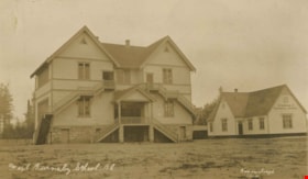
West Burnaby School (aka Kingsway West School)
https://search.heritageburnaby.ca/link/landmark727
- Repository
- Burnaby Heritage Planning
- Geographic Access
- Kingsway
- Associated Dates
- 1896
- Heritage Value
- West Burnaby School was to be Burnaby's second public school and it served the children who lived along the tram line and Vancouver Road (Kingsway).
- Historic Neighbourhood
- Central Park (Historic Neighbourhood)
- Planning Study Area
- Maywood Area
- Street View URL
- Google Maps Street View
Images
Expanded Site - Rezoning Reference # 08-24 - 7425, 7435 Kingsway (Expanded Site to include 7405, 7413 Kingsway and 7456 Britton Street) Edmonds Town Centre Plan Sub-Area 2
https://search.heritageburnaby.ca/link/councilreport56362
- Repository
- City of Burnaby Archives
- Report ID
- 77751
- Meeting Date
- 19-Oct-2009
- Format
- Council - Manager's Report
- Item No.
- 1
- Collection/Fonds
- City Council and Office of the City Clerk fonds
- Repository
- City of Burnaby Archives
- Report ID
- 77751
- Meeting Date
- 19-Oct-2009
- Format
- Council - Manager's Report
- Item No.
- 1
- Collection/Fonds
- City Council and Office of the City Clerk fonds
Documents
Liquor Licence Application # 06-04: Proposed new Liquor Primary Establishment, O'Ryan's Bar and Grill 5507 Kingsway (Civic Address: 5501 Kingsway)
https://search.heritageburnaby.ca/link/councilreport205
- Repository
- City of Burnaby Archives
- Report ID
- 66963
- Meeting Date
- 23-Apr-2007
- Format
- Council - Manager's Report
- Item No.
- 11
- Collection/Fonds
- City Council and Office of the City Clerk fonds
- Repository
- City of Burnaby Archives
- Report ID
- 66963
- Meeting Date
- 23-Apr-2007
- Format
- Council - Manager's Report
- Item No.
- 11
- Collection/Fonds
- City Council and Office of the City Clerk fonds
Documents
Rezoning Reference #03-40 - Kingsway/McMurray/Hazel Area Proposed Expansion to include Both sides of McMurray Avenue, North of Kingsway
https://search.heritageburnaby.ca/link/councilreport1857
- Repository
- City of Burnaby Archives
- Report ID
- 65290
- Meeting Date
- 3-May-2004
- Format
- Council - Manager's Report
- Manager's Report No.
- 13
- Item No.
- 1
- Collection/Fonds
- City Council and Office of the City Clerk fonds
- Repository
- City of Burnaby Archives
- Report ID
- 65290
- Meeting Date
- 3-May-2004
- Format
- Council - Manager's Report
- Manager's Report No.
- 13
- Item No.
- 1
- Collection/Fonds
- City Council and Office of the City Clerk fonds
Documents
Rezoning Reference # 05-64 - Proposed Relocated Kingsway Library (7311 Kingsway)
https://search.heritageburnaby.ca/link/councilreport441
- Repository
- City of Burnaby Archives
- Report ID
- 66721
- Meeting Date
- 30-Oct-2006
- Format
- Council - Manager's Report
- Item No.
- 2
- Collection/Fonds
- City Council and Office of the City Clerk fonds
- Repository
- City of Burnaby Archives
- Report ID
- 66721
- Meeting Date
- 30-Oct-2006
- Format
- Council - Manager's Report
- Item No.
- 2
- Collection/Fonds
- City Council and Office of the City Clerk fonds
Documents
Burnaby Municipal Hall
https://search.heritageburnaby.ca/link/landmark730
- Repository
- Burnaby Heritage Planning
- Geographic Access
- Kingsway
- Associated Dates
- 1899
- Heritage Value
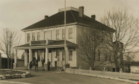
- Although Burnaby was incorporated as a municipality in 1892, its first Municipal Hall was not built until 1899 and located at Kingsway and Edmonds. It was close to the tram line on Kingsway and at the population centre of South Burnaby.
- Historic Neighbourhood
- Edmonds (Historic Neighbourhood)
- Planning Study Area
- Stride Avenue Area
- Street Address
- 7252 Kingsway
- Street View URL
- Google Maps Street View
Images
Powerhouse
https://search.heritageburnaby.ca/link/landmark731
- Repository
- Burnaby Heritage Planning
- Geographic Access
- Griffiths Avenue
- Kingsway
- Associated Dates
- 1891
- Heritage Value
- Constructed in 1891 between Edmonds and Highland Park on the Central Park Interurban Line, the steam plant provided power to run the line, then operated by Westminster and Vancouver Tramway Company. The steam powerhouse was replaced in 1905 by a B.C. Electric substation which was put into operation to receive and distribute power from the B.C.E.R. Buntzen Lake power dam. Prior to Burnaby having its own Municipal Hall, Council meetings were often held at the boarding house adjacent to the powerhouse and in 1892, Burnaby’s first Council meeting was held at the boarding house in 1892.
- Historic Neighbourhood
- Edmonds (Historic Neighbourhood)
- Planning Study Area
- Kingsway-Beresford Area
Images
Royal Oak Hotel
https://search.heritageburnaby.ca/link/landmark726
- Repository
- Burnaby Heritage Planning
- Geographic Access
- Kingsway
- Associated Dates
- 1891
- Heritage Value
- One of the most notorious landmarks in Burnaby was the Royal Oak Hotel, constructed around 1891 at the present-day northeast corner of Kingsway and Royal Oak. Levis Morrison built the hotel, then sold out to Charles Cridland, whose poor hotel reputation prompted Burnaby council to hire its second police constable. The hotel continued to operate until 1973 when it was demolished to build a Safeway store.
- Historic Neighbourhood
- Central Park (Historic Neighbourhood)
- Planning Study Area
- Marlborough Area
- Street View URL
- Google Maps Street View
Images
Windsor Neighbourhood
https://search.heritageburnaby.ca/link/landmark803
- Repository
- Burnaby Heritage Planning
- Associated Dates
- 1955-2008
- Heritage Value
- The Windsor Neighbourhood comprises a number of different districts with different characteristics. To the north, stretching to the border of the Deer Lake Park, is the primarily residential area that was developed after the building boom of the 1950s and now consists of a mix of single-family and multi-family housing. To the south, from Kingsway to the Skytrain line, an industrial area was maintained along with a significant commercial corridor along Kingsway. In recent years, the growth and development of this area has been guided by the Royal Oak Community Plan adopted by Council in 1999.
- Planning Study Area
- Windsor Area
Images
Central Park
https://search.heritageburnaby.ca/link/landmark728
- Repository
- Burnaby Heritage Planning
- Geographic Access
- Imperial Street
- Associated Dates
- 1891
- Heritage Value
- In 1860, as the Royal Engineers constructed the road from New Westminster to Vancouver (now Kingsway), a military reserve was set aside at the trail's highest point along the ridge. This reserve provided a particularly good scenic look-out since the original forest had burned down prior to 1860, the remaining stumps offered unobstructed views. By the 1880s, the city council of both New Westminster and Vancouver eyed the reserve as potential recreation ground. As construction of the tram line was underway, the Provincial Government moved to designate the whole reserve as a park. On January 14, 1891, the Lieutenant Governor of British Columbia proclaimed it as a public recreation ground.
- Historic Neighbourhood
- Central Park (Historic Neighbourhood)
- Planning Study Area
- Maywood Area
- Street Address
- 3883 Imperial Street
- Street View URL
- Google Maps Street View
Images
Central Park Neighbourhood
https://search.heritageburnaby.ca/link/landmark723
- Repository
- Burnaby Heritage Planning
- Associated Dates
- 1891-1904
- Heritage Value
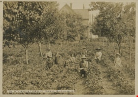
- Central Park was one of the first and fastest-growing communities in Burnaby. Located along the electric tram line and the Vancouver Road (Kingsway), it was also chosen for a government settlement project referred to as the Central Park Small Holdings. The lands held by the Provincial Government were subdivided and sold around 1894 and by 1899 the settlement was large enough to warrant the construction of an Anglican Church there.
- Historic Neighbourhood
- Central Park (Historic Neighbourhood)
- Planning Study Area
- Maywood Area
Images
East Burnaby Neighbourhood
https://search.heritageburnaby.ca/link/landmark739
- Repository
- Burnaby Heritage Planning
- Associated Dates
- 1892
- Heritage Value
- The original route of the Central Park tramline wound through New Westminster and then came up 6th Street to Edmonds, along Edmonds and across Westminster Road (Kingsway) to Highland Park and into Vancouver. Consequently, the first area of the future Municipality to attract settlers in any number was around 6th Street and Edmonds. By 1892, about 200 people had established homes in East Burnaby.
- Historic Neighbourhood
- Edmonds (Historic Neighbourhood)
- Planning Study Area
- Edmonds Area
Images
Edmonds Street Neighbourhood
https://search.heritageburnaby.ca/link/landmark827
- Repository
- Burnaby Heritage Planning
- Associated Dates
- 1955-2008
- Heritage Value
- The Edmonds Street Neighbourhood is part of the larger Edmonds Town Centre - one of four Town Centres in Burnaby. This neighbourhood is considered to be primarily residential, but a strong local commercial component developed along Edmonds and Kingsway.
- Historic Neighbourhood
- Edmonds (Historic Neighbourhood)
- Planning Study Area
- Edmonds Area
Images
Garden Village Neighbourhood
https://search.heritageburnaby.ca/link/landmark800
- Repository
- Burnaby Heritage Planning
- Associated Dates
- 1955-2008
- Heritage Value
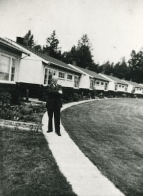
- Bounded by Moscrop Street to the north, Kingsway and Grange to the south, Willingdon to the east and Boundary Road to the west, the Garden Village Neighbourhood is characterised as a primarily residential area that is well-served due to its proximity to commercial, park and business centres. The north-east corner of the neighbourhood is a typical 1950s subdivision of mostly single family homes located on an irregular street pattern, while the remaining areas saw some transition to multi-family housing types throughout the 1970s and up to the current time.
- Historic Neighbourhood
- Central Park (Historic Neighbourhood)
- Planning Study Area
- Garden Village Area
Images
Marlborough Neighbourhood
https://search.heritageburnaby.ca/link/landmark802
- Repository
- Burnaby Heritage Planning
- Associated Dates
- 1955-2008
- Heritage Value
- The Marlborough Neighbourhood is another residential area that was witness to rapid growth and subdivision during the 1950s and 1960s, creating primarily single-family housing stock. In the 1970s and 1980s, as the commercial district around Kingsway grew, so too did higher density housing projects such as townhomes and condominiums.
- Historic Neighbourhood
- Central Park (Historic Neighbourhood)
- Planning Study Area
- Marlborough Area
Images
Richmond Park Neighbourhood
https://search.heritageburnaby.ca/link/landmark828
- Repository
- Burnaby Heritage Planning
- Associated Dates
- 1955-2008
- Heritage Value
- The Richmond Park Neighbourhood is part of the larger Edmonds Town Centre - one of four official Town Centres in the City. Richmond Park contains a residential subdivision that developed during the 1950s as well as a strong commercial and retail centre along Edmonds and Kingsway.
- Historic Neighbourhood
- Edmonds (Historic Neighbourhood)
- Planning Study Area
- Richmond Park Area
Images
1914 Kingsway East School Building Upgrading
https://search.heritageburnaby.ca/link/councilreport3576
- Repository
- City of Burnaby Archives
- Report ID
- 63572
- Meeting Date
- 23-Jul-2001
- Format
- Council - Committee Report
- Collection/Fonds
- City Council and Office of the City Clerk fonds
- Repository
- City of Burnaby Archives
- Report ID
- 63572
- Meeting Date
- 23-Jul-2001
- Format
- Council - Committee Report
- Collection/Fonds
- City Council and Office of the City Clerk fonds
Documents
2009 Kingsway Road Improvements
https://search.heritageburnaby.ca/link/councilreport55785
- Repository
- City of Burnaby Archives
- Report ID
- 72156
- Meeting Date
- 19-Jan-2009
- Format
- Council - Manager's Report
- Item No.
- 4
- Collection/Fonds
- City Council and Office of the City Clerk fonds
- Repository
- City of Burnaby Archives
- Report ID
- 72156
- Meeting Date
- 19-Jan-2009
- Format
- Council - Manager's Report
- Item No.
- 4
- Collection/Fonds
- City Council and Office of the City Clerk fonds
Documents
4509/4519/4539 Kingsway; 5956/5968 Willingdon Avenue; 5955/5967 Pioneer Avenue - Rezoning Reference # 05-48 (Metrotown Development Plan, Sub-Area 1) New Applicant
https://search.heritageburnaby.ca/link/councilreport49829
- Repository
- City of Burnaby Archives
- Report ID
- 67400
- Meeting Date
- 3-Mar-2008
- Format
- Council - Manager's Report
- Item No.
- 8
- Collection/Fonds
- City Council and Office of the City Clerk fonds
- Repository
- City of Burnaby Archives
- Report ID
- 67400
- Meeting Date
- 3-Mar-2008
- Format
- Council - Manager's Report
- Item No.
- 8
- Collection/Fonds
- City Council and Office of the City Clerk fonds
