More like 'Interview with Ron Burton by Kathy Bossort November 16, 2015 - Track 3'
Narrow Results By
Subject
- Advertising Medium - Signs and Signboards 25
- Agriculture 1
- Agriculture - Farms 3
- Animals - Birds 1
- Animals - Fish 1
- Arts 1
- Arts - Sculptures 1
- Buildings - Civic - Community Centres 1
- Buildings - Civic - Hospitals 1
- Buildings - Commercial 1
- Buildings - Commercial - Grocery Stores 3
- Buildings - Commercial - Restaurants 2

Burnaby's COVID-19 drive thru testing site
https://search.heritageburnaby.ca/link/museumdescription15391
- Repository
- Burnaby Village Museum
- Date
- 27 Apr. 2020
- Collection/Fonds
- Burnaby Village Museum COVID-19 collection
- Description Level
- Item
- Physical Description
- 1 video recording (mp4) (17 sec.) : digital, 24 fps, col., si.
- Scope and Content
- Film clip (no sound) of the COVID-19 drive thru testing site in Central Park parking lot in Burnaby. Orange traffic posts, wayfinding signs and white tents are set up in the parking lot and staff are wearing protective face masks.
- Repository
- Burnaby Village Museum
- Collection/Fonds
- Burnaby Village Museum COVID-19 collection
- Description Level
- Item
- Physical Description
- 1 video recording (mp4) (17 sec.) : digital, 24 fps, col., si.
- Scope and Content
- Film clip (no sound) of the COVID-19 drive thru testing site in Central Park parking lot in Burnaby. Orange traffic posts, wayfinding signs and white tents are set up in the parking lot and staff are wearing protective face masks.
- Subjects
- Advertising Medium - Signs and Signboards
- Geographic Features - Parks
- Public Services - Health Services
- Pandemics - COVID-19
- Geographic Access
- Central Park
- Imperial Street
- Accession Code
- BV021.2.8
- Access Restriction
- No restrictions
- Reproduction Restriction
- May be restricted by third party rights
- Date
- 27 Apr. 2020
- Media Type
- Moving Images
- Historic Neighbourhood
- Central Park (Historic Neighbourhood)
- Planning Study Area
- Maywood Area
- Notes
- Title based on contents of photograph
Images

Video
Burnaby's COVID-19 drive thru testing site, 27 Apr. 2020
Burnaby's COVID-19 drive thru testing site, 27 Apr. 2020
https://search.heritageburnaby.ca/media/hpo/_Data/_BVM_Moving_Images/2021_0002_0008_001.mp4
COVID-19 sign in Conderation Park
https://search.heritageburnaby.ca/link/museumdescription15363
- Repository
- Burnaby Village Museum
- Date
- 6 May 2020
- Collection/Fonds
- Burnaby Village Museum COVID-19 collection
- Description Level
- Item
- Physical Description
- 1 photograph (jpg)
- Scope and Content
- Photograph of a City of Burnaby COVID-19 sign in Confederation Park. Sign is attached to a tree near the running track and reads: "Do your part, Stay Apart..." and includes an illustration of two figures standing two metres apart. People are walking and running on the track and the tennis and baske…
- Repository
- Burnaby Village Museum
- Collection/Fonds
- Burnaby Village Museum COVID-19 collection
- Description Level
- Item
- Physical Description
- 1 photograph (jpg)
- Scope and Content
- Photograph of a City of Burnaby COVID-19 sign in Confederation Park. Sign is attached to a tree near the running track and reads: "Do your part, Stay Apart..." and includes an illustration of two figures standing two metres apart. People are walking and running on the track and the tennis and basketball courts are visible in the distance.
- Geographic Access
- Albert Street
- Confederation Park
- Accession Code
- BV021.2.25
- Access Restriction
- No restrictions
- Reproduction Restriction
- May be restricted by third party rights
- Date
- 6 May 2020
- Media Type
- Photograph
- Planning Study Area
- Sperling-Broadway Area
- Notes
- Title based on contents of photograph
Images


Do Your Part Eagle
https://search.heritageburnaby.ca/link/archivedescription95084
- Repository
- City of Burnaby Archives
- Date
- June 13, 2020
- Collection/Fonds
- Burnaby Photographic Society fonds
- Description Level
- Item
- Physical Description
- 1 photograph (tiff)
- Scope and Content
- Photograph of a sign along the Burnaby Lake Freeway Trail that reads: "Do your part. Stay 2 metres apart." The sign has a silhoutte drawing of an eagle with its wings open to illustrate the distance of two metres.
- Repository
- City of Burnaby Archives
- Date
- June 13, 2020
- Collection/Fonds
- Burnaby Photographic Society fonds
- Physical Description
- 1 photograph (tiff)
- Description Level
- Item
- Record No.
- 623-003
- Access Restriction
- No restrictions
- Reproduction Restriction
- No restrictions
- Accession Number
- 2020-10
- Scope and Content
- Photograph of a sign along the Burnaby Lake Freeway Trail that reads: "Do your part. Stay 2 metres apart." The sign has a silhoutte drawing of an eagle with its wings open to illustrate the distance of two metres.
- Media Type
- Photograph
- Photographer
- Gervan, Bonnie
- Notes
- Transcribed title
- Photographer's caption: "A sign shows how far to keep apart."
- Geographic Access
- Burnaby Lake Regional Nature Park
- Historic Neighbourhood
- Burnaby Lake (Historic Neighbourhood)
- Planning Study Area
- Burnaby Lake Area
Images

Interview with Tony Fabian by Kathy Bossort October 29, 2015 - Track 4
https://search.heritageburnaby.ca/link/oralhistory599
- Repository
- City of Burnaby Archives
- Date Range
- 1860-1995
- Length
- 0:15:57
- Summary
- This portion of the interview is about Tony Fabian’s description of the history of setting aside parkland on Burnaby Mountain, the creation of the Pavilion area in 1957, the history of proposals for how Burnaby Mountain could be used, the land transfer to SFU in 1963, and difficulty accessing the m…
- Repository
- City of Burnaby Archives
- Summary
- This portion of the interview is about Tony Fabian’s description of the history of setting aside parkland on Burnaby Mountain, the creation of the Pavilion area in 1957, the history of proposals for how Burnaby Mountain could be used, the land transfer to SFU in 1963, and difficulty accessing the mountain for recreation prior to 1965. He also talks about the dispute between SFU and the City of Burnaby over land ownership and control.
- Date Range
- 1860-1995
- Length
- 0:15:57
- Geographic Access
- Burnaby Mountain Conservation Area
- Interviewer
- Bossort, Kathy
- Interview Date
- October 29, 2015
- Scope and Content
- Recording is of an interview with Tony Fabian conducted by Kathy Bossort. Tony Fabian was one of 23 participants interviewed as part of the Community Heritage Commission’s Burnaby Mountain Oral History Project. The interview is mainly about Tony Fabian’s part in park creation and protection of natural areas in Burnaby, particularly as a member of the Park and Recreation Commission in the 1970s; his childhood and how that contributed to his land ethic; and the history of the uses made of and setting aside parkland on Burnaby Mountain.
- Biographical Notes
- Tony S. Fabian was born in 1934 in north Saskatchewan. At less than a year old Tony, along with his siblings, was removed from his family home and eventually placed with an immigrant farm family. As a child he worked on the farm and witnessed what he considered abusive treatment of the land and farm animals. When he was about 12 years old his adoptive family moved to the BC coast where he went on his own, working for a variety of farmers in Richmond and Delta. At 19 he contracted polio, quit farm work, and found work with the telephone company. In 1956 Tony married, and in 1957 he and his wife moved to a home on Hardwick Street in Burnaby where he still lives. Tony entered civic politics in the 1960s when he objected to development on Hardwick Park and became concerned about the destruction of Burnaby’s natural landscapes. He became a life long advocate for preserving natural areas and helped to create large parks in Burnaby on the foreshore of the Fraser River and on Burrard Inlet. He served as a member of the Parks and Recreation Commission 1970-1975, is a long time volunteer with the Burnaby Lake Park Association, and continues to stay current on local and regional environmental issues. In 2008 Tony was presented with the City of Burnaby Environment Award for Community Stewardship.
- Total Tracks
- 7
- Total Length
- 1:43:22
- Interviewee Name
- Fabian, Tony S.
- Interview Location
- Tony Fabian's home in Burnaby
- Interviewer Bio
- Kathy Bossort is a retired archivist living in Ladner, BC. She worked at the Delta Museum and Archives after graduating from SLAIS (UBC) in 2001 with Masters degrees in library science and archival studies. Kathy grew up in Calgary, Alberta, and, prior to this career change, she lived in the West Kootenays, earning her living as a cook for BC tourist lodges and work camps. She continues to be interested in oral histories as a way to fill the gaps in the written record and bring richer meaning to history.
- Collection/Fonds
- Community Heritage Commission Special Projects fonds
- Media Type
- Sound Recording
Audio Tracks
Track four of interview with Tony Fabian
Track four of interview with Tony Fabian
https://search.heritageburnaby.ca/media/hpo/_Data/_Archives_Oral_Histories/_Unrestricted/MSS196-007/MSS196-007_Track_4.mp3
Physical distancing sign
https://search.heritageburnaby.ca/link/archivedescription95106
- Repository
- City of Burnaby Archives
- Date
- 2020
- Collection/Fonds
- Burnaby Photographic Society fonds
- Description Level
- Item
- Physical Description
- 1 photograph (tiff)
- Scope and Content
- Photograph of the gardens outside the Shadbolt Centre of the Arts. In the foreground, attached to a tree is a sign encouraging social distancing; in the background is a jungle gym fenced off with orange mesh and caution tape to prohibit climbing.
- Repository
- City of Burnaby Archives
- Date
- 2020
- Collection/Fonds
- Burnaby Photographic Society fonds
- Physical Description
- 1 photograph (tiff)
- Description Level
- Item
- Record No.
- 623-024
- Access Restriction
- No restrictions
- Reproduction Restriction
- No restrictions
- Accession Number
- 2020-10
- Scope and Content
- Photograph of the gardens outside the Shadbolt Centre of the Arts. In the foreground, attached to a tree is a sign encouraging social distancing; in the background is a jungle gym fenced off with orange mesh and caution tape to prohibit climbing.
- Media Type
- Photograph
- Photographer
- King, Gloria
- Notes
- Transcribed title
- Geographic Access
- Deer Lake
- Street Address
- 6450 Deer Lake Avenue
- Historic Neighbourhood
- Burnaby Lake (Historic Neighbourhood)
- Planning Study Area
- Douglas-Gilpin Area
Images


Reconstructed Central Park Band Stand
https://search.heritageburnaby.ca/link/archivedescription95123
- Repository
- City of Burnaby Archives
- Date
- May 28, 2020
- Collection/Fonds
- Burnaby Photographic Society fonds
- Description Level
- Item
- Physical Description
- 1 photograph (tiff)
- Scope and Content
- Photograph of the band stand in Central Park. The band stand stairs are blocked off with orange netting and a City of Burnaby facility closure sign.
- Repository
- City of Burnaby Archives
- Date
- May 28, 2020
- Collection/Fonds
- Burnaby Photographic Society fonds
- Physical Description
- 1 photograph (tiff)
- Description Level
- Item
- Record No.
- 623-041
- Access Restriction
- No restrictions
- Reproduction Restriction
- No restrictions
- Accession Number
- 2020-10
- Scope and Content
- Photograph of the band stand in Central Park. The band stand stairs are blocked off with orange netting and a City of Burnaby facility closure sign.
- Subjects
- Buildings - Recreational - Bandstands
- Geographic Features - Parks
- Advertising Medium - Signs and Signboards
- Media Type
- Photograph
- Photographer
- Cheung, Ray
- Notes
- Transcribed title
- Geographic Access
- Central Park
- Imperial Street
- Street Address
- 3883 Imperial Street
- Historic Neighbourhood
- Central Park (Historic Neighbourhood)
- Planning Study Area
- Maywood Area
Images


Signage for Burnaby's COVID-19 drive thru testing site
https://search.heritageburnaby.ca/link/museumdescription15370
- Repository
- Burnaby Village Museum
- Date
- 5 Apr. 2020
- Collection/Fonds
- Burnaby Village Museum COVID-19 collection
- Description Level
- Item
- Physical Description
- 1 photograph (jpg)
- Scope and Content
- Photograph of portable LED signage at entrance to COVID-19 drive thru test site in Central Park parking lot in Burnaby. LED sign reads "Covid Care Enter Here".
- Repository
- Burnaby Village Museum
- Collection/Fonds
- Burnaby Village Museum COVID-19 collection
- Description Level
- Item
- Physical Description
- 1 photograph (jpg)
- Scope and Content
- Photograph of portable LED signage at entrance to COVID-19 drive thru test site in Central Park parking lot in Burnaby. LED sign reads "Covid Care Enter Here".
- Subjects
- Advertising Medium - Signs and Signboards
- Geographic Features - Parks
- Public Services - Health Services
- Pandemics - COVID-19
- Geographic Access
- Central Park
- Imperial Street
- Accession Code
- BV021.2.35
- Access Restriction
- No restrictions
- Reproduction Restriction
- May be restricted by third party rights
- Date
- 5 Apr. 2020
- Media Type
- Photograph
- Historic Neighbourhood
- Central Park (Historic Neighbourhood)
- Planning Study Area
- Maywood Area
- Notes
- Title based on contents of photograph
Images


Signage for Burnaby's COVID-19 drive thru testing site
https://search.heritageburnaby.ca/link/museumdescription15371
- Repository
- Burnaby Village Museum
- Date
- 5 Apr. 2020
- Collection/Fonds
- Burnaby Village Museum COVID-19 collection
- Description Level
- Item
- Physical Description
- 1 photograph (jpg)
- Scope and Content
- Photograph of portable LED signage at entrance to COVID-19 drive thru testing site in Central Park parking lot in Burnaby. LED sign reads "Mon-Fri / 12-5:45".
- Repository
- Burnaby Village Museum
- Collection/Fonds
- Burnaby Village Museum COVID-19 collection
- Description Level
- Item
- Physical Description
- 1 photograph (jpg)
- Scope and Content
- Photograph of portable LED signage at entrance to COVID-19 drive thru testing site in Central Park parking lot in Burnaby. LED sign reads "Mon-Fri / 12-5:45".
- Subjects
- Advertising Medium - Signs and Signboards
- Geographic Features - Parks
- Public Services - Health Services
- Pandemics - COVID-19
- Geographic Access
- Central Park
- Imperial Street
- Accession Code
- BV021.2.36
- Access Restriction
- No restrictions
- Reproduction Restriction
- May be restricted by third party rights
- Date
- 5 Apr. 2020
- Media Type
- Photograph
- Historic Neighbourhood
- Central Park (Historic Neighbourhood)
- Planning Study Area
- Maywood Area
- Notes
- Title based on contents of photograph
Images


Signage for Burnaby's COVID-19 drive thru testing site
https://search.heritageburnaby.ca/link/museumdescription15372
- Repository
- Burnaby Village Museum
- Date
- 5 Apr. 2020
- Collection/Fonds
- Burnaby Village Museum COVID-19 collection
- Description Level
- Item
- Physical Description
- 1 photograph (jpg)
- Scope and Content
- Photograph of portable LED signage at entrance to COVID-19 drive thru testing site in Central Park parking lot in Burnaby. LED sign reads "Burnaby Corona Virus.Com"
- Repository
- Burnaby Village Museum
- Collection/Fonds
- Burnaby Village Museum COVID-19 collection
- Description Level
- Item
- Physical Description
- 1 photograph (jpg)
- Scope and Content
- Photograph of portable LED signage at entrance to COVID-19 drive thru testing site in Central Park parking lot in Burnaby. LED sign reads "Burnaby Corona Virus.Com"
- Subjects
- Advertising Medium - Signs and Signboards
- Geographic Features - Parks
- Public Services - Health Services
- Pandemics - COVID-19
- Geographic Access
- Central Park
- Imperial Street
- Accession Code
- BV021.2.37
- Access Restriction
- No restrictions
- Reproduction Restriction
- May be restricted by third party rights
- Date
- 5 Apr. 2020
- Media Type
- Photograph
- Historic Neighbourhood
- Central Park (Historic Neighbourhood)
- Planning Study Area
- Maywood Area
- Notes
- Title based on contents of photograph
Images


Signage for Burnaby's COVID-19 drive thru testing site
https://search.heritageburnaby.ca/link/museumdescription15373
- Repository
- Burnaby Village Museum
- Date
- 5 Apr. 2020
- Collection/Fonds
- Burnaby Village Museum COVID-19 collection
- Description Level
- Item
- Physical Description
- 1 photograph (jpg)
- Scope and Content
- Photograph of portable LED signage at entrance to COVID-19 drive thru testing site in Central Park parking lot in Burnaby. LED sign reads "Sat-Sun / 12:30-5:15".
- Repository
- Burnaby Village Museum
- Collection/Fonds
- Burnaby Village Museum COVID-19 collection
- Description Level
- Item
- Physical Description
- 1 photograph (jpg)
- Scope and Content
- Photograph of portable LED signage at entrance to COVID-19 drive thru testing site in Central Park parking lot in Burnaby. LED sign reads "Sat-Sun / 12:30-5:15".
- Subjects
- Advertising Medium - Signs and Signboards
- Geographic Features - Parks
- Public Services - Health Services
- Pandemics - COVID-19
- Geographic Access
- Central Park
- Imperial Street
- Accession Code
- BV021.2.38
- Access Restriction
- No restrictions
- Reproduction Restriction
- May be restricted by third party rights
- Date
- 5 Apr. 2020
- Media Type
- Photograph
- Historic Neighbourhood
- Central Park (Historic Neighbourhood)
- Planning Study Area
- Maywood Area
- Notes
- Title based on contents of photograph
Images


Social distance in Burnaby Parks
https://search.heritageburnaby.ca/link/archivedescription95093
- Repository
- City of Burnaby Archives
- Date
- May 8, 2020
- Collection/Fonds
- Burnaby Photographic Society fonds
- Description Level
- Item
- Physical Description
- 1 photograph (tiff)
- Scope and Content
- Photograph of a City of Burnaby sign encouraging social distancing attached to a tree in Mary Avenue Park.
- Repository
- City of Burnaby Archives
- Date
- May 8, 2020
- Collection/Fonds
- Burnaby Photographic Society fonds
- Physical Description
- 1 photograph (tiff)
- Description Level
- Item
- Record No.
- 623-012
- Access Restriction
- No restrictions
- Reproduction Restriction
- Reproduce for fair dealing purposes only
- Accession Number
- 2020-10
- Scope and Content
- Photograph of a City of Burnaby sign encouraging social distancing attached to a tree in Mary Avenue Park.
- Media Type
- Photograph
- Photographer
- Asbia, Cher
- Notes
- Transcribed title
- Geographic Access
- 12th Avenue
- Historic Neighbourhood
- Edmonds (Historic Neighbourhood)
- Planning Study Area
- Edmonds Area
Images


Temporary one way at Deer Lake Park
https://search.heritageburnaby.ca/link/archivedescription95111
- Repository
- City of Burnaby Archives
- Date
- April 10, 2020
- Collection/Fonds
- Burnaby Photographic Society fonds
- Description Level
- Item
- Physical Description
- 1 photograph (tiff)
- Scope and Content
- Photograph of a sign detailing a temporary one-way walking route for Deer Lake Park. The sign is posted at the Royal Oak entrance of the park.
- Repository
- City of Burnaby Archives
- Date
- April 10, 2020
- Collection/Fonds
- Burnaby Photographic Society fonds
- Physical Description
- 1 photograph (tiff)
- Description Level
- Item
- Record No.
- 623-029
- Access Restriction
- No restrictions
- Reproduction Restriction
- No restrictions
- Accession Number
- 2020-10
- Scope and Content
- Photograph of a sign detailing a temporary one-way walking route for Deer Lake Park. The sign is posted at the Royal Oak entrance of the park.
- Media Type
- Photograph
- Photographer
- Snowdon, Nick
- Notes
- Transcribed title
- Photographer's caption: "Big signs show the one way system at Deer Lake. The signs are not detailed and lead to some confusion. Other signs are spread throughout the park including spay paint on the trails."
- Geographic Access
- Deer Lake Park
- Planning Study Area
- Windsor Area
Images

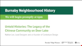
Untold Histories: The Legacy of the Chinese Community on Deer Lake
https://search.heritageburnaby.ca/link/museumdescription14758
- Repository
- Burnaby Village Museum
- Date
- 8 Oct. 2020
- Collection/Fonds
- Burnaby Village Museum fonds
- Description Level
- Item
- Physical Description
- 1 video recording (mp4) (56 min., 15 sec.) : digital, col., sd., stereo ; 29 fps
- Scope and Content
- Item consists of a video recording of a live Zoom webinar hosted by Burnaby Public Librarian, Mariah Gastaldo. The webinar is titled "Untold Histories: The Legacy of the Chinese Community on Deer Lake" and is presented by Nathan Lee, Lead Designer and co-founder of Contexture Design. The zoom webin…
- Repository
- Burnaby Village Museum
- Collection/Fonds
- Burnaby Village Museum fonds
- Description Level
- Item
- Physical Description
- 1 video recording (mp4) (56 min., 15 sec.) : digital, col., sd., stereo ; 29 fps
- Material Details
- Presenter: Nathan Lee
- Host: Mariah Gastaldo
- Date of Presentation: October 8, 6:00 pm - 8:00 pm
- Total Number of tracks: 1
- Total Length of all tracks: 56 min., 15 sec.
- Recording Device: Zoom video communication platform
- Scope and Content
- Item consists of a video recording of a live Zoom webinar hosted by Burnaby Public Librarian, Mariah Gastaldo. The webinar is titled "Untold Histories: The Legacy of the Chinese Community on Deer Lake" and is presented by Nathan Lee, Lead Designer and co-founder of Contexture Design. The zoom webinar is the third in a collection of seven "Burnaby Neighbourhood Speaker series" webinars that were presented and made available to the public between September 29 and October 27, 2020. The live webinar and recording was also made available on the Burnaby Village Museum's facebook page. In this webinar, Nathan Lee speaks about his public art installation that will be installed near the site of the Burnaby Art Gallery in Deer Lake Park. Nathan presents his background research which lead to the project. He tells how the site of the Burnaby Art Gallery and surrounding Century Garden are rich with stories of early settlers and of how British farmers and social elite have shaped the history of this area since the early 1900’s. Nathan's presentation highlights the unseen presence of a Chinese community that is equally profound in its connect. The presentation is supported with slides consisting of historical and contemporary photographs. At the conclusion of his presentation, Nathan takes questions from webinar participants.
- Subjects
- Persons - Chinese Canadians
- Arts - Sculptures
- Geographic Features - Parks
- Agriculture - Farms
- Geographic Access
- Deer Lake Avenue
- Deer Lake
- Deer Lake Park
- Accession Code
- BV020.29.3
- Access Restriction
- No restrictions
- Reproduction Restriction
- No known restrictions
- Date
- 8 Oct. 2020
- Media Type
- Moving Images
- Historic Neighbourhood
- Burnaby Lake (Historic Neighbourhood)
- Notes
- Title based on contents of video recording
- Video recording was edited for publication on Heritage Burnaby. Original mp4 video recording (BV020.29.3.1) is 66 min., 51 sec.
Images

Video
Untold Histories: The Legacy of the Chinese Community on Deer Lake, 8 Oct. 2020
Untold Histories: The Legacy of the Chinese Community on Deer Lake, 8 Oct. 2020
https://search.heritageburnaby.ca/media/hpo/_Data/_BVM_Moving_Images/2020_0029_0003_002.mp4
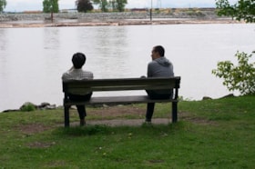
Friends Distancing, Including Their Dogs
https://search.heritageburnaby.ca/link/archivedescription95115
- Repository
- City of Burnaby Archives
- Date
- June 8, 2020
- Collection/Fonds
- Burnaby Photographic Society fonds
- Description Level
- Item
- Physical Description
- 1 photograph (tiff)
- Scope and Content
- Photograph of a group of women standing on Morley Drive, near the corner of Buckingham Drive. The women are chatting at a distance from one another, and two have small dogs on leashes.
- Repository
- City of Burnaby Archives
- Date
- June 8, 2020
- Collection/Fonds
- Burnaby Photographic Society fonds
- Physical Description
- 1 photograph (tiff)
- Description Level
- Item
- Record No.
- 623-033
- Access Restriction
- No restrictions
- Reproduction Restriction
- No restrictions
- Accession Number
- 2020-10
- Scope and Content
- Photograph of a group of women standing on Morley Drive, near the corner of Buckingham Drive. The women are chatting at a distance from one another, and two have small dogs on leashes.
- Media Type
- Photograph
- Photographer
- Peterman, Randall
- Notes
- Transcribed title
- Geographic Access
- Buckingham Drive
- Morley Street
- Planning Study Area
- Morley-Buckingham Area
Images

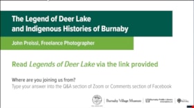
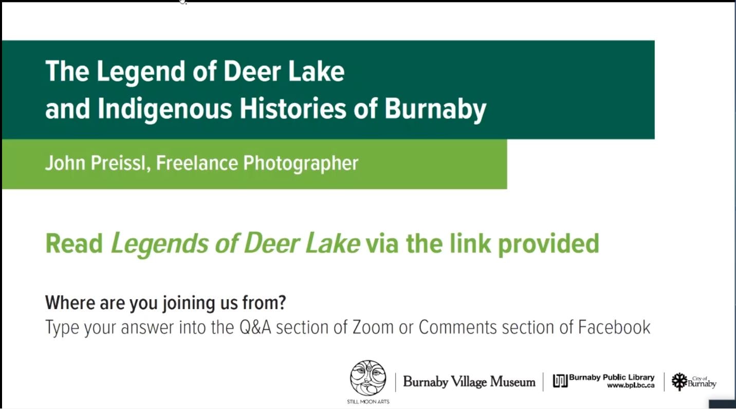
The Legend of Deer Lake and Indigenous histories of Burnaby
https://search.heritageburnaby.ca/link/museumdescription15666
- Repository
- Burnaby Village Museum
- Date
- 4 May 2021
- Collection/Fonds
- Burnaby Village Museum fonds
- Description Level
- Item
- Physical Description
- 1 video recording (mp4) (62 min., 28 sec.) : digital, col., sd., stereo ; 29 fps
- Scope and Content
- Item consists of a video recording of a live Zoom webinar hosted by Adrian Avendaño, Stewardship Program Manager with Still Moon Arts Society. The webinar is presented in partnership with the Burnaby Village Museum, Burnaby Public Library and Still Moon Arts Society. The webinar is titled "The Lege…
- Repository
- Burnaby Village Museum
- Collection/Fonds
- Burnaby Village Museum fonds
- Description Level
- Item
- Physical Description
- 1 video recording (mp4) (62 min., 28 sec.) : digital, col., sd., stereo ; 29 fps
- Material Details
- Presenter: John Preissl
- Host: Adrian Avendano (Still Moon Arts Society)
- Date of Presentation: Tuesday, May 4, 7:00 pm - 8:00 pm
- Total Number of tracks: 1
- Total Length of all tracks: 62 min., 28 sec.
- Recording Device: Zoom video communication platform
- Recording Note: Film was edited from it's original recorded version (77 min., 48 sec.) to edited version (62 min., 28 sec.) for public viewing on Heritage Burnaby.
- Scope and Content
- Item consists of a video recording of a live Zoom webinar hosted by Adrian Avendaño, Stewardship Program Manager with Still Moon Arts Society. The webinar is presented in partnership with the Burnaby Village Museum, Burnaby Public Library and Still Moon Arts Society. The webinar is titled "The Legend of Deer Lake and Indigenous histories of Burnaby" and is presented by John Preissl, Freelance Photographer of Sḵwx̱wú7mesh and Leq’á:mel Nation ancestry. The Zoom webinar is the third in a series of six "Neighbourhood Speaker series" webinars exploring a range of topics shared by Indigenous speakers and knowledge keepers that were presented and made available to the public between April 27 and May 12, 2021. The live webinar was also made available on the Burnaby Village Museum's facebook page. Community members were invited to participate by bringing questions during the interactive online sessions. This webinar was made available in In partnership with Still Moon Arts Society. In this webinar, John Preissl shares his family’s long history from the first Chief Capilano in the late 1700's to the present day. Looking through the lens of his camera, John weaves together stories of the Legend of Deer Lake, resource gathering in the Burnaby Lake Watershed, and protection of the sacred salmon and eagle habitat on the shared homelands of the hən̓q̓əmin̓əm and Sḵwx̱wú7mesh speaking peoples. The presentation is supported with photographs that John has taken over the years documenting the diverse environment and wildlife habitats in Burnaby, the lower mainland and west coast including waterways and the fight to protect it. Following the presentation, John Preissl takes questions from the audience that are moderated by the host, Adrian Avendaño.
- History
- John Preissl is a Burnaby-based environmental, adventure, wildlife and Indigenous freelance photographer. He is a media expert with over two decades of media experience and consulting. John is of Sḵwx̱wú7mesh and Leq’á:mel Nation ancestry. His Great times-two Grandfather was the Great Chief Joe Capilano. John leads many First Nations Tours in Burnaby from Deer Lake, Burnaby Lake, Burnaby Mountain and pretty well all over Sḵwx̱wú7mesh and Tsleil-Waututh Nations Lands.
- Subjects
- Indigenous peoples - British Columbia - Social life and customs
- Animals - Birds
- Animals - Fish
- Geographic Features - Lakes and Ponds
- Geographic Features - Ravines
- Names
- Preissl, John
- Tsleil-Waututh Nation
- Sḵwx̱wú7mesh Nation
- Avendaño, Adrian
- Burnaby Village Museum
- Accession Code
- BV021.17.3
- Access Restriction
- No restrictions
- Reproduction Restriction
- No known restrictions
- Date
- 4 May 2021
- Media Type
- Moving Images
- Historic Neighbourhood
- Burnaby Lake (Historic Neighbourhood)
- Planning Study Area
- Burnaby Lake Area
- Notes
- Title based on content of video recording The following links were shared at the end of the presentation:
- The Legend of Deer Lake: https://www.legendsofvancouver.net/deer-lake-burnaby-vancouver
- Saving the Salmon: the Brunette River Story, a short film about the preservation of Brunette River: https://search.heritageburnaby.ca/permalink/museumvideo4486
- Saving Burnaby Lake, a short film about the preservation of Burnaby Lake: https://search.heritageburnaby.ca/permalink/museumvideo4485
- Still Creek Streamkeepers: https://stillmoonarts.ca/stewardship/streamkeepers/
- John Preissl’s photography website: https://johnpreisslphotography.ca/
Images
Video
The Legend of Deer Lake and Indigenous histories of Burnaby, 4 May 2021
The Legend of Deer Lake and Indigenous histories of Burnaby, 4 May 2021
https://search.heritageburnaby.ca/media/hpo/_Data/_BVM_Moving_Images/2021_0017_0003_002.mp4
Burnaby hospital closes main entrance
https://search.heritageburnaby.ca/link/archivedescription95094
- Repository
- City of Burnaby Archives
- Date
- April 6, 2020
- Collection/Fonds
- Burnaby Photographic Society fonds
- Description Level
- Item
- Physical Description
- 1 photograph (tiff)
- Scope and Content
- Photograph of a rerouting sign posted to a sandwich board outside the Burnaby Hospital emergency lot. The sign states that the hospital entrance is closed and requests visitors use the Main Entrance of the hospital.
- Repository
- City of Burnaby Archives
- Date
- April 6, 2020
- Collection/Fonds
- Burnaby Photographic Society fonds
- Physical Description
- 1 photograph (tiff)
- Description Level
- Item
- Record No.
- 623-013
- Access Restriction
- No restrictions
- Reproduction Restriction
- No restrictions
- Accession Number
- 2020-10
- Scope and Content
- Photograph of a rerouting sign posted to a sandwich board outside the Burnaby Hospital emergency lot. The sign states that the hospital entrance is closed and requests visitors use the Main Entrance of the hospital.
- Subjects
- Buildings - Civic - Hospitals
- Geographic Features - Automobile Parking Lots
- Advertising Medium - Signs and Signboards
- Media Type
- Photograph
- Photographer
- Damer, Eric
- Notes
- Transcribed title
- Geographic Access
- Kincaid Street
- Street Address
- 3935 Kincaid Street
- Historic Neighbourhood
- Broadview (Historic Neighbourhood)
- Planning Study Area
- Cascade-Schou Area
Images


Costco happy shopper
https://search.heritageburnaby.ca/link/archivedescription95082
- Repository
- City of Burnaby Archives
- Date
- June 13, 2020
- Collection/Fonds
- Burnaby Photographic Society fonds
- Description Level
- Item
- Physical Description
- 1 photograph (tiff)
- Scope and Content
- Photograph of a woman wearing a black face mask, standing with a shopping cart full of groceries in a Costco parking lot.
- Repository
- City of Burnaby Archives
- Date
- June 13, 2020
- Collection/Fonds
- Burnaby Photographic Society fonds
- Physical Description
- 1 photograph (tiff)
- Description Level
- Item
- Record No.
- 623-001
- Access Restriction
- No restrictions
- Reproduction Restriction
- No restrictions
- Accession Number
- 2020-10
- Scope and Content
- Photograph of a woman wearing a black face mask, standing with a shopping cart full of groceries in a Costco parking lot.
- Media Type
- Photograph
- Photographer
- Gervan, Bonnie
- Notes
- Transcribed title
- Photographer's caption: "I asked this friendly woman if I could take her photo, as she was on her way to her car with her groceries."
- Geographic Access
- Still Creek Avenue
- Street Address
- 4500 Still Creek Avenue
- Planning Study Area
- Dawson-Delta Area
Images

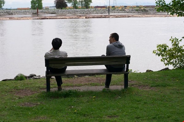
Keeping separate
https://search.heritageburnaby.ca/link/archivedescription95114
- Repository
- City of Burnaby Archives
- Date
- June 2, 2020
- Collection/Fonds
- Burnaby Photographic Society fonds
- Description Level
- Item
- Physical Description
- 1 photograph (tiff)
- Scope and Content
- Photograph of two men sitting on a bench at Fraser Foreshore Park. Photograph is taken from behind the bench, looking south over the Fraser River.
- Repository
- City of Burnaby Archives
- Date
- June 2, 2020
- Collection/Fonds
- Burnaby Photographic Society fonds
- Physical Description
- 1 photograph (tiff)
- Description Level
- Item
- Record No.
- 623-032
- Access Restriction
- No restrictions
- Reproduction Restriction
- Reproduce for fair dealing purposes only
- Accession Number
- 2020-10
- Scope and Content
- Photograph of two men sitting on a bench at Fraser Foreshore Park. Photograph is taken from behind the bench, looking south over the Fraser River.
- Subjects
- Geographic Features - Rivers
- Media Type
- Photograph
- Photographer
- Nielsen, Phil
- Notes
- Transcribed title
- Geographic Access
- Fraser River
- Historic Neighbourhood
- Fraser Arm (Historic Neighbourhood)
- Planning Study Area
- Big Bend Area
Images

More Covid Litter
https://search.heritageburnaby.ca/link/archivedescription95091
- Repository
- City of Burnaby Archives
- Date
- June 6, 2020
- Collection/Fonds
- Burnaby Photographic Society fonds
- Description Level
- Item
- Physical Description
- 1 photograph (tiff)
- Scope and Content
- Photograph of two discarded purple nitrile gloves in the Metrotown parking lot on Kingsway.
- Repository
- City of Burnaby Archives
- Date
- June 6, 2020
- Collection/Fonds
- Burnaby Photographic Society fonds
- Physical Description
- 1 photograph (tiff)
- Description Level
- Item
- Record No.
- 623-010
- Access Restriction
- No restrictions
- Reproduction Restriction
- Reproduce for fair dealing purposes only
- Accession Number
- 2020-10
- Scope and Content
- Photograph of two discarded purple nitrile gloves in the Metrotown parking lot on Kingsway.
- Media Type
- Photograph
- Photographer
- Asbia, Cher
- Notes
- Transcribed title
- Geographic Access
- Kingsway
- Historic Neighbourhood
- Central Park (Historic Neighbourhood)
- Planning Study Area
- Maywood Area
Images


Pandemic Litter
https://search.heritageburnaby.ca/link/archivedescription95131
- Repository
- City of Burnaby Archives
- Date
- April 30, 2020
- Collection/Fonds
- Burnaby Photographic Society fonds
- Description Level
- Item
- Physical Description
- 1 photograph (tiff)
- Scope and Content
- Photograph of two blue rubber gloves discarded on the ground of the Kensington Square Shopping Centre parking lot in North Burnaby.
- Repository
- City of Burnaby Archives
- Date
- April 30, 2020
- Collection/Fonds
- Burnaby Photographic Society fonds
- Physical Description
- 1 photograph (tiff)
- Description Level
- Item
- Record No.
- 623-049
- Access Restriction
- No restrictions
- Reproduction Restriction
- No restrictions
- Accession Number
- 2020-10
- Scope and Content
- Photograph of two blue rubber gloves discarded on the ground of the Kensington Square Shopping Centre parking lot in North Burnaby.
- Media Type
- Photograph
- Photographer
- Lapierre, Soleil
- Notes
- Transcribed title
- Geographic Access
- Hastings Street
- Street Address
- 6500 Hastings Street
- Historic Neighbourhood
- Lochdale (Historic Neighbourhood)
- Planning Study Area
- Lochdale Area
Images
