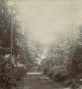
Douglas-Gilpin Neighbourhood
https://search.heritageburnaby.ca/link/landmark799
- Repository
- Burnaby Heritage Planning
- Associated Dates
- 1955-2008
- Heritage Value
- The Douglas-Gilpin Neighbourhood developed into a diverse area incorporating residential, business, educational and park districts in the period after 1955. The BCIT site was built in the early 1960s, shortly after the Burnaby Municipal Hall was located on Canada Way near Deer Lake in 1956. The construction of the Municipal Hall at this location fostered the creation of an administrative and business centre adjacent to the park, while the northern and central areas of the neighbourhood retained their primarily residential character.
- Historic Neighbourhood
- Burnaby Lake (Historic Neighbourhood)
- Planning Study Area
- Douglas-Gilpin Area
Images
Douglas Road
https://search.heritageburnaby.ca/link/landmark714
- Repository
- Burnaby Heritage Planning
- Associated Dates
- 1865
- Heritage Value
- Douglas Road was built between 1862-1865 by the Royal Engineers based in New Westminster. Originally known as the Douglas Street Trail, it took its name from Governor James Douglas. In 1926 a new connection was made to reach Grandview Road in Vancouver at Boundary Road. To distinguish this new highway it was renamed the Grandview Highway and it became commonly known as the combined Grandview-Douglas Highway until 1968 when the Burnaby and New Westminister sections were renamed Canada Way, in recognition of Canada's Centennial in 1967. The old part of Douglas Road north of Sprott Street remained intact.
- Historic Neighbourhood
- Burnaby Lake (Historic Neighbourhood)
- Planning Study Area
- Douglas-Gilpin Area
- Street View URL
- Google Maps Street View

