Narrow Results By
Decade
- 2020s 84
- 2010s
- 2000s 392
- 1990s 564
- 1980s 550
- 1970s 708
- 1960s 563
- 1950s 588
- 1940s 546
- 1930s 754
- 1920s 704
- 1910s 639
- 1900s 304
- 1890s 166
- 1880s 26
- 1870s
- 1860s 15
- 1850s 7
- 1840s 3
- 1830s
- 1820s 2
- 1810s 2
- 1800s 2
- 1790s 1
- 1780s 1
- 1770s 1
- 1760s 1
- 1750s 1
- 1740s 1
- 1730s 1
- 1720s 1
- 1710s 1
- 1700s 1
- 1690s 1
- 1680s 1
- 1670s 1
- 1660s 1
- 1650s 1
- 1640s 1
- 1630s 1
- 1620s 1
- 1610s 1
- 1600s 1
South Burnaby Garden Club fonds
https://search.heritageburnaby.ca/link/archivedescription97232
- Repository
- City of Burnaby Archives
- Date
- 1983-2012
- Collection/Fonds
- South Burnaby Garden Club fonds
- Description Level
- Fonds
- Physical Description
- 11.2 cm of textual records; 180 col. prints; 119 col. neg.
- Scope and Content
- Fonds consists of photographs and documents created and collected by the South Burnaby Garden Club, detailing Club activities including the Fall Fair.
- Repository
- City of Burnaby Archives
- Date
- 1983-2012
- Collection/Fonds
- South Burnaby Garden Club fonds
- Physical Description
- 11.2 cm of textual records; 180 col. prints; 119 col. neg.
- Description Level
- Fonds
- Accession Number
- 2008-17
- 2014-14
- Scope and Content
- Fonds consists of photographs and documents created and collected by the South Burnaby Garden Club, detailing Club activities including the Fall Fair.
- History
- The South Burnaby Garden Club was formed in 1901 when a group of Central Park residents met to form a Farmers’ Institute. They leased 17 acres of Central Park from the Provincial Government and with the support of government grants constructed a two-story building on the property. The building was constructed in time for the first annual Fall Fair in September 1901. In 1903, the Institute amalgamated with the South Vancouver and Burnaby Agricultural Society to become the Central Park Agricultural Association & Farmers Institute. In 1907, the membership doubled to 520 members. Increasing urbanization and the First World War saw the last exhibition in 1919, and then lease on the building expired in 1921. The Society continued to meet and hold small exhibitions in rented halls under the South Burnaby Horticultural Association name. After several name changes, the association became the South Burnaby Garden Club in 1958 and continues to this day.
- Media Type
- Photograph
- Textual Record
- Notes
- Photo catalogue 489
- MSS124
- MSS182
![Survey and Subdivision plans in New Westminster District Group 1 – Burnaby
, [1861]-[1910] thumbnail](/media/hpo/_Data/_BVM_Cartographic_Material/1977/1977_0093_0019a_001.jpg?width=280)
Survey and Subdivision plans in New Westminster District Group 1 – Burnaby
https://search.heritageburnaby.ca/link/museumdescription6988
- Repository
- Burnaby Village Museum
- Date
- [1861]-[1910]
- Collection/Fonds
- Burnaby Village Museum Map collection
- Description Level
- File
- Physical Description
- 14 plans : 3 plans : black ink on paper hand col. + 7 plans : black ink on paper + 4 plans : graphite on paper mounted on 2 sides of cardboard 76 x 102 cm
- Scope and Content
- Item consists of a large board of four New Westminster District Gp 1 - subdivision plans mounted on one side and ten New Westminster District Gp 1 - subdivision plans mounted on the other side. Side A: 1. "Plan /of / Lots 166A, 166 and 167 /, Gr.1, N.W.D. / Showing Misconstructed Roads in Gree…
- Repository
- Burnaby Village Museum
- Collection/Fonds
- Burnaby Village Museum Map collection
- Description Level
- File
- Physical Description
- 14 plans : 3 plans : black ink on paper hand col. + 7 plans : black ink on paper + 4 plans : graphite on paper mounted on 2 sides of cardboard 76 x 102 cm
- Material Details
- Scales [between 1:2376 and 1:7920]
- Index number on edge of board reads: "19"
- Scope and Content
- Item consists of a large board of four New Westminster District Gp 1 - subdivision plans mounted on one side and ten New Westminster District Gp 1 - subdivision plans mounted on the other side. Side A: 1. "Plan /of / Lots 166A, 166 and 167 /, Gr.1, N.W.D. / Showing Misconstructed Roads in Green / 5 chs = 1 in.". (plan is drawn in black ink and hand coloured in red, green and orange ink). A section in the centre of the plan is coloured in red ink and identified as "C.S. Richmond" running from the North Arm of Fraser River to Wiggins Road and divided by "New Wiggins Rd. (as gazetted)" (coloured in orange ink) and two"Constructed Road(s)" (coloured in green ink). Plan is initialed by: "RB" [sic] (in blue pencil crayon) 2. Plan of / Subdivision of / Lot 166 / Group One / New Westminster District / Scale 4 chs = 1 in. / Map No 524". Plan is drawn in graphite and signed by "Surrig [sic] Welhams [sic] / P.L.S." Plan is initialed by: "RB" [sic] (in blue pencil crayon) 3. Plan of "Survey / of Highway / For / Burnaby Council / in / Lots 13 _14 / Group One / Scale 4 chs = 1 in." Signed by "Albert J. Hill, P.L.S." Caribou Street and Caribou Road run through the centre of the plan. Plan is stamped: "Albert J. Hill, Civil Engineer / and / Provincial Land Surveyor, / New Westminster, / B.C.". Plan is initialed by: "RB" [sic] (in blue pencil crayon) 4. A Plan of Lots 166A, 166 and 167, Group One, New Westminster District (drawn in graphite). A section in the centre of the plan is identified as "C.S. Richmond" running from the North Arm of Fraser River and divided by "New Wiggins Rd. (as gazetted)" and two "Constructed Road(s)". Plan is initialed by: "RB" [sic] (in blue pencil crayon) Side B: 1. Small plan drawn in black ink (no title) identifying lots north of the "North Arm" of the Fraser River. Lots identified include: Lot 99, Lot 98, Lot 157, Lot 158, Lot 163, Lot 162, Lot 159, Lot 163, Lot 162, Lot 165, Lot 166A, Lot 155B, Lot 155A and Lot 159. "Scale 40 chains to one inch" . Plan is initialed by: "RB" [sic] (in blue pencil crayon) (Geographic location: Burnaby) 2. Small plan drawn in black ink (no title) identifying lots north of the North Arm of the Fraser River as "Lots 155, 155A, 155B, 155C, 162, 163, 164, 165, 166A and 167". Plan is initialed by: "RB" [sic] (in blue pencil crayon) (Geographic location: Burnaby) 3. Small plan drawn in black ink (no title) which identifies "Lot 151 / Reserve/ for / Race Course"; "Reserve / 64 A / L. 152 G.1"; and other Lots: 32, 33, 34, 35, 36, 38, 39. The plan is signed "Surveyor G.Turn [sic] July / 61 / from Vol 40 R.L. notes [sic]" Plan is stamped: "Albert J. Hill, Civil Engineer / and / Provincial Land Surveyor, / New Westminster, / B.C." Plan is initialed by: "RB" [sic] (in blue pencil crayon) (Geographic location: Burnaby) 4. Small plan drawn in black in with faded red colouring on centre lot identified as "Lot 34" running north from "Vancouver Road" . Plan is stamped: "Albert J. Hill, Civil Engineer / and / Provincial Land Surveyor, / New Westminster, / B.C." Plan is initialed by: "RB" [sic] (in blue pencil crayon) (Geographic location: Burnaby) 5. Plan drawn in graphite and identified as "Lot 98, Gr.1," along with the intials "RB" [sic] (both are handwritten in blue crayon pencil on top of plan) The B.C.E.Railway is identified running through the plan along with Jubilee Road and Royal Oak Road. The plan is signed with the name "Wm. Murray" and the Plan is stamped: "Albert J. Hill, Civil Engineer / and / Provincial Land Surveyor, / New Westminster, / B.C.". (Geographic location: Burnaby) 6. Plan drawn in graphite identified as "Port Lot 13, Gr.1" along with the intials "RB" [sic] (both are handwritten in blue crayon pencil on top of plan) Plan is stamped: "Albert J. Hill, Civil Engineer / and / Provincial Land Surveyor, / New Westminster, / B.C.". (Geographic location: Burnaby) 7.Plan drawn in black ink and identified as "Lot 98 G.1" along with the intials "RB" [sic] (both are handwritten in blue crayon pencil on top of plan). A "Road Reservation" is identified running north between "Electric Tramway" and connecting with "Royal Oak Road". Plan is stamped: "Albert J. Hill, Civil Engineer / and / Provincial Land Surveyor, / New Westminster, / B.C." (Geographic location: Burnaby) 8. Plan drawn in black ink and divided into two sections, the upper plan is identified as "Portion / Lots 100 / area / 101, Gr.1" and the lower plan is identified as "Portion L. 3 G. 1" along with the intials "RB" [sic] (these identifiers are handwritten in blue crayon pencil on top of the plan). Portions of Lot 100 and Lot 101 are each divided into 6 sections and the Portion of Lot 3 plan is divided into 24 sections. The plan includes a note in black ink that reads: " Received from Wm Fromme [sic] / from Wm. Trapp / Nov. 28, 1895 / A. J. T...[sic]". (Geographic location: Burnaby) 9. Plan drawn in black ink (no title) identifying soil, buildings and geographic features in southern Burnaby. The plan is bordered by "New Westminster City" (Tenth Avenue and DL 172) to the south east and DL 173 to the south, DL 158 to the west and the B.C.E. Tramway to the north. Plan includes District Lots: 155A, 158, 159, 171, 160, 53 and 95 and identifies soil, marshland and ravines throughout. Plan identifies the following features: a "Team Road" running through Lots 158 and 159 along with "Fair Orchard Soil / Even Surface Throughout / No Ravines", "Gravel and Shingle" (bottom of Lot 158), "North Arm Road" crossing "Byrne Road" and connecting with "Power House Road" which runs north to connect with "Highland Park Station" and the B.C.E. Tramway, "Power Ho" in the northeast corner of DL 160, a "Brook" connected with a "Deep Ravine" running between DL 53, DL 95 and DL 160 along with "Good Soil" and "Fair Orchard Soil" identified nearby in DL 95. Scale is identified as "10 chs = 1 in." Plan is stamped: "Albert J. Hill, Civil Engineer / and / Provincial Land Surveyor, / New Westminster, / B.C." Plan is initialed by: "RB" [sic] (in blue pencil crayon) (Geographic location: Burnaby) 10. Plan drawn in black ink (no title) with Burnaby Lake and Deer Lake at the centre. The plan is bordered by the following District Lots identified as: 117, 118 and 68 to the west, Lots 80, 79 and 85 to the southwest, Lots 11, 13, and 1 (City of New Westminster) to the south east, the North Road boundary to the east and Lots 8, 56, 57, 59, and 136 to the North. The lower right hand corner of the plan has a small inset which reads: "Burnaby Lake" and "Page 19 R.B. Notes". Plan is initialed by: "RB" [sic] (in blue pencil crayon) (Geographic location: Burnaby)
- Creator
- Hill, Albert James
- Accession Code
- HV977.93.19
- Access Restriction
- No restrictions
- Reproduction Restriction
- No known restrictions
- Date
- [1861]-[1910]
- Media Type
- Cartographic Material
- Scan Resolution
- 300
- Scale
- 72
- Notes
- Title based on contents of file
- Scale is measured in chains. (One chain equals 792 inches)
- The term "Lot" can also refer to a "District Lot”
- Some plans are stamped: "Albert J. Hill, Civil Engineer / and / Provincial Land Surveyor, / New Westminster, / B.C." and intialed: "RB" [sic]
Images
![Survey and Subdivision plans in New Westminster District Group 1 – Burnaby
, [1861]-[1910] thumbnail](/media/hpo/_Data/_BVM_Cartographic_Material/1977/1977_0093_0019a_001.jpg)

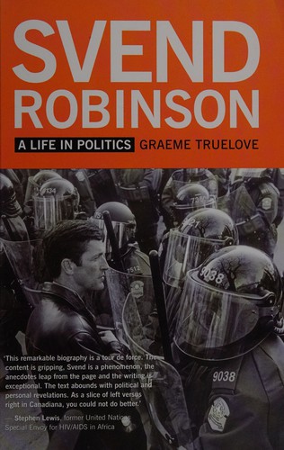
Svend Robinson : a life in politics
https://search.heritageburnaby.ca/link/museumlibrary6752
- Repository
- Burnaby Village Museum
- Author
- Truelove, Graeme, 1983-
- Publication Date
- 2013
- Call Number
- 971.0640 TRU
- Repository
- Burnaby Village Museum
- Collection
- Reference Collection
- Material Type
- Book
- ISBN
- 9781554200726
- Call Number
- 971.0640 TRU
- Author
- Truelove, Graeme, 1983-
- Place of Publication
- Vancouver
- Publisher
- New Star Books
- Publication Date
- 2013
- Printer
- Imprimerie Gauvin
- Physical Description
- 346 p. : ill. ; 23 cm.
- Library Subject (LOC)
- Canada. Parliament. House of Commons
- Gay politicians--Canada
- Politicians
- Politicians--British Columbia
- Politicians--Canada
- Politicians--Burnaby
- Biography
- Notes
- Includes bibliographical references (pages 306-326) and index.

Voices from Two Rivers : harnessing the power of the Peace and Columbia
https://search.heritageburnaby.ca/link/museumlibrary6429
- Repository
- Burnaby Village Museum
- Author
- Stanley, Meg, 1962-
- B.C. Hydro
- Publication Date
- c2010
- Call Number
- 333.793 STA
- Repository
- Burnaby Village Museum
- Collection
- Reference Collection
- Material Type
- Book
- ISBN
- 9781553654957
- Call Number
- 333.793 STA
- Author
- Stanley, Meg, 1962-
- B.C. Hydro
- Place of Publication
- Vancouver
- Publisher
- Douglas & McIntyre
- Publication Date
- c2010
- Physical Description
- vii, 312 p. : ill. (some col.), maps (some col.) ; 29 cm.
- Inscription
- Opposite of front end paper on the top half of page: "PRESENTED TO LISA COOD - CURATOR - BURNABY VILLAGE MUSEUM & CAROUSEL BY THE BC HYDRO POWER PIONEERS SEPT 29/12 HAPPY READING! PHIL HORTON - POWER PIONEER" [Printed in black ink]
- Library Subject (LOC)
- Hydroelectric power plants
- Notes
- Includes bibliographical references (p. 264-298) and index.
- "This book was commissioned by the BC Hydro Power Pioneers Association to recognize and celebrate the fiftieth anniversary of the BC Hydro and Power Authority."
William John Beamish genealogical records
https://search.heritageburnaby.ca/link/archivedescription100656
- Repository
- City of Burnaby Archives
- Date
- 1861-1942
- Collection/Fonds
- William Randolph Beamish fonds
- Description Level
- File
- Physical Description
- 0.5 cm. of textual records and 1 large b&w print.
- Scope and Content
- File consists of family history records related to the Beamishes, William Randolph Beamish's adopted family, including a letter certifying the birth and baptism of William John Beamish on December 13, 1860, and June 9, 1861, respectively; a certificate for William John Beamish for the Probationers'…
- Repository
- City of Burnaby Archives
- Date
- 1861-1942
- Collection/Fonds
- William Randolph Beamish fonds
- Physical Description
- 0.5 cm. of textual records and 1 large b&w print.
- Description Level
- File
- Record No.
- 66674
- Access Restriction
- No restrictions
- Accession Number
- 2023-03
- Scope and Content
- File consists of family history records related to the Beamishes, William Randolph Beamish's adopted family, including a letter certifying the birth and baptism of William John Beamish on December 13, 1860, and June 9, 1861, respectively; a certificate for William John Beamish for the Probationers' Course of Study of the Methodist Church of Canada; sermon notes written by W.J. Beamish, as well as "his life as he wrote it”; a financial statement of Newington Circuit; his ordination picture; and obituaries for W.J. Beamish.
- History
- William John Beamish was born in Prescott, Ontario, on December 30, 1860. He was brought up and confirmed in the Anglican Church. While in his teens, he was attending a Methodist Church, became converted, and entered the same church as a candidate for the ministry. His probationary years were spent in the Northern Ontario lumber camps, ministering to the men on Lake Tallon Mission and Nipissing Junction. Mr. Beamish attended McGill College and after ordination at Smiths Falls, Ontario, on June 2, 1896, was appointed to Locksley circuit near Pembroke, then followed pastorates at Hammon, Mille Roches, Moulinette, Morewood, and Berwick. In 1905, while at Morewood, he married Miss Agnes Crabbe, a nurse from Ottawa, formerly Pembroke. Together, they served Wakefield, Quebec, Newington, and Easton's Corners, Ontario. Coming to British Columbia in 1911, they settled first at Kaslo, then Salmon Arm, Vancouver (Dundas), and Maple Ridge. In 1918, Mr. Beamish superannuated and bought a home in Burnaby where he resided until his death on July 26, 1942. During his period of superannuation, Mr. Beamish served for about seven years as minister of East Burnaby Methodist Church and until his death, was a valued member of this congregation, now known as East Burnaby United. He was ever a true friend of the minister and his presence in the congregation was an inspiration. While in good health, he gave his time freely to sick visitation and, in a word, "he went about doing good." Funeral services were conducted by Rev. W.R. Walkinshaw, with Rev. H.E. Horton representing Westminster Presbyterian assisting. Four retired ministers and two laymen acted as pall bearers. His reamins lie in Forest Lawn Memorial Park. He was survived by his wife; one son, Randolph; two daughters, Ethel (Mrs. Paul B. Derrick) and Ilma (Mrs. William Dunn). He was a good husband, a loving father, a dutiful son, and a faithful minister of the Gospel. -- This text was composed and written by Rev. R.W. Walkinshaw and later published in The Observer, the United Church magazine. It has been lightly edited here for grammar and punctuation.
- Media Type
- Textual Record
Metro Vancouver’s RateOurHome.ca Campaign
https://search.heritageburnaby.ca/link/councilreport68759
- Repository
- City of Burnaby Archives
- Report ID
- 101372
- Meeting Date
- 23-Jan-2017
- Format
- Council - Committee Report
- Collection/Fonds
- City Council and Office of the City Clerk fonds
- Repository
- City of Burnaby Archives
- Report ID
- 101372
- Meeting Date
- 23-Jan-2017
- Format
- Council - Committee Report
- Collection/Fonds
- City Council and Office of the City Clerk fonds