Narrow Results By
Person / Organization
- British Columbia Electric Railway Company 1
- Brown, Cice Chandler 1
- Burnaby Arts Centre 3
- Burnaby Arts Council 3
- Burnaby Mountain Centennial Rose Garden 1
- Burnaby Mountain Preservation Society 1
- Burnaby South High School 2
- Burnaby Village Museum 3
- Burnaby Writers' Club 2
- Canadian Tamil Congress (CTC) 1
- Cliff Avenue United Football Club 1
- Currie, Marnie 1

East Burnaby Neighbourhood
https://search.heritageburnaby.ca/link/landmark712
- Repository
- Burnaby Heritage Planning
- Associated Dates
- 1925-1954
- Heritage Value
- After a lull in construction during the World War I period, East Burnaby Neighbourhood's growth resumed during the 1920s when many homes and businesses were constructed. The post-World War Two period also saw rapid construction and the creation of new housing developments in response to a population boom. The neighbourhood remained a primarily single-family residential area.
- Historic Neighbourhood
- Edmonds (Historic Neighbourhood)
- Planning Study Area
- Stride Avenue Area
Images


Alpha Secondary School
https://search.heritageburnaby.ca/link/landmark678
- Repository
- Burnaby Heritage Planning
- Geographic Access
- Parker Street
- Associated Dates
- 1950
- Heritage Value
- The unexpected period of growth in Burnaby during the first few years of the 1950s resulted in many overcrowded schools. As a result, the School Board decided it required a Junior High to alleviate enrolment issues at Gilmore Avenue Elementary-Junior school. Alpha opened in 1950 with 423 students. The new school had 12 rooms but added more in 1953. There were fires at the school in 1956 and 1964, resulting in the rebuilding of seven classrooms, library and administrative offices. There were additions made in 1968 and 1969 and in 1976 a gymnasium was built.
- Planning Study Area
- Brentwood Area
- Street Address
- 4600 Parker Street
- Street View URL
- Google Maps Street View
Images


Alta Vista Neighbourhood
https://search.heritageburnaby.ca/link/landmark707
- Repository
- Burnaby Heritage Planning
- Associated Dates
- 1925-1954
- Heritage Value
- As with many areas of Burnaby during this period, the years after World War Two marked a rapid growth in residential development in the Alta-Vista Neighbourhood. Subdivisions like Sussex and Suncrest were built and new schools and amenities were constructed to meet the demands of increased population.
- Historic Neighbourhood
- Alta Vista (Historic Neighbourhood)
- Planning Study Area
- Sussex-Nelson Area
Images


Burquitlam Neighbourhood
https://search.heritageburnaby.ca/link/landmark703
- Repository
- Burnaby Heritage Planning
- Associated Dates
- 1925-1954
- Heritage Value
- By the 1950s, the Burquitlam Neighbourhood was becoming a residential and commercial centre for the northeast section of Burnaby. The Sullivan Heights area was developed as a single-family residential area with the Lyndhurst School opening in 1954. The completion of the Lougheed Highway in 1953 encouraged more commercial and retail development and fostered the growth of the neighbourhood throughout this period.
- Historic Neighbourhood
- Burquitlam (Historic Neighbourhood)
- Planning Study Area
- Lyndhurst Area
Images


Central Park Neighbourhood
https://search.heritageburnaby.ca/link/landmark688
- Repository
- Burnaby Heritage Planning
- Associated Dates
- 1925-1954
- Heritage Value
- Although still largely a rural area during the 1920s, subdivisions began appearing in the Central Park neighbourhood at this time. Development was slowed by the Great Depression of the 1930s but the influx of commercial buildings and new housing initiatives in the post-war boom led to a period of rapid growth especially in the Garden Village subdivision which was undertaken in 1953 with the plan to build 500 modern homes in the 140-acre site. Despite the closure of the interurban line in 1953, the neighbourhood remained an active commercial and residential centre.
- Historic Neighbourhood
- Central Park (Historic Neighbourhood)
- Planning Study Area
- Maywood Area
Images


Douglas-Gilpin Neighbourhood
https://search.heritageburnaby.ca/link/landmark799
- Repository
- Burnaby Heritage Planning
- Associated Dates
- 1955-2008
- Heritage Value
- The Douglas-Gilpin Neighbourhood developed into a diverse area incorporating residential, business, educational and park districts in the period after 1955. The BCIT site was built in the early 1960s, shortly after the Burnaby Municipal Hall was located on Canada Way near Deer Lake in 1956. The construction of the Municipal Hall at this location fostered the creation of an administrative and business centre adjacent to the park, while the northern and central areas of the neighbourhood retained their primarily residential character.
- Historic Neighbourhood
- Burnaby Lake (Historic Neighbourhood)
- Planning Study Area
- Douglas-Gilpin Area
Images


Edmonds Neighbourhood
https://search.heritageburnaby.ca/link/landmark704
- Repository
- Burnaby Heritage Planning
- Associated Dates
- 1925-1954
- Heritage Value
- The historic growth of Edmonds as a neighbourhood was based on its strategic location on the early interurban line between Vancouver and New Westminster. Even by 1980 when a survey of the residential neighbourhoods was conducted, a full 25% of homes in the area predated 1930. The 1950s was a period of strong housing development, with both single-family and multi-family units being constructed. Although Burnaby's City Hall was moved from Kingsway and Edmonds in the early 1950s, Edmonds remained an important centre in the community.
- Historic Neighbourhood
- Edmonds (Historic Neighbourhood)
- Planning Study Area
- Stride Avenue Area
Images


Lochdale School
https://search.heritageburnaby.ca/link/landmark677
- Repository
- Burnaby Heritage Planning
- Geographic Access
- Aubrey Street
- Associated Dates
- 1953
- Heritage Value
- Lochdale Community School was opened in 1953 to help alleviate the increased enrolment at Sperling Elementary School caused by the new subdivisions under construction in this section of Burnaby. Lochdale was typical of the schools built at the period with classrooms constructed in a line, as close as possible to ground level. As needed, new classrooms were extended in a line and there were additions to Lochdale in 1962, 1964, 1966, 1971 and 1976.
- Historic Neighbourhood
- Lochdale (Historic Neighbourhood)
- Planning Study Area
- Lochdale Area
- Street Address
- 6990 Aubrey Street
- Street View URL
- Google Maps Street View
Images


Lozells Neighbourhood
https://search.heritageburnaby.ca/link/landmark701
- Repository
- Burnaby Heritage Planning
- Associated Dates
- 1925-1954
- Heritage Value
- Like a lot of residential neighbourhoods in Burnaby during the post-War boom, the Lozells area during the 1925-1954 period was one of new construction and subdivisions. Although more homes were being built, the neighbourhood still retained a somewhat rural characteristic well into the 1950s.
- Historic Neighbourhood
- Lozells (Historic Neighbourhood)
- Planning Study Area
- Government Road Area
Images


Marlborough Elementary School
https://search.heritageburnaby.ca/link/landmark695
- Repository
- Burnaby Heritage Planning
- Geographic Access
- Marlborough Avenue
- Associated Dates
- 1950
- Heritage Value
- Marlborough Elementary School was built in 1950 and was the second elementary school to be built in Burnaby after the start of the World War Two housing boom. Its design helped establish the general plans for future schools built in the city during this period - no basements, second stories or high stairways. Classrooms could easily be added, in line, as the need arose. There were additions made to Marlborough in 1952, 1961, 1967 and 1971.
- Historic Neighbourhood
- Central Park (Historic Neighbourhood)
- Planning Study Area
- Marlborough Area
- Street Address
- 6060 Marlborough Avenue
- Street View URL
- Google Maps Street View
Images


Morley Elementary School
https://search.heritageburnaby.ca/link/landmark835
- Repository
- Burnaby Heritage Planning
- Geographic Access
- Morley Street
- Associated Dates
- 1955
- Heritage Value
- In 1955 Morley Elementary School opened with 292 pupils, an indication of how quickly the residential areas around the Morley area were growing in the post-war period. Similar to other elementary schools built in Burnaby at the time, Morley was constructed on one level with classrooms in a line that could be added to as the need arose. Additions were made to the school in 1956, 1960 and 1969.
- Historic Neighbourhood
- Burnaby Lake (Historic Neighbourhood)
- Planning Study Area
- Morley-Buckingham Area
- Street Address
- 7355 Morley Street
- Street View URL
- Google Maps Street View
Images


Suncrest Neighbourhood
https://search.heritageburnaby.ca/link/landmark839
- Repository
- Burnaby Heritage Planning
- Associated Dates
- 1955-2008
- Heritage Value
- The Suncrest Neighbourhood is a small residential area south of Burnaby's Central Park. The Ocean View Burial Park takes up a large area of land in the north-east corner of this neighbourhood and the majority of the housing was built during the 1930-1960 period.
- Historic Neighbourhood
- Alta Vista (Historic Neighbourhood)
- Planning Study Area
- Suncrest Area
Images


Vancouver Heights Neighbourhood
https://search.heritageburnaby.ca/link/landmark666
- Repository
- Burnaby Heritage Planning
- Associated Dates
- 1925-1954
- Heritage Value
- Vancouver Heights remained an important residential and commercial centre in Burnaby throughout the 1925-1954 period. The area had its own Board of Trade and the North Burnaby Library was created to serve the residents. In 1949, the Hastings streetcars stopped running, but the area retained its reputation as one of the best shopping districts in the city.
- Historic Neighbourhood
- Vancouver Heights (Historic Neighbourhood)
- Planning Study Area
- Burnaby Heights Area
Images


Willingdon Heights Neighbourhood
https://search.heritageburnaby.ca/link/landmark777
- Repository
- Burnaby Heritage Planning
- Associated Dates
- 1955-2008
- Heritage Value
- The convenient location of Willingdon Heights to the Trans Canada Highway, Lougheed Highway and Hastings Street has fostered its development as a primarily residential commuter neighbourhood. Characterised in the post-World War Two period by predominantly single-family developments, the neighbourhood has retained this identity despite some higher density apartment buildings now found there.
- Planning Study Area
- Willingdon Heights Area
Images


Pioneer tales of Burnaby
https://search.heritageburnaby.ca/link/museumlibrary5860
- Repository
- Burnaby Village Museum
- Publication Date
- c1987
- Call Number
- 971.133 SON COPY 4
interviews,
offered leads o n contemporaries, sent informative periodicals a n d clippings, tracked d o w n
photographs — then awaited the birthing of Pioneer Tales w i t h rare h u m o r a n d patience.
The publisher of Pioneer Tales gratefully acknowledges the generous
contribution from the government
- Repository
- Burnaby Village Museum
- Collection
- Digital Reference Collection
- Reference Collection
- Material Type
- Book
- ISBN
- 096928280x
- Call Number
- 971.133 SON COPY 4
- Contributor
- Sone, Michael
- Place of Publication
- Burnaby, B.C.
- Publisher
- Corporation of the District of Burnaby
- Publication Date
- c1987
- Physical Description
- 495 p. : ill. ; 31 cm.
- Inscription
- "TR687 - Bryburgh" / handprinted in pencil on frontend page
- Library Subject (LOC)
- Pioneers--British Columbia--Burnaby
- Frontier and pioneer life
- Biography
- Object History
- Early Burnaby as recalled by the settlers themselves who arrived from every corner of the world between 1888 and 1930, some witnessing incorporation of the district in 1892, all seeking a better life for themselves and especially for their children, all helping transform the wilderness into the modern municipality of today.
- Notes
- "Editor Michael Sone".
- Includes index.
- 4 copies held: copy 4
Images

Digital Books
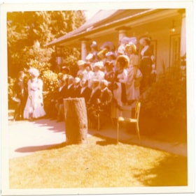
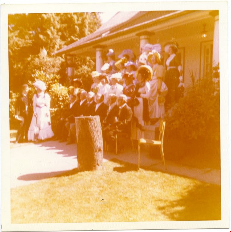
A group of people in costumes posing in front of a house.
https://search.heritageburnaby.ca/link/museumdescription4983
- Repository
- Burnaby Village Museum
- Date
- 1970-1980
- Collection/Fonds
- Burnaby Village Museum Photograph collection
- Description Level
- Item
- Physical Description
- 1 photograph : colour ; 10 x 10cm
- Scope and Content
- The Confederation Singers in 1890s costumes. The front row is men sitting, there are three rows of woman standing behind. There is a man and woman standing together to the left of the group.
- Repository
- Burnaby Village Museum
- Collection/Fonds
- Burnaby Village Museum Photograph collection
- Description Level
- Item
- Physical Description
- 1 photograph : colour ; 10 x 10cm
- Scope and Content
- The Confederation Singers in 1890s costumes. The front row is men sitting, there are three rows of woman standing behind. There is a man and woman standing together to the left of the group.
- History
- Mrs Bate was a church choir singer. In 1976 she was asked to help form the Confederation Singers at the North Burnaby Confederation Seniors Centre. She started the choir and conducted it until her retirement in 1986. The costume, as seen in several photographs and also in the Burnaby Vilalge Museum collection, was made by members of the choir who made similar 1890's period costumes for themselves. The choir sang in seniors centres and at special events at Century Park (now known as the Burnaby Village Museum). They were also invited to sing at Government House in Victoria.
- Other Title Information
- Title based on contents of photograph
- Accession Code
- BV010.8.13
- Access Restriction
- No restrictions
- Date
- 1970-1980
- Media Type
- Photograph
- Scan Resolution
- 600
- Scan Date
- 22-05-2018
Images
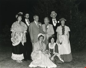
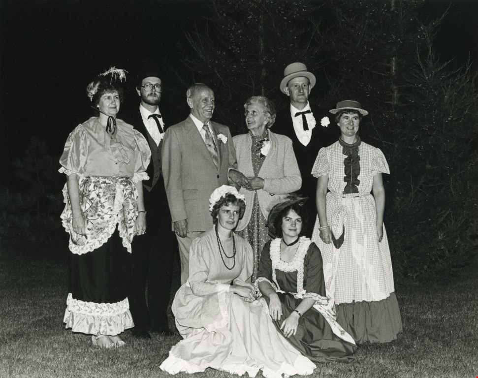
An elderly couple, joined by people dressed up in old fashioned clothing
https://search.heritageburnaby.ca/link/archivedescription59153
- Repository
- City of Burnaby Archives
- Date
- ca.1983
- Collection/Fonds
- Columbian Newspaper collection
- Description Level
- Item
- Physical Description
- 1 photograph : b&w ; 20 x 25 cm
- Scope and Content
- Photograph of an elderly couple surrounded by people dressed in period costume.
- Repository
- City of Burnaby Archives
- Date
- ca.1983
- Collection/Fonds
- Columbian Newspaper collection
- Physical Description
- 1 photograph : b&w ; 20 x 25 cm
- Description Level
- Item
- Record No.
- 480-1487
- Access Restriction
- No restrictions
- Reproduction Restriction
- Reproduce for fair dealing purposes only
- Accession Number
- 2009-01
- Scope and Content
- Photograph of an elderly couple surrounded by people dressed in period costume.
- Subjects
- Persons - Seniors
- Clothing - Costumes
- Media Type
- Photograph
- Notes
- Title based on contents of photograph
- Note on verso reads: "page A-7 / Burnaby / PMT / 90%"
Images
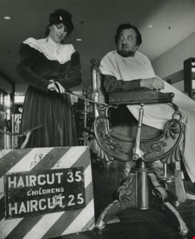
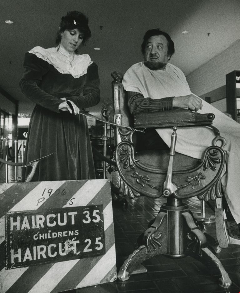
At a Barber Shop - Tracey Fedorchuck, Barber and Al Principe
https://search.heritageburnaby.ca/link/archivedescription59064
- Repository
- City of Burnaby Archives
- Date
- ca.1983
- Collection/Fonds
- Columbian Newspaper collection
- Description Level
- Item
- Physical Description
- 1 photograph : b&w ; 25.5 x 20.5 cm
- Scope and Content
- Photograph of a woman, identified as Tracey Fedorchuk, in period costume with a man identified as Al Principe, who sits in an old barber's chair. The sign next to them reads "1906 Prices / Haircuts 35 / Childrens Haircut 25". They appear to be inside a shopping mall.
- Repository
- City of Burnaby Archives
- Date
- ca.1983
- Collection/Fonds
- Columbian Newspaper collection
- Physical Description
- 1 photograph : b&w ; 25.5 x 20.5 cm
- Description Level
- Item
- Record No.
- 480-1470
- Access Restriction
- No restrictions
- Reproduction Restriction
- Reproduce for fair dealing purposes only
- Accession Number
- 2009-01
- Scope and Content
- Photograph of a woman, identified as Tracey Fedorchuk, in period costume with a man identified as Al Principe, who sits in an old barber's chair. The sign next to them reads "1906 Prices / Haircuts 35 / Childrens Haircut 25". They appear to be inside a shopping mall.
- Media Type
- Photograph
- Photographer
- Battistoni, Peter
- Notes
- Title based on contents of photograph
- Note on recto reads: "Tracey Fedorchuk - Barber / Al Principe"
- Photographer's stamp on verso
- Note on verso reads: "Page B-5 / Burnaby / Today / PMT 100%"
Images
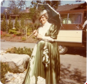
A woman from Confederation Singers in a 1890's costume.
https://search.heritageburnaby.ca/link/museumdescription5029
- Repository
- Burnaby Village Museum
- Date
- 1970-1980
- Collection/Fonds
- Burnaby Village Museum Photograph collection
- Description Level
- Item
- Physical Description
- 1 photograph : coloured ; 9 x 9 cm
- Scope and Content
- One of the Confederation singers standing on the side of a road. A van in the background along with a landscaped garden. She is wearing a green and white dress, has a parasol and a white hat with a large green feather as well as a matching bag.
- Repository
- Burnaby Village Museum
- Collection/Fonds
- Burnaby Village Museum Photograph collection
- Description Level
- Item
- Physical Description
- 1 photograph : coloured ; 9 x 9 cm
- Scope and Content
- One of the Confederation singers standing on the side of a road. A van in the background along with a landscaped garden. She is wearing a green and white dress, has a parasol and a white hat with a large green feather as well as a matching bag.
- History
- Mrs Bate was a church choir singer. In 1976 she was asked to help form the Confederation Singers at the North Burnaby Confederation Seniors Centre. She started the choir and conducted it until her retirement in 1986. The costume, as seen in several photographs and also in the Burnaby Vilalge Museum collection, was made by members of the choir who made similar 1890's period costumes for themselves. The choir sang in seniors centres and at special events at Century Park (now known as the Burnaby Village Museum). They were also invited to sing at Government House in Victoria.
- Other Title Information
- Title based on contents of photograph
- Accession Code
- BV010.8.59
- Access Restriction
- No restrictions
- Date
- 1970-1980
- Media Type
- Photograph
- Scan Resolution
- 600
- Scan Date
- 22-05-2018
Images

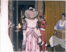
A woman in a pink costume.
https://search.heritageburnaby.ca/link/museumdescription5001
- Repository
- Burnaby Village Museum
- Date
- 1970-1980
- Collection/Fonds
- Burnaby Village Museum Photograph collection
- Description Level
- Item
- Physical Description
- 1 photograph : colour ; 9 x 11 cm
- Scope and Content
- A woman in a pink with black trim long dress standing at a doorway. She is also wearing a pink wide brim hat with black trim.
- Repository
- Burnaby Village Museum
- Collection/Fonds
- Burnaby Village Museum Photograph collection
- Description Level
- Item
- Physical Description
- 1 photograph : colour ; 9 x 11 cm
- Scope and Content
- A woman in a pink with black trim long dress standing at a doorway. She is also wearing a pink wide brim hat with black trim.
- History
- Mrs Bate was a church choir singer. In 1976 she was asked to help form the Confederation Singers at the North Burnaby Confederation Seniors Centre. She started the choir and conducted it until her retirement in 1986. The costume, as seen in several photographs and also in the Burnaby Vilalge Museum collection, was made by members of the choir who made similar 1890's period costumes for themselves. The choir sang in seniors centres and at special events at Century Park (now known as the Burnaby Village Museum). They were also invited to sing at Government House in Victoria.
- Other Title Information
- Title based on contents of photograph
- Accession Code
- BV010.8.31
- Access Restriction
- No restrictions
- Date
- 1970-1980
- Media Type
- Photograph
- Scan Resolution
- 600
- Scan Date
- 22-05-2018
Images
