Narrow Results By
Format
- Architectural Drawing 305
- Book 451
- Bylaws - Adopted 3928
- Bylaws - Other 1
- Bylaws - Repealed 413
- Cartographic Material 52
- Catalogue 1
- Council - Committee Report 5806
- Council - Manager's Report 8502
- Council - Mayor/Councillor/Staff Report 6790
- Council - Public Hearing Minutes 259
- Council - Regular Council Minutes 1585
Decade
- 2020s 2390
- 2010s
- 2000s 9733
- 1990s
- 1980s 12570
- 1970s 18320
- 1960s 12809
- 1950s
- 1940s
- 1930s 7962
- 1920s 12089
- 1910s 8836
- 1900s 4208
- 1890s 1864
- 1880s 301
- 1870s 128
- 1860s 179
- 1850s 45
- 1840s 24
- 1830s 14
- 1820s 11
- 1810s 8
- 1800s 11
- 1790s 6
- 1780s 5
- 1770s 5
- 1760s 5
- 1750s 5
- 1740s 5
- 1730s 5
- 1720s 5
- 1710s
- 1700s 6
- 1690s 5
- 1680s 6
- 1670s 4
- 1660s 4
- 1650s 4
- 1640s 4
- 1630s 4
- 1620s 4
- 1610s 4
- 1600s 4
- 1590s 1
- 1580s 1
- 1570s 1
- 1560s 1
- 1550s 1
- 1540s 1
- 1530s 1
- 1520s 2
- 1510s 1
- 1500s 1
- 1490s 1
- 1480s 1
Subject
- Accidents 2
- Accidents - Automobile Accidents 18
- Accidents - Train Accidents 6
- Adornment - Jewelry 2
- Advertising Medium 2
- Advertising Medium - Signs and Signboards 30
- Aerial Photographs 26
- Agricultural Tools and Equipment 6
- Agricultural Tools and Equipment - Cultivators 2
- Agricultural Tools and Equipment - Gardening Equipment 1
- Agricultural Tools and Equipment - Plows 1
- Agricultural Tools and Equipment - Tractors 1
Douglas-Gilpin Neighbourhood
https://search.heritageburnaby.ca/link/landmark799
- Repository
- Burnaby Heritage Planning
- Associated Dates
- 1955-2008
- Heritage Value
- The Douglas-Gilpin Neighbourhood developed into a diverse area incorporating residential, business, educational and park districts in the period after 1955. The BCIT site was built in the early 1960s, shortly after the Burnaby Municipal Hall was located on Canada Way near Deer Lake in 1956. The construction of the Municipal Hall at this location fostered the creation of an administrative and business centre adjacent to the park, while the northern and central areas of the neighbourhood retained their primarily residential character.
- Historic Neighbourhood
- Burnaby Lake (Historic Neighbourhood)
- Planning Study Area
- Douglas-Gilpin Area
Images
East Burnaby Neighbourhood
https://search.heritageburnaby.ca/link/landmark712
- Repository
- Burnaby Heritage Planning
- Associated Dates
- 1925-1954
- Heritage Value
- After a lull in construction during the World War I period, East Burnaby Neighbourhood's growth resumed during the 1920s when many homes and businesses were constructed. The post-World War Two period also saw rapid construction and the creation of new housing developments in response to a population boom. The neighbourhood remained a primarily single-family residential area.
- Historic Neighbourhood
- Edmonds (Historic Neighbourhood)
- Planning Study Area
- Stride Avenue Area
Images
Edmonds Neighbourhood
https://search.heritageburnaby.ca/link/landmark704
- Repository
- Burnaby Heritage Planning
- Associated Dates
- 1925-1954
- Heritage Value
- The historic growth of Edmonds as a neighbourhood was based on its strategic location on the early interurban line between Vancouver and New Westminster. Even by 1980 when a survey of the residential neighbourhoods was conducted, a full 25% of homes in the area predated 1930. The 1950s was a period of strong housing development, with both single-family and multi-family units being constructed. Although Burnaby's City Hall was moved from Kingsway and Edmonds in the early 1950s, Edmonds remained an important centre in the community.
- Historic Neighbourhood
- Edmonds (Historic Neighbourhood)
- Planning Study Area
- Stride Avenue Area
Images
Edmonds Street Neighbourhood
https://search.heritageburnaby.ca/link/landmark827
- Repository
- Burnaby Heritage Planning
- Associated Dates
- 1955-2008
- Heritage Value
- The Edmonds Street Neighbourhood is part of the larger Edmonds Town Centre - one of four Town Centres in Burnaby. This neighbourhood is considered to be primarily residential, but a strong local commercial component developed along Edmonds and Kingsway.
- Historic Neighbourhood
- Edmonds (Historic Neighbourhood)
- Planning Study Area
- Edmonds Area
Images
Frank Walsh Residence
https://search.heritageburnaby.ca/link/landmark581
- Repository
- Burnaby Heritage Planning
- Description
- Residential building.
- Associated Dates
- 1948
- Street View URL
- Google Maps Street View
- Repository
- Burnaby Heritage Planning
- Geographic Access
- Boundary Road
- Associated Dates
- 1948
- Description
- Residential building.
- Heritage Value
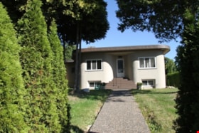
- This Streamline Moderne house is a rare example of this style in Burnaby and remains in excellent condition. Reflecting the influence of technology, industrial design and aerodynamic styling, the house has smooth rounded surfaces, rounded corners, a flat roof and prominent projecting eaves. It was built for prominent North Burnaby businessman Frank Wallace Walsh (1907-1963), who was a mechanic, and his wife Rena.
- Locality
- Vancouver Heights
- Historic Neighbourhood
- Vancouver Heights (Historic Neighbourhood)
- Planning Study Area
- Burnaby Heights Area
- Area
- 566.71
- Contributing Resource
- Building
- Ownership
- Private
- Street Address
- 270 Boundary Road
- Street View URL
- Google Maps Street View
Images
Fraser Arm Neighbourhood
https://search.heritageburnaby.ca/link/landmark708
- Repository
- Burnaby Heritage Planning
- Associated Dates
- 1925-1954
- Heritage Value
- By the late 1920s, the Fraser Arm Neighbourhood in Burnaby was developing into an industrial and manufacturing district. In 1931, the Canadian National Railway built a bridge over the Fraser River from Burnaby to Lulu Island and advertised that over 30 industries were currently operating along the North Fraser. Along with industries, this district remained an important agricultural area for the Lower Mainland. Chinese market gardens continued to develop and thrive and in 1926, the Vancouver Sun estimated that that Chinese farms in the Lower Fraser Valley then supplied 90 per cent of all green vegetables consumed in the Vancouver market area.
- Historic Neighbourhood
- Fraser Arm (Historic Neighbourhood)
- Planning Study Area
- Big Bend Area
Images
Garden Village Neighbourhood
https://search.heritageburnaby.ca/link/landmark800
- Repository
- Burnaby Heritage Planning
- Associated Dates
- 1955-2008
- Heritage Value
- Bounded by Moscrop Street to the north, Kingsway and Grange to the south, Willingdon to the east and Boundary Road to the west, the Garden Village Neighbourhood is characterised as a primarily residential area that is well-served due to its proximity to commercial, park and business centres. The north-east corner of the neighbourhood is a typical 1950s subdivision of mostly single family homes located on an irregular street pattern, while the remaining areas saw some transition to multi-family housing types throughout the 1970s and up to the current time.
- Historic Neighbourhood
- Central Park (Historic Neighbourhood)
- Planning Study Area
- Garden Village Area
Images
George Derby Centre
https://search.heritageburnaby.ca/link/landmark705
- Repository
- Burnaby Heritage Planning
- Geographic Access
- Cumberland Street
- Associated Dates
- 1947
- Heritage Value
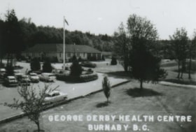
- The George Derby Centre was opened in 1947 as a rehabilitation Centre for young disabled veterans returning from the war. The centre was named after George Cleveland Derby, a World War I veteran who was injured in the Battle of Vimy Ridge and later went on to become a District Administrator in the Department of Solders’ Civil Re-establishment, the forerunner of the Department of Veterans Affairs. His work took him to wartime England where he was awarded the Order of the British Empire in 1943 for patriotic and philanthropic work.
- Historic Neighbourhood
- East Burnaby (Historic Neighbourhood)
- Planning Study Area
- Cariboo-Armstrong Area
- Street Address
- 7550 Cumberland Street
- Street View URL
- Google Maps Street View
Images
Glenwood School
https://search.heritageburnaby.ca/link/landmark842
- Repository
- Burnaby Heritage Planning
- Geographic Access
- Marine Drive
- Associated Dates
- 1956
- Heritage Value
- Glenwood Elementary School was built in 1956 to replace Riverway East School. Additions to the school were made in 1966 and 1969. Decreasing enrolment led to the school closure by 1980, but it was re-opened 1994.
- Historic Neighbourhood
- Fraser Arm (Historic Neighbourhood)
- Planning Study Area
- Clinton-Glenwood Area
- Street Address
- 5787 Marine Drive
- Street View URL
- Google Maps Street View
Images
Government Road Neighbourhood
https://search.heritageburnaby.ca/link/landmark822
- Repository
- Burnaby Heritage Planning
- Associated Dates
- 1955-2008
- Heritage Value
- After the building boom of the 1950s, the Government Road Neighbourhood became characterised as a stable, single-family residential area. In addition to the residential component, the neighbourhood also has a significant industrial sector, along the north side of Burnaby Lake, and a commercial zone to the north along the Lougheed Highway.
- Historic Neighbourhood
- Lozells (Historic Neighbourhood)
- Planning Study Area
- Government Road Area
Images
Helen 'The Swinging Girl' Neon Sign
https://search.heritageburnaby.ca/link/landmark591
- Repository
- Burnaby Heritage Planning
- Description
- Commercial building.
- Associated Dates
- 1956
- Formal Recognition
- Heritage Designation, Community Heritage Register
- Other Names
- Helen's Childrens Wear Sign
- Street View URL
- Google Maps Street View
- Repository
- Burnaby Heritage Planning
- Other Names
- Helen's Childrens Wear Sign
- Geographic Access
- Hastings Street
- Associated Dates
- 1956
- Formal Recognition
- Heritage Designation, Community Heritage Register
- Enactment Type
- Bylaw No. 12771
- Enactment Date
- 19/04/2010
- Description
- Commercial building.
- Heritage Value
- While the building here is of some importance as the former North Burnaby municipal office, its primary importance is its delightful neon sign that has become a North Burnaby landmark. Helen Arnold opened Helen’s Childrens Wear shop in the building next door to the old Municipal offices in 1948. In 1955, when North Burnaby moved out, she moved into the vacated building. As part of the renovations, Helen enlisted the assistance of her good friend Jimmy Wallace, owner of Vancouver’s Wallace Neon Company, to create a new sign for her expanded business. One of the company’s designers, Reeve Lehman, created the swinging neon girl that was installed in 1956. Designed in two parts, one section of the sign is cloud shaped and reads ‘Helen’s’ while the other section is a moving representation of a little girl on a swing. The sign is nine feet six inches high and nine feet wide, and the lower section is animated with an internal motor and gears. It immediately became a landmark on Hastings Street, and recently the sign’s design fame has spread far and wide as one of the best surviving examples of kinetic neon art in North America.
- Locality
- Vancouver Heights
- Historic Neighbourhood
- Vancouver Heights (Historic Neighbourhood)
- Planning Study Area
- Willingdon Heights Area
- Community
- Burnaby
- Names
- Helen's Childrens Wear
- Street Address
- 4142 Hastings Street
- Street View URL
- Google Maps Street View
Images
Kelly-Douglas Company
https://search.heritageburnaby.ca/link/landmark697
- Repository
- Burnaby Heritage Planning
- Geographic Access
- Kingsway
- Associated Dates
- 1946
- Heritage Value
- The Kelly Douglas Company was founded in 1896 as a wholesale grocery business. It enjoyed rapid success during the Klondike Goldrush of 1898 when it became a primary supplier for prospectors. In 1946, its headquarters moved from Vancouver to Burnaby and a manufacturing plant and warehouse was built on the site.
- Historic Neighbourhood
- Central Park (Historic Neighbourhood)
- Planning Study Area
- Maywood Area
- Street Address
- 4700 Kingsway
Images
Kingsway-Beresford Neighbourhood
https://search.heritageburnaby.ca/link/landmark805
- Repository
- Burnaby Heritage Planning
- Associated Dates
- 1955-2008
- Heritage Value
- Since the building boom of the 1950s, the Kingsway-Beresford Neighbourhood has maintained a residential character with the exception of the Kingsway corridor, which has become a primary commercial and light industrial sector.
- Historic Neighbourhood
- Edmonds (Historic Neighbourhood)
- Planning Study Area
- Kingsway-Beresford Area
Images
Lake City Neighbourhood
https://search.heritageburnaby.ca/link/landmark702
- Repository
- Burnaby Heritage Planning
- Associated Dates
- 1925-1954
- Heritage Value
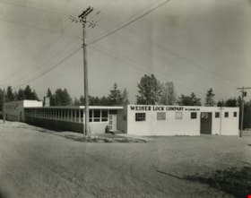
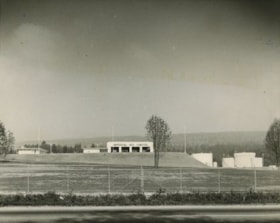
- When the Lake City Industrial Park first opened in the 1950's, it was a fairly isolated industrial enclave with convenient access to rail and road transportation routes. The sense of entrepreneurial flare and success that was anticipated for the area is evident in the naming of local streets which include "Production", "Enterprise" and "Venture". The anticipated potential of the area was also demonstrated by the inclusion of many significant development amenities of the time, such as paved streets, site landscaping, rail service, natural gas service, and architectural controls.
- Planning Study Area
- Lake City Area
Images
Lake City Neighbourhood
https://search.heritageburnaby.ca/link/landmark793
- Repository
- Burnaby Heritage Planning
- Associated Dates
- 1955-2008
- Heritage Value
- When Simon Fraser University opened in 1965, approximately sixteen industrial properties had been developed in the Lake City Industrial Park. In addition, significant tracts of land in the western portion had been pre-cleared and graded in anticipation of additional development, while most of the eastern half remained forested. Some of the early companies to locate in the area were Nabob Foods, Volkswagen Canada, British Columbia Television Broadcasting, Simpson Sears, and H.Y. Louie Company Limited. Both Imperial Oil and Shell Oil established petroleum storage and distribution facilities in the area. Initially a heavy industrial area, by 1979, single family neighbourhoods south of Lougheed Highway and west of Eagle Creek had been largely developed. By the mid1980's, the Burnaby 200 multi-family development along Forest Grove Drive had also been completed.
- Planning Study Area
- Lake City Area
Images
Lakeview Elementary School
https://search.heritageburnaby.ca/link/landmark834
- Repository
- Burnaby Heritage Planning
- Geographic Access
- Mayfield Street
- Associated Dates
- 1958
- Heritage Value
- The Burnaby School Inspector's report of 1955 estimated that by 1960, the total enrolment in Burnaby would go up by over 8000 pupils. As a result, new schools needed to be built to manage this increase, Lakeview being only one of many. Lakeview opened in 1958 with 193 students. Additions to the school were made in 1965 and 1969.
- Historic Neighbourhood
- Burnaby Lake (Historic Neighbourhood)
- Planning Study Area
- Lakeview-Mayfield Area
- Street Address
- 7777 Mayfield Street
- Street View URL
- Google Maps Street View
Images
Lakeview-Mayfield Neighbourhood
https://search.heritageburnaby.ca/link/landmark830
- Repository
- Burnaby Heritage Planning
- Associated Dates
- 1955-2008
- Heritage Value
- Like many other areas of the City, the Lakeview-Mayfield Neighbourhood was subdivided during the 1950s post-war building boom. Pockets of newer homes were built in the 1970s, and the neighbourhood retained its character as a primarily residential area. The neighbourhood is bordered to the east by Robert Burnaby Park.
- Planning Study Area
- Lakeview-Mayfield Area
Images
Lochdale Neighbourhood
https://search.heritageburnaby.ca/link/landmark668
- Repository
- Burnaby Heritage Planning
- Associated Dates
- 1925-1954
- Heritage Value
- In the 1931 "Burnaby Year Book" the Lochdale neighbourhood is described as follows: "Lochdale…is situated at the intersection of the Hastings-Barnet road at the point where Sperling Avenue crosses…Situated at the intersection…there are an up to date service station and a general store, at which the Lochdale Post Office is situated. Immediately north of this is the seventy acres on which the Shell Oil Co. are to build an up-to-date refinery...On going south on Sperling Avenue can be found some lovely homes of the residents, all of which possess the most beautiful flower gardens, some of which are hobbies, and some being in the nature of a business. Others are engaged in chicken farming...while others find employment at the Barnet Mill about two miles east on the Hastings-Barnet Road."
- Historic Neighbourhood
- Lochdale (Historic Neighbourhood)
- Planning Study Area
- Lochdale Area
Images
Lochdale Neighbourhood
https://search.heritageburnaby.ca/link/landmark790
- Repository
- Burnaby Heritage Planning
- Associated Dates
- 1955-2008
- Heritage Value
- Despite the rapid growth witnessed in Burnaby in the post-war years, the Lochdale Neighbourhood was characterised as a close-knit primarily residential community. Although a commercial zone developed along Sperling and Hastings, single-family, duplex and multi-family homes were the primary buildings in the area. Basement suites and student accommodation also flourished in this neighbourhood after the creation of Simon Fraser University on Burnaby Mountain.
- Historic Neighbourhood
- Lochdale (Historic Neighbourhood)
- Planning Study Area
- Lochdale Area
Images
Lochdale School
https://search.heritageburnaby.ca/link/landmark677
- Repository
- Burnaby Heritage Planning
- Geographic Access
- Aubrey Street
- Associated Dates
- 1953
- Heritage Value
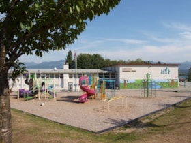
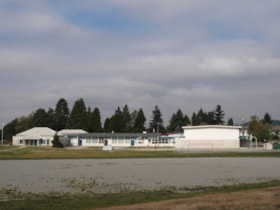
- Lochdale Community School was opened in 1953 to help alleviate the increased enrolment at Sperling Elementary School caused by the new subdivisions under construction in this section of Burnaby. Lochdale was typical of the schools built at the period with classrooms constructed in a line, as close as possible to ground level. As needed, new classrooms were extended in a line and there were additions to Lochdale in 1962, 1964, 1966, 1971 and 1976.
- Historic Neighbourhood
- Lochdale (Historic Neighbourhood)
- Planning Study Area
- Lochdale Area
- Street Address
- 6990 Aubrey Street
- Street View URL
- Google Maps Street View


