Narrow Results By
1961 Census of Canada - Population - Divisions and Subdivisions - Manitoba, Saskatchewan, Alberta, British Columbia, Yukon and Northwest Territories
https://search.heritageburnaby.ca/link/archivedescription32085
- Repository
- City of Burnaby Archives
- Date
- 1962
- Collection/Fonds
- Planning Department fonds
- Description Level
- File
- Physical Description
- Textual record
- Repository
- City of Burnaby Archives
- Date
- 1962
- Collection/Fonds
- Planning Department fonds
- Physical Description
- Textual record
- Description Level
- File
- Record No.
- 35099
- Accession Number
- 2006-16
- Media Type
- Textual Record
British Columbia Historical News
https://search.heritageburnaby.ca/link/archivedescription58523
- Repository
- City of Burnaby Archives
- Date
- 1968-1974
- Collection/Fonds
- Burnaby Historical Society fonds
- Description Level
- File
- Physical Description
- 1 file of textual records
- Scope and Content
- File consists of fourteen issues of "British Columbia Historical News."
- Repository
- City of Burnaby Archives
- Date
- 1968-1974
- Collection/Fonds
- Burnaby Historical Society fonds
- Subseries
- Gladys Killip subseries
- Physical Description
- 1 file of textual records
- Description Level
- File
- Record No.
- MSS085-033
- Accession Number
- BHS1998-11
- Scope and Content
- File consists of fourteen issues of "British Columbia Historical News."
- Media Type
- Textual Record
- Notes
- Title based on contents of file
Chance and Challenge - A Concept and Plan for the Development of the Lower Mainland Region of British Columbia
https://search.heritageburnaby.ca/link/archivedescription31981
- Repository
- City of Burnaby Archives
- Date
- 1963
- Collection/Fonds
- Planning Department fonds
- Description Level
- File
- Physical Description
- Textual record
- Repository
- City of Burnaby Archives
- Date
- 1963
- Collection/Fonds
- Planning Department fonds
- Physical Description
- Textual record
- Description Level
- File
- Record No.
- 34995
- Accession Number
- 2006-16
- Media Type
- Textual Record
Provincial Council for British Columbia and the Yukon - Boy Scouts of Canada Annual Report 1967
https://search.heritageburnaby.ca/link/archivedescription54995
- Repository
- City of Burnaby Archives
- Date
- 1967
- Collection/Fonds
- Burnaby Historical Society fonds
- Description Level
- File
- Physical Description
- Textual record
- Repository
- City of Burnaby Archives
- Date
- 1967
- Collection/Fonds
- Burnaby Historical Society fonds
- Subseries
- Burnaby Scouts subseries
- Physical Description
- Textual record
- Description Level
- File
- Record No.
- 39165
- Accession Number
- BHS1994-05
- Media Type
- Textual Record
Tourism in British Columbia
https://search.heritageburnaby.ca/link/archivedescription58189
- Repository
- City of Burnaby Archives
- Date
- 1954-1990
- Collection/Fonds
- Burnaby Historical Society fonds
- Description Level
- File
- Physical Description
- 1 file of textual records
- Scope and Content
- File consists of papers pertaining to tourism in British Columbia including newspaper clippings, brochures, correspondence and newsletters (mostly pertaining to heritage organizations). Also included in the file are Burnaby Hospital Society correspondence as well as an unused 1989 wall calendar .
- Repository
- City of Burnaby Archives
- Date
- 1954-1990
- Collection/Fonds
- Burnaby Historical Society fonds
- Subseries
- Evelyn Salisbury subseries
- Physical Description
- 1 file of textual records
- Description Level
- File
- Record No.
- MSS061-029
- Access Restriction
- In Archives only
- Accession Number
- BHS1991-24
- Scope and Content
- File consists of papers pertaining to tourism in British Columbia including newspaper clippings, brochures, correspondence and newsletters (mostly pertaining to heritage organizations). Also included in the file are Burnaby Hospital Society correspondence as well as an unused 1989 wall calendar .
- Media Type
- Textual Record
- Notes
- Title based on contents of file
Union of British Columbia Municipalities
https://search.heritageburnaby.ca/link/archivedescription755
- Repository
- City of Burnaby Archives
- Date
- 1911-1924
- Collection/Fonds
- City Council and Office of the City Clerk fonds
- Description Level
- File
- Physical Description
- 4 folders textual records
- Scope and Content
- File contains Union of B.C. Municipalities Constitution (1910 Amendment), correspondence regarding UBCM conventions and issues, Burnaby delegates reports, meeting minutes, brochures from UBCM conventions, and booklets of resolutions (1917, 1918).
- Repository
- City of Burnaby Archives
- Date
- 1911-1924
- Collection/Fonds
- City Council and Office of the City Clerk fonds
- Physical Description
- 4 folders textual records
- Description Level
- File
- Record No.
- 2495
- Accession Number
- 2001-02
- Scope and Content
- File contains Union of B.C. Municipalities Constitution (1910 Amendment), correspondence regarding UBCM conventions and issues, Burnaby delegates reports, meeting minutes, brochures from UBCM conventions, and booklets of resolutions (1917, 1918).
- Media Type
- Textual Record
![Survey and Subdivision plans in New Westminster District Group 1 and Group 2 – Vancouver, ʷməθkʷəy̓əm (Musqueam) Indian Reserve, Burnaby, Surrey
, [1910-1911] thumbnail](/media/hpo/_Data/_BVM_Cartographic_Material/1977/1977_0093_0017_001.jpg?width=280)
Survey and Subdivision plans in New Westminster District Group 1 and Group 2 – Vancouver, ʷməθkʷəy̓əm (Musqueam) Indian Reserve, Burnaby, Surrey
https://search.heritageburnaby.ca/link/museumdescription6986
- Repository
- Burnaby Village Museum
- Date
- [1910-1911]
- Collection/Fonds
- Burnaby Village Museum Map collection
- Description Level
- File
- Physical Description
- 9 plans : 4 plans : blueprint ink on paper + 4 plans : black ink on paper + 1 plan : graphite on paper mounted on 2 sides of cardboard 76 x 102 cm
- Scope and Content
- File consists of a large board of three survey plans in New Westminster District Group 1 mounted on one side and six survey and subdivision plans of District Lot 85, New Westminster District Group 1 mounted on the other side. Side A: 1. Plan : blueprint on paper ; 30.5 x 80 cm. Title reads: "Fras…
- Repository
- Burnaby Village Museum
- Collection/Fonds
- Burnaby Village Museum Map collection
- Description Level
- File
- Physical Description
- 9 plans : 4 plans : blueprint ink on paper + 4 plans : black ink on paper + 1 plan : graphite on paper mounted on 2 sides of cardboard 76 x 102 cm
- Material Details
- Scales vary (One chain equals 792 inches)
- Indexed number on tape on edge of board reads "17"
- Scope and Content
- File consists of a large board of three survey plans in New Westminster District Group 1 mounted on one side and six survey and subdivision plans of District Lot 85, New Westminster District Group 1 mounted on the other side. Side A: 1. Plan : blueprint on paper ; 30.5 x 80 cm. Title reads: "Fraser River Bridge / Plan of South Approach". Plan covers area of land north of the Fraser River and Great Northern Railway with approach for a bridge running through the "ʷməθkʷəy̓əm (Musqueam) Indian Reserve" (ʷməθkʷəy̓əm (Musqueam) First Nation) and lots marked as Dominion Government and the east half of Lot 2 identified as "C. F. Brown" "Plan 851". Plan is identified as "Plan 851 / traced / Mar. 17, 1911". (Geographic location in Vancouver) Scale: 100 feet = 1 inch, Signed by Albert J. Hill / P.L.S." 2. Plan : blueprint on paper ; 36.5 x 35 cm (no title). Includes three plans of lots on the east and west sides of North Road. Note on bottom of blueprint reads: "I.E.B. McKay Surveyor General - hereby certify / that this is a correct tracing from the field / notes of the Royal Engineers on file in the / Lands Department / E.B. McKay (signature) / Surveyor General / Victoria B.C. April 11th 1911" . Plan in top left titled "Page 11 / Vol. 1. / R.E. Notes" covers District Lots east of North Road including Lot 5, Lot 7, Lot 41, Lot 9 and Lot 107 in Coquitlam. Plan in top right corner titled "Page 17 / Vol. 1. / R.E. Notes" covers District Lots east of North Road including Lot 104, Lot 54, Lot 105, Lot 55, Lot 106, Lot 9 and Lot 107 in Coquitlam and Port Moody. Plan in lower left corner titled "Page 15 / Vol. 1 / R.E. Notes" covers District Lots west of North Road including Lot 147, Lot 148, Lot 100, Lot 15 in Burnaby. 3. Plan : blue print on paper ; 29.5 x 41.5 cm. (no formal title). Plan of the North 1/2 of Section 18. Plan covers area in the "North 1/2 of Sec.18 B.5 N RGE 1 W" and "Sec. 18 B.5 N. RGE 1 W" bordered by Section 7, Section 13, Section 17 and Section 19. Bon Accord Road runs through Sec. 18. The plan is signed by surveryor "I.H. Neville Smith... C.E.B.C.L.S. / Mar. 26th 1910" and signed by "Ludwig Pillath". (Geographic location: Surrey) Side B: 1. Plan : blueprint on paper ; 43.5 x 49.5 cm. Title reads: "Plan / of Subdivision / of a Portion / of / Lot 85 / Group One / New Westminster District. Plan covers portion of land east of Deer Lake and Pole Line Road (Sperling Avenue) and south of Hastings Road in District Lot 85 in Burnaby with section 4 and a portion of section 2 coloured in red. Plan is signed by "Albert J. Hill, B.C.L.S." Plan is initialed by: "RB" [sic] (in blue pencil crayon) Scale: 4 chains = 1 inch 2. Plaln : black black ink on linen ; 39 x 37 cm. Title reads: "L.C. Hill's Property, / Burnaby". Plan covers a triangular portion of land east of Pole Line Road (Sperling Avenue) and south of Hastings Road in District Lot 85 in Burnaby. Plan is intitaled by "RB" [sic] (in blue pencil crayon). Scale: 3 chains = 1 mile 3. Plan : graphite on paper ; 23 x 17 cm. Title reads: "Portion of Lot 85 / Gr.1". Plan covers portion of land north east of Deer Lake and west of Pole Line Road (now Sperling Avenue) in District Lot 85 in Burnaby. Plan is stamped in red ink: "Albert J. Hill, Civil Engineer". Plan is initialed by: "RB" [sic] (in blue pencil crayon). Scale: 1 chain = 1 inch 4. Plan : black ink on linen ; 16 x 19 cm. Title reads: "Lot 85". Plan covers the intersection of Pole Line Road (Sperling Avenue) and Hastings Road at the north west section of District Lot 79 and District Lot 85 in Burnaby. Plan is stamped: "A.J. Hill, Civil Engineer" with identitifed in blue pencil crayon. 5. Plan : black ink on paper ; 28.5 x 37 cm. (no formal title) Plan covers an area of land, west of Pole Line Road (Sperling Avenue) and south of Deer Lake in District Lot 85 in Burnaby. Plan is initialed by: "RB" [sic] (in blue pencil crayon) 6. Plan : black ink on paper ; 21 x 34 cm (no formal title). Plan covers an area of land, west of Pole Line Road (Sperling Avenue) and south of Deer Lake in District Lot 85 in Burnaby. Plan is initialed by: "RB" [sic] (in blue pencil crayon)
- Accession Code
- HV977.93.17
- Access Restriction
- No restrictions
- Reproduction Restriction
- No known restrictions
- Date
- [1910-1911]
- Media Type
- Cartographic Material
- Historic Neighbourhood
- Burnaby Lake (Historic Neighbourhood)
- Burquitlam (Historic Neighbourhood)
- Planning Study Area
- Morley-Buckingham Area
- Douglas-Gilpin Area
- Scan Resolution
- 600
- Scan Date
- 2023-06-26
- Notes
- Title based on contents of file
- Scale is measured in chains and feet. (One chain equals 792 inches).
- The term "Lot" also refers to a "District Lot”
- Some plans are stamped: "Albert J. Hill, Civil Engineer / and / Provincial Land Surveyor, / New Westminster, / B.C." and intialed: "RB" [sic]
Zoomable Images
![Survey and Subdivision plans in New Westminster District Group 1 and Group 2 – Vancouver, ʷməθkʷəy̓əm (Musqueam) Indian Reserve, Burnaby, Surrey
, [1910-1911] thumbnail](/media/hpo/_Data/_BVM_Cartographic_Material/1977/1977_0093_0017_003_seadragon/1977_0093_0017_003.jpg?w=280)
Survey and Subdivision plans in New Westminster District Group 1 and Group 2 – Vancouver, ʷməθkʷəy̓əm (Musqueam) Indian Reserve, Burnaby, Surrey , [1910-1911]
Zoom into Image
![Survey and Subdivision plans in New Westminster District Group 1 & Group 2 - Port Moody, Surrey
, [1898-1910] thumbnail](/media/hpo/_Data/_BVM_Cartographic_Material/1977/1977_0093_0073_001.jpg?width=280)
Survey and Subdivision plans in New Westminster District Group 1 & Group 2 - Port Moody, Surrey
https://search.heritageburnaby.ca/link/museumdescription7042
- Repository
- Burnaby Village Museum
- Date
- [1898-1910]
- Collection/Fonds
- Burnaby Village Museum Map collection
- Description Level
- File
- Physical Description
- 10 plans : graphite and ink on paper and linen; various sizes mounted on 2 sides of cardboard 76 x 102 cm
- Scope and Content
- File consists of a large board with four plans in New Westminster District mounted on one side and six plans mounted on the other side. Side A: 1. Plan : black ink and graphite on paper ; 46.5 x 37.5 cm. Title reads: "Bon Accord Hatchery / Sec 6 B5N R1W". Signed by Albert J. Hill P.L.S. August 1…
- Repository
- Burnaby Village Museum
- Collection/Fonds
- Burnaby Village Museum Map collection
- Description Level
- File
- Physical Description
- 10 plans : graphite and ink on paper and linen; various sizes mounted on 2 sides of cardboard 76 x 102 cm
- Material Details
- Scales vary (One chain equals 792 inches)
- Indexed number on tape on edge of board reads "73"
- Scope and Content
- File consists of a large board with four plans in New Westminster District mounted on one side and six plans mounted on the other side. Side A: 1. Plan : black ink and graphite on paper ; 46.5 x 37.5 cm. Title reads: "Bon Accord Hatchery / Sec 6 B5N R1W". Signed by Albert J. Hill P.L.S. August 12, 1903. Plan covers land identified as Section 6, Section 7, Located along the south shore of the Fraser River in Port Mann (Geographic location: Surrey). 2. Plan : black ink and graphite on paper ; 36 x 31 cm. Title reads: "Survey of Portions of Sec. 20 B5N R2W". Plan is stamped in red ink: "Albert J. Hill, Civil Engineer". Scale 4 chains = 1 inch. 3. Plan : black ink on linen ; 14 x 23 cm. Title reads:"Port Moody". Plan covers sections in Lot 191 (District Lot 191) bordered by Burrard Inlet to the west and Lot 235 and Lot 233 to the south. Streets identified include Water Street, Beauregard Street, Yonge Street, Clinton Street and Oxford Street. 4. Plan: graphite and ink on paper ; 43.5 x 64.5 cm. Title reads: "Sketch Plan Approved by Council [sic] / _[sic]1898". (No identifying geographic landmarks provided) Side B: 1. Plan : graphite on paper ; 53.5 x 31 cm. Title reads: "Plan of Lot 13, Gr. II, N.W. Dist". Sketch plan covers area along the Fraser River in District Lot 13, New Westminster District, Group 2. District Lot 13 is bordered by District Lot 14 (to the west) and Lot 12 (to the east). Natural geographic features within District Lot 13 are noted as "dense brush and fallen timber / sallal / rough spruce and cedar / swamp / fine alder / sallal / fine alder bottom land / fine brook". Scale: 3 chains = 1 inch (Geographic location: Surrey) 2. Plan : black ink on paper ; 50.5 x 34.5 cm. Title reads: "Indian Reserve / Opposite / New Westminster". Plan covers area on the south shore of the Fraser River in New Westminster District Group 2 in an area known as Brownsville. Lots are identified as District Lots 1, 2, 3, 4, 18, 17 and 8 and Sections A and B. Two areas of land are noted as "Indian Reserve"; one 6.3 acre parcel and one 104.25 acre parcel, both within District Lot 1. Note on plan reads: "N.B. this plan shows reserves and adjacent properties as they are on the ground". (Geographic location: Surrey) 3. Plan : black and col. ink on paper ; 19.5 x 31.5 cm. Title reads: "Bon Accord Road". Plan shows elevation. "Average section 10 feet = 1 inch". Plan is stamped in red ink: "Albert J. Hill, Civil Engineer and Provincial Land Surveyor, New Westminster, B.C." (Geographic location: Surrey) 4. Plan : black and col. ink on linen ; 16.5 x 25.5 cm. (no formal title) Plan covers area of Section 35, south of Yale Wagon Road and east of Quible Road. Plan is signed by "Albert J. Hill / B.C.L.S." (Geographic location: Surrey) 5. Plan: black and col. ink on linen ; 22.5 x 22.5 cm. (no formal title) Plan covers area between Yale Road and Townline Road in Surrey. Scale: 4 chains = 1 inch. Plan is signed by Albert J. Hill B.C.L.S. [190-] (Geographic location: Surrey) 6. Plan : graphite on paper ; 24 x 54 cm. (no formal title) Plan covers sectioned areas along Bon Accord Road. Sections are identified as " Sec. 8 / T.F. Patterson"; "Sec. 9 / Russell"; "Elliott_Burnett_Crean / Sec. 16"; "Dom. Govt. / Sec. 17". (Geographic location: Surrey, beneath the Port Mann bridge)
- Names
- ʷməθkʷəy̓əm (Musqueam)
- Accession Code
- HV977.93.73
- Access Restriction
- No restrictions
- Reproduction Restriction
- No known restrictions
- Date
- [1898-1910]
- Media Type
- Cartographic Material
- Scan Resolution
- 600
- Scan Date
- 2023-06-26
- Notes
- Title based on contents of file
- Note re plan 2B: The sight of Brownsville was also the former site of the Qayqayt First Nation and one of the main summer villages of the Kwantlen and ʷməθkʷəy̓əm (Musqueam) peoples
Zoomable Images
![Survey and Subdivision plans in New Westminster District Group 1 & Group 2 - Port Moody, Surrey
, [1898-1910] thumbnail](/media/hpo/_Data/_BVM_Cartographic_Material/1977/1977_0093_0073_003_seadragon/1977_0093_0073_003.jpg?w=280)
Survey and Subdivision plans in New Westminster District Group 1 & Group 2 - Port Moody, Surrey , [1898-1910]
Zoom into Image
![Survey and Subdivision plans in New Westminster District Group 2 - Surrey, Delta
, [1898-1910] thumbnail](/media/hpo/_Data/_BVM_Cartographic_Material/1977/1977_0093_0078_001.jpg?width=280)
Survey and Subdivision plans in New Westminster District Group 2 - Surrey, Delta
https://search.heritageburnaby.ca/link/museumdescription7047
- Repository
- Burnaby Village Museum
- Date
- [1898-1910]
- Collection/Fonds
- Burnaby Village Museum Map collection
- Description Level
- File
- Physical Description
- 10 plans : graphite and ink on paper and linen; various sizes mounted on 2 sides of cardboard 76 x 102 cm
- Scope and Content
- File consists of a large board with four plans in New Westminster District mounted on one side and six plans mounted on the other side. Side A: 1. Plan : black ink on paper with colour (no formal title). Plan covers area in New Westminster District, Group 2 situated along the south shore of the …
- Repository
- Burnaby Village Museum
- Collection/Fonds
- Burnaby Village Museum Map collection
- Description Level
- File
- Physical Description
- 10 plans : graphite and ink on paper and linen; various sizes mounted on 2 sides of cardboard 76 x 102 cm
- Material Details
- Scales vary
- Indexed number on tape on edge of board reads "78"
- Scope and Content
- File consists of a large board with four plans in New Westminster District mounted on one side and six plans mounted on the other side. Side A: 1. Plan : black ink on paper with colour (no formal title). Plan covers area in New Westminster District, Group 2 situated along the south shore of the Fraser River identified as "Indian Reserve / Turner 1868" situated in District Lot 1 between District Lot 2 identified as "Mohun's Line" and "Herring's Line" bordered by lots B and A. Includes note "see plan of subdivision of Lots 3 & 4 Gr. 2". (Geographic location: Surrey) 2. Plan : graphite on paper ; Title reads: "B5N R2W, Sec.26_Sec. 28 / Sec. 35_Sec.36". Plan covers a 60 acre parcel in Sec. 35 with Yale wagon road to the south. Scale: 6 chains = 1 inch (Geographic location: Surrey) 3. Plan : black ink on paper ; Title reads: "Survey for Proposed Highway in Indian Reserve Surrey". Plan covers area of land to the northwest of Lot 2 along the shore of the Fraser River and identfies route of proposed highway, proposed tramway as well at the Great Northern Railway and bridge. Scale: 2 chains = 1 inch 4. Plan : black ink on red lined graphing paper ; Title reads: "Sketch Plan Showing Section of Great Northern R. of W. at Point of Crossing of Proposed Ditch". Plan covers area of Lot 2 in New Westminster District, Group 2. (Surrey) Scale: 1 inch = 5 feet. (Geographic location: Surrey) Side B: 1. Plan : black ink on paper ; Title reads: "Plan of Subdivision of a Portion of Section 13, TP2, Surrey Municipality, New Westminster District, B.C.". Plan covers land bordered by Coast Meridian Road (to the east), Bose Road (to the south) and Pike Road (to the west). Surveyed for D.S. Bayners, Nov. 24, 1908. Scale: 5 chains= 1 inch 2. Plan : black ink on linen with colour ; Title reads: "Traverse of the Waterline in front of Lots 3 and 4, Group 2, New Westminster District with G.N. Railway Right of Way". Plan covers area along the southern shore of the Fraser River with a road crossing the Great Northern Railway and leading to a wharf. Scale: 100 feet = 1 inch (Geographic location: Surrey) 3. Plan : black ink on paper ; Title reads: "Survey of the South Boundary of Sec. 12, Township 2, New Westminster District". Plan covers area south of Bose Road and west of Coast Meridean Road and north of McClellen Road. Scale: 400 feet = 1 inch. Sec.12 (Geographic location: Surrey) 4. Plan : graphite on paper ; Title reads: "Plan of Subdivisioin of a part of S.E. 1/4 of Sec. 7, TP 8". Plan covers area of Section 7 in New Westminster District, Group 2, Township 8. Streets are identified running through lot including, Langley Ave., Robinson Ave, Melrose Ave., Hawthorne Ave., Broadway, Bond Ave., Mable Ave., Breene Ave. and McLelland Ave. and Clover Valley Road. Scale: 200 feet = 1 inch. Note in black ink reads: See Bd. 166 for blue print. (Geographic location: Surrey) 5. Plan : graphite on linen ; Title reads: "Sec.20, B5N R2W". Plan covers area north of Yale Road and is subdivided into parts identified as A, B, C, D, E, and unknown. (Geographic location: Surrey) 6. Plan : black ink and graphite on paper ; (no formal title) Plan covers lots surveyed along Ladner Road identified as A, B and Lots 13, 12 and 11. [Geographic location: Delta]
- Accession Code
- HV977.93.78
- Access Restriction
- No restrictions
- Reproduction Restriction
- No known restrictions
- Date
- [1898-1910]
- Media Type
- Cartographic Material
- Scan Resolution
- 600
- Scan Date
- 2023-06-26
- Notes
- Title based on contents of file
- Note re plans 1A & 3A: The sight of Brownsville was also the former site of the Qayqayt First Nation and one of the main summer villages of the Kwantlen and ʷməθkʷəy̓əm (Musqueam) peoples
- Scale is measured in chains and feet. (One chain equals 792 inches)
Zoomable Images
![Survey and Subdivision plans in New Westminster District Group 2 - Surrey, Delta
, [1898-1910] thumbnail](/media/hpo/_Data/_BVM_Cartographic_Material/1977/1977_0093_0078_003_seadragon/1977_0093_0078_003.jpg?w=280)
Survey and Subdivision plans in New Westminster District Group 2 - Surrey, Delta , [1898-1910]
Zoom into Image
![Political photographs, [1938-1990], predominant 1938-1953 thumbnail](/media/hpo/_Data/_BVM_Images/2013/2013_0012_0006_001.jpg?width=280)
Political photographs
https://search.heritageburnaby.ca/link/museumdescription3649
- Repository
- Burnaby Village Museum
- Date
- [1938-1990], predominant 1938-1953
- Collection/Fonds
- Harold Edward Winch collection
- Description Level
- File
- Physical Description
- 35 photographs : b&w + col. prints + slides
- Scope and Content
- File consists of photographs relating to Winch's political career, including professional portraits of Harold Winch, tourist photographs of Ottawa, and photographs of Winch with New Democratic Party (NDP) colleagues Dave Barrett (Premier of British Columbia, 1972-1975; also served as MLA and MP) an…
- Repository
- Burnaby Village Museum
- Collection/Fonds
- Harold Edward Winch collection
- Description Level
- File
- Physical Description
- 35 photographs : b&w + col. prints + slides
- Scope and Content
- File consists of photographs relating to Winch's political career, including professional portraits of Harold Winch, tourist photographs of Ottawa, and photographs of Winch with New Democratic Party (NDP) colleagues Dave Barrett (Premier of British Columbia, 1972-1975; also served as MLA and MP) and Dave Stupich (served as MLA and MP). Includes a photograph taken by photographer Ken McAllister of members of the CCF (Co-operative Commonwealth Federation) standing outside of the British Columbia Legislature [ca. 1941].
- Subjects
- Government - Federal Government
- Accession Code
- BV013.12.6
- Access Restriction
- No restrictions
- Reproduction Restriction
- May be restricted by third party rights
- Date
- [1938-1990], predominant 1938-1953
- Media Type
- Photograph
- Scan Resolution
- 600
- Scan Date
- 2023-04-14
- Photographer
- McAllister, Kenneth "Ken"
- Notes
- Title based on contents of file
- Annotation in blue ink on recto of photograph of CCF members [ca. 1941] includes names of people identified; "Arthur Tuenue, Colin Cameron, Laura Jamieson, Grant MacNeil / Wallis Lefeaux, Sam Guthrie, Bernard Webber, / Front: Bert Herridge, Grace MacInnis, Bert Gargrave, Harold Winch, Gretchen Steeves, Len Shepherd, Ernie Winch"
Images
![Political photographs, [1938-1990], predominant 1938-1953 thumbnail](/media/hpo/_Data/_BVM_Images/2013/2013_0012_0006_001.jpg)

Agricultural and floral societies' papers
https://search.heritageburnaby.ca/link/archivedescription57952
- Repository
- City of Burnaby Archives
- Date
- 1922 (date of original) -1970
- Collection/Fonds
- Burnaby Historical Society fonds
- Description Level
- File
- Physical Description
- 1 file of textual records and 1 photograph : b&w ; 8.5 cm x 8 cm
- Scope and Content
- File consists of miscellaneous promotional materials and certificates pertaining to agricultural and floral societies in British Columbia, including the Burnaby Rhododendron Society. File also contains one photograph a display at an agricultural fair.
- Repository
- City of Burnaby Archives
- Date
- 1922 (date of original) -1970
- Collection/Fonds
- Burnaby Historical Society fonds
- Subseries
- Bancroft family subseries
- Physical Description
- 1 file of textual records and 1 photograph : b&w ; 8.5 cm x 8 cm
- Description Level
- File
- Record No.
- MSS030-001
- Access Restriction
- No restrictions
- Reproduction Restriction
- May be restricted by third party rights
- Accession Number
- BHS1986-44
- Scope and Content
- File consists of miscellaneous promotional materials and certificates pertaining to agricultural and floral societies in British Columbia, including the Burnaby Rhododendron Society. File also contains one photograph a display at an agricultural fair.
- Media Type
- Textual Record
- Photograph
- Notes
- Title based on contents of file
Images

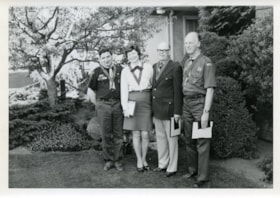
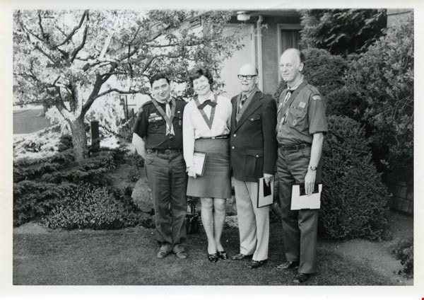
Awards
https://search.heritageburnaby.ca/link/archivedescription55145
- Repository
- City of Burnaby Archives
- Date
- 1962-1973
- Collection/Fonds
- Burnaby Historical Society fonds
- Description Level
- File
- Physical Description
- 18 photographs : b&w and col.
- Scope and Content
- Photographs of various Boy Scout award presentations and award recipients, including Amory Adventure Award ceremonies, a badge presentation, and the 1973 Silver Acorn award presented by Walter Stewart Owen, lieutenant governor of British Columbia, among others. File also includes one photograph of…
- Repository
- City of Burnaby Archives
- Date
- 1962-1973
- Collection/Fonds
- Burnaby Historical Society fonds
- Subseries
- Burnaby Scouts subseries
- Physical Description
- 18 photographs : b&w and col.
- Description Level
- File
- Record No.
- 631-001
- Access Restriction
- No restrictions
- Reproduction Restriction
- Reproduce for fair dealing purposes only
- Accession Number
- BHS1994-05
- Scope and Content
- Photographs of various Boy Scout award presentations and award recipients, including Amory Adventure Award ceremonies, a badge presentation, and the 1973 Silver Acorn award presented by Walter Stewart Owen, lieutenant governor of British Columbia, among others. File also includes one photograph of the Boy Scouts' first charter flight.
- Names
- Boy Scouts of Canada
- Media Type
- Photograph
- Notes
- Sticky note on verso of 631-001-1 read: "Don Phipps Lieutenant Governor". Note written on verso of photograph reads: "Don Phipps Presentation Silver Acorn 1973"
- Sticky note on verso of 631-001-2 read: "George Couterier Betty Forbes Bert Hill Fred Otte"
- Sticky note on verso of 631-001-3 read: "Don Phipps Betty Forbes"
- Sticky note on verso of 631-001-4 read: "Lieutenant Governor with Betty Forbes"
- Note in pencil on verso of 631-001-13 identifies individuals depicted as (top to bottom, left to right): Rick Bourgoin, Ian Black, Melvin Dudych, Fred Savinkoff, Dick Day, Drew Lydiard, Pat Connell, and Jeff Sluggett." Note below photograph on original album page read: "Emory [sic] Award 1st Burnaby Burrard".
- Note in album for 631-001-14 read: "George Courterier Betty Forbes Bert Gill Fred Otte"
- Note in album for 631-001-15 read: "1 2 3 George Shoebotham Barney Cavanagh"
- Note in album for 631-001-16 read: "- 2 Betty Forbes 3 Don Murray 4 Ernie Baird"
- Note adhered to verso of 631-001-17 reads: "Klondike '98 Revival 5th Burrard Company Winners of the Amory Adventure Award '72 / Back row l-r: (leader) Glen MacMillan, Dave Boychuck, Art Hornal, Gary D'Andrea, John Starkey, Terry Holdom, Pat Connell (leader) / Front row l-r: Rick Marusyk, Cliff Ickeringill, Brian Hoskins, Bob Hughes, Pete Hansen."
- Note adhered to verso of 631-001-18 reads: "Queen's Scout Badge Presentation - January 12th, 1962. / These boys are all from the 6th. Burnaby Centre Troop. Scoutmaster Fred Neilson. District Commissioner Sgt. John Brucker making the presentation. From left to right: Dennis Bendickson - Wayne Zral - Ricky Andersoff - Dennis Baitz - Roger Kozak - Sgt John Brucker - Tom McKeown - Barry Nixon.
Images
B.C. Gazette Extras
https://search.heritageburnaby.ca/link/archivedescription386
- Repository
- City of Burnaby Archives
- Date
- 1911
- Collection/Fonds
- City Council and Office of the City Clerk fonds
- Description Level
- File
- Physical Description
- Textual record
- Scope and Content
- File includes "The British Columbia Gazette Extra" regarding minimum land sale prices.
- Repository
- City of Burnaby Archives
- Date
- 1911
- Collection/Fonds
- City Council and Office of the City Clerk fonds
- Physical Description
- Textual record
- Description Level
- File
- Record No.
- 2079
- Accession Number
- 2001-02
- Scope and Content
- File includes "The British Columbia Gazette Extra" regarding minimum land sale prices.
- Media Type
- Textual Record
B.C. revenue tax receipts
https://search.heritageburnaby.ca/link/museumdescription9750
- Repository
- Burnaby Village Museum
- Date
- 1910-1912
- Collection/Fonds
- Hugh H. Stewart fonds
- Description Level
- File
- Physical Description
- 1 file of textual records
- Scope and Content
- File consists of three receipts from "British Columbia / Revenue Tax" made out the H.H. Stewart for the years, 1910, 1911 and 1912.
- Repository
- Burnaby Village Museum
- Collection/Fonds
- Hugh H. Stewart fonds
- Description Level
- File
- Physical Description
- 1 file of textual records
- Scope and Content
- File consists of three receipts from "British Columbia / Revenue Tax" made out the H.H. Stewart for the years, 1910, 1911 and 1912.
- Names
- Stewart, Hugh Henry
- Accession Code
- HV979.50.259
- Access Restriction
- Restricted access
- Reproduction Restriction
- Reproductions subject to FIPPA
- Date
- 1910-1912
- Media Type
- Textual Record
- Notes
- Title based on content of file
Blythe Eagles papers
https://search.heritageburnaby.ca/link/archivedescription58058
- Repository
- City of Burnaby Archives
- Date
- 1918-1927
- Collection/Fonds
- Burnaby Historical Society fonds
- Description Level
- File
- Physical Description
- 1 file of textual records
- Scope and Content
- File consists of records belonging to Dr Blythe Eagles which pertain to his schooling at the University of British Columbia, including report cards, exam questions, Congregation ceremony programmes as well as his student song book and library card (issued in 1921).
- Repository
- City of Burnaby Archives
- Date
- 1918-1927
- Collection/Fonds
- Burnaby Historical Society fonds
- Subseries
- Eagles family subseries
- Physical Description
- 1 file of textual records
- Description Level
- File
- Record No.
- MSS055-012
- Accession Number
- BHS1991-18
- Scope and Content
- File consists of records belonging to Dr Blythe Eagles which pertain to his schooling at the University of British Columbia, including report cards, exam questions, Congregation ceremony programmes as well as his student song book and library card (issued in 1921).
- Media Type
- Textual Record
- Notes
- Title based on contents of file
Burnaby Association for Retarded Children newsletters
https://search.heritageburnaby.ca/link/archivedescription58603
- Repository
- City of Burnaby Archives
- Date
- 1956-1963
- Collection/Fonds
- Burnaby Historical Society fonds
- Description Level
- File
- Physical Description
- 1 file of textual records
- Scope and Content
- File consists of the Burnaby Association for Retarded Children newsletters as well as the "Constitution For a Local Chapter of the Association for Retarded Children of British Columbia" (Robert Prittie was a director of this association in the late 1950s). File also includes pertinent newspaper cli…
- Repository
- City of Burnaby Archives
- Date
- 1956-1963
- Collection/Fonds
- Burnaby Historical Society fonds
- Subseries
- Robert Prittie subseries
- Physical Description
- 1 file of textual records
- Description Level
- File
- Record No.
- MSS086-006
- Accession Number
- BHS1999-01
- Scope and Content
- File consists of the Burnaby Association for Retarded Children newsletters as well as the "Constitution For a Local Chapter of the Association for Retarded Children of British Columbia" (Robert Prittie was a director of this association in the late 1950s). File also includes pertinent newspaper clippings.
- Media Type
- Textual Record
- Notes
- Title based on contents of file
Burnaby brochures and clippings
https://search.heritageburnaby.ca/link/archivedescription58490
- Repository
- City of Burnaby Archives
- Date
- 1958-1980
- Collection/Fonds
- Burnaby Historical Society fonds
- Description Level
- File
- Physical Description
- 1 file of textual records
- Scope and Content
- File consists of brochures and newspaper clippings pertaining to Burnaby including Parks and Recreation calendars and brochures pertaining to British Columbia's Centenary.
- Repository
- City of Burnaby Archives
- Date
- 1958-1980
- Collection/Fonds
- Burnaby Historical Society fonds
- Subseries
- Gladys Killip subseries
- Physical Description
- 1 file of textual records
- Description Level
- File
- Record No.
- MSS085-022
- Accession Number
- BHS1998-11
- Scope and Content
- File consists of brochures and newspaper clippings pertaining to Burnaby including Parks and Recreation calendars and brochures pertaining to British Columbia's Centenary.
- Media Type
- Textual Record
- Notes
- Title based on contents of file
Burnaby Heritage Advisory Committee papers
https://search.heritageburnaby.ca/link/archivedescription58192
- Repository
- City of Burnaby Archives
- Date
- 1963-1991
- Collection/Fonds
- Burnaby Historical Society fonds
- Description Level
- File
- Physical Description
- 1 file of textual records
- Scope and Content
- File consists of papers pertaining to the Burnaby Heritage Advisory Committee including newspaper clippings, a UBC (University of British Columbia) Alumni Chronicle and a Heritage Advisory Committee membership list.
- Repository
- City of Burnaby Archives
- Date
- 1963-1991
- Collection/Fonds
- Burnaby Historical Society fonds
- Subseries
- Evelyn Salisbury subseries
- Physical Description
- 1 file of textual records
- Description Level
- File
- Record No.
- MSS061-032
- Access Restriction
- In Archives only
- Reproduction Restriction
- Reproductions subject to FOIPPA
- Accession Number
- BHS1991-24
- Scope and Content
- File consists of papers pertaining to the Burnaby Heritage Advisory Committee including newspaper clippings, a UBC (University of British Columbia) Alumni Chronicle and a Heritage Advisory Committee membership list.
- Media Type
- Textual Record
- Notes
- Title based on contents of file
Burnaby Municipality - Railway Franchises and Extensions
https://search.heritageburnaby.ca/link/archivedescription65738
- Repository
- City of Burnaby Archives
- Date
- 1908-1910 (date of originals)
- Collection/Fonds
- Burnaby Historical Society fonds
- Description Level
- File
- Physical Description
- 1 file of textual records (photocopies)
- Scope and Content
- File consists of photocopied pages from a ledger describing telephone calls and decisions made regarding British Columbia Electric Railway "Franchises and Extensions" within the Municipality of Burnaby.
- Repository
- City of Burnaby Archives
- Date
- 1908-1910 (date of originals)
- Collection/Fonds
- Burnaby Historical Society fonds
- Subseries
- Brian Elder subseries
- Physical Description
- 1 file of textual records (photocopies)
- Description Level
- File
- Record No.
- 42660
- Accession Number
- BHS2001-01
- Scope and Content
- File consists of photocopied pages from a ledger describing telephone calls and decisions made regarding British Columbia Electric Railway "Franchises and Extensions" within the Municipality of Burnaby.
- Media Type
- Textual Record
- Notes
- Transcribed title
Cancellation of plan - Lots 63-80, Blocks 19 and 20, DL 93 (Booth - Milner Trust Ltd.)
https://search.heritageburnaby.ca/link/archivedescription863
- Repository
- City of Burnaby Archives
- Date
- 1913
- Collection/Fonds
- City Council and Office of the City Clerk fonds
- Description Level
- File
- Physical Description
- Textual record
- Scope and Content
- File contains petition filed with the Supreme Court of British Columbia by Alexander G. Henderson for an alteration to plans for the subdivision of lots 63-80, Blocks 19 and 20, DL 93, property which Mr. Henderson had purchased from Booth-Milner Trust.
- Repository
- City of Burnaby Archives
- Date
- 1913
- Collection/Fonds
- City Council and Office of the City Clerk fonds
- Physical Description
- Textual record
- Description Level
- File
- Record No.
- 2627
- Accession Number
- 2001-02
- Scope and Content
- File contains petition filed with the Supreme Court of British Columbia by Alexander G. Henderson for an alteration to plans for the subdivision of lots 63-80, Blocks 19 and 20, DL 93, property which Mr. Henderson had purchased from Booth-Milner Trust.
- Media Type
- Textual Record