Narrow Results By
Decade
- 2020s 41
- 2010s 26
- 2000s 146
- 1990s 158
- 1980s
- 1970s 550
- 1960s 252
- 1950s 255
- 1940s 188
- 1930s 167
- 1920s 319
- 1910s 143
- 1900s 64
- 1890s 28
- 1880s
- 1870s 5
- 1860s
- 1850s 3
- 1840s 1
- 1830s 1
- 1820s 1
- 1810s 2
- 1800s 2
- 1790s 2
- 1780s 2
- 1770s 2
- 1760s 2
- 1750s 2
- 1740s 2
- 1730s 2
- 1720s 2
- 1710s 2
- 1700s 2
- 1690s 2
- 1680s 2
- 1670s 1
- 1660s
- 1650s 1
- 1640s 1
- 1630s 1
- 1620s 1
- 1610s 1
- 1600s 1
- 1590s 1
- 1580s 1
- 1570s 1
- 1560s 1
- 1550s 1
- 1540s 1
- 1530s 1
- 1520s 2
- 1510s 1
- 1500s 1
- 1490s 1
- 1480s 1
Person / Organization
- Adams, Rocky 2
- Ansdell, Elsie Brown-John 1
- Army, Navy and Air Force Veterans in Canada, Pompier Unit #314 1
- Bateman, Edwin W. 1
- Bateman, Marianne May 1
- Bell-Irving, Henry P "Budge" 4
- Bell-Irving, Nancy 3
- Bingham, Alfred "Alf" 1
- The Bollywood Boyz 1
- Boy Scouts of Canada 13
- Braaten, Jean 1
- Brown, Donald N. "Don" 9

South Burnaby Cenotaph
https://search.heritageburnaby.ca/link/landmark860
- Repository
- Burnaby Heritage Planning
- Description
- The South Burnaby Cenotaph is located in Bonsor Park at the corner of Nelson Avenue and Imperial Street. The cenotaph commemorates those lost in the First World War, Second World War and the Korean War.
- Associated Dates
- 1988
- Other Names
- Bonsor Park Cenotaph
- Street View URL
- Google Maps Street View
- Repository
- Burnaby Heritage Planning
- Other Names
- Bonsor Park Cenotaph
- Geographic Access
- Nelson Avenue
- Associated Dates
- 1988
- Description
- The South Burnaby Cenotaph is located in Bonsor Park at the corner of Nelson Avenue and Imperial Street. The cenotaph commemorates those lost in the First World War, Second World War and the Korean War.
- Historic Neighbourhood
- Central Park (Historic Neighbourhood)
- Planning Study Area
- Marlborough Area
- Community
- Burnaby
- Cadastral Identifier
- P.I.D. No. 027-719-375
- Boundaries
- The property (Bonsor Park) is comprised of a single municipally-owned property located at 6749 Nelson Avenue.
- Area
- 3570.00
- Contributing Resource
- Landscape Feature
- Structure
- Ownership
- Public (local)
- Street Address
- 6749 Nelson Avenue
- Street View URL
- Google Maps Street View
Images


Douglas Road
https://search.heritageburnaby.ca/link/landmark714
- Repository
- Burnaby Heritage Planning
- Associated Dates
- 1865
- Heritage Value
- Douglas Road was built between 1862-1865 by the Royal Engineers based in New Westminster. Originally known as the Douglas Street Trail, it took its name from Governor James Douglas. In 1926 a new connection was made to reach Grandview Road in Vancouver at Boundary Road. To distinguish this new highway it was renamed the Grandview Highway and it became commonly known as the combined Grandview-Douglas Highway until 1968 when the Burnaby and New Westminister sections were renamed Canada Way, in recognition of Canada's Centennial in 1967. The old part of Douglas Road north of Sprott Street remained intact.
- Historic Neighbourhood
- Burnaby Lake (Historic Neighbourhood)
- Planning Study Area
- Douglas-Gilpin Area
- Street View URL
- Google Maps Street View
Images


Douglas-Gilpin Neighbourhood
https://search.heritageburnaby.ca/link/landmark799
- Repository
- Burnaby Heritage Planning
- Associated Dates
- 1955-2008
- Heritage Value
- The Douglas-Gilpin Neighbourhood developed into a diverse area incorporating residential, business, educational and park districts in the period after 1955. The BCIT site was built in the early 1960s, shortly after the Burnaby Municipal Hall was located on Canada Way near Deer Lake in 1956. The construction of the Municipal Hall at this location fostered the creation of an administrative and business centre adjacent to the park, while the northern and central areas of the neighbourhood retained their primarily residential character.
- Historic Neighbourhood
- Burnaby Lake (Historic Neighbourhood)
- Planning Study Area
- Douglas-Gilpin Area
Images


Lake City Neighbourhood
https://search.heritageburnaby.ca/link/landmark793
- Repository
- Burnaby Heritage Planning
- Associated Dates
- 1955-2008
- Heritage Value
- When Simon Fraser University opened in 1965, approximately sixteen industrial properties had been developed in the Lake City Industrial Park. In addition, significant tracts of land in the western portion had been pre-cleared and graded in anticipation of additional development, while most of the eastern half remained forested. Some of the early companies to locate in the area were Nabob Foods, Volkswagen Canada, British Columbia Television Broadcasting, Simpson Sears, and H.Y. Louie Company Limited. Both Imperial Oil and Shell Oil established petroleum storage and distribution facilities in the area. Initially a heavy industrial area, by 1979, single family neighbourhoods south of Lougheed Highway and west of Eagle Creek had been largely developed. By the mid1980's, the Burnaby 200 multi-family development along Forest Grove Drive had also been completed.
- Planning Study Area
- Lake City Area
Images


Morley-Buckingham Neighbourhood
https://search.heritageburnaby.ca/link/landmark829
- Repository
- Burnaby Heritage Planning
- Associated Dates
- 1955-2008
- Heritage Value
- In the 1980 "Residential Neighbourhood Environment Study," the Morley-Buckingham Neighbourhood is described as "perhaps Burnaby's most prestigious residential area. The lots are larger than most other areas of the Municipality and this, along with the new expensive housing developed over the past 10 years, has created a very desirable residential neighbourhood...The older area of Buckingham lies at the lower edge of the slope and here the homes and streets are more uniform and aged between 20 and 25 years old...to the east of Canada Way lies...a cluster townhouse development."
- Historic Neighbourhood
- Burnaby Lake (Historic Neighbourhood)
- Planning Study Area
- Morley-Buckingham Area
Images


Willingdon Heights Neighbourhood
https://search.heritageburnaby.ca/link/landmark777
- Repository
- Burnaby Heritage Planning
- Associated Dates
- 1955-2008
- Heritage Value
- The convenient location of Willingdon Heights to the Trans Canada Highway, Lougheed Highway and Hastings Street has fostered its development as a primarily residential commuter neighbourhood. Characterised in the post-World War Two period by predominantly single-family developments, the neighbourhood has retained this identity despite some higher density apartment buildings now found there.
- Planning Study Area
- Willingdon Heights Area
Images


Canada geese in the park
https://search.heritageburnaby.ca/link/archivedescription59046
- Repository
- City of Burnaby Archives
- Date
- ca.1983
- Collection/Fonds
- Columbian Newspaper collection
- Description Level
- Item
- Physical Description
- 1 photograph : b&w ; 17.5 x 20 cm
- Scope and Content
- Photograph of a flock of Canada geese on a grassy field in a park.
- Repository
- City of Burnaby Archives
- Date
- ca.1983
- Collection/Fonds
- Columbian Newspaper collection
- Physical Description
- 1 photograph : b&w ; 17.5 x 20 cm
- Description Level
- Item
- Record No.
- 480-1452
- Access Restriction
- No restrictions
- Reproduction Restriction
- Reproduce for fair dealing purposes only
- Accession Number
- 2009-01
- Scope and Content
- Photograph of a flock of Canada geese on a grassy field in a park.
- Subjects
- Geographic Features - Fields
- Geographic Features - Lakes and Ponds
- Geographic Features - Parks
- Animals - Birds
- Media Type
- Photograph
- Photographer
- Battistoni, Peter
- Notes
- Title based on contents of photograph
- Photographer's stamp on verso
- Note on verso reads: "page 4 / Burnaby / Today / PMT 100%"
Images

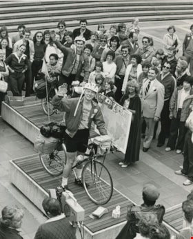
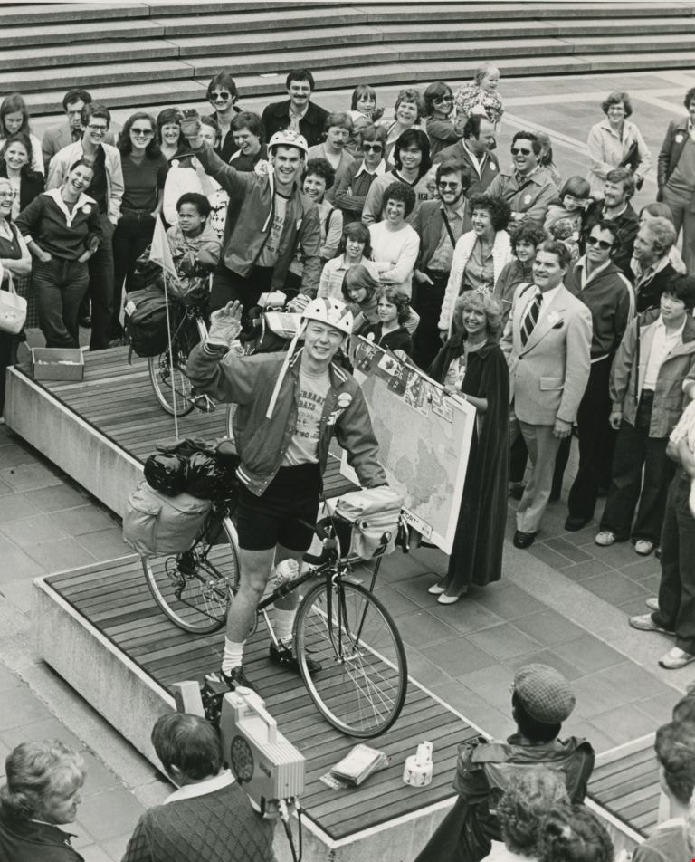
Cross Canada Bicycle Trip
https://search.heritageburnaby.ca/link/archivedescription45498
- Repository
- City of Burnaby Archives
- Date
- May 25, 1980
- Collection/Fonds
- Columbian Newspaper collection
- Description Level
- Item
- Physical Description
- 1 photograph : b&w ; 23.5 x 19.5 cm
- Scope and Content
- Photograph of Burnaby Villa bellboys Tony Urquart (front) and Rocky Adams as they prepare to set off from Simon Fraser University on a cross-Canada bicycle trip. A crowd, including the Queen of Burnaby, has gathered to see them off.
- Repository
- City of Burnaby Archives
- Date
- May 25, 1980
- Collection/Fonds
- Columbian Newspaper collection
- Physical Description
- 1 photograph : b&w ; 23.5 x 19.5 cm
- Description Level
- Item
- Record No.
- 480-393
- Access Restriction
- No restrictions
- Reproduction Restriction
- No restrictions
- Accession Number
- 2003-02
- Scope and Content
- Photograph of Burnaby Villa bellboys Tony Urquart (front) and Rocky Adams as they prepare to set off from Simon Fraser University on a cross-Canada bicycle trip. A crowd, including the Queen of Burnaby, has gathered to see them off.
- Names
- Urquhart, Tony
- Adams, Rocky
- Media Type
- Photograph
- Photographer
- King, Basil
- Notes
- Title based on contents of photograph
- Newspaper clipping attached to verso of photograph reads: "READY, SET ... Burnaby Villa bellboys Tony Urquart (front) and Rocky Adams prepare to set off from Simon Fraser University on a cross-Canada bicycle trip as part of SFU's Ethnic Day, Sunday, held as part of Burnay days '80. But not before a warming kiss from the Queen of Burnaby."
- Geographic Access
- University Drive
- Street Address
- 8888 University Drive
- Planning Study Area
- Burnaby Mountain Area
Images
Lee's Benevolent Association of Canada
https://search.heritageburnaby.ca/link/museumdescription16720
- Repository
- Burnaby Village Museum
- Date
- Oct. 1985, copied 2021
- Collection/Fonds
- Quon Lip Lee fonds
- Description Level
- Item
- Physical Description
- 1 photograph (tiff)
- Scope and Content
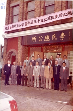
- Photograph of members of Lee's Benevolent Association of Canada on the occasion of the association's fifty third anniversary and opening of the new association building. The group is assembled in two rows inside the associaton building located at 313 East Pender Street, Vancouver. Members identifie…
- Repository
- Burnaby Village Museum
- Collection/Fonds
- Quon Lip Lee fonds
- Description Level
- Item
- Physical Description
- 1 photograph (tiff)
- Scope and Content
- Photograph of members of Lee's Benevolent Association of Canada on the occasion of the association's fifty third anniversary and opening of the new association building. The group is assembled in two rows inside the associaton building located at 313 East Pender Street, Vancouver. Members identified include; Quon Lip Lee, seated in the front row (second from the right) and Ron Bick Lee, seated in the centre. Association members are composed of Chinese businessmen with the name "Lee".
- Geographic Access
- Vancouver
- Accession Code
- BV021.18.4
- Access Restriction
- No restrictions
- Reproduction Restriction
- May be restricted by third party rights
- Date
- Oct. 1985, copied 2021
- Media Type
- Photograph
- Scan Resolution
- 600
- Scan Date
- April 8, 2021
- Scale
- 100
- Notes
- Title based on contents of photograph
- Note in upper left corner of photograph reads "Oct. 1985"
Images

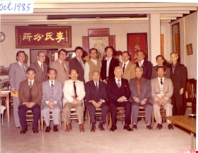
Lee's Benevolent Association of Canada
https://search.heritageburnaby.ca/link/museumdescription16721
- Repository
- Burnaby Village Museum
- Date
- Oct. 1985, copied 2021
- Collection/Fonds
- Quon Lip Lee fonds
- Description Level
- Item
- Physical Description
- 1 photograph (tiff)
- Scope and Content
- Photograph of members of Lee's Benevolent Association of Canada on the occasion of the association's fifty third anniversary and opening of the new association building. The group is assembled in two rows, standing outside of the associaton building located at 313 East Pender Street, Vancouver. Mem…
- Repository
- Burnaby Village Museum
- Collection/Fonds
- Quon Lip Lee fonds
- Description Level
- Item
- Physical Description
- 1 photograph (tiff)
- Scope and Content
- Photograph of members of Lee's Benevolent Association of Canada on the occasion of the association's fifty third anniversary and opening of the new association building. The group is assembled in two rows, standing outside of the associaton building located at 313 East Pender Street, Vancouver. Member, Quon Lip Lee is identified standing in the front row (fourth from the left). Association members are composed of Chinese businessmen with the name "Lee". Banners with Chinese lettering are hanging on the building above the group.
- Geographic Access
- Vancouver
- Accession Code
- BV021.18.5
- Access Restriction
- No restrictions
- Reproduction Restriction
- May be restricted by third party rights
- Date
- Oct. 1985, copied 2021
- Media Type
- Photograph
- Scan Resolution
- 600
- Scan Date
- April 8, 2021
- Scale
- 100
- Notes
- Title based on contents of photograph
Images

Burnaby School House
https://search.heritageburnaby.ca/link/archivedescription34856
- Repository
- City of Burnaby Archives
- Date
- 1985
- Collection/Fonds
- Burnaby Historical Society fonds
- Description Level
- Item
- Physical Description
- 1 photograph : col. ; 8.8 x 11.4 cm
- Scope and Content
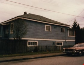
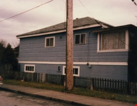
- Photograph of the exterior of the former Burnaby School building at 19th Avenue and Canada Way.
- Repository
- City of Burnaby Archives
- Date
- 1985
- Collection/Fonds
- Burnaby Historical Society fonds
- Subseries
- Evelyn Salisbury subseries
- Physical Description
- 1 photograph : col. ; 8.8 x 11.4 cm
- Description Level
- Item
- Record No.
- 145-004
- Access Restriction
- No restrictions
- Reproduction Restriction
- Reproduce for fair dealing purposes only
- Accession Number
- BHS1985-15
- Scope and Content
- Photograph of the exterior of the former Burnaby School building at 19th Avenue and Canada Way.
- Subjects
- Buildings - Schools
- Media Type
- Photograph
- Notes
- Title based on contents of photograph
- Geographic Access
- Canada Way
- Street Address
- 7376 Canada Way
- Historic Neighbourhood
- Edmonds (Historic Neighbourhood)
- Planning Study Area
- Edmonds Area
Images

Burnaby School House
https://search.heritageburnaby.ca/link/archivedescription34857
- Repository
- City of Burnaby Archives
- Date
- 1985
- Collection/Fonds
- Burnaby Historical Society fonds
- Description Level
- Item
- Physical Description
- 1 photograph : col. ; 8.8 x 11.3 cm
- Scope and Content
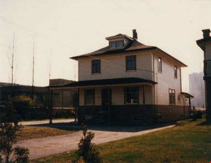
- Photograph of the exterior of the former Burnaby School building at 19th Avenue and Canada Way.
- Repository
- City of Burnaby Archives
- Date
- 1985
- Collection/Fonds
- Burnaby Historical Society fonds
- Subseries
- Evelyn Salisbury subseries
- Physical Description
- 1 photograph : col. ; 8.8 x 11.3 cm
- Description Level
- Item
- Record No.
- 145-005
- Access Restriction
- No restrictions
- Reproduction Restriction
- Reproduce for fair dealing purposes only
- Accession Number
- BHS1985-15
- Scope and Content
- Photograph of the exterior of the former Burnaby School building at 19th Avenue and Canada Way.
- Subjects
- Buildings - Schools
- Media Type
- Photograph
- Notes
- Title based on contents of photograph
- Geographic Access
- Canada Way
- Street Address
- 7376 Canada Way
- Historic Neighbourhood
- Edmonds (Historic Neighbourhood)
- Planning Study Area
- Edmonds Area
Images

Burnaby Winter Club's 25th Anniversary
https://search.heritageburnaby.ca/link/archivedescription58950
- Repository
- City of Burnaby Archives
- Date
- ca.1983
- Collection/Fonds
- Columbian Newspaper collection
- Description Level
- Item
- Physical Description
- 1 photograph : b&w ; 16.5 x 25 cm
- Scope and Content
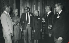
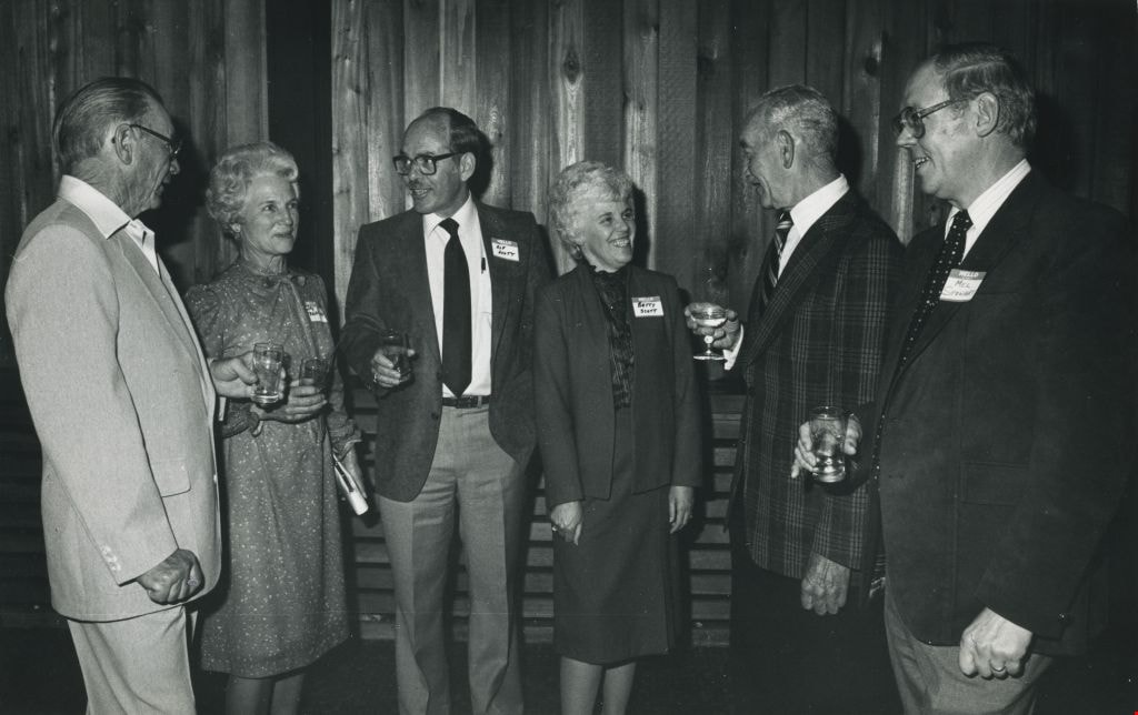
- Photograph of attendees at the Burnaby Winter Club's 25th anniversary reunion.
- Repository
- City of Burnaby Archives
- Date
- ca.1983
- Collection/Fonds
- Columbian Newspaper collection
- Physical Description
- 1 photograph : b&w ; 16.5 x 25 cm
- Description Level
- Item
- Record No.
- 480-1395
- Access Restriction
- No restrictions
- Reproduction Restriction
- Reproduce for fair dealing purposes only
- Accession Number
- 2009-01
- Scope and Content
- Photograph of attendees at the Burnaby Winter Club's 25th anniversary reunion.
- Subjects
- Celebrations
- Names
- Burnaby Winter Club
- Media Type
- Photograph
- Photographer
- Braid, Tom
- Notes
- Title based on contents of photograph
- Photographer's stamp on verso
- Note on verso reads: "PMT / 117% / page A-9 / Burnaby Today / reunion"
- Newspaper clipping attached to verso reads: "Reunion At Winter Club / Among hundreds of former and current members gathering Sunday for Burnaby Winter Club's 25th anniversary reunion were, from left, Cas and Mary Treleaven now of Maple Lake, B.C.; club president Alf Scott and his wife Bett, of Burnaby; Bill Hall of Burnaby and Mel Spowart, a past-president of the club."
- Street Address
- 4990 Canada Way
- Historic Neighbourhood
- Burnaby Lake (Historic Neighbourhood)
- Planning Study Area
- Douglas-Gilpin Area
Images
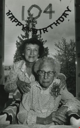
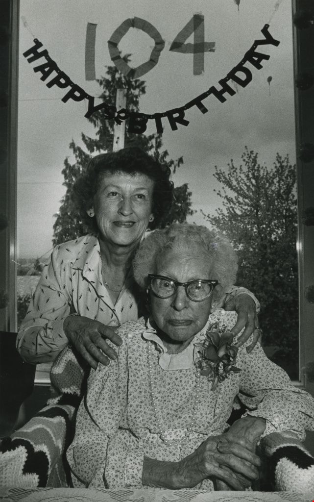
Elizabeth McIntyre's 104th birthday
https://search.heritageburnaby.ca/link/archivedescription45981
- Repository
- City of Burnaby Archives
- Date
- May 1983
- Collection/Fonds
- Columbian Newspaper collection
- Description Level
- Item
- Physical Description
- 1 photograph : b&w ; 22 x 14 cm
- Scope and Content
- Photograph of Elizabeth McIntyre, being hugged by her niece Jean Braaten, on her 104th birthday. The party was held at Carlton Hospital, where she was residing.
- Repository
- City of Burnaby Archives
- Date
- May 1983
- Collection/Fonds
- Columbian Newspaper collection
- Physical Description
- 1 photograph : b&w ; 22 x 14 cm
- Description Level
- Item
- Record No.
- 480-876
- Access Restriction
- No restrictions
- Reproduction Restriction
- Reproduce for fair dealing purposes only
- Accession Number
- 2003-02
- Scope and Content
- Photograph of Elizabeth McIntyre, being hugged by her niece Jean Braaten, on her 104th birthday. The party was held at Carlton Hospital, where she was residing.
- Subjects
- Celebrations
- Media Type
- Photograph
- Photographer
- Battistoni, Peter
- Notes
- Title based on contents of photograph
- Geographic Access
- Canada Way
- Street Address
- 4125 Canada Way
- Historic Neighbourhood
- Broadview (Historic Neighbourhood)
- Planning Study Area
- Cascade-Schou Area
Images
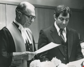
Justice G. L. Murray swearing in Mayor Dave Mercier
https://search.heritageburnaby.ca/link/archivedescription46289
- Repository
- City of Burnaby Archives
- Date
- March 11, 1980
- Collection/Fonds
- Columbian Newspaper collection
- Description Level
- Item
- Physical Description
- 1 photograph : b&w ; 19 x 24 cm
- Scope and Content
- Photograph of Justice G. L. Murray administrating the oath of office to Mayor Dave Mercier. Dave Mercier was a council member from 1968 to 1971, and from 1977 to 1981, serving as Mayor from 1979 to 1981.
- Repository
- City of Burnaby Archives
- Date
- March 11, 1980
- Collection/Fonds
- Columbian Newspaper collection
- Physical Description
- 1 photograph : b&w ; 19 x 24 cm
- Description Level
- Item
- Record No.
- 480-1177
- Access Restriction
- No restrictions
- Reproduction Restriction
- No restrictions
- Accession Number
- 2003-02
- Scope and Content
- Photograph of Justice G. L. Murray administrating the oath of office to Mayor Dave Mercier. Dave Mercier was a council member from 1968 to 1971, and from 1977 to 1981, serving as Mayor from 1979 to 1981.
- Media Type
- Photograph
- Photographer
- King, Basil
- Notes
- Title based on contents of photograph
- Geographic Access
- Canada Way
- Street Address
- 4949 Canada Way
- Historic Neighbourhood
- Burnaby Lake (Historic Neighbourhood)
- Planning Study Area
- Douglas-Gilpin Area
Images

![Mayor Lewarne and Council Members, [between 1981 and 1983] thumbnail](/media/hpo/_Data/_Archives_Images/_Unrestricted/316/351-001.jpg?width=280)
Mayor Lewarne and Council Members
https://search.heritageburnaby.ca/link/archivedescription37331
- Repository
- City of Burnaby Archives
- Date
- [between 1981 and 1983]
- Collection/Fonds
- Burnaby Historical Society fonds
- Description Level
- Item
- Physical Description
- 1 photograph : col. ; 20 x 25 cm
- Scope and Content
- Photograph of Mayor William Lewarne and Council members, 1981-1983. Back row (l to r): Alan Emmott, Egon Nikolai, Vic Stusiak, Donald Brown, Doug Drummond. Front row (l to r) George McLean, Tom Constable, William Lewarne, and Doreen Lawson. The photograph was taken in Council Chambers at Burnaby…
- Repository
- City of Burnaby Archives
- Date
- [between 1981 and 1983]
- Collection/Fonds
- Burnaby Historical Society fonds
- Subseries
- Municipal record subseries
- Physical Description
- 1 photograph : col. ; 20 x 25 cm
- Description Level
- Item
- Record No.
- 351-001
- Access Restriction
- No restrictions
- Reproduction Restriction
- Reproduce for fair dealing purposes only
- Accession Number
- BHS1997-11
- Scope and Content
- Photograph of Mayor William Lewarne and Council members, 1981-1983. Back row (l to r): Alan Emmott, Egon Nikolai, Vic Stusiak, Donald Brown, Doug Drummond. Front row (l to r) George McLean, Tom Constable, William Lewarne, and Doreen Lawson. The photograph was taken in Council Chambers at Burnaby Municipal Hall.
- Subjects
- Officials - Alderman and Councillors
- Buildings - Civic - City Halls
- Officials - Mayors and Reeves
- Names
- Emmott, Alan H.
- Nikolai, Egon
- Stusiak, Victor V. "Vic"
- Brown, Donald N. "Don"
- Drummond, Douglas P. "Doug"
- McLean, George H.F.
- Constable, Thomas W. "Tom"
- Lewarne, William A. "Bill"
- Lawson, Doreen A.
- Burnaby City Hall
- Media Type
- Photograph
- Notes
- Title based on contents of photograph
- Geographic Access
- Canada Way
- Street Address
- 4949 Canada Way
- Historic Neighbourhood
- Burnaby Lake (Historic Neighbourhood)
- Planning Study Area
- Douglas-Gilpin Area
Images
![Mayor Lewarne and Council Members, [between 1981 and 1983] thumbnail](/media/hpo/_Data/_Archives_Images/_Unrestricted/316/351-001.jpg)
![Burnaby Fire Department rescue truck, [after 1976] thumbnail](/media/hpo/_Data/_BVM_Images/2000/200200100005.jpg?width=280)
Burnaby Fire Department rescue truck
https://search.heritageburnaby.ca/link/museumdescription1607
- Repository
- Burnaby Village Museum
- Date
- [after 1976]
- Collection/Fonds
- Burnaby Village Museum Photograph collection
- Description Level
- Item
- Physical Description
- 1 photograph : b&w ; 20.5 x 25.2 cm
- Scope and Content
- Photograph of four unidentified firemen gathered beside Burnaby Fire Department's Rescue 1 truck (1976 Ford C 600 Rescue unit). The truck's side compartments are visible, housing fire extinguishers and other equipment. The truck appears to be parked at fire hall no. 1 at Sperling and Canada Way.
- Repository
- Burnaby Village Museum
- Collection/Fonds
- Burnaby Village Museum Photograph collection
- Description Level
- Item
- Physical Description
- 1 photograph : b&w ; 20.5 x 25.2 cm
- Scope and Content
- Photograph of four unidentified firemen gathered beside Burnaby Fire Department's Rescue 1 truck (1976 Ford C 600 Rescue unit). The truck's side compartments are visible, housing fire extinguishers and other equipment. The truck appears to be parked at fire hall no. 1 at Sperling and Canada Way.
- Names
- Burnaby Fire Department
- Geographic Access
- Canada Way
- Sperling Avenue
- Accession Code
- BV002.10.5
- Access Restriction
- Restricted access
- Reproduction Restriction
- May be restricted by third party rights
- Date
- [after 1976]
- Media Type
- Photograph
- Historic Neighbourhood
- Burnaby Lake (Historic Neighbourhood)
- Planning Study Area
- Morley-Buckingham Area
- Related Material
- For another photograph of the rescue truck taken from a different angle, see BV002.10.4
- Scan Resolution
- 600
- Scan Date
- 09-Jun-09
- Scale
- 100
- Notes
- Title based on contents of photograph
Images
![Burnaby Fire Department rescue truck, [after 1976] thumbnail](/media/hpo/_Data/_BVM_Images/2000/200200100005.jpg)

Interview with Minard Hill February 9, 1978 - Track 3
https://search.heritageburnaby.ca/link/oralhistory196
- Repository
- City of Burnaby Archives
- Date Range
- 1880-1914
- Length
- 0:10:09
- Summary
- This portion of the interview pertains to Minard Gerald "Gerry" Hill's relatives in England, his father's early life as well as life on the strawberry farm in Burnaby.
- Repository
- City of Burnaby Archives
- Summary
- This portion of the interview pertains to Minard Gerald "Gerry" Hill's relatives in England, his father's early life as well as life on the strawberry farm in Burnaby.
- Date Range
- 1880-1914
- Photo Info
- Minard Gerald Hill in uniform, 1914. Item no. 477-926
- Length
- 0:10:09
- Names
- Hill, Bernard R
- Geographic Access
- Douglas Road
- Canada Way
- Historic Neighbourhood
- Burnaby Lake (Historic Neighbourhood)
- Planning Study Area
- Douglas-Gilpin Area
- Interviewer
- Stevens, Colin
- Interview Date
- February 9, 1978
- Scope and Content
- Recording is of an interview with Minard Gerald "Gerry" Hill conducted by Colin Stevens, February 9, 1978. Major themes discussed are: the Burnaby Lake Neighbourhood, Gilley Brothers Logging Company and his father, Bernard Hill.
- Biographical Notes
- Minard Gerald “Gerry” Hill was born in Burnaby on July 31, 1893 to Marian (Berkeley) and Bernard Richard Hill. He was the youngest child in the family with older siblings Frank, Claude and Winnie. Bernard R. Hill was born in Bengal, India while his father worked for the East Indian Railway. He and his older brother Claude became strawberry farmers in Burnaby despite their years of training as engineers. Between them, the Hill brothers owned all the land between Burnaby Lake and Deer Lake where Deer Creek runs, and half way around Deer Lake. Bernard built his family home at Douglas Road near Deer Lake in 1892. After the decline in the strawberry industry, Bernard worked as a surveyor for the municipality. He also served as Burnaby Councillor and School Trustee. Gerry attended Miss Harriet Woodward’s kindergarten class, and went on to Edmonds School with Miss Ellen Lister as his teacher. He later went to Central high school in New Westminster, often on horseback. Gerry served in World War I, signing his recruitment papers November 9, 1914. When he returned home, he worked felling trees, then as an apprentice surveyor and finally as a carpenter. Minard Gerald “Gerry” Hill married Charlotte Elizabeth “Elizabeth” Vidal on September 28, 1920 and single-handedly built a house for him and his wife about a thousand feet from his parents’ home. He also bought property at Yellow Point, Vancouver Island around this time. By the early 1930s Gerry had moved to Yellow Point permanently and begun work building the lodge. Elizabeth and Gerry’s child, Richard Grant McEwan Hill was born at Ladysmith hospital. Charlotte Elizabeth “Elizabeth” (Vidal) Hill died February 11, 1984 at the age of eighty-seven. Minard Gerald “Gerry” Hill died January 30, 1988 at the age of ninety-three.
- Total Tracks
- 8
- Total Length
- 1:13:56
- Interviewee Name
- Hill, Minard Gerald "Gerry"
- Interview Location
- Yellow Point, Vancouver Island
- Collection/Fonds
- Burnaby Historical Society fonds
- Subseries
- Oral history subseries
- Media Type
- Sound Recording
- Web Notes
- Interview was digitized in 2010 allowing it to be accessible on Heritage Burnaby. The digitization project was initiated by the Community Heritage Commission with support from City of Burnaby Council and the BC History Digitization Program of the Irving K. Barber Learning Centre, University of British Columbia. It was recognized by the Heritage Society of BC with an award in 2012.
Images

Audio Tracks
Track three of interview with Minard Hill
Track three of interview with Minard Hill
https://search.heritageburnaby.ca/media/hpo/_Data/_Archives_Oral_Histories/_Unrestricted/MSS137-018-1/MSS137-018-1_Track_3.mp3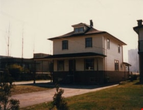
Lewis house
https://search.heritageburnaby.ca/link/archivedescription34855
- Repository
- City of Burnaby Archives
- Date
- March 31, 1985
- Collection/Fonds
- Burnaby Historical Society fonds
- Description Level
- Item
- Physical Description
- 1 photograph : col. ; 8.8 x 11.3 cm
- Scope and Content
- Photograph of the exterior of the house the belonged to the Lewis family on Canada Way.
- Repository
- City of Burnaby Archives
- Date
- March 31, 1985
- Collection/Fonds
- Burnaby Historical Society fonds
- Subseries
- Evelyn Salisbury subseries
- Physical Description
- 1 photograph : col. ; 8.8 x 11.3 cm
- Description Level
- Item
- Record No.
- 145-003
- Access Restriction
- No restrictions
- Reproduction Restriction
- Reproduce for fair dealing purposes only
- Accession Number
- BHS1985-15
- Scope and Content
- Photograph of the exterior of the house the belonged to the Lewis family on Canada Way.
- Subjects
- Buildings - Residential - Houses
- Media Type
- Photograph
- Notes
- Title based on contents of photograph
- Geographic Access
- Canada Way
Images
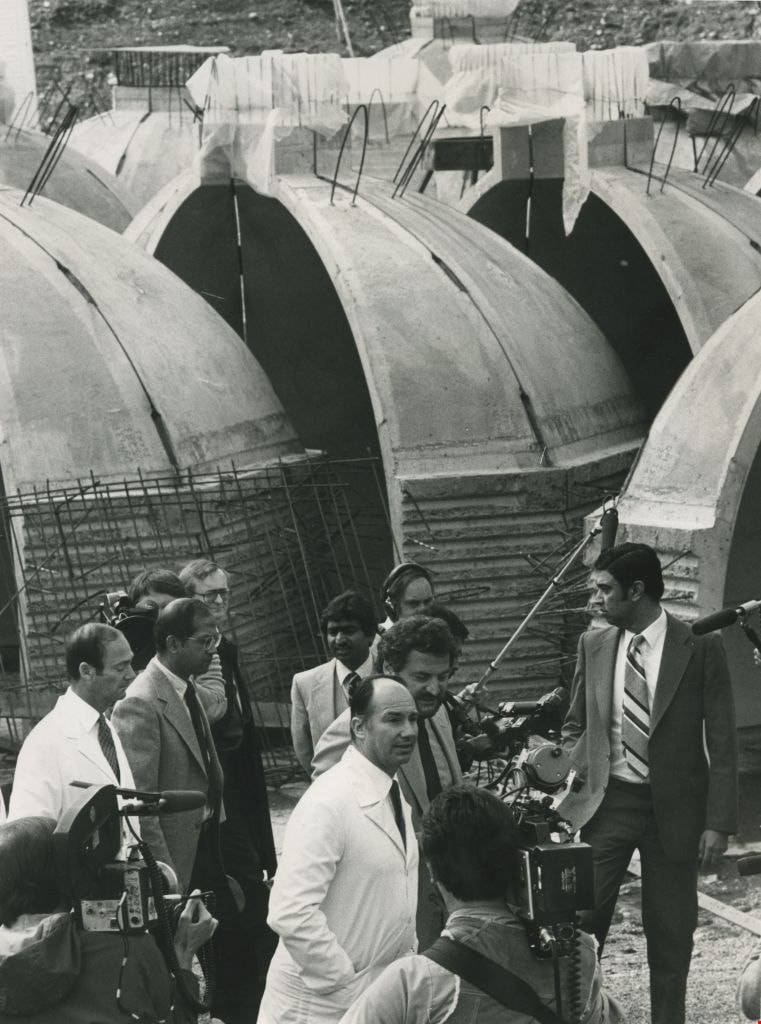
Shah Karim al-Hussayni, The Aga Khan IV
https://search.heritageburnaby.ca/link/archivedescription45783
- Repository
- City of Burnaby Archives
- Date
- April 21, 1983
- Collection/Fonds
- Columbian Newspaper collection
- Description Level
- Item
- Physical Description
- 1 photograph : b&w ; 24.5 x 18 cm
- Scope and Content
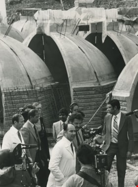
- Photograph of Shah Karim al-Hussayni, The Aga Khan IV visiting the construction site of the Darkhana Jamatkhana in Burnaby, during his "second Canadian visit of his silver jubilee". He and his escorts are surrounded by men with television cameras.
- Repository
- City of Burnaby Archives
- Date
- April 21, 1983
- Collection/Fonds
- Columbian Newspaper collection
- Physical Description
- 1 photograph : b&w ; 24.5 x 18 cm
- Description Level
- Item
- Record No.
- 480-677
- Access Restriction
- No restrictions
- Reproduction Restriction
- No restrictions
- Accession Number
- 2003-02
- Scope and Content
- Photograph of Shah Karim al-Hussayni, The Aga Khan IV visiting the construction site of the Darkhana Jamatkhana in Burnaby, during his "second Canadian visit of his silver jubilee". He and his escorts are surrounded by men with television cameras.
- Subjects
- Events - Royal Visits
- Media Type
- Photograph
- Photographer
- King, Basil
- Notes
- Title based on contents of photograph
- Geographic Access
- Canada Way
- Historic Neighbourhood
- Broadview (Historic Neighbourhood)
- Planning Study Area
- Cascade-Schou Area
Images