Narrow Results By
Subject
- Advertising Medium - Signs and Signboards 1
- Animals - Birds 1
- Buildings - Public - Detention Facilities 1
- Geographic Features - Creeks 1
- Geographic Features - Forests 2
- Geographic Features - Lakes and Ponds 3
- Geographic Features - Mountains 1
- Natural Phenomena - Snow 1
- Plants - Trees 1
- Recreational Activities - Canoeing 1
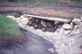
Beaver Creek - Royal Oak Avenue
https://search.heritageburnaby.ca/link/archivedescription91582
- Repository
- City of Burnaby Archives
- Date
- August 9, 1996
- Collection/Fonds
- Doreen Lawson fonds
- Description Level
- File
- Physical Description
- 13 photographs : col. slides ; 35 mm
- Scope and Content
- File consists of photographs of Beaver Creek and Royal Oak Avenue taken during the Royal Oak Avenue Realignment project.
- Repository
- City of Burnaby Archives
- Date
- August 9, 1996
- Collection/Fonds
- Doreen Lawson fonds
- Physical Description
- 13 photographs : col. slides ; 35 mm
- Description Level
- File
- Record No.
- 605-015
- Access Restriction
- No restrictions
- Reproduction Restriction
- No restrictions
- Accession Number
- 2003-30
- Scope and Content
- File consists of photographs of Beaver Creek and Royal Oak Avenue taken during the Royal Oak Avenue Realignment project.
- Subjects
- Geographic Features - Creeks
- Names
- Lawson, Doreen A.
- Media Type
- Photograph
- Photographer
- Lawson, Doreen A.
- Notes
- Title based on contents of photographs
- Geographic Access
- Deer Lake Park
- Historic Neighbourhood
- Burnaby Lake (Historic Neighbourhood)
- Planning Study Area
- Oakalla Area
Images

Canadian journal of earth sciences : historic changes in an urban watershed determined by pollen and geochemical analyses of lake sediment, volume 19, number 11, 1982
https://search.heritageburnaby.ca/link/museumlibrary7458
- Repository
- Burnaby Village Museum
- Author
- Mathewes, Rolf W.
- D'Auria, John M
- Publication Date
- 1982
- Call Number
- 557.113 CAN
- Repository
- Burnaby Village Museum
- Collection
- Reference Collection
- Material Type
- Textual Record
- Call Number
- 557.113 CAN
- Author
- Mathewes, Rolf W.
- D'Auria, John M
- Place of Publication
- Ottawa
- Publisher
- National Research Council Canada
- Publication Date
- 1982
- Physical Description
- pp. 2114 - 2125 [12] : ill ; 26 cm
- Library Subject (LOC)
- Geology--British Columbia
- Geology--British Columbia--Burnaby
- Burnaby (B.C.)--Geography
- Planning Study Area
- Oakalla Area
- Notes
- "reprinted from Canadian journal of earth sciences" -- cover.
- "A 60cm long sediment core from Deer Lake, Burnaby, British Columbia was analyzed palynologically..." -- p. 2114.
Deer Lake
https://search.heritageburnaby.ca/link/archivedescription91583
- Repository
- City of Burnaby Archives
- Date
- May 10, 1997
- Collection/Fonds
- Doreen Lawson fonds
- Description Level
- File
- Physical Description
- 15 photographs : col. slides ; 35 mm
- Scope and Content
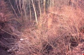
- File consists of photographs of Deer Lake. Photographs depict foliage, primarily consisting of long grasses and deciduous tress, along the lake's shore and in the forest.
- Repository
- City of Burnaby Archives
- Date
- May 10, 1997
- Collection/Fonds
- Doreen Lawson fonds
- Physical Description
- 15 photographs : col. slides ; 35 mm
- Description Level
- File
- Record No.
- 605-016
- Access Restriction
- No restrictions
- Reproduction Restriction
- No restrictions
- Accession Number
- 2003-30
- Scope and Content
- File consists of photographs of Deer Lake. Photographs depict foliage, primarily consisting of long grasses and deciduous tress, along the lake's shore and in the forest.
- Names
- Lawson, Doreen A.
- Media Type
- Photograph
- Photographer
- Lawson, Doreen A.
- Notes
- Title based on contents of photographs
- Note in black ink on recto of slide frame of photograph 605-015-3 reads: "Deer Lake"
- Note in black ink on recto of slide fram of photograph 605-015-15 reads: "Deer Lake Park Tour / with Dinty Moore"
- Geographic Access
- Deer Lake Park
- Historic Neighbourhood
- Burnaby Lake (Historic Neighbourhood)
- Planning Study Area
- Oakalla Area
Images


Deer Lake
https://search.heritageburnaby.ca/link/archivedescription91707
- Repository
- City of Burnaby Archives
- Date
- 1994-1996
- Collection/Fonds
- Doreen Lawson fonds
- Description Level
- File
- Physical Description
- 55 photographs : col. slides ; 35 mm
- Scope and Content
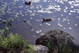
- File consists of scenic photographs of Deer Lake and Deer Lake Park, including closeup photographs of the lake and landscape photographs with the lake in the foreground and mountains and skyline visible in the distance. The photographs capture Deer Lake in the fall, winter, and spring. Also inclu…
- Repository
- City of Burnaby Archives
- Date
- 1994-1996
- Collection/Fonds
- Doreen Lawson fonds
- Physical Description
- 55 photographs : col. slides ; 35 mm
- Description Level
- File
- Record No.
- 618-025
- Access Restriction
- No restrictions
- Reproduction Restriction
- No restrictions
- Accession Number
- 2015-15
- Scope and Content
- File consists of scenic photographs of Deer Lake and Deer Lake Park, including closeup photographs of the lake and landscape photographs with the lake in the foreground and mountains and skyline visible in the distance. The photographs capture Deer Lake in the fall, winter, and spring. Also included in the file are four photographs of Deer Lake Park signs.
- Subjects
- Natural Phenomena - Snow
- Geographic Features - Lakes and Ponds
- Plants - Trees
- Geographic Features - Mountains
- Advertising Medium - Signs and Signboards
- Names
- Burnaby Art Gallery
- Media Type
- Photograph
- Photographer
- Lawson, Doreen A.
- Notes
- Title based on contents of photographs
- Geographic Access
- Deer Lake
- Historic Neighbourhood
- Burnaby Lake (Historic Neighbourhood)
- Planning Study Area
- Oakalla Area
Images

Deer Lake algae and Burnaby Lake Mountain Parkway
https://search.heritageburnaby.ca/link/archivedescription91576
- Repository
- City of Burnaby Archives
- Date
- 1995-1998
- Collection/Fonds
- Doreen Lawson fonds
- Description Level
- File
- Physical Description
- 30 photographs : col. slides ; 35 mm
- Scope and Content
- File consists of photographs of Deer Lake algae, Burnaby Lake Mountain Parkway, and construction at an unidentified waterway. The file also contains two photographs of an unidentified young man sitting in a canoe with his arm outstretched beside an oar, which stands upright in the water without as…
- Repository
- City of Burnaby Archives
- Date
- 1995-1998
- Collection/Fonds
- Doreen Lawson fonds
- Physical Description
- 30 photographs : col. slides ; 35 mm
- Description Level
- File
- Record No.
- 605-009
- Access Restriction
- No restrictions
- Reproduction Restriction
- No restrictions
- Accession Number
- 2003-30
- Scope and Content
- File consists of photographs of Deer Lake algae, Burnaby Lake Mountain Parkway, and construction at an unidentified waterway. The file also contains two photographs of an unidentified young man sitting in a canoe with his arm outstretched beside an oar, which stands upright in the water without assistance.
- Names
- Lawson, Doreen A.
- Media Type
- Photograph
- Photographer
- Lawson, Doreen A.
- Notes
- Transcribed title
- Title transcribed from file photographs were originally housed in
- Photographs were originally housed within file MSS071-017
- Photographs 605-009-1 : 605-009-11 depict Deer Lake algae
- Photographs 605-009-12 : 605-009-22 depict Burnaby Mountain Highway
- Historic Neighbourhood
- Burnaby Lake (Historic Neighbourhood)
- Planning Study Area
- Oakalla Area
Images

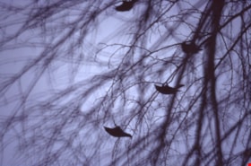
Deer Lake wildlife
https://search.heritageburnaby.ca/link/archivedescription91578
- Repository
- City of Burnaby Archives
- Date
- January 29, 1996
- Collection/Fonds
- Doreen Lawson fonds
- Description Level
- File
- Physical Description
- 9 photographs : col. slides ; 35 mm
- Scope and Content
- File consists of photographs of a great grey owl and a murder of crows. The birds are perched in trees at Deer Lake Park. Photographs were taken in the early morning or evening.
- Repository
- City of Burnaby Archives
- Date
- January 29, 1996
- Collection/Fonds
- Doreen Lawson fonds
- Physical Description
- 9 photographs : col. slides ; 35 mm
- Description Level
- File
- Record No.
- 605-011
- Access Restriction
- No restrictions
- Reproduction Restriction
- No restrictions
- Accession Number
- 2003-30
- Scope and Content
- File consists of photographs of a great grey owl and a murder of crows. The birds are perched in trees at Deer Lake Park. Photographs were taken in the early morning or evening.
- Names
- Lawson, Doreen A.
- Media Type
- Photograph
- Photographer
- Lawson, Doreen A.
- Notes
- Title based on contents of photographs
- Note in black ink on recto of photograph 605-011-5 slide case reads: "Deer Lake / Great Grey Owl"
- Note in black ink on recto of photograph 605-011-7 slide case reads: "Crows Deer Lake"
- Geographic Access
- Deer Lake Park
- Deer Lake
- Historic Neighbourhood
- Burnaby Lake (Historic Neighbourhood)
- Planning Study Area
- Oakalla Area
Images


Municipality of Burnaby - Volume XVI and Volume XVII
https://search.heritageburnaby.ca/link/museumdescription8684
- Repository
- Burnaby Village Museum
- Date
- May 1927
- Collection/Fonds
- Burnaby Village Museum Map collection
- Description Level
- File
- Physical Description
- 4 plans on 4 sheets : col. lithographic prints ; 63.5 x 53.5 cm folded to 53 x 31.5 cm
- Scope and Content
- File consists of four pages of plans removed from a bound book containing a series of fire insurance plans of the Municipality of Burnaby. Page "D" is titled: "GREATER VANCOUVER B.C. / VOLUME XVI / Surveyed _ May 1927 / MUNICIPALITY OF / BURNABY / PLAN DEPT. FIRE BRANCH _ B.C. INSURANCE UNDERWRITE…
- Repository
- Burnaby Village Museum
- Collection/Fonds
- Burnaby Village Museum Map collection
- Description Level
- File
- Physical Description
- 4 plans on 4 sheets : col. lithographic prints ; 63.5 x 53.5 cm folded to 53 x 31.5 cm
- Material Details
- Scale [1:1200] and [1:6000]
- Scope and Content
- File consists of four pages of plans removed from a bound book containing a series of fire insurance plans of the Municipality of Burnaby. Page "D" is titled: "GREATER VANCOUVER B.C. / VOLUME XVI / Surveyed _ May 1927 / MUNICIPALITY OF / BURNABY / PLAN DEPT. FIRE BRANCH _ B.C. INSURANCE UNDERWRITERS ASSN." / KEY PLAN". Plans covered in this "Key Plan" are numbered 1601 to 1626, 1632 and 1651 covering District Lots: 15; 31; 100 to 102; 114; 141 to 144; 147 and 148; 209 to 214. Plan "E" is part of "GREATER VANCOUVER B.C. / VOLUME XVII / Municipality of Burnaby / May 1927" and covers plans: 1701 to 1705; 1711 to 1715; 1723 to 1727; 1729 to 1733; 1737 to 1742 and District Lots: 68 to 74; 80 to 84; 32 to 35 and 38 to 39. Plan marked "F" is a key plan titled: "GREATER VANCOUVER B.C. / VOLUME XVII / Surveyed _ May 1927 / MUNICIPALITY OF / BURNABY and covers plans: 1706 to 1710; 1716 to 1722; 1734 and 1735; 1743 to 1752 and District Lots: 42 to 44; 59; 75 to 80; 83 to 87; 89 to 93 and 130. Plan "1729" is part of "GREATER VANCOUVER B.C. / VOLUME XVII / Municipality of Burnaby / May 1927" and covers District Lots 34 and 35.
- Responsibility
- British Columbia Underwriters' Association
- Accession Code
- HV972.111.6
- Access Restriction
- No restrictions
- Reproduction Restriction
- May be restricted by third party rights
- Date
- May 1927
- Media Type
- Cartographic Material
- Historic Neighbourhood
- Barnet (Historic Neighbourhood)
- Burquitlam (Historic Neighbourhood)
- Central Park (Historic Neighbourhood)
- Burnaby Lake (Historic Neighbourhood)
- Broadview (Historic Neighbourhood)
- Planning Study Area
- Burnaby Mountain Area
- Lyndhurst Area
- Lake City Area
- Cascade-Schou Area
- Garden Village Area
- Douglas-Gilpin Area
- Oakalla Area
- Scan Resolution
- 400
- Scan Date
- 2021-11-18
- Notes
- Title based on content of plans
- See also BV987.1.70d for revised versions of plans
- Scale is measured 1 inch = 500 feet
Zoomable Images


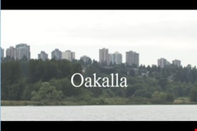
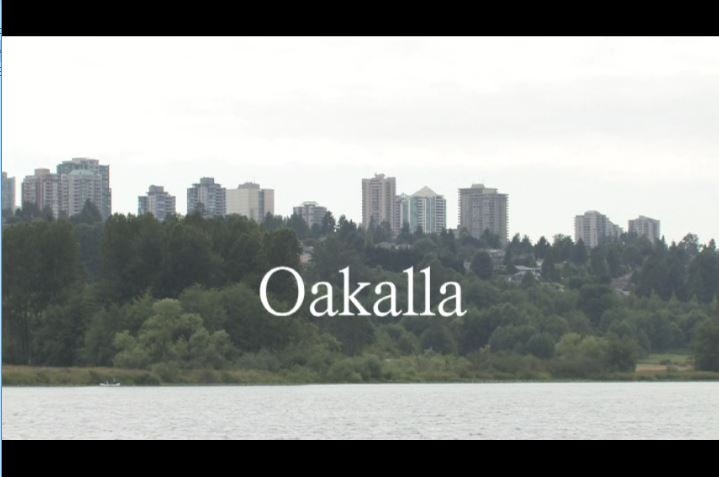
Oakalla
https://search.heritageburnaby.ca/link/museumlibrary1393
- Repository
- Burnaby Village Museum
- Author
- Jack, Ronald
- Publication Date
- c2009
- Call Number
- 365.9711 JAC VR
- Repository
- Burnaby Village Museum
- Collection
- Reference Collection
- Material Type
- Moving Images
- Accession Code
- BV020.5.1059
- Call Number
- 365.9711 JAC VR
- Author
- Jack, Ronald
- Place of Publication
- Vancouver, B.C.
- Publisher
- Runagate Pictures
- Publication Date
- c2009
- Physical Description
- 1 videodisc (9 min., 52 sec.) : sd., col. ; 4 3/4 in
- Library Subject (LOC)
- Lower Mainland Regional Corrections Centre--History
- Prisons--British Columbia
- Historic Neighbourhood
- Burnaby Lake (Historic Neighbourhood)
- Planning Study Area
- Oakalla Area
- Geographic Access
- Oakmount Crescent
- Street Address
- 5220 Oakmount Crescent
- Notes
- "A preview DVD" titled "Oakalla" compiled by Ronald Jack. Film footage consists of historic and contemporary images regarding Oakalla Prison Farm and includes commentaries from Burnaby Village Museum Curator, Tom Gooden; Oakalla Historian and Vancouver Police Officer, Earl Anderson and Burnaby Mayor, Derek Corrigan (former Oakalla prison guard). A collection of Oakalla artifacts are included in the film footage.
- Contact Burnaby Village Museum to view video content
Images