![Aerial view of Vancouver, North Vancouver and West Vancouver, [195-] (date of orignal), copied 1985 thumbnail](/media/hpo/_Data/_BVM_Images/1985/1985_0457_0008_001.jpg?width=280)
Aerial view of Vancouver, North Vancouver and West Vancouver
https://search.heritageburnaby.ca/link/museumdescription10589
- Repository
- Burnaby Village Museum
- Date
- [195-] (date of orignal), copied 1985
- Collection/Fonds
- Burnaby Village Museum Photograph collection
- Description Level
- Item
- Physical Description
- 1 photograph : b&w copy negative ; 10 x 12.5 cm
- Scope and Content
- Aerial photograph looking west towards Vancouver, North Vancouver and West Vancouver.
- Repository
- Burnaby Village Museum
- Collection/Fonds
- Burnaby Village Museum Photograph collection
- Description Level
- Item
- Physical Description
- 1 photograph : b&w copy negative ; 10 x 12.5 cm
- Scope and Content
- Aerial photograph looking west towards Vancouver, North Vancouver and West Vancouver.
- Accession Code
- BV985.457.8
- Access Restriction
- No restrictions
- Reproduction Restriction
- May be restricted by third party rights
- Date
- [195-] (date of orignal), copied 1985
- Media Type
- Photograph
- Scan Resolution
- 1200
- Scan Date
- 2022-06-07
- Photographer
- Aero Surveys Limited
- Notes
- Title based on contents of photograph
Images
![Aerial view of Vancouver, North Vancouver and West Vancouver, [195-] (date of orignal), copied 1985 thumbnail](/media/hpo/_Data/_BVM_Images/1985/1985_0457_0008_001.jpg)

Cabinets of curiosities : collections of the Vancouver Museum, 1894-1981
https://search.heritageburnaby.ca/link/museumlibrary981
- Repository
- Burnaby Village Museum
- Author
- Vancouver Museum
- Publication Date
- c1982
- Call Number
- 708.11 CAB
- Repository
- Burnaby Village Museum
- Collection
- Reference Collection
- Material Type
- Book
- ISBN
- 0919253067
- Call Number
- 708.11 CAB
- Author
- Vancouver Museum
- Contributor
- Maranda, Lynn, 1942-
- Mayer, Carol E. (Carol Elizabeth), 1945-
- Sayers, Ivan W. (Ivan William), 1946-
- Vancouver Museums and Planetarium Association
- Place of Publication
- Vancouver
- Publisher
- Vancouver Museums and Planetarium Association
- Publication Date
- c1982
- Physical Description
- iv, 92, v-xi p. : ill. (some col.) ; 23 cm.
- Library Subject (LOC)
- Vancouver Museum
- Catalogs
- Notes
- "Prepared by ... Lynn Maranda, Carol Mayer and Ivan Sayers"--p. iv.
- Includes index.
City of Vancouver heritage inventory of Vancouver schools : report
https://search.heritageburnaby.ca/link/museumlibrary1000
- Repository
- Burnaby Village Museum
- Author
- Bodnar, Diana, 1950-
- Publication Date
- 1982
- Call Number
- 727. BOD
- Repository
- Burnaby Village Museum
- Collection
- Reference Collection
- Material Type
- Book
- Call Number
- 727. BOD
- Author
- Bodnar, Diana, 1950-
- Place of Publication
- [Vancouver, B.C]
- Publisher
- City of Vancouver
- Publication Date
- 1982
- Physical Description
- 60 leaves : ill. ; 28 cm.
- Library Subject (LOC)
- Architecture
- Subjects
- Buildings - Heritage
- Buildings - Schools
- Geographic Access
- Vancouver
- Notes
- Includes bibliographical references (p. 58-60).
- Prepared for the Vancouver Heritage Advisory Committee.
![Sectional map and street directory of Vancouver : Dial map of greater Vancouver including adjacent municipalities, [ca. 1950] thumbnail](/media/hpo/_Data/_BVM_Cartographic_Material/2000/2000_0003_0011_001%20WEB.jpg?width=280)
Sectional map and street directory of Vancouver : Dial map of greater Vancouver including adjacent municipalities
https://search.heritageburnaby.ca/link/museumdescription8697
- Repository
- Burnaby Village Museum
- Date
- [ca. 1950]
- Collection/Fonds
- Burnaby Village Museum Map collection
- Description Level
- Item
- Physical Description
- 2 maps and 1 p. of textual records on 1 sheet : lithographic prints, col. ; 55.5 x 75 cm + 2 dials and 25 x 72 cm + directory on sheet 55.5 x 75 cm, folded to 28.5 x 12.5 cm
- Scope and Content
- Item is a sectional map and street directory titled "Dial Map of Greater Vancouver and adjacent Municipalities" with a map on one side titled "Dial Map of Greater Vancouver and Suburbs" including Vancouver, West Vancouver, North Vancouver and Burnaby and includes street car and bus lines, railways,…
- Repository
- Burnaby Village Museum
- Collection/Fonds
- Burnaby Village Museum Map collection
- Description Level
- Item
- Physical Description
- 2 maps and 1 p. of textual records on 1 sheet : lithographic prints, col. ; 55.5 x 75 cm + 2 dials and 25 x 72 cm + directory on sheet 55.5 x 75 cm, folded to 28.5 x 12.5 cm
- Material Details
- Scales 1:42240, 1:144823
- 2 alphabetic dials on narrow strips of paper attached to map by grommets
- Scope and Content
- Item is a sectional map and street directory titled "Dial Map of Greater Vancouver and adjacent Municipalities" with a map on one side titled "Dial Map of Greater Vancouver and Suburbs" including Vancouver, West Vancouver, North Vancouver and Burnaby and includes street car and bus lines, railways, hospitals, parks, block nos. and street indexes with two alphabetic dials, one for Vancouver, the other for New Westminster. The other side of the map includes a map of "Fraser Valley" along with a directory of Vancouver street car and bus routes, business blocks, public buildings, hospitals, bathing beaches, locations of Vancouver fire halls and Vancouver city schools.
- Creator
- Dominion Map and Blueprint Co.
- Publisher
- Sectional Map and Street Directory Company
- Geographic Access
- Vancouver
- Accession Code
- BV000.3.11
- Access Restriction
- No restrictions
- Reproduction Restriction
- No known restrictions
- Date
- [ca. 1950]
- Media Type
- Cartographic Material
- Scan Resolution
- 380
- Scan Date
- 22-Dec-2020
- Scale
- 100
- Notes
- Title based on contents of map
Images
![Sectional map and street directory of Vancouver : Dial map of greater Vancouver including adjacent municipalities, [ca. 1950] thumbnail](/media/hpo/_Data/_BVM_Cartographic_Material/2000/2000_0003_0011_001%20WEB.jpg)


Vancouver discovers Vancouver : an excerpt from the rough logs of Second Lieutenant Peter John Puget
https://search.heritageburnaby.ca/link/museumlibrary1146
- Repository
- Burnaby Village Museum
- Author
- Puget, Peter John
- Publication Date
- 1990
- Call Number
- 971.1133 PUG
- Repository
- Burnaby Village Museum
- Collection
- Reference Collection
- Material Type
- Book
- Call Number
- 971.1133 PUG
- Author
- Puget, Peter John
- Contributor
- Lamb, W. K.
- Place of Publication
- Burnaby
- Publisher
- Vancouver Conference on Exploration and Discovery
- Publication Date
- 1990
- Physical Description
- 23 p. : ill. ; 22 cm.
- Library Subject (LOC)
- Burrard Inlet (B.C.)--Discovery and exploration
- Discoveries in geography
- Notes
- "To Commemorate the arrival of Captain George Vancouver on the Pacific Northwest Coast of North America in 1792"
- "Simon Fraser University will host An International and Interdisciplinary Conference on Exploration and Discovery in April 1992"

Commercial Map of Greater Vancouver and District
https://search.heritageburnaby.ca/link/museumdescription9552
- Repository
- Burnaby Village Museum
- Date
- July 1921
- Collection/Fonds
- Burnaby Village Museum Map collection
- Description Level
- Item
- Physical Description
- 1 map : col. lithograph mounted on linen ; 107 x 138 cm
- Scope and Content
- Commercial map of Greater Vancouver and District. Map depicts district lots, railroads, electric railways, streets, street car stops, schools, buildings, postal block numbers, parks and First Nations reserves. Map covers the geographcial areas of Vancouver, Burnaby, New Westminster, portions of Ric…
- Repository
- Burnaby Village Museum
- Collection/Fonds
- Burnaby Village Museum Map collection
- Description Level
- Item
- Physical Description
- 1 map : col. lithograph mounted on linen ; 107 x 138 cm
- Material Details
- Includes Legend and Index
- Scope and Content
- Commercial map of Greater Vancouver and District. Map depicts district lots, railroads, electric railways, streets, street car stops, schools, buildings, postal block numbers, parks and First Nations reserves. Map covers the geographcial areas of Vancouver, Burnaby, New Westminster, portions of Richmond, West Vancouver, North Vancouver, and Surrey with half mile circles that radiate from Vancouver City Hall on the corner of Main and Hastings. Bottom of map includes an index of street names, along with their corresponding map grid locations. The map is bordered by Marine Drive to the west, North Road to the east, Dempsey Street to the north and 20th Road to the south.
- History
- Bought by donor at thrift store years ago. No known provenance.
- Publisher
- Produced by Photo - Lithography, Colonist , Victoria, B.C.
- Geographic Access
- Vancouver
- Accession Code
- BV018.24.1
- Access Restriction
- No restrictions
- Reproduction Restriction
- No known restrictions
- Date
- July 1921
- Media Type
- Cartographic Material
- Scan Resolution
- 300
- Scan Date
- 16-Jun-20
- Scale
- 100
- Notes
- Transcribed title
- Title on map reads: "COMMERCIAL MAP / OF / GREATER VANCOUVER / AND / DISTRICT / Compiled and Published by / The Vancouver Map & Blueprint Co. Ltd. / 441 Seymour St. Vancouver B.C. / July, 1921".
Images

The days before yesterday in Cedar Cottage
https://search.heritageburnaby.ca/link/museumlibrary4830
- Repository
- Burnaby Village Museum
- Collection
- Special Collection
- Material Type
- Book
- Accession Code
- BV009.8.17
- Call Number
- 971.133 GLA
- Contributor
- Lysell, Alan
- Reid, Glen
- Place of Publication
- Vancouver
- Publisher
- Gladstone Secondary School
- Publication Date
- 1968
- Physical Description
- 76 p. : ill. : 24 x 28 cm.
- Library Subject (LOC)
- Vancouver (B.C.)--History
- Geographic Access
- Vancouver
- Object History
- The donation relates to the Robert and Annie Keig family and their daughter Margery Vera (known as Vera) Robert Keig was a finish carpenter and jointer. The family lived in West Burnaby on Rupert St. from approximately 1920 to late 1930's. Robert worked replacing the roof on the Hotel Vancouver during the 1930's. Robert moved to Powell River to work in the 1940's but the family retained the house in Burnaby. The artifacts were made by Robert or purchased as gifts for Vera when she was about 5 / 6 years old. She was a sickly child. The tools were used by Robert in his trade. There are a copies of Vera's birth registration and what was intended to be her memorial service in the accession file.
- Notes
- "Editors: Glen Reid, Alan Lysell" -- page 75
![Indexed guide map of the City of Vancouver and suburbs, [1920] thumbnail](/media/hpo/_Data/_BVM_Cartographic_Material/1975/1975_0061_0013_001.jpg?width=280)
Indexed guide map of the City of Vancouver and suburbs
https://search.heritageburnaby.ca/link/museumdescription8678
- Repository
- Burnaby Village Museum
- Date
- [1920]
- Collection/Fonds
- Burnaby Village Museum Map collection
- Description Level
- Item
- Physical Description
- 1 map + textual record : col. lithographic print on paper ; 51.5 x 71 cm folded to 21 x 10 cm
- Scope and Content
- Item consists of a fold out map entitled "Indexed Guide Map of Vancouver and Suburbs" with index. Map includes concentric circles raditating out from Vancouver City Hall on corner of Hastings Street and Main Street; electric railways are indicated by heavy red lines in centres of streets. Includes …
- Repository
- Burnaby Village Museum
- Collection/Fonds
- Burnaby Village Museum Map collection
- Description Level
- Item
- Physical Description
- 1 map + textual record : col. lithographic print on paper ; 51.5 x 71 cm folded to 21 x 10 cm
- Material Details
- Scale [1:47520]
- Index on 4 pages within cardstock cover with advertisements on verso
- Scope and Content
- Item consists of a fold out map entitled "Indexed Guide Map of Vancouver and Suburbs" with index. Map includes concentric circles raditating out from Vancouver City Hall on corner of Hastings Street and Main Street; electric railways are indicated by heavy red lines in centres of streets. Includes old and new street names. Index includes a District Lot Index and Street Index.
- Publisher
- Vancouver Map and Blue Print Company
- Accession Code
- HV975.61.13
- Access Restriction
- No restrictions
- Reproduction Restriction
- No known restrictions
- Date
- [1920]
- Media Type
- Cartographic Material
- Textual Record
- Publisher Series
- 6th edition revised June 1920
- Scan Resolution
- 600
- Scan Date
- 2023-11-10
- Notes
- Title based on contents of map
- Cover of booklet reads: "INDEXED / Guide Map / of the CITY of / VANCOUVER / and / SUBURBS / Compiled and Published by / The Vancouver Map & Blue Print Co. / ...."INTERNATIONAL / BOOK SHOP / Cor. Columbia and Hastings Sts._Vancouver, B.C.".
Documents
Zoomable Images
![Indexed guide map of the City of Vancouver and suburbs, [1920] thumbnail](/media/hpo/_Data/_BVM_Cartographic_Material/1975/1975_0061_0013_002_seadragon/1975_0061_0013_002.jpg?w=280)

Indexed guide map of the city of Vancouver and Suburbs
https://search.heritageburnaby.ca/link/museumdescription8694
- Repository
- Burnaby Village Museum
- Date
- 1914
- Collection/Fonds
- Burnaby Village Museum Map collection
- Description Level
- Item
- Physical Description
- 1 map + textual record : col. lithographic print on paper ; 55 x 78 cm on sheet 58.5 x 82 cm folded to 20 x 10 cm
- Scope and Content
- Item consists of a map "Indexed Guide Map of the City of Vancouver and Suburbs compiled and published by The Vancouver Map and Blueprint Co. Ltd. Map shows district lots, blocks and boundaries between City of Vancouver, Point Grey, South Vancouver, Burnaby, New Westminster and parts of Richmond, No…
- Repository
- Burnaby Village Museum
- Collection/Fonds
- Burnaby Village Museum Map collection
- Description Level
- Item
- Physical Description
- 1 map + textual record : col. lithographic print on paper ; 55 x 78 cm on sheet 58.5 x 82 cm folded to 20 x 10 cm
- Material Details
- Scale not defined
- Map is folded into booklet form
- Scope and Content
- Item consists of a map "Indexed Guide Map of the City of Vancouver and Suburbs compiled and published by The Vancouver Map and Blueprint Co. Ltd. Map shows district lots, blocks and boundaries between City of Vancouver, Point Grey, South Vancouver, Burnaby, New Westminster and parts of Richmond, North Vancouver and West Vancouver. Concentric cirlces indicate the distance in miles from the intersection of Main Street and Hastings Street, Vancouver in intervals of 1/2 mile. Map is folded into booklet form and includes a four page index with cardstock cover. Index page 1 is titled "Hotels"; page 2 is titled "District Lot Index"; pages 3-8 "Street Index".
- Publisher
- Vancouver Map and Blueprint Company Limited
- Edition
- 5th Edition revised to June 1914
- Geographic Access
- Vancouver
- Accession Code
- HV983.9.18
- Date
- 1914
- Media Type
- Cartographic Material
- Scan Resolution
- 600
- Scan Date
- 2023-08-17
- Notes
- Transcribed title from map and cover
- Sticker adhered to front cover of index of two lions "Service / "WE GIVE IT" / WESTERN SPECIALTY / LIMITED/ STATIONERS AND PRINTERS / VANCOUVER - B.C."
Documents
Zoomable Images

Linking the Atlantic to the Pacific, ocean to ocean : Montreal greets Vancouver, 23rd May, 1887
https://search.heritageburnaby.ca/link/museumlibrary7457
- Repository
- Burnaby Village Museum
- Collection
- Reference Collection
- Material Type
- Textual Record
- Call Number
- 385.1 VAN
- Edition
- 3rd ed.
- Place of Publication
- Vancouver, B.C.
- Publisher
- Vancouver City Archives
- Publication Date
- 1968
- Printer
- Brock Webber Printing Co. Ltd.
- Physical Description
- 36 p. : ill, maps ; 23 cm.
- Library Subject (LOC)
- Vancouver (B.C.)--History
- Notes
- Author's full name and dates: James Skitt Matthews, 1878-1970.
- "With the compliments of the Trustees and Governors, City Archives, Vancouver." -- cover
- "The first Trans-Canada train, Montreal to Vancouver..." -- p. 1
Vancouver historical journal, January 1958
https://search.heritageburnaby.ca/link/museumlibrary1142
- Repository
- Burnaby Village Museum
- Collection
- Reference Collection
- Material Type
- Textual Record
- Call Number
- 971.1 VAN
- Place of Publication
- Vancouver
- Publisher
- Archives Society of Vancouver
- Publication Date
- 1958
- Physical Description
- 70 p. : ill. ; 23 cm.
- Library Subject (LOC)
- Vancouver (B.C.)--History
- Vancouver (B.C.)
- Periodicals
- Biography
The Vancouver Medical Association bulletin
https://search.heritageburnaby.ca/link/museumlibrary5893
- Repository
- Burnaby Village Museum
- Collection
- Special Collection
- Material Type
- Book
- Accession Code
- BV988.6.113
- Call Number
- 610 VAN
- Contributor
- MacDermot, J. H.
- Place of Publication
- Vancouver
- Publisher
- Vancouver Medical Association
- Publication Date
- 1942
- Physical Description
- 61 p. : ill. ; 25 cm.
- Library Subject (LOC)
- Medicine
- Geographic Access
- Vancouver
- Object History
- This item was transferred from the Faculty of Pharmaceutical Sciences at the University of British Columbia.
- Notes
- Issue: November 1942, Vol XIX - No. 2
- Editor MacDermot, J. H.
Vancouver's Golden Jubilee, 1886-1936 : official pictorial souvenir programme
https://search.heritageburnaby.ca/link/museumlibrary7368
- Repository
- Burnaby Village Museum
- Collection
- Special Collection
- Material Type
- Textual Record
- Accession Code
- HV973.148.1
- Call Number
- 917.1133 VAN
- Place of Publication
- [Vancouver, B.C.]
- Publisher
- Vancouver Sun
- Publication Date
- 1936
- Physical Description
- 79 p. : ill., maps, port. ; 23 x 31 cm.
- Library Subject (LOC)
- Vancouver (B.C.)--History
- British Columbia--History--Pictorial works
- Vancouver (B.C.)--Description and travel
- Notes
- "Litho'd in Canada by the Vancouver Sun." -- back cover
- List of committees involved (including Chinese and Japanese) listed on page 7.
34th Danish Canadian Conference, Vancouver, British Columbia, May 21 - May 24, 2015
https://search.heritageburnaby.ca/link/museumlibrary6647
- Repository
- Burnaby Village Museum
- Collection
- Reference Collection
- Material Type
- Book
- Call Number
- 305.83981 DAN
- Contributor
- Kuhlman, Ed
- Place of Publication
- Vancouver
- Publisher
- Federation of Danish Associations in Canada
- Publication Date
- 2015
- Notes
- Includes index.
- Contributor: "Editors of the Annual Heritage Book Vancouver 2015 Ed Kuhlman"
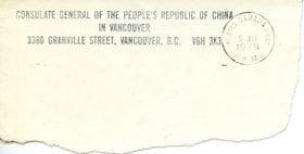
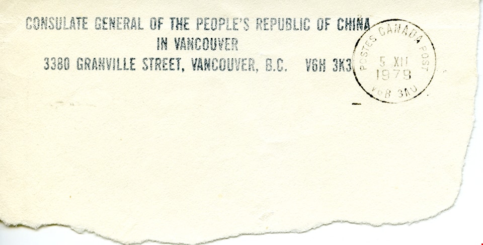
Address of the Consulate General of the People's Republic of China in Vancouver
https://search.heritageburnaby.ca/link/museumdescription14806
- Repository
- Burnaby Village Museum
- Date
- 5 Oct. 1979
- Collection/Fonds
- Julie Lee and Cecil Lee family fonds
- Description Level
- Item
- Physical Description
- 1 p.
- Scope and Content
- Item consists of a segment of a post marked envelope with the address of the Consulate General of the People's Republic of China in Vancouver.
- Repository
- Burnaby Village Museum
- Collection/Fonds
- Julie Lee and Cecil Lee family fonds
- Description Level
- Item
- Physical Description
- 1 p.
- Scope and Content
- Item consists of a segment of a post marked envelope with the address of the Consulate General of the People's Republic of China in Vancouver.
- Accession Code
- BV019.6.36
- Access Restriction
- No restrictions
- Reproduction Restriction
- No known restrictions
- Date
- 5 Oct. 1979
- Media Type
- Textual Record
- Scan Resolution
- 600
- Scan Date
- 13-Oct-2020
- Scale
- 100
- Notes
- Title based on content of item
- Item is part of a scrapbook album created by Cecil Lee
Images
A guide to Burnaby : the heart of Greater Vancouver
https://search.heritageburnaby.ca/link/museumlibrary6728
- Repository
- Burnaby Village Museum
- Collection
- Reference Collection
- Material Type
- Textual Record
- Call Number
- 971.133 BUR
- Place of Publication
- Burnaby, B.C.
- Publisher
- City of Burnaby
- Publication Date
- 2003
- Physical Description
- 1 map : ill ; 10 x 23 cm.
- Library Subject (LOC)
- Burnaby, B.C.
- Burnaby (B.C.)--Description and travel
- Burnaby (B.C.)--Geography
- Burnaby (B.C.)--Buildings, structures, etc.
A hurricane in the basement, and other Vancouver experiences : stories and photos from the millennium collection
https://search.heritageburnaby.ca/link/museumlibrary1235
- Repository
- Burnaby Village Museum
- Author
- Constantine, Barbara
- Publication Date
- 2000
- Call Number
- 971.133 CON
- Repository
- Burnaby Village Museum
- Collection
- Reference Collection
- Material Type
- Book
- Call Number
- 971.133 CON
- Author
- Constantine, Barbara
- Place of Publication
- Vancouver
- Publisher
- City of Vancouver, Office of Cultural Affairs
- Publication Date
- 2000
- Physical Description
- 96 p. : ill. (some col.) ; 28 cm.
- Library Subject (LOC)
- Vancouver (B.C.)--History--Anecdotes
- Vancouver (B.C.)
- Biography
- Notes
- "Published as part of Portrait V2K: The City of Vancouver Millennium Project ..."--P. 2.
- Includes index.
The ambitious city: a history of the City of North Vancouver
https://search.heritageburnaby.ca/link/museumlibrary1409
- Repository
- Burnaby Village Museum
- Author
- Sommer, Warren, 1951-
- Publication Date
- c2007
- Call Number
- 971.133 SOM
- Repository
- Burnaby Village Museum
- Collection
- Reference Collection
- Material Type
- Book
- ISBN
- 9781550174113
- 1550174118
- Call Number
- 971.133 SOM
- Author
- Sommer, Warren, 1951-
- Place of Publication
- Madeira Park, BC
- Publisher
- Harbour
- Publication Date
- c2007
- Physical Description
- 342 p. : ill., maps, ports. ; 29 cm.
- Library Subject (LOC)
- North Vancouver (B.C.)--History
- North Vancouver (B.C.)
- Biography
- Notes
- Includes bibliographical references (p. 331-337) and index.
- Maps on lining papers.
![Bandsand in Stanley Park, Vancouver, BC, [between 1908 and 1911] thumbnail](/media/hpo/_Data/_BVM_Images/1972/1972_0050_0010_001.jpg?width=280)
Bandsand in Stanley Park, Vancouver, BC
https://search.heritageburnaby.ca/link/museumdescription1071
- Repository
- Burnaby Village Museum
- Date
- [between 1908 and 1911]
- Collection/Fonds
- Burnaby Village Museum Photograph collection
- Description Level
- Item
- Physical Description
- 1 photograph : sepia ; 7.3 x 9.9 cm
- Scope and Content
- Photograph of people walking towards the bandstand in Stanley Park, Vancouver. In 1934, the Malkin Bowl was erected at the site where the banstand used to be. An annotation on the back of the photograph reads, "Band stand in Stanley Park where Malkin Bowl now stands."
- Repository
- Burnaby Village Museum
- Collection/Fonds
- Burnaby Village Museum Photograph collection
- Description Level
- Item
- Physical Description
- 1 photograph : sepia ; 7.3 x 9.9 cm
- Scope and Content
- Photograph of people walking towards the bandstand in Stanley Park, Vancouver. In 1934, the Malkin Bowl was erected at the site where the banstand used to be. An annotation on the back of the photograph reads, "Band stand in Stanley Park where Malkin Bowl now stands."
- Geographic Access
- Vancouver
- Accession Code
- HV972.50.10
- Access Restriction
- No restrictions
- Reproduction Restriction
- No known restrictions
- Date
- [between 1908 and 1911]
- Media Type
- Photograph
- Scan Resolution
- 600
- Scan Date
- 2023-04-04
- Photographer
- Dean, H.M.
- Notes
- Title based on contents of photograph
Images
![Bandsand in Stanley Park, Vancouver, BC, [between 1908 and 1911] thumbnail](/media/hpo/_Data/_BVM_Images/1972/1972_0050_0010_001.jpg)
![Bateman family parlour in Vancouver, [1920 or 1921] thumbnail](/media/hpo/_Data/_BVM_Images/2000/200400280002.jpg?width=280)
Bateman family parlour in Vancouver
https://search.heritageburnaby.ca/link/museumdescription1758
- Repository
- Burnaby Village Museum
- Date
- [1920 or 1921]
- Collection/Fonds
- E.W. Bateman family fonds
- Description Level
- Item
- Physical Description
- 1 photograph : sepia ; 6 x 12 cm
- Scope and Content
- Photograph of the Bateman family parlour at 2976 7th West Avenue in Vancouver.
- Repository
- Burnaby Village Museum
- Collection/Fonds
- E.W. Bateman family fonds
- Description Level
- Item
- Physical Description
- 1 photograph : sepia ; 6 x 12 cm
- Scope and Content
- Photograph of the Bateman family parlour at 2976 7th West Avenue in Vancouver.
- Geographic Access
- Vancouver
- Accession Code
- BV004.28.2
- Access Restriction
- No restrictions
- Reproduction Restriction
- No known restrictions
- Date
- [1920 or 1921]
- Media Type
- Photograph
- Scan Resolution
- 600
- Scan Date
- 09-Jun-09
- Scale
- 100
- Notes
- Title based on contents of photograph
- Notes on verso of photograph read: "Parlor" and "2976 - 7th. W"
Images
![Bateman family parlour in Vancouver, [1920 or 1921] thumbnail](/media/hpo/_Data/_BVM_Images/2000/200400280002.jpg)