C.N. Ballast Train
- Repository
- City of Burnaby Archives
- Date
- 1927
- Collection/Fonds
- Burnaby Historical Society fonds
- Description Level
- Item
- Physical Description
- 1 photograph : sepia ; 6.8 x 12 cm on page 17.5 x 26.4 cm
- Scope and Content
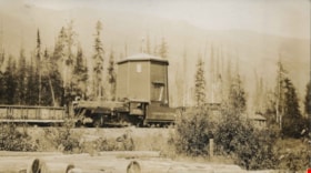
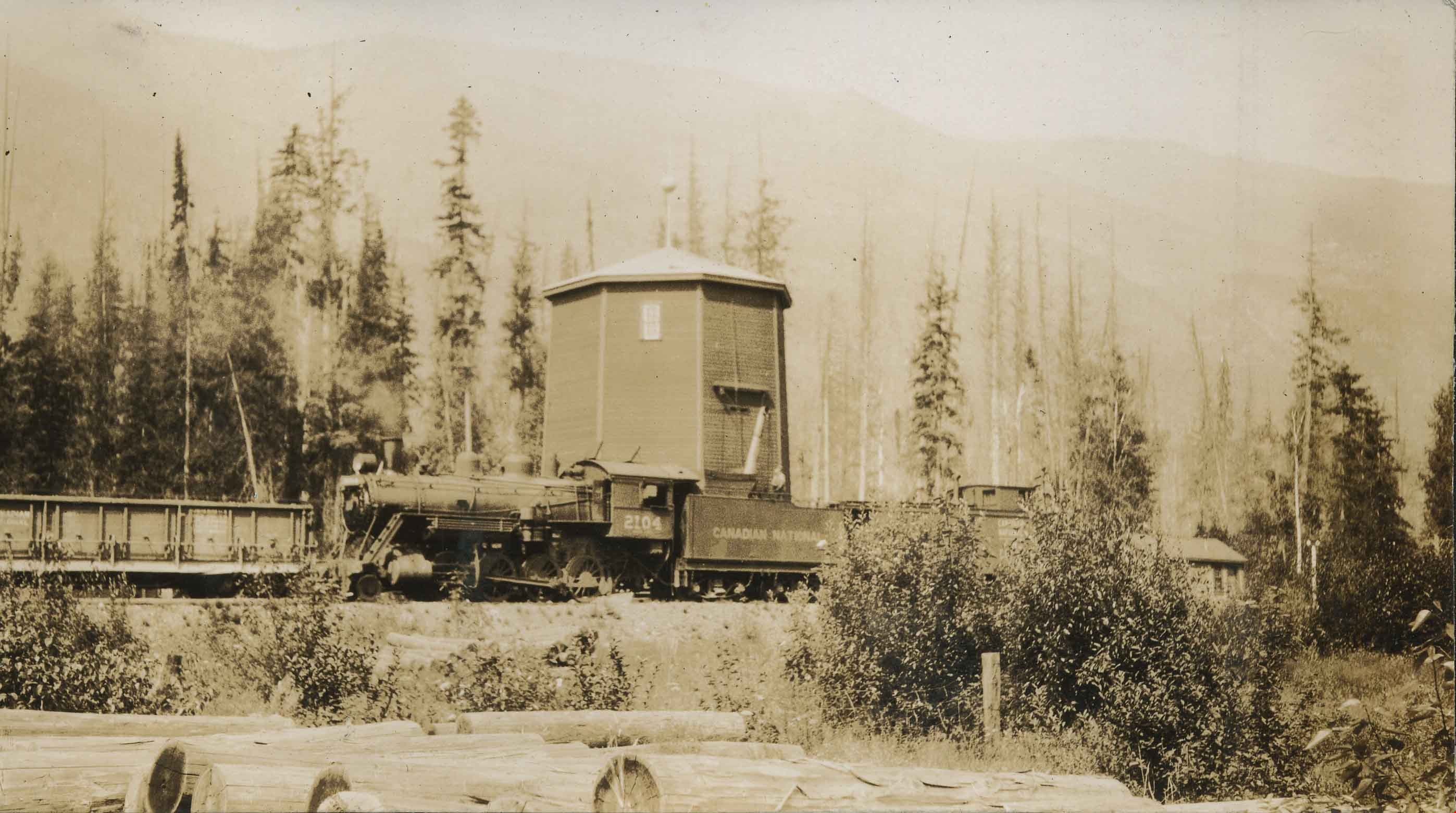
- Photograph of a locomotive travelling along the tracks in front of a wooden structure in a location identified as Avola, BC. "Canadian National" can be seen painted on the side of the train car and in the foreground can be seen a pile of logs. The caption accompanying the photograph reads: "C.N. …
- Repository
- City of Burnaby Archives
- Date
- 1927
- Collection/Fonds
- Burnaby Historical Society fonds
- Series
- Community Archives Collection series
- Subseries
- Peers family subseries
- Physical Description
- 1 photograph : sepia ; 6.8 x 12 cm on page 17.5 x 26.4 cm
- Description Level
- Item
- Record No.
- 020-190
- Access Restriction
- No restrictions
- Reproduction Restriction
- No known restrictions
- Accession Number
- BHS2007-04
- Scope and Content
- Photograph of a locomotive travelling along the tracks in front of a wooden structure in a location identified as Avola, BC. "Canadian National" can be seen painted on the side of the train car and in the foreground can be seen a pile of logs. The caption accompanying the photograph reads: "C.N. Ballast Train." This photograph appears to have been taken by Arthur Peers, who travelled through the Fraser River Valley and worked on the construction of the Trans-Provincial Highway during the later 1920s.
- Subjects
- Transportation - Rail
- Names
- Canadian National Railway
- Media Type
- Photograph
- Photographer
- Peers, Arthur Francis "Mike"
- Notes
- Title based on caption accompanying photograph
Less detail
Map of Dominion of Canada
- Repository
- Burnaby Village Museum
- Date
- [1932]
- Collection/Fonds
- Burnaby Village Museum Map collection
- Description Level
- Item
- Physical Description
- 1 map : col. ink on paper ; 50 x 88 cm on paper 58.5 x 96 cm
- Scope and Content
- Item consists of "Map of the Dominion of Canada" produced by the Department of the Interior and the National Development Bureau in 1932. The map includes information about the railway lines in operation and under construction for the Canadian National Railways, Canadian Pacific Railways, and other …
- Repository
- Burnaby Village Museum
- Collection/Fonds
- Burnaby Village Museum Map collection
- Series
- Maps of British Columbia and Canada series
- Description Level
- Item
- Physical Description
- 1 map : col. ink on paper ; 50 x 88 cm on paper 58.5 x 96 cm
- Material Details
- Scale 100 miles = 1 inch
- Scope and Content
- Item consists of "Map of the Dominion of Canada" produced by the Department of the Interior and the National Development Bureau in 1932. The map includes information about the railway lines in operation and under construction for the Canadian National Railways, Canadian Pacific Railways, and other railways. The map also includes Steamship Routes with distances included.
- Creator
- Government of Canada - Department of the Interior
- Accession Code
- BV006.24.20
- Access Restriction
- No restrictions
- Reproduction Restriction
- May be restricted by third party rights
- Date
- [1932]
- Media Type
- Cartographic Material
- Notes
- Transcribed title
Less detail
Siwash Creek
- Repository
- City of Burnaby Archives
- Date
- 1925
- Collection/Fonds
- Burnaby Historical Society fonds
- Description Level
- Item
- Physical Description
- 1 photograph : b&w; 6.3 x 9.8 cm on page 17.5 x 26.3 cm
- Scope and Content
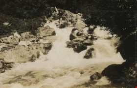
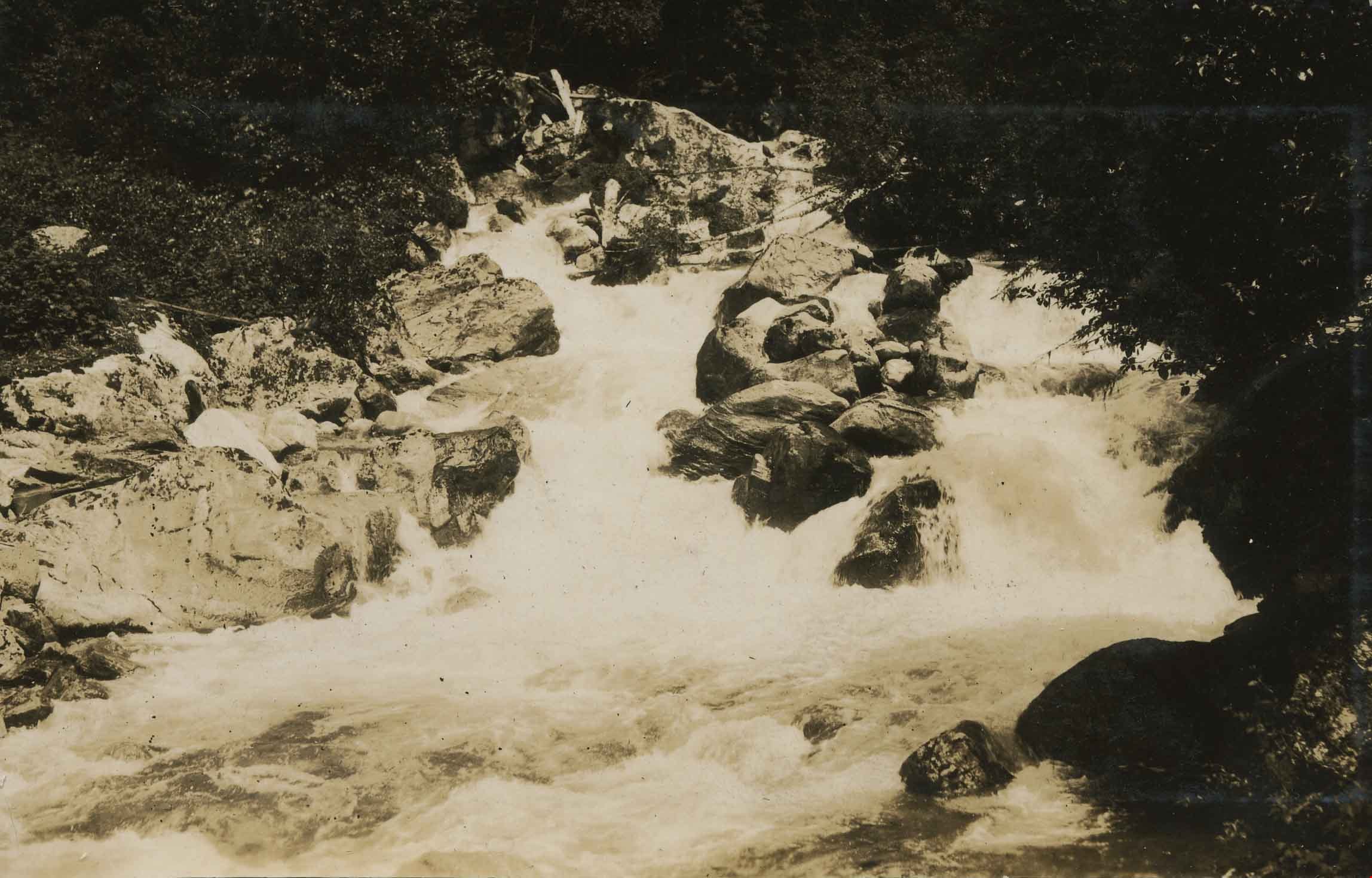
- Photograph of Siwash Creek, near the Canadian National Railway line. This photograph appears to have been taken by Arthur Peers, who travelled through the Fraser River Valley and worked on the construction of the Trans-Provincial Highway during the later 1920s.